Lost New England Goes West: Sutter Street, San Francisco

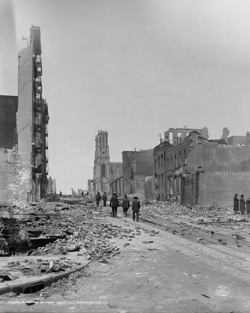
Looking west on Sutter Street from Grant Avenue in San Francisco, in the aftermath of the April 18, 1906 earthquake. Image courtesy of the Library of Congress, Detroit Publishing Company Collection.

872_1906c loc

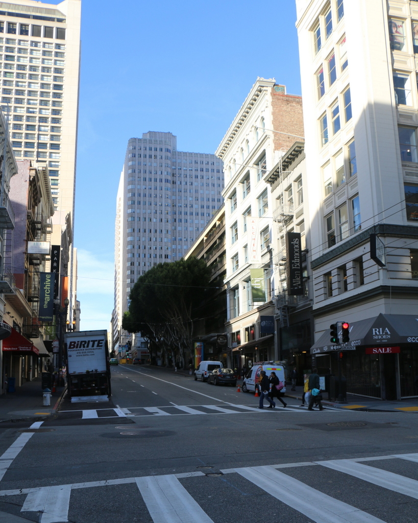
Sutter Street in 2015:

872_2015
The scene in the first photo is typical of what so much of San Francisco looked like after the 1906 earthquake and the subsequent fires. All of the buildings in this scene were completely destroyed, and the photo was probably only taken a few days after the disaster, because the street is still covered in debris. The people in the photo are walking carefully along the cable car tracks in the middle of the street, stepping over bricks and charred pieces of wood. One of the men in the distance is wearing a sailor’s uniform; he was probably one of the many naval personnel who assisted in the firefighting efforts for three days after the earthquake.

The most prominent building in the first photo is the Temple Emanu-El, located in the center of the photo. It was home to the oldest Jewish congregation in the western part of the country, and although the two tall towers survived the earthquake, the building was gutted by fire. The congregation later relocated to the western part of the city, and here on Sutter Street everything was completely rebuilt. Today, nothing pre-earthquake appears to have survived, but some of the buildings in the foreground probably date back to the reconstruction in the immediate aftermath of the disaster.

This post is part of a series of photos that I took in California this past winter. Click here to see the other posts in the “Lost New England Goes West” series.

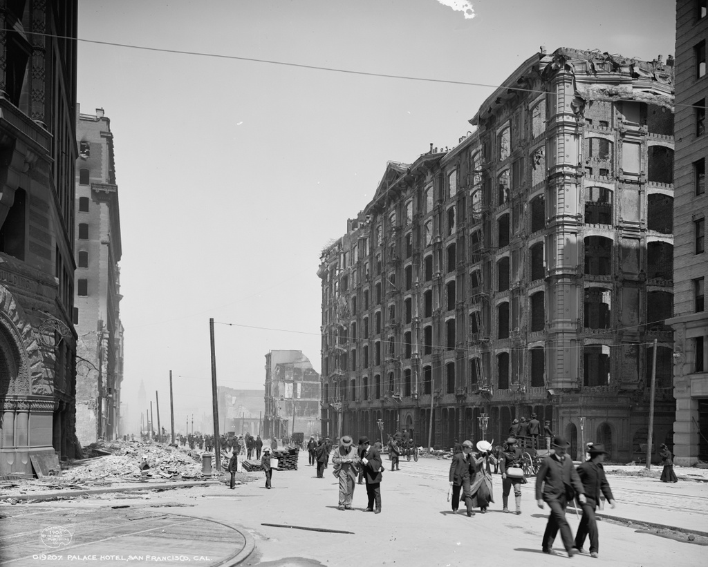
Lost New England Goes West: Palace Hotel, San Francisco

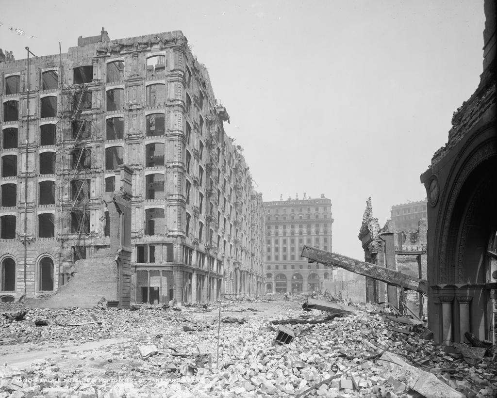
Looking north on New Montgomery Street from near Mission Street in San Francisco, in the aftermath of the April 18, 1906 earthquake. Image courtesy of the Library of Congress, Detroit Publishing Company Collection.

871_1906c loc

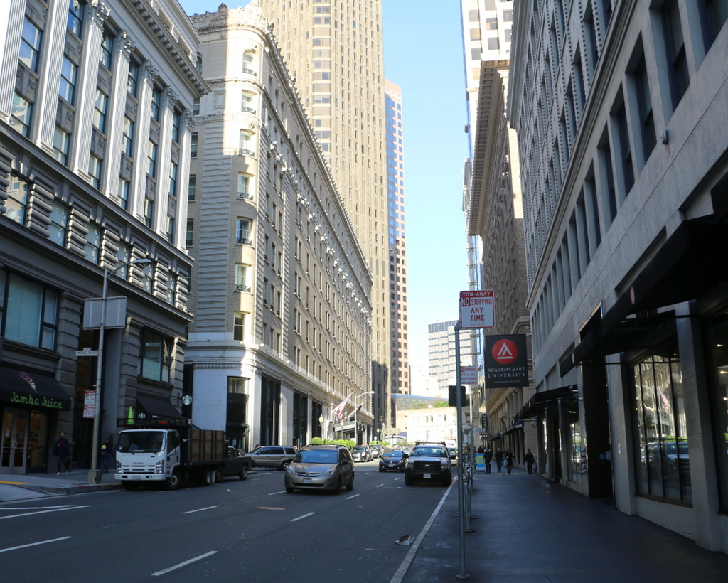
The view in  2015:

871_2015
The Palace Hotel, seen on the left side of the photo, opened in 1875 as the city’s largest hotel, with seven floors and 755 guest rooms. It featured such modern conveniences as bathrooms in every guest room and hydraulic elevators, and it was also designed to withstand both earthquakes and fires. To prevent earthquake damage, the brick exterior walls were two feet thick and reinforced with iron bands around the building, and it featured modern firefighting equipment such as hydrants around the building and a 358,000 gallon cistern in the basement.

The earthquake reinforcements apparently helped, because the building survived it with minor damage while, as the first photo shows, most of its neighbors were leveled. However, the earthquake started a number of fires that soon spread throughout the city. Although the hotel’s designers had planned well for a fire emergency, the staff was poorly trained and the city’s fire department had limited resources and manpower, so ultimately the fires reached the hotel, which was quickly gutted by the flames.

In the aftermath of the disaster, the hotel was rebuilt on the same site, and it is still standing today. It reopened in 1909, and like its predecessor it hosted a number of prominent guests. Many US presidents have stayed here, with the most notable presidential visit being Warren Harding, who died here on August 2, 1923 during a visit to the west coast. Several hours later, Calvin Coolidge was inaugurated as president on the other side of the continent, in the parlor of his father’s house in Vermont.

This post is part of a series of photos that I took in California this past winter. Click here to see the other posts in the “Lost New England Goes West” series.
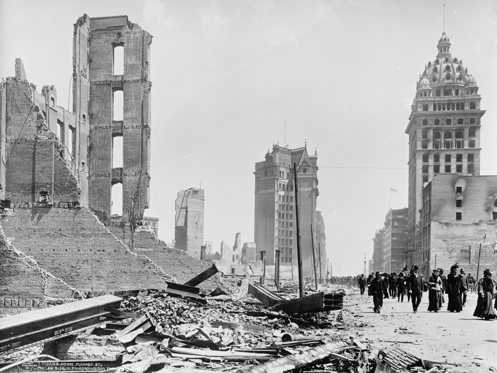
Lost New England Goes West: Market Street, San Francisco

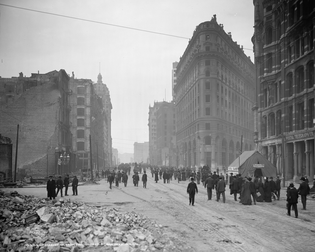
The view looking southwest on Market Street from Second Street in San Francisco, in the aftermath of the April 18, 1906 earthquake. Image courtesy of the Library of Congress, Detroit Publishing Company Collection.

870_1906c loc

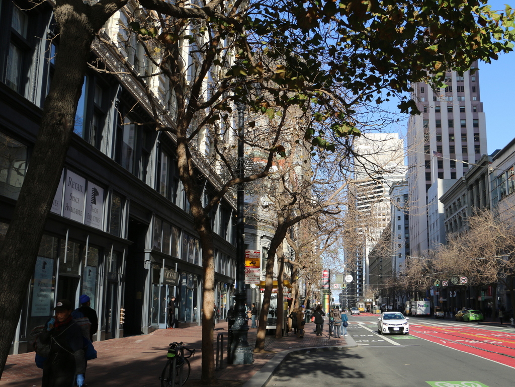
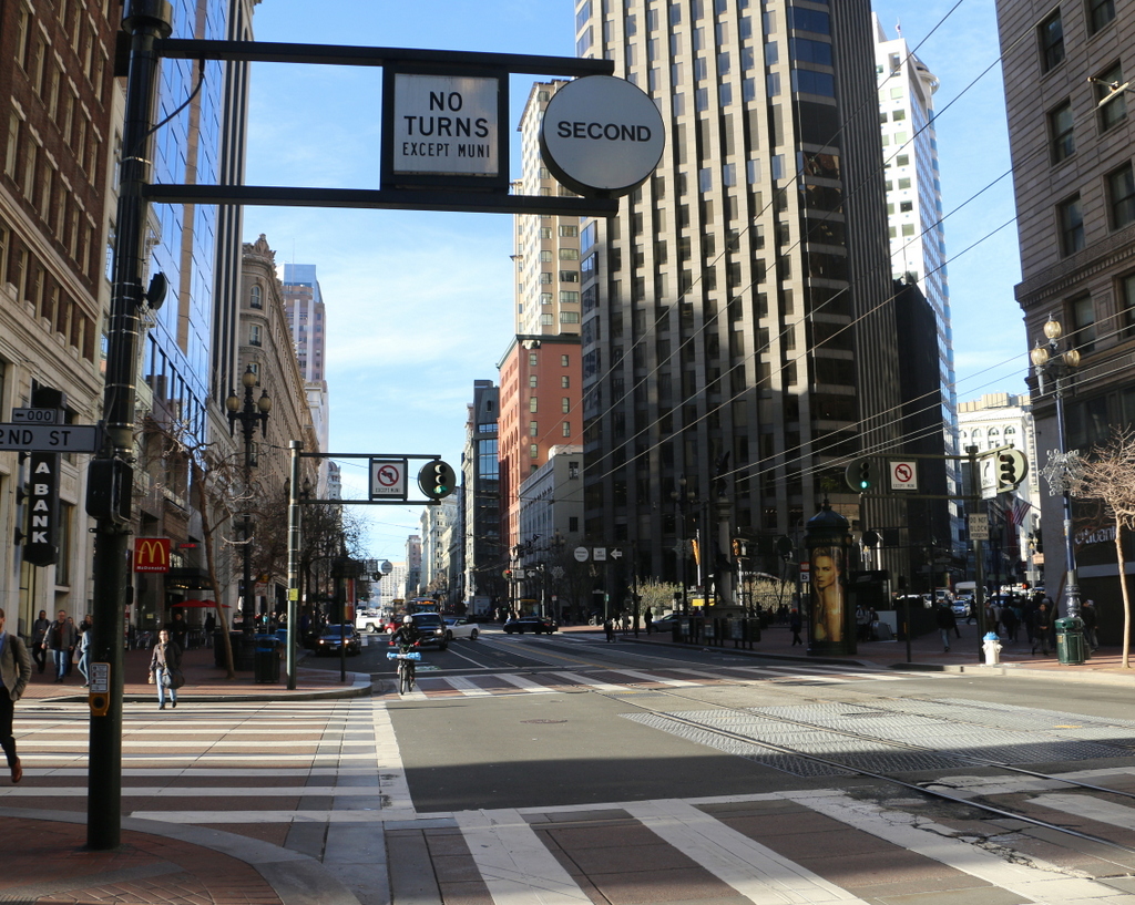
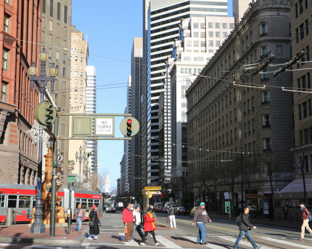
Market Street in 2015:

870_2015
Market Street is one of the main streets in downtown San Francisco, and at the time of the 1906 earthquake there were many important businesses along here. The first photo is undated, but it was likely taken within a week or so of the earthquake, and many of the people on the crowded street were likely surveying the damage for the first time. Walking along here, they would have seen a number of buildings that had either been destroyed by the earthquake itself or gutted by the fires that raged throughout the city for several days afterward. Many of these were subsequently demolished, including the Palace Hotel in the distance on the left. This prominent hotel was destroyed in the fires, and its replacement is still standing on the site today. Other displaced businesses included the Postal Telegraph Company, whose building on the far right was destroyed. When the photo was taken, the company was operating out of a tent, as seen in front of the building.

However, some of the buildings from the first scene are still standing today, although they have since been dramatically renovated. Nothing in the foreground survives, but the Call Building in the distance on the left, which was at the time of the earthquake the tallest building west of the Mississippi River, was repaired and later renovated as the Central Tower. On the right side, two historic buildings are still standing, including the red-brick Chronicle Building in the center of the photo. However, just about all that is left of the original building is the exterior facade, as the interior has been completely gutted by both the fires and by subsequent renovations over the years, including the addition of a tall tower on top of the 1890 structure in 2007. The last historic building in this scene is barely visible just beyond the Chronicle Building. Built in 1902, the Mutual Savings Bank Building survived the earthquake, and despite an addition in 1964 the original building is still standing today.

This post is part of a series of photos that I took in California this past winter. Click here to see the other posts in the “Lost New England Goes West” series.
Lost New England Goes West: Union Square, San Francisco

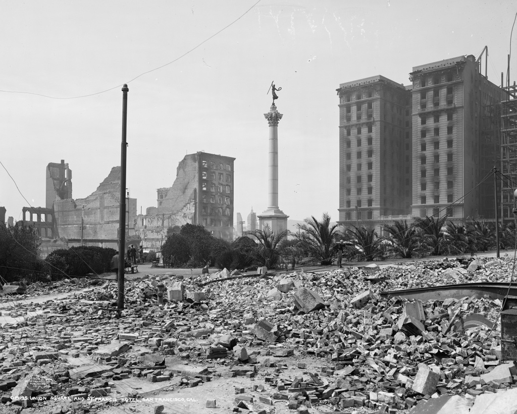
Union Square, seen from the corner of Post and Stockton Streets shortly after the April 18, 1906 earthquake. Image courtesy of the Library of Congress, Detroit Publishing Company Collection.

869_1906c loc

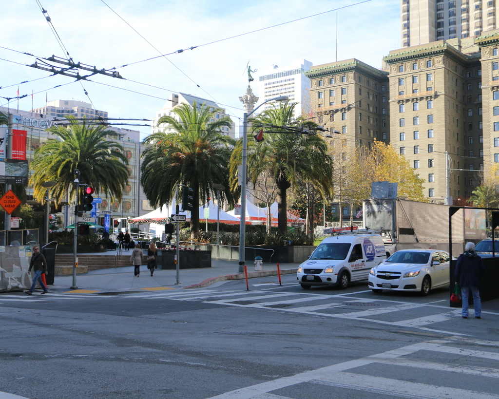
Union Square in 2015:

869_2015
Today, Union Square is one of the premier shopping areas in San Francisco, but 110 years ago it was, like the rest of the city, covered in earthquake debris and surrounded by burned-out buildings. The most prominent building in the first photo is the St. Francis Hotel, on the right side of the scene. Completed only two years earlier, the building survived the earthquake itself with minimal damage, but a combination of damaged firefighting infrastructure and poor city leadership allowed fires to spread throughout much of the city. The hotel was completely gutted by the fire, as the first photo shows, but it remained structurally sound. Soon after the photo was taken, a temporary hotel was built in the middle of the square, where it housed guests until the burned-out hotel reopened a year and a half later. Now known as the Westin St. Francis, it has been expanded several times, and today it still stands overlooking Union Square.

Another Union Square landmark from the first photo is the Dewey Monument, located in the center of the square. It was designed by sculptor Robert Aitken, whose later works included the pediment atop the US Supreme Court Building, and it was dedicated in 1903 by Theodore Roosevelt, in honor of Spanish-American War hero Admiral George Dewey and recently-assassinated President William McKinley. The 85-foot tall monument survived both the earthquake and the subsequent fires, and it is still standing in Union Square today, although it is now partially hidden by the palm trees around it.

This post is part of a series of photos that I took in California this past winter. Click here to see the other posts in the “Lost New England Goes West” series.
1007-1017 Main Street, Springfield, Mass

The building at the corner of Main and Union Streets in Springfield, around 1938-1939. Image courtesy of the Springfield Preservation Trust.

866_1938-1939c spt

The scene in 2015:

866_2015
The section of Main Street south of State Street was once primarily residential, but as the city grew in the second half of the 19th century many of the homes were either demolished or, in many cases, had storefronts built in front of them. Based on its blend of Greek Revival and Italianate architectural styles, this house was probably built around the 1850s, but sometime around 1900-1910 the owners built a one-story commercial building around it, presumably incorporating the first floor of the house into the stores. This is similar to what happened to the John Avery House, a c.1825 house located diagonally across the street from here.

When the first photo was taken, the building had several commercial tenants, including The Linoleum Shoppe on the left and a cigar store on the right. The old house was still clearly visible at the time, but later taken down after a fire. The rest of the building was damaged in the June 1, 2011 tornado, and was subsequently renovated into its current appearance, as seen in the 2015 photo.

130 Union Street, Springfield, Mass

The building at 130 Union Street, just east of Main Street in Springfield, around 1938-1939. Image courtesy of the Springfield Preservation Trust.

865_1938-1939c spt

The building in 2015:

865_2015
This two-story brick building was built around 1906-1910, on the site of the Swedish Evangelical Lutheran Bethesda Church, which had been built here in 1897. Although the church building was short-lived, I suspect that part of the church walls may have been incorporated into this building, because part of the first floor walls are made of stone, the same material as the church. This is also consistent with the church’s footprint as it appeared in the 1899 city atlas, although I do not have any photos of the church to confirm my theory.

In any case, when the first photo was taken the building had a sign that read “Bay State Mattress Company,” which may have occupied the upper floor, because the ground floor appears to have been used as a repair garage. There is a car visible inside the building, with signs on the exterior for “Brake Service & Greasing” and for Exide batteries. Later on, this building was home to Radding Signs, as the vertical neon sign on the left still indicates. Most recently, the building was owned by the Anti-Displacement Project, but it was damaged in the 2011 tornado and now appears to be vacant.