William Bradford Monument, Plymouth, Massachusetts

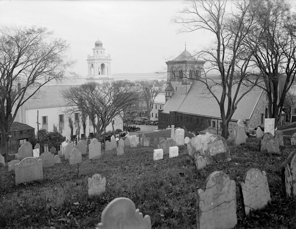
The William Bradford monument at Burial Hill in Plymouth, around the 1920s. Image courtesy of the Boston Public Library; photographed by Leon Abdalian.

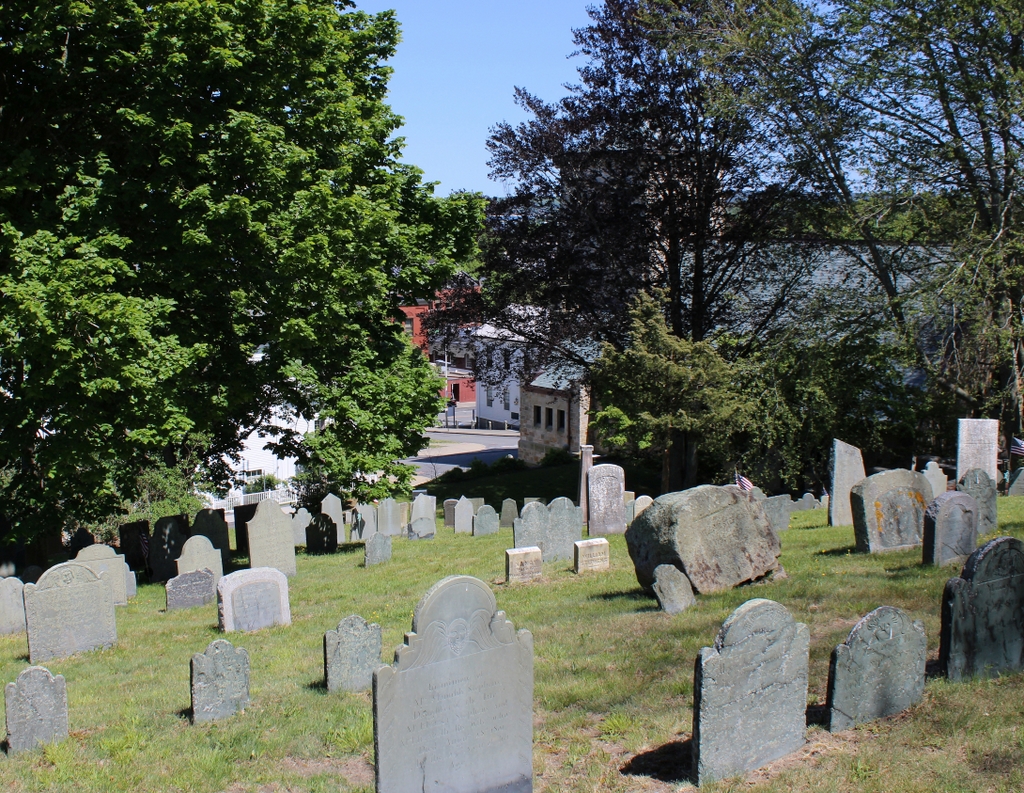
The scene in 2023:

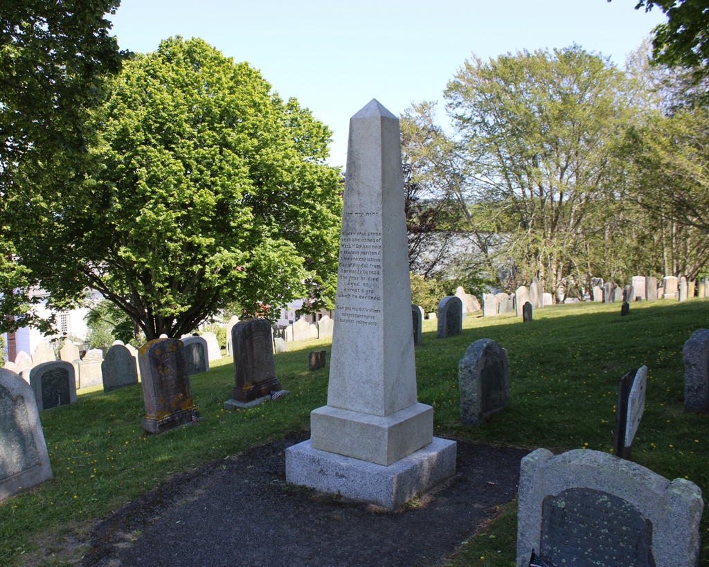
These two photos show a scene on Burial Hill, not too far from the site of the photos in the previous post. In the foreground of the photos is a memorial obelisk for William Bradford, one of the leaders of the Mayflower Pilgrims who served as governor of the colony for many years. In the foreground are the gravesites for other members of the Bradford family, and further in the distance is a mix of different gravestones from the 18th and early 19th centuries.

William Bradford was born in England in 1590. As a young man he joined the Separatist group that left England for the Dutch Republic, where they sought greater religious freedom. Then, in 1620 he traveled with the Separatists to the New World, landing first at Cape Cod—where his first wife Dorothy died after falling overboard from the Mayflower—and then to Plymouth, where the settlers experienced a harsh first winter in New England. The colony’s first governor, John Carver, died in April 1621, and Bradford was subsequently elected to succeed him. Bradford would continue to serve in that capacity for many years. With the exception of several short intervals, he remained as governor until his death in 1657 at the age of 67.

The exact location of William Bradford’s gravesite is uncertain. During the early years of the Plymouth Colony, Cole’s Hill was the main burial site for the settlers. By contrast, Burial Hill was not definitely in use as a graveyard until much later in the 1600s. Combined with the fact that gravestones were generally not used until the late 1600s, it makes it difficult to determine where many of the Mayflower passengers, including Bradford, were actually buried.

By the early 19th century, it was widely believed that Bradford had been buried here in this plot on Burial Hill. Several of his family members are buried here, including his son William Bradford Jr., whose gravestone is in the foreground on the right side of these photos. However, the belief that Governor Bradford was buried here was based on tradition, rather than historical documentation.

Regardless of the actual site of his final resting place, this site is now marked by the memorial obelisk that stands in the center of these two photos. It was dedicated in 1835, and it is made of marble with a granite base. The main inscription reads:

Under this stone
rest the ashes of
Willm Bradford
a zealous puritan &
sincere christian
Gov. of Ply. Col. from
April 1621 to 1657
(the year he died
aged 69)
except 5 yrs
which he declined.
Qua patres difficillime
adeptisunt nolite
turpiter relinquere

The final three lines are a Latin phrase that translates to “What our forefathers with so much difficulty secured, do not basely relinquish.” Aside from this, the stone also features a line of Hebrew, which can be seen directly above the inscription. According to an 1835 newspaper article reporting on the dedication of the monument, this Hebrew inscription is taken from Psalm 16:5 and reads “Jehovah is the portion of my inheritance.”

By the time the first photo was taken, the monument had been here for nearly a century. This was no longer an active graveyard by then, but it was a popular tourist attraction, likely aided in part by the well-publicized 300 anniversary of the arrival of the Mayflower in 1920. In the background of the scene are two 19th century churches: the 1840 Church of the Pilgrimage on the left, and the 1899 First Parish Church on the right.

Today, hardly anything has changed since the first photo was taken. The monument is still standing here, as are most of the other nearby gravestones. Some have been encased in granite in an effort to protect them, although this likely occurred sometime in the mid-20th century, because this conservation technique is generally not practiced anymore. The churches in the background are also still standing, although they are mostly hidden from view by the trees in the second photo.

Burial Hill, Plymouth, Massachusetts

The view looking southeast from near the top of Burial Hill in Plymouth, on October 22, 1929. Image courtesy of the Boston Public Library; photographed by Leon Abdalian.

The scene in 2023:

These two photos show the view looking toward the center of Plymouth from Burial Hill, the main colonial-era graveyard in the town. This site offers expansive views of Plymouth and the harbor further in the distance, and it was here on this hill that the Pilgrims constructed a fort in 1622. This fort also served as the town’s meeting house, and it was protected by a palisade. The fort was enlarged several times over the years, and it was also joined by a brick watchtower here on the hill in 1643.

After the conclusion of King Philip’s War in 1676, this site was no longer needed for defensive fortifications. The structures here were dismantled, and by 1679 the hill was in use as a graveyard. This was not the first burial ground that was used by European settlers in Plymouth. During the first winter of 1620-1621, the dead were evidently buried closer to the harbor on Cole’s Hill, and that site remained in use until at least the 1640s. As  result, most of the Mayflower passengers were likely buried there in unmarked graves, rather than here on Burial Hill. The oldest surviving gravestone on Burial Hill is dated 1681, which is long after most of the Mayflower passengers had died.

Burial Hill continued to be used for new interments until around the mid-19th century. By that point, trends had shifted in favor of newer, park-like cemeteries, rather than the old colonial-era graveyards such as this one. Instead, Burial Hill came to be recognized for its historical significance, both in terms of its use as a fort in the 17th century and also for its variety of intricately-carved headstones, which often feature skulls and other grim reminders of death.

In the meantime, downtown Plymouth continued to grow and develop over the years. The first photo, taken in 1929, shows two churches in the background at the foot of Burial Hill. On the left is the Third Congregational Church, also known as the Church of the Pilgrimage. This building was constructed in 1840, but it was subsequently remodeled in 1898 to give it more of a Colonial Revival appearance. The church to the right is the First Parish Church in Plymouth. It was built in 1899 on the site of an earlier church building, and it has a Romanesque-style design that resembles the style of church buildings that existed in England prior to the Pilgrims’ departure.

The trees in the present-day scene make it difficult to see the churches and other buildings at the base of the hill, but not much has changed in nearly a century since the first photo was taken, and both church buildings are still standing. Here on Burial Hill, the scene has likewise remained essentially the same. Most of the gravestones from the first photo are still here, although some have since been encased in granite in an effort to better protect them. Because of its significance to the early history of Plymouth, Burial Hill was added to the National Register of Historic Places in 2013.

Ephraim Huit Gravestone, Windsor, Connecticut

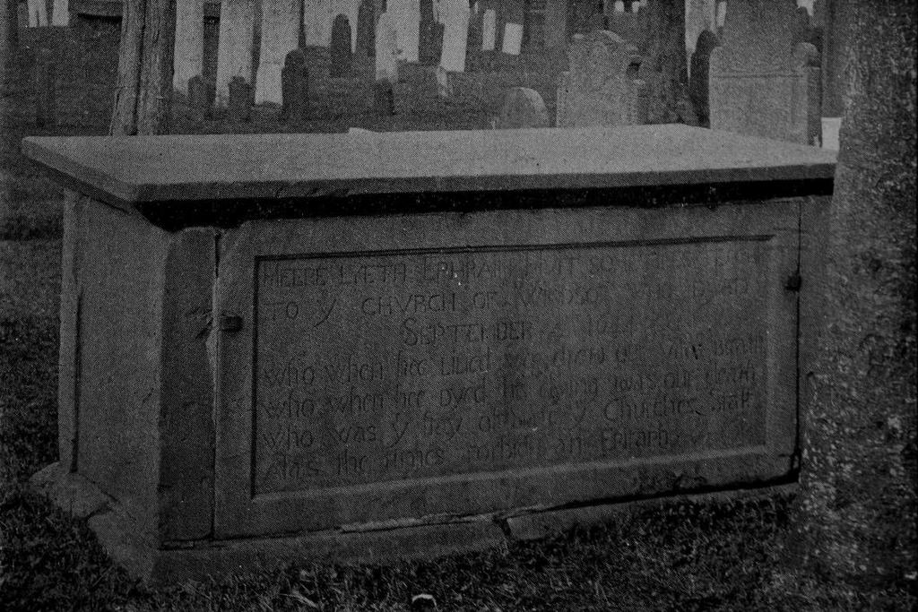
The gravestone of Ephraim Huit at Palisado Cemetery in Windsor, Connecticut, around 1900. Image from Connecticut Magazine, Volume VI.
The scene in 2023:

These two photos show the gravestone of the Reverend Ephraim Huit, who died in 1644. This is generally believed to be the oldest dated gravestone in New England, and it may also be the oldest in the United States. It is located in Palisado Cemetery, which was the colonial-era burying ground for Windsor, the first English settlement in Connecticut.

Ephraim Huit was born in England and was educated at Cambridge. He served as a clergyman in Warwickshire, but he found himself in conflict with the Anglican authorities, apparently because of his nonconformist Puritan views. This may have been what prompted him to emigrate to North America, and he eventually made his way to Windsor, where he was ordained as an assistant pastor of the church in 1639. However, he died only five years later in 1644, when he was about 50 years old.

Among those who had traveled to Windsor with Ephraim Huit were brothers Matthew and Edward Griswold. Both were evidently masons, because Edward is documented as having constructed “the Fort,” a fortified brick house in Springfield, while Matthew was, according to tradition, responsible for carving the gravestone of his in-laws, Henry and Elizabeth Wolcott, here at Palisado Cemetery. Gravestone scholars have likewise attributed several other gravestones to Matthew, including this one here for Ephraim Huit.

The term for this type of grave marker is a box tomb, and it consists of a large flat top that is supported by legs on the corners. In between the legs are four panels, one of which bears the inscription identifying it as the final resting place of Ephraim Huit. Although called a tomb, his body would not have actually been interred in the above-ground space inside it. Rather, his remains would have likely been directly beneath the box tomb.

It is carved of sandstone, which was likely quarried in Windsor. Sandstone was a common material for gravestones in the Connecticut River Valley during 17th and 18th centuries, but it varied in quality depending on its source. Many carvers worked in brown sandstone from the Middletown and Portland area, but this stone tends to be coarse-grained and porous, making the gravestones vulnerable to weathering. Windsor sandstone, on the other hand, tends to have more of an orange-brown color, and it is very fine grained. As a result, gravestones sourced from Windsor have generally survived in much better condition than their Middletown counterparts.

The inscription on the Ephraim Huit stone is carved fairly shallow, but the quality of the material has meant that it is still easily legible nearly four centuries later. Early New England gravestones often have concise inscriptions that give only basic information such as name, age, and date of death. However, this inscription is far more lengthy. It reads:

HEERE LYETH EPHRAIM HVIT SOMETIMES TEACHER
TO Ye CHVRCH OF WINDSOR WHO DYED
SEPTEMBER 4 1644
Who when hee Liued wee drew our vitall Breath
Who when hee Dyed his dying was our death
Who was ye stay of State ye Churches Staff
Alas the times forbides an Epitaph

This last line is particularly puzzling, since it is is an epitaph that says that the “times forbides an Epitaph.” This apparent contradiction is also made more unclear by uncertainty over the meaning of “times.” Did the carver mean it as in there wasn’t enough time to carve a proper epitaph? Or did “times” mean the social, religious, and/or political context of 17th century Connecticut? This latter interpretation seems plausible, since the Puritans generally took a dim view on any kind of elaborate funerary rituals. Could this have been a subversive critique of Puritan society, carved into, of all places, the gravestone of a Puritan pastor?

As for the identity of the carver, there are no surviving records that specifically identify him. It has generally been attributed to Matthew Griswold based on tradition and circumstantial evidence, and it is stylistically similar to several other mid-17th century gravestones that can be found in places such as Hartford, Springfield, and New London. However, it is possible that there may have been another hand involved in making this stone. Matthew’s nephew George Griswold—the son of Matthew’s brother Edward—was also a gravestone carver. His identity as a carver is more firmly established in historical records, and there are dozens of stones that he apparently carved, including many here at Palisado Cemetery.

The bulk of George Griswold’s work dates to the 1670s through 1690s, and his gravestones tended to be small, conventional markers, in contrast to the large box tomb of Ephraim Huit. However, those stones nonetheless show a high degree of skill, leading some scholars to infer that George likely learned from his uncle Matthew. If that was the cause, it seems plausible that he may have assisted in carving the Huit stone. Perhaps the strongest evidence in support of this theory is the lettering on the stone, particularly the letter “y.” On his later gravestones, George Gridswold used a distinctive “y,” with an elongated, curved “tail” that often swooped beneath the preceding letter. Here on this stone, almost every “y” has this feature, with the exception of the one in “LYETH,” which has a standard capital “Y.” This inconsistency might suggest that there may have been more than one carver at work on this stone.

As for the exact date when this stone was carved, it is hard to say. Backdating was a common practice for colonial-era gravestones, with many stones being carved years or even decades after the person’s death. If George Griswold did, in fact, carve some of the letters, then the stone was likely not carved immediately after Huit’s death, since George would have been just 11 years old at the time. But, since the style and lettering is consistent with other mid-17th century stones in the area, it was probably not backdated by much, and was likely carved around the 1650s.

Because backdating was so common during that time period, it is impossible to say with certainty which gravestone is the oldest in New England. There are a handful of others from the 1640s and 1650s, but the Huit stone has the earliest date of any of these. Because of this, and in the absence of any records firmly documenting when a particular stone was carved, the Huit stone seems to have the strongest claim to being the oldest gravestone in the region, and it may also be the oldest dated gravestone in the country. There is a knight’s tombstone in Jamestown, Virginia from 1627, but this stone does not appear to have any dates or other markings.

It would not be until the late 17th century that gravestones would become more common in New England. Early graves may have been marked by wooden markers, or by simple fieldstones, but the idea of permanent, carved monuments was not firmly established in the region until several decades after the Ephraim Huit stone was carved.

Here in Windsor, George Griswold became the first carver in Connecticut to produce gravestones on a large scale. Over the next century and a half, the high-quality sandstone here would continue to draw gravestone carvers to the town, and some of their works can be seen in the background of these two photos. Most visible among these are the three stones directly beyond the Huit stone in this scene. The shortest one, located furthest to the left, marks the grave of John Warham Strong, who died in 1752. His stone was carved by Joseph Johnson, one of the most talented of all the colonial-era carvers in Connecticut.

The two stones on the right, just beyond the Huit stone, were both carved by Ebenezer Drake, another prolific carver in the Windsor area. The stone further to the left marks the grave of Return Strong, who died in 1776, and the one on the right is for his wife Sarah, who died in 1801. The designs of these stones reflect the changes in gravestone carving traditions during those intervening years. When Return died, most gravestones were topped by a winged face that likely represented the soul ascending to heaven. However, by the turn of the 19th century these tastes had shifted to more neoclassical symbols such as willows and urns, as depicted on the top of Sarah’s gravestone.

When Sarah’s gravestone was installed here at the turn of the 19th century, the Ephraim Huit stone was already a relic of a much earlier era. It was also in poor condition, and by the early 19th century it had collapsed. The panel with the inscription was left lying flat and facing up so that it could be read, but the other large panel on the opposite side of the stone evidently disappeared. However, in 1842 it was restored, and a new panel was installed on the other side of the stone, bearing an inscription that commemorated another early Windsor pastor, the Reverend John Warham.

The first photo in this post was taken around 1900, and by this point the gravestone was widely recognized for its historical significance. An 1894 newspaper article described it as “the oldest original monument in the Connecticut valley,” and it also quoted the “quaint inscription” on the stone. In later years, this inscription would also catch the attention of other writers, and it was even featured in a Ripley’s Believe It or Not! newspaper cartoon panel in 1958.

Today, nearly 380 years after the death of Ephraim Huit, his gravestone has remained in good condition. It has seen few noticeable changes since the first photo was taken, although the left side of it does appear to be more weathered and eroded than in 1900. Palisado Cemetery is still an active cemetery, with many modern burials, but the oldest stones are here in the southwestern part of the cemetery. The Huit stone is the oldest of these, but there are many other 17th and 18th century gravestones here in the cemetery, providing many opportunities to study the changing ways in which colonial New Englanders chose to memorialize the dead.

Groton Monument, Groton, Connecticut

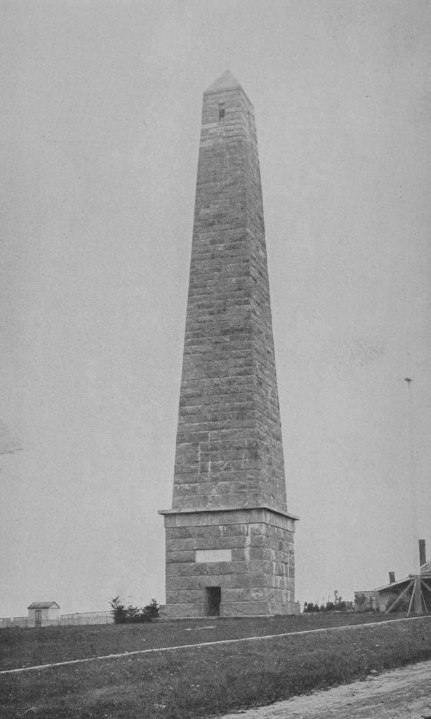
The Groton Monument, seen from the southwest around 1900. Image from The Battle of Groton Heights (1903).

The monument in 2022:

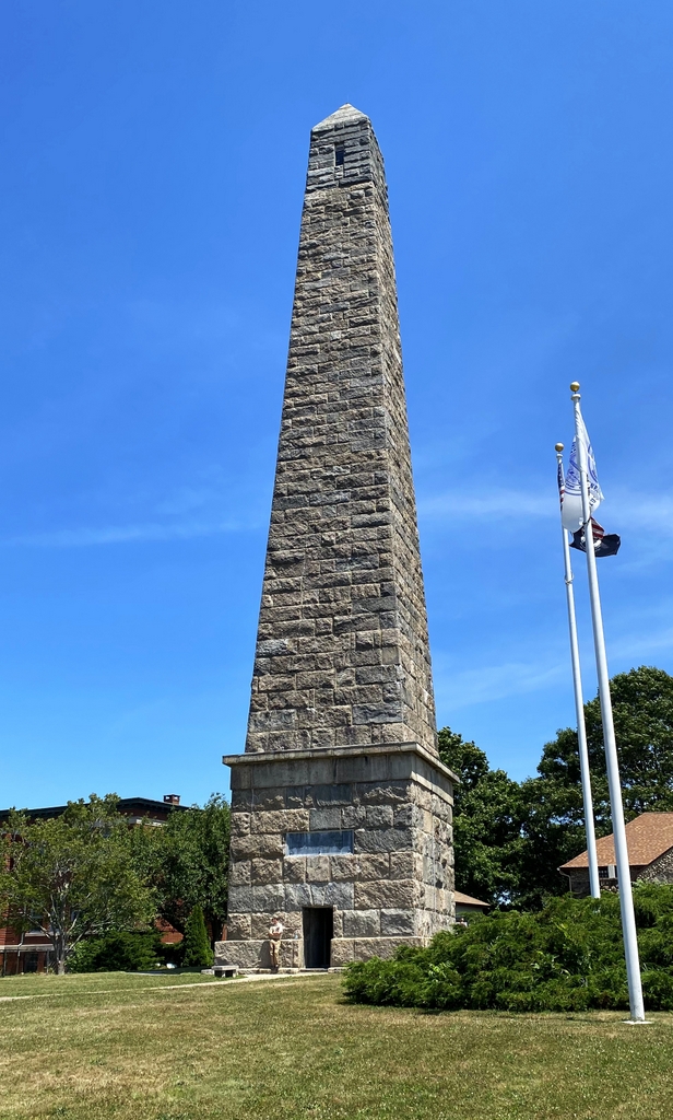
These two photos show the Groton Monument, a 135-foot obelisk that memorializes the American soldiers who died at nearby Fort Griswold during the Battle of Groton Heights. It resembles the more famous Bunker Hill Monument, and these two monuments were actually built around the same time. The cornerstone for Bunker Hill was laid several months earlier, but the Groton Monument was completed in 1830, 13 years before Bunker Hill was completed.

Aside from similar designs, the two monuments also commemorate similar battles that, in many ways, bookend the American Revolution in New England. Bunker Hill was the first major battle of the war in the region, and Groton Heights was the last. Both involved relatively small numbers of Americans fighting from an elevated position against a much larger British force, and both ultimately ended as British victories, but not before the Americans inflicted heavy casualties on them. And, both were essentially pyrrhic victories; the British took substantial losses, and were unable to exploit any real strategic advantages from the battles.

In the end, about 85 American soldiers were killed here at the Battle of Groton Heights, and about 48 British soldiers. In addition, about 35 Americans were wounded, and about 145 British, and many of these wounded men on both sides subsequently died of their injuries. Making this battle particularly controversial was the fact that, according to many American accounts of the battle, most of the American losses occurred after they attempted to surrender once the British breached the walls of the fort. There are different theories about exactly what led to this, including the possibility that the British had mistakenly interpreted a flag being shot down in the midst of the battle as a signal of surrender, which then made them wary of the actual surrender later in the battle. Either way, the 160 American defenders suffered extremely high casualty rates. As a result, the battle is also sometimes referred to as the Fort Griswold Massacre.

This battle would prove to be one of the last major land battles of the war. Less than a month and a half later, the combined forces of George Washington and Jean-Baptiste de Rochambeau forced the surrender of General Cornwallis at Yorktown, Virginia, which effectively ended the war. As a result, Fort Griswold had essentially no bearing on the outcome of the war, and it was soon overshadowed by Yorktown, which might explain why it is not as well-known as some of the other major battles that occurred in New England during the war.

For many years after the war, there were very few monuments of any kind at any of the battlefields. However, this started to change somewhat by the 1820s, around the time that the surviving veterans of the war were reaching advanced ages. Over the next few decades, a handful of monuments were dedicated, ranging from relatively modest ones like the obelisk at the site of Old North Bridge in Concord, to far more ambitious ones like the 221-foot Bunker Hill Monument.

Here in Groton, there was a similar desire to memorialize the defenders of Fort Griswold. On September 6, 1825, on the 44th anniversary of the battle, the cornerstone was laid for this monument. The ceremony drew a crowd of an estimated 8,000-10,000 people, and the guests of honor included 18 survivors of the battle. One of them wore the same vest that he had worn during the battle, which still had two bullet holes in it.

The keynote speaker for the ceremony was William F. Brainard, a New London lawyer. His address, as described in the New London Gazette, “was at once patriotic, vehement, animated, original and in short most eloquent.” He covered a range of topics, including highlighting the many ways in which European powers have harmed the Americans before transitioning into discussing the specifics of this battle. Along the way, he also emphasized the many wrongs that had been committed—and were still being committed—against Native Americans. He identified it as a sin committed by their forefathers, and he also criticized Americans of his own time period for their hypocrisy in supporting missionary work in faraway places, rather than using their money to help support Native Americans here in this country.

To emphasize this last point, Brainard noted the irony of “sending to a distant land, small and pitiful donations, the spare change from the produce of farms, all of which were wrested from Indians, and some of which are cultivated by slaves.” Brainard then acknowledged that, while the topic was only partially related to his address on the American Revolution, he believed that it was important to mention the memory of the Pequots, “whose land we occupy.”

Brainard then spent the second half of his speech describing the events of the battle, and he concluded on a confident note, believing that the monument would have a long future ahead of it. He declared:

In such hands, whatever structure may be here raised, the keeping of it will be safe. The relatives and decendants of the dead may be presumed to inherit a portion of their spirit, and will defend the sepulchres of their fathers.

Never again, it may be fairly predicted, never again will this spot be invaded with success. We owe this assurance to the dead defenders of this place.

Yonder are their graves—peace to their memories!

Following the ceremony, some newspapers noted that some critics had derided the monument as merely being a copy of the Bunker Hill Monument, which had likewise just begun construction. However, as noted earlier, the Groton Monument would be completed much sooner than Bunker Hill. It was finished in 1830, although its appearance was different from these two photos. It originally stood 127 feet high, and it was topped by a cupola.

The monument would have that design throughout most of the 19th century, but in 1881 the upper part was reconstructed, with a pyramidion replacing the original cupola. As part of this project, the height of the monument was raised eight feet, bringing it to its present-day height of 135 feet.

The 1881 alterations coincided with the centennial of the battle, which was celebrated on September 6, 1881. This event was well attended, with various estimates ranging from 30,000 to 100,000 people here. It featured a reenactment of the battle, along with a speech by Senator Joseph R. Hawley of Connecticut. Prominent guests included General William T. Sherman, along with Chief Justice Morrison Waite, who was a Connecticut native.

Sherman gave a short speech at the request of the audience, and he somehow ended up talking about Native Americans, just as Brainard had almost 60 years ago. However, Sherman was not as progressive in his views as Brainard had been. He began his speech by praising the people of Connecticut, and he noted that his ancestors came from the state. However, as the Springfield Republican noted in its coverage, “[t]hen Sherman took occasion to advocate the extermination of the Indians.” He spent most of the remainder of his speech defending this reasoning, while also reminding Connecticut residents who might sympathize with the western Indians that it was Connecticut that had set this precedent by killing the Pequots early in the colonial era. This tirade does not seem to have had much direct connection to the subject at hand, although Sherman did make an attempt to compare the massacre of the fort’s defenders to the deaths of George Custer and his men at the Battle of Little Bighorn.

After Sherman, the next speaker was Congressman John T. Wait, the cousin of the Chief Justice. He was followed by the Rev. Leonard W. Bacon, who recited a poem, “The Lay of Groton Height,” that he had composed about the battle. Next was a military parade on State Street in New London, and then the day’s festivities were concluded with an elaborate fireworks display in the evening.

The first photo was taken only about 20 years after this centennial celebration, and the scene still looks largely the same as it did in the first photo, aside from more trees in the landscape today. The monument itself has not seen any significant exterior changes since then, and it is still open to the public seasonally, for those who are willing to climb the narrow 166-foot spiral staircase to the top. It is part of the Fort Griswold State Park, which also includes a small museum in the old caretaker’s house to the right, along with the preserved fort itself.

Lower Battery of Fort Griswold, Groton, Connecticut

The Lower Battery of Fort Griswold, seen from the southwest corner of the upper fort around 1900. Image from The Battle of Groton Heights (1903).

The scene in 2022:

As explained in more detail in an earlier post, Fort Griswold was built during the American Revolution, on a hill overlooking New London Harbor. It was completed in 1778, and it was the focal point of the Battle of Groton Heights on September 6, 1781, when British forces under the command of Benedict Arnold captured the fort and killed around 85 American soldiers in the process.

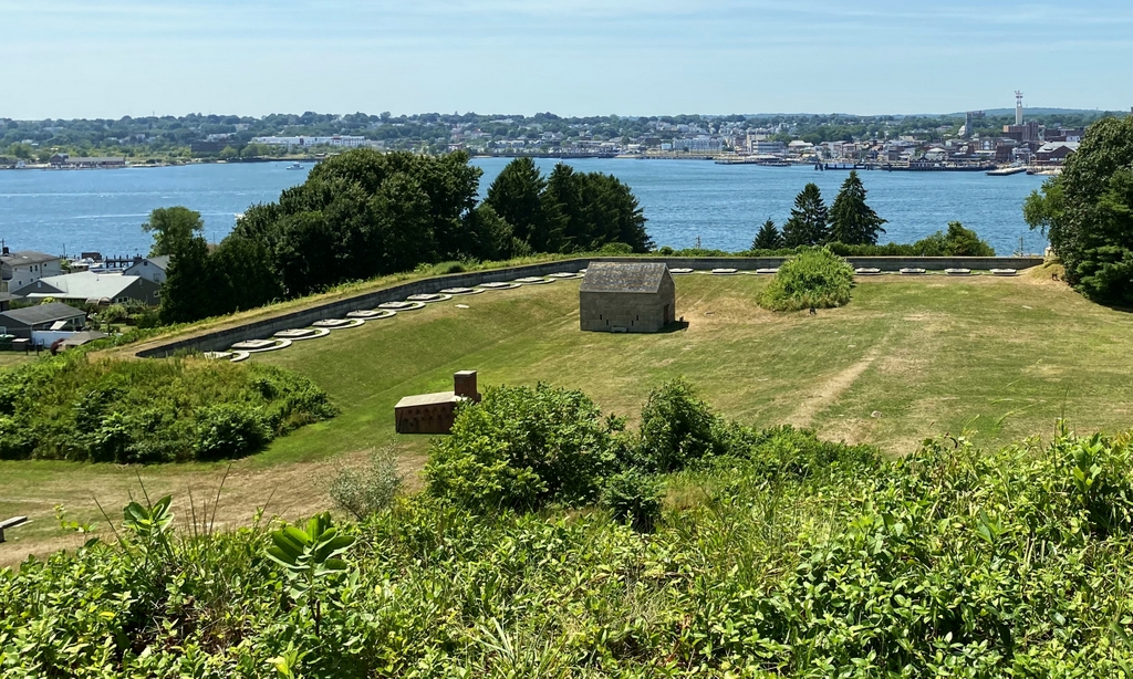
The main part of the fort was designed as a typical star fortress, with a roughly pentagonal shape that had bastions on each corner. However, it also had a lower battery, which was located just to the southwest of the fort, between the fort and the river. It was connected to the fort via a trench and a sally port in the southern wall of the fort. This battery did not see any significant action during the battle, since the British approached the fort from the southeast, rather than on the southwestern side.

After capturing the fort during the battle, the British attempted to ignite the powder magazine and destroy the fort. However, this plan failed and the fort ultimately survived. It remained in use for many years as a part of the harbor defenses, although it played a secondary role to Fort Trumbull in New London, which became the main fortification in the harbor.

Unlike Fort Trumbull, which was reconstructed several times after the Revolution, the main part of Fort Griswold would remain well preserved in its 18th century appearance. The only significant changes to Fort Griswold were at the lower battery, which is shown here in these two photos. This part of the fort was reconstructed in the early 1840s, with new emplacements for 20 guns, along with a shot furnace and a powder magazine. Both of these structures were built in 1843, with the powder magazine being used to store gunpowder and the shot furnace for heating cannonballs, in order to set wooden ships on fire upon impact.

The fort’s guns would be upgraded to Rodman guns around the time of the Civil War, and these appear to have been the types of guns that are visible in the first photo, which was taken around the turn of the 20th century. Fort Griswold would continue to be used as an active military installation until after World War II, although for much of this time it was only lightly garrisoned.

The state of Connecticut subsequently acquired the property, and in 1953 the fort and battlefield became the Fort Griswold State Park. As shown in these two photos, the lower battery has remained well preserved, with the only significant difference being the lack of guns in the present-day scene. The upper part of the fort, where these two photos were taken, is similarly preserved, and the facility is open to the public for self-guided tours, along with the nearby Groton Monument, which honors those who died in the battle.

Fort Griswold, Groton, Connecticut (2)

The interior of Fort Griswold facing north toward the Groton Monument, around 1900, Image from The Battle of Groton Heights (1903).

The scene in 2022:

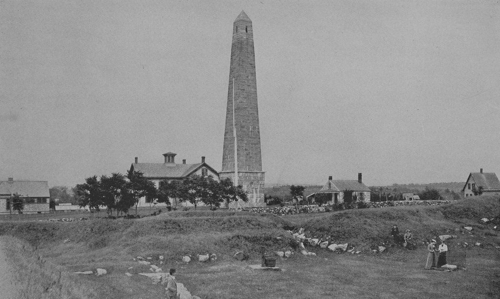
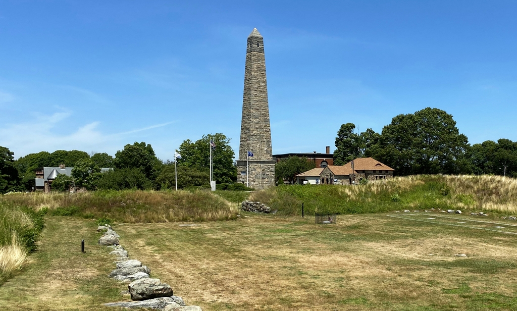
As explained in more detail in the previous post, Fort Griswold was the site of one of the last major battles of the American Revolution. The fort was constructed between 1775 and 1778 on a hill near the waterfront in Groton, directly across the harbor from New London. Like most forts of the time period, it was star-shaped, with bastions on the corners to prevent blind spots where attackers could take cover. The walls of the fort were made of stone and earth, and inside the walls was a barracks building, which stood on the far right side of this scene, on a spot that is now marked by a rectangular stone outline. These two photos were taken from the southwest bastion, and they show the interior of the fort facing north. In the distance, the gap in the north wall is where the main entrance to the fort was located.

The fort played a major role in the raid on New London, which occurred on September 6, 1781. It was led by Benedict Arnold, a native of nearby Norwich who had fought in the Continental Army until his treasonous activities were discovered a year earlier. He was subsequently commissioned as a brigadier general in the British army, and he commanded redcoats in several important battles in 1781, including the raid on Richmond in January and the Battle of Blandford in April. His raid here in New London would prove to be his last command, and it was also the last major military action in New England during the war.

Arnold’s forces included about 1,700 men, which he divided roughly in half. One half, which he personally led, conducted the raid of New London on the west side of the Thames River, while the other half, led by Lieutenant Colonel Edmund Eyre, landed in Groton on the east side, and attacked Fort Griswold. They approached the fort from the southeast, behind and to the right of where these photos were taken, and they sustained heavy casualties against a much smaller group of American defenders, which numbered about 160 men commanded by Lieutenant Colonel William Ledyard.

Because of their much larger numbers, the British eventually managed to get a few men over the walls, who were then able to open the gate on the northern side and allow the rest of the redcoats into the fort. It was at this point that Ledyard, seeing that the battle was clearly lost, attempted to surrender. There is considerable debate about exactly what happened and who did it, but American accounts of the battle generally agree that Ledyard, when asked by a British officer who commanded the fort, responded “I did, sir, but you do now,” and presented him with his sword with the handle facing the British officer and the point facing himself, as a sign of surrender. However, rather than accepting the surrender, the British officer took the sword and stabbed Ledyard with it. The spot where he fell is now marked by a stone marker surrounded by a low fence, as shown in the lower right side of both photos.

After Ledyard’s death, British soldiers continued to attack the American defenders here in the fort. Prior to this point, only about six or seven Americans had been killed, but around 85 would end up being killed, along with others who would later die of their wounds. Once the fighting stopped, many of the survivors were taken prisoner, although those who were badly wounded were generally paroled rather than being transported to New York. On the British side, Arnold reported that 48 were killed in the battle and 145 were wounded, many of whom later died.

Overall, the battle was a British victory, but it proved to be ineffective. They had attempted to destroy the fort by igniting the powder magazine, but this plan failed and they left Groton with the fort still intact. The main purpose of the raid had been to take some pressure off of General Cornwallis in Virginia, since the combined forces of George Washington and Jean-Baptiste de Rochambeau were, at the time, making their way south to lay siege to Cornwallis’s army. However, the raid was not enough to divert their attention, and Cornwallis ultimately surrendered his army a little over a month later, effectively ending the American Revolution.

Fort Griswold would remain a part of the harbor defenses here for many years, but in the meantime the battlefield also became the site of the Groton Monument, which is shown in the background of these two photos. Construction began in 1825, with a cornerstone-laying ceremony on 44th anniversary of the battle, which was attended by 18 survivors from the fort. This was only a few months after work began on the Bunker Hill Monument, which was similarly designed as an obelisk. However, the Groton Monument was completed in 1830, while the taller Bunker Hill Monument would not be completed until 1843.

The Groton Monument was originally 127 feet tall and topped with a cupola, but in 1881 the top was reconstructed with a pyramidion, and the monument now stands eight feet taller. This appears to be the reason why the stone blocks near the top are a slightly different shade than the rest of the monument.

The first photo was taken around the turn of the 20th century, and not much has changed since then. Both the fort and the monument are now part of the Fort Griswold State Park, which was established in 1953. It also includes the Monument House, which is visible just to the right of the monument. It was built in 1830 as the home of the caretaker, but at some point after the first photo was taken it was expanded with a large addition to the back of it, and it now houses a museum that focuses on the battle and the history of the fort. Also visible in both photos, in the distance on the far left side, is the Bill Memorial Library, which was built in 1890. The only significant change here is the Groton Heights School, which once stood beyond and to the left of the monument. This school building was later demolished, and the newer school building is partially visible beyond and to the right of the monument in the present-day scene.