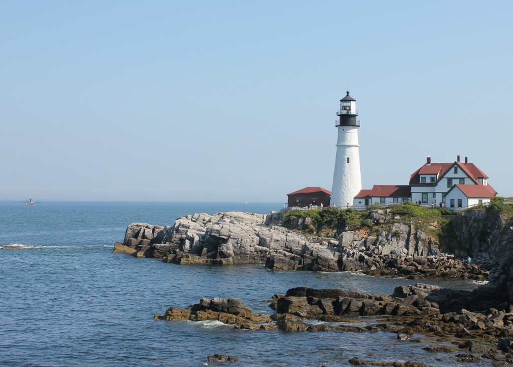
Portland Head Light, Cape Elizabeth, Maine (3)

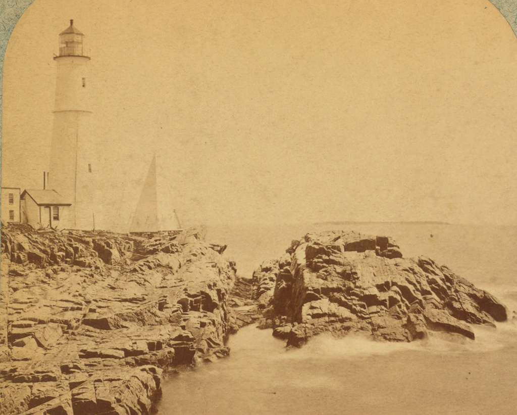
Another view of Portland Head Light, probably taken around the 1870s. Image courtesy of the New York Public Library.

741_1865-1883c nypl

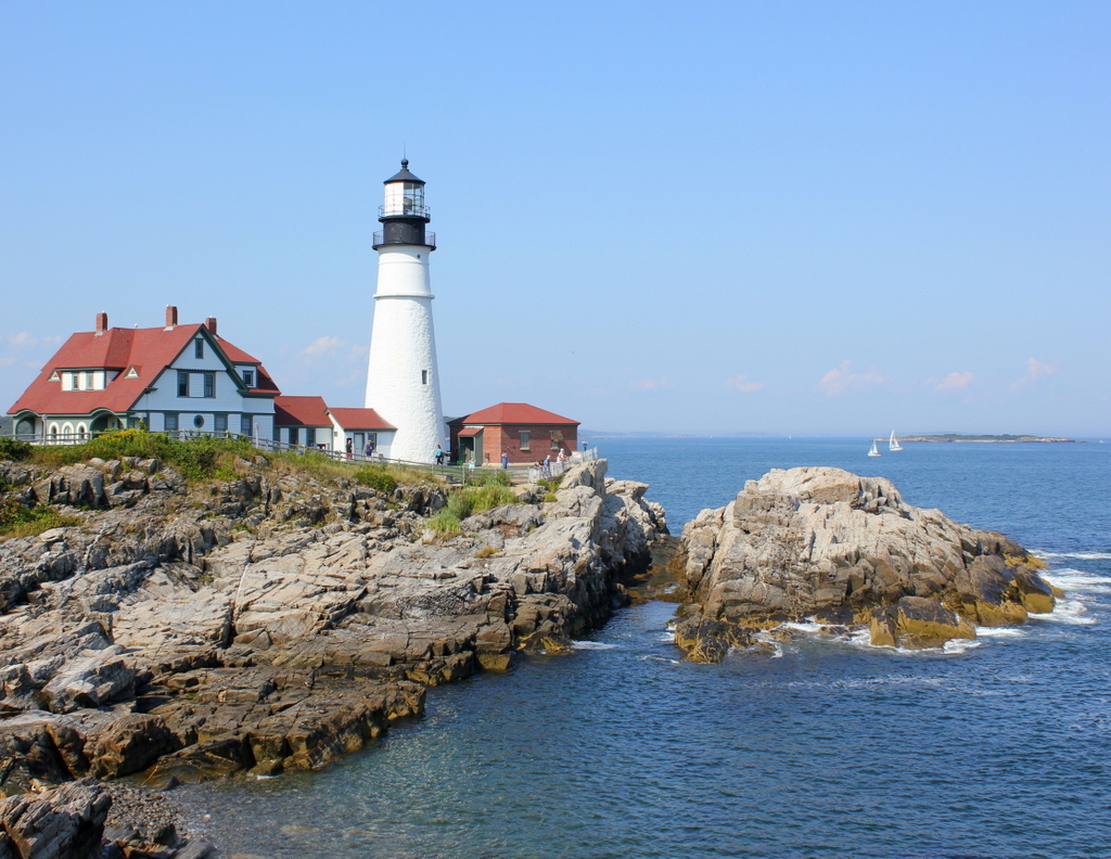
The lighthouse in 2015:

741_2015
The first photo here was probably taken around 10-20 years before the ones in the previous two posts here and here, and it shows the tower as it appeared following its 1865 height change.  As mentioned in more detail in the first post, the lighthouse was built in 1791, but was reduced in height by 20 feet in 1812, to the spot below the lantern where a horizontal band runs around the tower.  Those 20 feet were restored in 1865, as seen in the first photo, but the tower was trimmed down again in 1883.  Just two years later, though, enough sailors complained that it was raised 20 feet yet again, with changes such as a larger lantern room at the top and  a second gallery below it.  Since 1885, it hasn’t seen very many changes, and it remains an active lighthouse as well as a popular tourist destination along the southern coast of Maine.

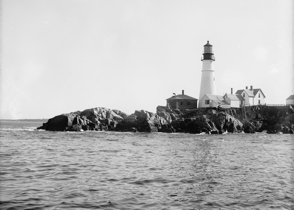
Portland Head Light, Cape Elizabeth, Maine (2)

Another view of Portland Head Light, taken from the north side probably around 1890. Image courtesy of the Library of Congress, Detroit Publishing Company Collection.

740_1900-1910c loc
The lighthouse in 2015:

740_2015
The angle here isn’t exact; the first photo was taken from the water, a little to the left of where the 2015 photo was taken.  The previous post explains more about the history of the lighthouse, which was built in 1791 on a rocky outcropping at the entrance to Portland Harbor.  The first view was presumably taken around the same time as the one on the other post, because it shows the old 1816 keeper’s house, which was replaced by the current one in 1891.

Being surrounded by water on three sides and facing the open ocean provides some dramatic views for visitors and photographers, and it probably also provided the inspiration for Henry Wadsworth Longfellow’s poem “The Lighthouse.”  Longfellow grew up in Portland, and the certainly seemed to be describing this lighthouse, writing in the first two stanzas:

The rocky ledge runs far into the sea,
And on its outer point, some miles away,
The Lighthouse lifts its massive masonry,
A pillar of fire by night, of cloud by day.

Even at this distance I can see the tides,
Upheaving, break unheard along its base,
A speechless wrath, that rises and subsides
In the white lip and tremor of the face.

The lighthouse would have looked a little different when Longfellow wrote the poem, though.  The keeper’s house would have been the same as the one in the first photo, but as mentioned in the previous post, its height was periodically changed throughout the 19th century, and did not assume its present-day appearance until 1885, three years after Longfellow’s death.  Today, with the old keeper’s house gone, the only thing left from Longfellow’s childhood visits is the section of the tower below the horizontal band a little below the lantern.

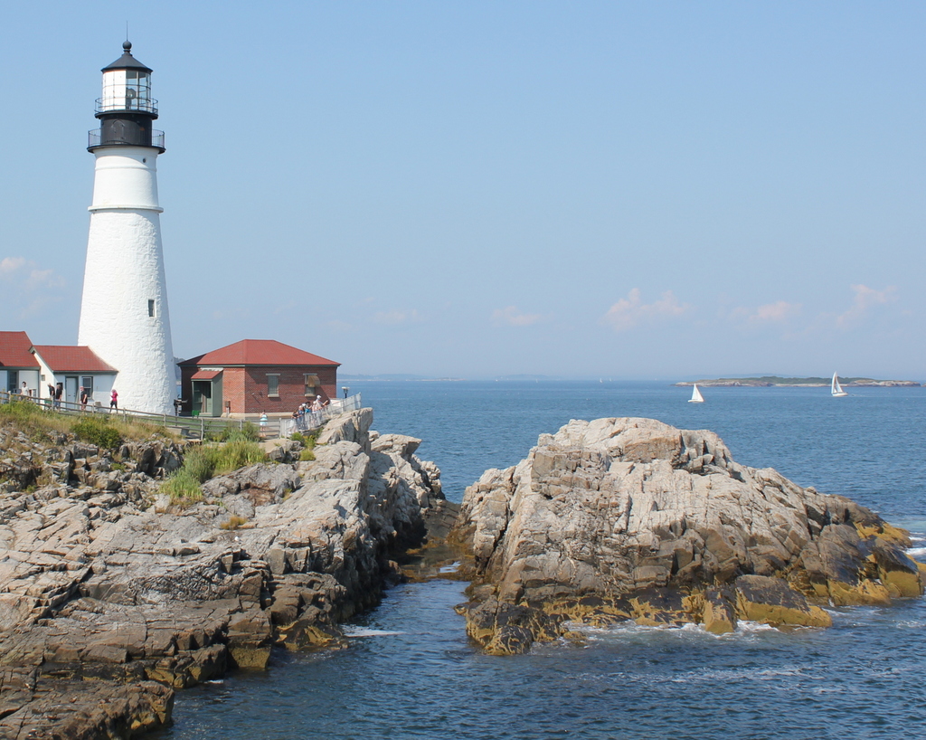
Portland Head Light, Cape Elizabeth, Maine (1)

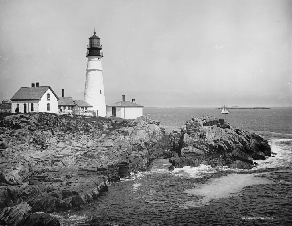
The view of Portland Head Light, possibly around 1890. Image courtesy of the Library of Congress, Detroit Publishing Company Collection.
739_1902c loc

The lighthouse in 2015:

739_2015
Aside from perhaps lobsters and pine trees, Portland Head Light is one of Maine’s most recognizable symbols.  The iconic lighthouse is among the most famous in the world, and in the past few years it has been featured in lists such as USA Today’s “10 best lighthouses around the USA“, The Weather Channel’s “11 Amazing Lighthouses of the World“, and Mental Floss’s “10 of the Most Beautiful Lighthouses in the World.”  However, this is not a recent phenomenon; the picturesque lighthouse overlooking Portland’s Casco Bay has attracted generations of photographers, as seen in the photo from the Detroit Publishing Company over a hundred years earlier.

The lighthouse was completed in 1791, in what was at the time part of Massachusetts.  As its name suggests, Portland was, and still is, one of New England’s major commercial ports, so a lighthouse was needed to mark the southern edge of the main shipping channel into the harbor. It was the first lighthouse to be built by the United States government (all earlier lighthouses were built prior to the Revolution or prior to the federal government assuming control over lighthouses), and it was also the first of many lighthouses in present-day Maine.

As built, Portland Head Light looked very different from today.  It was only 72 feet tall, but poor construction of both the tower and the keeper’s house became evident within 20 years.  The leaking lighthouse was lowered by 20 feet in 1812, and the keeper’s house was replaced in 1816 by the one seen in the first photo.  This website provides more details, along with a few historic photos of the lighthouse, including one from 1859 that is barely recognizable compared to the two views shown above.

The tower’s height continued to fluctuate throughout the 19th century.  In response to a deadly 1864 shipwreck, it was raised 20 feet for better visibility, only to be reduced again in 1883.  Two years later, though, the third and final height change gave the tower its present appearance.  This is still noticeable today; the ring around the upper section of the tower separates the 1885 addition from the original 1791 structure.

The only obvious difference between the two photos above is the keeper’s house to the left, and this is where there is somewhat of a discrepancy with the date of the photo.  The Library of Congress estimates that the first photo was taken around 1902. However, the records indicate that the present-day keeper’s house was built in 1891, and assuming this is correct, it would make that the earliest that this photo could have been taken.  This is far earlier than most of the other photos in the Detroit Publishing Company collection, though, so the exact date seems to be questionable.

Date questions aside, the lighthouse is still an active aid to navigation for one of the busiest ports on the east coast, although the keeper’s house is no longer used as a residence.  The light was automated in 1989, eliminating the need for a full-time lighthouse keeper. so today the house is owned by the town of Cape Elizabeth, and is operated as a maritime museum as part of Fort Williams Park.
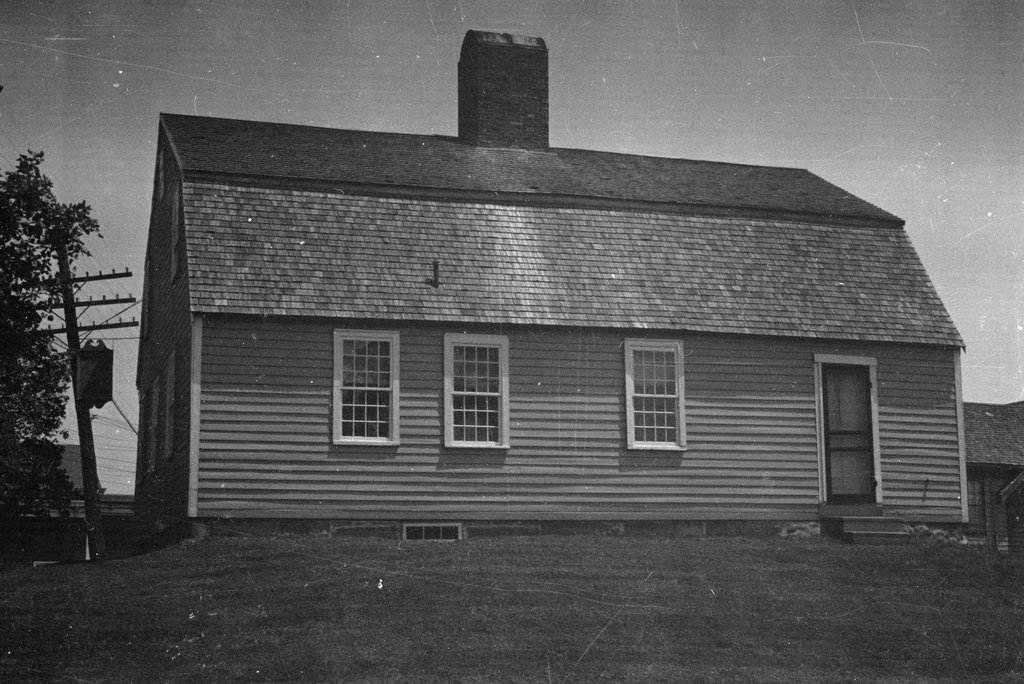
Burnham Tavern, Machias, Maine (2)

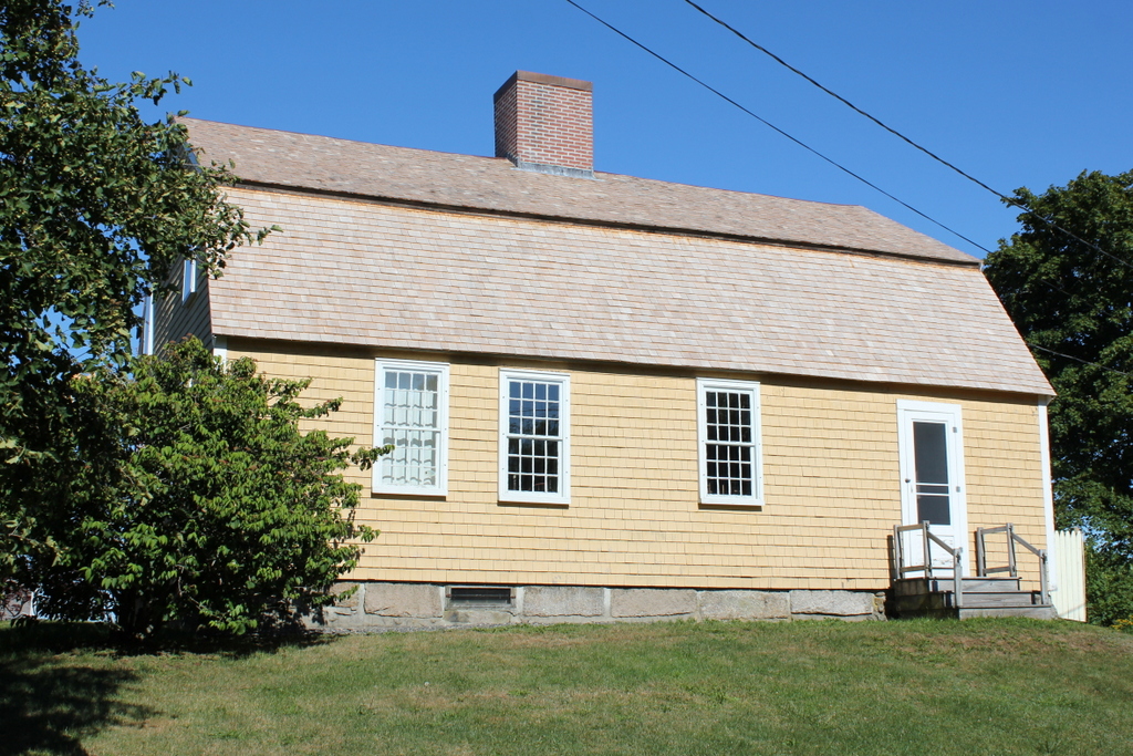
Another view of the Burnham Tavern, taken on June 17, 1937. Image courtesy of the Library of Congress, Historic American Buildings Survey Collection.

738_1937-06-17 loc habs

The building in 2015:

738_2015
This view shows the rear of Burnham, which as explained in the previous post was built in 1770 and played a role in the planning of the Battle of Machias, one of the first naval battles of the American Revolution.  Today, the building is well-preserved, and is maintained by the local chapter of the Daughters of the American Revolution as a museum, complete with period furnishings on the interior.  The first photo shows its appearance when it was documented for the Historic American Buildings Survey in 1937, and its exterior is virtually unchanged in the nearly 80 years since.  The only noticeable difference is the use of painted shingles instead of clapboards; this is actually in keeping with 18th century customs of putting clapboard on the front and shingles on the sides and back.

Burnham Tavern, Machias, Maine (1)

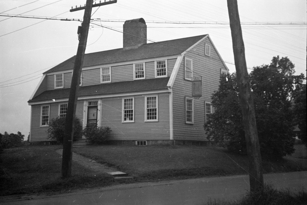
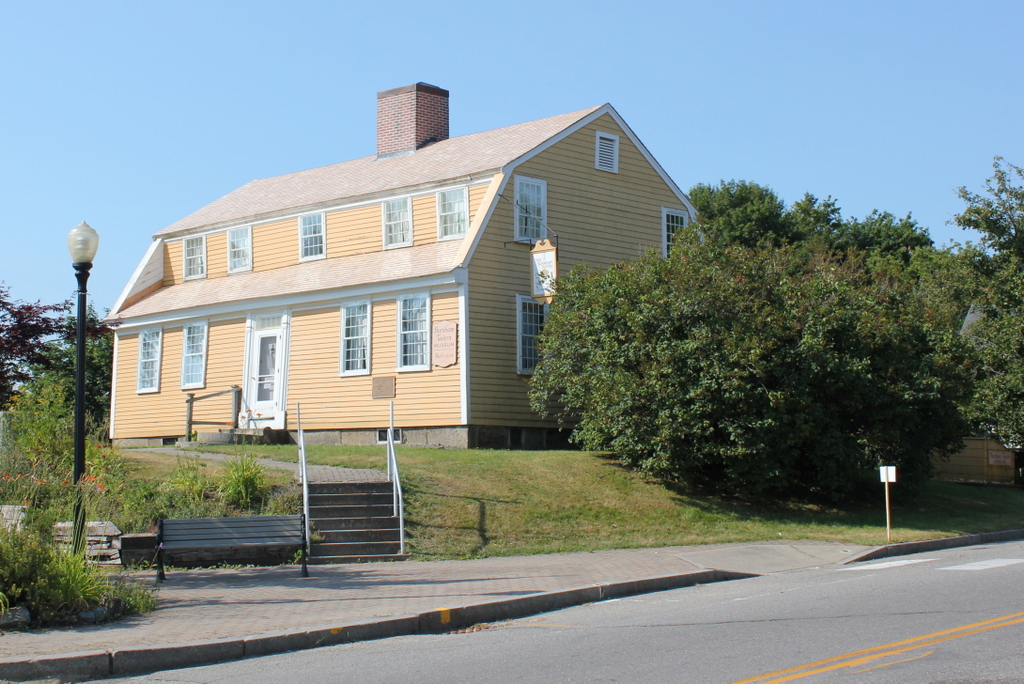
Burnham Tavern in Machias, seen on June 17, 1937. Image courtesy of the Library of Congress, Historic American Buildings Survey Collection.

737_1937-06-17 loc habs

The building in 2015:

737_2015
This building is so old that it was built in a different state.  Maine was part of Massachusetts until 1820, and this tavern not only predates Maine statehood, but it also predates the American Revolution by several years.  Despite its remote location on the extreme eastern edge of the United States, it played a role early on in the Revolution, and it remains preserved as a historic landmark over 240 years later.

Burnham Tavern was built in 1770, just seven years after the area was first settled by English colonists.  Five years later, the American Revolution started, and the tavern was used to plan what became the second naval battle of the war.  In June 1775, a group of local militiamen led by Jeremiah O’Brien and Benjamin Foster captured the British schooner HMS Margaretta.  The Margaretta was renamed the Machias Liberty, and in August it and another captured vessel were commissioned as the first two ships in the Massachusetts navy.

In part because of its proximity to the British colonies in present-day Canada, Machias became a base of operations for privateers who captured British merchant vessels during the war.  In response, the British launched an attack in August 1777, with an invasion force of 123 marines and four of the most harmless-sounding ships in naval history: the HMS Rainbow, HMS Blonde, HMS Mermaid, and HMS Hope.  Undeterred by such intimidating ship names, local militiamen and Native American allies drove off the ships, and Machias survived the war without any additional attacks.

The building’s historic significance was already understood by the time the 1937 photo was taken, when it was documented for the Historic American Buildings Survey.  Not much has changed since then, down to the sign hanging on the right side of the building.  It retains much of its 18th century appearance, both on the outside and on the inside, and it is operated as a museum by the local chapter of the Daughters of the American Revolution.

John Brown’s Fort, Harpers Ferry, West Virginia

The fire engine house at the Harpers Ferry Armory, more commonly referred to as “John Brown’s Fort,” as seen around 1860. Image courtesy of the Library of Congress, Civil War Collection.

732_1860c loc

The same view in May 1939. Image courtesy of the Library of Congress, FSA/OWI Collection.

732_1939-05 loc

The scene in 2015:

732_2015 loc
This small, seemingly nondescript building was built in 1848 at the entrance to the Harpers Ferry Armory, and was used as a guard house and fire engine house.  Normally, such a building would not be the subject of an 1860s stereocard, but it gained widespread fame just a few years earlier, due to its role in John Brown’s raid on the armory.

On October 16, 1859, northern abolitionist John Brown led a group of 22 men who attempted to take the armory and start a slave rebellion. They succeeded in taking the armory, and took a number of Harpers Ferry citizens hostage, but the plan quickly unraveled and they ended up barricading themselves in this building, surrounded by local militiamen and other armed townspeople.  Eventually, Colonel Robert E. Lee, still fighting in the US Army at the time, led a detachment of Marines, who succeeded in taking the building and capturing John Brown and most of his men.

To many northern abolitionists, John Brown was a hero, but to southern slaveowners he was a dangerous radical and a criminal. He was executed on December 2 in nearby Charles Town, but the failed raid helped to set the Civil War in motion a little over a year later.  The first photo was probably taken within three years of the raid, and in it the building still bears some of the scars from the fight.

Unlike most of the armory buildings, this one actually survived the war, and over time it became a tourist attraction and a symbol of the abolitionist movement. However, many residents feared that it would become a major draw for African-Americans to visit the town, so they were looking for ways to get rid of it.  Finally, in 1891 the owners decided to dismantle the fort and reassemble it at the World’s Columbian Exposition in Chicago.  It was a colossal failure at the exposition, though; the move cost $60,000, and just 11 people paid the 50 cent admission fee to view the fort.

The fort underwent further dismantlings and reconstructions, before eventually moving to its present-day site about 150 feet to the right of here.  However, it doesn’t have much real historic value, because of the number of times it has been reconstructed and the amount of original materials that has been lost over time.

After the fort was moved from here, the Baltimore & Ohio Railroad built new railroad embankments through the site of the fort, so today it is at a substantially higher elevation than it was in the first photo.  The monument, seen in the last two photos, was added by the railroad and marks the original location.