Rufus Colton House, Agawam, Mass

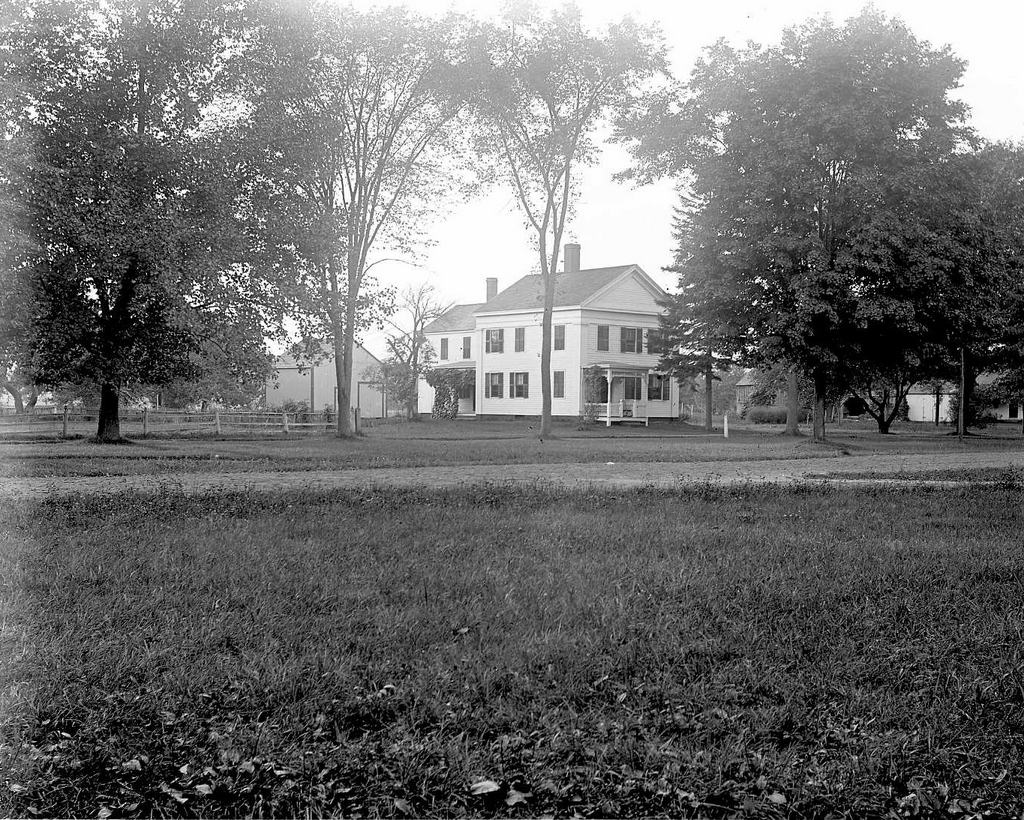
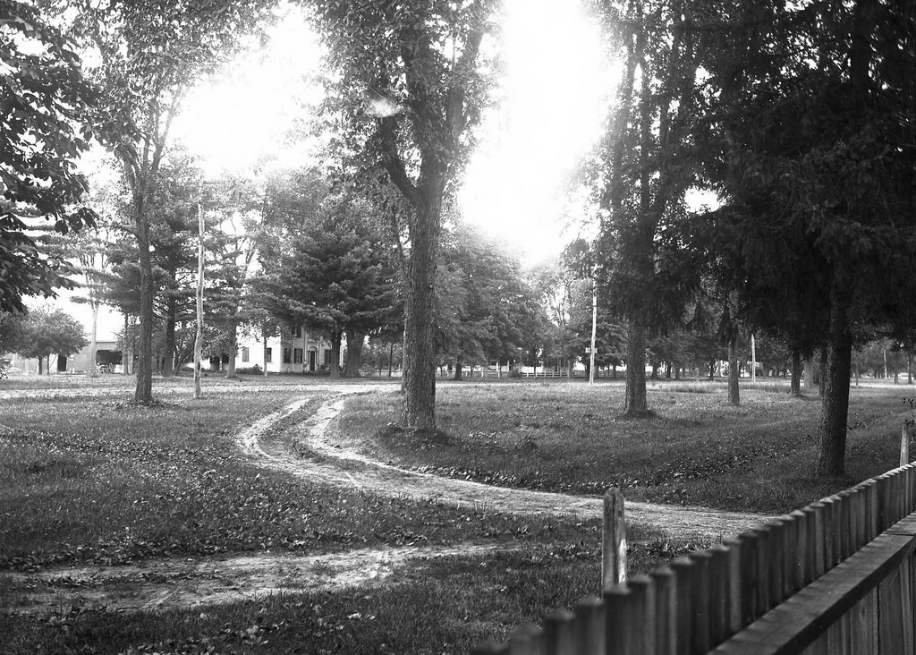
A view of Main Street in Agawam from the corner of Elm Street, with the Rufus Colton House in the distance on the left, seen around 1895-1896. Image courtesy of the Agawam Historical Association.
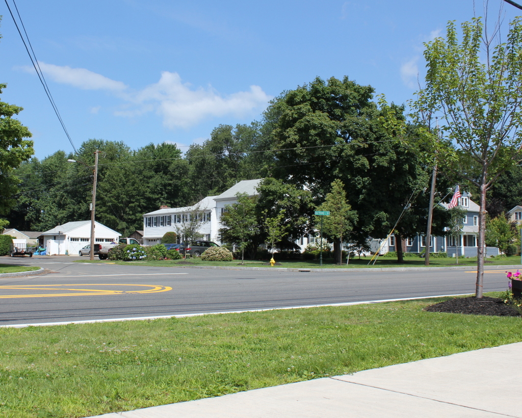
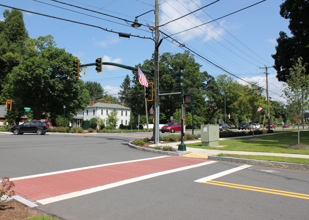
629_1895-1896c aha

The scene in 2015:

629_2015
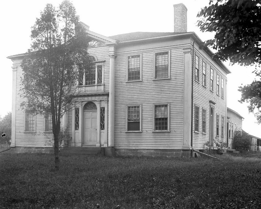
Built in 1806, the Rufus Colton House is architecturally similar to the nearby Captain Charles Leonard House, which was built a year earlier.   Both are believed to have been designed by Asher Benjamin, and like the Leonard House it was built for a local militia officer, Lieutenant Rufus Colton.  Beginning around 1830, it was owned by Martin King (not Martin Luther King, just Martin King), who operated a tavern here for some time.  Main Street was once part of the Boston Post Road, connecting Boston to New York and points south, so it is likely that a good part of King’s business was from travelers on the road.

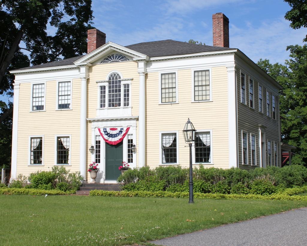
Today, Main Street is busier, with paved streets replacing the dirt roads of the 1890s, but the Rufus Colton House remains well-preserved after over two centuries.  It may or may not have been designed by Asher Benjamin, but either way it is an excellent example of Federal architecture, and it retains many of its original elements, including the hip roof, the fan window over the door, and the Palladian window in the center of the second floor.  In 2001, it was added to the National Register of Historic Places as part of the Agawam Center Historic District.

Congregational Church Parsonage, Agawam, Mass

The parsonage on Main Street in Agawam, around 1895-1896. Image courtesy of the Agawam Historical Association.

628_1895-1896c aha

The house in 2015:

628_2015
This house on Main Street opposite School Street was built around 1850 as the parsonage for the Agawam Congregational Church, which is located a few hundred yards south of here on the opposite side of Main Street.  The church building that it once served was several decades older; it was built in the early 1800s and was demolished in the 1960s, when the current church was built on the same spot.

Today, the parsonage is partially hidden by trees from this angle, but it is still there, with some alterations.  It appears to be a multi-unit apartment now, with additions in the back of the house where the barn once stood in the 1890s photo.  The area around the house has also changed; the house to the right was probably built in the early 1900s, and later on the land behind the parsonage was subdivided and Raymond Circle was developed.  Despite the changes, however, the building is a contributing property in the Agawam Center Historic District on the National Register of Historic Places.

Captain Charles Leonard House, Agawam Mass

The Captain Charles Leonard House on Main Street in Agawam, around 1895-1896. Image courtesy of the Agawam Historical Association.

547_1895-1896 agawamhistoricalassociation

The house in 2015:

547_2015
This house on Main Street in Agawam hasn’t changed much in the past 120 years, nor had it changed much between its construction in 1805 and the 1890s photo.  It is a very well-preserved example of early 19th century Federal architecture, designed by noted architect Asher Benjamin for Captain Charles Leonard, a local militia officer who operated a tavern out of the building.  At the time that the first photo was taken, it was owned by George Fowler, and in the 1930s it was purchased by Minerva Davis and restored to its early 19th century appearance.  Since then, it has been owned by the nonprofit Captain Charles Leonard House Corporation, and has been rented for weddings, banquets, receptions, and a variety of other gatherings.

Agawam Ferry, Springfield Mass

The Agawam Ferry, sometime in the 1870s or earlier. Photo from Springfield: Present and Prospective, published in 1905.

Agawam

The view in 2014:

227_2014

The cities of Springfield and Hartford have historically had a strong connection, being located along the same river only about 25 miles apart.  However, they are located on opposite sides of the river, so travelers have had to cross it one way or another.  Before the construction of the bridges in Springfield, the Agawam ferry, located near the present-day South End Bridge, was the primary way to cross the river when coming from the south.  The ferry was used up until 1879, when the original South End Bridge opened.  This bridge, in turn, was replaced by the present South End Bridge, which is partially visible on the far right of the 2014 photo.  Both photos are taken from the Agawam side of the river, near Bondi’s Island, facing the South End of Springfield.