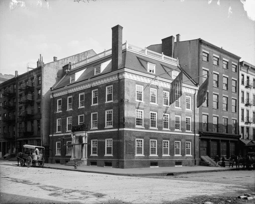
Fraunces Tavern at the corner of Broad and Pearl Streets in New York City, between 1900 and 1906. Image courtesy of the Library of Congress, Detroit Publishing Company Collection.

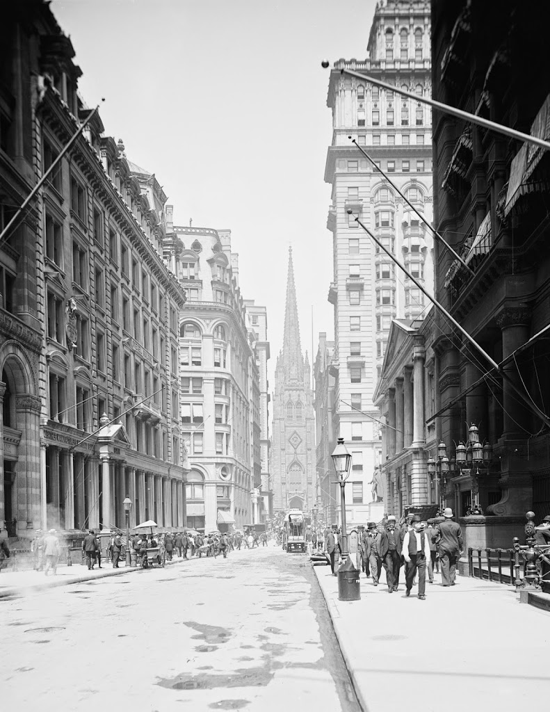
After its reconstruction, around 1907-1915. Image courtesy of the Library of Congress, Detroit Publishing Company Collection.
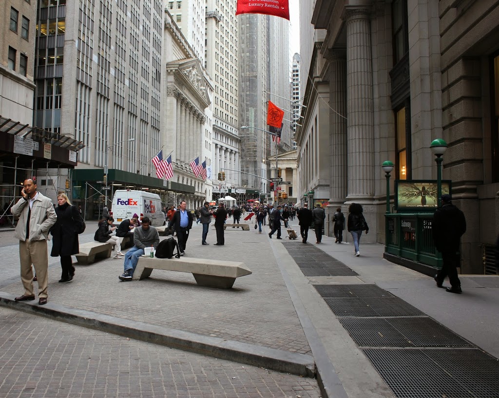
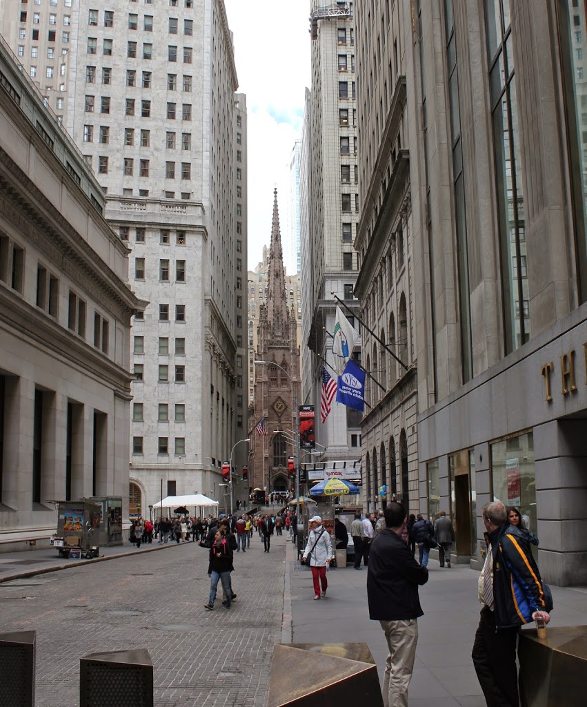
In 2014:
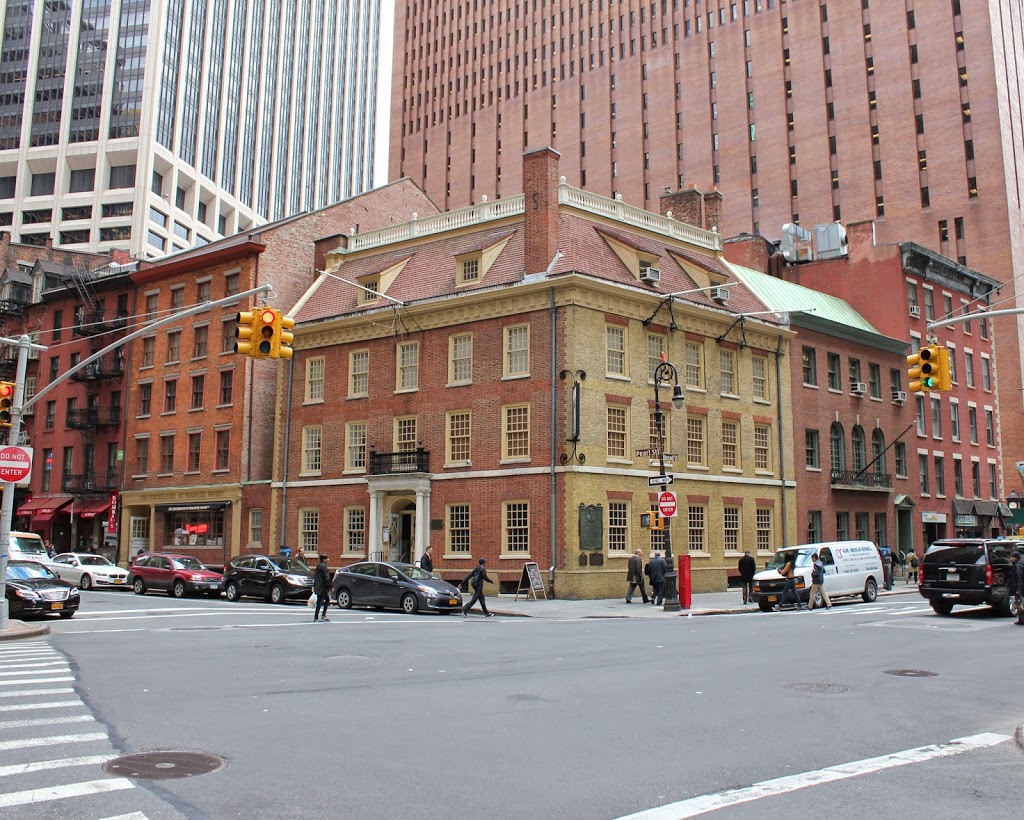
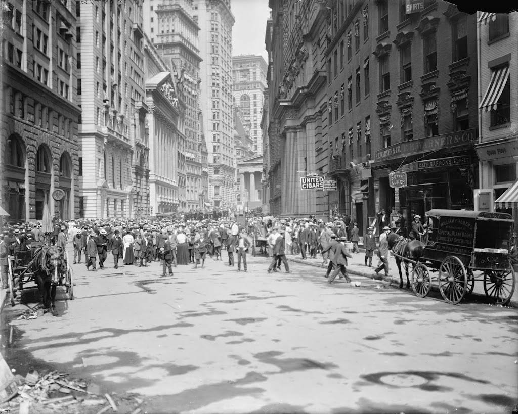
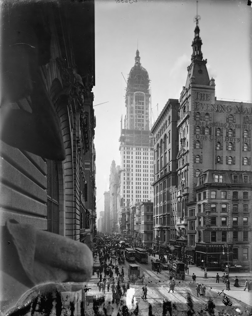
Claimed to be the oldest building in Manhattan, the building was constructed in 1719, and was used as a tavern in the second half of the 18th century and well into the 19th century. However, the building suffered some serious fires in the mid 19th century, and was consequently reconstructed several times. By the turn of the century, it looked nothing like its original appearance. In fact, when it was finally “restored” in 1907, it was redesigned based on what was presumed to be colonial appearance; its actual 18th century configuration is unknown. I don’t know how much of the original structure is left, but I would hazard a guess that it is an architectural equivalent to the ship of Theseus, with the question being, if a building has, over time, had every single part of it replaced, is it still the same building? And if not, at what point did it cease to be the same building? But, if it is the same building, what would happen if, theoretically, all of the original pieces were recovered and reconstructed, say, across the street. Which would be the “real” building? Inquiring minds want to know.