Mather-Eliot House, Boston

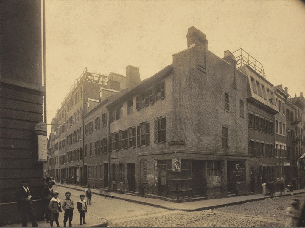
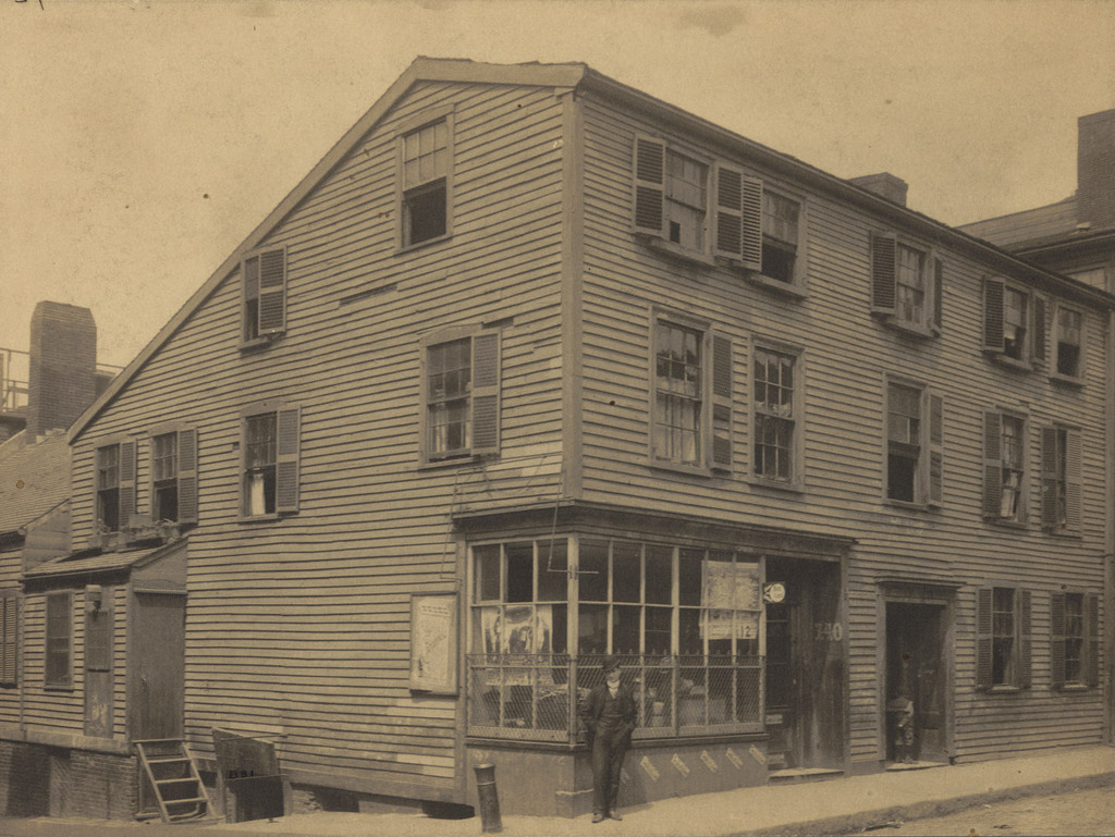
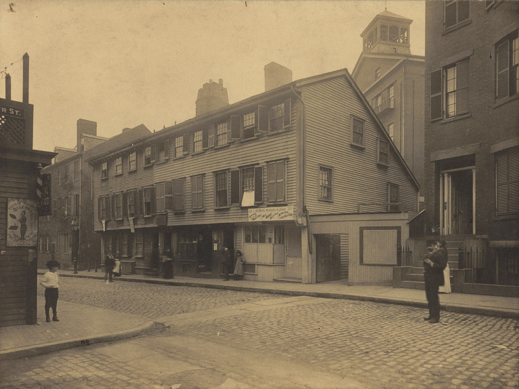
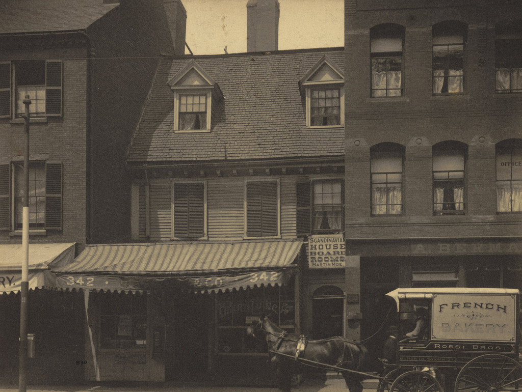
The Mather-Eliot House on Hanover Street, near North Bennet Street in Boston’s North End, around 1898. Photo courtesy of Boston Public Library.
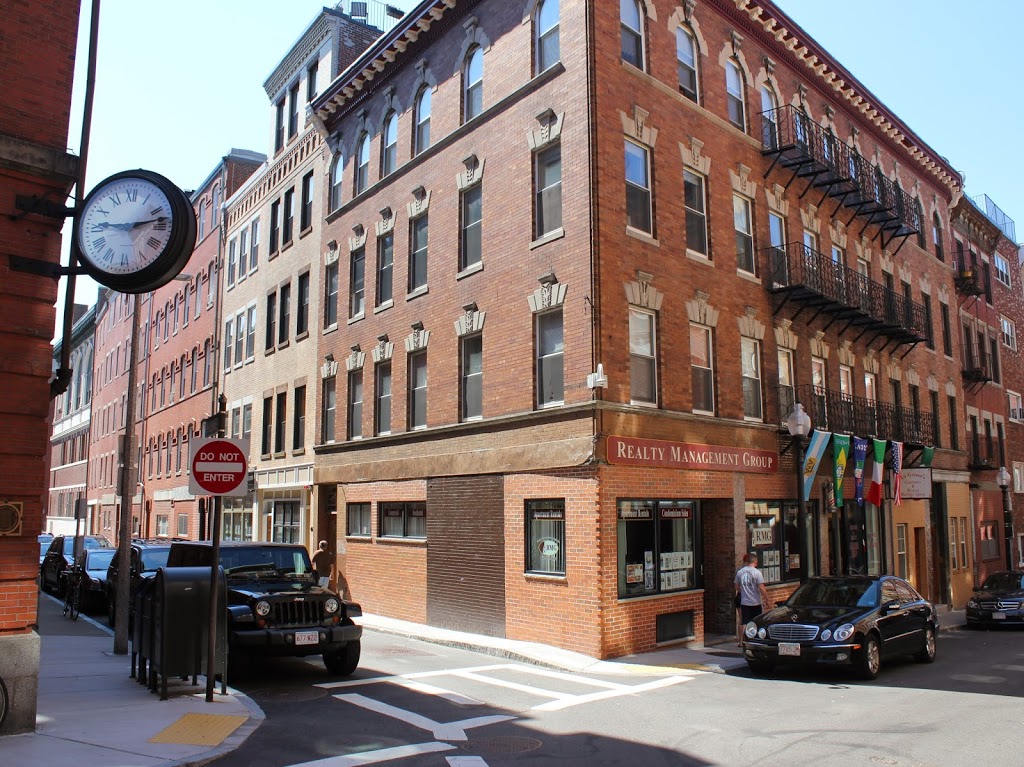
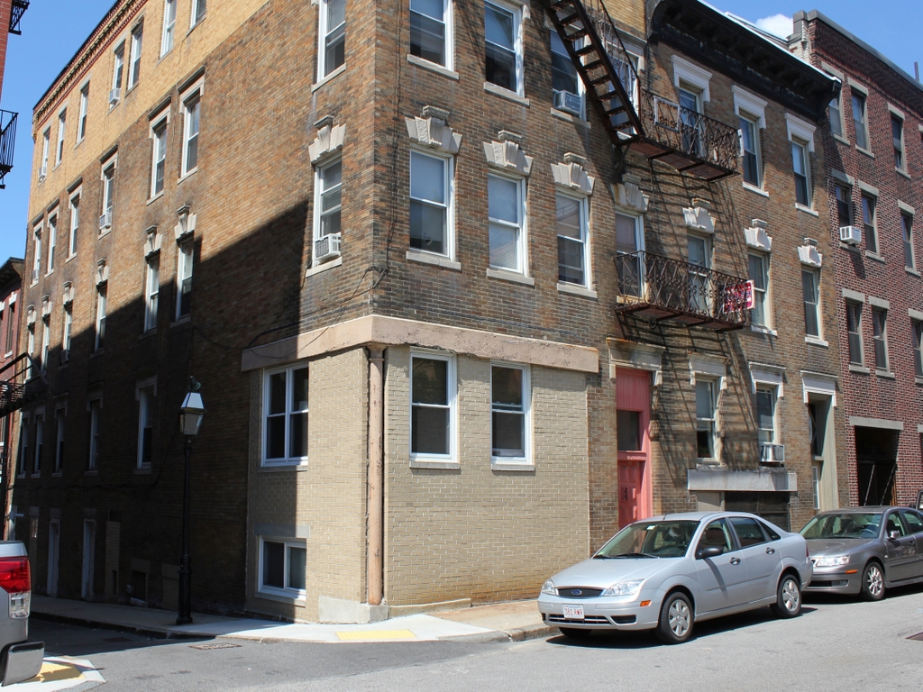
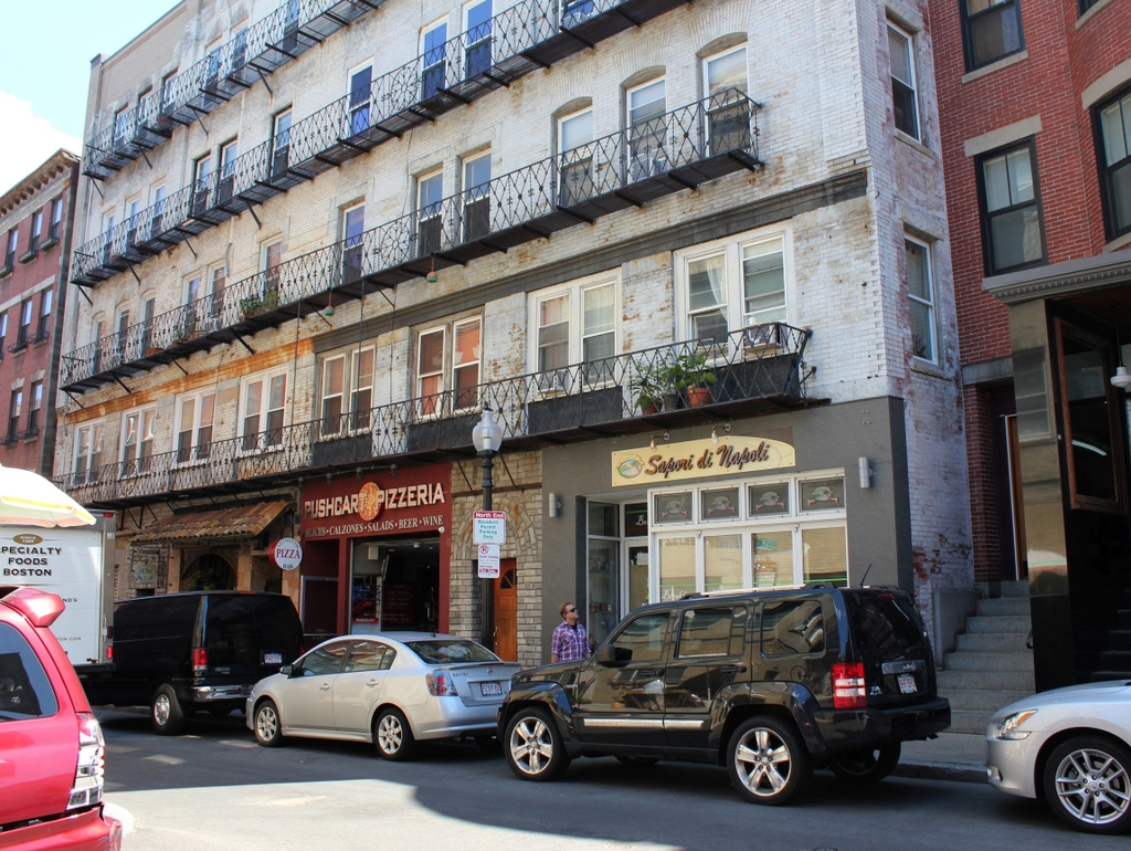
The scene in 2014:

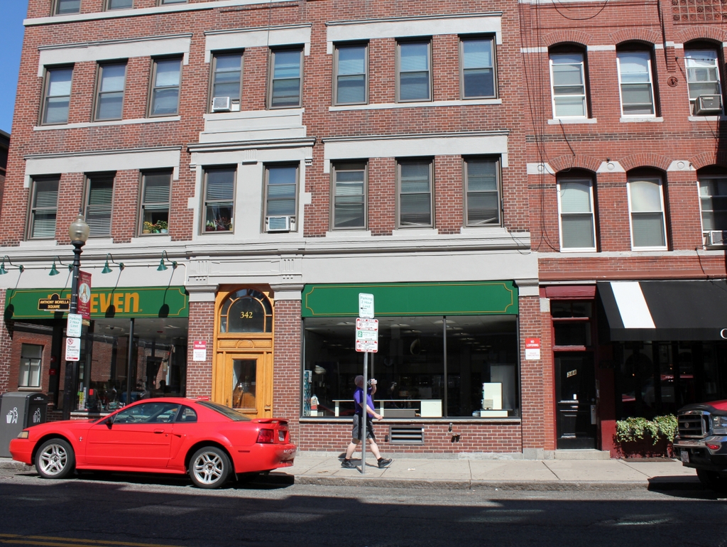
In his 1887 book, Rambles in Old Boston, New England, Edward Griffin Porter describes the house in the first photo as a “fragment of an ancient wooden dwelling, crowded almost out of sight by the larger brick buildings.”  The house at 342 Hanover Street was built in 1677 by noted Puritan minister Increase Mather, after his previous house was destroyed in the fire of 1676.  His son, Cotton Mather, grew up here, and later went on to be a prominent minister as well.  The Mathers only lived here for 11 years, but later on the house was owned by two other famous ministers, Andrew and John Eliot.  The house was still standing in 1899, but was demolished by 1908.  As seen in the 2014 photo, a 7-Eleven now occupies the first floor of the building that sits on the site now.  The building to the left of the Mather-Eliot House is long gone, but the one on the right, which was built in 1884, is still there.

Incidentally, after the fire of 1676 destroyed Increase Mather’s old house, a new house was built on the same site around 1680, and survives today – it is best known as the Paul Revere House.

Noah Lincoln House, Boston

The Noah Lincoln House at the corner of North Bennet and Salem Streets in the North End, around 1898. Photo courtesy of Boston Public Library.

273_1898c-2Bbpl

The corner in 2014:

273_2014

Also known as the Avis House, the Noah Lincoln House was built around 1716, just a short distance down Salem Street from where Old North Church would be built only a few years later.  It was modified somewhat by Noah Lincoln in the early 1800s, and the third floor was added.  According to a turn-of-the-century book, it was still standing in 1899, but was probably demolished soon after and replaced with the present building.

William Gray House, Boston

The William Gray House, at the corner of Prince Street and Lafayette Avenue in Boston’s North End, around 1898. Photo courtesy of Boston Public Library.

The location in 2014:

The house in the first photo, known as the William Gray House, was built around 1750, and was used by the British as a hospital after the Battle of Bunker Hill.  It survived until around the turn of the 20th century – it appears in the 1898 Boston atlas, but is gone by the 1908 atlas.  Nothing else from the first photo survives today, although Lafayette Avenue is still there, to the left.  Despite its name, it is actually a narrow alley that is barely wide enough to fit a single vehicle between the curbs – a holdover from Boston’s pre-automobile street network.


Wells Adams House, Boston

Looking up Salem Street from the corner of Cooper Street, in Boston’s North End, before 1894. Photo courtesy of Boston Public Library.

The same scene in 2014:

The building in the first photo was known as the Wells Adams House, and according to late 19th century sources was built sometime in the late 1600s, probably around the same time as the Paul Revere House.  Like many other historic colonial-era North End buildings, it was demolished in 1894, and the current building was probably built shortly after that.  The only building that appears in both photos is the one on the far right; it was built in the 1840s, and is one of the few bow fronted houses that remains in the North End.

South Station, Boston

South Station around the time that it opened in 1899. Image courtesy of the Library of Congress, Detroit Publishing Company Collection.

263_1899c-loc

The same view around 1905, after the construction of the Atlantic Avenue Elevated. Image courtesy of the Library of Congress, Detroit Publishing Company Collection.

Transportation

South Station in 2014:

These three photos reveal the changes that have taken place here at South Station over the past 115 years.  While the building itself (or at least most of it) has remained essentially the same, its surroundings have continually changed.

Before 1899, four different railroads had terminals in the general vicinity of the present-day station.  To make things simpler, South Station was built, and all four lines were rerouted to it.  A few years later, in 1901, the Atlantic Avenue Elevated was built, as seen in the second photo.  The rapid transit line included a station at South Station, which can be seen on the far right of the 1905 photo.

The third photo shows the result of changes in the way people travel; the Atlantic Avenue Elevated closed in 1938, and was demolished four years later.  Even South Station was seeing a severe drop in passengers in postwar America, as cars became the primary method of travel.  However, Boston’s colonial-era street network was not particularly accommodating to large number of cars, so the Central Artery was built in the 1950s.  Most of the Central Artery was elevated, but it was put underground for a few blocks near South Station, and was known as the Dewey Square Tunnel.

The Dewey Square Tunnel turned out to be a foreshadowing of things to come; part of Boston’s infamous Big Dig involved putting the entire Central Artery underground.  Today, the tunnel is still there, directly underneath where I was standing when I took the photo.  It is the only existing part of the Central Artery; the remainder of the 1950s-era expressway was demolished upon completion of the Big Dig.

Today, South Station has been trimmed a bit – notice that the facade on both sides is shorter than in the first two photos.  This was a result of demolition in the 1960s, at a time when many railroads were cutting back or eliminating passenger service.  However, today South Station is a busy transportation center again – it is the busiest railroad station in New England and the sixth busiest in the country, and it is the northern terminus of the Northeast Corridor, the busiest rail line in the country.

Quincy Market, Boston (3)

Quincy Market, facing west toward Faneuil Hall, sometime in the 1800s.  Photo courtesy of Boston Public Library.

251_1800sc-bpl

The scene in 2014:

251_2014

Another view of Quincy Market, showing the difference between the business-oriented market in the 1800s, and the tourist-oriented scene today.  In this particular 2014 view, it was taken during the Urban Raid, a 5k race and obstacle course that went through the City Hall area of Boston.