Aaron Bascom House, Chester, Massachusetts

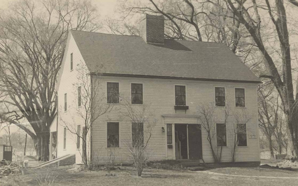
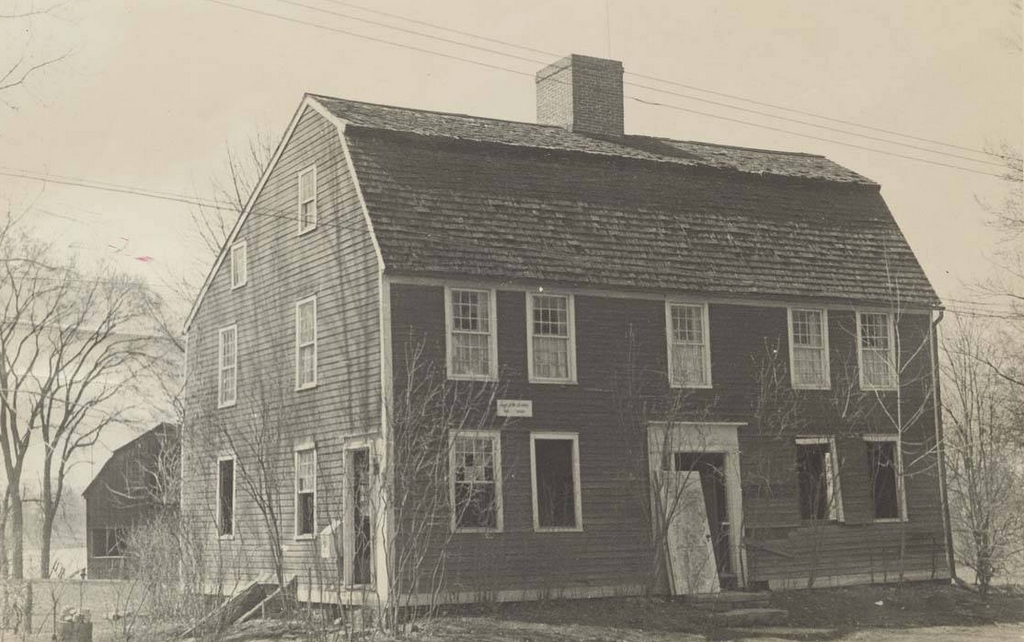
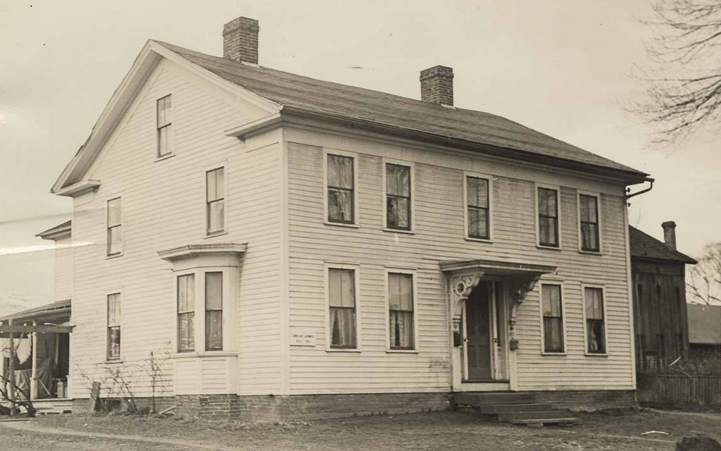
The house across from the corner of Skyline Trail and Bromley Road in Chester, Massachusetts, in April 1938. Photo by Arthur C. Haskell, courtesy of the Library of Congress, Historic American Buildings Survey Collection.

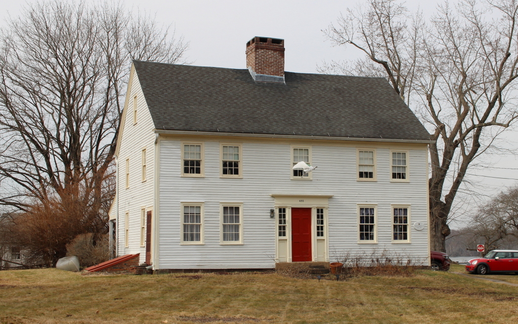
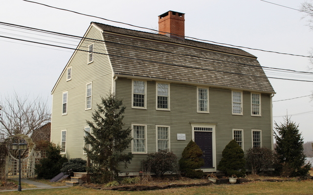
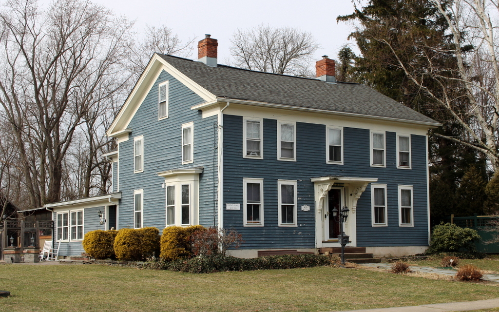
The scene in 2024:

This house is one of the oldest surviving buildings in Chester, and it was built in 1769 as the home of the Reverend Aaron Bascom, the first pastor of the town’s church. The town had been incorporated several years earlier in 1765, but it was originally named Murrayfield, although it was later renamed Chester in 1783. At the time, this area on modern-day Skyline Trail was the town center. It was located along a ridgeline of rolling hills between the Middle Branch and West Branch of the Westfield River, and it was fairly close to the geographic center of the town. The center consisted of the meeting house, a schoolhouse, Rev. Bascom’s house, and several other nearby homes.

Aaron Bascom was originally from Warren, Massachusetts. He graduated from Harvard in 1768, and a year later he accepted the position as the pastor of the church here in Murrayfield. He was ordained on December 20, 1769, at the age of 23. According to the 1963 publication The First Congregational Church of Chester, his compensation included an initial settlement of 70 pounds, along with an annual salary of 40 pounds for three years, which would then increase five pounds per year until it reached 60 pounds. In addition, he was provided with firewood and, most significantly, a house, which is shown here in these two photos.

The house is typical for mid-18th century homes in Massachusetts. It features a front façade with four windows and a central door on the first floor, and five windows on the second floor. It originally had a large central chimney, but as was often the case, this chimney was later removed in order to create more space for a staircase and entry hall. Over the years, the exterior of the house also saw alterations and additions. The shutters in the top photo would not have been original to the house, and it seems likely that the Greek Revival style front entryway was probably a mid-19th century alteration.

Aaron Bascom lived here until his death in 1814, and the house was later purchased by Dr. Thaddeus Kingsley DeWolf in 1832. He was a noted local physician, and he lived here with his first wife Correlia Benham and their children Oscar, Homer, Sarah, and Martha. Correlia died of dysentery on August 7, 1847, and young Martha likewise died of dysentery five days later. However, Dr. DeWolf remarried rather quickly. Less than two months later, on September 28, the 46-year-old widower married 19-year-old Mary Phelps. They had two children together: Henry Clay DeWolf, who was born in 1850; and DeWitt Clinton DeWolf, who was born in 1864. DeWitt is known to have been born in this house, and the older children presumably were as well.

By the time the younger children were born, the town of Chester had undergone significant changes. In 1841 the Western Railroad was built along the West Branch of the Westfield River, in the southern and western part of the town. This spurred new developments in the valley, with the village of Chester Factories eventually becoming the town center, in place of the old town center here on Chester Hill, as it came to be called.

This shift was part of a broader trend in the rural hilltowns of Western Massachusetts. With more productive farmland available in the west, and new opportunities in the nation’s industrial cities, many towns and villages experienced population decline in the second half of the 19th century. Among those who left the area was Dr. DeWolf’s oldest son Oscar. He went to medical school, served as a surgeon in the U.S. Army during the Civil War, and then moved to Northampton before relocating to Chicago in 1873. There he became the city’s commissioner of health, a position that he held for 14 years.

During that time, Oscar’s younger half brother DeWitt joined him in Chicago, moving to the city around the late 1870s when he was 15. Rather than pursuing medicine like his father and brother, DeWitt went into business. He first worked for a shoe company, but then became involved in the coal industry, eventually serving as president of one coal company and vice president of another.

However, both brothers would eventually return home to Chester in their later years. Oscar left Chicago in 1891 and moved to London, where he practiced medicine for 12 years before retiring and moving back across the Atlantic to his old hometown. He had inherited the family home after his father’s death in 1890, and the 1894 county atlas indicated that he owned several other nearby homes. When he returned to Chester in 1903, he appears to have moved into the neighboring home at 346 Skyline Trail, which still stands just to the left of the old house, out of view in these photos.

Oscar DeWolf died in 1910, and then in 1915 his brother DeWitt moved back to Chester. Because DeWitt owned multiple properties, none of which had street numbers at the time, it is difficult to trace exactly where he lived, but it was apparently either his birthplace house here in these photos, or in the house next door that his brother had lived in. It seems that, over the course of his 20 years in Chester, he may have lived in both houses at different times.

The 1920 census does not indicate which house DeWitt DeWolf was living in, but it shows him in Chester with his wife Harriet and their daughters Elsie, Louise, and Virginia. Their household also included James H. Ellis, who was listed as a lodger. He later married their oldest daughter Elsie in 1926.

Shortly after his return to Chester, DeWitt DeWolf became involved in politics. He served in a variety of town offices, but he was also active in the state’s Democratic Party. He was a delegate at the Democratic National Convention in 1924 and again in 1928, and both times he was a strong advocate for New York Governor Al Smith, who earned the party’s nomination in 1928 but ultimately lost to Herbert Hoover in the general election. During the 1930 state gubernatorial election, DeWitt campaigned on behalf of his friend Joseph B. Ely of Westfield. Ely won the election, and he served as governor from 1931 to 1935. Upon taking office, Ely appointed DeWitt as his executive secretary, and DeWitt later became the state commissioner of labor and industries.

Despite working on Beacon Hill, DeWitt DeWolf continued to live here in Chester. His wife Harriet had died in 1922, and by 1930 he was living alone, probably in the house next door to this one. A 1930 article in the Springfield Republican, written after his appointment as executive secretary to Governor-elect Ely, indicated that his daughter Elsie was living in the old house, and also implied that DeWitt was not living in it at the time. However, DeWitt died in 1935, and the newspaper coverage stated that he died in the house where he was born, suggesting that at some point before his death he moved back into the old house.

The top photo was taken in April 1938, a few years after DeWitt’s death. The family still owned the house at this point, and the outbuilding on the left even had a sign that said “DeWitt C. DeWolf.” The building was photographed as part of the Historic American Buildings Survey, a Depression-era federal program that documented historic resources across the country.

The property was evidently sold a few months after the photo was taken, based on an auction notice that was published in the Republican in September 1938. The house would subsequently change hands several more times over the course of the 20th century, and in 1988 it was added to the National Register of Historic Places as a contributing property in the Chester Center Historic District. This historic district is comprised of several other historic 18th and early 19th century buildings that all date back to when this small village was the town center.

The photographs that accompanied the National Register nomination form in the 1980s show the exterior of the house in reasonably good repair. However, the house has since been vacant for many years. All of the barns and other outbuildings are now gone, the property is overgrown, and the house itself is badly deteriorated. As shown in the second photo, the ground floor windows and doors are boarded up, and there is a sign next to the front door from the board of health, stating that it is unfit for human habitation. It is an important historic house, but in its current condition it is in danger of being permanently lost.

East Windsor Hill Post Office, South Windsor, Connecticut

The East Windsor Hill Post Office in South Windsor, around 1935-1942. Image courtesy of the Connecticut State Library.

The scene in 2022:

These two photos show the post office at 1865 Main Street in the East Windsor Hill neighborhood of South Windsor. The building dates back to 1757, when Jeremiah Bullard constructed the one-story section on the left side. He operated a store there, and then in the 1760s David Bissell built the two-story section on the right side, where he likewise had a store.

The building was used by a variety of businesses during the late 18th and early 19th centuries, but it is perhaps best known for its claim of being the oldest continuously-operating post office in the country. As indicated on the historical marker on the building, the store “received the first government post rider in 1783.” However, the building was not officially designated as a post office until 1837, so it seems questionable whether occasional post rider visits would qualify it as being a true post office, much less one that was in “continuous use.” A stronger contender for the oldest continuously-used post office would seem to be the one in Hinsdale, New Hampshire, which has been located in the same building since 1816.

Either way, though, the East Windsor Hill post office is definitely still among the oldest existing post offices in the country, and the building itself is a rare surviving example of a colonial-era commercial building. The top photo shows the building around the late 1930s, and it has seen only minor exterior changes since then. These include removing the shutters on the left side and installing new windows on the right side, both of which were likely done to improve the historical accuracy of the building. Today, the building remains in use as a post office, and it is part of the East Windsor Hill Historic District, which was added to the National Register of Historic Places in 1986.

Ebenezer Grant House, South Windsor, Connecticut

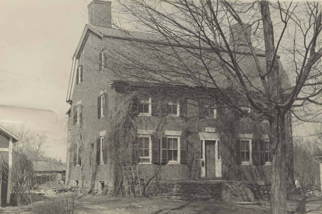
The Ebenezer Grant House on Main Street in South Windsor, Connecticut, around 1934-1937. Image courtesy of the Connecticut State Library.

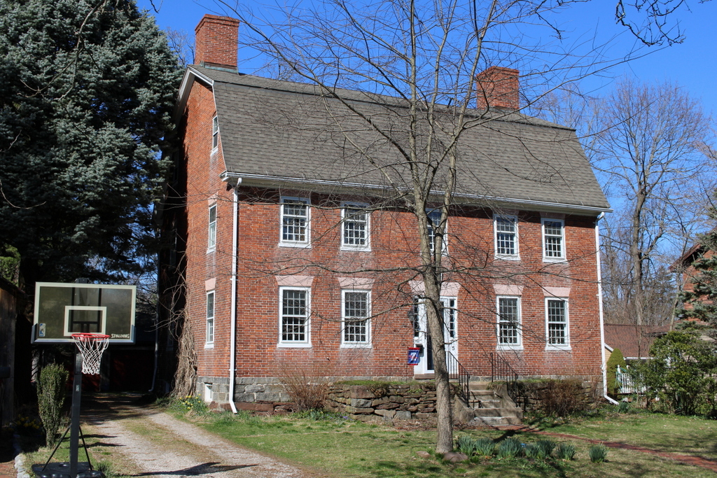
The house in 2022:

The East Windsor Hill neighborhood of South Windsor has many well-preserved 18th and early 19th century homes along Main Street, but perhaps the most celebrated of these is the Ebenezer Grant House, shown here in these two photos. Long recognized as an architectural masterpiece, the house exemplifies the type of homes that were built for the upper class families of the Connecticut River Valley during the mid-18th century.

This house was built around 1757-1758 by Ebenezer Grant (1706-1797), a prosperous merchant who lived in what was, at the time, the eastern part of the town of Windsor. Although located many miles from the ocean, this area is near the head of navigation for oceangoing vessels on the Connecticut River, and Grant was heavily involved in the West Indies trade. He exported commodities such as horses, lumber, tobacco, staves, bricks, and barrel hoops to Barbados and other West Indies ports, and in return imported rum, molasses, sugar, and indigo.

Grant also built several merchant ships here in modern-day South Windsor, near the mouth of the Scantic River, and he was a part owner in many other ships. It does not seem clear as to whether Grant was directly involved in the slave trade, but most of the goods that he imported and exported were closely tied to the plantation economies of the Caribbean colonies.

Aside from trading bulk commodities and other raw materials, Grant also purchased wholesale consumer goods, which he then sold here in his hometown. He had accounts with many of the leading colonial-era merchants in Boston and New York, including John Hancock. Around 1767 he built a store just to the south of his house, and there he sold “dry goods, rum, groceries, hardware, and fancy articles,” according to Henry Reed Stiles in his book History and Genealogies of Ancient Windsor, Connecticut.

Ebenezer Grant’s wealth and social standing were reflected in his house, which was built when he was in his early 50s. Its overall form, with four windows and a door on the ground floor and five windows above them, was typical for houses of the period in this region. But, unlike many of the other mid-18th century houses, it has two chimneys in the main part of the house, rather than a single large chimney in the center. This design choice enabled the house to have a large front entrance hall and staircase, rather than a small entryway with a winding staircase that was typical for the center-chimney homes.

This house is also different from most of its contemporaries in its exterior detail. Most homes of this period were relatively plain on the exterior, but the Grant house included details such as pediments over the first floor windows on the front of the house, and similar pediments over the side doors, which are not visible in these photos. Overall, though, its most famous feature is the highly elaborate front doorway, as shown in these two photos. Often referred to as a “Connecticut Valley doorway,” this style of doorway was perhaps the single most important architectural innovation to be developed in western New England. There were many variations on the design, some with or without the scroll pediment above the door, but the one on the Grant house is among the finest in the region. It is also one of only a handful of scroll pediment doorways that are still on their original houses; many homes were demolished or altered over the years, and several similar doorways are now on display in museums.

As was often the case for 18th century New England homes, the Grant house also included a wing, or an “ell” on the back of the house. These were often added years or decades after the house was built, to accommodate growing families. However, the ell on the Grant house might be even older than the house itself. Some sources, including Stiles’s book, cite a tradition that say the ell was built by Ebenezer Grant’s father Samuel Grant in the late 17th century as a house, and was later moved and incorporated into the new house when it was built in the 1750s. Other sources, though, including the 1900 book Early Connecticut Houses: An Historical and Architectural Study, are skeptical of this theory. It seems more likely that the ell was built at the same time as the main house, perhaps using old timbers that had been repurposed from the previous house.

Ebenezer Grant and his first wife Ann (1712-1783) had six children, although four died young, including three who died within a month and a half of each other in the fall of 1747. By the time they moved into this house in the late 1750s they had two surviving children: a son Roswell (1745-1834) and a daughter Ann (1748-1838). As the only surviving son, Roswell would go on to become a partner in his father’s merchant firm, following his graduation from Yale in 1767. He went on to serve as an officer in the Continental Army during the American Revolution, and after the war he married Flavia Wolcott, whose uncle Oliver Wolcott Sr. had been one of the signers of the Declaration of Independence.

In the meantime, Ebenezer Grant’s wife Ann died in 1783, and a year later he remarried to Jemima Ellsworth. She was the widow of David Ellsworth, and she was also the mother of Oliver Ellsworth, a lawyer who later went on to become a U.S. Senator and Chief Justice of the United States. Jemima died in 1790 at the age of 67, and Ebenezer continued to live here in this house until hos own death in 1797 at the age of 91.

After his death, the house would remain in the Grant family for many years. His grandson Frederick W. Grant later inherited the house, and he lived here throughout most of the 19th century. In his book, Stiles credited Frederick with restoring and preserving the house, which was recognized as an important landmark even as early as the late 19th century. By this point the Grant family had also become famous, due to Ebenezer’s great-great-great nephew Ulysses S. Grant, who was descended from Ebenezer’s older brother Noah.

The top photo was taken sometime around the late 1930s, as part of an effort to document historic homes across Connecticut. By this point the house had seen some alterations, including the addition of an enclosed porch on the left side and the installation of shutters on the windows. Both the porch and shutters were apparently installed around the late 19th or early 20th centuries, since they were not present in a c.1890 photo of the house.

Those changes were later reversed, and today the exterior of the house better reflects its original 18th century design. It stands as an important architectural landmark in the Connecticut River Valley, and it is a contributing property in the East Windsor Hill Historic District, which was added to the National Register of Historic Places in 1986.

Martindale Farm, Ware, Massachusetts

The Martindale Farm in Ware (formerly Enfield), Massachusetts, on April 6, 1946. Image courtesy of the Metropolitan District Water Supply Commission, Quabbin Reservoir, Photographs of Real Estate Takings collection.

The scene in 2024:

This house, located on Webster Road in the town of Enfield, Massachusetts was built around the year 1800 by Jesse Fobes. Jesse moved to Webster Road in 1796 from Bridgewater, MA into a smaller house just north of this property. Once this home was completed, he would move his family to the much larger farm house. When Enfield became an incorporated town in 1816, Jesse would serve as one of its first Selectmen. Ownership of the farm would be passed onto Jesse’s son, Henry Fobes. Much like his father, Henry would also become a Selectmen of the town. Henry would hold onto ownership of the farm until selling it to Joel and William Martindale in 1870 for $8,000. Included in the sale of the farm was a provision that the Martindale’s would have to house and feed Henry until his death. Considering Henry lived another 15 years until dying at the age of 92 in 1885, it seems like Henry got the better end of the deal.

By the 1880s, the farm had a considerable amount of outbuildings. On the 182 acre property were a large carriage shed, garage, hen house, brooder house, three barns, and an assortment of other smaller chicken coops. Joel Martindale would officially call the farm Maple Terrace, in reference to the three terraces that lead up to the front of the house. A sketch of the farm house with its terraces and some outbuildings was even included in the 1879 book History of the Connecticut Valley in Massachusetts. Maple Terrace had become something of a local landmark by this point.

The farm would pass into the hands of Joel’s grandson, Emory Bartlett in 1917. He would drop the Maple Terrace name, and officially incorporate the farm as Martindale Farms Inc. But the glory days of the farm were farm behind at this point. Only a few years later, Emory would sell the farm to Harry Ryther in 1925 as payment for a large debt.

Because of its proximity to the Quabbin Reservoir watershed, the Massachusetts Metropolitan District Water Supply Commission purchased the house and the 182 acres it sat on from Harry Ryther in 1934 for the sum of $11,900. Two Martindale sisters were still living in the farm house when the Water Supply Commission purchased the property.

Martha and Mary Martindale were daughters of Joel Martindale, and both had lived in the house almost their entire lives. This led to debate as to whether or not the home should be torn down. The home appears to be right on the line of the watershed, so some thought the house should stay up and be used as employee housing. Others believed the home was still too close to the reservoir, and should be torn down immediately. An agreement was reached with the Water Supply Commission that allowed the Martindale sisters to live in the home until they either died or moved away. During that time, the home would also be used by Quabbin employees.

Mary Martindale would die in 1952 at the age of 77. Her sister, Martha would decide to move out of the large home into a smaller apartment in Springfield in 1955 so she could be closer to her remaining friends and family. Martha Martindale would be the last private resident to live inside the boundaries of the Quabbin Reservoir land. The home was torn down shortly after, and the landscape allowed to go wild. Building materials from the home were reported as being reused in a future home in the area.

The before photo was taken in 1946, much later than many of the Water Supply Commissions photos of old Quabbin homes. At this point, the reservoir was already fully flooded and the home was now located in the town of Ware, following the disincorporation of Enfield in 1938. Today, the terraces to the home are still clearly visible when you visit the farm. The home’s cellar hole is completely filled in, and much of the yard is overgrown with brambles and vines. The foundations for the outbuildings are easily found out of frame to the right of the photo. Walking down the old driveway leads to the foundations of the barns, as well as some stone walls. The tree to the left of the house in the before photo is almost certainly the same tree on the far left of the current photo. Other old trees can be seen today that would have been very young at the time the home was sold to the Water Supply Commission.

The Martindale Farm is one of the best and most easily accessible spots in Quabbin for history lovers. Located near the end of Webster Road through Gate 53, the old farm is located in a large clearing on the west side of the road. In the summertime, Quabbin rangers will sometimes do history programs at this location and go into greater detail on who the people were that owned this farm.

Buttolph-Williams House, Wethersfield, Connecticut (3)

The east side of the Buttolph-Williams House in Wethersfield, in August 1938. Image courtesy of the Library of Congress, Historic American Buildings Survey Collection.

The house in 2024:

These two photos show the east side of the Buttolph-Williams House. Built around 1711, the house is one of the oldest in Wethersfield, and it is one of the many historic homes that line the streets of the town center. The top photo was taken as part of the Historic American Buildings Survey in 1938, and by this point the house had undergone many alterations from its original appearance, including newer windows and clapboards, and an ell on the back of the house.

At the time that the top phot was taken, the house was the home of siblings Kate and Frank Vibert. They had grown up in the house in the late 19th century, and they lived here until their deaths in the 1940s. The house was then acquired by the Connecticut Antiquarian and Landmarks Society—now known as Connecticut Landmarks—and it was restored to its original appearance in the late 1940s. This included re-installing diamond-paned casement windows, removing the rear ell, and removing the newer clapboards that had covered the original second-story overhang.

The house was once believed to have been built in the 1690s, but subsequent research has shown that it was actually built around 1711. Either way, though, it has many of the post-medieval architectural elements that were common on 17th century New England homes, and it survives as an excellent example of a First Period House. It is still owned by Connecticut Landmarks, and it is operated as a museum by the nearby Webb-Deane-Stevens Museum.

Granite Railway Incline, Quincy, Massachusetts

The Granite Railway Incline on Granite Rail Court in Quincy, Massachusetts, in April 1934. Image courtesy of the Library of Congress, Historic American Buildings Survey Collection.

The scene in 2021:

These two photos show the Granite Railway Incline, an important civil engineering landmark from the early days of railroads. It opened in 1830 as a branch of the Granite Railway, a 3-mile-long horse-drawn railroad that is often regarded as the first commercial railroad in the United States. The railroad itself had been established four years earlier, in 1826, for the purpose of supplying granite for the construction of the Bunker Hill Monument. The original 1826 route of the railroad extended about three miles from the Quincy quarries to the wharves on the Neponset River, and from there the quarried stone was transported by boat to Charlestown.

Prior to its construction, there had been a few small railroads in Britain and the United States, and there were even some early steam locomotives that had been developed, but the long-term viability of railroads was still very much uncertain in 1826. The Erie Canal had been completed just a year earlier, and many Americans viewed long-distance canals as the future of transportation. Nonetheless, the engineer for this project, Gridley Bryant, set out to build a horse-drawn railroad. And, because railroad technology was still in its infancy, he had to essentially design it from scratch. As a result, he is credited with developing turntables and switches, among other railroad innovations. He also had to design his own rails, which were made of wood and topped with iron straps except for at road crossings, where the rails were granite and iron.

The Granite Railway opened on October 7, 1826, and over the next few years it overcame skepticism as it steadily delivered cut granite blocks to the wharves on the river. Then, in 1830 Bryant expanded the railroad with a short branch that connected it to the Pine Hill Quarry. Because of the elevation change, this involved constructing a large inclined plane up to the quarry, as shown here in these two photos. In total, it was 315 feet long, and rose 84 feet in elevation, for an average grade of nearly 27%. This is significantly steeper than a conventional railroad, and by way of comparison it is even stepper than the average grade of the Mount Washington Cog Railway, although obviously much shorter. And, because of the need for durable materials here on the slope, Bryant constructed it of granite rails with iron straps, rather than the wooden rails that were used on most of the other sections of track on the railroad.

The inclined plane was built with two parallel sets of track, one for ascending cars and one for descending ones. In the center of each track was a chain that ran on pulleys. It formed a continuous loop up and down the inclined plane, pulling the empty cars up the hill while also controlling the descent of the fully-loaded cars that were leaving the quarry. Bryant later described the operation of the inclined plane in a letter that he wrote in 1859 to Charles B. Stuart:

It had an endless chain, to which the cars were attached in ascending or descending; at the head of this inclined plane I constructed a swing platform to receive the loaded cars as they came from the quarry. This platform was balanced by weights, and had gearing attached to it in such a manner that it would always return (after having dumped) to a horizontal position, being firmly supported on the periphery of an eccentric cam. When the cars were out on the platform there was danger of their running entirely over, and I constructed a self-acting guard, that would rise above the surface of the rail upon the platform as it rose from its connection with the inclined plain, or receded out of the way when the loaded car passed on to the track; the weight of the car depressing the platform as it was lowered down.

Overall, it was an important technological innovation, but the inclined plane also became the site of one of the first fatal railroad accidents in American history. This occurred on July 25, 1832, when a group of four visitors ascended an empty car. On the way up, the chain broke, sending the car on an uncontrolled descent. The resulting derailment killed one passenger and seriously injured two others, as described in an article published in the next day’s Boston Evening Transcript:

Yesterday a party of four Gentlemen, boarders at the Tremont House, consisting of Messrs Andrew E. Belknap and John G. Gibson of this city,—Mr Thomas Backus of St Jago de Cuba, and Wm B. Bend of New York, (formerly of Baltimore) rode out to the Quincy Rail-way. Whilst ascending the inclined plane, near the Granite quarry in one of the cars, and when near the summit, the chain parted and the car descended with frightful rapidity.

The force with which it struck the resting place, at the foot of the declivity, was so great that the car and passengers were thrown by the percussion twenty feet into the air, from whence it fell down a precipice of more than thirty feet, amongst the rocks beneath.

Mr Backus was killed instantly. Mr Bend had three ribs broken, and the sinews of a leg parted. Mr Gibson’s head was fractured, jaw broke, and leg broke. Mr Belknap escaped without injury to his bones, but his body is severely bruised.

Messrs Gibson and Bend are at the Railway House, too ill to be removed. Mr Belknap has returned to the city. Mr Backus, we understand, was to be buried this afternoon at Quincy Church. The plane which they were ascending is said to be inclined at angle of nearly forty degrees; and it is supposed that when the car struck, it must have acquired a velocity of sixty miles an hour.

Aside from this accident, the inclined plane appears to have had a good safety record, and it remained in use into the 20th century. The Granite Railway was eventually acquired by the Old Colony Railroad in 1871, and most of the old track was upgraded. However, the inclined plane was too steep to operate steam trains on, so it remained in use in its original configuration until 1901, when modern rails were laid atop the granite track.

It underwent more changes in 1920, when the 1901 rails were removed and replaced by metal channels, which enabled it to be used by trucks. The top photo shows these channels, along with a pair of obelisks that were installed at the base of the inclined plane in 1921 in order to commemorate its role in the early history of railroads.

The inclined plane remained in use until the 1940s, but at some point the upper part of it was removed during quarrying operations. As a result, only the lower portion of it still exists, as shown in the bottom photo. The quarry at the top of the hill eventually closed in 1963, and in 1985 the site of the quarry was acquired by the Metropolitan District Commission.

Today, the old quarry and the inclined plane are part of the Quincy Quarries Reservation. Although significantly smaller than it had been when the top photo was taken, the inclined plane is nonetheless the best-preserved remnant of the old Granite Railway. It still features the old granite rails, some of the iron straps atop them, and the old pulleys. Because of its historic significance, the inclined plane was added to the National Register of Historic Places in 1973, and it survives as an important landmark from the early days of railroad development.