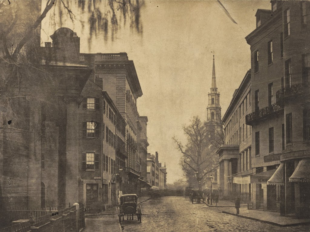
Colonnade Row, Tremont Street, Boston

Looking north along Tremont Street in Boston, near Avery Street around 1860. Photo courtesy of Boston Public Library.

302_1860-2Bbpl

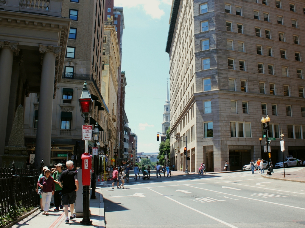
The scene in 2014:

302_2014

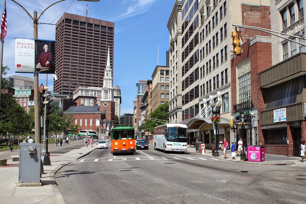
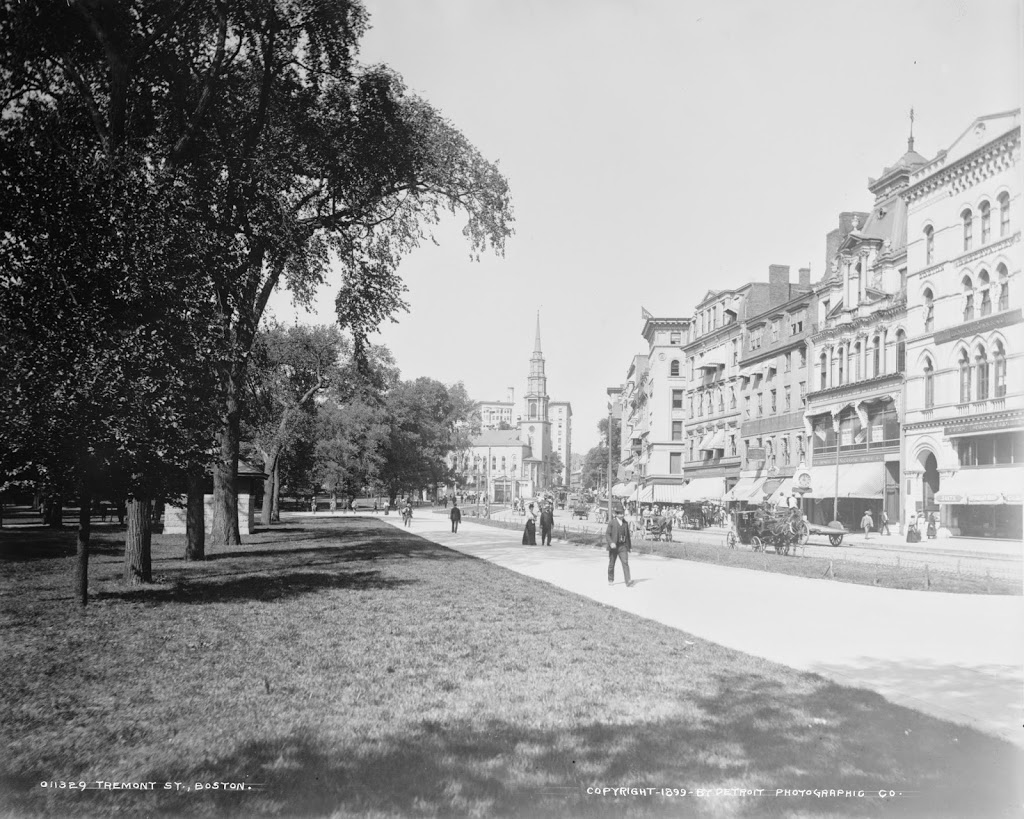
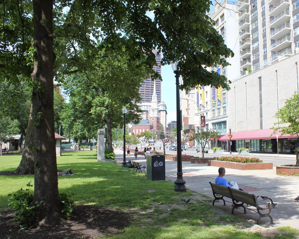
Tremont Street has substantially changed over the past 150 years, as seen in the stark contrast between Charles Bulfinch’s 1810 Colonnade Row and the modern high-rise apartment buildings of today.  The 19 houses that made up Colonnade Row were similar to those along Beacon Street on the other side of the Common, but while many of the early 19th century homes on Beacon Hill remain today, the ones on Colonnade Row are long gone.  Some of the houses survived into the mid-20th century, as seen in this photo on the Boston Public Library Flickr account, but obviously today none are left.  There is, however, at least one building in the 2014 photo that predates Colonnade Row – Park Street Church in the distance was completed in 1809 and still stands at the corner of Park and Tremont.

Beach Street, Boston

Looking west on Beach Street toward Harrison Avenue in 1860. Photo courtesy of Boston Public Library.

301_1860-2Bbpl

Beach Street in 2014:

301_2014

Taken before the neighborhood was redeveloped as a major commercial district, the first photo shows a variety of early 19th century architecture, with a combination of a hotel (the Boston Hotel on the left), a church (Beach Street Church), and residential buildings.  Notice also the awning that advertises “cool soda” at the business on the right.  Today, this area has undergone total redevelopment, and is now in the midst of Boston’s Chinatown neighborhood.

Chauncy Street, Boston (2)

Looking northeast along Chauncy Street with Bedford Street in the foreground, in 1860. Photo courtesy of Boston Public Library.

300_1860-2Bbpl

Chauncy Street in 2014:

300_2014

These photos were taken from almost the same spot as the ones in this post, just facing the opposite direction on Chauncy Street. The church in the distance is the old First Church in Boston building, which was built in 1808 and was the home to Boston’s oldest church congregation until 1867, when they moved to the Back Bay. At the time of the 1860 photo, this was an upscale residential neighborhood, although it was becoming increasingly commercial by the 1860s.   Just a few years later, much of the area was destroyed in the Great Fire of 1872. In the distance is the Macy’s building at Downtown Crossing, with Summer Street, the epicenter of the 1872 fire, beyond it in the distance.

Chauncy Street, Boston (1)

Looking southwest on Chauncy Street in Boston, toward modern-day Avenue de Lafayette from Bedford Street, taken around 1860. Photo courtesy of Boston Public Library.

299_1860-2Bbpl

Chauncy Street in 2014:

Another work of noted photographer Josiah Johnson Hawes, the first photo shows a very different Chauncy Street than the present-day view. The church at the corner is the Rowe Street Baptist Church, which was built in 1847. The church, along with all of the other buildings in the photo, was destroyed in the Great Fire of 1872, which is one of the reasons why none of the building in the 1860 scene survive to this day.

Harrison & Essex Streets, Boston

The corner of Harrison Avenue and Essex Street in Boston, in 1860. Photo courtesy of Boston Public Library.

298_1860-2Bbpl

The scene in 2014:

Located in present-day Chinatown, this scene has completely changed in the past 150 years, with none of the 1860 buildings surviving today. Even the streets have changed somewhat, with Harrison Avenue (the street in the lower left foreground) being extended across Essex Street, through where the house on the right-hand side of the 1860 photo once stood.  That house was home of Wendell Phillips, a noted 19th century abolitionist, lawyer, and candidate for governor of Massachusetts.

Incidentally, the first photo was taken by Josiah Johnson Hawes, who worked with Albert Sands Southworth in the famous Southworth & Hawes photographic company.  Together, they were among the early pioneers of quality photography, and some of Hawes’s photographs, including the one above, give a rare glimpse of Boston on the eve of the Civil War.

North Market, Boston

North Market in Boston, next to Quincy Market, around 1855. Photo courtesy of Boston Public Library.

297_1855c-2Bbpl

The scene in 2014:

297_2014

These photos show the same scene as the ones in this post, just from a different angle.  The building on the far left of the 1855 photo is the Old Feather Shop, the same one seen in the photo in the other post.  Built in 1680, it was demolished around 1860, soon after the first photo was taken.  Both pictures were taken from right in front of Faneuil Hall (which can be seen on the far right of the 2014 photo), and this area has been a major commercial center since the 1600s, when it was known as Dock Square.  Today, most of the commercial activity centers around tourism, and the location is adjacent to Quincy Market and along the Freedom Trail.  The red brick path of the Freedom Trail can be seen in the foreground of the 2014 photo.