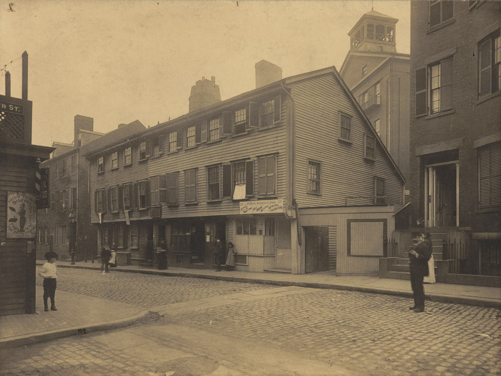
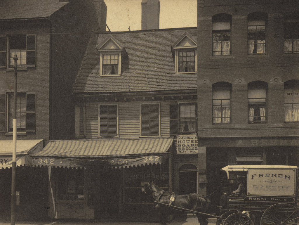
Mather-Eliot House, Boston

The Mather-Eliot House on Hanover Street, near North Bennet Street in Boston’s North End, around 1898. Photo courtesy of Boston Public Library.

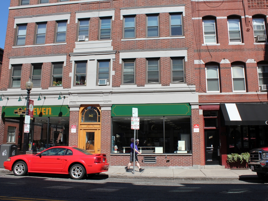
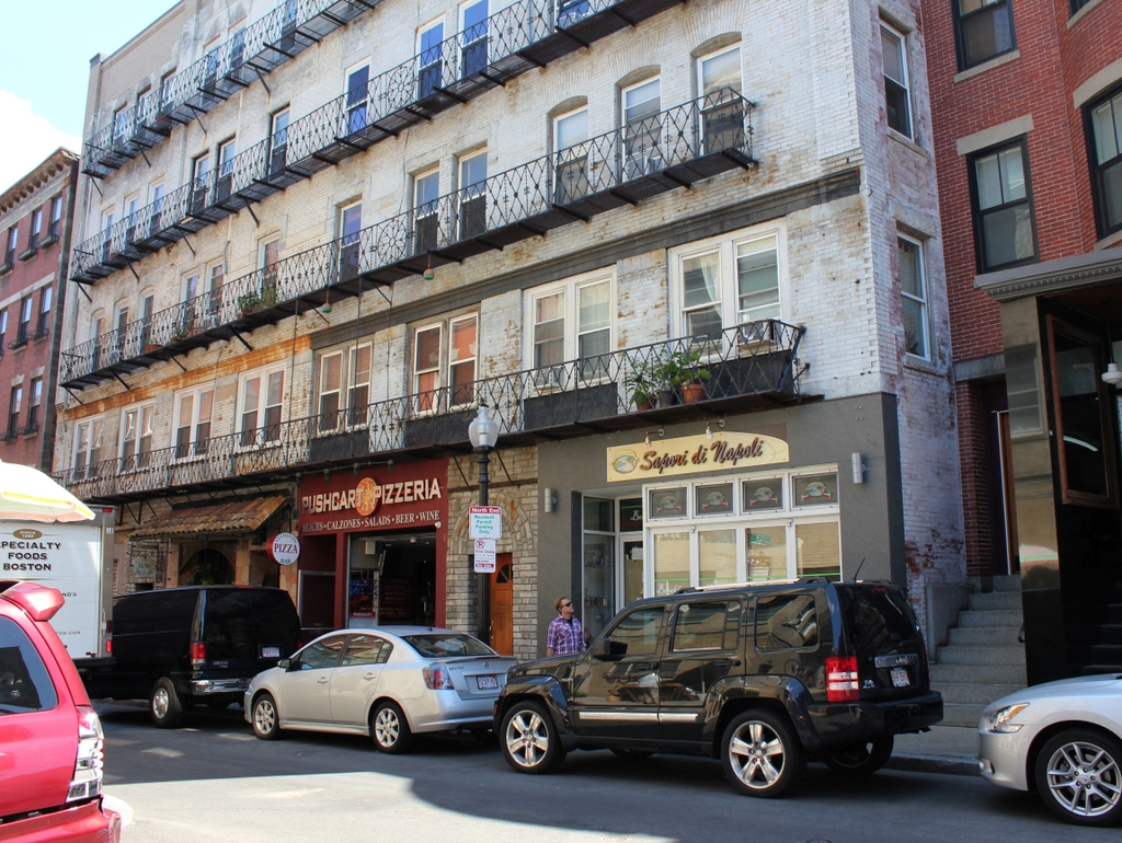
The scene in 2014:

In his 1887 book, Rambles in Old Boston, New England, Edward Griffin Porter describes the house in the first photo as a “fragment of an ancient wooden dwelling, crowded almost out of sight by the larger brick buildings.”  The house at 342 Hanover Street was built in 1677 by noted Puritan minister Increase Mather, after his previous house was destroyed in the fire of 1676.  His son, Cotton Mather, grew up here, and later went on to be a prominent minister as well.  The Mathers only lived here for 11 years, but later on the house was owned by two other famous ministers, Andrew and John Eliot.  The house was still standing in 1899, but was demolished by 1908.  As seen in the 2014 photo, a 7-Eleven now occupies the first floor of the building that sits on the site now.  The building to the left of the Mather-Eliot House is long gone, but the one on the right, which was built in 1884, is still there.

Incidentally, after the fire of 1676 destroyed Increase Mather’s old house, a new house was built on the same site around 1680, and survives today – it is best known as the Paul Revere House.

Noah Lincoln House, Boston

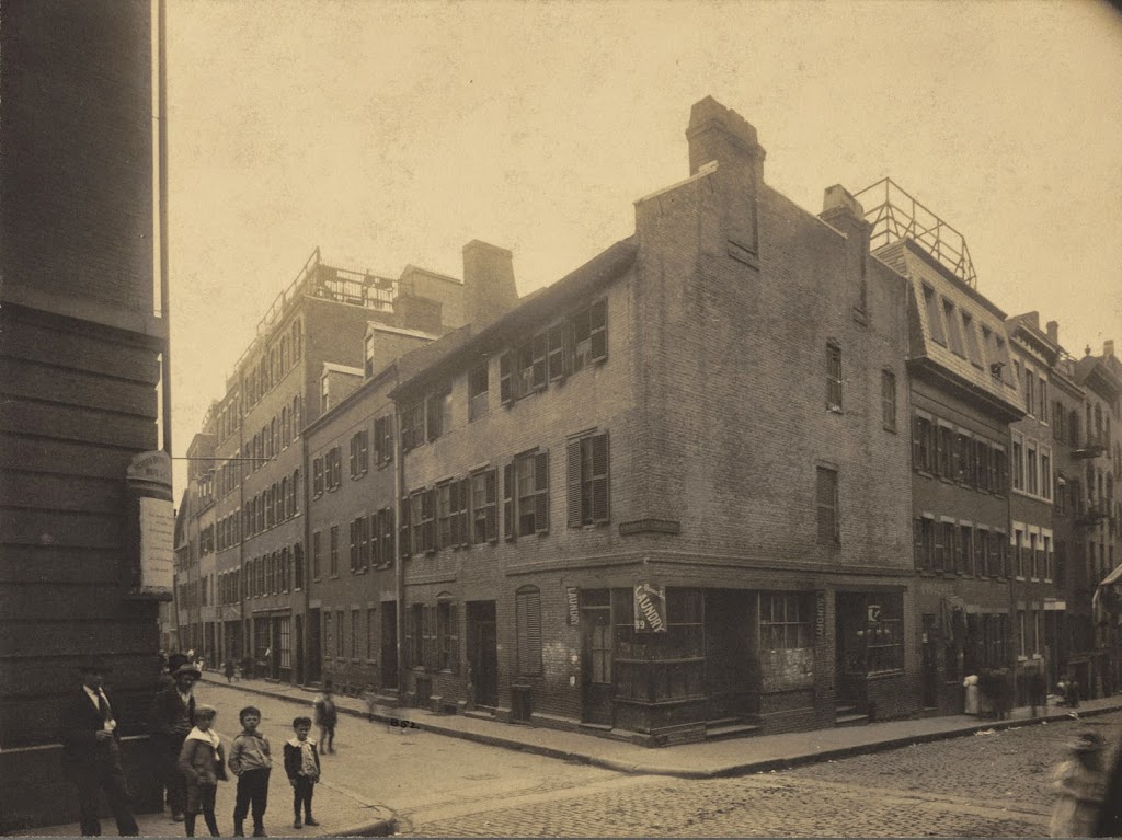
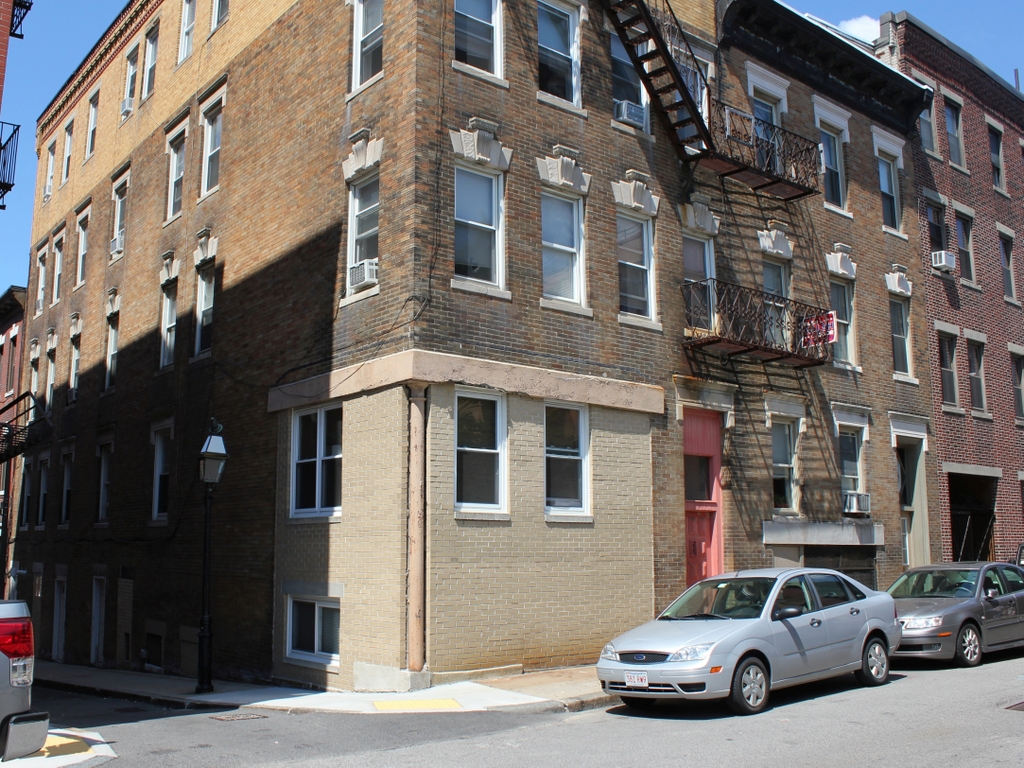
The Noah Lincoln House at the corner of North Bennet and Salem Streets in the North End, around 1898. Photo courtesy of Boston Public Library.

273_1898c-2Bbpl

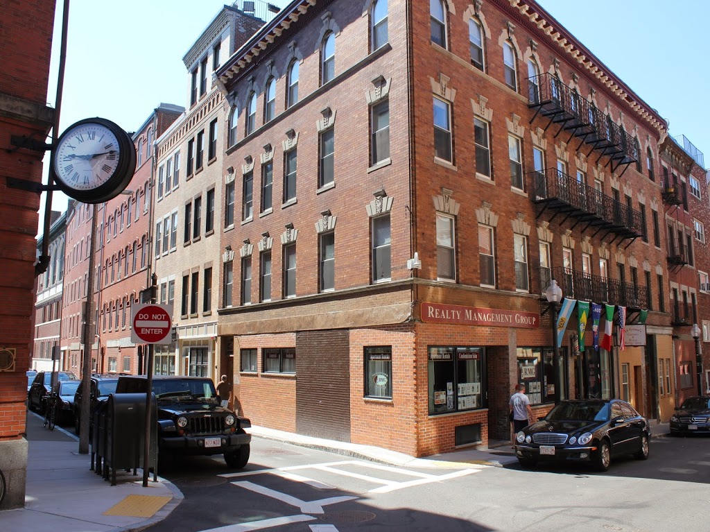
The corner in 2014:

273_2014

Also known as the Avis House, the Noah Lincoln House was built around 1716, just a short distance down Salem Street from where Old North Church would be built only a few years later.  It was modified somewhat by Noah Lincoln in the early 1800s, and the third floor was added.  According to a turn-of-the-century book, it was still standing in 1899, but was probably demolished soon after and replaced with the present building.

William Gray House, Boston

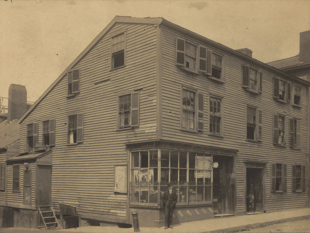
The William Gray House, at the corner of Prince Street and Lafayette Avenue in Boston’s North End, around 1898. Photo courtesy of Boston Public Library.

The location in 2014:

The house in the first photo, known as the William Gray House, was built around 1750, and was used by the British as a hospital after the Battle of Bunker Hill.  It survived until around the turn of the 20th century – it appears in the 1898 Boston atlas, but is gone by the 1908 atlas.  Nothing else from the first photo survives today, although Lafayette Avenue is still there, to the left.  Despite its name, it is actually a narrow alley that is barely wide enough to fit a single vehicle between the curbs – a holdover from Boston’s pre-automobile street network.


Wells Adams House, Boston

Looking up Salem Street from the corner of Cooper Street, in Boston’s North End, before 1894. Photo courtesy of Boston Public Library.

The same scene in 2014:

The building in the first photo was known as the Wells Adams House, and according to late 19th century sources was built sometime in the late 1600s, probably around the same time as the Paul Revere House.  Like many other historic colonial-era North End buildings, it was demolished in 1894, and the current building was probably built shortly after that.  The only building that appears in both photos is the one on the far right; it was built in the 1840s, and is one of the few bow fronted houses that remains in the North End.

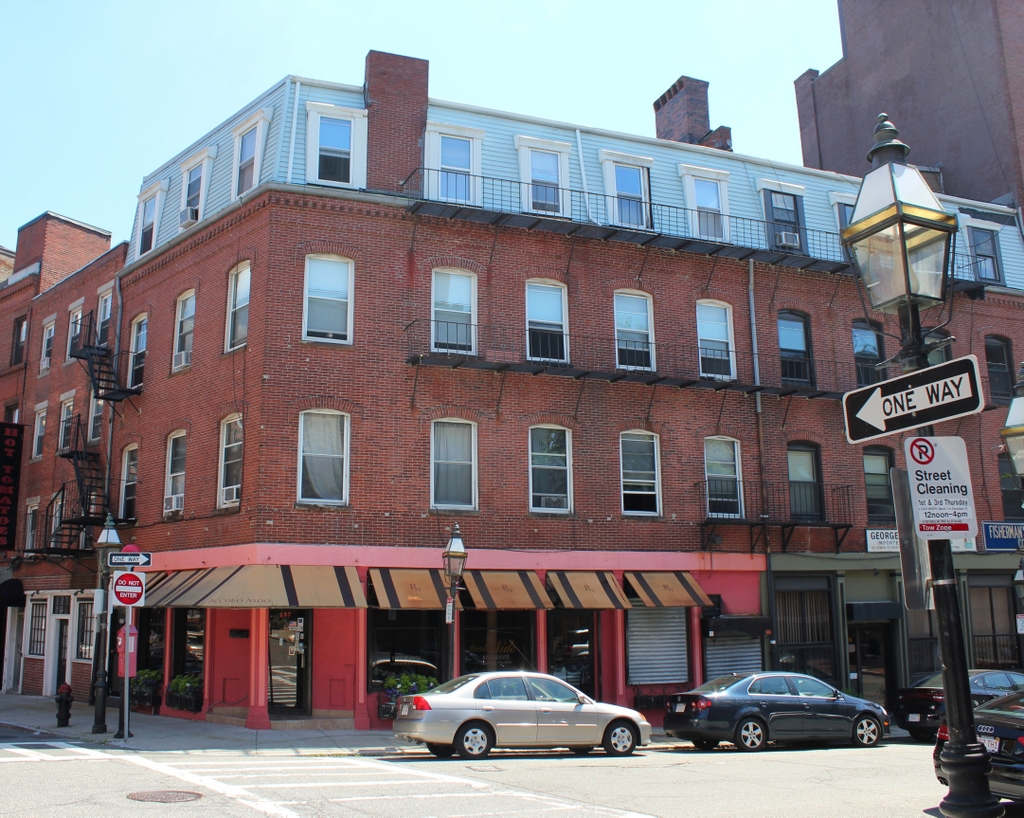
Corner of Lewis & North Streets, Boston

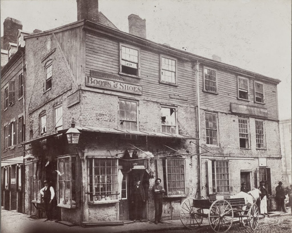
The eastern corner of Lewis and North Streets in Boston’s North End, sometime in the 1860s. Photo courtesy of Boston Public Library.

270_1860sc-bpl

The street corner in 2014:

This ancient building in the first photo probably dated to the early 18th century, but it didn’t last for too long after the photo was taken.  The present-day building on the site was completed around 1874, so the days were numbered for the old building by the 1860s.  At that time, the North End was somewhat of a slum, and the building itself looked like it wasn’t in the greatest condition (note the broken windows on the second floor), so its demolition and replacement was probably hailed as a 19th century version of urban renewal.


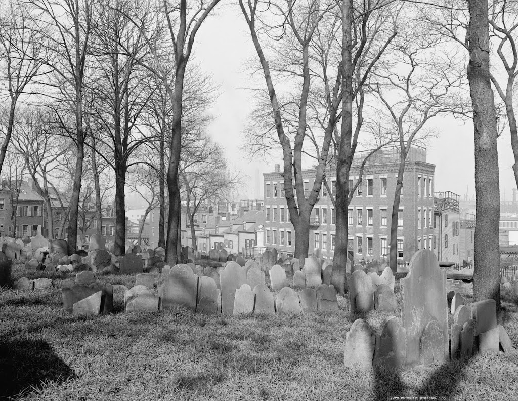
Copp’s Hill Burying Ground, Boston

Copps Hill Burying Ground, around 1904. Image courtesy of the Library of Congress, Detroit Publishing Company Collection.

Cemeteries

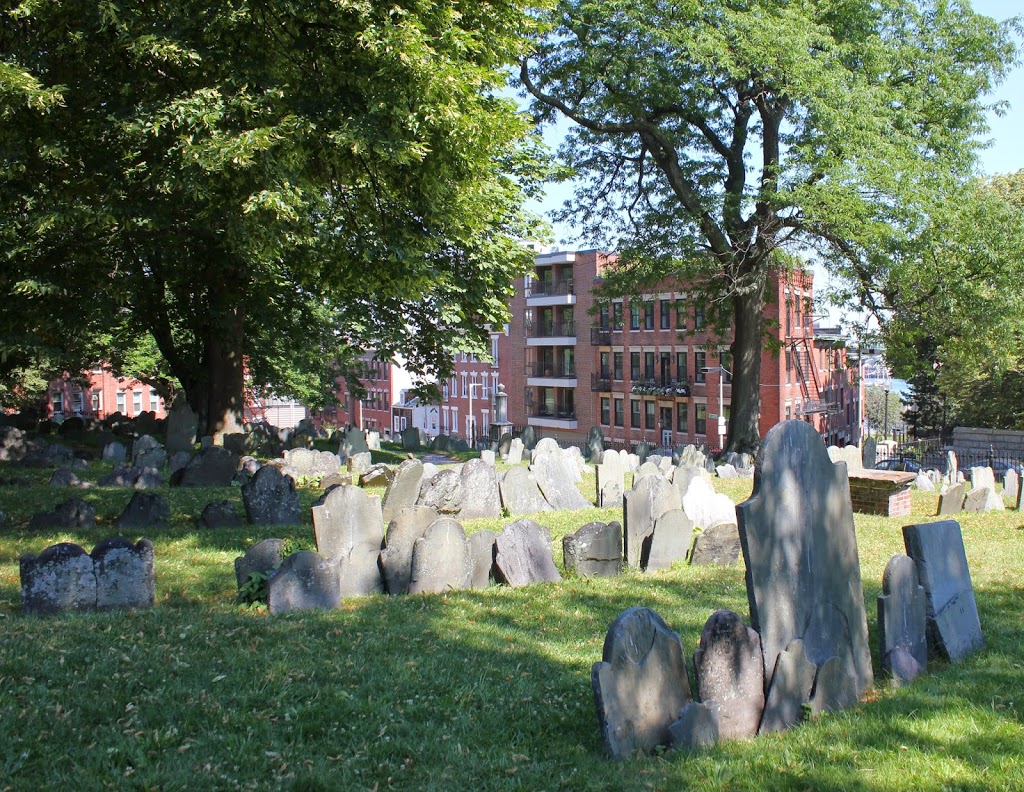
The cemetery in 2014:

267_2014

It’s almost a little eerie to see how little the cemetery has changed in the past 110 years.  Many of the headstones are even still tilted the same way as they were in 1904, and a few of the trees are still there; the tall, skinny tree in the 1904 photo just to the left of the corner of the building in right-center appears to be the same one that is there today.

The cemetery is located just up the hill from Old North Church, and is a stop on the Freedom Trail in Boston’s North End.  Although it doesn’t have as many famous interments as the Granary Burying Ground, there are still some notable people buried here, including Puritan ministers Increase and Cotton Mather, and Edmund Hartt, a shipbuilder whose most famous work, the USS Constitution, still sits right across the harbor from here.