North End Bridge, West Springfield Mass

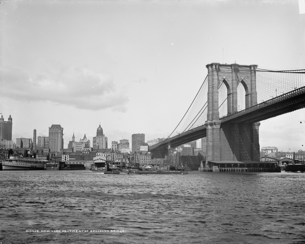
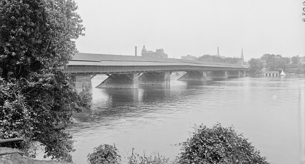
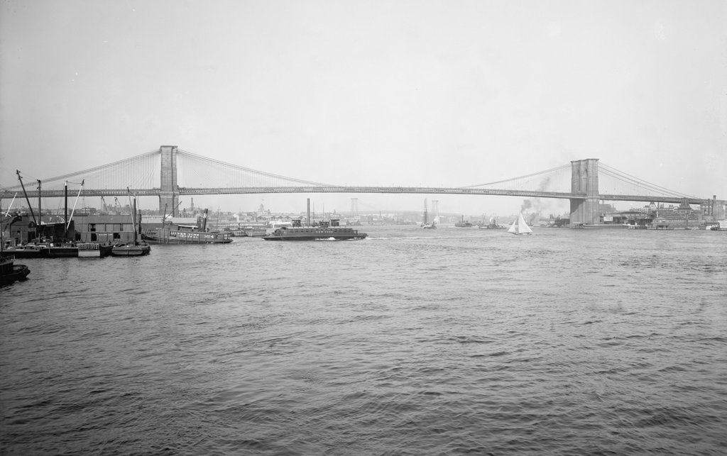
The view looking east over the North End Bridge from the West Springfield side of the river, around 1900-1910.  Image courtesy of the Library of Congress, Detroit Publishing Company Collection.
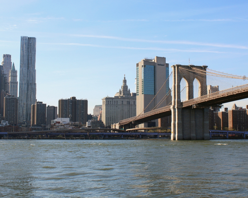
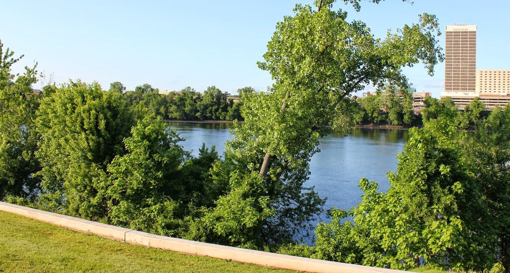
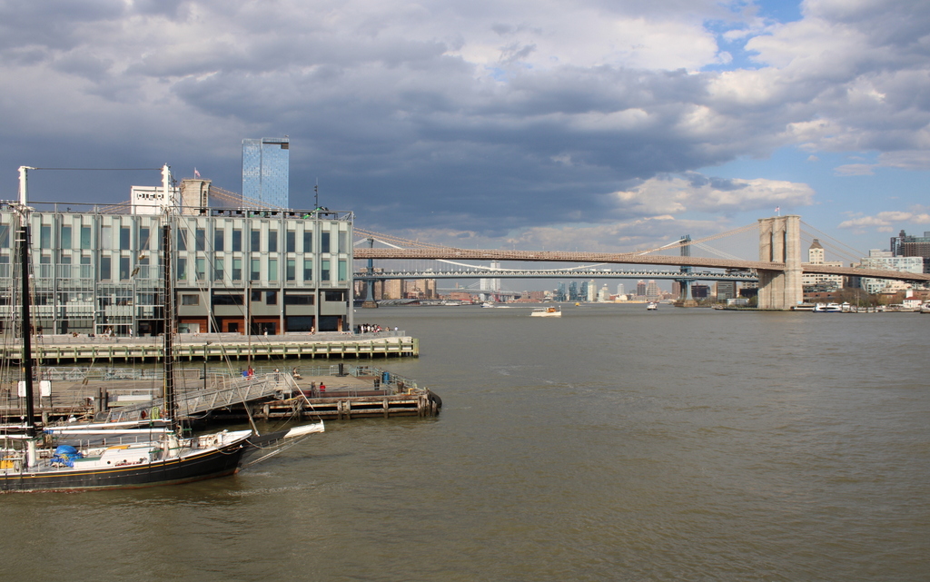
225_1900-1910-loc.tif

The bridge in 2014:

225_2014

The North End Bridge was the second road bridge to be built across the Connecticut River in Springfield, and opened in 1877.  Both views show the bridge looking east from West Springfield toward Springfield.  This bridge was particularly significant to West Springfield residents, as it directly connected downtown West Springfield to the north end of Springfield and, more importantly at the time, Springfield’s railroad station.

The old bridge was described by King’s Handbook of Springfield in 1884 as being “one of the handsomest highway bridges in the United States.”  In 1923, though, it caught fire and was completely destroyed. Two years later a new bridge was completed, and it remains in use today, carrying US Route 20, the longest road in America, over the Connecticut River.  The road on the far left-hand side just before the bridge in the first photo is Riverdale Street; it didn’t look like much at the turn of the last century, but today it is part of Route 5, and is a major north-south route through the Springfield area.  It does not actually pass through this intersection anymore, though.  The 2014 photo was taken from the center of a rotary, which was built atop a tunnel for Route 5.

As an incidental historical note, there is a sign on the bridge in the first photo, which is barely legible.  In higher-resolution copies of the photo, it reads: “No person shall ride or drive a horse or mule on any part of this bridge at a rate faster than a walk under a penalty of two dollars for each offence.”  Today, the bridge traffic usually travels at a significantly higher rate of speed than a walk, except during rush hour.

Manhattan and Brooklyn Bridge

The view of Manhattan and the Brooklyn Bridge from Brooklyn, around 1900. Image courtesy of the Library of Congress, Detroit Publishing Company Collection.

126_1900c loc

The view in 2013:

126_2013

The scene in 2023:

The difference is like night and day.  Cheesy puns aside though, there is quite a difference in the Manhattan skyline between the two photos, over 100 years apart.  The Brooklyn Bridge is still there, but otherwise, as far as I can tell, none of the buildings in the first photo are visible in the second.  At least one of them – the tall Park Row Building at the far left of the first photo – still exists today, but I don’t think it can be seen from here.

April 2023 Update: I have added an updated photo, showing the scene during the daytime.

Brooklyn Bridge Promenade

The view along the Brooklyn Bridge Promenade, looking toward Manhattan, between 1908 and 1920. Image courtesy of the Library of Congress, Detroit Publishing Company Collection.

125_1908-1920 loc

The same view in 2013:

125_2013

The angle here isn’t exact, since they were taken from different sides of the walkway, but both photos show the same view of the Brooklyn Bridge and of the Manhattan skyline.  The first photo is interesting, because although the subject of the photo is the bridge, the background shows three different buildings that were, at one point, the tallest in the world:

1. New York World Building: The tallest from 1890 to 1894, demolished in 1955 to expand the approaches for the Brooklyn Bridge.  The dome of the building is barely visible under the left-hand arch of the bridge tower.

2. Park Row Building:  Held the record from 1899 to 1901, and the building still exists, although it’s not visible in the 2013 photo.  It can be seen in the first photo, near the center, with the two towers on top.

3. Singer Building: Held the record from 1908 to 1909, and was demolished in 1968.  It is readily visible on the far left of the first photo, and its location today is marked by One Liberty Plaza, the large black rectangle at the base of the new World Trade Center building.

Springfield Skyline (3)

The view of Springfield from West Springfield, between 1900 and 1910. Image courtesy of the Library of Congress, Detroit Publishing Company Collection.

058_1900-1910-2Bloc

The view in 2014:

058_2014

The most obvious difference here is the lack of a covered bridge – this bridge was replaced by the current Memorial Bridge (just to the right of the scene in the 2013 photo) in 1922. The first bridge across the river in Springfield was an uncovered, six span bridge that was built in 1805. It collapsed in 1814, and was replaced by the covered bridge, which was completed in 1820. The designer was Isaac Damon, the same architect who designed Springfield’s Old First Church.  This bridge far outlasted its predecessor, and even the present Memorial Bridge hasn’t reached the 102 years that the covered bridge made it to.

The bridge was finally demolished – or, to be more accurate, dismantled piece by piece to reuse the wood – in 1922, upon completion of Memorial Bridge. Although there are no visible traces of the bridge itself, it’s still easy to pinpoint its location; there is a Bridge Street in Springfield, and another one directly across the river in West Springfield. Neither street currently leads to a bridge, but they were once the approaches to the old covered bridge.

Railroad Arch, Springfield

Looking north toward the Boston & Albany Railroad arch over Main Street in Springfield, between 1900 and 1910. Image courtesy of the Library of Congress, Detroit Publishing Company Collection.

028_1900-1910-2Bloc

The railroad arch in 2018:


For many years, there was no bridge over Main Street, forcing the busy rail line to cross the busy road at grade.  Finally, in 1890, the stone arch was built, and survives to this day, even when none of the other buildings from the first decade of the 20th century have.  See the 1882 photo in this post for a view of Main Street before the arch was built.

Brooklyn Bridge, New York

The Brooklyn Bridge from the south, as it appeared around 1904. The towers of the Williamsburg Bridge are barely visible in the distance. Image courtesy of the Library of Congress, Detroit Publishing Company Collection.

016_1904c-2Bloc

The same view in February, 2012:

016_2012

The Brooklyn Bridge hasn’t changed much in the past 108 years, but its surroundings have.  In addition to the Manhattan Bridge behind it, the skyline of the Lower East Side has also substantially changed, with high-rises covering much of the shoreline in this area.