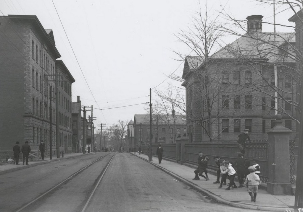
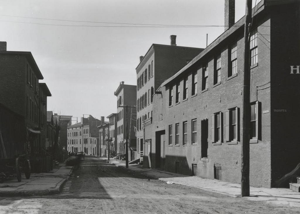
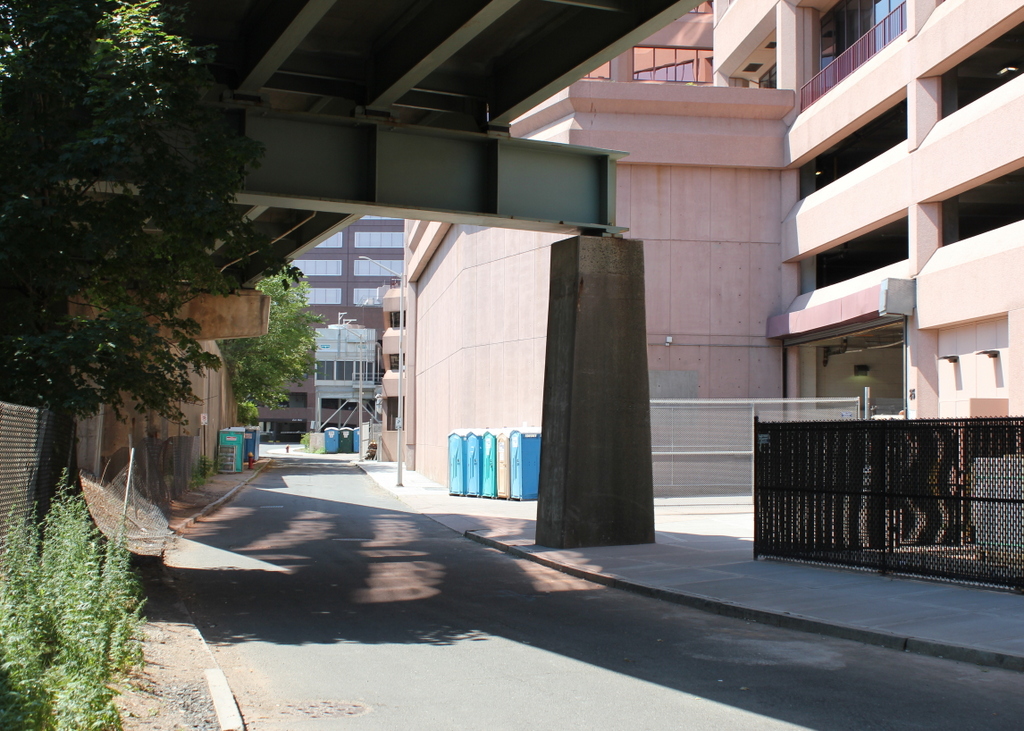
Market Street from Talcott Street, Hartford, Connecticut (2)

Looking north on Market Street from Talcott Street, around 1903-1906. Image courtesy of the Connecticut State Library.

Street scene

The scene in 2016:

991_2016
Taken from the same location as those in the previous post, these photos show the view in the opposite direction, looking north on Market Street. To the right is the Brown School, a public school that was built in 1869 at the northeast corner of Market and Talcott. It was expanded in 1897 as the neighborhood grew, with large numbers of immigrants moving into this part of the city. The children roughhousing in the foreground were probably students at the school, and many were likely first-generation Americans with immigrant parents.

Today, the school and the rest of the neighborhood have long since been demolished. The narrow street from the first photo is now a five-lane thoroughfare, with tall parking garages on either side and Interstate 84 a block away in the distance.

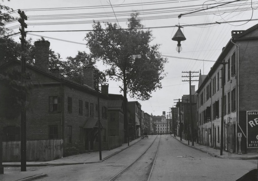
Market Street from Talcott Street, Hartford, Connecticut

Looking south on Market Street from the corner of Talcott Street, on September 19, 1904. Image courtesy of the Connecticut State Library.

Market St. south of Talcott St.

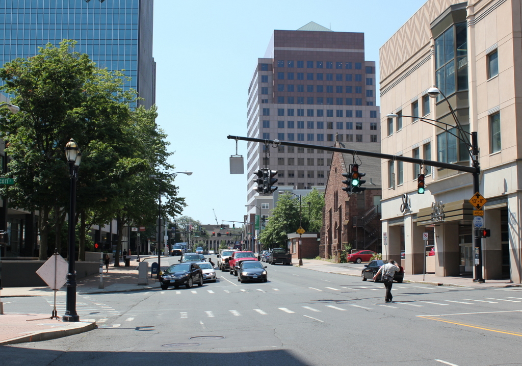
Market Street in 2016:

990_2016
In these early 20th century views of the east side of Hartford, a common theme is that none of the historic buildings are still standing today. Anything that was left standing by the early 1960s was demolished to build Constitution Plaza, but in this scene there was one exception. St. Anthony’s Church, located on the right side of the street, is only partially visible in the first photo, but today it is the last surviving 19th century building in what had once been a large immigrant neighborhood.

Built in 1855, the church was originally St. Paul’s Episcopal Church, but by the time the first photo was taken it was St. Anthony’s, a Catholic church that served the area’s large Italian-American population. The building no longer serves as a church, but it still stands out amid modern office buildings as a reminder of the residential neighborhood that was once located here.

Morgan Street from Market Street, Hartford, Connecticut

Looking west on Morgan Street from Market Street, in May 1906. Image courtesy of the Connecticut State Library.

Morgan St. west of Market

Morgan Street in 2016:

989_2016
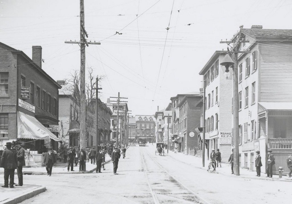
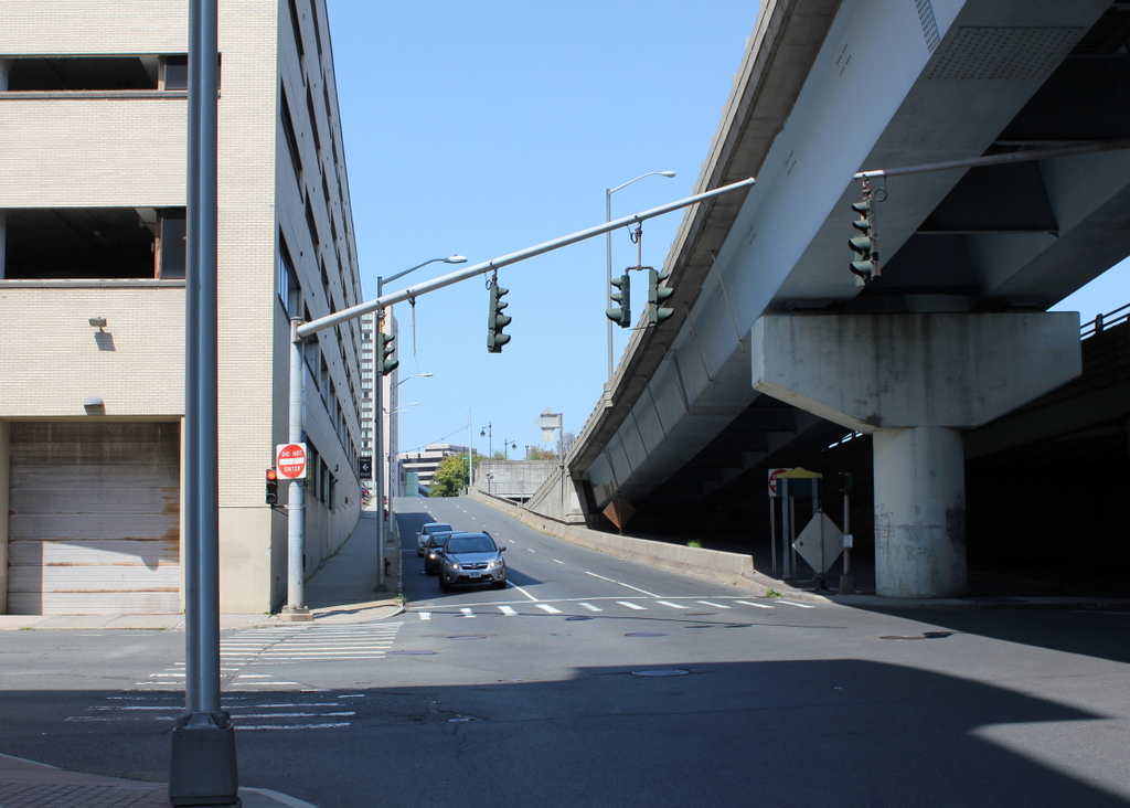
Like the view a little further east on Morgan Street, nothing is left from the first photo. Along with the other scenes of this neighborhood, the first photo shows a mix of architecture, dating as far back as the first half of the 19th century. By 1906, the street included some mid-19th century commercial buildings as well as several Greek Revival homes mixed in. Most of the signs are not readable with the photo resolution, but one on the far left indicates that the building was the home of the Socialist Educational Political Club.

Today, along with all of the buildings being demolished, even Morgan Street itself has been changed. In the first photo, it had trolley tracks running down the middle, but it now has an interstate highway in the middle. The street now consists of parallel eastbound and westbound sections, separated by Interstate 84. To the right in the 2016 photo is one of the highway ramps, connecting eastbound traffic on I-84 to northbound I-91.

Temporary Bridge, Hartford, Connecticut

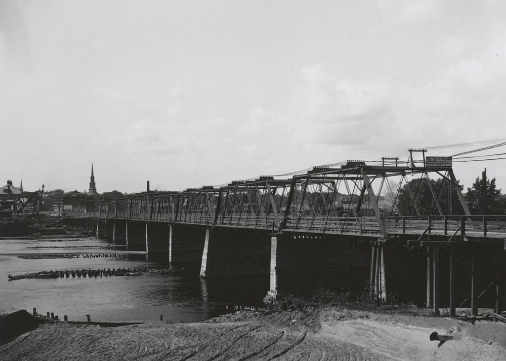
The bridge across the Connecticut River at Hartford, seen from the East Hartford side on September 9, 1903. Image courtesy of the Connecticut State Library.

Temporary bridge, East Hartford end

The scene in 2016:

988_2016
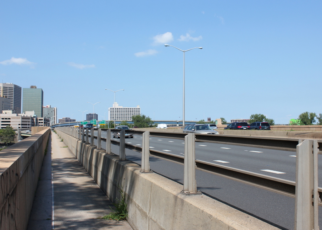
For many years, the only bridge across the Connecticut River at Hartford was here at the site of the Bulkeley Bridge. In 1818, a covered bridge was built here, and it survived until May 17, 1895, when it was destroyed in a fire. With no other crossings available, a makeshift bridge was quickly built upstream of the ruins, opening just three weeks later. Before the end of the year it was washed away, but was replaced with the temporary bridge that is seen in the first photo.

As inconvenient as the loss of the old covered bridge may have been, it allowed Hartford the opportunity to build an elegant new bridge that reflected the city’s prosperity and importance. When the first photo was taken, work had already begun on building the Bulkeley Bridge and reconstructing Morgan Street on the Hartford side of the bridge. The temporary bridge was demolished after the new one was completed in 1908. The bridge has since been joined by two others in Hartford, but it still plays an important role in the city’s transportation, carrying Interstate 84 and US Routes 6 and 44. At over 100 years old, it is possibly the oldest bridge in the Interstate Highway System, predating the actual establishment of the highway system by nearly 50 years.

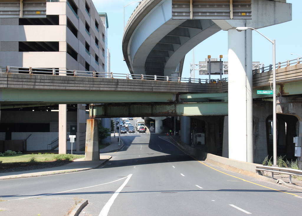
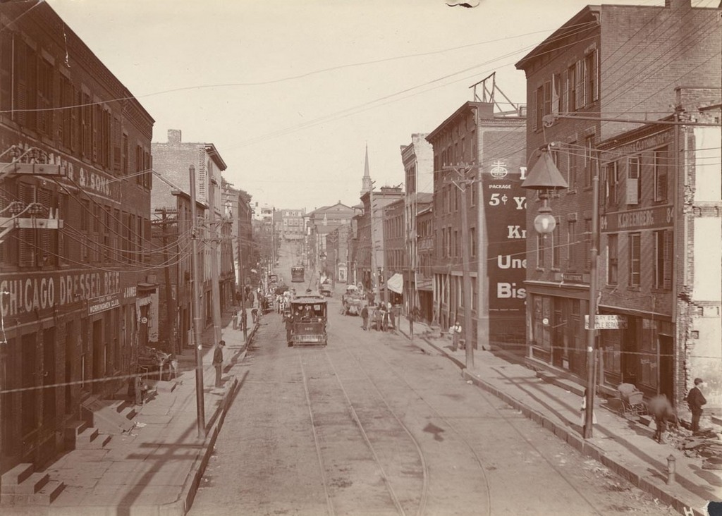
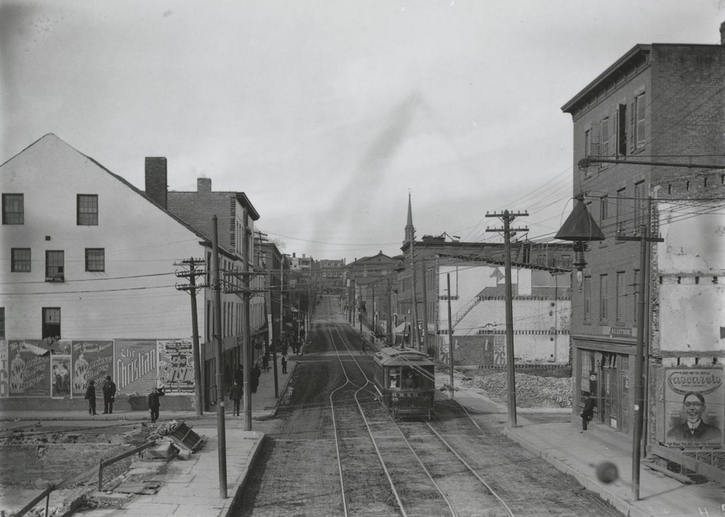
Morgan Street, Hartford, Connecticut

Looking west on Morgan Street from near the corner of Front Street (today’s Columbus Boulevard), on August 21, 1903. Image courtesy of the Connecticut State Library.
Morgan St. looking east

The view just two months later, on October 25, 1903. Image courtesy of the Connecticut State Library.
Morgan St., west of railroad bridge

The scene in 2016:

987_2016
For many years, the only bridge across the Connecticut River at Hartford was here at the foot of Morgan Road, just behind the photographer. The original covered bridge that had been built here in 1818 burned down in 1895, and although a temporary replacement was soon built here, a more permanent bridge was in the works. The city ultimately chose a stone arch bridge, which was completed in 1908 and is still standing as the Bulkeley Bridge. As part of the project, they designed broad avenues on either side of the bridge, which required demolition along Morgan Street.

As seen in the first two photos, Morgan Street was fairly narrow, and passed through the working-class neighborhood on the east side of the city. Looking to improve this and provide a more impressive entryway into the city, they demolished the buildings on both sides of the street to widen it. Although taken only two months apart, the first two photos here show the demolition progress, with at least five of the buildings gone by the time the second photo was taken. The buildings that were still standing were covered in advertisements, including the one on the far left that has posters for plays entitled “The Christian” and “A Working Girl’s Wrongs.”

In later years, further transportation improvements would reshape Morgan Street again. With the coming of the Interstate Highway System, this spot just west of the Bulkeley Bridge became the intersection of I-91, Connecticut’s primary north-south route, and I-84, one of the main east-west routes in the state. Any of the early 20th century efforts to make Morgan Street a grand boulevard were completely undone by the 1970s, when I-84 was built directly above the street. Today, instead of being lined with the tenement houses and merchant storefronts that once stood here, the street is now surrounded by parking garages and elevated highways.
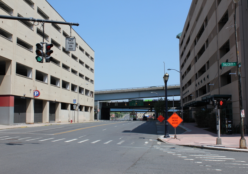
Charles Street, Hartford, Connecticut (2)

Looking south on Charles Street from Talcott Street in Hartford, on March 4, 1906. Image courtesy of the Connecticut State Library.

Charles St. south of Talcott

Charles Street in 2016:

986_2016
This view shows the same block as an earlier post, just from the opposite direction, facing south toward Kilbourn Street. As with the other photo, most of the 19th century buildings here appear to be either industrial buildings or tenement homes, which would have housed this neighborhood’s large population of Italian immigrants. Behind the camera, Charles Street once continued north to Morgan Street, but that section of the road has since been completely destroyed to build Interstate 91, leaving just this southern one-block stretch of Charles Street, sandwiched between the highway to the left, an office building to the right, and an exit ramp for Interstate 91 directly above it.