South Station, Boston

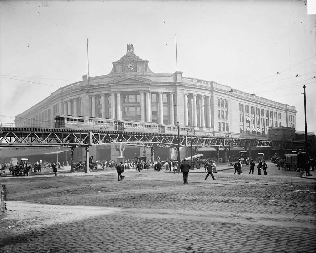
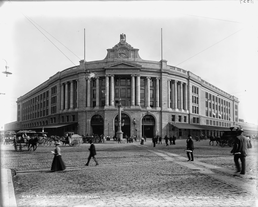
South Station around the time that it opened in 1899. Image courtesy of the Library of Congress, Detroit Publishing Company Collection.

263_1899c-loc

The same view around 1905, after the construction of the Atlantic Avenue Elevated. Image courtesy of the Library of Congress, Detroit Publishing Company Collection.

Transportation

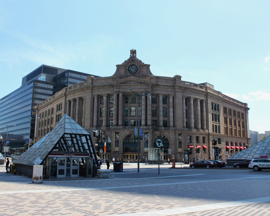
South Station in 2014:

These three photos reveal the changes that have taken place here at South Station over the past 115 years.  While the building itself (or at least most of it) has remained essentially the same, its surroundings have continually changed.

Before 1899, four different railroads had terminals in the general vicinity of the present-day station.  To make things simpler, South Station was built, and all four lines were rerouted to it.  A few years later, in 1901, the Atlantic Avenue Elevated was built, as seen in the second photo.  The rapid transit line included a station at South Station, which can be seen on the far right of the 1905 photo.

The third photo shows the result of changes in the way people travel; the Atlantic Avenue Elevated closed in 1938, and was demolished four years later.  Even South Station was seeing a severe drop in passengers in postwar America, as cars became the primary method of travel.  However, Boston’s colonial-era street network was not particularly accommodating to large number of cars, so the Central Artery was built in the 1950s.  Most of the Central Artery was elevated, but it was put underground for a few blocks near South Station, and was known as the Dewey Square Tunnel.

The Dewey Square Tunnel turned out to be a foreshadowing of things to come; part of Boston’s infamous Big Dig involved putting the entire Central Artery underground.  Today, the tunnel is still there, directly underneath where I was standing when I took the photo.  It is the only existing part of the Central Artery; the remainder of the 1950s-era expressway was demolished upon completion of the Big Dig.

Today, South Station has been trimmed a bit – notice that the facade on both sides is shorter than in the first two photos.  This was a result of demolition in the 1960s, at a time when many railroads were cutting back or eliminating passenger service.  However, today South Station is a busy transportation center again – it is the busiest railroad station in New England and the sixth busiest in the country, and it is the northern terminus of the Northeast Corridor, the busiest rail line in the country.

Custom House, Boston

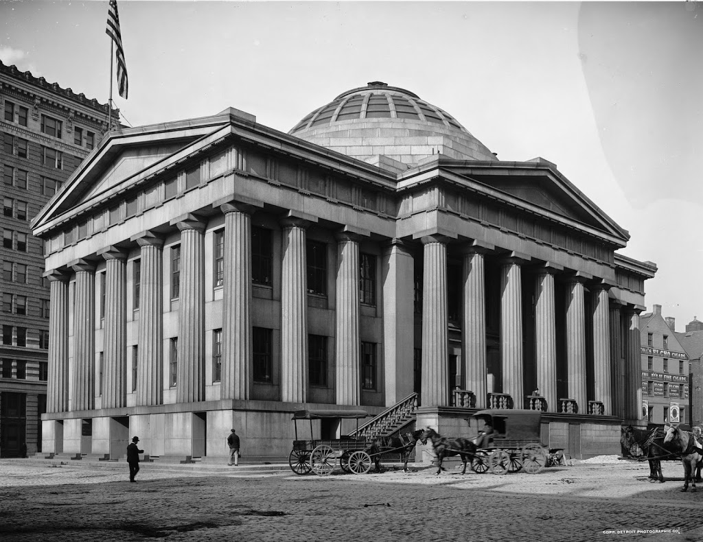
Boston’s Custom House, around 1900-1906. Image courtesy of the Library of Congress, Detroit Publishing Company Collection.

254_1900-1906c-oc.tif

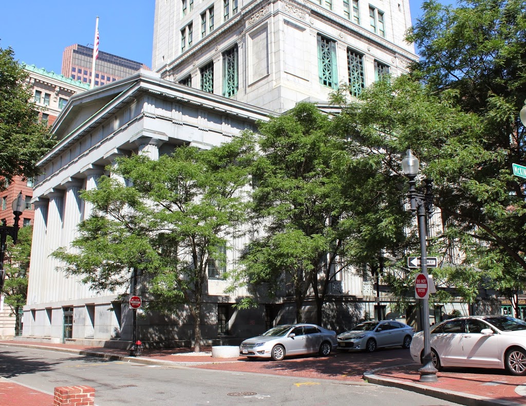
The building in 2014:

254_2014

Although no longer used as a US Customs office, the Custom House still looks much the same as it did when it was completed in 1849, aside from the addition of a 32-story skyscraper on top of it.  When it was built, it was on the waterfront, roughly level with Quincy Market, which was also located along the water.  It was a convenient location, as it facilitated the inspection of ship cargoes.  Today it is several blocks away from Long Wharf, but it continued to be used by Customs for many years.

By the time the first photo was taken, the increase in shipping to Boston necessitated expanding the Custom House, which led to the construction of the Custom House Tower in 1915. At the time, Boston  restricted the height of buildings to 125 feet, but as a federal building it was exempt from these restrictions.  As a result, it was the tallest building in Boston until the completion of the Prudential Tower in 1964.  US Customs left the building in 1986, and it is now a Mariott hotel.

Faneuil Hall and Quincy Market, Boston

The east face of Faneuil Hall, with Quincy Market to the right, taken in 1875.  Photo courtesy of Boston Public Library.

252_1875-bpl

The same view in 2014:

252_2014

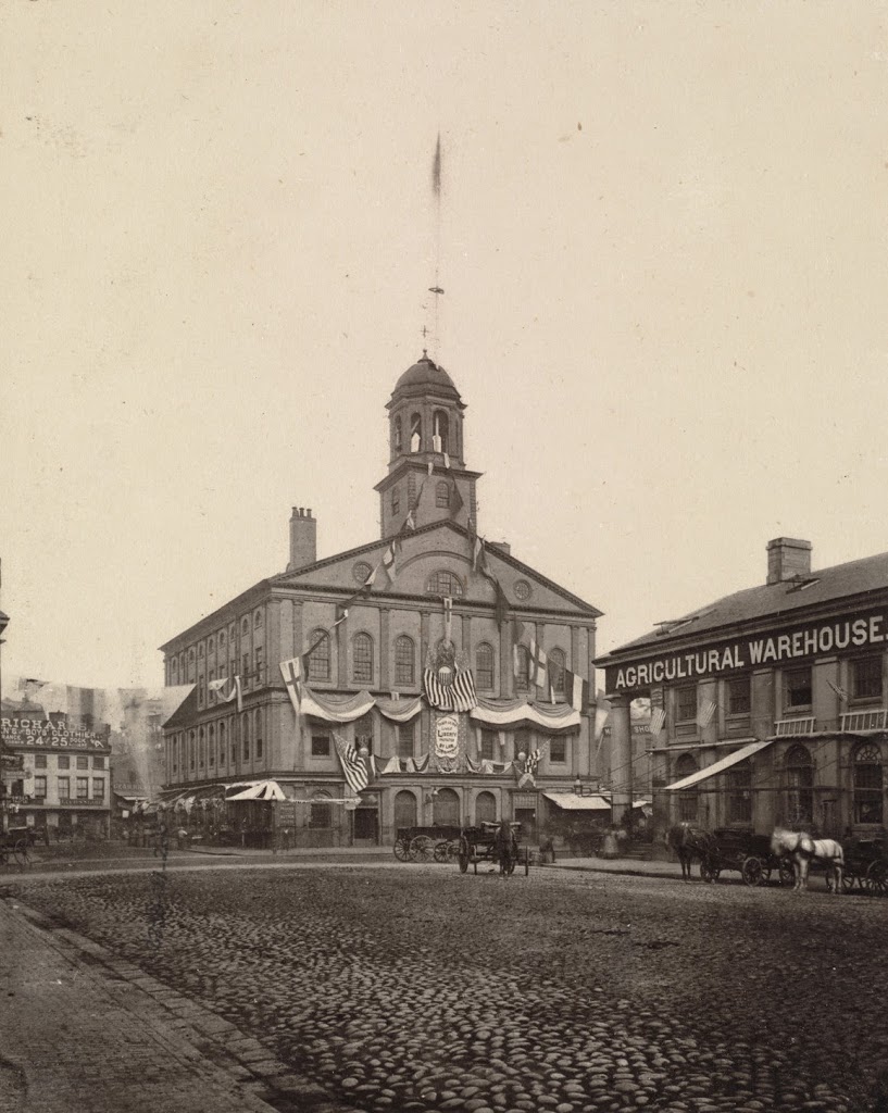
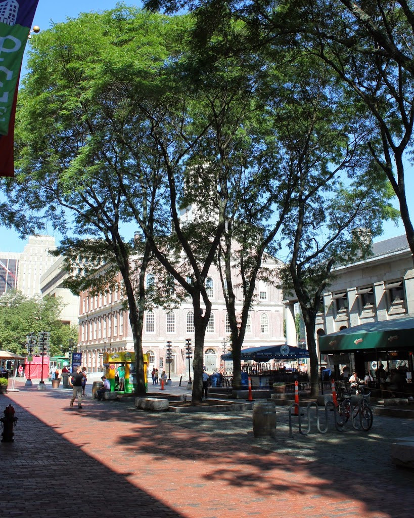
Compare with the photos in this post, wheich show Faneuil Hall a little closer and about 20 years after his 1875 photo was taken.  Faneuil Hall and Quincy Market are still there, having been built in 1742 and 825, respectively.  However, the scene is very different in the background.  Boston’s massive City Hall building is just beyond and to the left of Faneuil Hall, with other modern skyscrapers behind it.  This was once the Scollay Square neighborhood of Boston, which was completely demolished in the 1960s to build City Hall and the surrounding buildings, with the neighborhood being renamed Government Center.

Quincy Market, Boston (3)

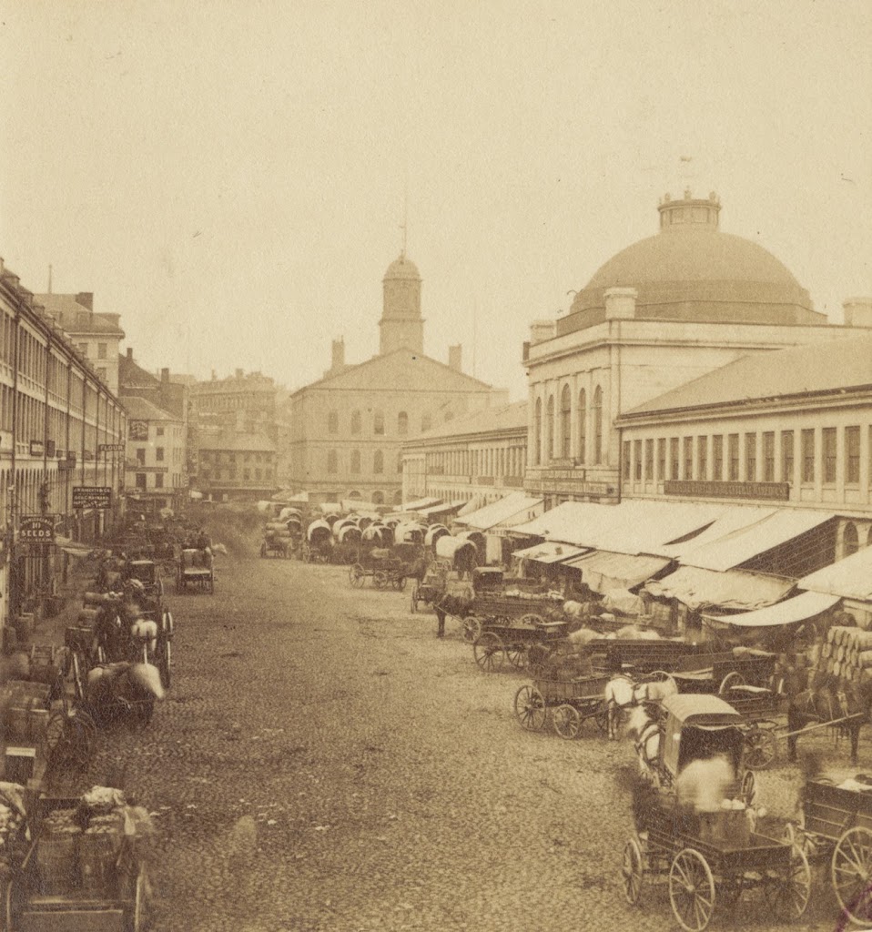
Quincy Market, facing west toward Faneuil Hall, sometime in the 1800s.  Photo courtesy of Boston Public Library.

251_1800sc-bpl

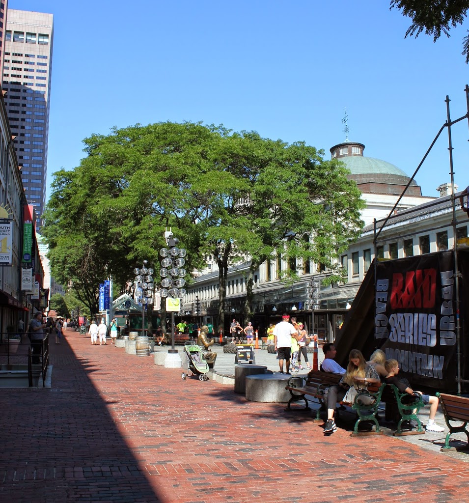
The scene in 2014:

251_2014

Another view of Quincy Market, showing the difference between the business-oriented market in the 1800s, and the tourist-oriented scene today.  In this particular 2014 view, it was taken during the Urban Raid, a 5k race and obstacle course that went through the City Hall area of Boston.

Quincy Market, Boston (2)

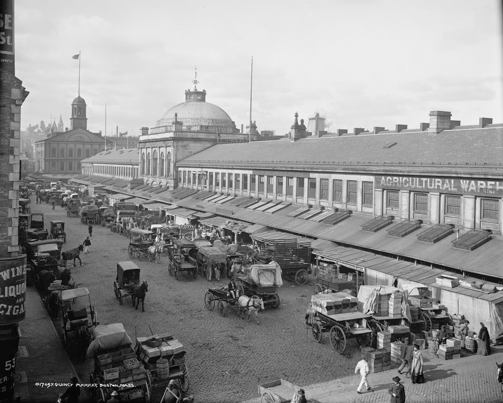
Another Quincy Market scene, facing west, looking toward Faneuil Hall, around 1904. Image courtesy of the Library of Congress, Detroit Publishing Company Collection.

Boston

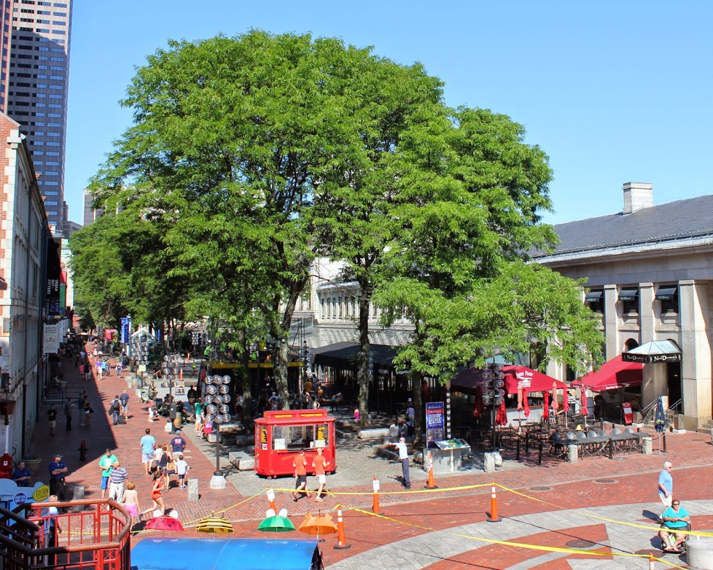
The same scene in 2014:

250_2014

Another view of Quincy Market, with the 1904 photo showing the various food vendors outside the building.  Today, the market is oriented toward tourists instead of Boston residents, although the exterior of the building is largely the same.  The South Market building, on the extreme left-hand side of the photos, is also there, as is the corresponding North Market building on the opposite side of Quincy Market.

Quincy Market, Boston (1)

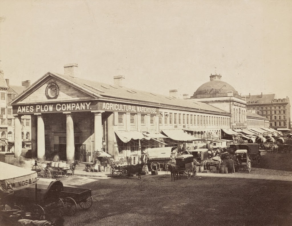
The view of Quincy Market looking east from in front of Faneuil Hall, sometime in the 1800s.  Photo courtesy of Boston Public Library.

249_1800sc-bpl

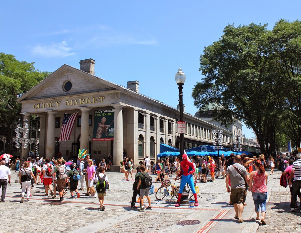
The same view of Quincy Market in 2014:

249_2014

Built in 1825, Quincy Market has been a major commercial center for nearly 200 years.  However, its role and the surrounding neighborhood have certainly changed.  Originally, as seen in the first photo, it was a place for Bostonians to buy and sell food products, ranging from fruits and vegetables to cheese and meat.  It was also built right along the waterfront; today it is several blocks from Boston Harbor.  But, the building hasn’t moved – the waterfront has.  Over the years, Boston has significantly expanded its land area, both through annexing surrounding towns but also through landfill, which included dumping dirt, rocks, construction debris, and even old ships into the harbor and building atop it.

Because of that, Quincy Market is no longer has a waterfront location, but it is still a commercial center, although today it consists of fast food vendors that primarily cater to tourists and workers from nearby City Hall.  The Quincy Market area also offers shopping, gift stores, and in this particular scene, photos with Spider-Man.  It is also located along the Freedom Trail, which is marked by the brick path in the foreground.