Sun Tavern, Dock Square, Boston

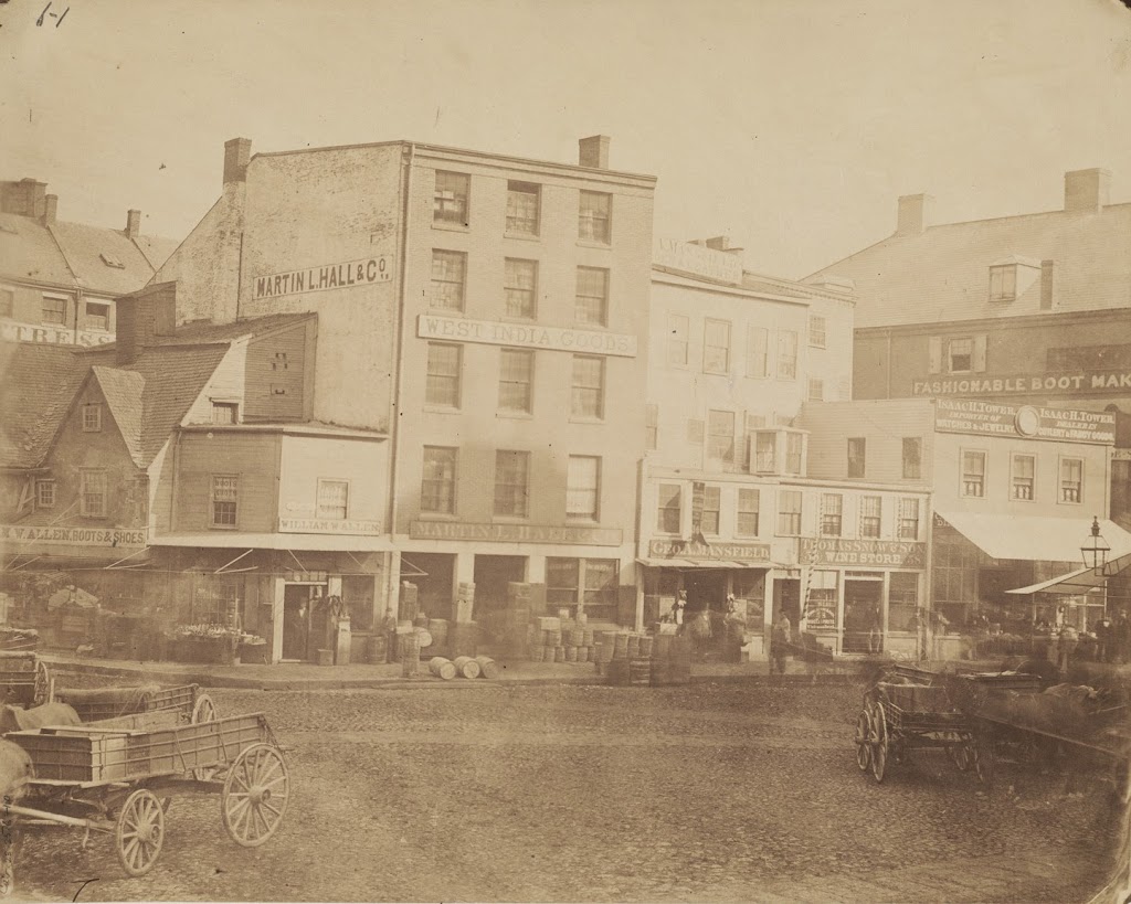
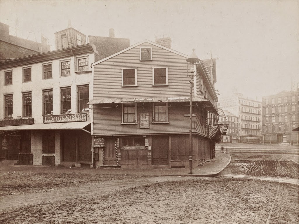
The Sun Tavern at Dock Square, across from Faneuil Hall in Boston, sometime in the 1800s. Photo courtesy of Boston Public Library.

Taverns

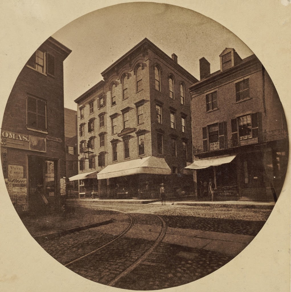
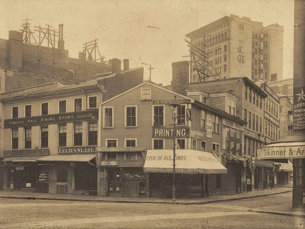
Dock Square and the Sun Tavern around 1898. Photo courtesy of Boston Public Library.
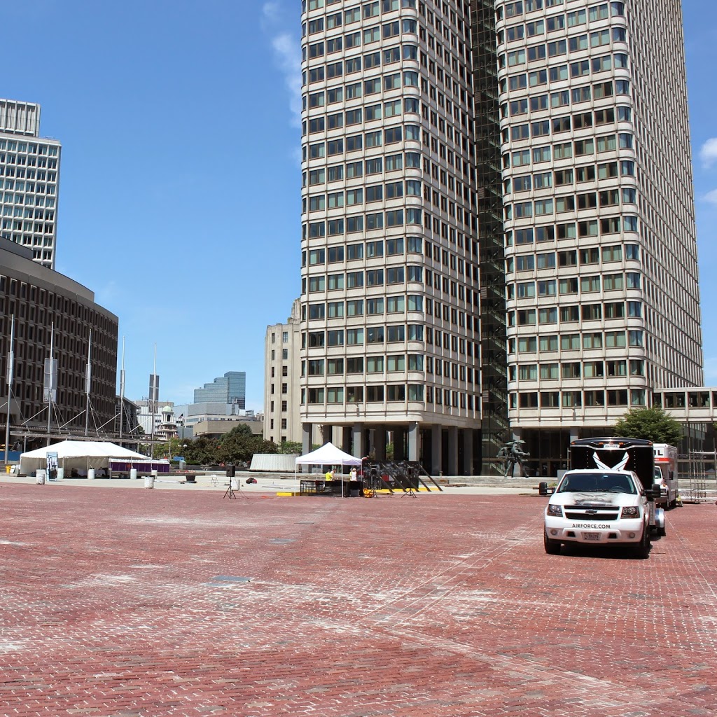
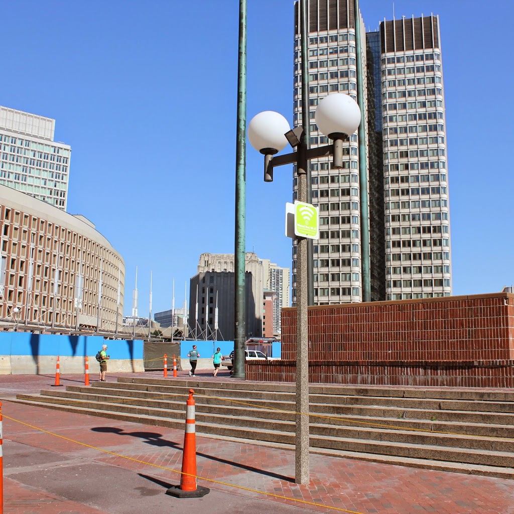
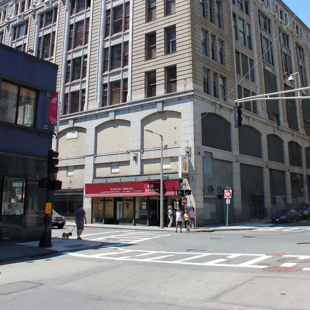
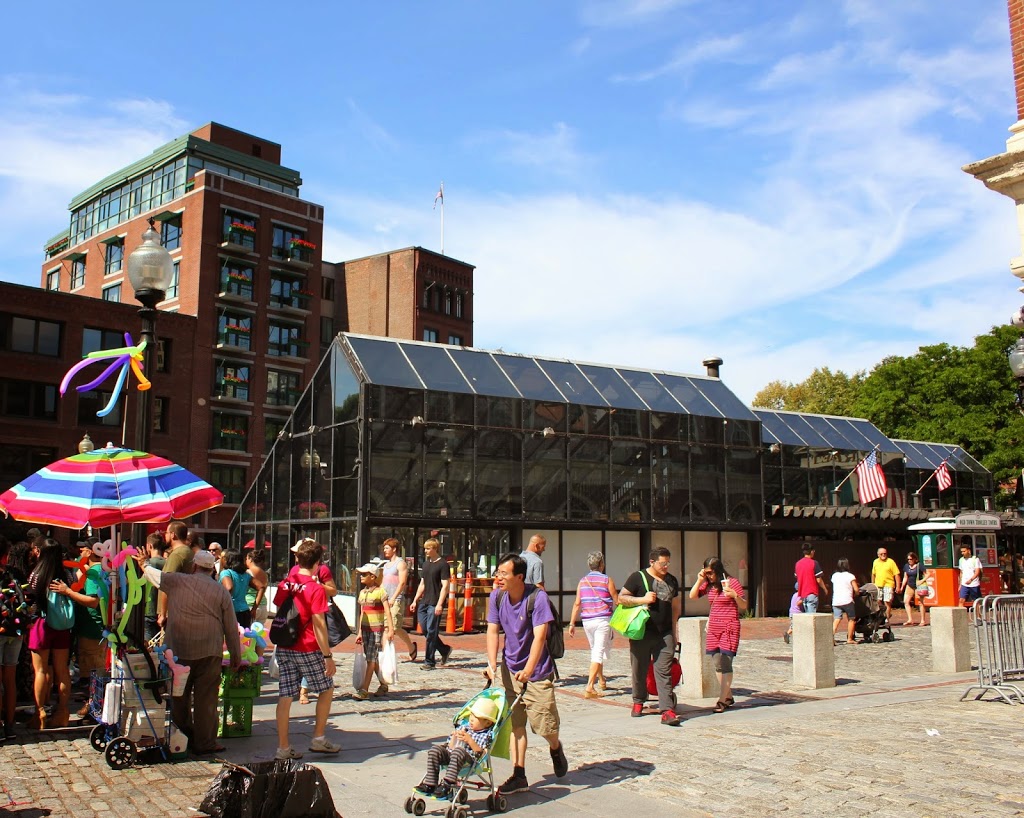
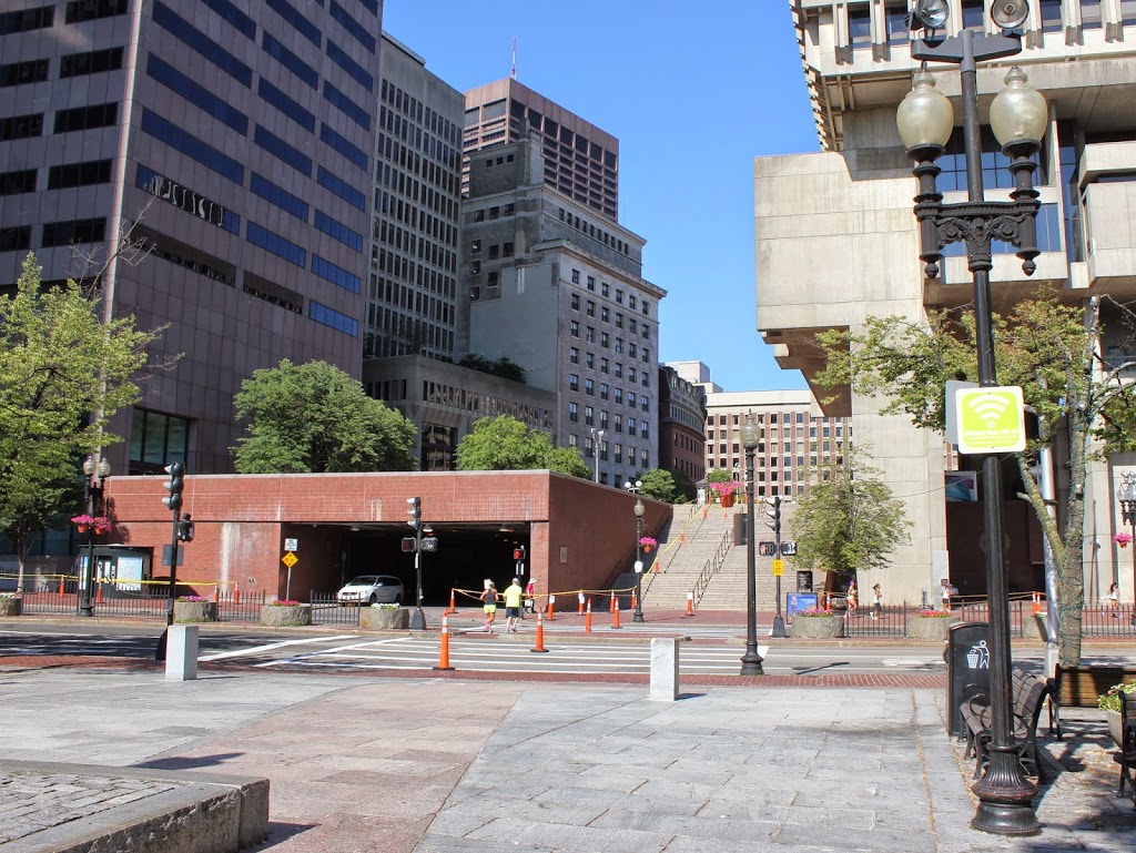
312_1898c-2Bbpl

The scene in 2014:

312_2014

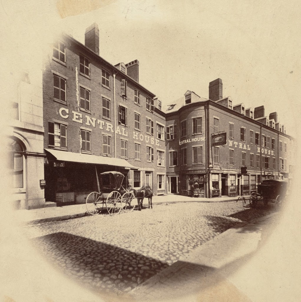
According to the sign above the building in the first photo, the Sun Tavern was built in 1690, although some estimates that I have seen have dated its construction even earlier.  In either case, the building was extremely old by the time it was photographed in 1898,  It was a tavern by the first decade of the 18th century, although possibly earlier, and was at the time located right next to the town dock, hence the name of Dock Square.  It wouldn’t be until over 50 years after it opened that its familiar neighbor, Faneuil Hall, was built, and another 80 years after that before Quincy Market was built atop what was once Boston Harbor.

The building survived until about 1910 (it appears in the 1908 atlas, but is gone by the 1912 one), and sometime in the 1920s or 1930s a good portion of Dock Square was torn down.  The rest would come down in the 1960s, when the area that once made up Dock Square, Adams Square, and Scollay Square was demolished to build Boston City Hall, seen on the right-hand side of the 2014 photo.

Central House, Boston

The Central House on Brattle Square, Boston, in 1860.  Photo courtesy of Boston Public Library.

306_1860-2Bbpl

The scene in 2014:

306_2014

Located next to the Quincy House, immediately to the right of the building in the 1860 photo of this post,  the Central House was at one point its own hotel, but was later absorbed into the Quincy House.  Eventually, like the rest of the Quincy House, this section was expanded to seven stories in the 1880s, although it isn’t apparent whether the existing floors were added on to, or if the brick section was entirely demolished.  In any case, the entire neighborhood is gone, along with the street network, so this photo and the other one of the Quincy House are recreated based on estimates from comparing historic and modern maps; no landmarks remain from either of the two 1860 photos.

Quincy House, Boston

The Quincy House on Brattle Street in Boston, taken in 1860. Photo courtesy of Boston Public Library.

305_1860-2Bbpl

The scene in 2014:

305_2014

Located just as short distance from Scollay, Adams, Dock, and Faneuil Hall Squares, the Quincy House enjoyed a prominent location in downtown Boston.  The hotel was built around 1819, and was constructed of granite, only a few years before similar materials were used to build Quincy Market just a few block away.  In its heyday, it was one of the best hotels in Boston, and was also used by many different labor unions as a meeting place.

The 1860 photo, taken by photography pioneer Josiah Johnson Hawes, shows the hotel’s original appearance, before a renovation in the 1880s that added an additional three stories and a clock tower, as seen in this photo from the City of Boston Archives. However, by the 1920s the aging hotel suffered from increased competition, and closed in 1929. The building itself was demolished in 1935, less than 30 years before the entire neighborhood was taken down to build City Hall and the City Hall Plaza, as seen in the 2014 photo.

Beach Street, Boston

Looking west on Beach Street toward Harrison Avenue in 1860. Photo courtesy of Boston Public Library.

301_1860-2Bbpl

Beach Street in 2014:

301_2014

Taken before the neighborhood was redeveloped as a major commercial district, the first photo shows a variety of early 19th century architecture, with a combination of a hotel (the Boston Hotel on the left), a church (Beach Street Church), and residential buildings.  Notice also the awning that advertises “cool soda” at the business on the right.  Today, this area has undergone total redevelopment, and is now in the midst of Boston’s Chinatown neighborhood.

Harrison & Essex Streets, Boston

The corner of Harrison Avenue and Essex Street in Boston, in 1860. Photo courtesy of Boston Public Library.

298_1860-2Bbpl

The scene in 2014:

Located in present-day Chinatown, this scene has completely changed in the past 150 years, with none of the 1860 buildings surviving today. Even the streets have changed somewhat, with Harrison Avenue (the street in the lower left foreground) being extended across Essex Street, through where the house on the right-hand side of the 1860 photo once stood.  That house was home of Wendell Phillips, a noted 19th century abolitionist, lawyer, and candidate for governor of Massachusetts.

Incidentally, the first photo was taken by Josiah Johnson Hawes, who worked with Albert Sands Southworth in the famous Southworth & Hawes photographic company.  Together, they were among the early pioneers of quality photography, and some of Hawes’s photographs, including the one above, give a rare glimpse of Boston on the eve of the Civil War.

North Market, Boston

North Market in Boston, next to Quincy Market, around 1855. Photo courtesy of Boston Public Library.

297_1855c-2Bbpl

The scene in 2014:

297_2014

These photos show the same scene as the ones in this post, just from a different angle.  The building on the far left of the 1855 photo is the Old Feather Shop, the same one seen in the photo in the other post.  Built in 1680, it was demolished around 1860, soon after the first photo was taken.  Both pictures were taken from right in front of Faneuil Hall (which can be seen on the far right of the 2014 photo), and this area has been a major commercial center since the 1600s, when it was known as Dock Square.  Today, most of the commercial activity centers around tourism, and the location is adjacent to Quincy Market and along the Freedom Trail.  The red brick path of the Freedom Trail can be seen in the foreground of the 2014 photo.