Tremont Street, Boston (2)

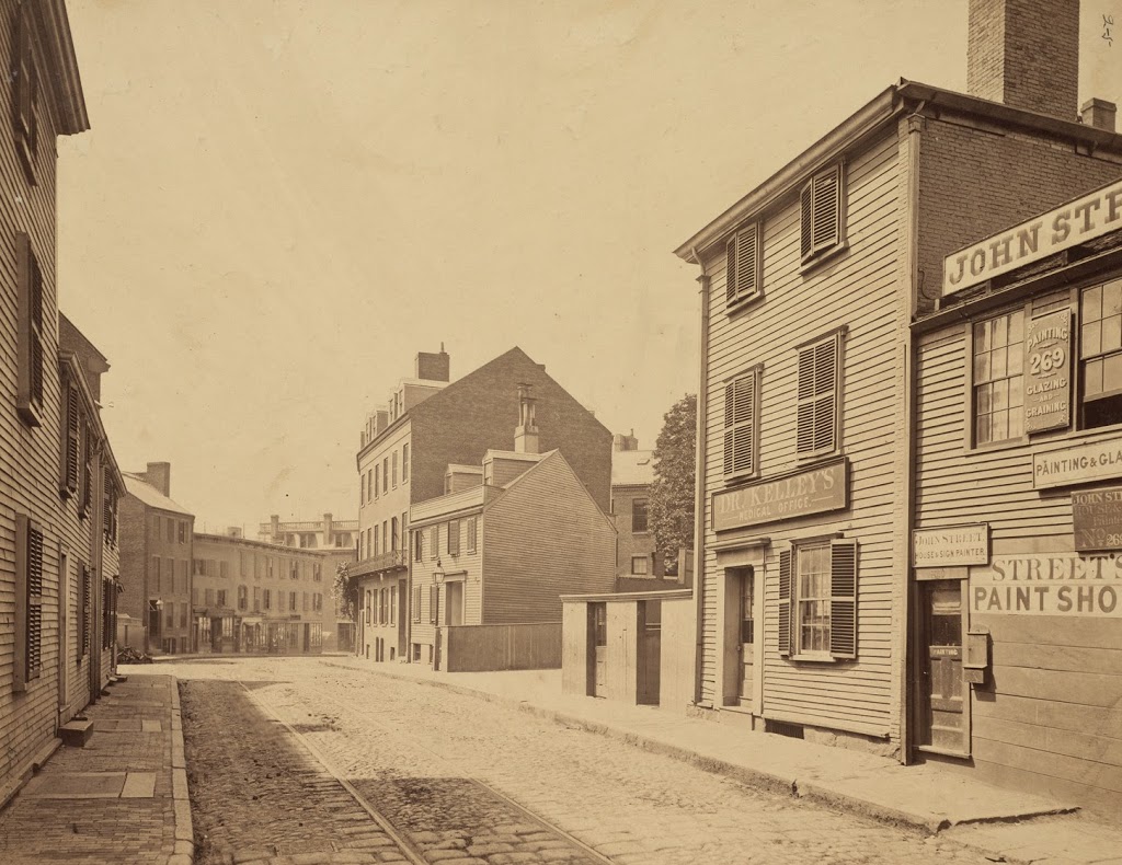
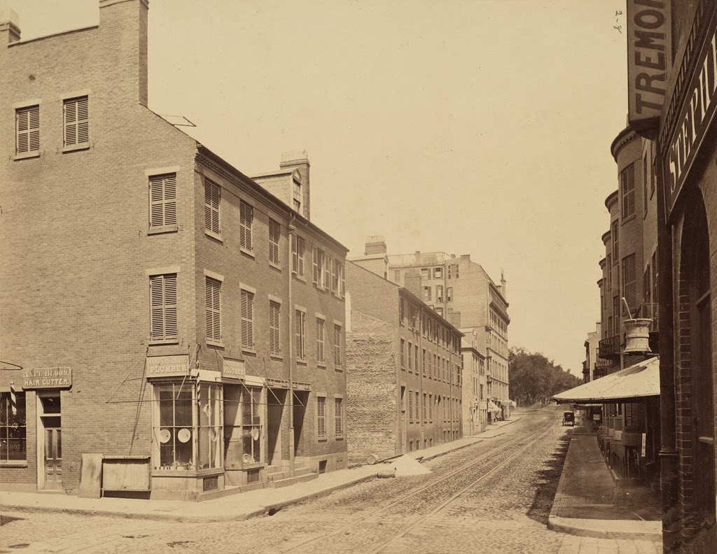
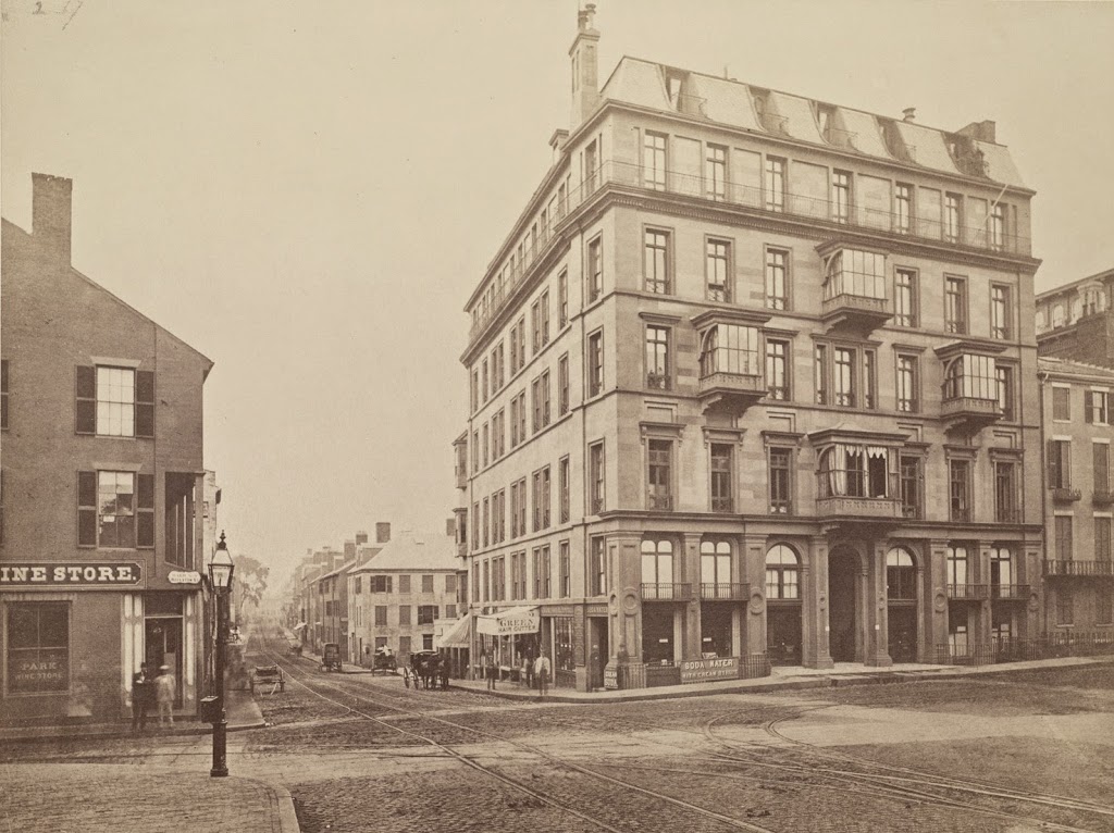
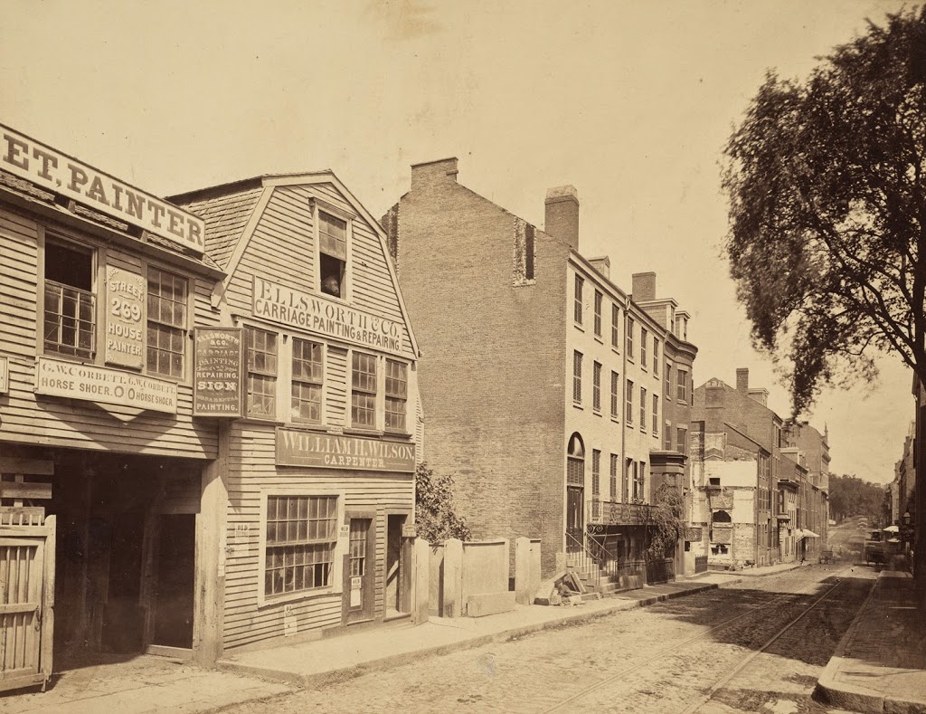
Tremont Street in Boston, looking north toward Eliot Street (present-day Stuart Street) and Boston Common in the distance, in 1869. Photo courtesy of Boston Public Library.
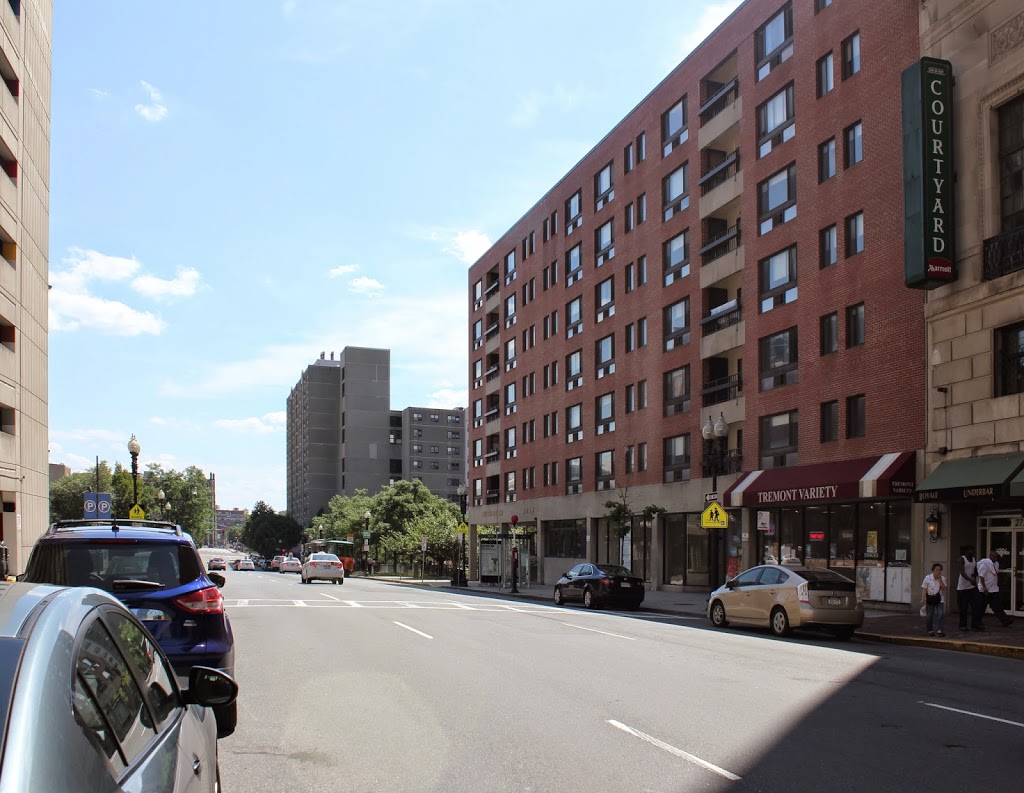
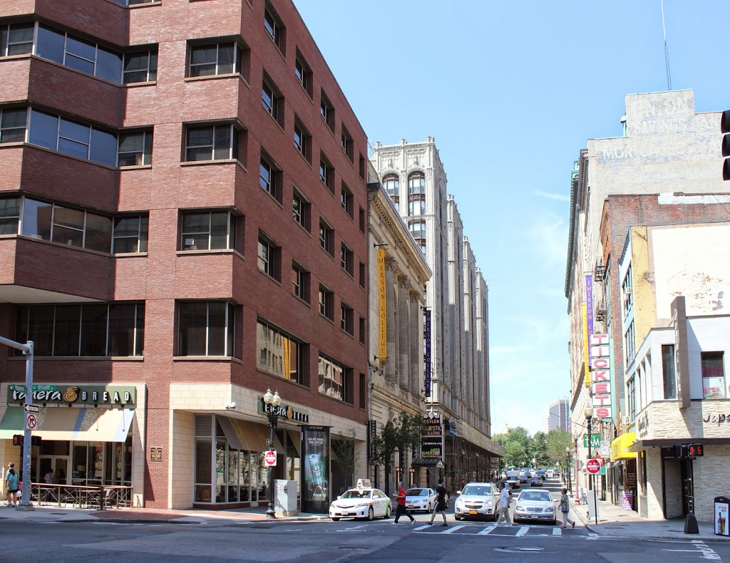
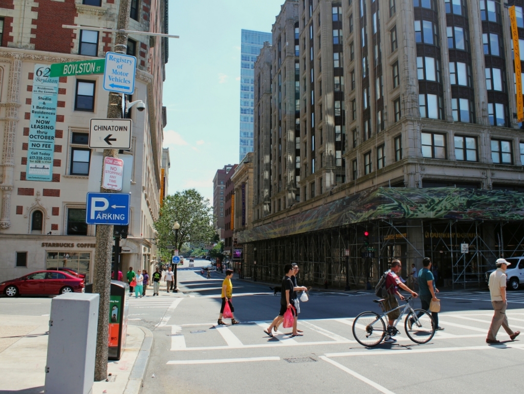
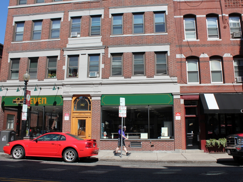
288_1869-2Bbpl

The scene in 2014:

288_2014

The first photo was taken from nearly the same location as the one in this post, just facing the opposite direction. All of the buildings in the first photo are gone, and most of them were probably demolished very soon after the first photo was taken, when Tremont Street was widened. Today, the narrow, cobblestone street is a distant memory, and Tremont Street is a major road that, in the 2014 photo, passes through Boston’s Theater District.

Tremont Street, Boston (1)

Tremont Street, facing south from between modern-day Stuart and Oak Streets, around 1869. Photo courtesy of Boston Public Library.

287_1869-2Bbpl

Tremont Street in 2014:

287_2014

Today, Tremont Street is a major road in Boston, three lanes wide along with room for parking and sidewalks on both sides. It’s very different from how it appeared in the 1860s, before the road was widened and the buildings on the right were demolished. The narrow streets of the old photo were typical of pre-automobile Boston, and many similar streets survive to this day, helping to contribute to Boston’s reputation as a terrible place to drive.

Tremont Street from Eliot Street, Boston

The view looking up Tremont Street from Eliot Street (modern-day Stuart Street) in 1869. Photo courtesy of Boston Public Library.

286_1869-2Bbpl

The scene in 2014:

286_2014

The first photo was taken before Tremont Street was widened in 1869. All of the buildings on the left-hand side were (presumably) demolished, except for the Hotel Pelham, which was moved 14 feet to the left and survived until 1916. Although the buildings on the right were unaffected by the widening, none of them appear to have survived to the present day. Today, the location is in the middle of the Theater District, with several of the theaters visible on either side of Tremont Street in the 2014 photo.

Hotel Pelham, Boston

Facing the southwest corner of Boylston and Tremont in Boston around 1859, toward the newly-constructed Hotel Pelham.  Photo courtesy of Boston Public Library.

1850s

The same scene 2014:

Constructed in 1857, the Hotel Pelham was possibly the first apartment building of its type in the United States.  Although named a hotel, the term in the mid 19th century was commonly used to refer to what today we would call an apartment building – they catered more toward long-term residents than temporary visitors.

The date on the first photo is probably 1859, but some sources date it to 1869.  In either case, 1869 is the latest possible date for the photo, because in that year Tremont Street (the street that the photos are facing down) was widened.  Rather than demolishing and rebuilding, the owners moved the 5,000 ton building 14 feet to the west (right), a move that took three months to complete.  Following the move, the hotel remained in business for nearly 50 more years, before being demolished in 1916 and replaced with the present-day office building.


Summer Street near Atlantic Avenue, Boston

Looking toward the northern side of Summer Street, with Atlantic Avenue in the distance, sometime in the 1800s. Photo courtesy of Boston Public Library.

282_1800sc-2Bbpl

The scene in 2014:

These photos were taken from alongside South Station (although I’m not sure if South Station was here at the time of the first photo), around the spot where the present-day station facade ends.  The buildings in the first photo are the Hathaway Building (distance) and the New England Building (foreground), and an 1898 atlas of Boston lists both buildings as belonging to Francis Hathaway.  I don’t know when the buildings were demolished, but they were gone by the late 1960s, when construction began on the building that currently occupies the site, Boston’s Federal Reserve Bank Building, which takes up most of the right-hand side of the photo.


Mather-Eliot House, Boston

The Mather-Eliot House on Hanover Street, near North Bennet Street in Boston’s North End, around 1898. Photo courtesy of Boston Public Library.

The scene in 2014:

In his 1887 book, Rambles in Old Boston, New England, Edward Griffin Porter describes the house in the first photo as a “fragment of an ancient wooden dwelling, crowded almost out of sight by the larger brick buildings.”  The house at 342 Hanover Street was built in 1677 by noted Puritan minister Increase Mather, after his previous house was destroyed in the fire of 1676.  His son, Cotton Mather, grew up here, and later went on to be a prominent minister as well.  The Mathers only lived here for 11 years, but later on the house was owned by two other famous ministers, Andrew and John Eliot.  The house was still standing in 1899, but was demolished by 1908.  As seen in the 2014 photo, a 7-Eleven now occupies the first floor of the building that sits on the site now.  The building to the left of the Mather-Eliot House is long gone, but the one on the right, which was built in 1884, is still there.

Incidentally, after the fire of 1676 destroyed Increase Mather’s old house, a new house was built on the same site around 1680, and survives today – it is best known as the Paul Revere House.