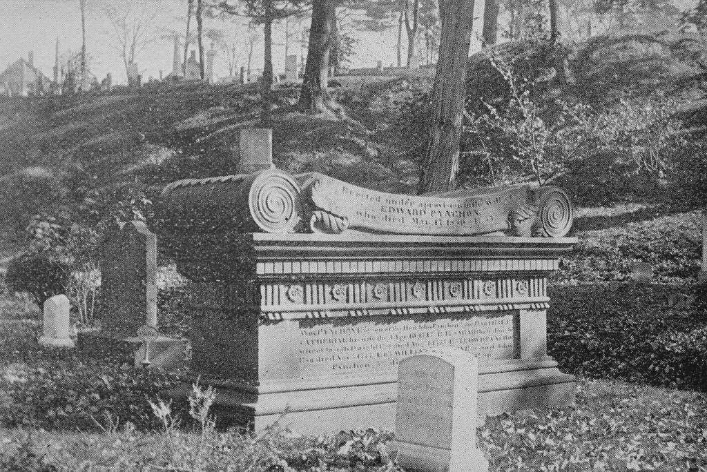
Pynchon Monument, Springfield, Mass

The Pynchon family plot in Springfield Cemetery, around 1892. Image from Picturesque Hampden (1892).

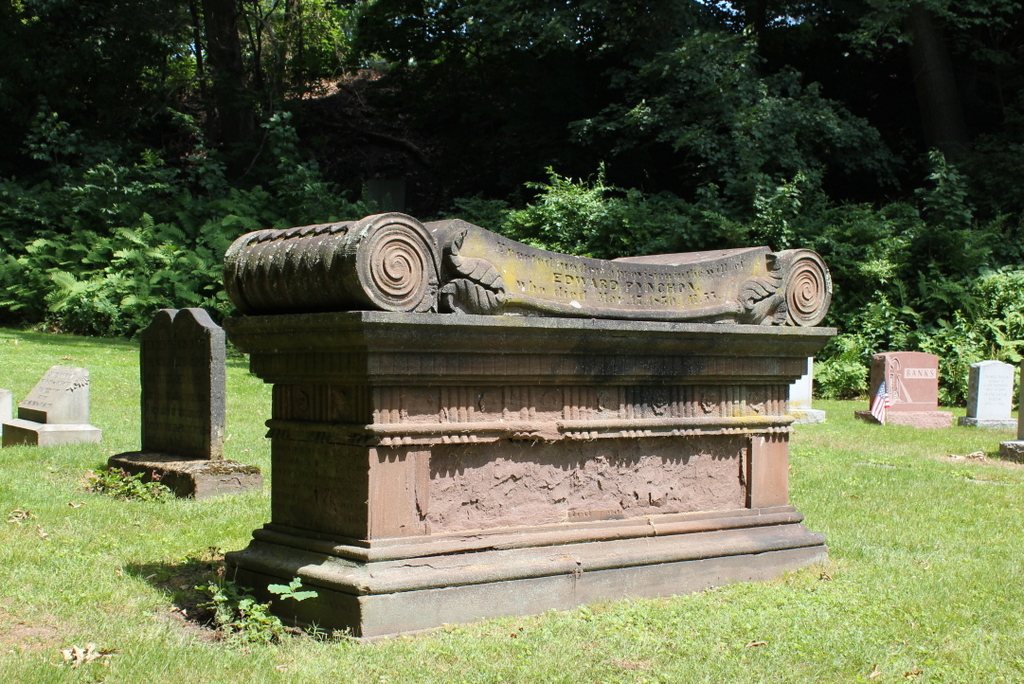
The scene in 2020:

Springfield Cemetery was established in 1841, but it includes the remains of many of Springfield’s earliest colonial settlers, dating back to the mid-1600s. Originally, these residents were buried in a graveyard in downtown Springfield, on Elm Street between Old First Church and the Connecticut River. However, by the 1840s that land had become valuable real estate in the center of a growing town, and part of the graveyard was in the path of a new railroad along the river. Because of this, in 1848 the remains were exhumed, and nearly all were reinterred in Springfield Cemetery.

A total of 2,434 bodies were removed from the old graveyard, along with 517 gravestones. Friends and family members of the deceased had the option of having the remains buried in a different cemetery, or in a private lot here in Springfield Cemetery, but most were interred along the Pine Street side of the cemetery. Those bodies accompanied by gravestones were buried beneath their respective stones, and the hundreds of unidentified remains with no gravestones were buried in an adjacent lot.

Among those buried in private lots were members of the Pynchon family. The Pynchons were probably the most influential family in the early years of Springfield’s history, in particular the family patriarch, William Pynchon, who founded the settlement in 1636. He returned to England in 1652 after the publication of his controversial book, which the Puritan leaders found heretical, so he was not buried in Springfield. However, his children stayed here in Springfield, where they would play an important role in the town throughout the rest of the 17th century.

One of William Pynchon’s children was his daughter Mary, who came to Springfield as a teenager in the 1630s and married Elizur Holyoke in 1640. She died in 1657, and her gravestone is the oldest surviving stone here in the cemetery. It is visible on the left side of this scene, just behind and to the left of the large monument in the center of the photos. Gravestones were uncommon in New England before the late 1600s, as early burials were typically marked by simple fieldstones or wooden markers, if at all. Few gravestones in the region are dated prior to the 1660s, and many of these were likely carved years or decades after the fact. It is possible that Mary’s gravestone was carved at a later date, but either way it is definitely very old and was likely carved at some point in the 1600s.

Aside from its age, Mary Pynchon Holyoke’s gravestone is also memorable for its epitaph, which reads:

Shee yt lyes here was while she stood
A very glory of womanhood
Even here was sown most pretious dust
Which surely shall rise with the just

When her body was disinterred from the old burying ground in the spring of 1848, the remains of two different people were found beneath this stone. Writing several decades later in 1885, in Record of the Pynchon Family in England and America, Dr. J. C. Pynchon speculated that the second body may have been Elizur Holyoke, although there is no known record of where he was buried. In any case, there was little left of either body, with Pynchon writing:

These remains were found side by side, in the white sand, about six feet below the surface. This sand was discolored, and some few pieces of the skulls and other bones were found, while even the screws or nails of the coffins were wholly destroyed, their places being marked by the rust only, while no other vestige of the coffins remained. The few remains were gathered, which soon crumbled to dust on exposure to the air, and, with the surrounding earth, deposited in the new cemetery, after having lain in the old burying ground, in the case of Mary Holyoke, one hundred and ninety-one years.

Aside from Mary’s gravestone, the Pynchon family lot here also includes the large monument in the center of the scene. As indicated by the inscription here on this side of it, the monument was “Erected under a provision in the will of Edward Pynchon, who died Mar. 17, 1830. Æ 55.” Edward Pynchon was the 4th great grandson of William Pynchon, and he held a number of local political offices, including town clerk, town treasurer, county treasurer, and county register of deeds. In his will, he noted that the old Pynchon family monument had fallen into disrepair, and instructed his executors to install a new monument on the same spot in the old burying ground, with inscriptions for the family members buried there. This was carried out after his death, and then in the late 1840s this monument was moved here to this lot in Springfield Cemetery, presumably accompanied by the remains of the Pynchons who were buried beneath it.

The monument is carved of sandstone, which was the most common gravestone material in the Connecticut River Valley during the 17th, 18th, and early 19th centuries. However, sandstone does not always weather very well, and many of the inscriptions on the Pynchon monument have been eroded away, particularly here on the west side, where the entire panel has been obliterated. Although much of the monument is now illegible, the Springfield Republican published a transcription of it in 1911, along with the location of each name:

(East side over panel):— Hon. John Pynchon died Jan 17 1702, Æ 76, Amy his wife died Jan 9 1698 Æ 74

(South end): Hon John Pynchon died Apr 25 1721 Æ 74, Margaret his wife died Nov 11, 1746

(On north end): John Pynchon 3d Esq. died July 12, 1742 Æ 68. Bathshua his wife died June 20 1710 Æ 27; Phebe his wife dwho died Oct 10 1722 Æ 36; John Pynchon his son died Apr 6 1754 Æ 49.

(On west side over panel): Erected under a provision in the will of Edward Pynchon who died Mar 17 1830 Æ 55.

(On west side in panel, probably a continuation of north end): Bathshua his daughter & wife of Lieut Robert Harris died 1760 Æ 52.
William Pynchon Eqs. son of Hon John Pynchon 2d died Jan 1741 Æ 52; Catharine his wife died Apr 10 1747 Æ 47; Sarah their daughter wife of Josiah Dwight Esq died Aug 4 1755 Æ 34. Edward Pynchon Esq son of John Pynchon 3d died Jan 11 1783, Æ 80.

(On west side under panel) Susan wife of Edward Pynchon died Oct 15 1872 Æ 82.

(East side panel) Sarah relict of William Pynchon Esq died Feb 21 1796 Æ 84.
Elizabeth relict of Benjamin Colton daughter of John Pynchon 3d Esq died Sept 26 1776 Æ 74; Capt George Pynchon son of John Pynchon 3d died June 26 1797 Æ 81; Maj William Pynchon died Mar 24 1808 Æ 69; Lucy his wife died Feb 17 1814 Æ 75; John Pynchon died Mar. 1826 Æ 84.

The first photo was taken a little over 40 years after the gravestones were moved here to Springfield Cemetery. Since then, there have been a few small changes, such as the deterioration of the inscriptions on the Pynchon monument. Along with this, there are now newer gravestones in this section of the cemetery, and several of the 19th century gravestones appear to have been removed or replaced, including the one in the lower foreground of the first photo. This one might still be here, as there is a mostly-buried gravestone in the same location today, but its lettering is mostly illegible. Overall, though, despite these changes this scene still looks much the same as it did more than 125 years ago, and Springfield Cemetery retains its appearance as a rural cemetery in the midst of a large city.

Civil War Soldier’s Monument, Springfield, Mass

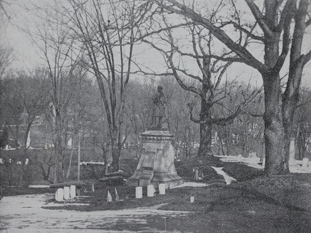
The Civil War monument at the soldiers’ plot in Springfield Cemetery, around 1892. Image from Picturesque Hampden (1892).

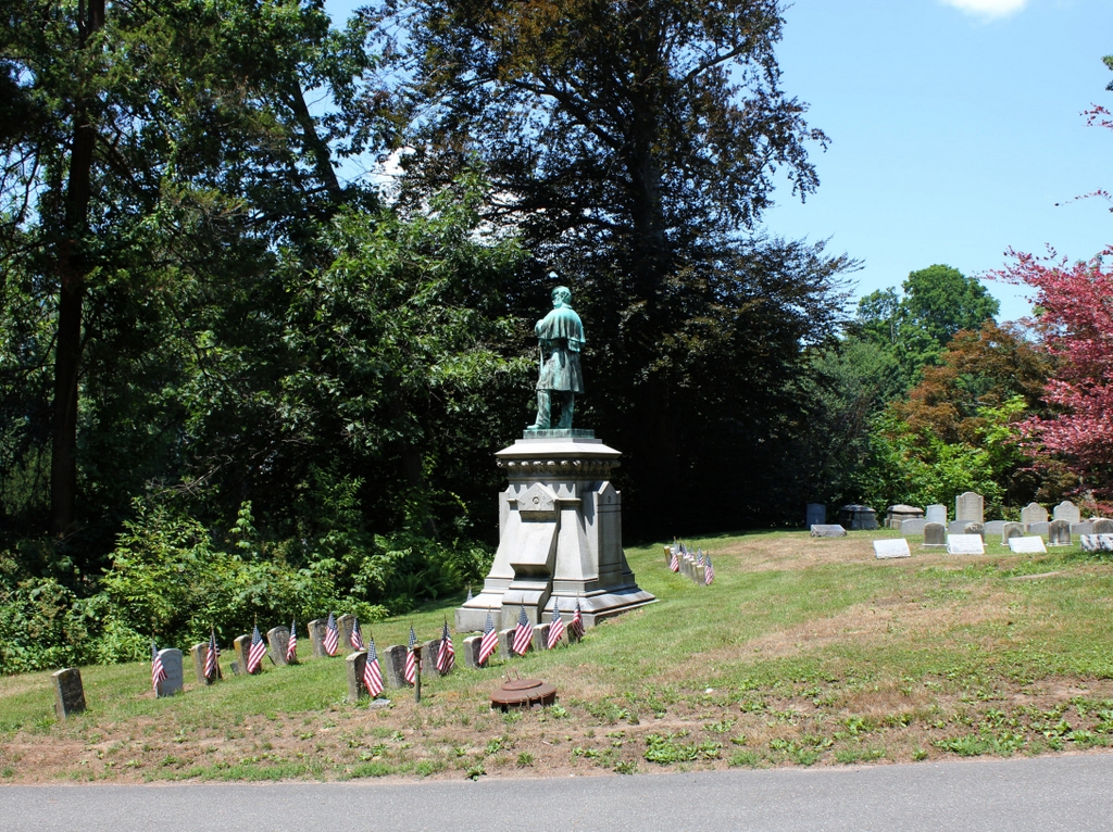
The scene in 2020:

Springfield has three major Civil War statues in honor of its veterans. Of these, the one at Court Square is by far the largest and most visible, but the city’s first monument was the one shown here in these two photos. It was dedicated in 1877, and it stands in the soldiers’ plot in Springfield Cemetery, near the main entrance. It features a granite base topped by a bronze soldier, which was designed by noted sculptor Henry J. Ellicott and cast by Maurice J. Power at the National Fine Art Foundry in New York City. The funds for the monument came from the Soldiers’ Rest Association, which had been established during the war to provide assistance to soldiers. At the end of the war, a little over $4,000 remained in this fund, and this money was used to commission this monument.

The first photo shows the monument in the early 1890s, less than 15 years after its dedication. At the time, it was joined by four bronze cannons that had been donated by the United States government, but these have since been removed. Otherwise, the only significant difference between these two photos is the number of headstones here, as there were many Civil War veterans who were still alive when the first photo was taken. There are now about 200 veterans buried here in the soldiers’ plot, with some here in the upper section next to the statue, and others in the lower section on the other side of the trees.

Florida Baptist Church, Florida, Mass

The Florida Baptist Church, seen looking north on Church Road in Florida, around 1893. Image from Picturesque Berkshire (1893).

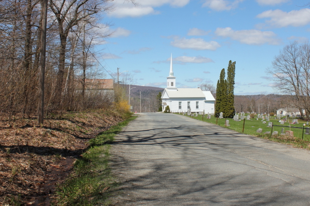
The scene in 2020:

The origins of the name of Florida, Massachusetts are murky, but there seems to have been a certain level of irony to it, since the town has little in common with its southern namesake. Located high in the Hoosac Range of the northern Berkshires, just south of the Vermont state border, Florida has cool weather and high elevations. The town center, shown here, is nearly 1,900 feet above sea level, and the town’s lowest point, located along the Deerfield River, is nearly twice the elevation of the highest point in the state of Florida. Because of this remote, mountainous location, the area was not settled until around 1783, and it was not incorporated as a town until 1805, when it acquired the name of Florida.

In the vast majority of New England towns, incorporation was soon followed by the establishment of a Congregational church. However, here in Florida, the town’s first church was a Baptist church, which was established in 1810 with about 20 members. The first church building was constructed in 1824, and it was used until 1861, when the building here in this scene was completed. The old building was then sold and converted into a house, and it still stands just a little to the north of here, at the present-day corner of Church Road and the Mohawk Trail.

Architecturally, the new building featured a Greek Revival-style exterior, similar to the other small church buildings in the hill towns of western Massachusetts during this period. Writing many decades later in 1907, the North Adams Transcript described how, in the shadow of the impending Civil War, “the whole parish made many sacrifices and literally bared their backs to the burden, considering personal labor, and economy in wearing apparel, thus erecting a new house of worship at the cost of $1,800.” At the time, the church had 51 members, and it had two different pastors who served here in 1861. Rev. J. M. Mace was the pastor for at least part of the year, but he was succeeded by Rev. John Fairman, who served from 1861 to 1865.

Throughout the first half of the 19th century, Florida’s economy was largely agricultural, although the lumber industry was also prosperous here, with at least 14 sawmills in the town by the mid-1850s. However, during the 1860s the town saw a population boom as a result of construction on the Hoosac Tunnel. This 4.75-mile railroad tunnel was built between 1851 and 1873, and most of it, including the eastern portal and the central shaft, is located within the town of Florida. The tunnel runs about a half mile to the north of the church, and about a thousand feet underground. The eastern portal is just under a mile away from here, although the actual travel distance is about 3.5 miles by way of steep, winding mountain roads.

The influx of workers in Florida led to a brief but substantial rise in population, more than doubling in residents from 645 in 1860 to 1,322 in 1870. Much of this growth appears to have been concentrated in the area around the eastern portal along the Deerfield River, so it seems unclear as to what effect this influx had on church membership. Given that many of the workers were Irish, and thus presumably Catholic, it seems unlikely that many would have been interested in making the long uphill climb to attend services at a rural Baptist church.

In any case, the tunnel workers left as quickly as they had arrived, and by the 1880 census the town was down to 459 residents. However, while the town itself experienced a net loss of more than a quarter of its residents between 1860 and 1880, the church saw a substantial increase during this time, growing to 79 members by 1885. During this time, in 1883, the building underwent renovations and repairs, including wallpaper, paint for the pews, and repairs to the chimney. The total cost for the project was about $400. Just after it was completed, the newly-repaired chimney was struck by lightning, but the damage to the building was minimal, and the repair costs were estimated at under five dollars.

The first photo was taken around a decade after these renovations occurred. It shows the view looking north, with the church in the center and a small cemetery next to it. In the foreground, the road is a muddy, heavily rutted path that is lined by a stone wall on the right side and some sort of drainage ditch on the left. Further in the distance, Spruce Mountain provides a dramatic backdrop to the scene. Its peak, on the left side of the photo, rises more than 2,700 feet above sea level, making it one of the highest mountains in the state.

The church was renovated again in 1907. This work was apparently limited to the interior, and it was done by Daniels & Canfield of North Adams. The dedication ceremony was held on September 15, 1907, and the event included guest speaker James McCullough from Savoy, whose grandfather Nathaniel McCullough had been the pastor of the Florida church in the early 1830s. Rev. Willard E. Waterbury of Springfield delivered the sermon, which was based on Isaiah 52:1—”Awake, awake; put on thy strength, O Zion; put on thy beautiful garments.”

Today, more than 125 years after the first photo was taken, parts of this scene have undergone significant changes. Perhaps the most ominous sign of the passage of time is the much-enlarged cemetery next to the church. Other changes include the old Florida Town Hall, which was built in 1923 across the street. The road itself has gone from a muddy dirt path to a paved road, but the most significant transportation change to this scene is the Mohawk Trail, which opened in the early 20th century. The Mohawk Trail made it easy for cars to pass over the Hoosac Range, and over the years it has served as a popular route for scenic road trips.

Throughout this time, the Florida Baptist Church has remained a distinctive landmark for travelers as they approach the road’s high point at Whitcomb Summit. Its exterior appearance has changed somewhat over the years, including a 1980 renovation that involved alterations to the front entryway an addition to the rear, but overall it survives as a good example of a mid-19th century rural New England church.

Benjamin Franklin Grave, Philadelphia, Pennsylvania

The grave of Benjamin Franklin in Christ Church Burial Ground, seen through the iron fence along Arch Street, around 1900. Image courtesy of the Library of Congress, Detroit Publishing Company Collection.

The scene in 2019:

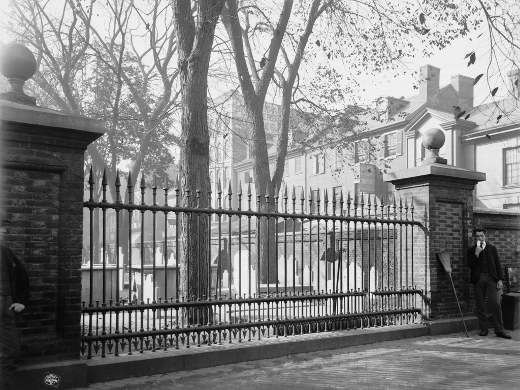
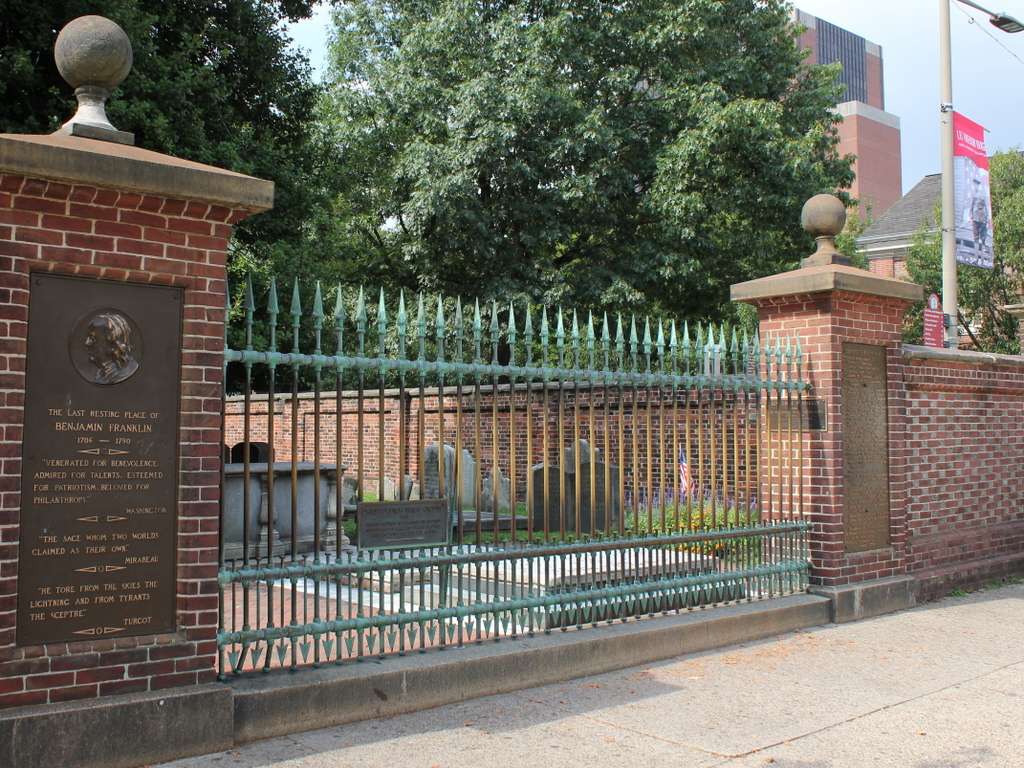
As discussed more detail in the previous post, Christ Church Burying Ground is the final resting place of Benjamin Franklin, who is interred here alongside his wife Deborah under the stone slab on the other side of the fence. Although located just a few feet from the sidewalk, his gravestone was originally hidden from the street by the brick wall that encircles the graveyard. Over time, the gravesite languished in this corner of the graveyard, and was largely forgotten. However, in an effort to boost civic pride in the city’s famous statesman, this section of the wall was replaced by an iron fence in 1858, allowing passers-by to easily view the gravesite.

By the time the first photo was taken at the turn of the 20th century, Franklin’s grave was an important tourist attraction in the city. As shown in the photo, though, the 125-year-old brick wall had fallen into disrepair. It would continue to crumble over the next few decades until it was finally rebuilt in 1927, using many of the original materials in the process. The rest of the graveyard continued to deteriorate, though, and it was closed to the public from 1977 until 2003, when it finally reopened following an extensive conservation project.

Restoration work has continued since then, including repairs to Franklin’s gravestone that were completed in 2017 and largely funded by Jon Bon Jovi. Today, the scene looks very similar to the first photo, aside from the lost buildings in the background along Fifth Street. The graveyard is open to the public for a small fee, and it features both self-guided and group tours that highlight the many famous people buried here, including Franklin and a number of other prominent 18th and early 19th century Americans.

Christ Church Burial Ground, Philadelphia, Pennsylvania

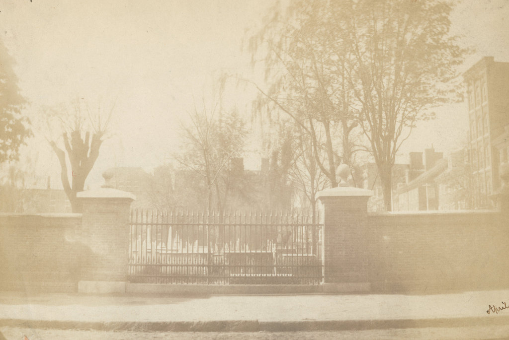
The Christ Church Burial Ground, seen looking south from Arch Street in April 1859. Image courtesy of the Library Company of Philadelphia, Frederick De Bourg Richards Photograph Collection.

The scene in 2019:

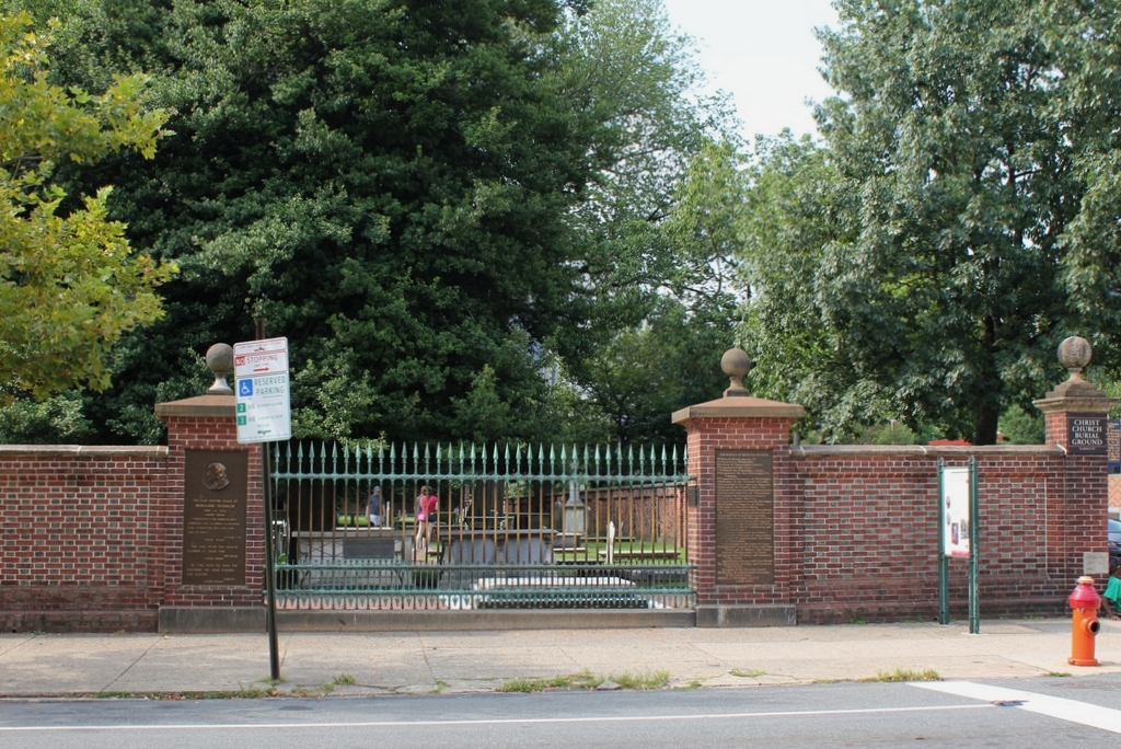
As discussed in an earlier post, Christ Church was established in 1695, and its parishioners originally worshipped in a small wooden church on Second Street, just north of Market Street. The church had a small burial ground next to it, but this soon became too small, so in 1719 the church purchased this property two blocks away at the corner of Arch and Fifth Streets. It would become the church’s primary burial ground, along with being the final resting place for many of the city’s most prominent colonial-era leaders, including five signers of the Declaration of Independence. The most famous of these is Benjamin Franklin, whose gravestone is the low slab on the other side of the iron fence.

A brick wall was constructed along the perimeter of the burial ground in 1772. When Franklin died 20 years later, he was interred here, right alongside the fence and next to his wife Deborah. His grave was only a few feet from the sidewalk, yet it eventually fell into obscurity because the fence obscured its view from the street. This became an issue in the mid-19th century, in part because of a rivalry between Philadelphia and Franklin’s birthplace of Boston. By this point Boston had honored their native son with a massive pyramidal monument above Franklin’s parents’ gravesite, and had dedicated a statue in front of City Hall. In the meantime, though, Franklin’s gravesite here in Philadelphia languished in a rarely-visited corner of the graveyard until 1858, when proponents persuaded Christ Church to allow this section of the brick wall to be replaced with an iron fence, in order to make the grave visible from the street. The first photo was taken a year later, showing the grave just beyond the lower right side of the iron fence.

Today, more than 160 years after the first photo was taken, all of the buildings in the background are long gone, but the burial ground is still here. The wall looks the same as it did in the first photo, but it was actually reconstructed in 1927, using many of the bricks from the original wall. The gap in the brick wall was retained here, and it is now flanked by plaques describing Franklin and his life. Notwithstanding the rebuilt fence, though, the graveyard fell into disrepair by the late 20th century, and it was closed for many years before finally reopening in 2003 following an extensive restoration project. It is now open to the public for a small fee, and offers both self-guided and group tours.

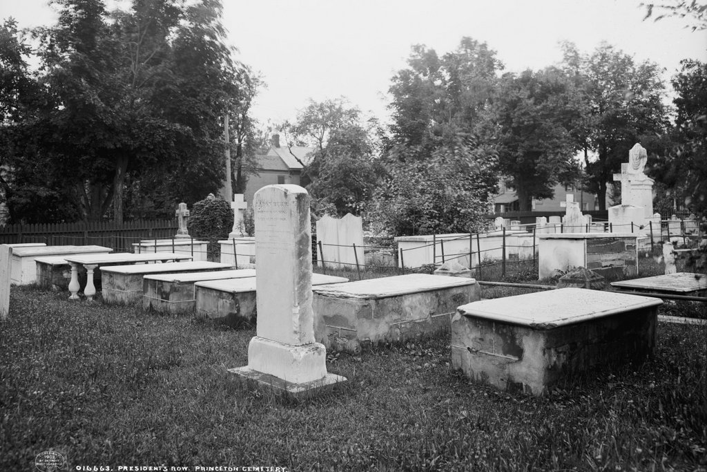
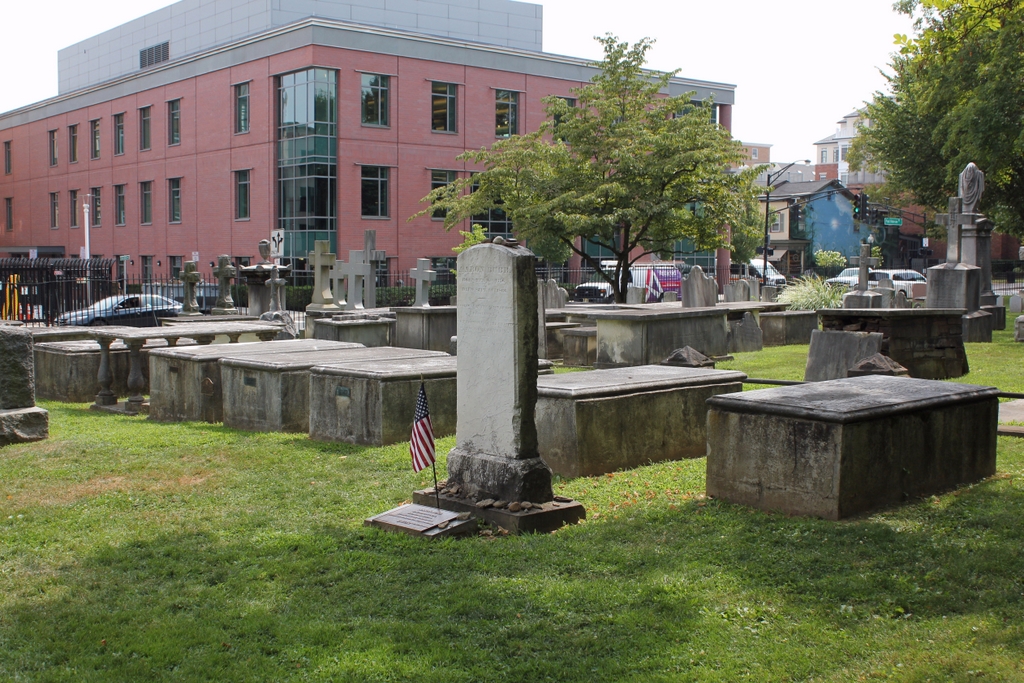
Presidents’ Row, Princeton, New Jersey

Presidents’ Row at Princeton Cemetery in Princeton, around 1903. Image courtesy of the Library of Congress, Detroit Publishing Company Collection.

The scene in 2019:

This section of Princeton Cemetery is located in the southwest corner of the cemetery, near the corner of Wiggins and Witherspoon Streets. It is sometimes referred to as Presidents’ Row, as it is the final resting place of many of Princeton’s early presidents. Among these, probably the most famous were Jonathan Edwards, the theologian and pastor who was one of the leaders of the Great Awakening, and John Witherspoon, who was the only clergyman to sign the Declaration of Independence. In addition, U. S. Vice President Aaron Burr—who was both the son and grandson of Princeton presidents—is buried here, and his headstone stands in the center of this scene.

The graves of the former Princeton presidents are arranged roughly in order of when they served, beginning on the far right with Aaron Burr Sr. He was the second president of the college, following the brief tenure of John Dickinson in 1747, and he served until his death in 1757. He was then succeeded by his father-in-law, Jonathan Edwards, who had previously served as pastor of the church in Northampton, Massachusetts and then a missionary to Native Americans in Stockbridge, Massachusetts. Edwards was also an influential author, and he was highly sought by the school’s trustees to replace Burr. Despite reservations about his abilities, Edwards accepted the position, and was installed as president on February 16, 1758.

However, Edwards’s time as president proved to be brief. He arrived in Princeton in the midst of a smallpox outbreak, and one of his first acts as president was to receive an inoculation, in order to encourage students to do the same. Ideally, the inoculation would give Edwards only a mild case of smallpox, which would then give him lifetime immunity. Instead, though, his condition only worsened, and he died on March 22, 1758, barely a month after becoming president. He was buried here in the cemetery, just to the left of Burr’s gravestone. Edwards’s daughter Esther, the widow of Aaron Burr Sr., had cared for him during his illness, and she subsequently contracted smallpox too, dying on April 7 at the age of 26. Her death left her two children orphaned, including the two-year-old future vice president. Edwards’s wife Sarah then briefly took custody of them, but she died later in 1758 from dysentery at the age of 48.

Neither of Edwards’s next two successors as president, Samuel Davies (served 1759-1761) and Samuel Finley (1761-1766), were president for a particularly long time, and both died relatively young. They are also buried here, with Davies on the left side of Edwards and Finley on the other side of Davies. It took the school several years to replace Finley, but in 1768 Scottish minister John Witherspoon accepted the position and immigrated to the American colonies. He went on to serve as pastor for more than 25 years, and during this time he was also involved in politics. He was a New Jersey delegate to the Continental Congress throughout most of the American Revolution, and in this role he signed both the Declaration of Independence and the American Revolution. Witherspoon remained president of the college until his death in 1794, and he was buried here in the cemetery on the left side of Finley; his gravestone is the fifth from the right side of the row.

The next president after Witherspoon was Samuel Stanhope Smith, who served from 1795 until his resignation in 1812. He is buried beneath the table monument with the pillars, directly to the left of Witherspoon. Beyond Smith’s gravestone is Walter Minto, a mathematics professor who died in 1796. He is one of the few non-presidents who is buried in this plot. Then, beyond Minto’s grave on the far left side of the scene is Ashbel Green, who served as president from 1812 to 1822, and died in 1848. There are several more gravestones beyond Green, including college presidents James Carnahan and John Maclean, but these are in the distance beyond the frame of these photos.

Aside from the college presidents, the other noteworthy burial here is Aaron Burr, whose tall narrow headstone is very different from the flat tables of the presidents. As his headstone indicates, he served as a colonel in the Continental Army during the American Revolution, and he was subsequently vice president from 1801 to 1805, during Thomas Jefferson’s first term. However, he is best remembered for having killed Alexander Hamilton, and his reputation was also marred by his involvement in a bizarre plot to establish an independent country in what is now the southwestern United States. He lived in poverty for much of his later life, before marrying a wealthy widow when he was 77. However, they separated for months later, and she subsequently divorced him. Appropriately enough, her lawyer in the case was Alexander Hamilton Jr. Burr died in a Staten Island boarding house in 1836 at the age of 80, and he was interred here next to his parents and grandparents.

The first photo was taken around 1903, more than a century after many of the burials in this scene. Some of the stones appear to have fared poorly over the years, particularly those of Jonathan Edwards and Aaron Burr Sr., both of which are heavily chipped. However, the gravestones appear to have been restored since then, because they are more intact in the present-day scene than they were in 1903. Overall, this section of the cemetery has seen few changes since the first photo was taken, and the only major different in the current photo is the Princeton Public Library, which now stands in the distance on the other side of Wiggins Street.