F.A. Gurney Delivery Wagon, Wilbraham Mass

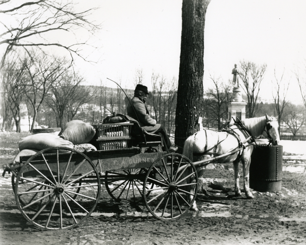
The delivery wagon for F.A. Gurney’s Store, seen on Main Street in Wilbraham around 1903. Photo courtesy of the Wilbraham Public Library.

455_1903c wpl

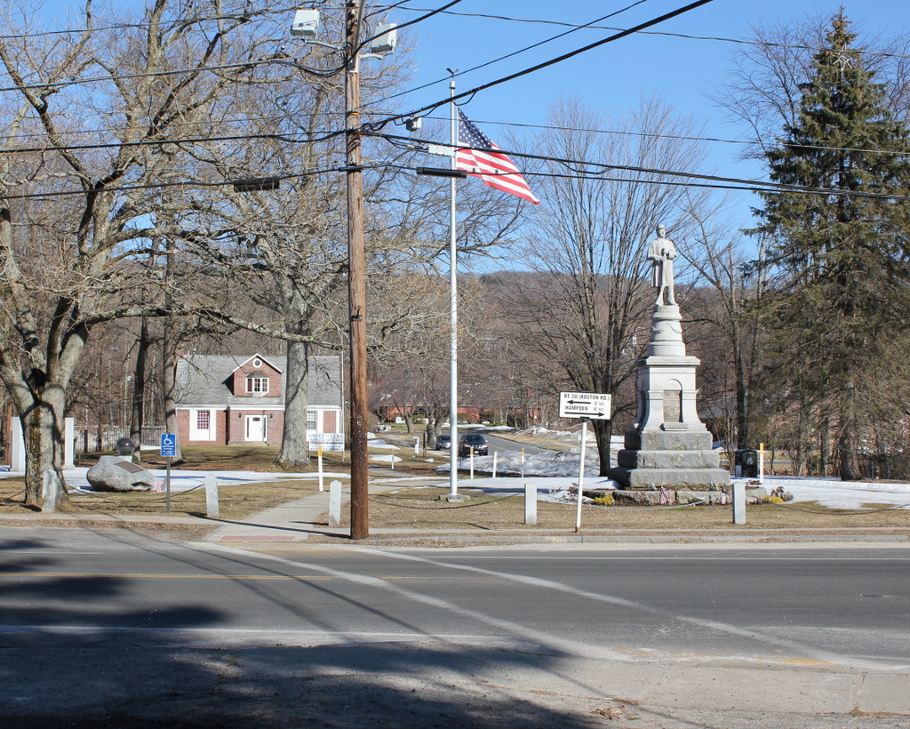
The same scene in 2015:

455_2015

The town of Wilbraham was originally part of Springfield, located on the far eastern end of Springfield’s original 1636 boundaries, where the relatively flat Connecticut River valley comes to an abrupt end at the hills seen in the distance.  When first settled in 1730, it was known as the “Outward Commons,” and even earlier a part of present-day Wilbraham was given the rather hyperbolic name of “World’s End,” which seems to give a rather dramatic idea of how remote this area was to Springfield’s Puritan settlers.

These two photos are taken in the town center, just across from Crane Park and the Soldiers’ Monument.  According to the information provided by the Wilbraham Public Library, the 1903 scene shows Frank Blodgett driving the delivery wagon for the F.A. Gurney Store, a general store that was located just behind the photographer.  The destination of his goods is Sixteen Acres, just across the city line into Springfield.  Today, Sixteen Acres is a suburban neighborhood in Springfield, but at the turn of the last century it was a rural farming community, and the photo appears to have been taken sometime in late winter as the snow was melting, so the goods on the wagon were probably headed for farmers who were preparing for the coming spring.

The only obvious landmark in both photos is the Soldiers’ Monument, which was dedicated in 1894.  One of the guests at the dedication was future Governor and Senator Winthrop M. Crane, whose grandmother Lucinda Brewer once lived in a house on this spot.  Lucinda Brewer married paper manufacturer Zenas Crane, the founder of Crane & Co. in Dalton, Massachusetts.  Winthrop himself was the company president, and in 1879 he obtained a contract to produce the paper for United States paper money.  The company has been producing paper for American currency ever since, and Wilbraham’s Crane Park is named for the family.

Mt. Washington Cog Railway

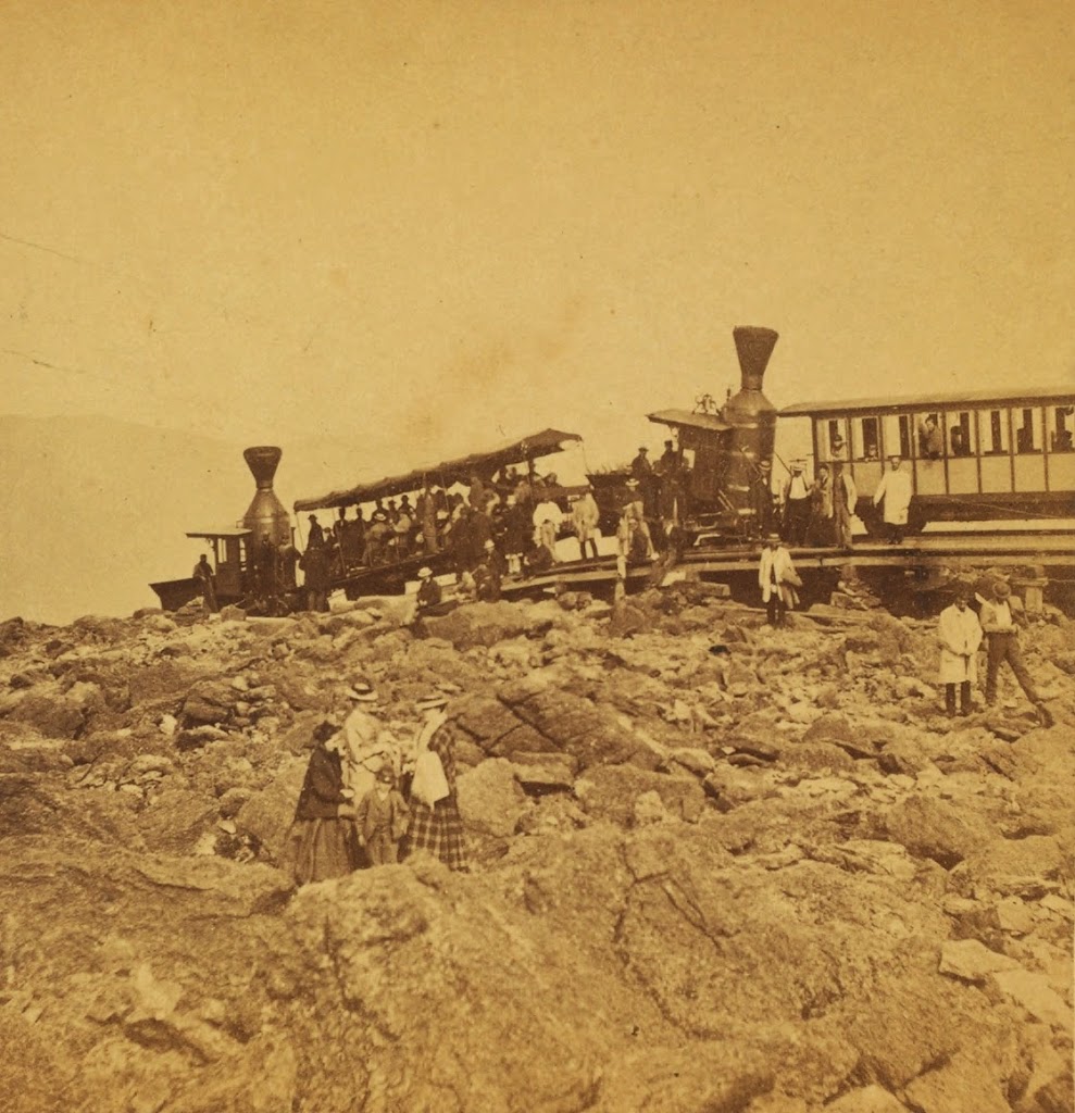
The Mt. Washington Cog Railway, near the summit, probably in the early 1870s. Photo courtesy of New York Public Library.
446_1860sc-2Bnypl

The scene in 2013:

446_2013

The first photo was probably taken within a few years of the opening of the Mt. Washington Cog Railway.  By the mid 19th century, the White Mountains had become a popular summer destination, and Mount Washington in particular became a favorite destination.  The only problem was getting to the top; this was first solved by the Mount Washington Carriage Road (today the Auto Road), but even before the road opened, another man had an even more ambitious idea – to build a railroad to the top.

Railroads were still in their infancy in America in 1852, and many major cities still did not have rail connections, but Sylvester Marsh had a plan to build a cog railway to the top, something that had never been done up the side of a mountain before.  The New Hampshire legislature gave him a charter in 1858, with one legislator reportedly remarking that they should give him a charter to make a railway to the moon, indicating how impossible it seemed to build a railroad to the top of the tallest peak in the Northeast.

The railroad was completed to the summit in July 1869, only a couple months after the completion of the Transcontinental Railroad.  It is about 3 miles long, with an average grade of about 25%, and it set the stage for future mountain-climbing railroads such as the one up Pikes Peak.  The locomotives in the first photo indicate that it is an early photo of the railroad; they appear to be the George Stephenson and the Hercules, which entered service in 1869 and were replaced in 1878 and 1874, respectively.

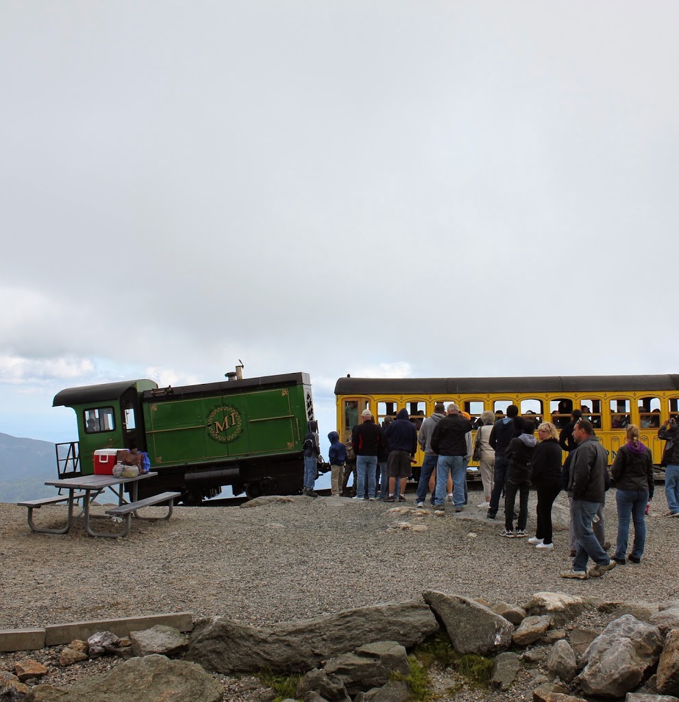
The present-day scene here is remarkably similar; the trains are still operating (most of the locomotives are modern biodiesel ones, but several date back to the 1870s), and there seems to be as many people riding in the 2013 photo as there were nearly 150 years earlier, although clothing styles have changed a bit.  It’s not visible from here, but the road to the top is also still there, although it is no longer the Carriage Road but the Auto Road.  There are a lot more buildings at the top than there were in the 1870s, although the Tip Top House is still there; it is older than either the Auto Road or the railroad.

Springfield Municipal Group, Springfield, Mass

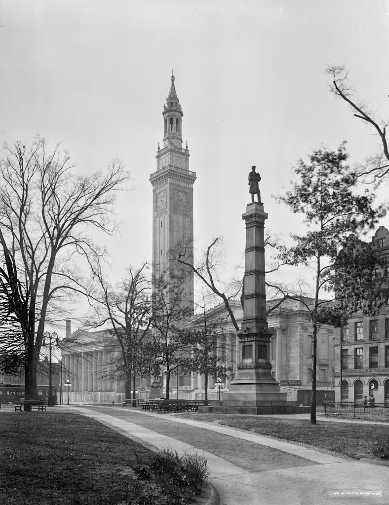
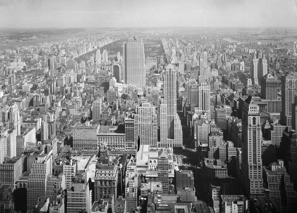
The Springfield Municipal Group from across Court Square, probably around 1913.  Image courtesy of the Library of Congress, Detroit Publishing Company Collection.

443_1910-1920-2Bloc.tif

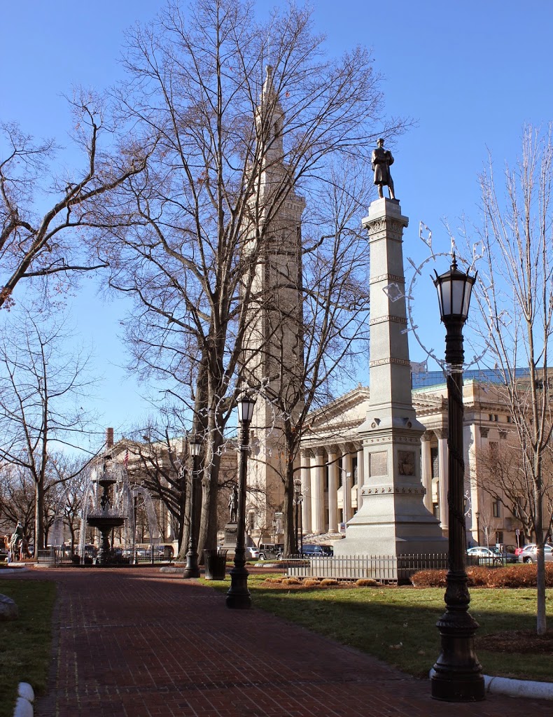
The Municipal Group in 2014:

443_2014

The first photo was taken shortly before the Springfield Municipal Group was completed, perhaps even on the same day as the first photo in this post.  In this photo, the buildings are still surrounded by a fence, and a sign for A.E. Stephens Co, the contractors, can be seen on a temporary shed on the right-hand side of the photo. In the ensuing 100 or so years in between the two photos, not much has changed in this scene.  City Hall, Symphony Hall, and Campanile tower are all still there, as is the Civil War monument and the Miles Morgan statue, which is barely visible in the distance in front of the bell tower.  One thing that has changed, though, is the way people get to City Hall.  In the first photo, a trolley can be seen on the far left, and no automobiles are visible anywhere in the scene.  Today, there are no trolleys to be found in Springfield, and instead Court Square is surrounded by cars, as seen in the 2014 photo.

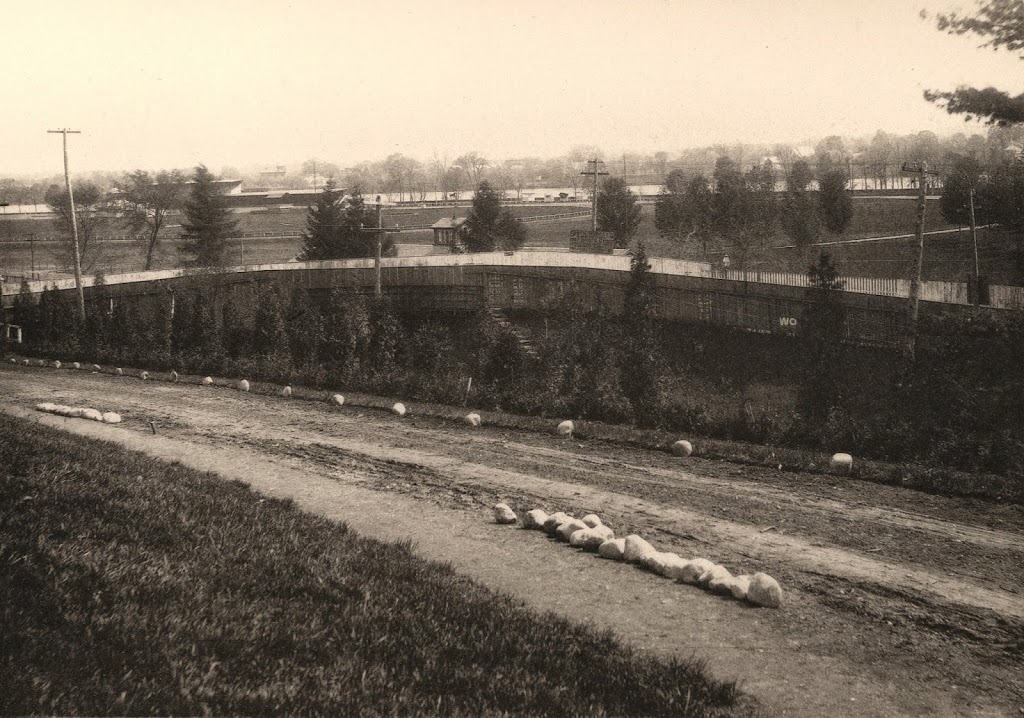
Hampden Park from Round Hill, Springfield, Mass

The view of Hampden Park from the North End of Springfield, around 1882. Photo from Springfield Illustrated (1882).

440_1882c-2Bspringfieldillustrated

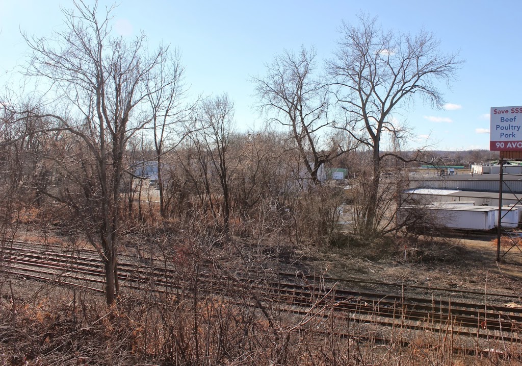
The view in 2014:

440_2014

The location of the second photo isn’t exact – the actual location would be somewhere in the southbound lane of Interstate 91, so I did the next best thing; I took the 2014 photo from a bridge over the highway.  Either way, not much remains the same today.  The railroad tracks are still there, as is the Connecticut River, but otherwise it’s a completely different scene.  Hampden Park is visible in the distance; this was home to bicycle races, minor league baseball games, and even the occasional college football game.  A more in-depth history of the park is explained in this post.

In later years, the part of Hampden Park closest to the North End Bridge became Pynchon Park, and was the home of several different minor league teams until the 1960s.  Today, the former site of Hampden Park is now primarily industrial, with warehouses and other facilities on the spot where Harvard and Yale used to play early college football games.  Pynchon Park is now a Pride station, and can barely be seen through the trees just to the left of the billboard on the right-hand side of the photo.

Springfield Cemetery, Springfield, Mass

A scene in Springfield Cemetery, around 1900-1906. Image courtesy of the Library of Congress, Detroit Publishing Company Collection.

376_1900-1906-2Bloc

The same scene in 2015:

376_2015

As mentioned in previous posts here and here, Springfield Cemetery was designed as a peaceful, beautifully-landscaped scene in the middle of the city along the same lines as Mount Auburn Cemetery in Cambridge.  Today, the scene is more grown-in, and obviously there are more gravestones in the scene, but otherwise the landscaping remains very much the same as it was over 100 years ago.

Many of Springfield’s notable residents of the past are buried here, from Congressmen like Chester Chapin, William Calhoun, and Samuel Knox, to businessmen, including Milton Bradley and Horace Smith (of Smith and Wesson), and even one of the victims of the Titanic sinking, Milton Long.  The headstone of another notable burial can be seen in the first photo – the large stone at the top of the hill above the footbridge is that of Chester Harding, a portrait painter from the first half of the 19th century.  Some of his portraits included presidents James Madison, James Monroe, and John Quincy Adams, Chief Justice John Marshall, Declaration of Independence signer Charles Carroll, and senators Henry Clay and John Calhoun.  His grave is still there, although today it isn’t visible from this angle because of the tree growth.  It was thanks to his headstone, though, that I was able to confirm the location of the photo, since there aren’t any other clear landmarks visible in both photos.

Soldiers’ Plot, Springfield, Mass

The Soldiers’ Plot in Springfield Cemetery, around 1900-1910. Image courtesy of the Library of Congress, Detroit Publishing Company Collection.

375_1900-1910-2Bloc

The scene in 2015:

375_2015

Springfield Cemetery was established in the 1840s as a beautifully-landscaped city cemetery in the middle of the city.  Within a few decades, it would become the final resting place for a number of men from Springfield who were killed in the Civil War.  A total of 167 were killed or missing in the war, with more lost to disease than to combat deaths.  Many of those men are buried here in the Soldiers’ Plot, not far from the entrance to the cemetery.  The plot includes the headstones at the bottom and top of the slope, with a statue at the top.  The statue was dedicated in 1877 using funds from the Soldier’s Rest Association.  The organization had been established during the war to care for returning veterans, and they used leftover funds to commission the statue.

Today, the headstones and statue are still there, although they are no longer decorated with flags and wreaths, and the landscaping isn’t as perfectly manicured as it was a century ago – the headstones on the lower section seem to almost blend in with the slope.  Of course, in the first photo the Civil War was still in the memory of many people, with many still alive who had either served in or lost loved ones in the war, so it is understandable that the plot would have been better cared for back then.