Henry Wadsworth Longfellow Gravesite, Watertown, Mass

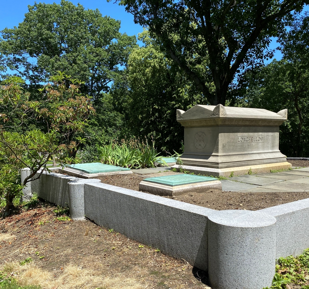
The gravesite of Henry Wadsworth Longfellow in Mount Auburn Cemetery, around 1900-1910. Image courtesy of the Boston Public Library.

The scene in 2021:

These two photos show the final resting place of prominent 19th century poet Henry Wadsworth Longfellow and his family. Born in Portland in 1807, he later attended Bowdoin College, became a professor there, traveled abroad in Europe, and then eventually ended up in Cambridge as a Harvard professor in 1836. In the meantime, he had married his first wife, Mary, in 1831, but she died in Europe in 1835 as a result of complications from a miscarriage, and her body was returned here for burial in the newly-established Mount Auburn Cemetery.

When he moved to Cambridge after her death, he rented a room in a mansion that, more than 60 years earlier, had been George Washington’s headquarters during the Siege of Boston. He eventually purchased this house, and he lived there for the rest of his life. He remarried in 1843, to Frances Appleton, and they had six children together, one of whom died in infancy and was buried here. Unfortunately, Frances also died under tragic circumstances, when her dress caught fire while she was trying to melt wax to seal envelopes. Longfellow himself was also badly burned while trying to put out the flames, which led him to grow his beard to hide the scars.

Throughout his time in Cambridge, Longfellow was the most celebrated poet in America. Some of his most popular works included long epic poems such as Evangeline and The Song of Hiawatha, along with shorter poems, such as “The Courtship of Miles Standish,” “Paul Revere’s Ride,” and “The Village Blacksmith.” His poems often told highly romanticized versions of historical events, in many cases focusing on the colonial or Revolutionary eras.

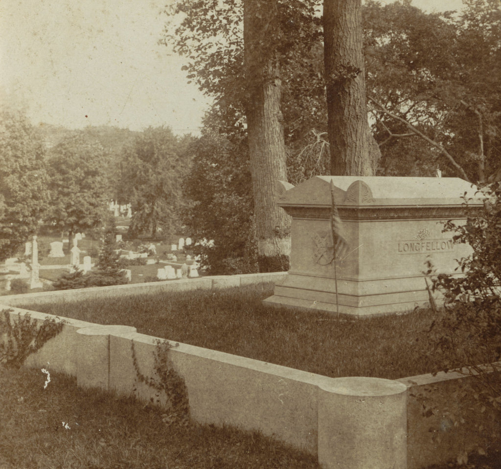
Longfellow died in 1882 at the age of 75, and he was buried here in the family plot in Mount Auburn Cemetery, alongside his two wives and infant daughter. The first photo was taken a couple decades later, showing the family monument. It was carved out of Indiana limestone by Longfellow’s nephew, William Pitt Preble Longfellow, and on the side it features a symbol in the form of a circle with an X over it. The X is inscribed with “Dux,” “Lex,” “Lux,” and “Rex,” and the words are arranged so that they all share a small X in the center of the larger X. This Latin inscription translates to “Leader,” “Law,” “Light,” and “King.”

By the time the first photo was taken, Longfellow’s oldest child, Charles, had also been buried here. His other four children were still living at the time, but his son Ernest died in 1921, and his daughter Alice in 1928, and both were subsequently buried in the family plot. Aside from these additional interments, the only changes here have been the landscaping. The family plot is no longer covered in grass, and the trees in the distance on the hillside have grown in, but otherwise this scene is still easily recognizable more than a century after the first photo was taken.

Auburn Lake, Watertown, Mass

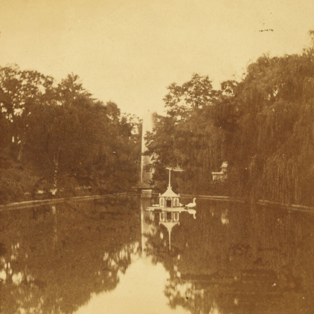
Auburn Lake in Mount Auburn Cemetery, around the 1870s or 1880s. Image courtesy of the New York Public Library.

The scene in 2021:

As discussed in the previous post, Mount Auburn Cemetery was established in 1831 as the first rural cemetery in the United States. Up until this point, Boston-area graveyards typically occupied small plots of land near town centers. They were a practical necessity as a place to bury the dead, with little emphasis on landscaping. Even the gravestones themselves, while often elaborately carved, served a purpose by reminding people of death and mortality.

However, by the early 19th century many of these graveyards were becoming overcrowded, especially in fast-growing places like Boston. Motivated by concerns about public health, along with shifting societal attitudes regarding death, proponents such as Dr. Jacob Bigelow advocated for a new, expansive   cemetery on the outskirts of Boston. The result was Mount Auburn Cemetery, which was laid out on the north side of the Charles River, on the border of Cambridge and Watertown,

Unlike the purely functional colonial-era graveyards, Mount Auburn was designed to be both a quiet resting place for the dead, and also a peaceful place for the living to visit in the days before public parks were common. It was carefully landscaped, with burial plots situated along winding paths, and  grounds that were interspersed with trees, hills, and ponds. Overall, the effect was a park-like setting that, to many, may have helped to soften the harsh realities of death.

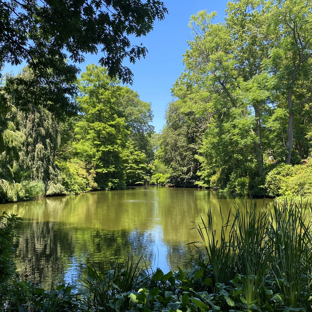
These two photos show Auburn Lake, one of the three ponds in the cemetery. It was once known as Meadow Pond, but in the late 1850s it was renamed Auburn Lake. This appears to have occurred around the same time that the ponder underwent improvements, including lining the banks with stone. By the time the first photo was taken around the 1870s, Auburn Lake featured a bridge, which crossed the narrow portion between the northern and southern halves of the pond, and it also had a swan house in the center, with at least one swan visible in the photo.

Today, about 150 years after the first photo was taken, not much has changed in this scene. The swan house is long gone, but otherwise Auburn Lake looks much the same as it did in the first photo. This is due, in part, to an extensive restoration project that occurred in 1998, involving draining and dredging it, and then replanting the areas along the banks. Overall, as is the case with Auburn Lake, the cemetery still has the same park-like environment that its founders had envisioned, and it remains a quiet place in the midst of the busy inner suburbs of Boston.

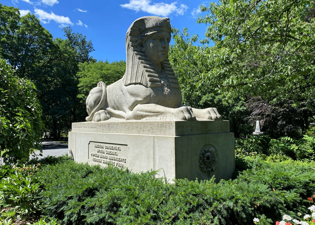
Mount Auburn Sphinx, Watertown, Mass

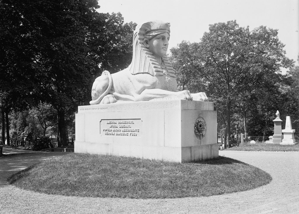
The Sphinx at Mount Auburn Cemetery in Watertown, around 1900-1906. Image courtesy of the Library of Congress, Detroit Publishing Company Collection.

The scene in 2021:

Civil War monuments are a ubiquitous feature in towns throughout New England. Most of these were dedicated in the late 19th century, and their designs typically consist of a soldier in uniform, standing atop a pedestal that is inscribed with names of battles, patriotic sentiments, or similar statements. However, perhaps the most unusual Civil War monument in the region is the Sphinx, located here in Mount Auburn Cemetery. It was commissioned by Dr. Jacob Bigelow and designed by prominent sculptor Martin Milmore, and it was installed in 1872, on a site directly across from the cemetery chapel.

Jacob Bigelow was a prominent Boston physician who, in the early 19th century, proposed the idea of a rural, park-like cemetery on the outskirts of Boston. The result was Mount Auburn Cemetery in Watertown and Cambridge, which opened in 1831. This carefully-landscaped cemetery was a sharp contrast to the grim, overcrowded colonial-era graveyards in downtown Boston, and it served as a model for many similar cemeteries that would subsequently be opened across the region during the mid-19th century.

In the aftermath of the Civil War, Bigelow wanted to create a monument in the cemetery that would celebrate the two main accomplishments of the war: the preservation of the union, and the end of slavery. However, rather than a standard soldier-with-gun-atop-pedestal design, Bigelow envisioned a sphinx, which represented the combination of intellect and strength. He also saw this ancient symbol as being a representation of the nation’s future potential, as he explained in his remarks to the cemetery’s trustees in 1871:

It essays to express the present attitude and character of a nation perhaps as far remote in time from the building of the pyramids as was that event from the earliest constructions attempted by man. The same ideal from which, as it were, on the dividing ridge of time, has looked backward on unmeasured antiquity, now looks forward to illimitable progress. It stands as a landmark of a state of things which the world has not before seen—a great, warlike and successful nation, in the plentitude and full consciousness of its power, suddenly reversing its energies, and calling back its military veterans from bloodshed and victory to resume the still familiar acts of peace and good will to man. What symbol can better express the attributes of a just, calm and dignified self-reliance than one which combines power with attractiveness, the strength of a lion with the beauty and benignity of woman?

The resulting statue was carved of Hallowell granite, and it sits atop a base with an American water lily on the front, and an Egyptian lotus on the back. On either side is an inscription, which is written in Latin on the left side and in English on the right side. The English translation reads:

American Union preserved
African slavery destroyed
By the uprising of a great people
By the blood of fallen heroes

Despite—or perhaps because of—its unconventional design, the Sphinx appears to have been well-received by contemporary observers. Writing shortly after it was installed here, the Boston Daily Evening Transcript remarked:

The Mount Auburn Sphinx has solved her own riddle, and stands upon her everlasting base at last. She is intended to commemorate the war and the heroes it cost us, and if the peril of art in such commemoration has been the falling into a monotonous sameness and peopling New England with statues of the “private soldier at rest,” that peril has in this case been notably avoided. It is certainly unique, and certainly not grotesque. Egyptian art has long been laid under contribution for expressions of reverence for the memory of the dead.

The first photo was taken about 40 years later, showing the Sphinx at the turn of the 20th century. Since then, very little has changed here aside from the landscaping around the base of the pedestal. Mount Auburn Cemetery still has the same park-like appearance that Bigelow had worked to create, and his Sphinx remains one of its most distinctive features, along with being a remarkably innovative way of memorializing the Union soldiers of the Civil War.

Mount Toby from South Sugarloaf Mountain, Deerfield, Mass

A panoramic view looking east from South Sugarloaf Mountain in Deerfield, toward Mount Toby in Sunderland, around 1891. Image from Picturesque Franklin (1891).

The scene in 2021:

These two photos were not taken from the exact same spot, as shown by the different angles of the bridges in the lower right, but they show the same general view of the Connecticut River, the town of Sunderland, and Mount Toby in the distance. Both were taken from near the summit of South Sugarloaf Mountain, a relatively small hill that forms the southern end of the Pocumtuck Range, which is part of the larger Metacomet Ridge. Sugarloaf is best known for its dramatic views of the valley to the south, but this eastern view is also offers impressive scenery.

South Sugarloaf is often referred to simply as Sugarloaf Mountain, although it is the smaller of the two summits that comprise the mountain. However, the northern peak, while nearly 200 feet higher in elevation, has only limited views from the summit, and is rarely visited. By contrast, the southern peak has long been a popular tourist destination. Rising to an elevation of 610 feet, it is about 500 feet higher than the Connecticut River, which passes just a third of a mile from the summit.

The first photo was likely taken from the Summit House, which was built here in 1864. These types of mountaintop hotels were popular in the northeast during the second half of the 19th century, and several others were located on nearby summits on the Metacomet Ridge, including the Prospect House on Mount Holyoke and the Eyrie House on Mount Nonotuck. Even Mount Toby briefly had a tower and hotel at the summit, but the buildings burned in 1882. This was a common fate for summit houses, given their isolated locations far above water sources, and the summit house on Sugarloaf Mountain would eventually be destroyed by a fire in 1966.

Mount Toby, which towers in the distance beyond the town of Sunderland, is geologically related to Sugarloaf Mountain. It is the highest peak on the Metacomet Ridge, and at 1,269 feet it is more than twice the height of South Sugarloaf. However, as the photos show, the mountain is not a single peak. Its rugged landscape has many different summits, the highest of which is on the northern side, on the far left side of both photos.

The mountain is said to be named for Elnathan Toby, supposedly the first white settler to climb it. In the 19th century, though, the prominent geologist Edward Hitchcock criticized this rather bland name. Hitchcock, who would later serve as president of Amherst College, published a report on the state’s geology in 1841. In it, he included Mount Toby, along with Sugarloaf and a number of other peaks, as part of a list of “uncouth and vulgar names” for Massachusetts mountains. Hitchcock tended to prefer Native American names, and he succeeded in renaming several peaks, including Hilliard’s Knob, which was renamed Mount Norwottuck in a large mountaintop ceremony in 1846. He made a similar attempt on Mount Toby three years later, naming it Mettawompe in honor of the Native American chief who had sold the surrounding land to white settlers. However, unlike Norwottuck, this name didn’t stick, apparently because of local opposition among Sunderland residents, and the mountain has continued to be known as Mount Toby.

Aside from the ill-fated attempts to operate a summit house on Mount Toby during the 19th century, the mountain has remained largely undeveloped, and today it looks essentially the same as it did when the first photo was taken around 1891. The town of Sunderland has also retained much of its rural appearance, and many of the houses along Main Street are still standing, as is the 1836 First Congregational Church, which is visible on the right side of both photos. Another town landmark in this scene is the Buttonball Tree. Although not identifiable from this distance, it stands near the center of the scene in both photos, about a quarter mile north of the church. With a girth of over 25 feet, this sycamore tree is one of the widest trees in the region, and it is estimated to be over 350 years old. Overall, probably the only easily-noticeable difference in these photos is the bridge over the Connecticut River. The one in the first photo was built in 1877, and it spanned the river until 1936, when a bridge further upstream was washed away in a flood and crashed into this bridge.

In the meantime, here on South Sugarloaf, the mountain continues to offer some of the finest mountaintop views in the state. It is now part of the Mount Sugarloaf State Reservation, and there is an auto road to the summit, along with several short hiking trails. In place of the 19th century summit house, the mountain is now topped by an observation tower with several different levels of platforms.

Deerfield River Valley, Charlemont, Mass

The view looking east along the Deerfield River in the western part of Charlemont, around 1891. Image from Picturesque Franklin (1891).
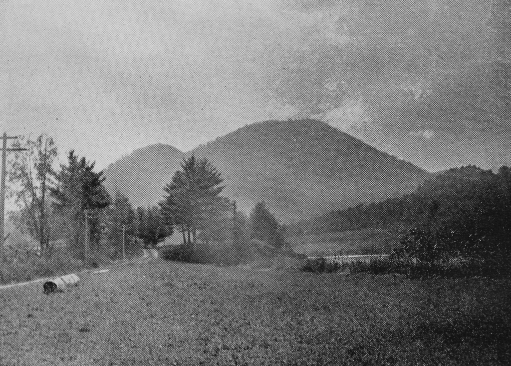
The scene in 2021:
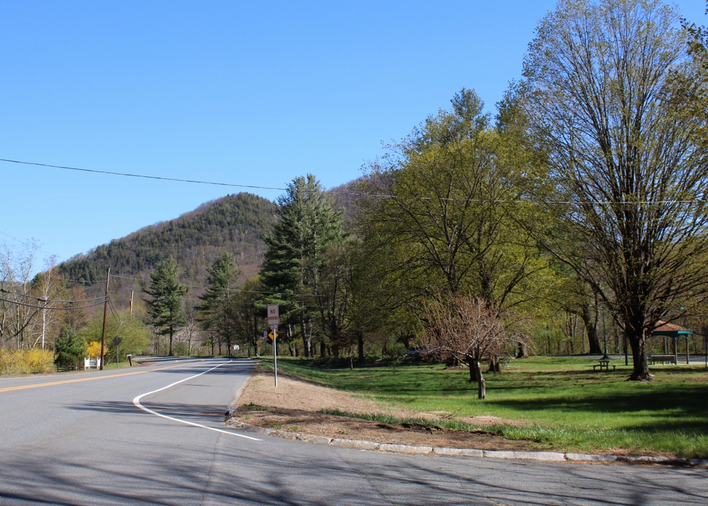
These two photos show the road heading toward the center of Charlemont, with the Deerfield River on the right and the distinctive summits of Mount Peak in the distance. Today, the road is known as the Mohawk Trail, and its route through the Berkshires offers some of the finest scenery in the state. However, the current road is largely an early 20th century creation, and its route over the mountains bears little resemblance to its predecessors.

The northern Berkshires have long been a major obstacle to east-west travel through the area. Unlike further south, there are no low-elevation mountain passes here. For a westbound traveler, heading in the opposite direction of where these photos are facing, the Deerfield River valley provides an easy route deep into the mountains. However, a few miles to the west of here, the narrow valley turns abruptly to the north at the base of the Hoosac Mountains. These mountains form a continual ridgeline for miles in either direction, with elevations exceeding two thousand feet.

In the pre-colonial period, Native Americans crossed the mountains by way of a footpath, but not until the 1750s did European settlers build a road across the mountain. This road was later improved and partially rerouted in the 1760s, and it appears to have followed the Deerfield River before ascending along the northern slope of Clark Mountain.  Then, in 1797, the Second Massachusetts Turnpike was incorporated to construct a toll road across the mountains. Rather than beginning the ascent at Clark Mountain, this road followed the river along present-day Zoar Road and River Road almost as far as the current site of the Hoosac Tunnel, before climbing up the mountain by way of Whitcomb Hill Road. However, many travelers chose to continue taking the older road in order to avoid paying tolls on the new turnpike, so the older road came to be known as a “shunpike.”

This information is relevant to this particular site here in Charlemont, because the rest area on the right side of the present-day photo is known as the Shunpike Rest Area. It features a historical marker, installed by the Mohawk and Taconic Trail Association in 1957, that reads:

To the Thrifty Travelers of the Mohawk Trail who in 1797 here forded the Deerfield River rather than pay toll at the Turnpike Bridge and who in 1810 won the battle for free travel on all Massachusetts Roads.

However, despite the claims of this sign, there seems to be little historical evidence to suggest that this spot in Charlemont was where shunpike travelers would ford the river. The turnpike bridge over the Deerfield River was some 3.5 miles further upstream from here, at the border of Charlemont and Florida. That bridge was also the eastern end of the turnpike; the company’s original charter allowed it to construct a turnpike over the mountain “from the west line of Charlemont.” In addition, that bridge was the point where the turnpike and the older road diverged, so it seems more likely that these “shunpikers” would have crossed the river somewhere near that bridge, rather than several miles downstream at this spot.

In any case, the first photo was taken sometime around the early 1890s, only a few decades before the road through the mountains was substantially upgraded with the construction of the Mohawk Trail. Heading west through Charlemont, it follows existing roads as far as this spot here, but just to the west of here, in the opposite direction of these photos, the Mohawk Trail crosses to south side of the Deerfield River. It then follows the steep, narrow gorge of the Cold River, a smaller tributary of the Deerfield, before making its final ascent to the plateau at the top of the ridgeline.

With its current route, the Mohawk Trail completely bypasses the earlier roads up the eastern side of the mountain, including both the turnpike and the earlier shunpike. It also does not go anywhere near the part of the Deerfield River where turn-of-the-19th-century shunpikers would have most likely forded the river. If that is the case, it raises the question of why this historically-dubious marker would have been placed here at this rest area.

The answer might have something to do with the date that this historical marker was installed here. The modern-day Massachusetts Turnpike, which bears no relationship to similarly-named roads of the 19th century, opened in 1957, the same year that this marker was installed. According to newspaper articles from the period, local residents along the Mohawk Trail were concerned that the new highway would hurt business here in the northern part of the state. So, the Mohawk and Taconic Trail Association created the slogan “Go turnpike—return shunpike” in the hopes of encouraging motorists to make a grand tour of western Massachusetts, rather than taking the turnpike in both directions.

Probably not coincidentally, this was the same association that, around the same time, dedicated this historical marker “To the Thrifty Travelers.” It would not have been possible to place such a marker on the Mohawk Trail at the seemingly more plausible site of the shunpike ford, since the road does not go there. Instead, the road’s promoters seem to have played fast and loose with the history in order to appeal to nostalgia and Yankee frugality, in order to boost tourism through here.

Regardless of the accuracy of the historical marker, though, this particular section of the Mohawk Trail has been part of the east-west route through the northern Berkshires since at least the 18th century, with maps as early as the 1790s showing it taking this same course eastward toward Charlemont. The road is very different from its appearance in the first photo, and the rest area now takes the place of the meadow next to the river, but the road is still in the same spot, and this scene is still easily recognizable from the first photo because of Mount Peak in the distance.

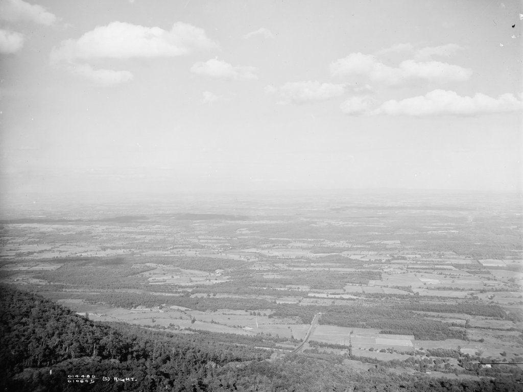
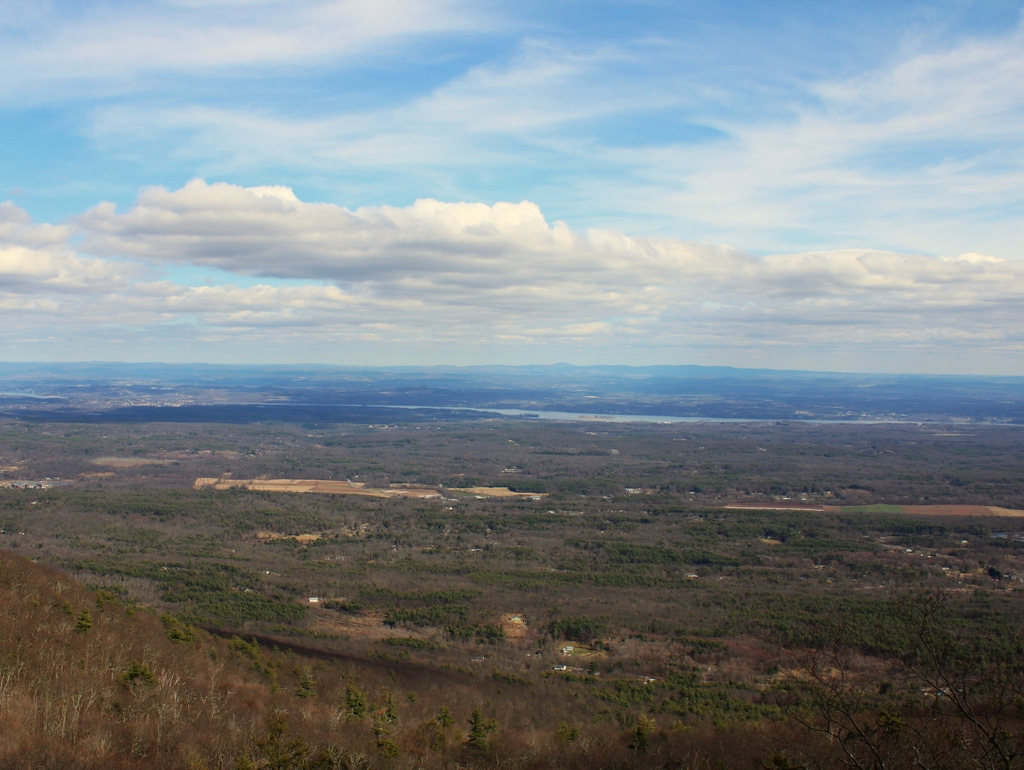
Eastern View From Catskill Mountain House, Catskill, New York

The view looking east from the Catskill Mountain House, around 1902. Image courtesy of the Library of Congress, Detroit Publishing Company Collection.

The scene in 2021:

These photos were taken from the same spot as the ones in the previous post, but these are facing more to the east, directly across the Hudson River Valley. When the first photo was taken, this was the site of the Catskill Mountain House, a hotel that had been constructed here in 1824. Because of its dramatic views and easy accessibility from New York and other large cities, the hotel soon became one of the country’s most popular resort destinations. These views also helped to inspire a number of prominent artists, including Thomas Cole, the founder of the art movement that would come to be known as the Hudson River School.

Originally, most guests would have reached the Mountain House by taking a Hudson River steamboat to the village of Catskill, which is located in the distance on the far left side of these photos. From there, it was a 12-mile stagecoach ride to the Mountain House, which took about three or four hours. However, by the time the first photo was taken at the turn of the 20th century, railroads had shortened this travel time to just 40 to 50 minutes. The narrow gauge Catskill Mountain Railroad took guests to the base of the escarpment, and then the remaining portion of the journey was by way of the Otis Elevating Railway, a 1.3-mile-long funicular railroad that rose more than 1,600 feet in elevation from the valley to the Mountain House. A portion of this railroad, including the large trestle near the base of the incline, is visible in the lower center of the first photo.

For guests at the Mountain House, one of the highlights of their stay was to watch the sunrise from this vantage point. Early in the summer season, the sun rises on the extreme left side of these two photos, but as the summer progresses the sunrise location migrates steadily to the west. By mid-October the sun rises directly above Mount Everett in the center of this scene, and by the winter solstice the sunrise is on the far right side, although few 19th century visitors would have seen it, since the hotel was only open during the warmer months.

Among those inspired by the sunrise here was artist Frederic Edwin Church, a student of Thomas Cole. One of his earliest paintings, Morning, Looking East over the Hudson Valley from Catskill Mountains (1848), shows the sunrise here, with an emphasis on sunlight and clouds that would become a major characteristic of his later works. Church would subsequently travel the world for subject matter for his landscape paintings, but in the early 1870s he returned to the Catskills and built his one, Olana, on the east side of the Hudson River, opposite the village of Catskill. This house still stands as a museum, and it is barely visible in the distance of the second photo.

Today, some 120 years after the first photo was taken, the Catskill Mountain House is long gone, having been deliberately burned in 1963 after sitting vacant for more than 20 years. However, the view from here is as impressive as ever, and from this distance there are not too many major changes to the landscape. Perhaps the most significant difference is the number of trees in this scene. When the first photo was taken, there were many open fields here in the valley. However, with the decreased importance of agriculture in this region, many of these fields have now been reclaimed by trees, resulting in a landscape that is far more forested than what the 19th century guests of the Mountain House would have seen.