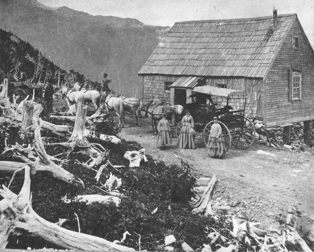
Halfway House, Mt. Washington, NH

The Halfway House on the Mount Washington Carriage Road in New Hampshire, around the 1870s. Image courtesy of the Mount Washington Auto Road.

971_1870sc mwar

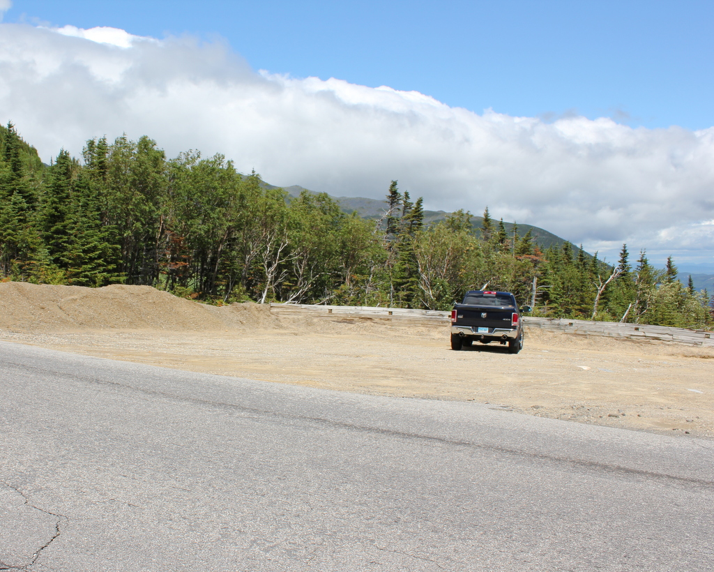
The scene in 2016:

971_2016
Mount Washington is the tallest peak in the northeastern United States, and it has been a popular tourist destination since the mid-19th century. By the end of the 1860s, the mountain had a hotel at the summit, along with both a cog railway and a carriage road to bring visitors to the top. The nearly eight-mile long carriage road opened in 1861, and this small building along the side of the road served an important purpose for early travelers. Known as the Halfway House, it was located about four miles up the road, hence the name, and it was used as a toll house. It was also a good resting place during the four-hour carriage ride up the mountain, and when necessary its location just below the treeline made it a refuge from the unpredictable and often dangerous weather in the alpine zone.

The building in the first photo was later replaced with a more substantial two-story structure. This one served the same purpose as the original, but over time it suffered from vandalism because of its isolated location, and it was finally destroyed by a fire in 1984. Today, the carriage road is now the Mount Washington Auto Road, and aside from cars replacing horses, not much has changed about the road, which still follows the same route that was laid out in the 1850s. The drive to the summit now takes about 30 minutes, and while the Halfway House no longer stands here, the site is still used as a stopping place. It is no longer necessary to rest horses here, but the climb is still taxing for cars, so the site here is used by drivers heading up the mountain to cool their radiators, and by those heading down to cool their brakes.

Mt. Washington Cog Railway

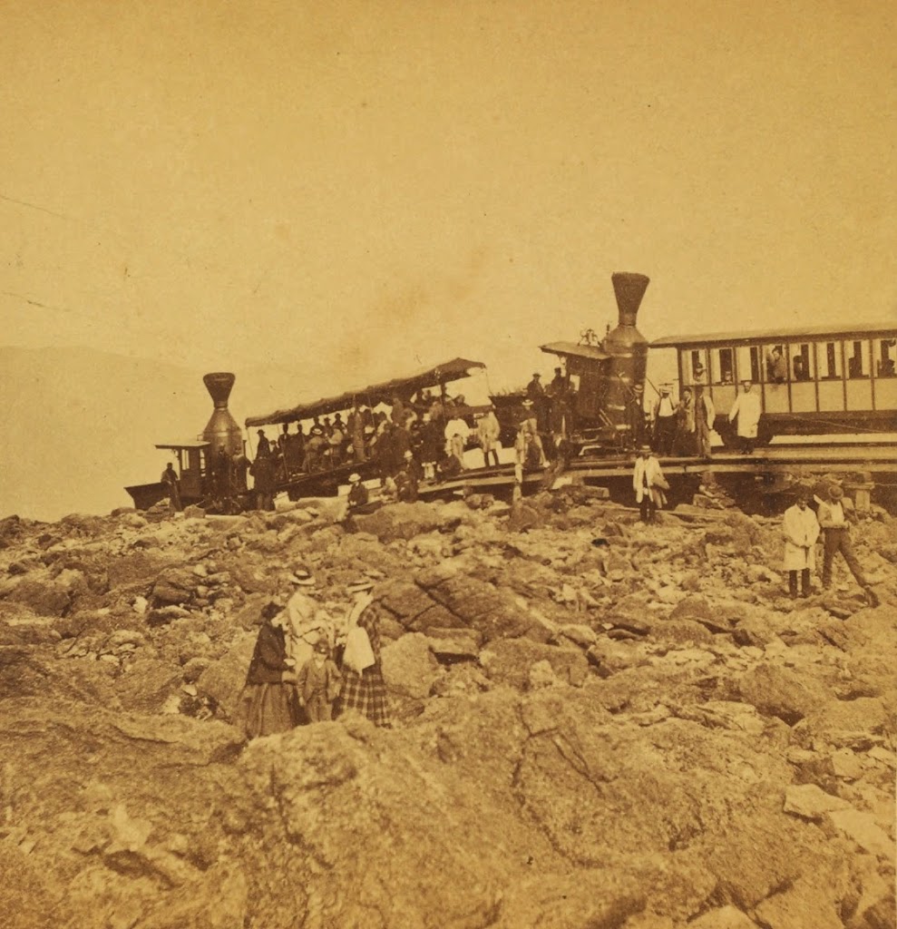
The Mt. Washington Cog Railway, near the summit, probably in the early 1870s. Photo courtesy of New York Public Library.

446_1860sc-2Bnypl

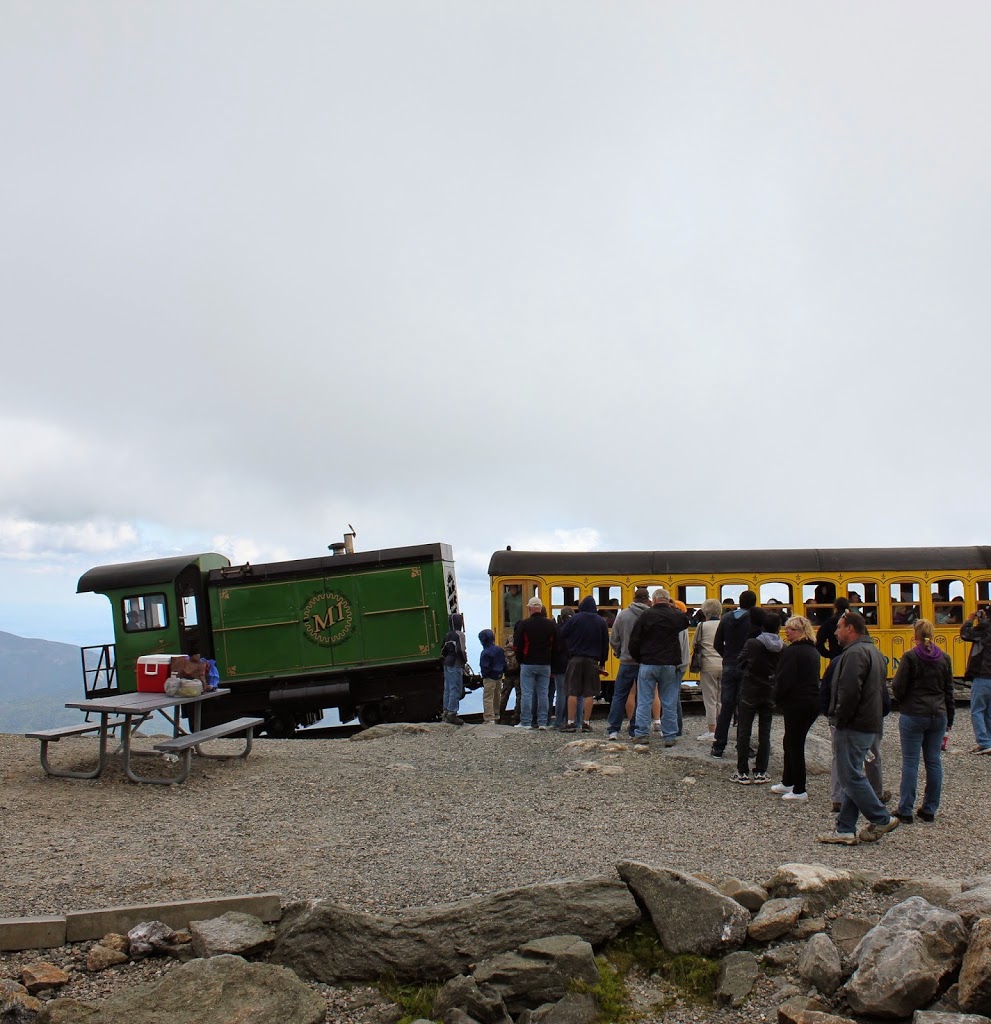
The scene in 2013:

446_2013

The first photo was probably taken within a few years of the opening of the Mt. Washington Cog Railway.  By the mid 19th century, the White Mountains had become a popular summer destination, and Mount Washington in particular became a favorite destination.  The only problem was getting to the top; this was first solved by the Mount Washington Carriage Road (today the Auto Road), but even before the road opened, another man had an even more ambitious idea – to build a railroad to the top.

Railroads were still in their infancy in America in 1852, and many major cities still did not have rail connections, but Sylvester Marsh had a plan to build a cog railway to the top, something that had never been done up the side of a mountain before.  The New Hampshire legislature gave him a charter in 1858, with one legislator reportedly remarking that they should give him a charter to make a railway to the moon, indicating how impossible it seemed to build a railroad to the top of the tallest peak in the Northeast.

The railroad was completed to the summit in July 1869, only a couple months after the completion of the Transcontinental Railroad.  It is about 3 miles long, with an average grade of about 25%, and it set the stage for future mountain-climbing railroads such as the one up Pikes Peak.  The locomotives in the first photo indicate that it is an early photo of the railroad; they appear to be the George Stephenson and the Hercules, which entered service in 1869 and were replaced in 1878 and 1874, respectively.

The present-day scene here is remarkably similar; the trains are still operating (most of the locomotives are modern biodiesel ones, but several date back to the 1870s), and there seems to be as many people riding in the 2013 photo as there were nearly 150 years earlier, although clothing styles have changed a bit.  It’s not visible from here, but the road to the top is also still there, although it is no longer the Carriage Road but the Auto Road.  There are a lot more buildings at the top than there were in the 1870s, although the Tip Top House is still there; it is older than either the Auto Road or the railroad.

Summit of Mt. Washington

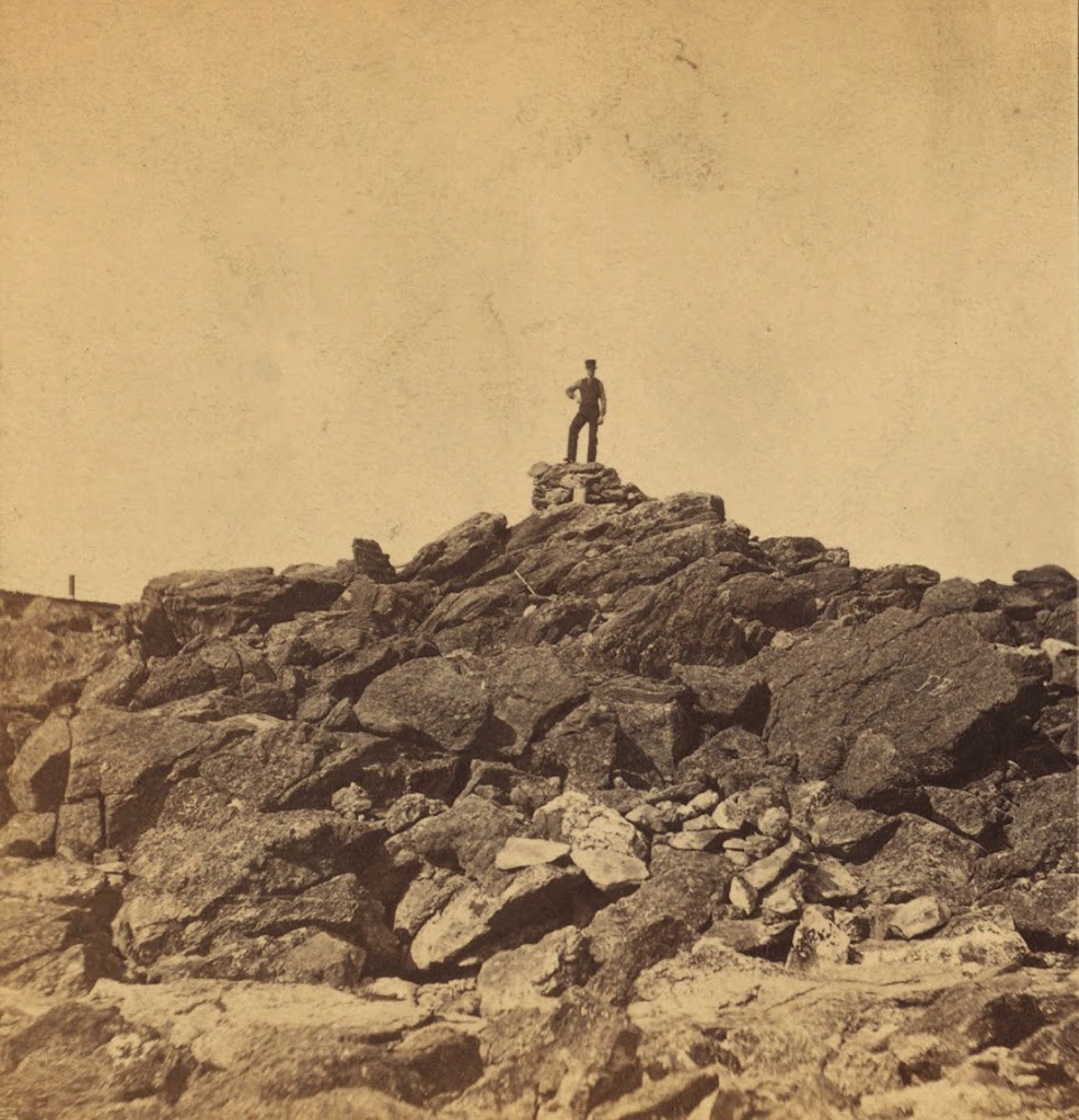
The summit of Mt. Washington, around 1860. Photo courtesy of New York Public Library.

Mt. Washington

The summit in 2013:

086_2013

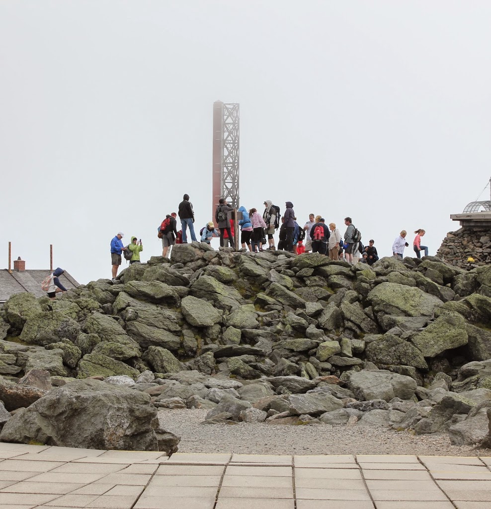
I don’t know if the two photos were taken from the same angle – it’s impossible to tell without any landmarks – but they clearly show how popular the northeast’s tallest mountain has become.  On the day that we went, there was literally a line of people waiting to ascend the pile of rocks that form the summit.  Some climbed to the top, while others took the Cog Railway or, like us, drove to he top.  If the 1860 date is correct, however, neither of these options were available to the individual standing on the top – the carriage road was not completed for another year, and the railway not until 1868.

Old Man of the Mountain

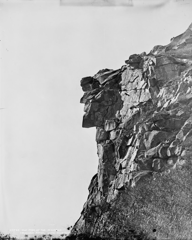
The Old Man of the Mountain, between 1890 and 1910. Image courtesy of the Library of Congress, Detroit Publishing Company Collection.

New Hampshire

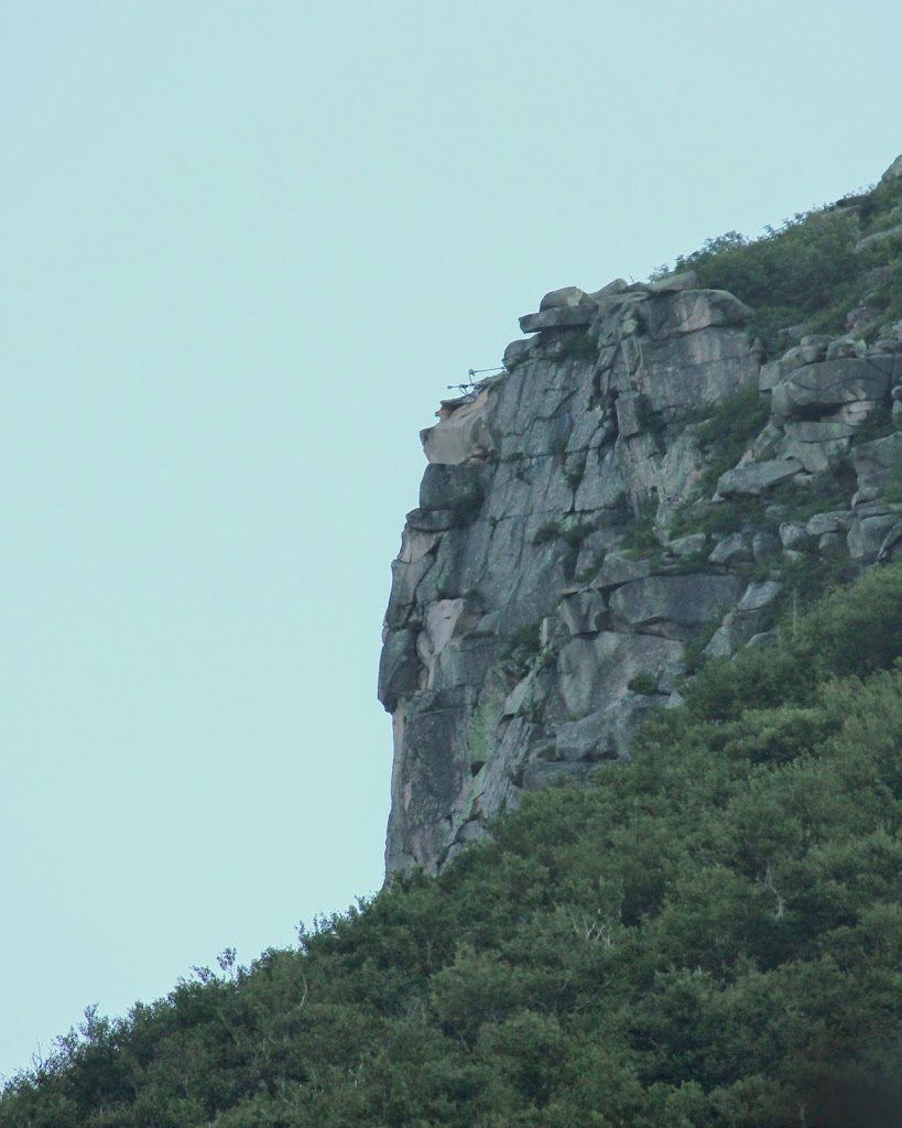
The same view in 2013:

052_2013

“Discovered” by surveyors in 1805, New Hampshire’s famous rock formation lasted for almost 200 more years, before collapsing in May 2003 as a result of centuries of freezing and thawing.  Concern over the figure’s eventual collapse began even before the first photo was taken.  Frederick Wilkinson Kilbourne wrote in Chronicles of the White Mountains in 1916 that “Professor Hitchcock’s fear, expressed more than forty years ago, that, owing to the friability of the granite of which the ledges are composed and its consequent rapid disintegration, the ledges might soon disappear, has so far not been realized”  Kilbourne went on to write, “Sad will be the day (may it never come!) when that marvel of Nature shall be marred or be no longer to be seen.”

Concerns about the stability of the rocks continued through the 20th century, and in 1958 steel rods and other equipment were used in an attempt to secure the rocks.  Several of the rods are still visible at the top of the cliff.  The Old Man of the Mountain also influenced the construction of Interstate 93 through Franconia Notch; the segment of highway is one of the few two-lane Interstate highways, and was built that way partially because of concerns that construction of a wider highway could damage the rock formation.  Regardless of these efforts, though, the rocks collapsed in May 2003.

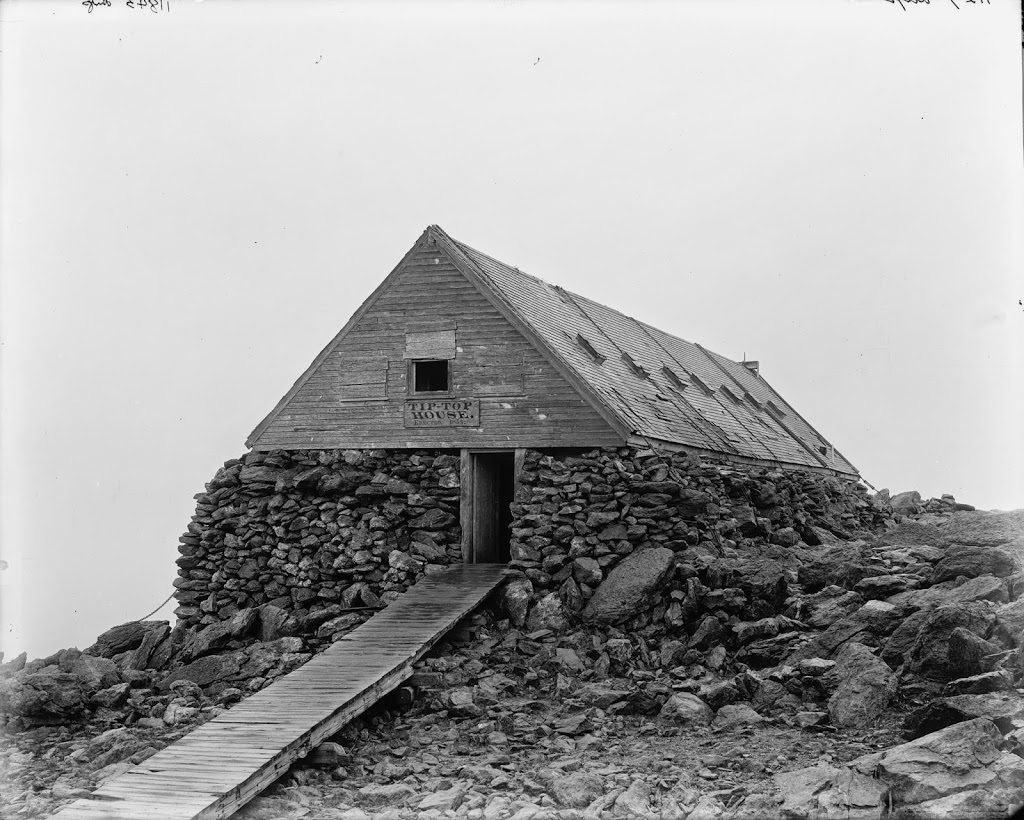
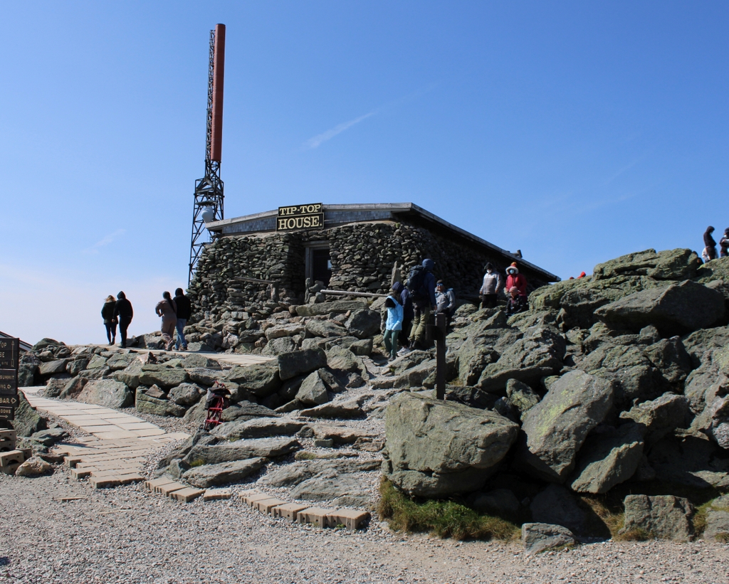
Tip Top House, Mt. Washington

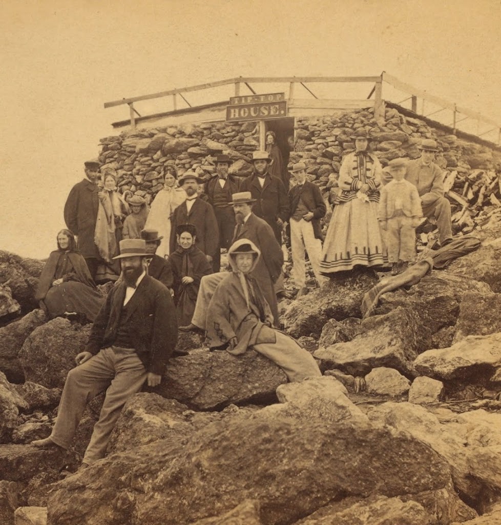
The Tip-Top House on Mount Washington in New Hampshire, sometime in the early 1860s. Image courtesy of the New York Public Library.

1860s

The building between 1890 and 1901. Image courtesy of the Library of Congress, Detroit Publishing Company Collection.

White Mountains

The same view in 2021:


Originally built as a hotel in 1853, it is the oldest surviving building at the summit of Mt. Washington, and is located just below the summit, which is just to the right of the building and outside of the picture.  After many years of being abandoned, it was restored in 1987 to its original appearance and now serves as a museum – the steeply pitched roof was not added until the 1860s, which provides a date for the first photo.