City Hall, Philadelphia, Pennsylvania

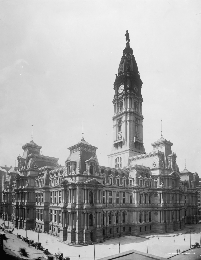
The northeast corner of Philadelphia City Hall, seen from the corner of Market and Filbert Streets, around 1905. Image courtesy of the Library of Congress, Detroit Publishing Company Collection.

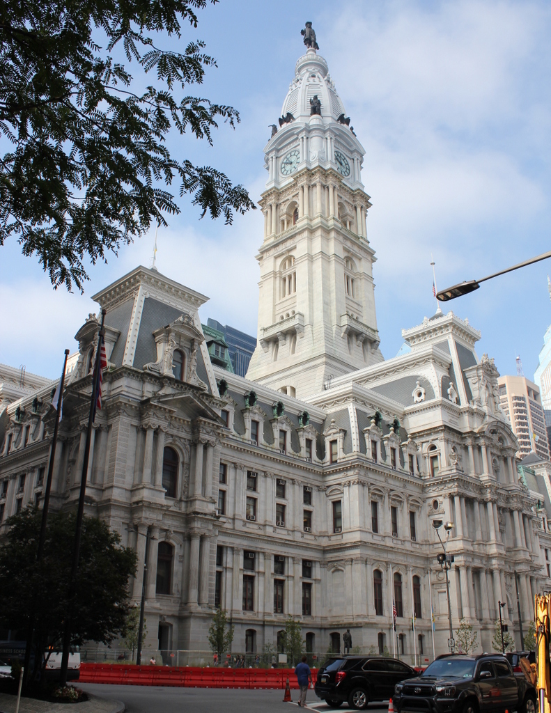
The scene in 2019:

Throughout most of the 19th century, Philadelphia’s municipal government was located in the old city hall building, adjacent to Independence Hall at the corner of Chestnut and Fifth Streets. Built in the 1790s, when Philadelphia had a population of barely 30,000 people, this building had become too small for the rapidly-growing city by the mid-19th century. The result was a new city hall, shown here in these two photos. It would be everything that the small, plain Federal-style building was not: it would be massive and architecturally opulent. Upon completion, it also held the title of the tallest habitable building in the world, marking the only time that a building in Philadelphia would hold this distinction.

The site of the current city hall had previously been a park, known as Centre Square. This park had been a part of William Penn’s original design for the city’s street grid, and it proved to be an ideal location for city hall, at the intersection of the north-south oriented Broad Street and the east-west Market Street. The building was designed by John McArthur Jr., a Scottish-born architect who spent most of his life in Philadelphia. His design featured a Second Empire-style exterior, which was particularly popular for government buildings in the United States during the post-Civil War era. Work began in 1871, but it would ultimately take 30 years to finish, at a cost of $25 million, thanks to construction cost overruns and governmental corruption.

City Hall is laid out in the shape of a square, with seven floors surrounding a central courtyard. In the middle of each side of the building is a large, ornate pavilion that rises above and projects outward from the rest of the building, as shown on the rights side of this scene. On the ground floor of each pavilion is an open archway leading into the courtyard. Along with these pavilions, the building also features matching turrets at each of the four corners. However, by far the most distinguishing feature of City Hall is the tower here at the northern side of the building. It rises 548 above the street, and it is topped by a 37-foot statue of William Penn that was designed by sculptor Alexander Milne Calder.

Although the interior was not completed until 1901, portions of the building were in use by the late 1870s. The tower topped out in 1894, surpassing Germany’s Ulm Minster as the tallest habitable building in the world. As such, it became the first non-religious building in recorded history to hold this distinction, and it would also become the last non-commercial building to do so. Its height was eventually surpassed by the Singer Building in 1908, and since then all of the record holders have been modern skyscrapers. Because of this, Philadelphia City Hall has a unique position on the timeline of the world’s tallest buildings, representing a transition from the cathedrals of the 19th century to the skyscrapers of the 20th century.

Despite its record-setting height, the size of City Hall is somewhat deceptive when viewed in photographs. Part of this was intentional on McArthur’s part, as the arrangement of windows gives the appearance, at first glance, that there are only three floors above the ground floor. This illusion affects the apparent scale of the tower as well, and it is hard to tell from a photograph that the statue is actually 37 feet tall, rather than simply being life-sized. As a result, photographs do not fully capture just how massive this building is. However, it is quite the imposing building when seen in-person, and this would have been even more so for the people in the first photo, which was taken when City Hall was still the world’s tallest building.

Unfortunately for architect John McArthur, the many construction delays meant that he did not live to see the completion of his magnum opus; he died in 1890, at the age of 66. These delays also meant that, by the time it was completed, the design of City Hall was hopelessly out of date. By the late 19th century, tastes had shifted away from the highly ornate features of Second Empire architecture, and City Hall was seen as a relic of an earlier era. This criticism started even before the construction was finished, with the Philadelphia Inquirer declaring it to be an “architectural monstrosity” that “always will be until that bizarre French roof is ripped off and a couple of substantial stories added.”

City Hall would continue to face criticism after its completion, both for its design and also for its location in the middle of a major intersection. As early as 1916 there were calls for its demolition. The Inquirer reiterated its criticism of the design, which the newspaper believed “belongs to a thoroughly discredited era of architectural merit.” Furthermore, the building “blocks our two chief streets and hampers developments which are essential to the welfare of the people and to Philadelphia’s progress.” Consequently, the Inquirer argued, “everyone will agree that where it stands now is an obstruction and a nuisance and the only open question relates to the expediency from a practical and business-like viewpoint of its obliteration.”

This proposal ultimately gained little headway, but the building survived several more serious proposals to demolish it, including one in the 1950s. However, this plan failed in part because of the enormous expense of demolishing such a large masonry structure; the demolition costs would have been roughly equal to what it had cost to build City hall a half century earlier.

Despite the long history of criticism of City Hall, it retained the title of tallest building in Philadelphia throughout most of the 20th century, thanks to an informal gentleman’s agreement that no building should rise higher than the statue of William Penn. However, its height was ultimately surpassed by One Liberty Place in 1987, and other skyscrapers soon followed. Because of this, City Hall is now only the 12th-highest in the city.

Today, more than 120 years after its completion, City Hall remains in use by Philadelphia’s municipal government. It is the largest city hall in the country in terms of interior floor space, and it also stands as the world’s tallest freestanding masonry building in the world. Several other masonry structures are taller, including the Washington Monument, but these do not qualify as buildings and so are listed in a separate category. Over the years, the views on City Hall’s architectural design have changed, and the building is now highly-regarded as a masterpiece of Second Empire architecture. As a result, in 1976 it was designated as a National Historic Landmark, which is the highest level of federal recognition for a historic building.

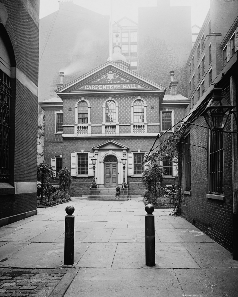
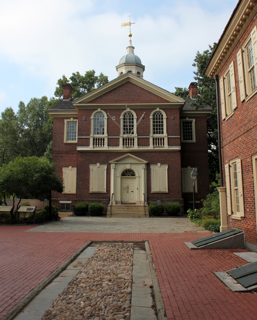
Carpenters’ Hall, Philadelphia, Pennsylvania (2)

Carpenters’ Hall in Philadelphia, around 1900. Image courtesy of the Library of Congress, Detroit Publishing Company Collection.

The scene in 2019:

As explained in more detail in the previous post, Carpenters’ Hall is an important historic landmark in Philadelphia, having been the meeting place for the First Continental Congress in 1774. Over the ensuing years, it would be used for a variety of other purposes, including as a hospital during the American Revolution, as the offices of Secretary of War Henry Knox during the early 1790s, and as the temporary home of both the First Bank of the United States and the Second Bank of the United States. By the mid-19th century it had become an auction house, a comparatively undignified use that helped to inspire the restoration and preservation of the building in 1857.

By the time the first photo was taken at the turn of the 20th century, Carpenters’ Hall was more than 125 years old, but it still retained its colonial-era exterior appearance. However, by this point the building, which is situated at the end of a narrow alley in the middle of a city block, was hemmed in by much larger buildings. This would remain the case until the mid-century, when the Independence National Historical Park was created. Among the more controversial aspects of the park’s creation was the large-scale demolition of many historic 19th and early 20th century buildings, in order to create a more park-like setting that highlighted only the Revolutionary-era buildings.

Today, Carpenters’ Hall is now twice as old as it had been when the first photo was taken. However, because of the removal of so many surrounding buildings, its exterior setting now more closely resembles what it would have looked like when the delegates to the First Continental Congress arrived here in 1774. It is still owned by its original occupant, the Carpenters’ Company of the City and County of Philadelphia, and it is open to the public as one of the many preserved 18th century buildings here in Philadelphia.

Judges Cave, New Haven, Connecticut

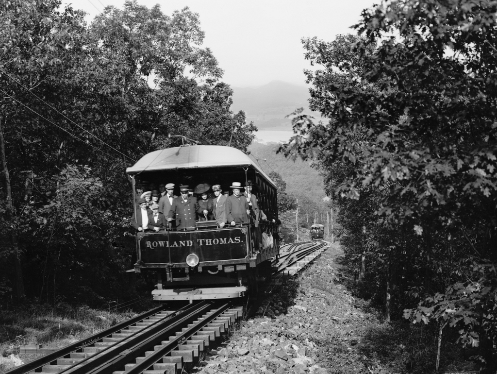
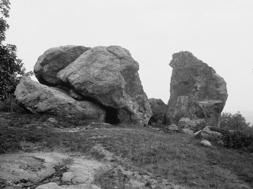
The Judges Cave on West Rock in New Haven, around 1901. Image courtesy of the Library of Congress, Detroit Publishing Company Collection.
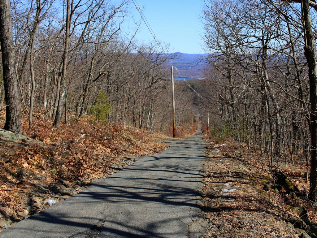
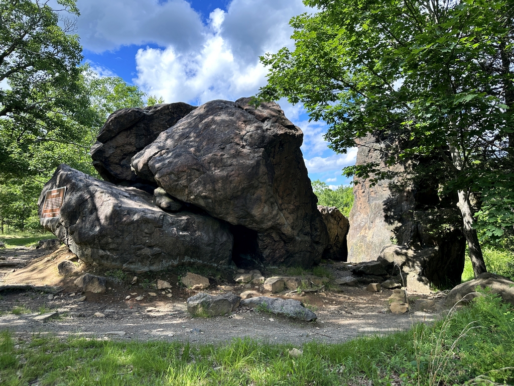
The scene in 2024:
The immediate origins of the American Revolution can be traced back to the 1760s, when colonists began protesting taxes that were being levied on the colonies in the aftermath of the French and Indian War. However, this was hardly the first time that the colonies had defied the British crown. A century earlier, following the English Civil War and the eventual restoration of the monarchy, the colony of New Haven protected several regicides who had signed the death warrant of Charles I in 1649. This ultimately helped lead to the downfall of the colony and its merger with Connecticut in 1664, but none of the regicides were ever captured, and the incident has lived on in New England lore.

John Dixwell, William Goffe, and Edward Whalley were three military officers who had fought on the side of Parliament during the English Civil War in the 1640s. Following the defeat of the Royalists, King Charles I was captured put on trial for treason, and was found guilty of being a “tyrant, traitor, murderer and public enemy.” These three men were among the 59 commissioners who signed his death warrant, and he was subsequently beheaded on January 30, 1649.

This led to a decade-long interregnum, during which time Puritan leader Oliver Cromwell took on the title of Lord Protector of the Commonwealth of England. However, this government collapsed soon after Cromwell’s death in 1558, and in 1660 Charles II, the son of Charles I, returned from exile became king. That same year, Parliament passed the Indemnity and Oblivion Act, which pardoned most of the people who took part in the war but specifically excluded the 59 regicides and other high-ranking leaders who were connected to the trial and execution of Charles I. Over the next few years, royal officials tracked down many of these people, who were then imprisoned or executed. Even those who were already dead could not escape punishment; the bodies of Cromwell and several other dead regicides were exhumed from their graves, publicly executed, and then beheaded.

In the meantime, Dixwell, Goffe, and Whalley fled to the New World, to seek shelter among the Puritans. The exact date and location of Dixwell’s arrival is unknown, but he was presumed dead by the British and was not actively pursued by royal authorities. As for Goffe and Whalley, they arrived in Boston in July 1660, and they lived openly in Cambridge, before news of the Indemnity and Oblivion Act reached the colony in the fall. Over the next few months, the colonial leaders debated what to do about the two men. Although many were sympathetic to them and their cause, they feared the consequences to the colony if they continued to shelter them. So, on February 26, 1661 Goffe and Whalley left Cambridge for New Haven, where they arrived on March 7.

Here in New Haven, the men initially lived with the Reverend John Davenport. However, within a few months they were again in danger. News of their formal arrest warrant, dated March 5, reached New Haven around the end of April. This was soon followed by the arrival of royal officials in nearby Guilford, where they met with Governor William Leete. He managed to delay them in Guilford for several days, allowing Goffe and Whalley to quite literally take to the hills in order to escape arrest.

Goffe and Whalley spent several nights in temporary lodgings, aided by local farmers, before they were brought here to this rock formation on May 15. Although commonly referred to as Judges Cave, it is a cave in only the most generous sense of the word. In reality, it is a pile of boulders that, in a few areas, overhang enough to provide minimal shelter from the elements.  It is located high atop West Rock, a traprock ridge located about three miles northwest of the center of New Haven. At the time, this was a remote, sparsely-settled area, and they were able to live here for nearly a month without being detected.

Throughout this month, Goffe and Whalley received food every day from Richard Sperry, a local farmer who lived about a mile from here. They spent several nights at a nearby house during periods of inclement weather, but otherwise they lived here on the hill, which they named Providence Hill. In the meantime, royal officials were diligently searching for them in New Haven, offering generous rewards for their capture while also threatening Reverend Davenport for having aided them. The two regicides considered turning themselves in, in order to spare the colony any further trouble, but Governor Leete convinced them to remain in hiding. Within a few years, though, New Haven’s aid to the regicides would be a contributing factor in the demise of the colony, which was absorbed by the neighboring Connecticut colony in 1664.

According to legend, it was ultimately not royal officials who drove Goffe and Whalley from this cave, but rather a mountain lion that made an appearance at the entrance to the cave and frightened the two men. They left here on June 11, and lived at two other locations in the vicinity of West Rock for the next few months before finding more permanent lodgings at a house in Milford. They remained at this house for the next two or three years, before eventually moving to Hadley, Massachusetts, where they spent the rest of their lives in safety.

Because of the obvious need for secrecy in the movements of the regicides, there are few contemporary sources to corroborate these events. Perhaps the only primary source document was a diary that Goffe kept from 1660 to 1667, which he wrote in an easily-decipherable shorthand. This diary is now lost to history, but in the mid-1700s it was owned by Thomas Hutchinson, the royal lieutenant governor and later governor of the Province of Massachusetts Bay.

Aside from his role in colonial government, Hutchinson was also a historian, and in 1764 he published The History of the Colony of Massachusetts Bay. This book included an account of the regicides, which was based largely on Goffe’s journal. However, as a loyalist in the years leading up to the American Revolution, Hutchinson took a dim view of the regicides, and this bias is evident in much of his narrative. For example, he emphasizes the role that colonial officials had in trying to apprehend them, in an effort to portray the majority of 17th century New Englanders as having been loyal to the crown

Regardless of the biases, and the fact that it was written a century after the events happened, Hutchinson’s book provides the earliest significant account of the regicides and their flight through New England. The section relevant to their time here at Judges Cave, which is part of a lengthy footnote, reads as follows:

About that time, news came to Boston that ten of the judges were executed, and the governor received a royal mandate, dated March 5, 1660, to cause Whaley and Goffe to be secured. This greatly alarmed the country, and there is no doubt that the court were now in earnest in their endeavours to apprehend them; and to avoid all suspicion, they gave commission and instruction to two young merchants from England, Thomas Kellond and Thomas Kirk, zealous royalists, to go through the colonies, as far as Manhados, in search of them. They had friends who informed them what was doing, and they removed from Mr. Davenport’s to the house of one Jones, where they lay hid until the 11th of May, and then removed to a mill, and from thence, on the 13th, into the woods, where they met Jones and two of his companions, Sperry and Burril, who first conducted them to a place called hatchet-harbor, where they lay two nights, until a cave or hole in the side of a hill was prepared to conceal them. This hill they called Providence hill; and there they continued, from the 15th of May to the 11th of June, sometimes in the cave, and, in very tempestuous weather, in a house near to it. During this time, the messengers went through New-Haven to the Dutch settlement, from whence they returned to Boston by water. They made diligent search, and had full proof that the regicides had been seen at Mr. Davenport’s, and offered great rewards to English and Indians who should give information that they might be taken, but, by the fidelity of these three friends, they remained undiscovered.

Goffe’s journal remained in Hutchinson’s possession until 1765, when his house was ransacked by a Patriot mob in protest of the Stamp Act. The journal was either lost or destroyed in the process, making Hutchinson’s book the only surviving description of its contents. However, at least one other prominent historian, future Yale president Ezra Stiles, had the opportunity to examine the journal before its disappearance. He saw it during a 1763 visit to Hutchinson’s house, and he subsequently wrote his own history of the regicides.

Unlike Hutchinson’s description of the regicides, which fills just seven pages in his massive multi-volume history of the colony, Ezra Stiles published an entire book about their exploits in 1794. Titled A History of Three of the Judges of King Charles I, the book is over 350 pages long, and it relies heavily on oral traditions that were passed down to the descendants of the men involved in helping the regicides. Like Hutchinson’s account, Stiles’s book also has a political slant, although in the opposite direction. Writing just a decade after the American Revolution, in the midst of republican, anti-monarchical sentiment, Stiles viewed the regicides in a positive light, and he even included a chapter in which he justified their actions.

Stiles’s seemingly uncritical use of oral tradition in his book would come under criticism from later scholars, including biographer Edmund S. Morgan. Writing in his 1962 book The Gentle Puritan: A Life of Ezra Stiles, 1727-1795, Morgan asserted that it “represents Stiles at his worst. It is a tedious hodgepodge of fact and fancy, compounded mainly out of dim recollections by old men and women of things their grandfathers had told them fifty years before.” One such recollection, which relates to the Judges Cave, came from an interview with Joseph Sperry, whose grandfather Richard Sperry had aided the regicides in 1661. Stiles provided the following account in his book, including a description of this cave:

In 1785 I visited aged Mr. Joseph Sperry, then living, aged 76, a grandson of the first Richard, a son of Daniel Sperry, who died in 1751, aged 86, from whom Joseph received the whole family tradition. Daniel was the sixth son of Richard, and built a house at the south end of Sperry’s farm, in which Joseph now lives, not a half a mile west from the Cave, which Joseph shewed me. There is a notch in the mountain against Joseph’s house, through which I ascended along a very steep acclivity up to the Cave. From the south end of the mountain for three or four miles northward, there is no possible ascent or descent on the west side, but at this notch, so steep is the precipice of the rock. I found the Cave to be formed, on a base of perhaps forty feet square, by an irregular clump or pile of rocks, or huge broad pillars of stone, fifteen and twenty feet high, standing erect and elevated above the surrounding superficies of the mountain, and enveloped with trees and forest. These rocks coalescing or contiguous at top, furnished hollows or vacuities below, big enough to contain bedding and two or three persons. The apertures being closed with boughs of trees or otherwise, there might be found a well covered and convenient lodgement.

After this description of the cave and its surroundings, he wrote of what he learned from Joseph Sperry:

Here, Mr. Sperry told me, was the first lodgment of the Judges, and it has ever since gone and been known by the name of the Judges’ Cave to this day. Goffe’s Journal says, they entered this Cave the 15th of May, and continued in it till the 11th of June following—Richard Sperry daily supplied them with victuals from his house, about a mile off; sometimes carrying it himself, at other times sending it by one of his boys, tied up in cloth, ordering him to lay it on a certain stump and leave it: and when the boy went for it at night he always found the basons emptied of the provisions, and brought them home. The boy wondered at it, and used to ask his father the design of it, and he saw no body. His father only told him there was some body at work in the woods that wanted it. The sons always remembered it, and often told it to persons now living, and to Mr. Joseph Sperry particularply [sic].

They continued here till 11th of June. Mr. Joseph Sperry told me that the incident which broke them up from this Cave was this, that this mountain being a haunt for wild animals, one night as the Judges lay in bed, a panther, or catamount, putting his head into the door or aperture of the Cave, blazed his eye-balls in such a hideous manner upon them, as greatly affrighted them. One of them was so terrified by this grim and ferocious monster, her eyes and her squawling, that he took to his heels, and fled down the mountain to the Sperry’s house for safety. They thereupon considered this situation too dangerous, and quitted it. All the Sperry families have this tradition.

Aside from the events here in New Haven, the subsequent lives of Goffe and Whalley in Hadley are shrouded in mystery and legend. They lived at the home of the Reverend John Russell, but it appears that most townspeople were unaware of their identities. At some point around 1664, they were reunited with John Dixwell, the third regicide who had fled to New England. He eventually moved to New Haven, where he lived under the name John Davids until his death in 1689. Because the authorities believed that he was dead, he was able to live in relative security, and does not appear to have required the use of this cave or any other improvised shelters.

In the meantime, Edward Whalley died in Hadley around 1675 of natural causes, but Goffe lived long enough to become the subject of perhaps the most memorable regicide legend. According to tradition, at some point in either 1675 or 1676 the town of Hadley was facing an attack by Native Americans during King Philip’s War. The townspeople started panicking, but then an elderly man, identified in the legend as William Goffe, emerged and began to take charge. Some 30 years after he fought the Cavaliers on the battlefields of the English Civil War, he rallied the people and led their defense, and succeeded in saving the town. Then, as suddenly as he had appeared, the “Angel of Hadley” was gone.

As is the case for nearly all of the regicide-related stories, the first published account of the Angel of Hadley did not appear for nearly a century, until Thomas Hutchinson included it in his book in 1764. He included it at the end of his lengthy footnote on the movements of the regicides, writing:

The town of Hadley was alarmed by the Indians in 1675, in the time of publick worship, and the people were in the utmost confusion. Suddenly, a grave elderly person appeared in the midst of them. In his mien and dress he differed from the rest of the people. He not only encouraged them to defend themselves; but put himself at their head, rallied, instructed and led them on to encounter the enemy, who by this means were repulsed. As suddenly, the deliverer of Hadley disappeared. The people were left in consternation, utterly unable to account for this strange phœnomenon. It is not probable, that they were ever able to explain it. If Goffe had been then discovered, it must have come to the knowledge of those persons, who declare by their letters that they never knew what became of him.

Writing in his book 30 years after Hutchinson, Stiles repeats essentially the same account of the incident, although his wording tends to be more explicitly favorable to Goffe. Rather than describing him as “a grave elderly person,” Stiles writes of “a man of a very venerable aspect.” He copies Hutchinson’s wording by saying “the inhabitants could not account for the phœnomenon,” but then added “but considering that person as an Angel sent of God upon that special occasion for their deliverance; and for some time after said and believed that they had been delivered and saved by an Angel.”

Stiles’s romanticized description helped to solidify the idea of the “Angel of Hadley,” and by the early 19th century the story had become a part of early American folklore. In his 1823 novel Peveril of the Peak, Scottish writer Sir Walter Scott alluded to the incident, and in 1829 James Fenimore Cooper included it in his novel The Wept of Wish-ton-Wish. Nathaniel Hawthorne, who was never one to pass up a good story about the Puritans, also took inspiration from it. As a young man, he visited Judges Cave here in New Haven, and one of his early short stories, “The Gray Champion,” was loosely based on the Angel of Hadley legend. In the story, the title character is a shadowy, mysterious figure who embodies the Puritan ancestors of New England. Instead of defending a town against Native Americans, Hawthorne’s hero challenges the authoritarian rule of Edmund Andros in the 1680s. The Gray Champion disappears once the threat to the colony is over, but over the years he continues to make appearances whenever American liberty is at stake, including nearly a century later on the battlefields at Lexington and Bunker Hill.

Although Hutchinson’s and Stiles’s accounts provided plenty of material for 19th century authors, many historians began calling into question the accuracy of these tales, especially the ones that were handed down to Stiles through multi-generational hearsay. Legends such as the Angel of Hadley might very well have some basis in reality, but at this point it is difficult to sort out fact from fiction, given the inherent secrecy involved in the regicides and their activities here in New England. As for the tradition that the regicides spent a month hiding here in this rock formation, it is impossible to state with certainty that this is true. However, this belief does not seem to have been seriously questioned, and it seems plausible that this was, in fact, their hiding place during the spring of 1661.

The first photo was taken around 1901, showing the south side of the rock formation. By this point, the surrounding land was owned by the city of New Haven as part of West Rock Park. In the early 1890s a road was opened up here to the Judges Cave, and then in 1896 a plaque was installed here on the rocks. This plaque, which is visible here on the right side of the scene, commemorates the role that this site played in sheltering the regicides, and it was presented to the city by the Society of Colonial Wars. The formal dedication occurred on October 14, 1896, and it was attended by dignitaries such as Mayor Frederick B. Farnsworth, state adjutant general Edward E. Bradley, future governor Simeon E. Baldwin, and writer Charles Dudley Warner. Along with providing a short description of the regicides, the plaque features the phrase “opposition to tyrants is obedience to God,” which had apparently been inscribed on the rocks here as early as 1803.

Today, more than a century after the first photo was taken, the Judges Cave still looks essentially the same. It is still preserved as parkland, although it was acquired by the state in 1975, and it is now named West Rock Ridge State Park. The Judges Cave remains an important landmark within the park, and the only real difference between these two photos is the loss of the plaque, which was evidently stolen at some point. Its replacement is a somewhat larger plaque on the left side, although it bears the same inscription as the original one. It includes the same closing line about how “opposition to tyrants is obedience to God,” reflecting the beliefs that had led two Puritans across the Atlantic Ocean and to this secluded cave on the fringes of European settlements in the New World.


Meriam’s Corner, Concord, Mass

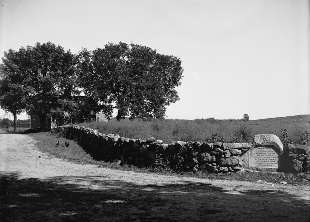
The view looking northeast at Meriam’s Corner in Concord, with Old Bedford Road to the left and Lexington Road on the right, around 1900. Image courtesy of the Library of Congress, Detroit Publishing Company Collection.

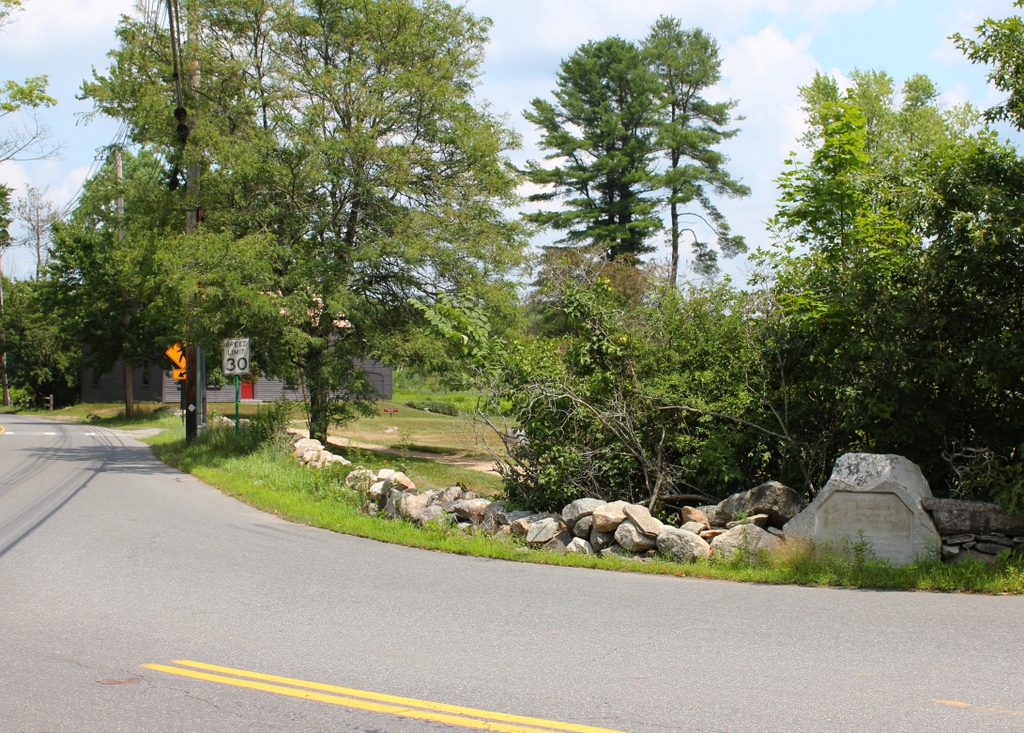
The scene in 2020:

The battles of Lexington and Concord on April 19, 1775 marked the start of the American Revolution, when colonial militiamen resisted British attempts to seize military supplies in Concord. However, the fighting did not consist of a single battle, but rather a series of skirmishes spread out across several towns between Boston and Concord. It began at dawn in Lexington, when about 80 of the town’s militiamen gathered on the town common to confront the advancing British. A tense standoff led to both sides exchanging gunfire, killing eight colonists before the British continued their march to Concord. There, they seized some of the colonial supplies, but their advance was halted at Old North Bridge, where militiamen fired the famous “shot heard ’round the world” and forced three companies of redcoats to retreat.

Up until this point, the day was relatively bloodless for the British, who had one soldier wounded at Lexington, three killed at Old North Bridge, and nine wounded there. They had partially succeeded in their objectives, having destroyed some of the colonial cannons and supplies, but they now found themselves deep in hostile territory, with an ever-increasing number of militiamen streaming in from the surrounding towns. Facing a 17-mile march back to the safety of Boston, the redcoats ate lunch in Concord before leaving the town around noon.

Lt. Colonel Francis Smith, the commander of the British soldiers here, ordered a flank guard to protect the column of redcoats as they marched out of Concord. However, just beyond this intersection the road crosses a small stream, requiring the flank guard to return to the road in order to cross the bridge. At the same time, militiamen from Reading, Chelmsford, and Billerica arrived on scene. Observing that the British were vulnerable to attack without a flank guard, Captain John Brooks of the Reading minutemen ordered his soldiers to open fire, beginning what would soon turn into a long and bloody struggle for the British as they made their way back to Boston.

This intersection is known as Meriam’s Corner because it was the longtime home of the Meriam family, who had lived here since the mid-1600s. By 1775 there were three different houses here that belonged to members of the family, including the one on the left side of these photos. Built around 1705 by Joseph Meriam, it was subsequently owned by his son Nathan, who was living here with his wife Abigail and their children in 1775. Nathan was 54 years old at the time, and he was serving as one of the three town selectmen in Concord. He does not appear to have participated in the fighting here, but accounts of the battle suggest that his house and outbuildings were probably among the structures that the militiamen used for cover when they opened fire on the British column.

Contemporary descriptions of the day’s fighting lack specific details about how the fighting unfolded here at Meriam’s Corner, but several later accounts provide more information. Among these is a letter, written in 1825 by Reverend Edmund Foster, who had been one of the Reading minutemen who fought here a half century earlier. In this letter, he wrote the following, which is quoted from the National Park Service’s Historic Structure Report on the Meriam house:

We rendezvoused near the middle of the town of Bedford; left horses, and marched forward in pursuit of the enemy. A little before we came to Merriam’s hill, we discovered the enemy’s flank guard, of about 80 or 100 men, who, on their retreat from Concord, kept that height of land, the main body [being] in the road. The British troops and the Americans, at that time, were equally distant from Merriam’s corner. About twenty rods short of that place, the Americans made a halt. The British marched down the hill with very slow, but steady step, without music, or a word being spoken that could be heard. Silence reigned on both sides. As soon as the British had gained the main road, and passed a small bridge near that corner, they faced about suddenly, and fired a volley of musketry upon us. They overshot; and no one, to my knowledge, was injured by the fire. The fire was immediately returned by the Americans, and two British soldiers fell dead a little distance from each other, in the road near the brook. The battle now began, and was carried on with little or no military discipline and order, on the part of the Americans, during the remainder of that day. Each one sought his own place and opportunity to attack and annoy the enemy from behind trees, rocks, fences and buildings, as seemed most convenient.

As noted in the letter, the brief exchange of fire here at Meriam’s Corner was only the beginning of what would become an afternoon of guerilla warfare and ambushes on the part of the colonial militiamen. They inflicted particularly heavy casualties less than a mile to the east of here, at a spot now known as the Bloody Angle, where 30 British soldiers were killed or wounded. By the time the column reached Lexington the retreat had turned into a rout, and only the timely arrival of reinforcements from Boston saved the British from total disaster.

The British retreat marked the beginning of the Siege of Boston, which lasted until they evacuated the town 11 months later in March 1776. In the meantime, no further fighting occurred here in Concord for the rest of the war, and life in the town largely returned to normal. Nathan Meriam continued to live here in this house until his death in 1782. His son Ephraim subsequently acquired the property, and it would remain in his family until the death of his son Rufus in 1870. Rufus was a bachelor with no children, and the family sold the house a year later, ending two centuries of Meriam family ownership of this lot.

In 1871, the house was purchased by Thomas and Rose Burke, two Irish immigrants who lived here with their four children. He was a farmer, and he and Rose were still living here when the first photo was taken around 1900. According to that year’s census, all four of their children, who were now adults, were also still here, along with a hired hand who worked on the farm and lived with the family.

The first photo shows the scene looking northeast from the intersection. From here, the road on the left is Old Bedford Road, the route that the Reading minutemen took to get here. Out of view on the right is Lexington Road, which the British took on their way to and from Boston on the day of the battle. In the foreground on the right side of the scene is an inscribed boulder, which was installed in 1885 as part of the commemoration of the 250th anniversary of Concord’s founding. It reads: “Meriam’s Corner. The British troops retreating from the Old North Bridge were here attacked in flank by the men of Concord and neighboring towns and driven under a hot fire to Charlestown.”

Today, around 120 years after the first photo was taken, this scene has not changed substantially, except for the paved roads and increase in vegetation. The commemorative boulder is still there, as is the Meriam House in the distance, although it is now mostly hidden by trees from this angle. This site, along with much of the land surrounding the historic Battle Road, is now preserved and administered by the National Park Service as part of the Minute Man National Historical Park, which was established in 1959.

Melvin Memorial, Concord, Mass (2)

The Melvin Memorial at Sleepy Hollow Cemetery in Concord, around 1910-1920. Image courtesy of the Library of Congress, Detroit Publishing Company Collection.

The scene in 2020:

As explained in the previous post, the Melvin Memorial was created in honor of Concord natives Asa, John, and Samuel Melvin. These three brothers all died during the Civil War, and in 1897 their only surviving brother, James C. Melvin, commissioned prominent sculptor Daniel Chester French to design a memorial for them. It was dedicated here in Sleepy Hollow Cemetery in 1909, and it features a relief sculpture titled Mourning Victory. The sculpture shows Victory draped in a flag and carrying a laurel sprig to symbolize the Union victory in the war, but it also shows Victory with downcast eyes, representing the loss of life that was required in order to win the war.

In more than a century since the first photo was taken, remarkably little has changed here in this scene. Sleepy Hollow Cemetery was designed as a natural, park-like cemetery that could be used by both the living and the dead, and it has retained that same appearance over the years. Even the tree in the center of the first photo appears to be the same one that is still standing here in the 2020 photo. As for the memorial itself, it underwent a major restoration from 2018 to 2019, including cleaning, repointing, and repairing the marble, along with replacing the tablets beneath the sculpture of Victory. As a result, the memorial now looks essentially the same as it did the first photo, and it stands as a significant work by one of the nation’s leading sculptors of the late 19th and early 20th centuries.

Melvin Memorial, Concord, Mass

The Melvin Memorial at Sleepy Hollow Cemetery in Concord, around 1909-1912. Image courtesy of the Library of Congress, Detroit Publishing Company Collection.

The scene in 2020:

This monument in Sleepy Hollow Cemetery was dedicated in 1909 in honor of Asa, John, and Samuel Melvin, three brothers who died during the Civil War. All three were Concord natives, and they served in Company K of the First Massachusetts Heavy Artillery. Their deaths represented three of the leading causes of death in the war: disease, combat, and poor conditions prisoner of war camps. John died of dysentery in 1863, Asa was killed in battle during the siege of Petersburg in 1864, and Samuel died of disease and malnutrition in 1864 at the Andersonville prison in Georgia, following his capture after the Battle of Spotsylvania.

A fourth brother, James C. Melvin, was too young to join older siblings at the start of the war, but he enlisted later in the war once he was old enough. He was the only one to survive the war, and he went on to become a businessman in Boston, where he was involved in a cold storage company. One of his goals was to create a memorial in honor of his three older brothers, so in 1897 he commissioned prominent sculptor Daniel Chester French to design one.

Although a native of New Hampshire, French was no stranger to Concord. One of his first major works was The Minute Man, a bronze statue dedicated in 1875 at Old North Bridge, at the site of the Battle of Concord. That iconic symbol of the American Revolution has remained one of his most famous works, perhaps eclipsed only by one of his last works, the 30-foot marble statue of Abraham Lincoln inside the Lincoln Memorial in Washington, D.C.

For the Melvin Memorial, French drew little inspiration from existing Civil War monuments, which typically featured some variation of a uniformed soldier holding a rifle. Instead, he took inspiration from classical art, creating a relief sculpture that he titled Mourning Victory. The design features a seven-foot-tall figure of Victory emerging from the marble, draped in an American flag and carrying a laurel sprig. These symbols express patriotism and the triumphant victory of the Union during the war, but French also portrayed Victory with downcast eyes, mourning the human cost of that victory. Directly beneath the sculpture are tablets for each of the three brothers, with inscriptions identifying them and the circumstances of their deaths. The other inscription on the memorial, located below Victory, reads:

In memory of three brothers born in Concord who as private soldiers gave their lives in the war to save the country this memorial is placed here by their surviving brother, himself a private soldier in the same war.

“I with uncovered head
Salute the sacred dead
Who went and who return not”

The memorial was dedicated on June 16, 1909, in a ceremony that was well attended by surviving members of the First Massachusetts Heavy Artillery. The first photo was taken shortly after the dedication, and it shows the monument in its location in Sleepy Hollow Cemetery. However, while it is in a cemetery, none of the brothers are actually buried here beneath the memorial. Only John’s body was returned home during the war, and he is buried elsewhere in the cemetery in the family plot, alongside his brother James, who died in 1915. As for the other two brothers, Samuel is buried in the Andersonville National Cemetery, while Asa lies in a mass grave in Petersburg.

Today, more than a century after the dedication of the Melvin Memorial, it still looks essentially the same as it did in the first photo, thanks to a restoration project that was completed in 2019. It is regarded as one of Daniel Chester French’s finest works, and a replica of it—which was also commissioned by James Melvin—is housed in the Metropolitan Museum of Art in New York. Overall, perhaps the only thing that has changed here in Sleepy Hollow Cemetery since the first photo was taken is the number of gravestones, which has obviously increased over the years. Appropriately enough, one of these stones is for Daniel Chester French himself, who died in 1931 and is buried up on the ridge behind the memorial.