Sumner Avenue, Springfield Mass

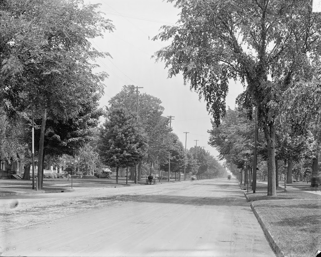
Looking east on Sumner Avenue, Springfield Massachusetts, from near the intersection with present-day Washington Road, around 1900-1910. Image courtesy of the Library of Congress, Detroit Publishing Company Collection.

223_1900-1910-loc.tif

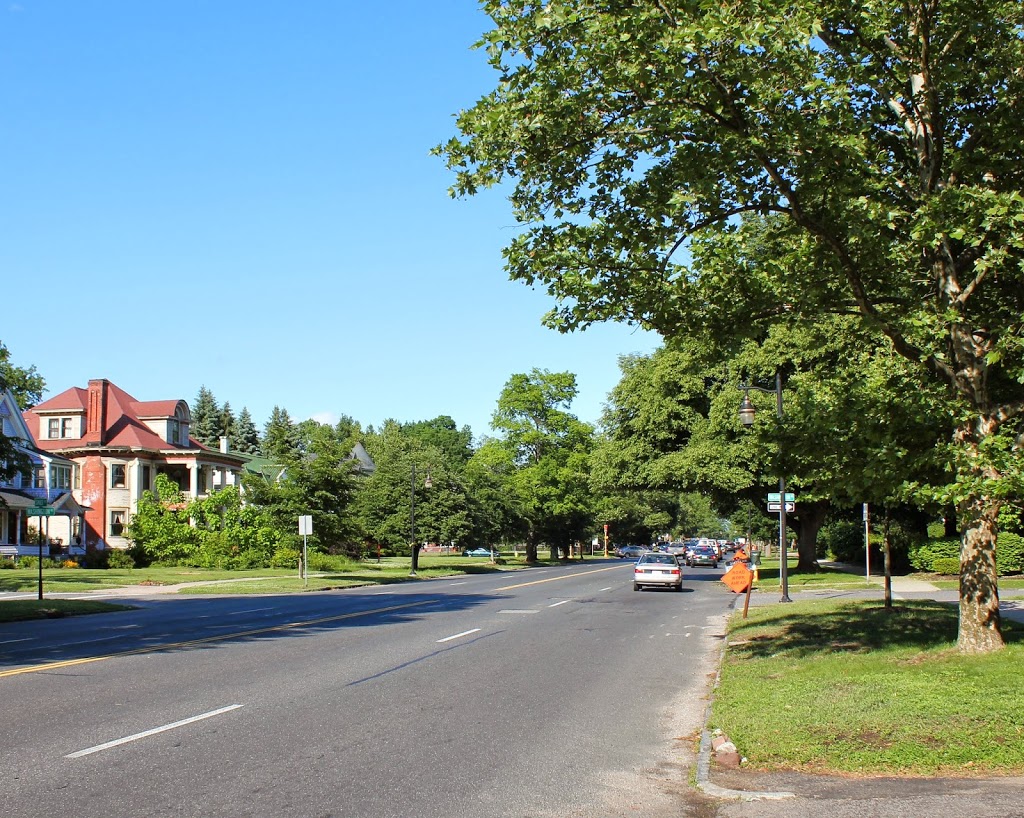
The same view in 2014:

223_2014

Sumner Avenue is the primary thoroughfare across the southern part of Springfield, passing through the Forest Park neighborhood.  At the time that the first photo was taken, this was a prominent, expensive neighborhood with large, ornate houses, similar to the ones seen on Maple Street and other parts of the city.  However, like many of these other areas, the neighborhood has declined, with most of the wealthy residents moving to Longmeadow or somewhere else outside the city.  Today, most of the houses are still there, though, including the Smith Platt House on the extreme left, and the Lathrop House next to it.

Maple Street Homes, Springfield Mass

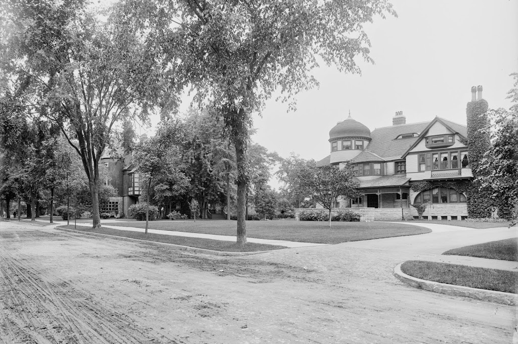
Several homes on Maple Street in Springfield, around 1905. Image courtesy of the Library of Congress, Detroit Publishing Company Collection.

222_1905c-loc

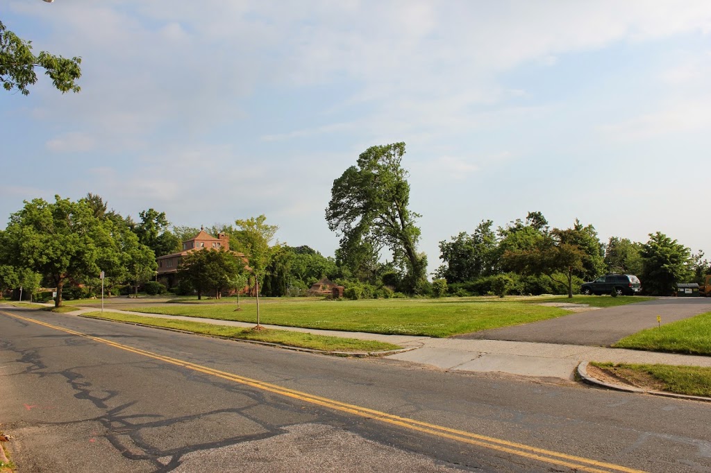
The same view in 2014:

222_2014

Around the turn of the last century, Maple Street was one of the best places in Springfield to live. This side of the street was particularly desirable, because of the view looking toward downtown Springfield and across the Connecticut River. Today, that isn’t the case. Although the view is still there, it is no longer one of the city’s premier residential areas, and the two mansions in the first photo no longer exist.

Located directly across the street from the former MacDuffie School campus, this area was right in the path of the June 1, 2011 tornado that tore across western Massachusetts. These houses, however, were gone long before then.  The one on the right was at the time the home of businessman and city library president Nathan D. Bill, and was built in the 1880s as the Andrew Fennessy House. It was destroyed in a suspicious fire in 1969, after having been vacant for several years. Today, only the concrete driveway is still there, and can be seen better on Google Maps. The house just beyond it was built in 1882 and belonged to Walter H. Wesson, the son of Daniel Wesson, co-founder of Smith & Wesson. In 1982, this historic house was also heavily damaged in a fire, and was subsequently demolished.

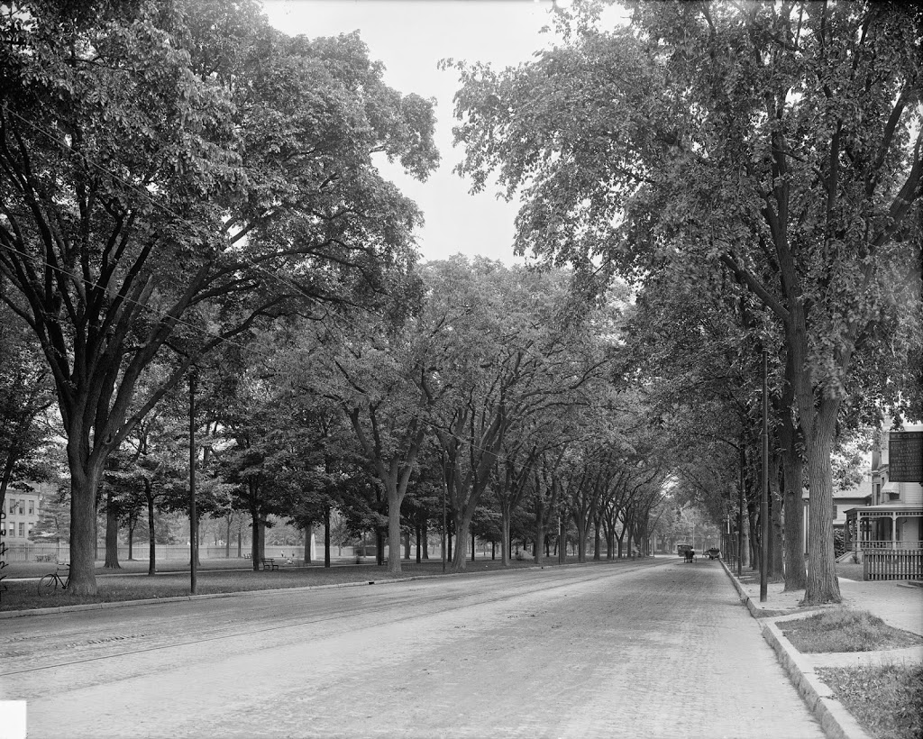
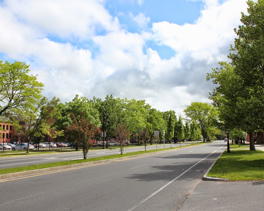
State Street from Elliot Street, Springfield Mass

The view looking east on State Street from near the intersection of State & Elliot, around 1908. Image courtesy of the Library of Congress, Detroit Publishing Company Collection.

215_1908c-loc

The view in 2015:

215_2015

As with the previous post, State Street in Springfield looks very different before and after Dutch Elm Disease.  However, far more has changed than just that.  This stretch of State Street, leading up the hill to the Armory, was once predominantly residential, mostly single-family homes.  Some of these historic homes are still here, and for the most part have been converted to commercial use.

The present-day photo actually appears to be a few steps ahead of where the 1908 photo was taken; the pillars on the extreme left-hand side of the 1908 photo appear to be those of the rectory of St. Michael’s Cathedral, which is directly across Elliot Street from the courthouse.  Barely visible through the trees in the left-center of the photo appears to be the Alexander House, which was built in 1811.  It is one of Springfield’s oldest existing buildings, although the construction of the federal courthouse, which now occupies the space along State Street between Elliot and Spring Streets, required it to be moved around the corner to a new location on Elliot.  However, the architect of the courthouse designed the building around the two massive trees that once stood next to the Alexander House, and one of the trees is visible on the left-hand side of the 2015 photo.  The trees are almost certainly there in the 1908 photo as well, but it’s hard to pick them out among all of the other foliage.  One other landmark that exists in both photos is the entrance to the Armory grounds at Byers Street; the gates are barely visible in the distance on the left-hand side of State Street.

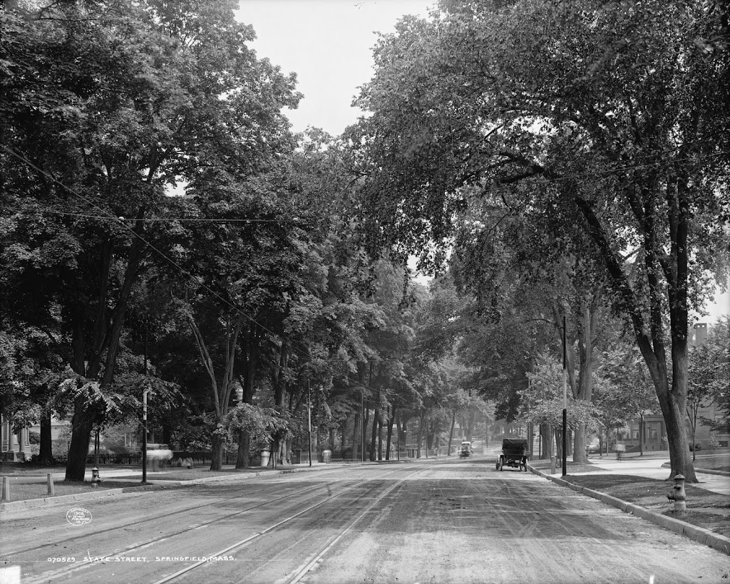
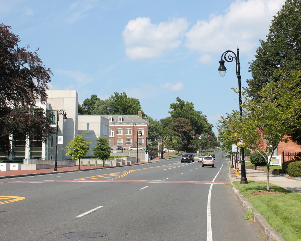
State Street from Walnut Street, Springfield Mass

The view looking east on State Street from the corner of State & Walnut, between 1900 and 1910. Image courtesy of the Library of Congress, Detroit Publishing Company Collection.

210_1900-1910-loc.tif

The same view in 2014:

210_2014

This was once a common scene in the towns and cities of New England: streets lined with stately elms that formed almost a tunnel over the road with their branches.  However, within a few decades of the first photo being taken, most of the large elms in the northeast, and eventually the entire country, were wiped out by Dutch Elm Disease.  Today, flora aside, a trip down State Street is very different from a century ago; instead of single-family homes, the road is fronted primarily by apartment buildings and commercial developments, although the buildings on the far left that once made up part of the Springfield Armory are still there.

Springfield Public Library, Springfield Mass (3)

The newly-completed Springfield Public Library, around 1912. Image courtesy of the Library of Congress, Detroit Publishing Company Collection.

219_1912c-loc.tif

The building in 2014:

219_2014

Springfield’s current main branch of the public library system was opened on January 10, 1912, which is probably around the time that the first photo was taken. The Library of Congress data indicates that it was taken between 1900 and 1910, but obviously that is not the case. Regardless, not much has changed with this view, although the foreground is now a parking lot; in 1912, it was the front lawn of the Church of the Unity.

Springfield Public Library, Springfield Mass (2)

Springfield Public Library, around 1900-1910. Image courtesy of the Library of Congress, Detroit Publishing Company Collection.

218_1900-1910-loc.tif

The same view in 2014:

218_2014

Another view of the old library, which was built in 1871 and moved around 1910 in preparation for the construction of the new library, which sits on the same spot today.