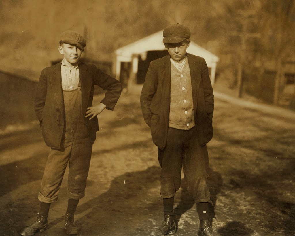
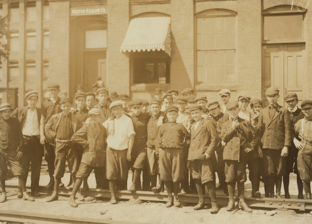
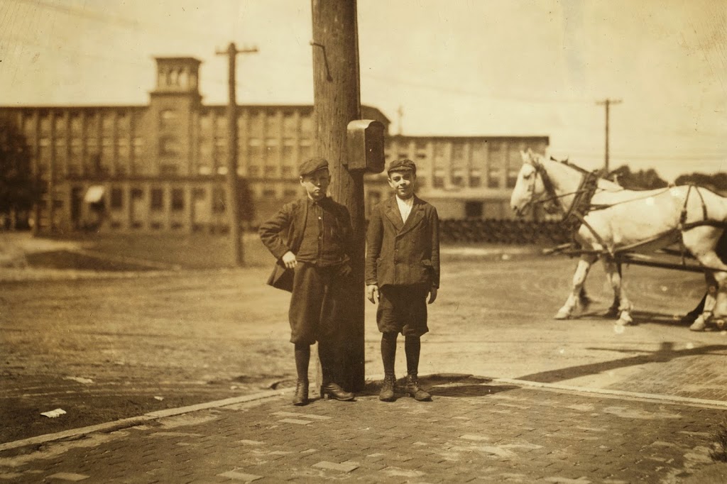
Great Boston Fire (7)

A view of Trinity Church on Summer Street in Boston, taken in 1860. Photo courtesy of Boston Public Library.

295_1860-2Bbpl

A photo from a similar angle, taken in the aftermath of the Great Boston Fire of 1872. Photo courtesy of Boston Public Library.

295_1872-2Bbpl

The scene in 2014:

295_2014

Taken from almost the same location as the photos in this post, and from the opposite direction of the ones here, these photos illustrate not only the damage after the Great Boston Fire, but also what the scene looked like before the fire.  As mentioned previously, the church was built in 1829, where Boston’s Downtown Crossing shopping district is located today.  The area was heavily damaged in the fire, and the church’s congregation relocated to the present-day Trinity Church at Copley Square later in the 1870s.  Today, nothing remains from the first two photos, and even the historic former Filene’s building in the center of the photo is a shell of its former self – literally.  The interior of the building was completely demolished, leaving only the facade as seen in the photo.  As evidenced by the construction work in the photo, the renovation work is ongoing as of July 2014.

Copp’s Hill Burying Ground, Boston

Copps Hill Burying Ground, around 1904. Image courtesy of the Library of Congress, Detroit Publishing Company Collection.

Cemeteries

The cemetery in 2014:

267_2014

It’s almost a little eerie to see how little the cemetery has changed in the past 110 years.  Many of the headstones are even still tilted the same way as they were in 1904, and a few of the trees are still there; the tall, skinny tree in the 1904 photo just to the left of the corner of the building in right-center appears to be the same one that is there today.

The cemetery is located just up the hill from Old North Church, and is a stop on the Freedom Trail in Boston’s North End.  Although it doesn’t have as many famous interments as the Granary Burying Ground, there are still some notable people buried here, including Puritan ministers Increase and Cotton Mather, and Edmund Hartt, a shipbuilder whose most famous work, the USS Constitution, still sits right across the harbor from here.

Scollay Square, Boston

Scollay Square in Boston, around 1906. Image courtesy of the Library of Congress, Detroit Publishing Company Collection.

266_1906c-loc

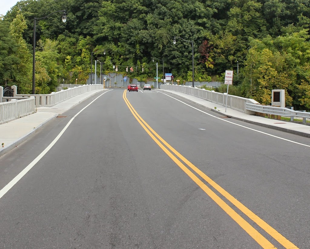
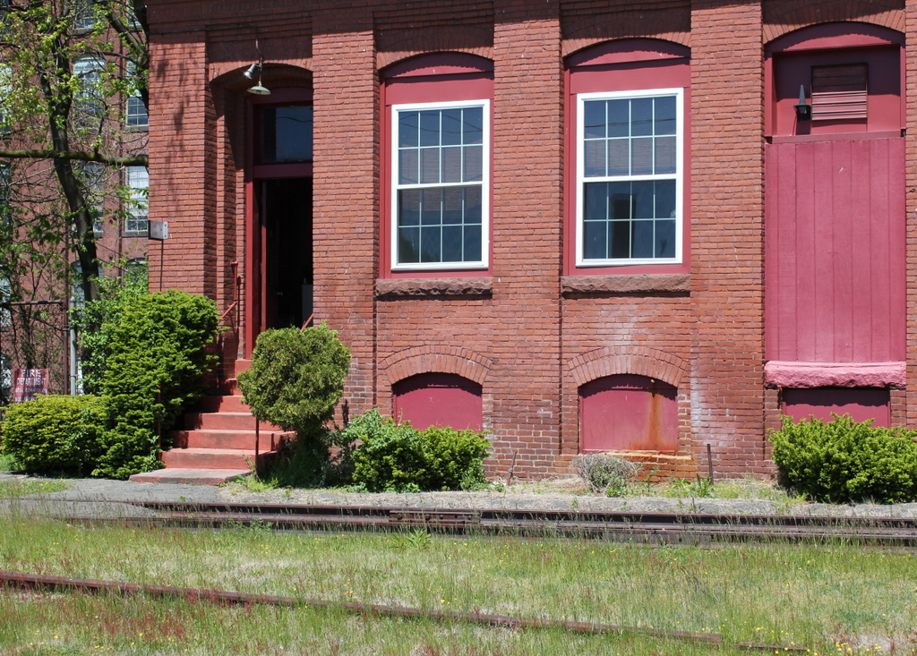
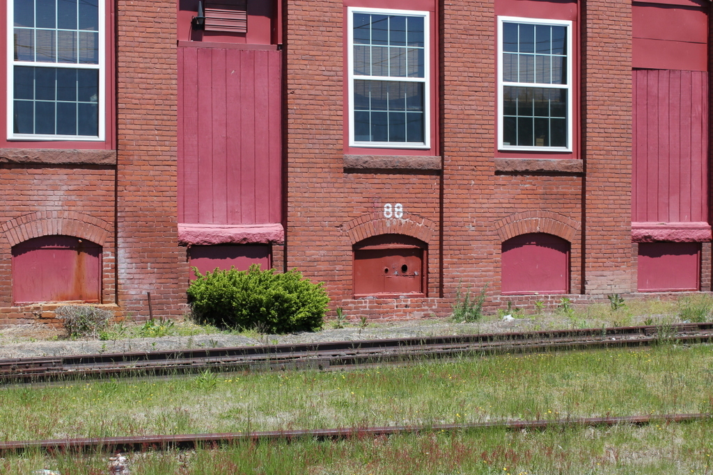
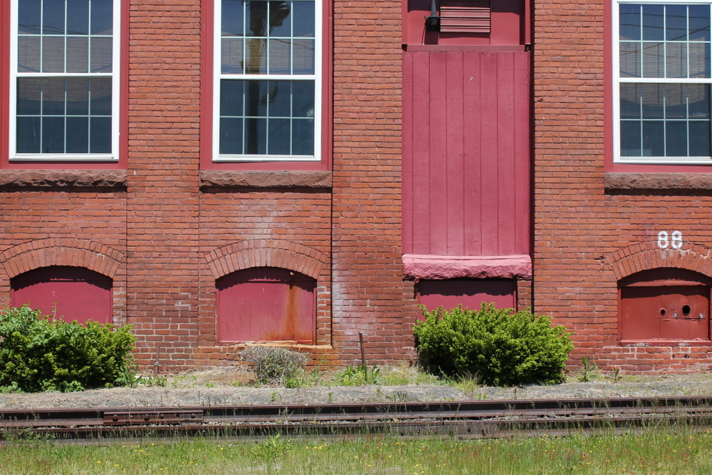
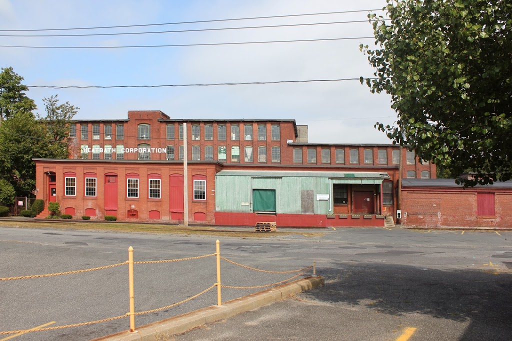
The same scene in 2014:
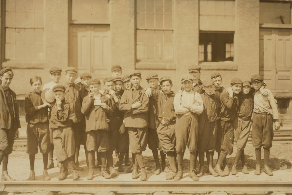
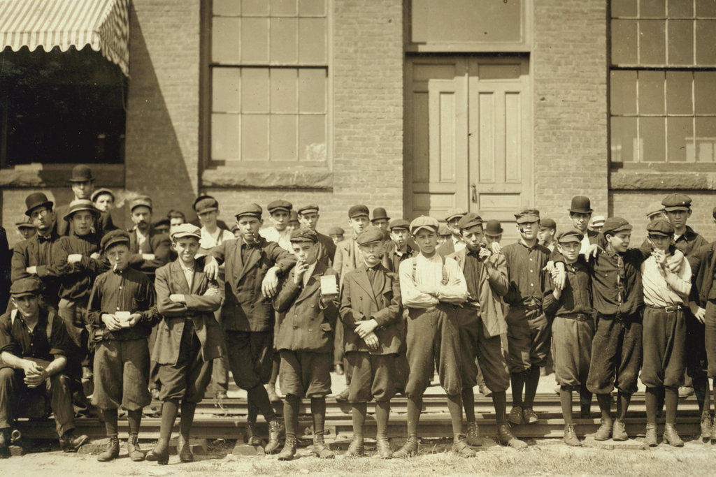
Scollay Square is one of the more dramatic, and perhaps infamous examples of urban renewal in Boston.  Located at the corner of Tremont and Court streets, it was a busy commercial center for several centuries.  However, by the 1950s it was a seedy neighborhood with low-income residents, so the entire area was demolished in the 1960s and replaced with Government Center, which included City Hall and City Hall Plaza (just to the right of where the 2014 photo was taken).

The two small buildings in the center of the square in the 1906 photo are two different subway stations; the one in the foreground is Court Street on the East Boston Tunnel (present-day Blue Line), and the larger, more ornate one in the background is the Scollay Square station on the Tremont Street Subway (today’s Green Line).  This was the original terminus of the East Boston Tunnel when it opened in 1904; it extended from Maverick Station in East Boston, and ran under Boston Harbor and up State Street to here.  In 1916, the line was extended to Bowdoin, and the Court Street Station was closed, and a new station was opened under the Scollay Square station; not surprisingly, it was called Scollay Under.

Today, very little remains from the 1906 photo.  Only two buildings survive; the one on the far left (modern-day Bank of America), and the Suffolk County Courthouse, visible in the distance in left-center (and no longer visible from this spot today, although it’s still there).  Even the subway station has changed; the Blue and Green lines still meet here, but it is now the Government Center station, and the entrance is further to the right, at City Hall Plaza.  The station itself was reconstructed in the 1960s, and is currently being reconstructed again.  It was closed earlier this year, and is not scheduled to reopen until 2016.

Arlington Street Church, Boston

Arlington Street Church in Boston, around 1862.  Photo taken by J.J. Hawes, courtesy of Museum of Fine Arts, Boston.

ArlingtonStChurch_ca1862_byJJHawes_MFABoston

The church around 1904. Image courtesy of the Library of Congress, Detroit Publishing Company Collection.

264_1904c-loc

The church in 2014:

264_2014

For the first two centuries of Boston’s history, this location was right on the waterfront. However, as the city grew in population, they needed more land, so by the 1850s, the city started filling in the Back Bay, adding new real estate along the Charles River from the Public Garden (seen in the lower right of the 1904 photo) to the Kenmore Square area.  The Arlington Street Church, completed in 1861, was one of the first buildings to be constructed on the newly-created land.  The first photo shows the neighborhood just as it began to be developed; plenty of empty land beyond the church is visible in the space between it and the apartment building to the right.  Today, it remains an active church, and aside from no longer having ivy on its walls, it looks very much the same as it did 110 years ago.

South Station, Boston

South Station around the time that it opened in 1899. Image courtesy of the Library of Congress, Detroit Publishing Company Collection.

263_1899c-loc

The same view around 1905, after the construction of the Atlantic Avenue Elevated. Image courtesy of the Library of Congress, Detroit Publishing Company Collection.

Transportation

South Station in 2014:

These three photos reveal the changes that have taken place here at South Station over the past 115 years.  While the building itself (or at least most of it) has remained essentially the same, its surroundings have continually changed.

Before 1899, four different railroads had terminals in the general vicinity of the present-day station.  To make things simpler, South Station was built, and all four lines were rerouted to it.  A few years later, in 1901, the Atlantic Avenue Elevated was built, as seen in the second photo.  The rapid transit line included a station at South Station, which can be seen on the far right of the 1905 photo.

The third photo shows the result of changes in the way people travel; the Atlantic Avenue Elevated closed in 1938, and was demolished four years later.  Even South Station was seeing a severe drop in passengers in postwar America, as cars became the primary method of travel.  However, Boston’s colonial-era street network was not particularly accommodating to large number of cars, so the Central Artery was built in the 1950s.  Most of the Central Artery was elevated, but it was put underground for a few blocks near South Station, and was known as the Dewey Square Tunnel.

The Dewey Square Tunnel turned out to be a foreshadowing of things to come; part of Boston’s infamous Big Dig involved putting the entire Central Artery underground.  Today, the tunnel is still there, directly underneath where I was standing when I took the photo.  It is the only existing part of the Central Artery; the remainder of the 1950s-era expressway was demolished upon completion of the Big Dig.

Today, South Station has been trimmed a bit – notice that the facade on both sides is shorter than in the first two photos.  This was a result of demolition in the 1960s, at a time when many railroads were cutting back or eliminating passenger service.  However, today South Station is a busy transportation center again – it is the busiest railroad station in New England and the sixth busiest in the country, and it is the northern terminus of the Northeast Corridor, the busiest rail line in the country.

Park Street, Boston

Looking up Park Street from Tremont Street, around 1906. Image courtesy of the Library of Congress, Detroit Publishing Company Collection.

262_1906c-loc

Park Street in 2014:

262_2014

Not much has changed on Park Street in the past century. Boston Common is still there, fence and all. The Massachusetts State House still dominates the top of Beacon Hill, and to the right Park Street Church still looks almost the same. Even the storm drain and manholes are still there.