State Street from Main Street, Hartford, Connecticut

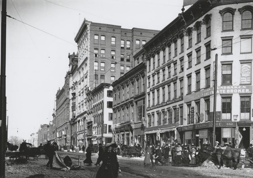
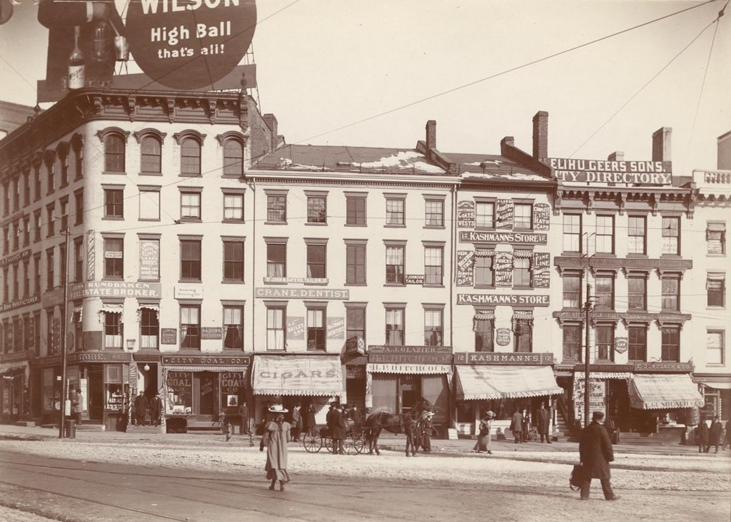
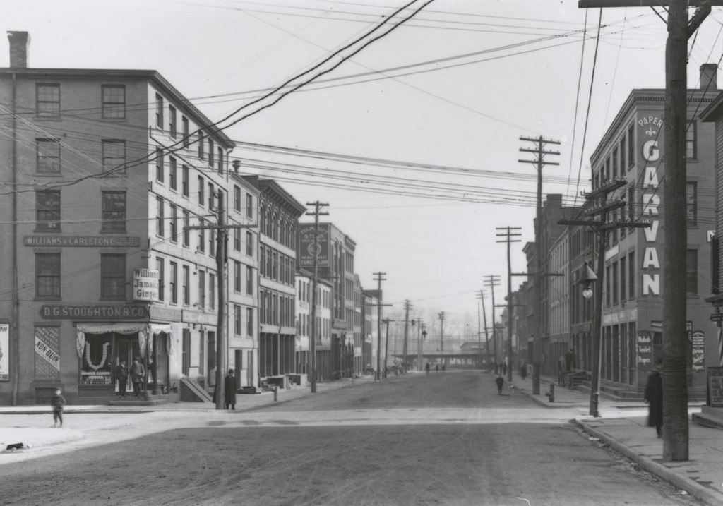
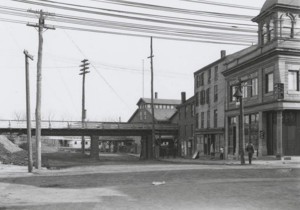
Looking east on State Street from Main Street in Hartford, on April 22, 1906. Image courtesy of the Connecticut State Library.
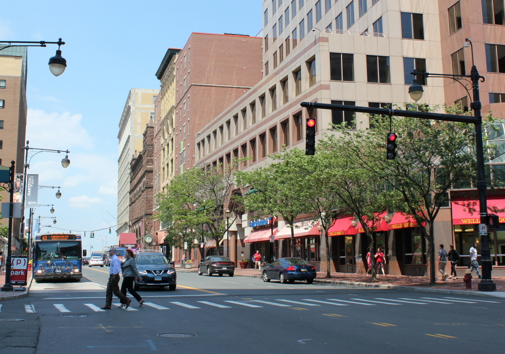
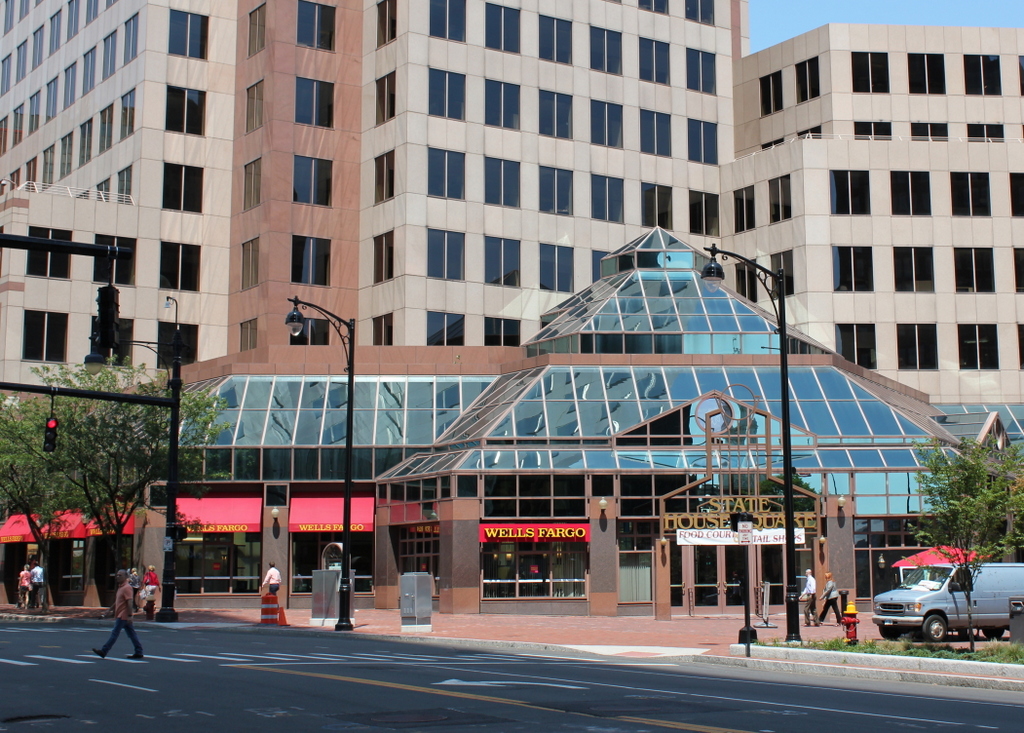
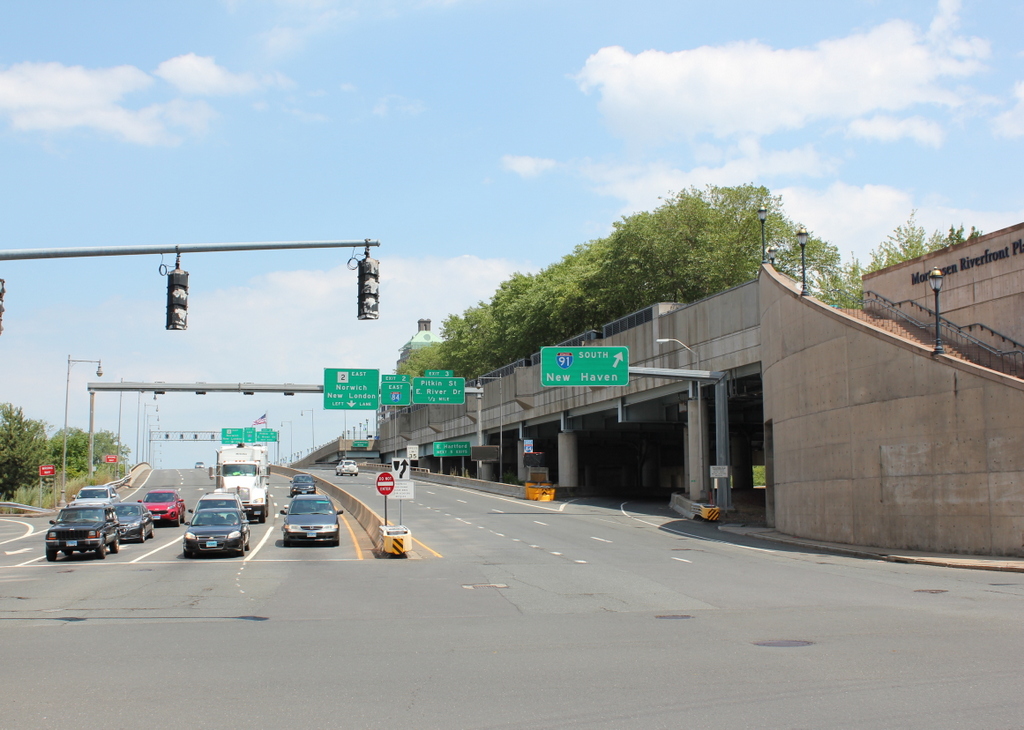
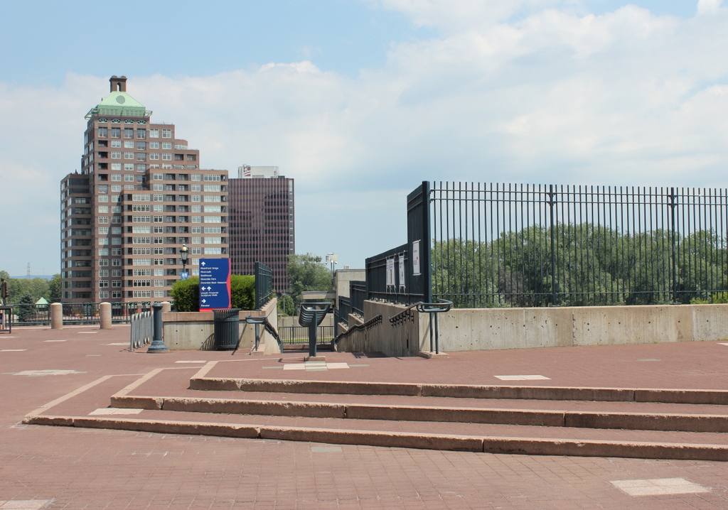
State St. east of Main

The scene in 2016:

1001_2016
The 1906 photo here shows several prominent buildings at the western end of State Street, including the Old State House on the far right and the post office building next to it. On the left side of the street, the long four-store building near the foreground was the United States Hotel. It was built in the early 1800s, and for much of the century it was one of the finest hotels in the city. The eastern part of the building was demolished in the 1890s to build the First National Bank Building, which was completed in 1899 and dominates the left side of the first photo. By the time this photo was taken in 1906, the rest of the hotel was still standing, but had been converted into offices in 1901.

Built in 1796, the Old State House was probably the oldest building in the first photo, and today it is the only one that has survived relatively intact. The old United States Hotel building was demolished in 1924, and the post office followed in 1933. In the early 1980s, the entire left side of the photo was redeveloped as State House Square, and the only remnant of the old commercial buildings here is the First National Bank Building, whose facade was incorporated into the construction of the modern office building.

Main Street, Hartford, Connecticut (2)

Looking north on Main Street from State Street in Hartford, on January 30, 1904. Image courtesy of the Connecticut State Library.

East side of Main St. from corner State to Morgan

Main Street in 2016:

1000_2016
These photos were taken from nearly the same spot as the ones in the previous post, just looking a little further to the left. This view shows the commercial development along the east side of Main Street north of State Street, including the mid-19th century Exchange Block on the right. Beyond it, there are several other buildings from around the same time period, all of which have long since been demolished. The site of these buildings has since been redeveloped into State House Square, which now stands on the right side of the photo.

Most of the other buildings from the first photo have since been demolished, but a few are still standing. The tall building in the center of the first photo was built only a few years earlier, in 1898, and was the home of the Sage-Allen department store. The company closed in 1994, and for almost a decade the building’s fate was in limbo, but its facade was ultimately preserved and incorporated into a new development.

Another prominent building, which has survived more or less intact from the first photo, is the Cheney Building at the corner of Temple Street, just beyond the Sage-Allen Building. This brownstone building was designed by prominent architect Henry Hobson Richardson and completed in 1876, and for many years it was the Brown-Thomson department store. A third department store, G. Fox, was also located along this section of Main Street. Their building, barely visible in the first photo beyond the Cheney Building, burned in 1917, and was replaced with their much larger flagship store, which is still standing in the distance of the 2016 photo.

Exchange Block, Hartford, Connecticut

The Exchange Block at the northeast corner of Main and State Streets, on December 6, 1903. Image courtesy of the Connecticut State Library.

999_1903-12-06 csl

The scene in 2016:

999_2016
This location at the corner of Main and State Streets, directly opposite the Old State House, has long been an important commercial center for the city. Known as the Exchange Block, it dates back to the 1830s, when it replaced an earlier building destroyed in a fire. By 1903, when the first photo was taken, the signs here indicate a wide range of businesses and professional offices, including a coal company, cigar store, clothing store, tailors, lawyers, a real estate broker, a dentist, and a physician.

The oldest portion of the building appears to be the section in the center, with Greek Revival architecture that likely dates back to the 1830s. The left side of the building has more of an Italianate design, and was probably built or renovated around the 1850s or 1860s. This part of the building was demolished in the 1920s, and everything else from the first photo was gone sometime between the 1930s and 1984, when construction began on State House Square, the office building that now stands on the site here.

Ferry Street, Hartford, Connecticut

Looking east on Ferry Street from Front Street (now Columbus Boulevard) around 1903-1906. Image courtesy of the Connecticut State Library.

Street scene

The scene in 2016:

998_2016
As the present-day scene shows, Ferry Street no longer exists, but it once extended east from Front Street to Commerce Street, at the banks of the Connecticut River. Because of its proximity to the Connecticut River and the railroad tracks, this section of Hartford was largely industrial. There were some tenement houses on this street, but in the days before zoning laws they were interspersed between stables, storehouses, foundries, and related businesses. The most visible of these from the first photo is the building on the left, which according to the sign was a “carriage and wagon factory,” with “horseshoeing and general blacksmith” work done here as well.

Unfortunately for whoever owned that business, carriage and wagon making, horseshoeing, and blacksmith work were all on their way to becoming obsolete by the time the photo was taken. Many of these buildings were probably damaged or destroyed some 25 years later during several floods in the 1930s, which caused considerable damage in this neighborhood and furthering its decline. Many of the older buildings in the first photo were probably gone by the 1950s, but any that were left would have been demolished in the Constitution Plaza urban renewal project, which was completed in the 1960s. The entire neighborhood was leveled and rebuilt, and some streets, such as Ferry Street, were completely eliminated in the process. Today, the One State Street office building is located where Ferry Street used to be.

State Street from Columbus Boulevard, Hartford, Connecticut

Looking east on State Street from Front Street (now Columbus Boulevard) in Hartford, on November 12, 1905. Image courtesy of the Connecticut State Library.

State St. east of Front

State Street in 2016:

997_2016
This same intersection was previously seen in other posts, facing north and west from here. This scene is also a block west of the photos in the previous post, which show the same elevated railroad tracks that are visible in the distance here. The first photo shows State Street facing toward the Connecticut River, as it appeared at the turn of the last century. State Street begins two block west of here at Main Street, at the commercial center of the city, with prominent banks, insurance companies, hotels, and government buildings nearby. However, as one moved further down the hill toward the river, like in this photo, the street became much less glamorous, with warehouses and other industrial uses along the railroad tracks and riverfront.

Photographer William H. Thompson captured scenes like this, using his camera to document the areas of the city that did not appear on postcards or in tourist publications. Because of this, we are able to see the largely immigrant and working-class eastern section of the city, essentially all of which was demolished in the late 1950s for the Constitution Plaza urban renewal project. Around the same time, in 1958, the Founders Bridge opened, extending State Street across the Connecticut River to East Hartford. Just beyond this intersection, it crosses over Interstate 91, which was built along the river a few years later. Just to the right in the 2016 scene is the Mortensen Riverfront Plaza, which was built above I-91 and provides access to the parks along the river.

State Street from Commerce Street, Hartford, Connecticut

Looking east on State Street toward the Connecticut River, from the corner of Commerce Street, on November 19, 1905. Image courtesy of the Connecticut State Library.

Section of State St. from Commerce St. (East)

The scene in 2016:

996_2016
It was hard to pinpoint the exact location of this photo, because Interstate 91 has completely obliterated the old street layout along the Connecticut River. The highway now runs directly through the 1905 scene here, but the present-day photo was taken from the plaza above the highway. So, it is the same spot as the first photo, just elevated probably about 20-30 feet.

Today, State Street extends across the Founders Bridge into East Hartford, and is a major thoroughfare in and out of the city. However, at the turn of the last century it ended here at the river, in much more humble surroundings than the busy commercial center just a few block away at the other end of the street. In the foreground is a bridge for the railroad tracks that ran along the Connecticut River, and just beyond it, in the center of the photo, was a warehouse for the Hartford & New York Transportation Company, a steamboat line that operated on the river. One of the boats is partially visible in the distance at the foot of State Street, at the city’s steamboat landing.

Steamboats have long since disappeared from the Connecticut River, along with all of the buildings here. Some were probably damaged or destroyed in the major floods of the 1930s, but any that did survive would have been gone by the 1960s, when I-91 was built through here. Today, this plaza above the highway provides riverfront access for pedestrians, and also connects to the walkway on the Founders Bridge. The only surviving remnant from the first photo is the railroad, which is still active but now mostly hidden beneath the highway.