Lost New England Goes West: Palace Hotel, San Francisco

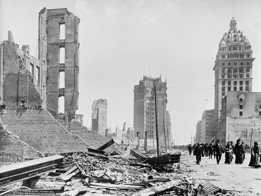
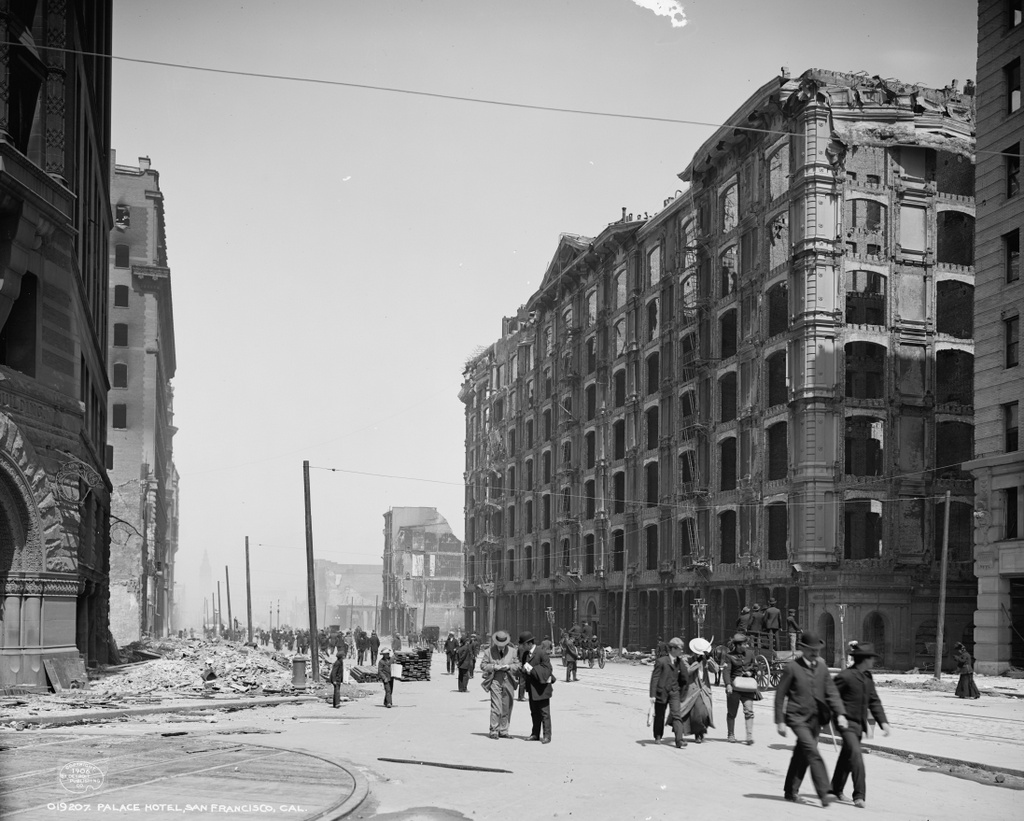
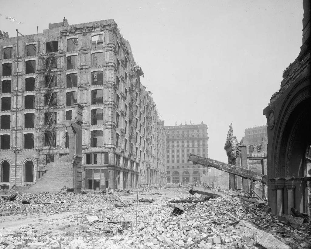
Looking north on New Montgomery Street from near Mission Street in San Francisco, in the aftermath of the April 18, 1906 earthquake. Image courtesy of the Library of Congress, Detroit Publishing Company Collection.

871_1906c loc

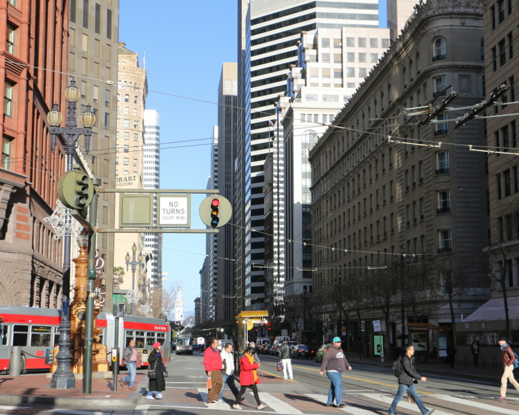
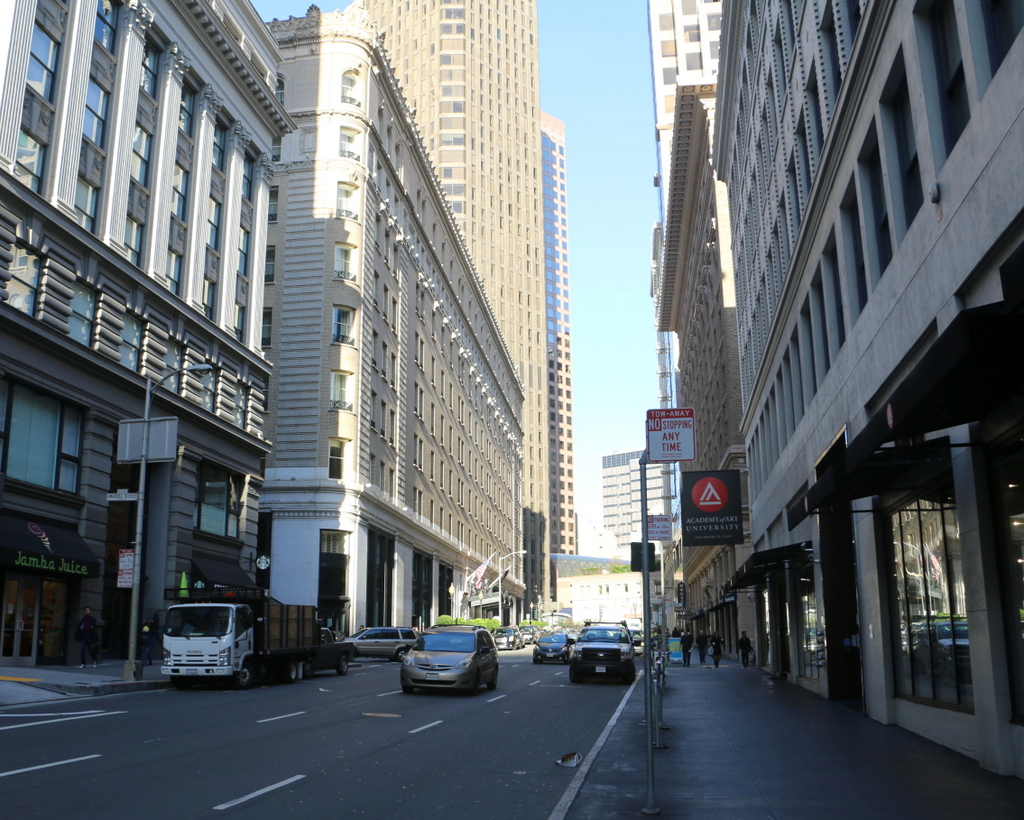
The view in  2015:

871_2015
The Palace Hotel, seen on the left side of the photo, opened in 1875 as the city’s largest hotel, with seven floors and 755 guest rooms. It featured such modern conveniences as bathrooms in every guest room and hydraulic elevators, and it was also designed to withstand both earthquakes and fires. To prevent earthquake damage, the brick exterior walls were two feet thick and reinforced with iron bands around the building, and it featured modern firefighting equipment such as hydrants around the building and a 358,000 gallon cistern in the basement.

The earthquake reinforcements apparently helped, because the building survived it with minor damage while, as the first photo shows, most of its neighbors were leveled. However, the earthquake started a number of fires that soon spread throughout the city. Although the hotel’s designers had planned well for a fire emergency, the staff was poorly trained and the city’s fire department had limited resources and manpower, so ultimately the fires reached the hotel, which was quickly gutted by the flames.

In the aftermath of the disaster, the hotel was rebuilt on the same site, and it is still standing today. It reopened in 1909, and like its predecessor it hosted a number of prominent guests. Many US presidents have stayed here, with the most notable presidential visit being Warren Harding, who died here on August 2, 1923 during a visit to the west coast. Several hours later, Calvin Coolidge was inaugurated as president on the other side of the continent, in the parlor of his father’s house in Vermont.

This post is part of a series of photos that I took in California this past winter. Click here to see the other posts in the “Lost New England Goes West” series.

Lost New England Goes West: Union Square, San Francisco

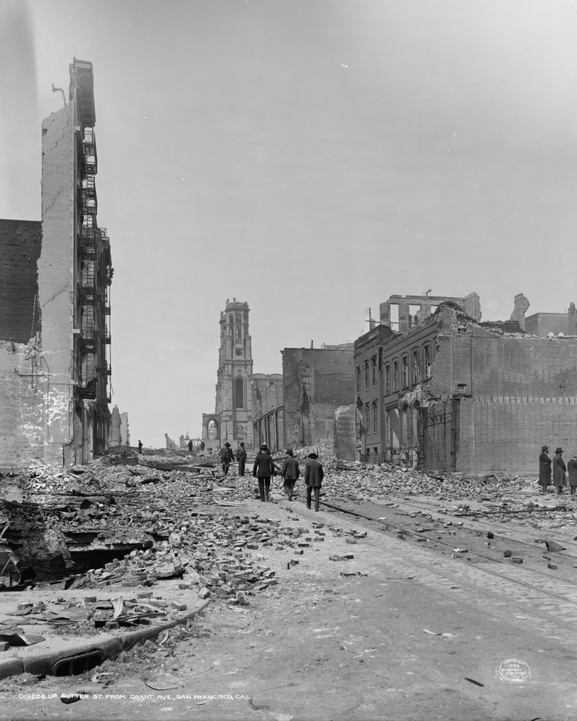
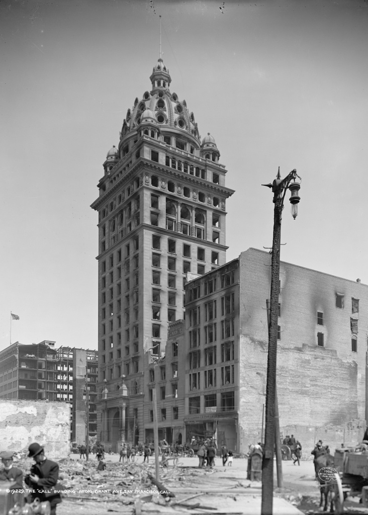
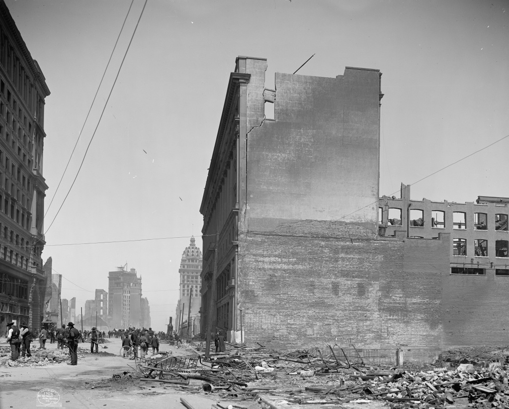
Union Square, seen from the corner of Post and Stockton Streets shortly after the April 18, 1906 earthquake. Image courtesy of the Library of Congress, Detroit Publishing Company Collection.

869_1906c loc

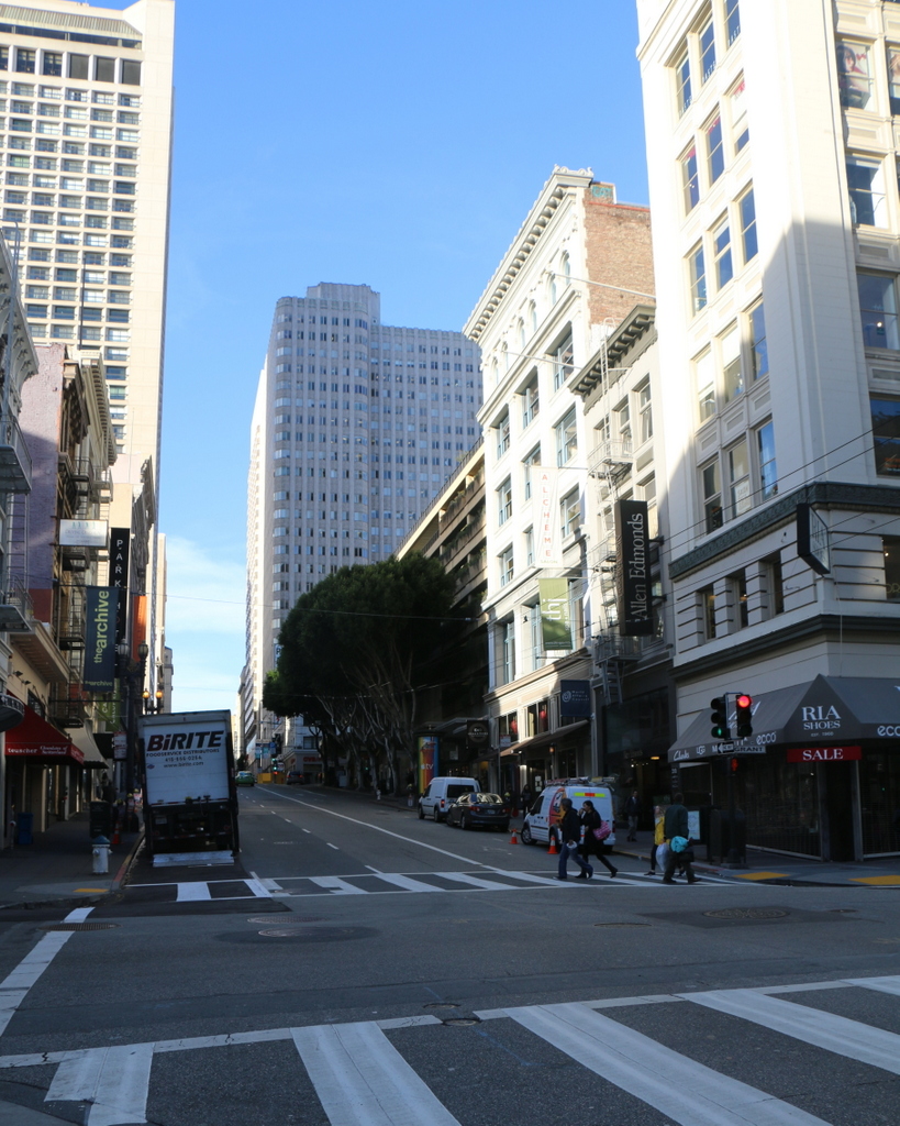
Union Square in 2015:

869_2015
Today, Union Square is one of the premier shopping areas in San Francisco, but 110 years ago it was, like the rest of the city, covered in earthquake debris and surrounded by burned-out buildings. The most prominent building in the first photo is the St. Francis Hotel, on the right side of the scene. Completed only two years earlier, the building survived the earthquake itself with minimal damage, but a combination of damaged firefighting infrastructure and poor city leadership allowed fires to spread throughout much of the city. The hotel was completely gutted by the fire, as the first photo shows, but it remained structurally sound. Soon after the photo was taken, a temporary hotel was built in the middle of the square, where it housed guests until the burned-out hotel reopened a year and a half later. Now known as the Westin St. Francis, it has been expanded several times, and today it still stands overlooking Union Square.

Another Union Square landmark from the first photo is the Dewey Monument, located in the center of the square. It was designed by sculptor Robert Aitken, whose later works included the pediment atop the US Supreme Court Building, and it was dedicated in 1903 by Theodore Roosevelt, in honor of Spanish-American War hero Admiral George Dewey and recently-assassinated President William McKinley. The 85-foot tall monument survived both the earthquake and the subsequent fires, and it is still standing in Union Square today, although it is now partially hidden by the palm trees around it.

This post is part of a series of photos that I took in California this past winter. Click here to see the other posts in the “Lost New England Goes West” series.
Willow Street, Springfield, Mass

Looking north on Willow Street in Springfield, around 1892. Image from Picturesque Hampden (1892).

856_1892c picturesquehampden

Willow Street in 2023:

When the first photo was taken, the building on the right was the headquarters of the Milton Bradley Company, which had been founded in Springfield in 1860 as a lithograph company. Its owner, Milton Bradley, soon switched to board games, beginning with The Checkered Game of Life in 1860. By around 1880-1881, the company built this factory on Willow Street, as seen on the right side of the photo. This is the oldest part of the facility, which was soon expanded as demand increased. By the early 1900s, the company owned the entire block between Park, Willow, and Cross Streets, with its buildings almost completely surrounding a central courtyard.

Aside from Milton Bradley, this section of downtown Springfield was once home to several other factories. On the other side of Cross Street from the Milton Bradley factory was Smith & Wesson, whose factory also occupied an entire block. None of the buildings are visible in the first photo, but the brick and concrete building just beyond the Milton Bradley building was built by Smith & Wesson in the early 1900s.

Today, all of the houses on the left side of the photo are gone, and the lots are now used for parking. Smith & Wesson moved its factory to a different location in Springfield in the mid-1900s, and around the same time Milton Bradley moved to nearby East Longmeadow. Most of the Smith & Wesson buildings are gone now, except for the one in the distance of the 2015 scene. The Milton Bradley buildings are still standing, though, and along with the Smith & Wesson building they have since been converted into apartments.

Elliot Street, Springfield, Mass

Looking down Elliot Street from Edwards Street, around 1892. Image from Picturesque Hampden (1892).

855_1892c picturesquehampden

The view in 2015:

855_2015
Most of the views of Springfield featured in Picturesque Hampden almost 125 years ago are now drastically changed, but thankfully very little is different about this view of Elliot Street. Aside from the one on the far left, all of the other buildings in this scene are still standing. The most prominent is the North Congregational Church, which was designed by noted architect Henry Hobson Richardson and completed in 1873. It was one of his earlier works, and is one of two of his buildings, along with the Hampden County Courthouse, that is still standing in Springfield. To the left is the William Mattoon House, which was built around 1870 and is the oldest building in the scene. It was owned by William Mattoon, who also owned the land behind it that was later developed as Mattoon Street. To the right in both photos is the duplex at 95-99 Elliot Street, which was built in 1887, only a few years before the first photo was taken. Today, all of these buildings have been restored and are part of the Quadrangle-Mattoon Street Historic District on the National Register of Historic Places.

Olivet Church, Springfield, Mass

The Olivet Congregational Church on State Street in Springfield, around 1892. Image from Picturesque Hampden (1892).

The scene in 2015:

854_2015
For the first two centuries of Springfield’s history, most of the development was confined to the downtown area along Main Street, and it was not until the first half of the 19th century that other parts of the town began to see significant growth. Here on the “Hill” section of town, expansion of the Armory had spurred development along this part of State Street, and by the 1830s there was sufficient demand for a church.

The Fourth Congregational Church was established in 1833, and a year later they built this church here on State Street, directly opposite the Armory.  The building was extensively remodeled in 1854-1855, giving it the appearance as shown in the first photo, and it was renamed Olivet Congregational Church. By 1884, King’s Handbook of Springfield records that the church membership was up to 340, with plans to further expand the building. I don’t know whether the additions were ever carried out, but the church remained here for about 30 more years, until it was demolished to build Commerce High School around 1915.

Today, the 101 year old Commerce High School building is still used as a school.  The only building still standing from the first photo is the three story brick one on the left. It is visible just beyond the church in the first photo, with a three-story porch on the side.

Chestnut Street, Springfield, Mass

Looking south on Chestnut Street in Springfield, around 1892. Image from Picturesque Hampden (1892).

846_1892c picturesquehampden

Chestnut Street in 2015:

846_2015
This section of Chestnut Street runs atop a hill overlooking downtown Springfield, and in the first half of the 19th century it became home to some of the city’s wealthiest residents. The two houses in the foreground are the George Merriam House and the George Bancroft House, both of which have been featured in previous posts. The Merriam house on the left side was owned by George Merriam, who along with his brother Charles founded Merriam-Webster. The house in the center was owned by a series of prominent individuals, including George Bancroft, a historian and future Secretary of the Navy and Ambassador to the United Kingdom. Other owners included George Walker who was a prominent business executive, and William H. Haile, a politician who erved as Lieutenant Governor of Massachusetts from 1890 to 1892.

Today, all of these houses are gone. The only building that has survived from the first photo is Christ Church Cathedral, which is barely visible in the distance. The Merriam house was demolished around 1905 and two new houses were built on the lot, including the 1905 Kilroy House on the far left. The Bancroft house was demolished by 1933, when the D’Amour Museum of Fine Arts was built here, and the third house in the distance was also demolished in the early 20th century to build the church rectory, which is still standing today.