Samuel Bours House, Newport, Rhode Island

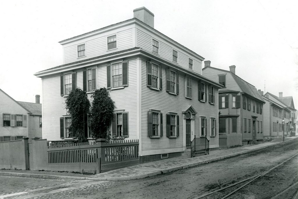
The house at 175 Spring Street, just south of Mill Street in Newport, around 1932. Image courtesy of the Providence Public Library.

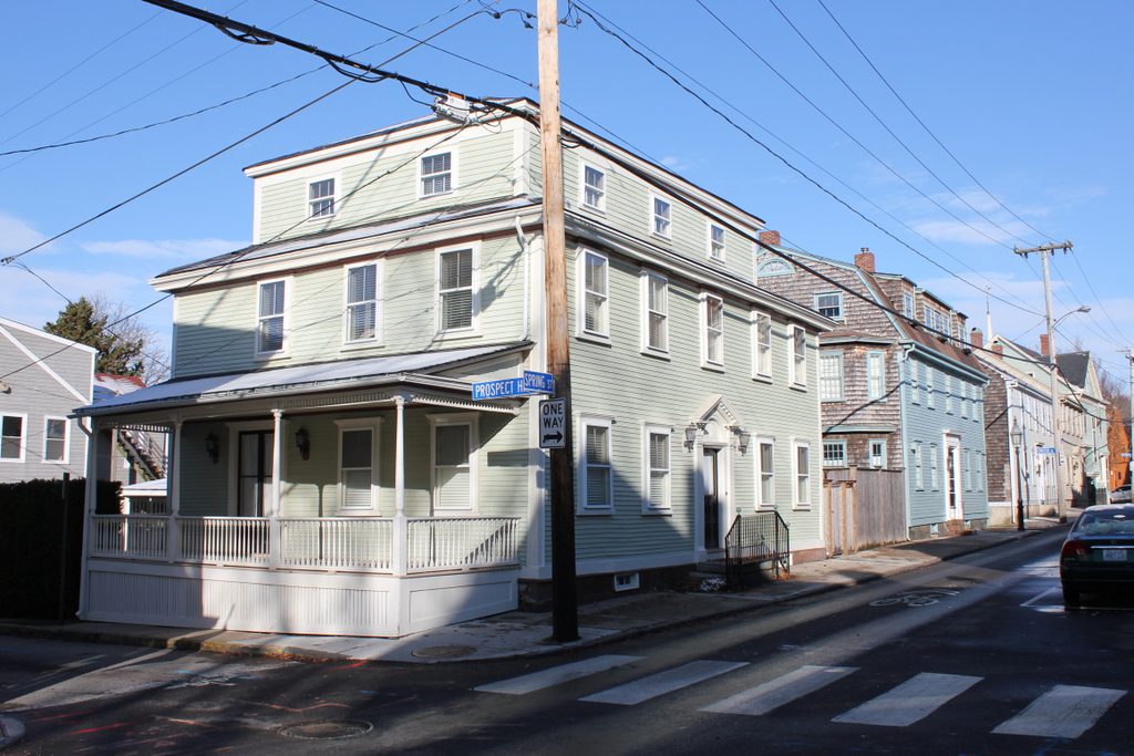
The scene in 2017:

The first photo shows a group of buildings on the west side of Spring Street, just south of the corner of Mill Street. Of these, the oldest might be the Jonathan Gibbs House, which was built around 1771 and still stands on the left side of the scene. However, its much larger neighbor in the center of the photo was probably built around the same time, and was definitely here by 1777, when it was owned by the merchant Samuel Bours. Its architecture is similar to many other colonial-era homes in Newport, with Georgian-style details and a gambrel roof, although it had a rather unusual main entrance, which was located on the side of the house instead of facing the street.

By the early 19th century, the house was owned by Samuel’s son, John Bours. This period coincided with the economic decline of Newport, though, and in subsequent years this former merchant’s house became the home of working class residents. The 1880 census shows two families living here, with carpenter George A. Brown living in one unit with his wife Mary and their son Orin, and florist Carl H. Jurgens living in the other unit with his wife Louise and three children.

The Brown family continued to live here in the house for many years, and the 1910 census shows George, Mary, and Orin all still living here. Orin was 39 years old and working as a mailman by this point, and he lived here with his wife Nellie and their four young children. The first photo was taken a little over 20 years later, in 1932. Nellie had died a year before, but Orin was still living here, and he also rented part of the house to Norwegian-born fisherman Henry Monsen and his wife Josephine.

Orin Brown subsequently remarried to his second wife, Fannie, and he lived here in this house until his death in 1953, at the age of 83. Then, in 1969, the house was purchased by the Newport Restoration Foundation, which also acquired the neighboring Jonathan Gibbs House in the same year. Also in 1969, the organization purchased the c.1811 Alexander Jack, Jr. House, which had previously stood on Levin Street. The house was moved to the corner of Spring and Mill Streets, adjacent to the Bours House, and is visible on the right side of the 2017 photo. All three of these houses were restored in the early 1970s, and they are now part of the Newport Historic District, which is a National Historic Landmark district.

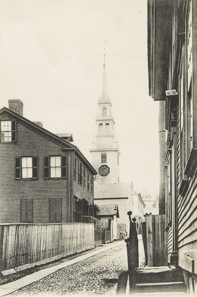
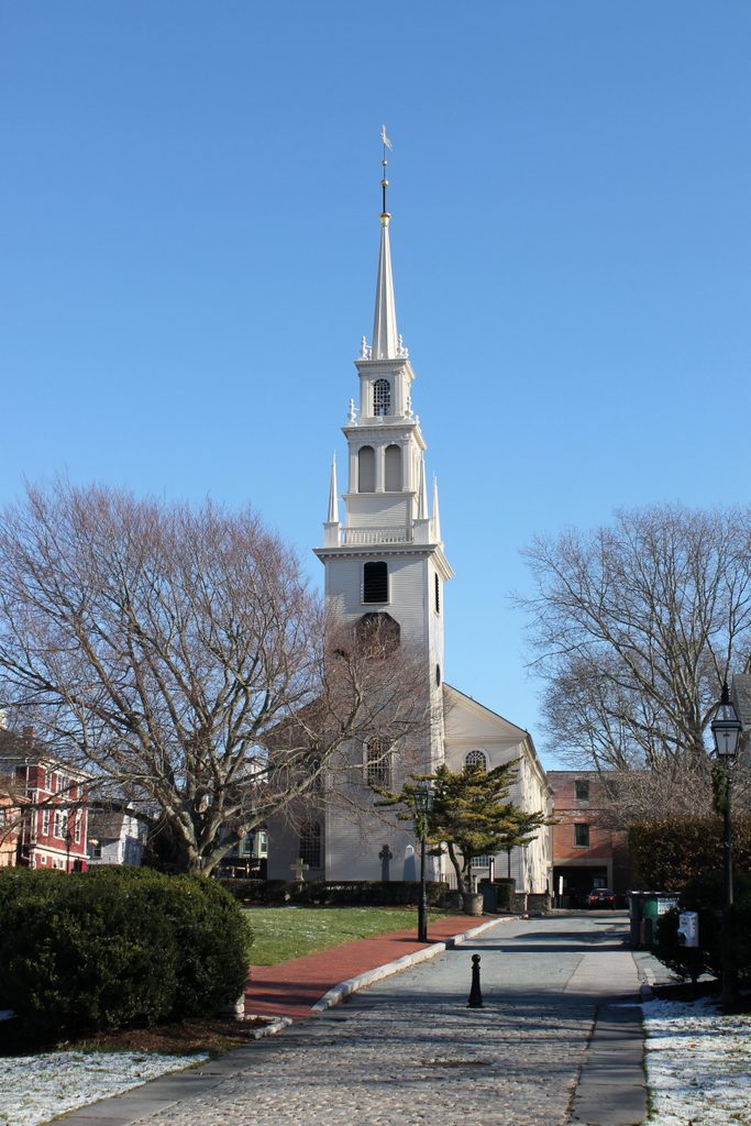
Spring Street from Church Street, Newport, Rhode Island

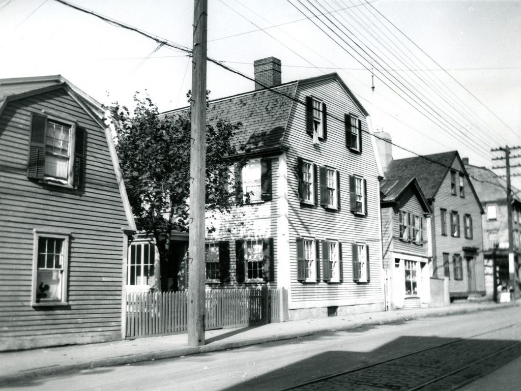
Looking north on Spring Street from the corner of Church Street in Newport, around 1887. Image courtesy of the Providence Public Library.

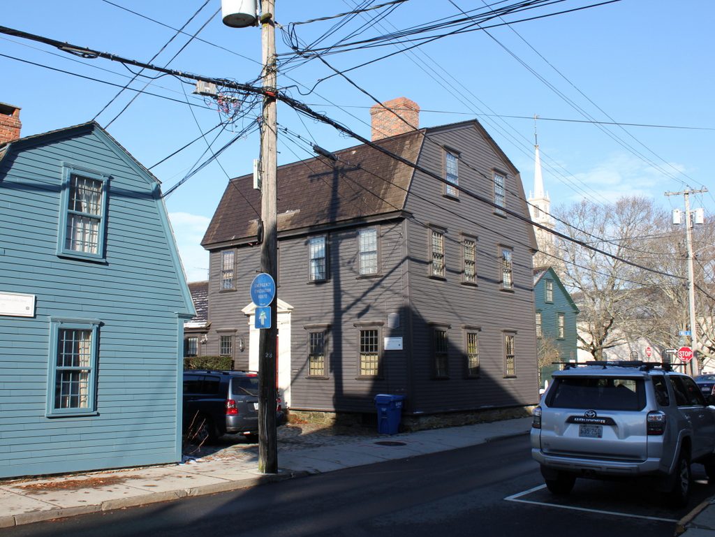
The scene in 2017:

These photos were taken directly across Spring Street from Trinity Church, and show the west side of the street, on the block between Church and Mary Streets. A small portion of the churchyard is visible on the far left side of the scene, with an assortment of commercial and residential buildings beyond it. Most of the buildings from the first photo are still standing today, with remarkably few exterior changes, but the one significant difference between the two photos is the building in the foreground, at the corner of Church Street. The first photo shows a colonial-era, gambrel-roofed house that was probably built in the early or mid-18th century. It was probably constructed as a house, but by the late 19th century it included a storefront on the Spring Street facade, which was occupied by the L. Schaefer shoe repair shop. However, the building was demolished sometime around the turn of the 20th century, when the present-day building was constructed on the site.

Further down the street, most of the buildings are still standing. Starting closest to the foreground is the blue and white John Preston Mann House, which was built around 1827. Next to it, with the mansard roof and two-story bay window, is the William B. Sherman House, which was built around the 1860s and is now the Outlook Inn. Further in the distance, barely visible in both photos, is the gambrel-roofed Samuel Barker House. This elegant house was built around 1714, and stands as probably the oldest recognizable building in this scene, predating most of its neighbors by more than a century. Today, all of these buildings, including the turn-of-the-century corner building, are now contributing properties in the Newport Historic District, which was designated as a National Historic Landmark in 1968.

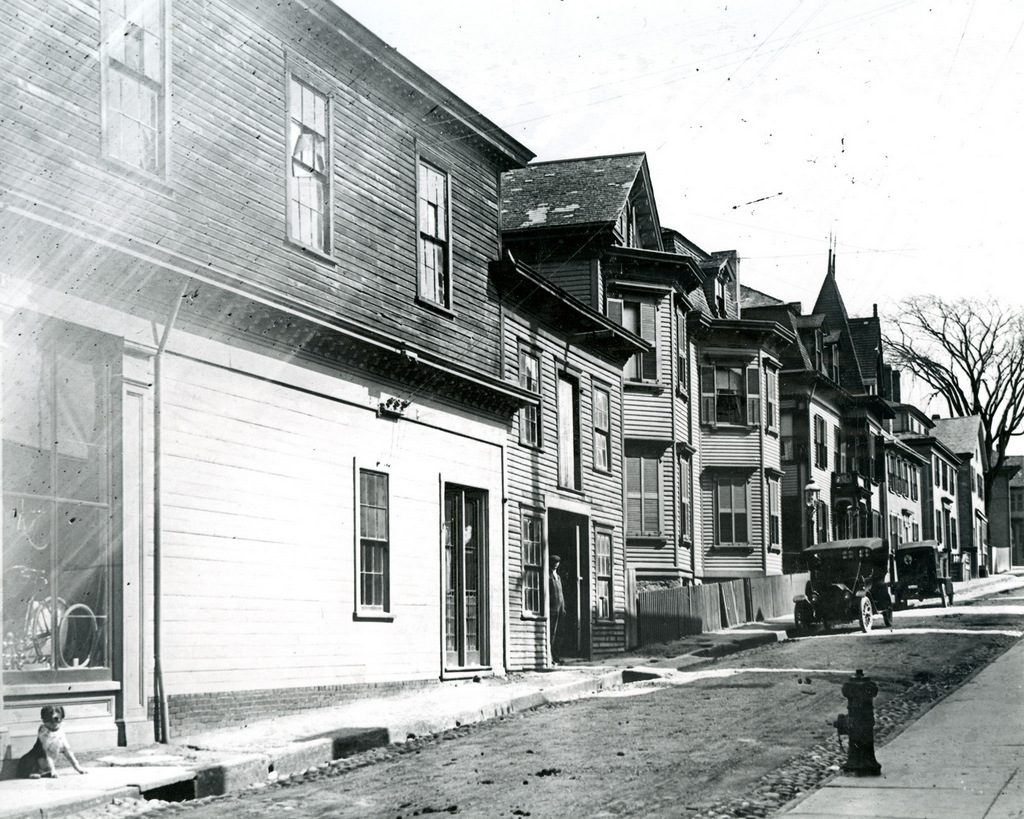
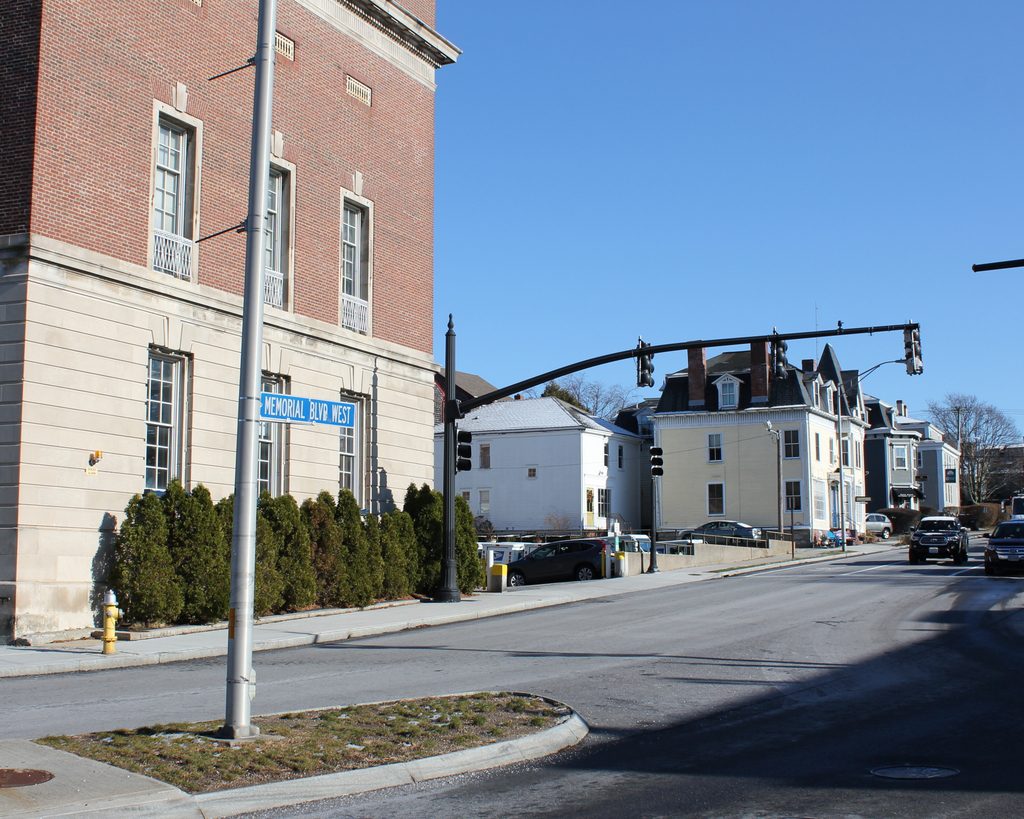
Spring Street from Mary Street, Newport, Rhode Island

Looking north on Spring Street, toward the corner of Mary Street in Newport, around the 1920s. Image courtesy of the Providence Public Library.

The scene in 2017:

Narrow streets such as these are typical in downtown Newport, where the street network was laid out long before the advent of automobiles. Even Spring Street, which is a fairly major street, is hemmed in by densely-crowded historic buildings on either side, leaving just a single travel lane for northbound traffic in the present-day photo. This is not much of a change from the first photo, taken around the 1920s, which shows several cars sharing the narrow street with a trolley line on the right side.

In nearly a century since the first photo was taken, most of the buildings in this scene are still standing. On the far left is the Odlin-Otis House, which is probably the oldest building in this scene. It was constructed around 1705 and was subsequently expanded, although by the time the first photo was taken it had been altered and converted into a two-family home. On the other side of Mary Street, just beyond the Odlin-Otis House, is the Franklin Bakery, which was built in 1876 and stands as the only brick building in the scene.

Further in the distance on the left side of the street, there are several houses beyond the Franklin Bakery. Closest to the foreground is the c.1870s George C. Barker House, which still stands and now features a coat of dark blue paint. Two houses down from the Barker House is the gambrel-roofed Elisha Johnson House, which was built around 1750 and is now painted brown. In between these two houses, the first photo shows a gable-roofed house with two windows on the first and second floors. This building is the only noticeable change from the first photo, as it was demolished around 1969 in order to move the c.1807 Edward Willis House onto the site.

The buildings on the right side of this scene are not as easily visible from this angle, but they have been similarly well-preserved over the years. Today, thia section of Spring Street features a remarkable collection of historic 18th and 19th century buildings, all of which are now part of the Newport Historic District. This is one of the many historic districts in Newport, encompassing much of the downtown area, and in 1968 it was designated as a National Historic Landmark, the highest level of historic recognition in the country

Broadway from Farewell Street, Newport, Rhode Island

Looking north on Broadway from the corner of Farewell Street in Newport, around 1884. Image courtesy of the Providence Public Library.

The scene in 2017:

This view shows the west side of Broadway, looking north from the Colony House at the corner of Farewell Street and Courthouse Way. Although taken more than 130 years apart, not much has changed in these two photos. Like much of downtown Newport, this area has remained remarkably well-preserved since the colonial era, and both photos show an eclectic mix of historic buildings that date as far back as the 17th century.

Perhaps the oldest building in this scene is the one on the far left, at 2-6 Broadway. It was built sometime before 1700, and was once owned by Peleg Sanford (1639-1701), who served as the colonial governor of Rhode Island from 1680 to 1683. Sanford came from a leading Rhode Island family, with his father, John Sanford (c.1605-1653), having briefly served as governor of Newport and Portsmouth in 1653. However, his most notable relative was his grandmother, Anne Hutchinson (1591-1643), the famed religious dissenter whose 1638 banishment from Boston had helped lead to the establishment of Newport.

Peleg Sanford died in 1701, and the house was later owned by his son-in-law, Job Almy, who purchased the property in 1723. The house would remain in the Almy family for over a century, until it was sold in 1827. By this point, the first floor of the house had been converted into a storefront, and the building would see even more drastic changes around 1845, when it was enlarged to its present size. This addition concealed most of its original appearance, although the building retained its overhanging second floor, which was a distinctive feature of many 17th century homes.

By the time time the first photo was taken around 1884, the building was occupied by several commercial tenants, including J. B. Deblois & Son, whose grocery store was located in the corner storefront. In later years, the ground floor was occupied by Lalli’s, a variety store that was in business here from 1923 until 1986. It was during this time that, in 1976, the exterior of the building was restored, giving it more of a 17th century appearance. Today, despite all of these changes, the structure of the original house is still there, making it possibly one of the oldest surviving buildings in Newport.

Aside from the Peleg Sanford House, there are a number of other historic buildings in this scene. Immediately to the right of it is the William P. Shefield House, which was built around 1850, although its exterior has been altered beyond recognition since the first photo was taken. Next, in the center of the scene, is the William H. Stanhope House, at 12-18 Broadway. It was built around 1815 as a private home, and its Federal-style architecture is still recognizable today, despite having been converted to commercial use during the 19th century. Further in the distance, barely visible in the 2017 photo, are two late 18th century homes at 20-24 and 26-30 1/2 Broadway, both of which are also now commercial properties.

Today, the vehicles on the street have changed, and this block of Broadway is now a one way street for southbound traffic, but otherwise the buildings themselves have seen few changes. All of them are now contributing properties in the Newport Historic District, which encompasses much of downtown Newport. The district was designated as a National Historic Landmark in 1968, because of the survival of so many historic buildings from the 17th, 18th, and 19th centuries.

Broadway from Spring Street, Newport, Rhode Island

Looking south on Broadway toward the corner of Spring Street in Newport, around 1885. Image courtesy of the Providence Public Library.

The scene in 2017:

These two photos were taken more than 130 years apart, yet they show remarkably little change. In fact, many of these buildings were already old by the time the first photo was taken. Newport had been a prosperous seaport throughout much of the 18th century, but its economy was hit hard by the American Revolution. Its shipping industry never fully recovered, and the city saw very little growth during the first half of the 19th century. The first federal census, taken in 1790, shows 6,719 residents living here, and over the next 50 years Newport saw only a very modest increase in population, with 8,333 by 1840.

This long period of stagnation hurt Newport’s economy, and there was very little new construction during this time. By the time the first photo was taken around 1885, Newport had reinvented itself as a Gilded Age summer resort, with most of this development occurring to the south of the downtown area. As a result, downtown Newport remained remarkably well-preserved, and it now boasts one of the largest collection of 18th and early 19th century buildings in the country, many of which are visible in this scene.

Along with the buildings themselves, Newport has also retained its colonial-era street network, complete with narrow streets, sharply-angled intersections, and oddly-shaped building lots. These photos show the view looking south on Broadway, at the complex intersection of Broadway, Spring Street, Bull Street, and Marlborough Street. Both Spring Street, to the left, and Marlborough Street, on the extreme right, intersect with Broadway at sharp angles, creating triangular-shaped lots on either side of Broadway.

The narrower of these two lots is on the left, between Broadway and Spring Street. Long before the Flatiron Building was constructed on a similarly-shaped plot of land, a small three-story, wood-frame commercial building was built here. It appears to date back to the late 18th or early 19th centuries, and by the time the first photo was taken it was occupied by Cornell & Son, a grocery store operated by William Cornell and his son Rodman. William also lived here in the building, and the 1880 census showed him here with his wife Sarah and their daughter Ellen.

Today, this scene has not undergone few significant changes, and many of the buildings from the first photo are still standing, including the former Cornell building. Newport remains a popular summer resort, and the storefronts in this scene are now filled with a variety of shops and restaurants that cater to tourists and seasonal residents. Because of its level of preservation, and its high concentration of historic buildings, the downtown area now forms the Newport Historic District, which was designated as a National Historic Landmark in 1968.

High Street from Essex Street, Holyoke, Mass

Looking north on High Street from the corner of Essex Street in Holyoke, around 1910-1915. Image from Illustrated & Descriptive Holyoke Massachusetts.

The scene in 2017:

In the northern part of downtown Holyoke, much of High Street has remained well-preserved, with entire blocks that have hardly been changed since they were developed in the second half of the 19th century. However, this is not the case further to the south, where newer buildings and vacant lots are a more common sight. This block, between Essex and Appleton Streets, has a small group of historic buildings at its northern end, but the southern part of the block, seen here in the foreground, is hardly recognizable from the first photo.

The most prominent building in the first photo is the eight-story LaFrance Hotel, which occupies much of the right side of the scene. It was built in the first decade of the 20th century, and was originally owned by Louis A. LaFrance, a French-Canadian immigrant who became a prominent figure in Holyoke’s real estate and construction business. The LaFrance Hotel was among his most notable properties, and was designed by local architect William B. Reid. It was also among the tallest buildings in the city, towering above the other commercial blocks on High Street, which generally ranged from two to six stories.

Further in the distance, at the corner of Appleton Street, is a pair of six-story buildings that were constructed a few years earlier in the 1890s. The narrower of these two is the red brick McLean Building, and just beyond it is the yellow brick Senior Block, which extends to Appleton Street. Diagonally across from the Senior Block is the turreted YMCA building, which is visible just to the left of the trolley in the distance of the first photo. This was probably the most historically-significant building in the scene, as it was the place where, in 1895, William G. Morgan invented the game of volleyball.

Today, all of the buildings in the foreground of the first photo have either been demolished or altered beyond recognition, and may of the buildings further in the distance are gone as well. Both the McLean Building and Senior Block are still there, but the historic YMCA building across the street was destroyed in a fire in 1943. The LaFrance Hotel, which later became the Essex House, stood here for many years. However, by the early 2000s it was vacant and in poor condition, with bricks regularly falling onto neighboring buildings. It was slated for demolition in 2014, but the process was expedited by a partial collapse that occurred the day before demolition work was scheduled to begin. The rest of the building was subsequently taken down, and the site is now a vacant lot.