Mt. Washington Cog Railway

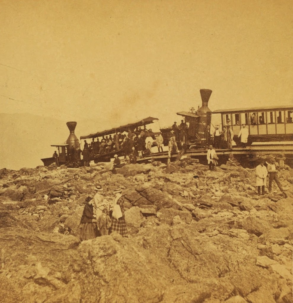
The Mt. Washington Cog Railway, near the summit, probably in the early 1870s. Photo courtesy of New York Public Library.
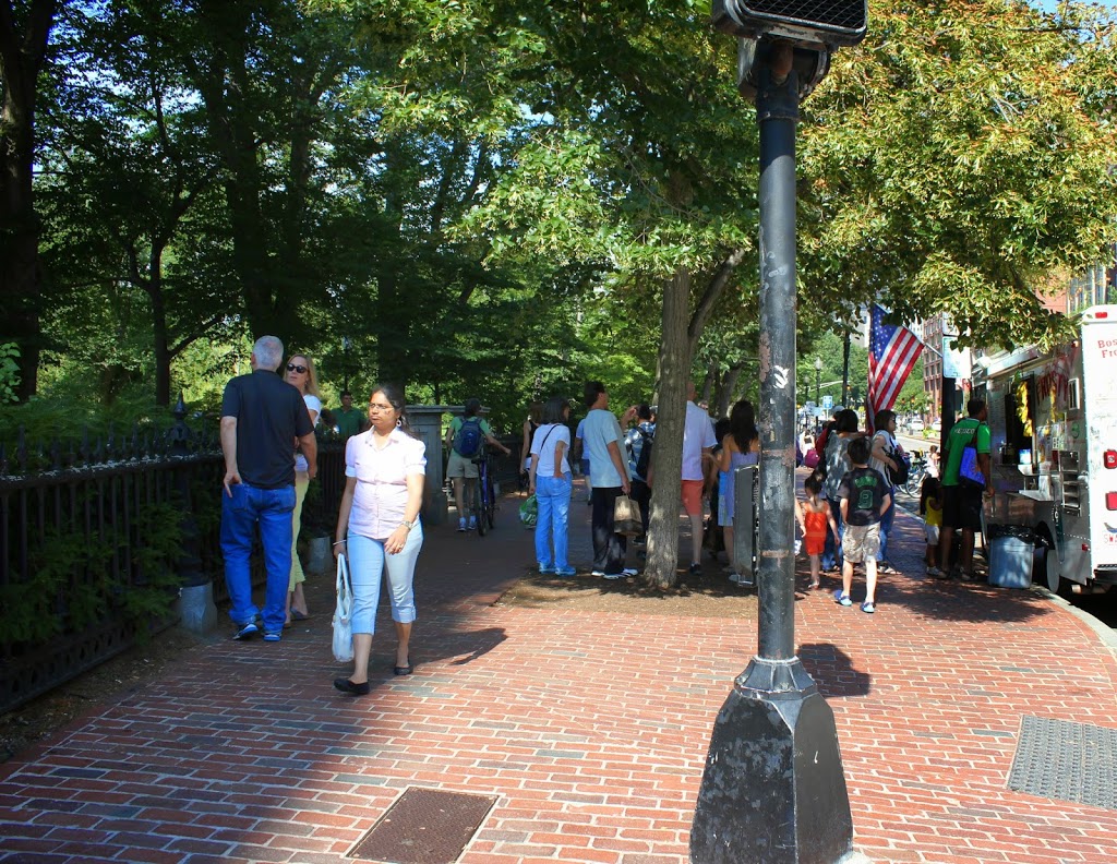
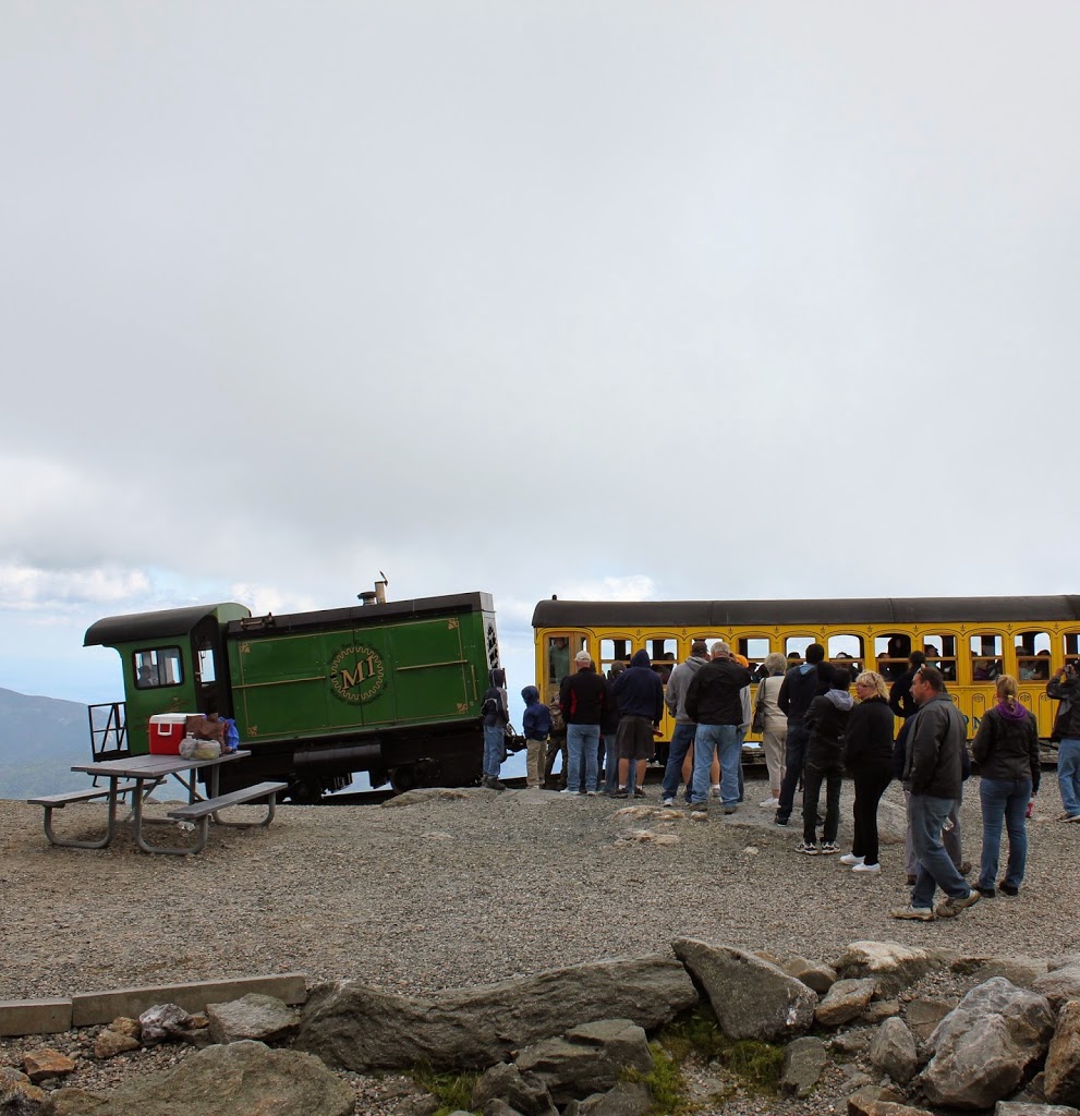
446_1860sc-2Bnypl

The scene in 2013:

446_2013

The first photo was probably taken within a few years of the opening of the Mt. Washington Cog Railway.  By the mid 19th century, the White Mountains had become a popular summer destination, and Mount Washington in particular became a favorite destination.  The only problem was getting to the top; this was first solved by the Mount Washington Carriage Road (today the Auto Road), but even before the road opened, another man had an even more ambitious idea – to build a railroad to the top.

Railroads were still in their infancy in America in 1852, and many major cities still did not have rail connections, but Sylvester Marsh had a plan to build a cog railway to the top, something that had never been done up the side of a mountain before.  The New Hampshire legislature gave him a charter in 1858, with one legislator reportedly remarking that they should give him a charter to make a railway to the moon, indicating how impossible it seemed to build a railroad to the top of the tallest peak in the Northeast.

The railroad was completed to the summit in July 1869, only a couple months after the completion of the Transcontinental Railroad.  It is about 3 miles long, with an average grade of about 25%, and it set the stage for future mountain-climbing railroads such as the one up Pikes Peak.  The locomotives in the first photo indicate that it is an early photo of the railroad; they appear to be the George Stephenson and the Hercules, which entered service in 1869 and were replaced in 1878 and 1874, respectively.

The present-day scene here is remarkably similar; the trains are still operating (most of the locomotives are modern biodiesel ones, but several date back to the 1870s), and there seems to be as many people riding in the 2013 photo as there were nearly 150 years earlier, although clothing styles have changed a bit.  It’s not visible from here, but the road to the top is also still there, although it is no longer the Carriage Road but the Auto Road.  There are a lot more buildings at the top than there were in the 1870s, although the Tip Top House is still there; it is older than either the Auto Road or the railroad.

Tucker Toll Bridge, Bellows Falls, Vermont (2)

Another view of the Tucker Toll Bridge, from the downstream side, probably around 1900 Image courtesy of the Rockingham Free Public Library.

The bridge in 2018:

This is another view of the bridge across the Connecticut River at Bellows Falls, seen from the Vermont side facing upstream.  As explained in this post, this was the site of the first bridge across the Connecticut River when a primitive bridge was built across here in 1785.  The bridge in the 1907 photo was the second on the site, and opened in 1840.  This bridge, known as the Tucker Toll Bridge, was replaced by the current concrete arch bridge, the Vilas Bridge, in 1930.  However, the bridge has been closed since 2009, and as of 2018 it is unknown what will happen to it.

This angle gives a good view of the gorge at Bellows Falls, where the Connecticut River drops 52 feet through a narrow gorge.  It was originally known as the Great Falls, and an early stagecoach line that ran through here advertised that passengers would be able to “view one of the most stupendous works of Nature.”  Today, much of the river’s water is diverted into a power canal just above the falls, so it isn’t as dramatic as it would have been to an 18th century traveler, but it is still an impressive view looking down from the top of the gorge.

Tucker Toll Bridge, Bellows Falls, Vermont (1)

The Tucker Toll Bridge over the Connecticut River at Bellows Falls, Vermont, around 1900-1910. Image courtesy of the Library of Congress, Detroit Publishing Company Collection.

Vermont

The scene in 2014:

418_2014

As mentioned in this post, Bellows Falls became a major transportation and industrial center in the region during the 19th century because of its location on the Connecticut River.  As seen in these photos, the river drops 52 feet in elevation through a narrow gorge, making it an ideal site for hydroelectrically-powered industries, but also a strategic location to build a bridge.  Further south, the river was much wider and bridge-building viewed as almost impossible; one man reportedly commented on the idea in Springfield, Mass. around 1800, saying, “Gentlemen, you might as well undertake to bridge the Atlantic Ocean.”

However, here in Bellows Falls the width of the river and the rocky outcroppings meant a shorter bridge and no need to build piers in the river.  As a result, the first bridge across any part of the Connecticut River opened on this spot in 1785, connecting New Hampshire and Vermont and facilitating trade from New Hampshire to Montreal and other northern destinations.  At the time, Vermont was actually an independent nation, which I suppose technically made the first bridge an international border crossing.

The construction of the bridge was authorized by the state of New Hampshire, who also set the tolls for travelers; in 1804, the tolls ranged from three cents for a person on foot, to 30 cents for a four wheel carriage with four horses.  Upon completion, the Massachusetts Spy gave a glowing review of the bridge, writing:

“We hear from Walpole, state of New Hampshire, that Colonel Enoch Hale hath erected a bridge across the Connecticut River on the Great Falls, at his own expense.  This bridge is thought to exceed any ever built in America in strength, elegance, and public utility, as it is the direct way from Boston through New Hampshire and Vermont to Canada, and will exceedingly accommodate the public travel to almost any part of the state of Vermont.”

The 1907 book History of the Town of Rockingham Vermont provides this depiction of the bridge, viewed from about the same spot as the two photographs:

Picture1

This first bridge was uncovered, which meant the wood deck and structure was exposed to the elements, so by 1840 it was in need of replacement.  The new bridge, which is the same one in the first photo here, was built directly over the old one, about 15 feet above it, which allowed the old bridge to continue to be used even as its replacement was being built.  The 1840 bridge became known as the Tucker Toll Bridge, named after the family who owned it for many years.  It remained in the hands of private owners until 1904, when the towns of Rockingham and Walpole purchased it and made it free for travel.  This bridge was, in turn, replaced by the current concrete arch bridge in 1930.  However, it has deteriorated over the years, and was closed in 2009 because of safety concerns.  At this point, it remains to be seen what will happen to the bridge.

Brattleboro, Vermont (4)

Looking toward the Connecticut River from the corner of Main & Canal Streets in Brattleboro, Vermont, around 1917. Image courtesy of the Library of Congress.

350_1917c-2Bloc

The scene in 2014:

350_2014

On the right-hand side is Brattleboro’s Union Station, which was brand new when the first photo was taken; it opened in 1915. It was built along the Central Vermont Railway, which provided service north through Vermont to Montreal and south through Massachusetts and Connecticut to New London. Today the tracks through Brattleboro are operated by the New England Central Railroad, with Amtrak providing passenger service on their Vermonter route. In the distance in the 1917 photo is the 1878 railroad arch over the Whetstone Brook. It isn’t visible in the 2014 photo, but it is still there, and still carries the railroad over the brook.

The top photo is part of a panoramic view; the other parts can be viewed here:

Part 1
Part 2
Part 3

Public Garden Incline, Boston (2)

Trolleys at the Public Garden Incline at the corner of Boylston and Arlington Streets in Boston, around 1910-1911. Image courtesy of the Library of Congress, Detroit Publishing Company Collection.

338_1910-1920-2Bloc

The scene in 2014:

338_2014

These were taken from near the location of the photos in this post, showing trolleys entering and emerging from the Tremont Street Subway onto Boylston Street.  The car on the right-hand side is returning from Brookline Village, and the one on the left is heading toward Huntington Avenue, along the modern-day E Branch of the Green Line.  This car is particularly intriguing, because one of the flyers on the front reads “Baseball to-day American League Huntington Avenue,” The exact date of this photo isn’t clear, and the Library of Congress estimates that it was taken between 1910 and 1920, but this little flyer indicates that it couldn’t have been any later than 1911, the last year that the Red Sox played at Huntington Avenue before moving to Fenway Park.  Many of the people on the trolley are probably fans heading to the game, and will likely see future Red Sox legends such Smoky Joe Wood, Tris Speaker, and Harry Hooper.  Today, Red Sox fans still travel along this route to get to the game, although the incline that the trolleys once emerged from has been closed for a century, and no evidence remains on the surface that it ever existed.

Public Garden Incline, Boston (1)

Trolleys entering and exiting the Tremont Street Subway at its southern end at the Boston Public Garden, around 1904. Image courtesy of the Library of Congress, Detroit Publishing Company Collection.

337_1904c-2Bloc

The scene in 2014:

337_2014

When the Tremont Street Subway opened in 1897 as the first subway in the country, trolleys ran underground from downtown all the way until the corner of Arlington and Boylston, where the tracks emerged here and continued along Boylston Street to points west.  The three cars in the first photo represent three different routes, with the one on the far right returning from Newton, the one ahead of it coming from Roxbury, and the one in distance is heading toward Huntington Avenue.  Today’s Green Line still has four different branches, all that is left of what was once a much larger streetcar system.  The subway portal itself closed in 1914, when the subway was extended under Boylston Street to Kenmore, and no evidence remains on the surface to suggest that trolleys once emerged here from underground.