Park Street Station, Boston

Tremont Street during construction of the Park Street subway station in 1897. Photo courtesy of Boston Public Library.

336_1897-2Bbpl

Park Street Station after completion, taken in 1906. Photo courtesy of Boston Public Library.

336_1906-2Bbpl

Park Street Station in 2014:

336_2014

As mentioned in previous posts, the Tremont Street Subway (today’s MBTA Green Line) was the first subway in the country, and Park Street was one of the first two stations, along with Boylston.  The station opened in 1897, and helped to relieve congestion on Tremont Street by removing the trolleys from the surface, as seen in the first photo.  Today, the station is still there, as is Park Street Church behind it.

See this post and this post for a few photos of the interior of the station.

Tremont Street Trolleys, Boston

Looking up Tremont Street toward Park Street Church in Boston, in 1895. Photo courtesy of Boston Public Library.

335_1895-2Bbpl

Tremont Street in 2014:

335_2014

These photos were taken from almost the same spot as the ones in this post and this post, but the first one here shows Tremont Street as it appeared before the construction of the Tremont Street Subway.  By the time the 1895 photo was taken, Tremont Street was becoming crowded with traffic, from pedestrians to carriages and even trolleys, as seen in the distance of the first photo.  Toalleviate the congestion, the trolley lines were put underground, making this the first subway in the country.  Today, Tremont Street is still a busy road, but trolleys such as the green and orange one in the 2014 photo are purely for tourism – the real trolleys still run underground through here on the MBTA Green Line.

Explosion, Corner of Tremont and Boylston Streets, Boston

An explosion at the corner of Tremont and Boylston during the construction of the Tremont Street Subway on March 4, 1897.  Photo courtesy of Boston Public Library.

319_1897-03-04-2Bbpl

The scene in 2014:

319_2014

The corner of Boylston and Tremont is the location of a sharp 90 degree curve on the Green Line, where the underground tracks turn off of Boylston and onto Tremont.  In 1897, however, this was still under construction.  During this time, one of the gas lines at the intersection began leaking.  The escaped gas accumulated in the empty space underground, until a horse-drawn streetcar, the one marked “Mount Auburn” in the photo, ignited the gas as it passed above ground.  The explosion killed ten people and caused significant damage to the surrounding buildings, including the Hotel Touraine, which was still under construction in the first photo and stands to this day.  The subway itself would go on to open on September 1, and the location of the explosion became the Boylston station.

Scollay Square, Boston

Scollay Square in Boston, around 1906. Image courtesy of the Library of Congress, Detroit Publishing Company Collection.

266_1906c-loc

The same scene in 2014:

Scollay Square is one of the more dramatic, and perhaps infamous examples of urban renewal in Boston.  Located at the corner of Tremont and Court streets, it was a busy commercial center for several centuries.  However, by the 1950s it was a seedy neighborhood with low-income residents, so the entire area was demolished in the 1960s and replaced with Government Center, which included City Hall and City Hall Plaza (just to the right of where the 2014 photo was taken).

The two small buildings in the center of the square in the 1906 photo are two different subway stations; the one in the foreground is Court Street on the East Boston Tunnel (present-day Blue Line), and the larger, more ornate one in the background is the Scollay Square station on the Tremont Street Subway (today’s Green Line).  This was the original terminus of the East Boston Tunnel when it opened in 1904; it extended from Maverick Station in East Boston, and ran under Boston Harbor and up State Street to here.  In 1916, the line was extended to Bowdoin, and the Court Street Station was closed, and a new station was opened under the Scollay Square station; not surprisingly, it was called Scollay Under.

Today, very little remains from the 1906 photo.  Only two buildings survive; the one on the far left (modern-day Bank of America), and the Suffolk County Courthouse, visible in the distance in left-center (and no longer visible from this spot today, although it’s still there).  Even the subway station has changed; the Blue and Green lines still meet here, but it is now the Government Center station, and the entrance is further to the right, at City Hall Plaza.  The station itself was reconstructed in the 1960s, and is currently being reconstructed again.  It was closed earlier this year, and is not scheduled to reopen until 2016.

South Station, Boston

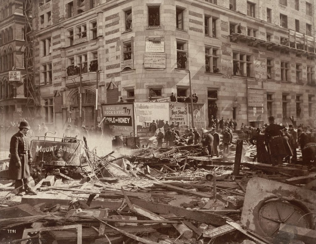
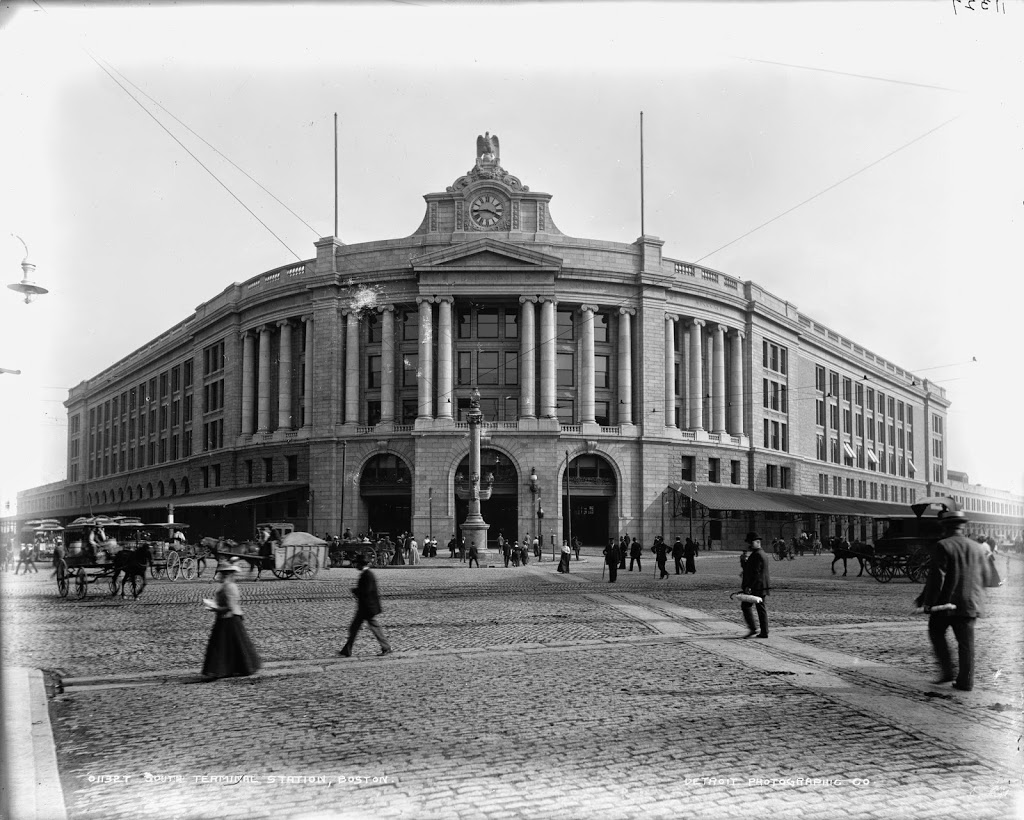
South Station around the time that it opened in 1899. Image courtesy of the Library of Congress, Detroit Publishing Company Collection.

263_1899c-loc

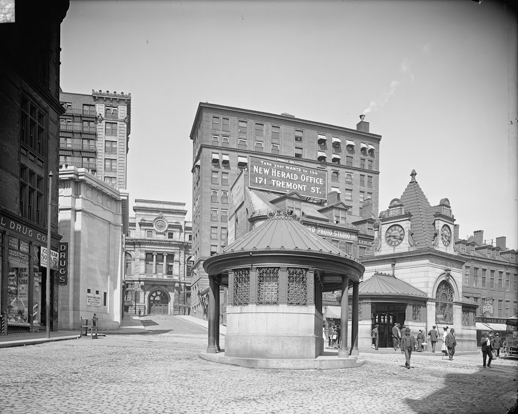
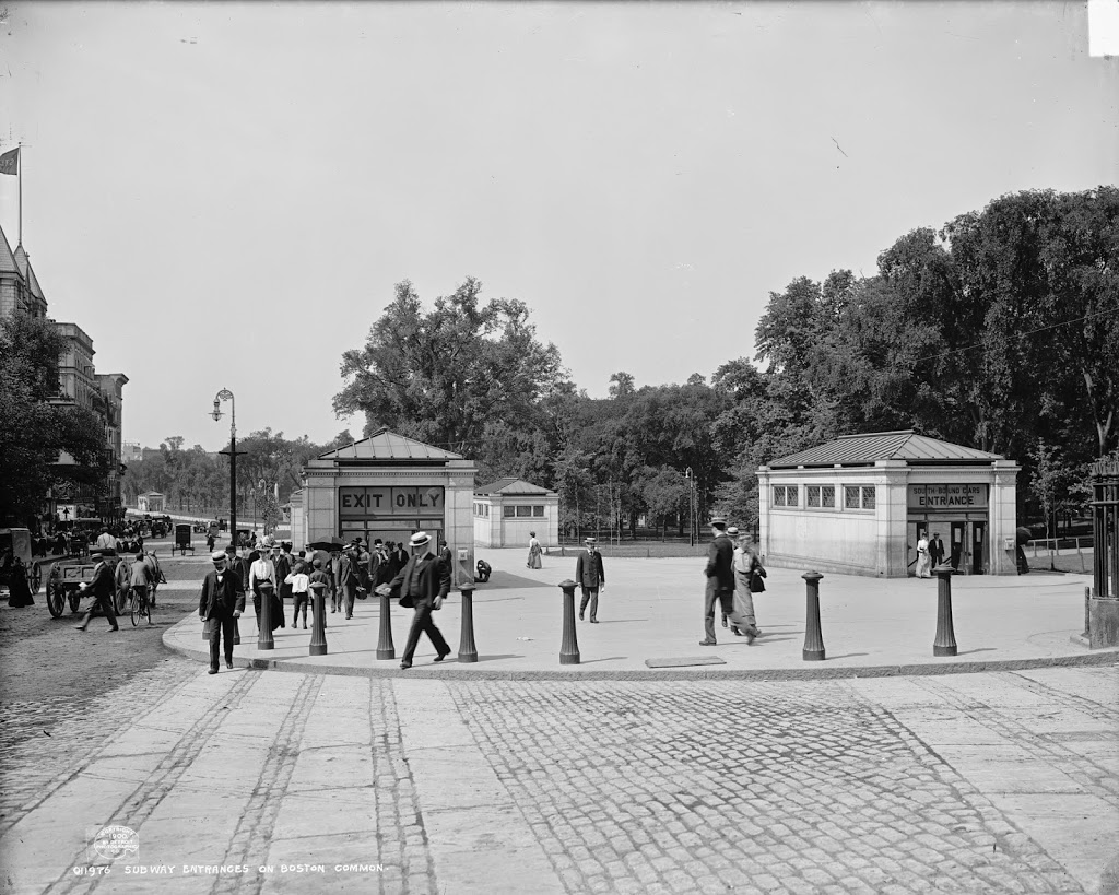
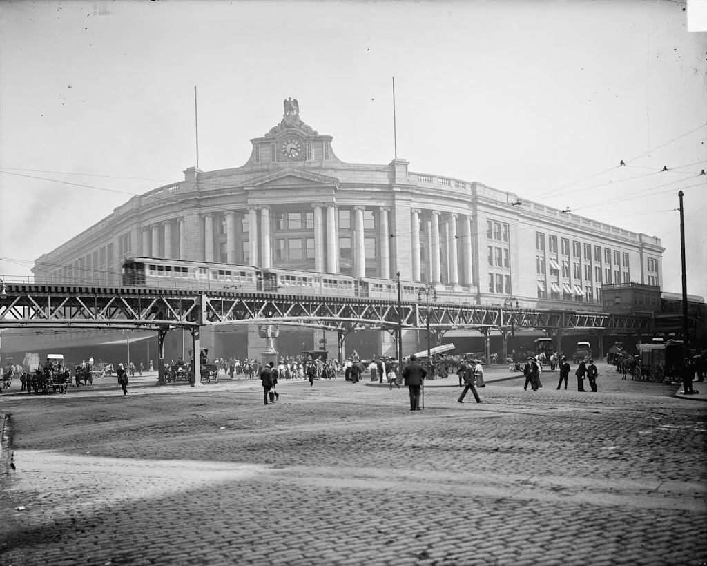
The same view around 1905, after the construction of the Atlantic Avenue Elevated. Image courtesy of the Library of Congress, Detroit Publishing Company Collection.

Transportation

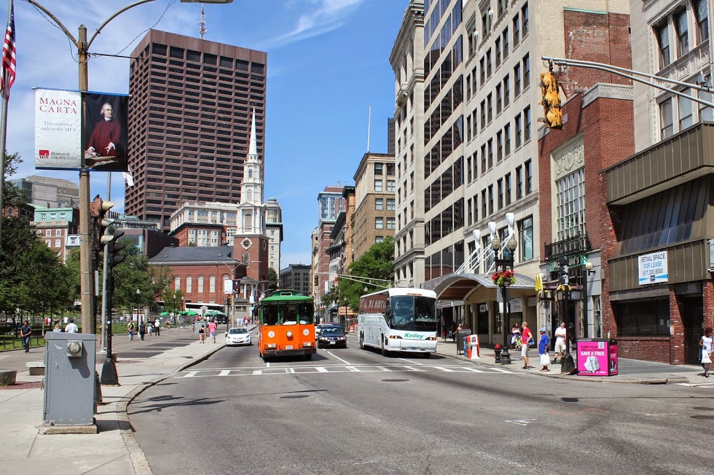
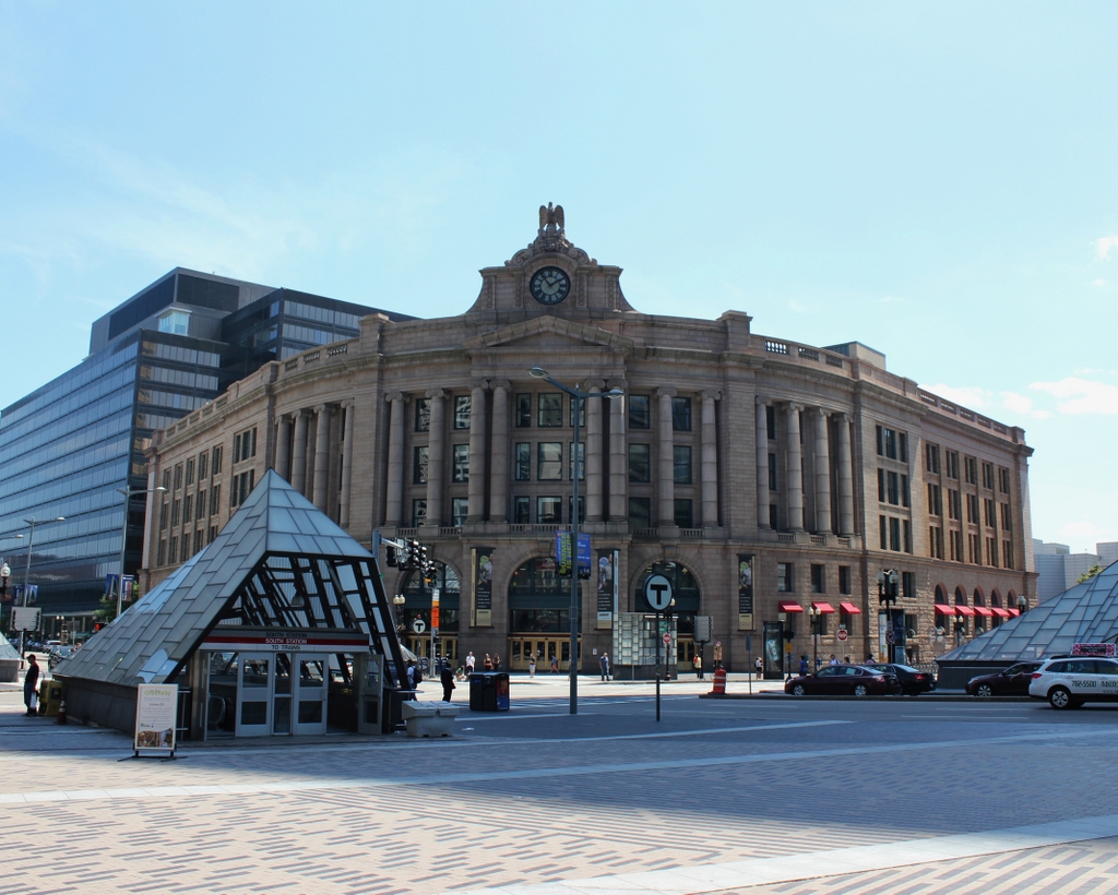
South Station in 2014:

These three photos reveal the changes that have taken place here at South Station over the past 115 years.  While the building itself (or at least most of it) has remained essentially the same, its surroundings have continually changed.

Before 1899, four different railroads had terminals in the general vicinity of the present-day station.  To make things simpler, South Station was built, and all four lines were rerouted to it.  A few years later, in 1901, the Atlantic Avenue Elevated was built, as seen in the second photo.  The rapid transit line included a station at South Station, which can be seen on the far right of the 1905 photo.

The third photo shows the result of changes in the way people travel; the Atlantic Avenue Elevated closed in 1938, and was demolished four years later.  Even South Station was seeing a severe drop in passengers in postwar America, as cars became the primary method of travel.  However, Boston’s colonial-era street network was not particularly accommodating to large number of cars, so the Central Artery was built in the 1950s.  Most of the Central Artery was elevated, but it was put underground for a few blocks near South Station, and was known as the Dewey Square Tunnel.

The Dewey Square Tunnel turned out to be a foreshadowing of things to come; part of Boston’s infamous Big Dig involved putting the entire Central Artery underground.  Today, the tunnel is still there, directly underneath where I was standing when I took the photo.  It is the only existing part of the Central Artery; the remainder of the 1950s-era expressway was demolished upon completion of the Big Dig.

Today, South Station has been trimmed a bit – notice that the facade on both sides is shorter than in the first two photos.  This was a result of demolition in the 1960s, at a time when many railroads were cutting back or eliminating passenger service.  However, today South Station is a busy transportation center again – it is the busiest railroad station in New England and the sixth busiest in the country, and it is the northern terminus of the Northeast Corridor, the busiest rail line in the country.

Park Street Station, Boston

The entrances to the Park Street station, taken from in front of Park Street Church, around 1900. Image courtesy of the Library of Congress, Detroit Publishing Company Collection.

260_1900c-loc

The scene in 2014:

260_2014

The entrances to the subway are still there, as is Boston Common, but the background is very different, with the skyline of Boston’s Back Bay rising above the trees on Boston Common.  Boston’s two tallest buildings can be seen here: the John Hancock Tower, which is in the center of the photo, and the Prudential Center, barely visible to the right of the John Hancock Tower.  The Freedom Trail passes through this intersection, with the brick path echoing the cobblestone rows that once crossed Park Street.