Arlington Station, Boston

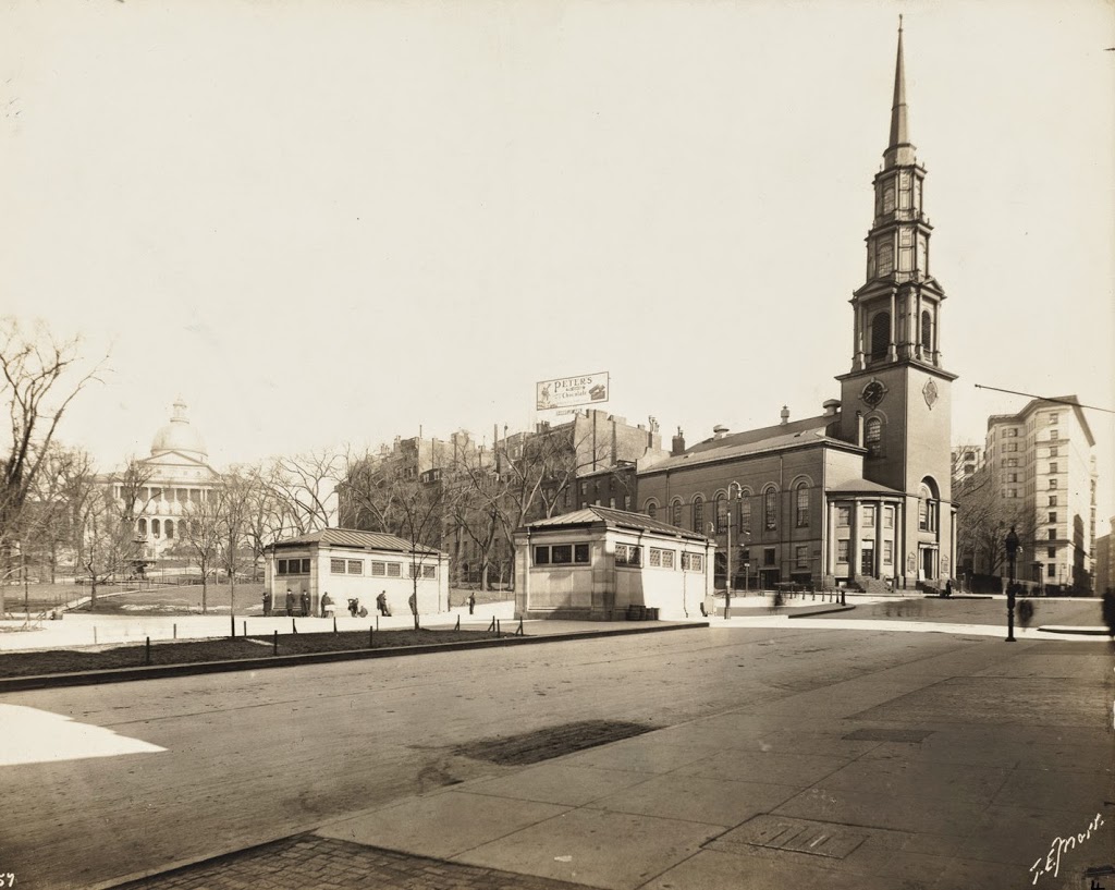
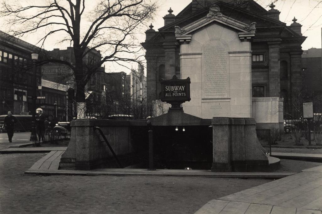
The entrance to the Arlington subway station, taken from the Boston Public Garden in front of the Arlington Street Church, on March 17, 1937. Image courtesy of the City of Boston Archives.
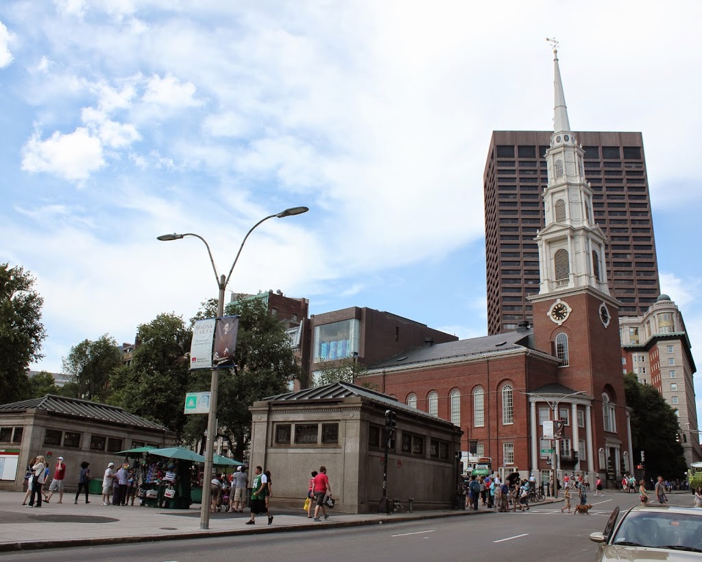
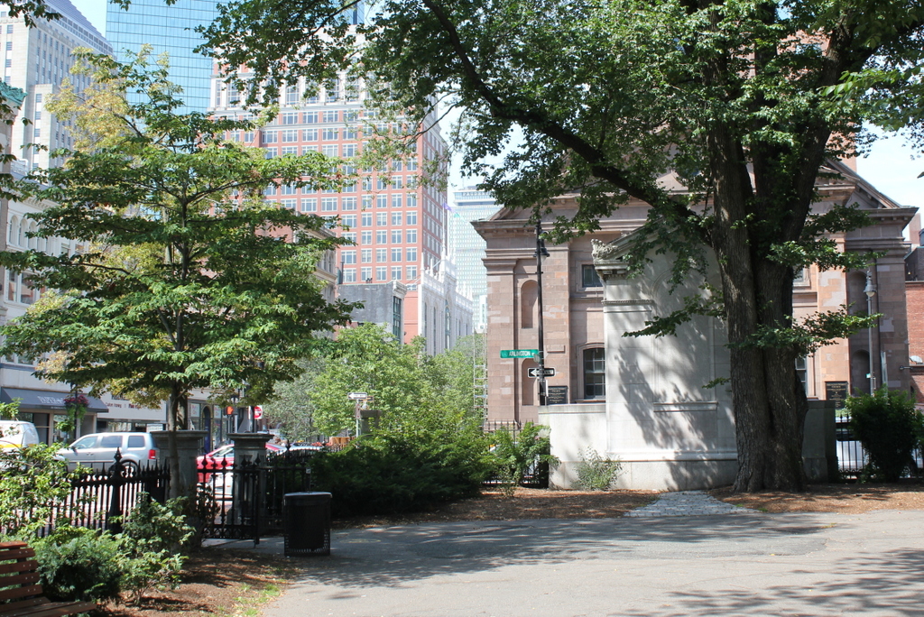
680_1937-03-17

The scene in 2015:

680_2015
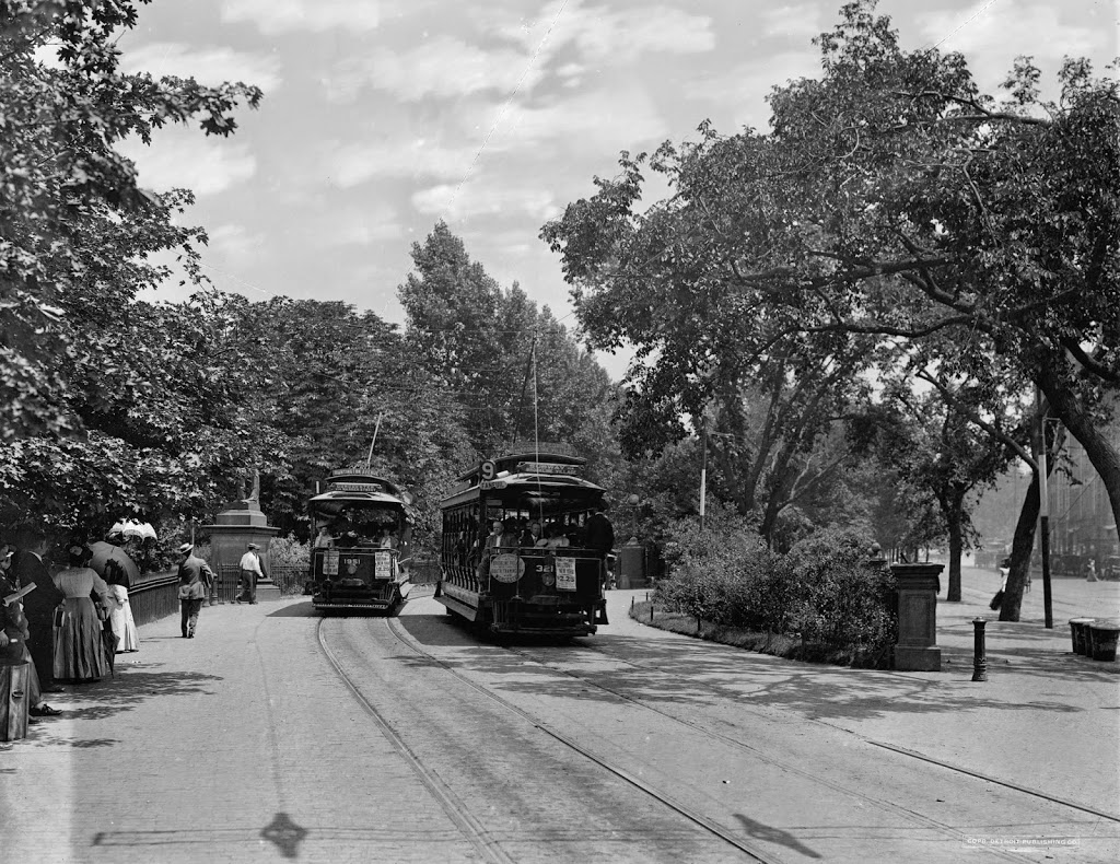
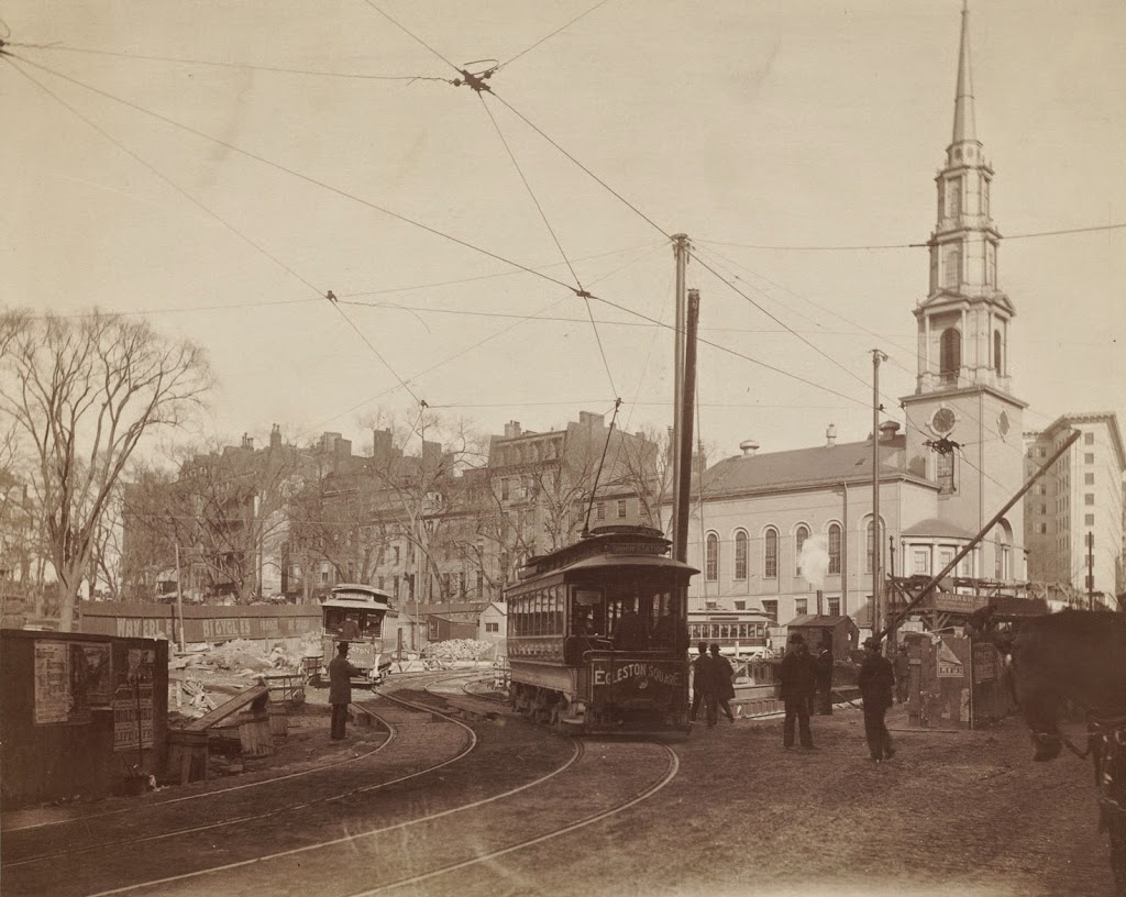
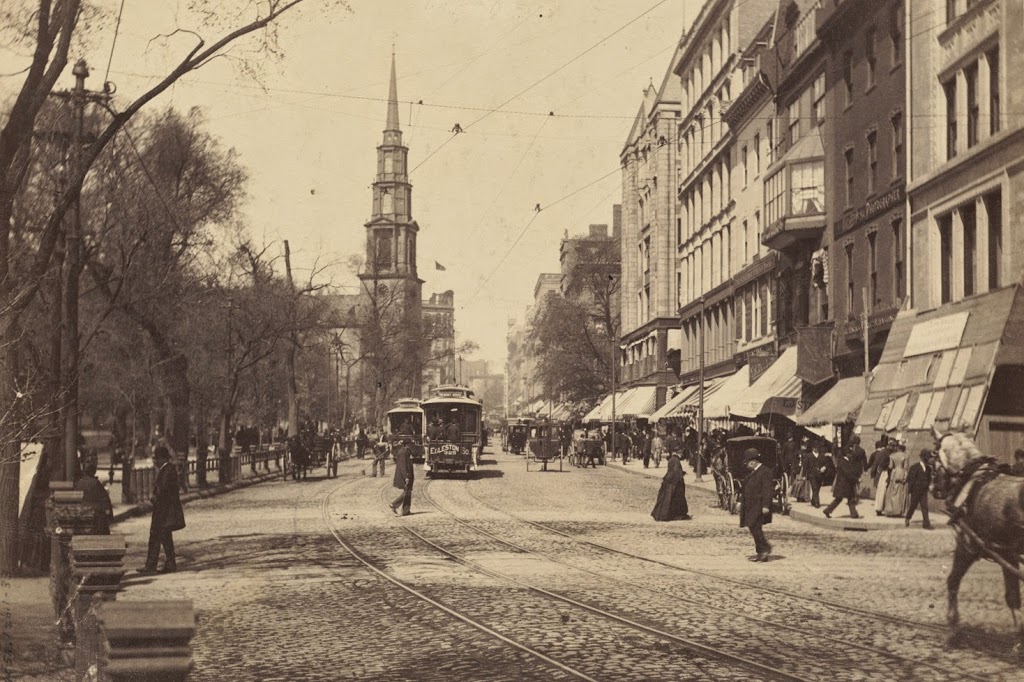
When the present-day Green Line subway tunnel was built in 1897, it only went as far west as Arlington Street; from here, the trolleys came to the surface (as seen in this post) and traveled along the center of Boylston Street through the Back Bay.  However, in 1914 the subway was extended west to Kenmore Square, and from here the closest stations were either a third of a mile to the east at Boylston, or an equal distance to the west at Copley Square.  This gap was resolved in 1921 when Arlington station opened here, with the original entrance being located in the Public Garden at the corner of Arlington and Boylston Streets.

The station has been renovated over the years, and the Public Garden entrance no longer exists, but many of the surrounding buildings from nearly 80 years ago are still standing.  The most prominent is the 1861 Arlington Street Church, which is partially blocked in both photos by the back of a statue and monument honoring William Ellery Channing, a Unitarian minister who was once the pastor of the congregation that later built the church.  Many of the buildings along Boylston Street in the distance are also still there today, but the skyline behind them has dramatically increased; some of the skyscrapers visible today include the old John Hancock Building, the new John Hancock Tower, and the Prudential Tower.

Public Garden Incline, Boston (2)

Trolleys at the Public Garden Incline at the corner of Boylston and Arlington Streets in Boston, around 1910-1911. Image courtesy of the Library of Congress, Detroit Publishing Company Collection.

338_1910-1920-2Bloc

The scene in 2014:

338_2014

These were taken from near the location of the photos in this post, showing trolleys entering and emerging from the Tremont Street Subway onto Boylston Street.  The car on the right-hand side is returning from Brookline Village, and the one on the left is heading toward Huntington Avenue, along the modern-day E Branch of the Green Line.  This car is particularly intriguing, because one of the flyers on the front reads “Baseball to-day American League Huntington Avenue,” The exact date of this photo isn’t clear, and the Library of Congress estimates that it was taken between 1910 and 1920, but this little flyer indicates that it couldn’t have been any later than 1911, the last year that the Red Sox played at Huntington Avenue before moving to Fenway Park.  Many of the people on the trolley are probably fans heading to the game, and will likely see future Red Sox legends such Smoky Joe Wood, Tris Speaker, and Harry Hooper.  Today, Red Sox fans still travel along this route to get to the game, although the incline that the trolleys once emerged from has been closed for a century, and no evidence remains on the surface that it ever existed.

Public Garden Incline, Boston (1)

Trolleys entering and exiting the Tremont Street Subway at its southern end at the Boston Public Garden, around 1904. Image courtesy of the Library of Congress, Detroit Publishing Company Collection.

337_1904c-2Bloc

The scene in 2014:

337_2014

When the Tremont Street Subway opened in 1897 as the first subway in the country, trolleys ran underground from downtown all the way until the corner of Arlington and Boylston, where the tracks emerged here and continued along Boylston Street to points west.  The three cars in the first photo represent three different routes, with the one on the far right returning from Newton, the one ahead of it coming from Roxbury, and the one in distance is heading toward Huntington Avenue.  Today’s Green Line still has four different branches, all that is left of what was once a much larger streetcar system.  The subway portal itself closed in 1914, when the subway was extended under Boylston Street to Kenmore, and no evidence remains on the surface to suggest that trolleys once emerged here from underground.

Park Street Station, Boston

Tremont Street during construction of the Park Street subway station in 1897. Photo courtesy of Boston Public Library.

336_1897-2Bbpl

Park Street Station after completion, taken in 1906. Photo courtesy of Boston Public Library.

336_1906-2Bbpl

Park Street Station in 2014:

336_2014

As mentioned in previous posts, the Tremont Street Subway (today’s MBTA Green Line) was the first subway in the country, and Park Street was one of the first two stations, along with Boylston.  The station opened in 1897, and helped to relieve congestion on Tremont Street by removing the trolleys from the surface, as seen in the first photo.  Today, the station is still there, as is Park Street Church behind it.

See this post and this post for a few photos of the interior of the station.

Tremont Street Trolleys, Boston

Looking up Tremont Street toward Park Street Church in Boston, in 1895. Photo courtesy of Boston Public Library.

335_1895-2Bbpl

Tremont Street in 2014:

335_2014

These photos were taken from almost the same spot as the ones in this post and this post, but the first one here shows Tremont Street as it appeared before the construction of the Tremont Street Subway.  By the time the 1895 photo was taken, Tremont Street was becoming crowded with traffic, from pedestrians to carriages and even trolleys, as seen in the distance of the first photo.  Toalleviate the congestion, the trolley lines were put underground, making this the first subway in the country.  Today, Tremont Street is still a busy road, but trolleys such as the green and orange one in the 2014 photo are purely for tourism – the real trolleys still run underground through here on the MBTA Green Line.

Explosion, Corner of Tremont and Boylston Streets, Boston

An explosion at the corner of Tremont and Boylston during the construction of the Tremont Street Subway on March 4, 1897.  Photo courtesy of Boston Public Library.

319_1897-03-04-2Bbpl

The scene in 2014:

319_2014

The corner of Boylston and Tremont is the location of a sharp 90 degree curve on the Green Line, where the underground tracks turn off of Boylston and onto Tremont.  In 1897, however, this was still under construction.  During this time, one of the gas lines at the intersection began leaking.  The escaped gas accumulated in the empty space underground, until a horse-drawn streetcar, the one marked “Mount Auburn” in the photo, ignited the gas as it passed above ground.  The explosion killed ten people and caused significant damage to the surrounding buildings, including the Hotel Touraine, which was still under construction in the first photo and stands to this day.  The subway itself would go on to open on September 1, and the location of the explosion became the Boylston station.