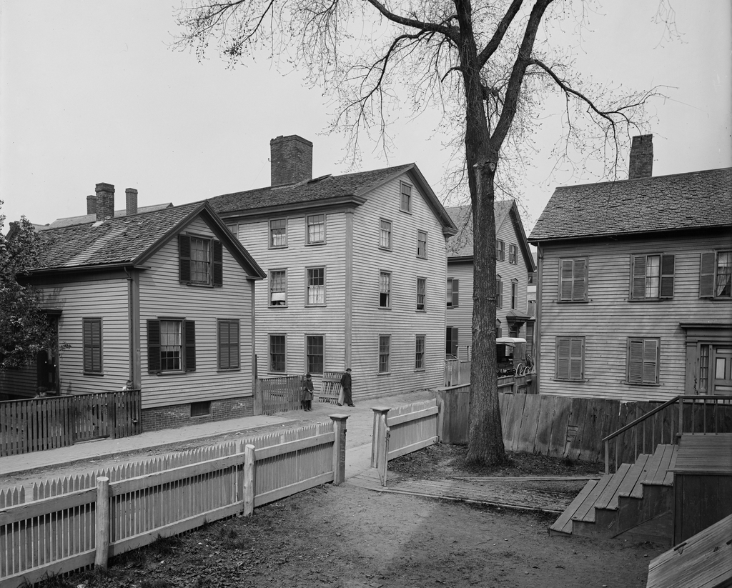
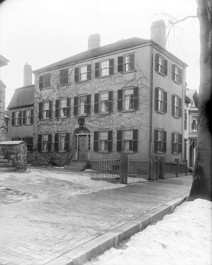
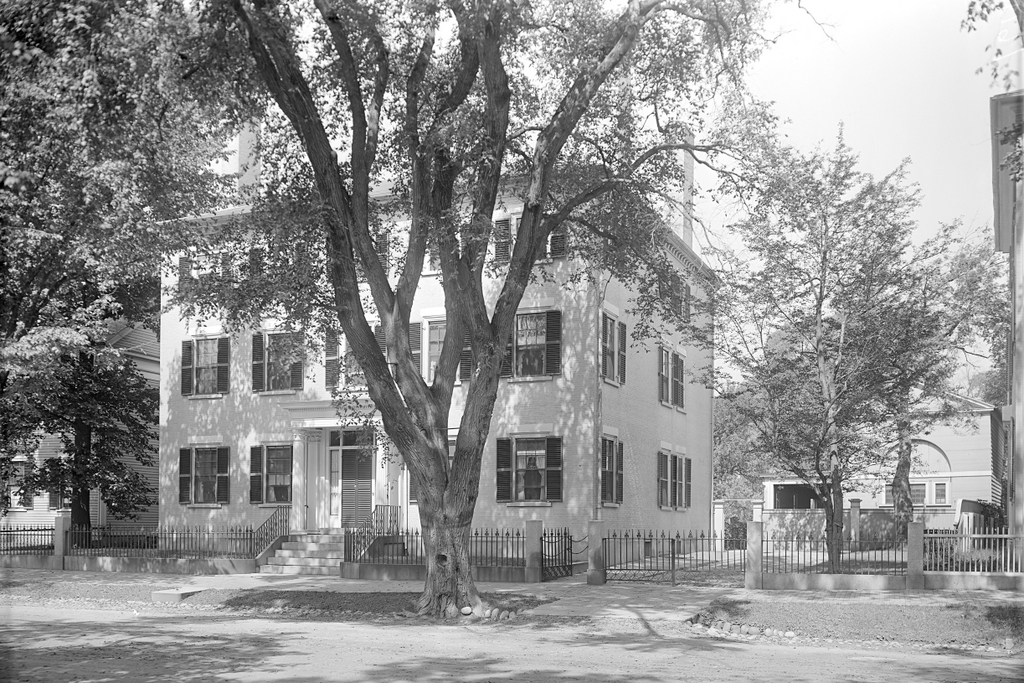
The houses at 77 and 69 Lexington Road in Concord, around 1895-1905. Image courtesy of the Boston Public Library.
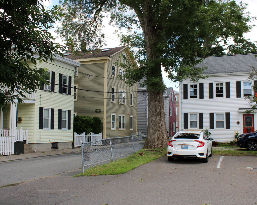
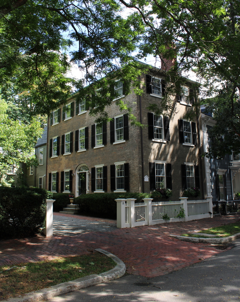
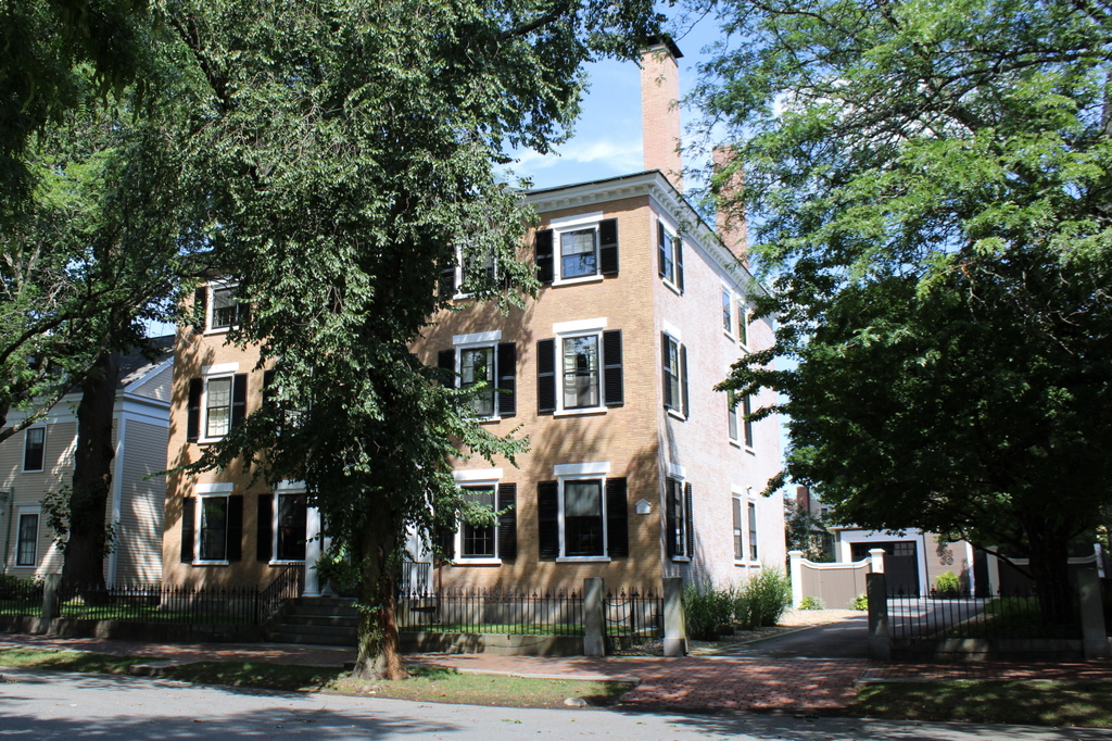
The scene in 2023:
These two photos show a pair of houses on the north side of Lexington Road, just east of the town center of Concord. Although located on separate parcels now, the histories of these homes are closely connected. The house on the right, at 77 Lexington Road, was evidently built around 1720. At one point it was believed to have been constructed around 1667, but this is not supported by architectural evidence inside the house, which suggests an early 18th century date.
According to the building’s MACRIS documentation, the house’s early 18th century ownership is difficult to untangle, but it appears to have been owned by the Bulkeley family, including Colonel Joseph Bulkeley and his son John Bulkeley, before being sold to Francis Fletcher in 1725. Exactly which owner built the house is uncertain, but it appears to have been built by the time Fletcher purchased it. He then sold the property to Edward Emerson in 1737, whose widow Hannah later sold it to Henry Gould in 1750.
Gould was a saddler, and he lived in the house on the right, but he may have had his saddler’s shop in the house on the left. It was likely also built sometime around the 1720s, and historical evidence suggests that it was originally a manufacturing shop, before being converted into a residence in the 19th century. After Gould’s death, his widow sold the entire property to another saddler, Reuben Brown, who may have been Gould’s apprentice.
These buildings are perhaps best remembered for their involvement with the events of April 19, 1775, during the Battles of Lexington and Concord. During their brief occupation of the Concord town center, British soldiers looted Brown’s shop. They commandeered his chaise and used it to transport wounded soldiers, and they helped themselves to saddles, bridles, stirrups, and cartridge boxes. They also started a fire in his shop. It may have been accidental, and it was soon extinguished, but it was one of only two buildings in town that were damaged by fire on the day of the battle.
Despite having property damaged and stolen at the start of the Revolution, the war ultimately proved lucrative for Brown. He produced various leather products for the army, and by the 1780s he was able to afford a major expansion of the house, which had previously been much smaller. He and his wife Polly lived here for the rest of their lives, until her death in 1823 and his death in 1832, and their son Reuben Brown Jr. subsequently inherited the property.
The younger Reuben died in 1854, and both the house and the saddler’s shop were then purchased by George Clark, who lived here with his wife Julia. It was apparently during their ownership that the saddler’s shop on the left was converted into a residential building. The Clarks lived in the former saddler’s shop, and they operated both buildings as boarding houses. Among the people who are said to have rented rooms here include Transcendentalist author Ralph Waldo Emerson and abolitionist John Brown.
After George Clark’s death in 1871, Julia continued to run the boarding house here in both buildings, but in 1886 she sold the larger house at 77 Lexington Road to the Concord Antiquarian Society, which used the house as its museum. Julia remained in the house on the left at 69 Lexington Road until her death in 1899, and her daughter Harriet Warren subsequently inherited it.
The top photo was taken at some point around the turn of the 20th century, when the Concord Antiquarian Society was still located in the house on the right. However, in 1930 the organization moved down the street to a new, purpose-built museum building. Now known as the Concord Museum, it is still located there today.
After the museum moved out of 77 Lexington Road, the house was sold and operated as a restaurant and inn for many years, before eventually being converted back into a private residence in 1955. In the meantime, the former saddler’s shop on the left went through a variety of owners over the course of the 20th century, and remains a private residence.
Today, more than a century after the top photo was taken, this scene still looks largely the same. There have been some landscaping changes, including the retaining wall in the front yard of 77 Lexington Road, and the house itself has seen some modifications, including the triple windows on the third floor and an addition to the ell on the south side of the house. Neither of the houses still have shutters, although these were likely 19th century additions, as colonial New England houses generally did not have exterior shutters. Overall, these two homes survive as important witness houses to the events of April 19, 1775, and they are among the many historic homes that line this portion of Lexington Road.