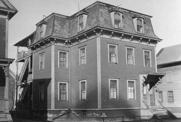
Gregg-Stone House, Salem, Massachusetts

The house at 8 Chestnut Street in Salem, around 1890-1910. Image courtesy of the Phillips Library at the Peabody Essex Museum, Frank Cousins Glass Plate Negatives Collection.

The house in 2023:

According to the MACRIS documentation for this house, it was built around 1805 by Daniel Gregg, and was originally a one-story building. It stood adjacent to the South Church, which was later lost in a fire, and it was used as a store. However, it was later purchased by John Stone, who expanded it around 1829 by adding the upper stories. He used it as a rental property for about a decade, before moving into the house in 1839.

During the second half of the 19th century, the house had a number of different owners and residents. The top photo was taken sometime around the turn of the 20th century by Frank Cousins, a photographer who used his camera to document the many historic homes in Salem. Not much has changed in this scene since then, and today the house still looks essentially the same as it did more than a century after the top photo was taken.

Chestnut Street from Cambridge Street, Salem, Massachusetts

The view looking west on Chestnut Street from the corner of Cambridge Street in Salem, around 1890-1910. Image courtesy of the Phillips Library at the Peabody Essex Museum, Frank Cousins Glass Plate Negatives Collection.

The scene in 2023:

These two photos show the view looking down Chestnut Street, which was developed in the early 19th century as an upscale residential neighborhood for Salem’s merchant class. Most of the homes feature Federal style architecture, and some of the ones in this scene have been highlighted in previous posts, including the James B. Bott House, the John C. Lee House, and the Captain Jonathan Hodges House.

Closest to the foreground, at the corner of Cambridge Street, is the house at 10 Chestnut Street, which was built around 1808 as the home of merchant Nathan Robinson. He lived here until his death in 1835, and the house was subsequently owned by several other families before being purchased by artist Philip Little in 1888. He was living here when the top photo was taken around the turn of the 20th century, and he remained here until his death in 1942.

Today, very little has changed in more than a century since the top photos was taken. All of the houses are still standing, and most have remained relatively unaltered. The street is one of the best surviving examples of a Federal-style residential neighborhood anywhere in New England, and it is part of the Chestnut Street District, which was added to the National Register of Historic Places in 1973.

Captain Jonathan Hodges House, Salem, Massachusetts

The house at 12 Chestnut Street in Salem, probably around 1890-1910. Image courtesy of the Phillips Library at the Peabody Essex Museum, Frank Cousins Glass Plate Negatives Collection.

The house in 2023:

This house was built around 1804 as the home of Captain Jonathan Hodges, his wife Mary, and their six children. Hodges was a merchant, and the early 19th century was the height of Salem’s prosperity as a seaport. During that time, this area around Chestnut Street was developed as a fashionable residential area for the city’s merchants and other wealthy residents. Many in the neighborhood were designed by architect Samuel McIntire, including this one, although this is the only house on Chestnut Street itself that is documented to McIntire.

It was originally built as a two-family home, and from 1805 to 1811 the Hodges family shared it with Jonathan Hodges’s former apprentice, Nathaniel Bowditch. As a boy in the 1780s, Bowditch had been indentured to Ropes & Hodges Chandlery, where he gained experience in bookkeeping. He later taught himself algebra and calculus, sailed as a ship’s clerk and later as a captain, and eventually published his famous book, Bowditch’s American Practical Navigator. By the time he moved into this house he was about 32 years old, and was married to his second wife Mary. They had an infant son, Nathaniel Ingersoll Bowditch, and over the years they would have seven more children.

The Bowditch family eventually moved to a different house, but Hodges remained here for the rest of his life. In 1829 he sold the house to his niece, Sally F. Orne, but eh continued to live here until his death in 1837. According to the house’s MACRIS documentation, subsequent 19th an early 20th century owners included Jonathan Willard Peele, Nathan Nichols, and Emily C. F. West. Emily West owned the house when the top photo was taken around the turn of the 20th century, and it remained in her family until 1941.

Today, more than a century after the top photo was taken, not much has changed in the exterior appearance of this house or the surrounding streetscape. Even the tree on the far left side of the photo is still there from the top photo, standing in front of the adjacent John C. Lee house. Overall, the house survives as a good example of early 19th century Federal-style architecture, and along with the rest of the street it is now part of the Chestnut Street District, which was added to the National Register of Historic Places in 1973.

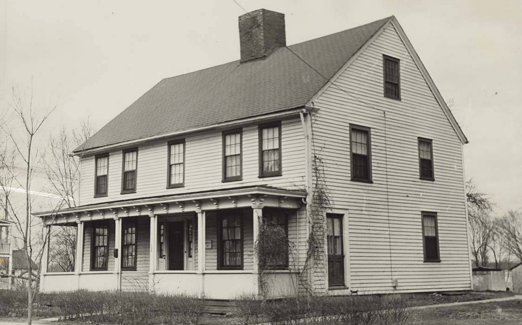
John Dickinson House, Hatfield, Massachusetts

The house at the corner of South Street and Bridge Lane in Hatfield, in April 1934. Image taken by Arthur C. Haskell. Library of Congress, Historic American Buildings Survey Collection.

The house in 2024:

This house, which is also referred to in some sources as the Morton House, was built around 1762 by John Dickinson. It is a saltbox-style house, with a second story on the front part of the house and a long, sloping roof in the back. This design was typical for mid-18th century homes in the Connecticut River valley, and the large center chimney was also a common feature from homes of this period. However, this house is probably best known for its elaborate front doorway. Such doorways were often found on higher-end homes in the valley during the mid-18th century, although this one is unusual because it is topped by a rounded pediment, rather than the more common flat-top or scroll pediments.

During the 19th century, the house was owned by the Morton family, with the 1873 county atlas showing an M. Morton here. By the time the top photo was taken in 1934, it was owned by Eugene E. Jubenville. The photo was part of the Historic American Buildings Survey documentation of the house, which also included a series of architectural drawings of the interior. By this point, the exterior of the house had undergone some changes, including the installation of exterior shutters and 2-over-2 windows, but overall it retained much of its 18th century form, including its distinctive doorway.

Today, the house is still standing here, as shown in the second photo. There have been some changes, including the loss of the outbuildings and barns behind the house, but otherwise the house itself has seen few changes. In some ways, it even looks more true to its historic appearance now than it did in 1934, due to the removal of the shutters and the installation of 18th century-style 12-over-12 windows. The ornate doorway is also still there, although it is now hidden from this angle by the large hydrangea bush. This plant must be around 100 years old now, because it is also visible in the 1934 photo, back when it was much smaller.

David Billings House, Hatfield, Massachusetts

The house at 18 Main Street in Hatfield, Massachusetts, in 1938. Image taken by Arthur C. Haskell. Library of Congress, Historic American Buildings Survey Collection.

The house in 2024:

This house was built in 1783 as the home of Lieutenant David Billings (1731-1807). It stands on the east side of Main Street, between the street and the Connecticut River, with a lot that originally extended all the way back to the river. The house remained in the Billings family for many years, and subsequent owners included his grand nephew Joseph Dickinson Billings (1813-1882), and then by Joseph’s daughter Mary Billings Dickinson (1843-1922). It is an excellent example of an early Federal-style house, and in 1910 the A History of Hatfield, Massachusetts noted that [t]he house has the same appearance as of old, having been kept in excellent repair.”

The top photo was taken in 1938, as part of the Historic American Buildings Survey (HABS). This federal program involved documenting historic architecture across the country, and this house was one of several here in Hatfield that were included. At the time, the house still retained its original exterior appearance, but later in the 20th century it was altered with the installation of modern materials, including aluminum siding. However, the exterior has since been restored, and it now much more closely resembles its original appearance when compared to how it looked a few years ago.

Theodore Roosevelt’s Carriage Accident, Pittsfield, Massachusetts (3)

The wrecked carriage that President Theodore Roosevelt had been riding in on South Street in Pittsfield on September 3, 1902. Image courtesy of the Harvard Library, Theodore Roosevelt Collection.

The scene in 2023:

As explained in more detail in an earlier post, this spot on South Street was the site of a collision between an electric trolley and a horse-drawn carriage that was carrying President Theodore Roosevelt on September 3, 1902. It occurred on a section of South Street just south of the culvert over Wampenum Brook, when both the carriage and the trolley were heading south toward Pittsfield Country Club. Just beyond the culvert, the roadway narrowed, requiring southbound vehicles to cross over the tracks to continue.

The trolley, which was car 29 of the Pittsfield Street Railway, was filled with passengers hoping to see the president at the country club. Its conductor was James T. Kelly, and it was operated by motorman Euclid Madden. In the carriage, aside from the president, was Governor Winthrop Murray Crane, Roosevelt’s aide George Cortelyou, Secret Service bodyguard William Craig, and driver David J. Pratt. The carriage itself was a landau, and had a team of four horses.

The exact speed of the trolley was later subject to much debate, with some claiming that the crew was being pressured to travel at an unsafe speed to overtake the president before he reached the country club. Either way, at around 9:45 a.m. the trolley struck the left front wheel of the carriage while the carriage was starting to cross the tracks. The impact threw both Craig and Pratt from the carriage, killing Craig instantly and severely injuring Pratt. The other three occupants sustained relatively minor injuries, although Roosevelt had a cut on his lower lip, bruising and swelling on his face, a black eye, and a bruised left shin.

In the aftermath, once Roosevelt discovered that Craig was dead, the president confronted the motorman, with the next day’s Boston Globe quoting him as saying:

This is the most damnable outrage I ever knew. If you lost control of your car, there is some excuse, but if you tried to pass us, disregarding all our warnings, you ought to be punished.

Other accounts add that Roosevelt shook his fist while saying this, and then questioned Madden about why he was operating the trolley in such a manner, to which Madden supposedly protested that he had the right of way.

Following this confrontation, the president and his party went to the home of Maroa Stevens, a 53-year-old widow who lived in the house directly across the street from the accident. This house was blocked from view in the top photo because of the wrecked carriage and the bystanders in the foreground, but it is still standing here, and it is shown in the center of the bottom photo. There, his surgeon treated his injuries, and he rested and recuperated in the house for about a half hour. During that time, a new carriage was obtained, and he then continued his journey toward Lenox and eventually back to his home on Long Island by the end of the day.

Today, the scene looks very different from its appearance in 1902, and there are no historical markers or other indication that the accident occurred here. The only readily-identifiable landmarks from contemporary accounts of the accident are the culvert over the Wampenum Brook, which is located on the far left side of the photo, and the Stevens house in the center of the photo.