Lost New England Goes West: California Street, San Francisco (2)

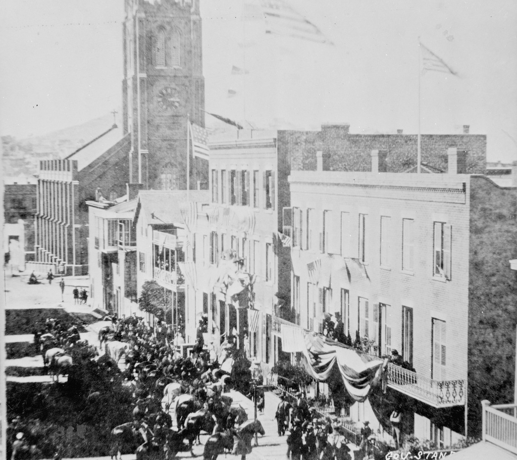
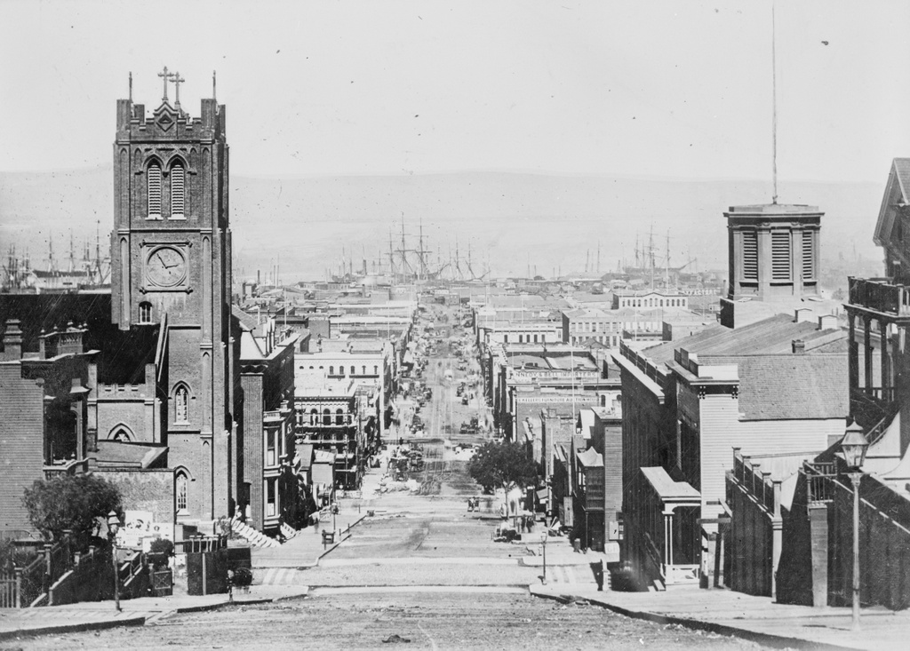
Looking east down California Street in between Grant and Stockton Streets in San Francisco, in 1863. Image courtesy of the Library of Congress, Historic American Buildings Survey Collection.

894_1863c loc

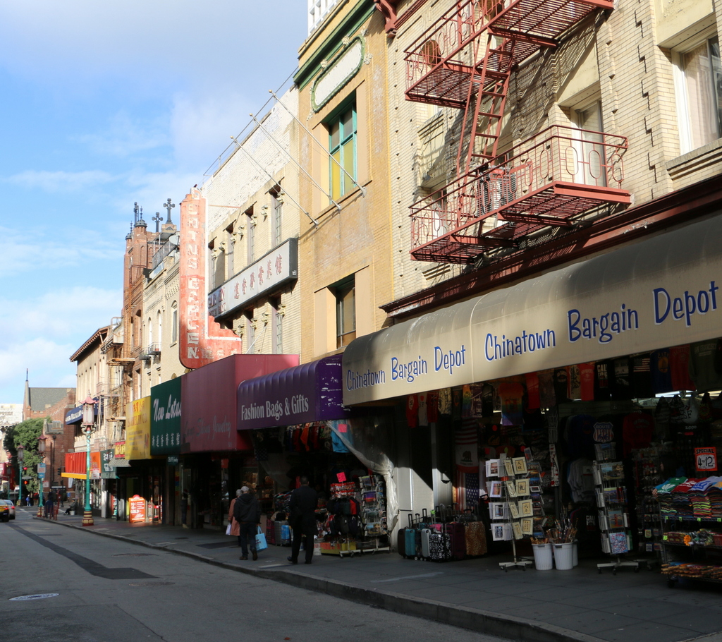
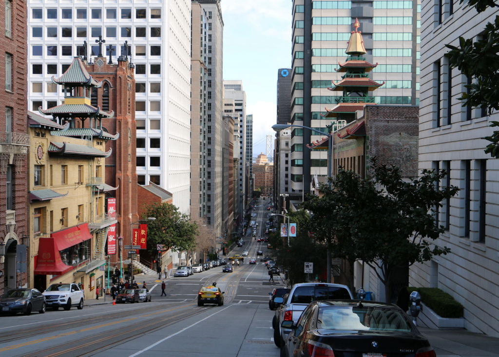
California Street in 2015:

894_2015
When the first photo was taken, the United States was in the midst of the Civil War, and although the bulk of the fighting was some 2,000 miles away, California nonetheless contributed to the Union war effort. Thanks to the Gold Rush about 15 years earlier, San Francisco was a prosperous, rapidly-growing city, and much of this gold was used to fund the Union army. Although southern California had a substantial number of Confederate sympathizers at the time, the northern part of the state, including San Francisco, was predominantly pro-Union, and provided a number of soldiers who went east to fight.

After the Civil War, San Francisco’s prosperity continued, and this section of California Street in the distance became the city’s Financial District. However, the entire area was destroyed in the 1906 earthquake and the resulting fires that spread across the city, and only a few buildings in this scene survived. The photo in this earlier post, taken from the base of the hill facing up California Street, shows some of the destruction.

The most notable survivor from the 1863 photo here is the Old Saint Mary’s Cathedral on the left, at the corner of Grant Avenue. Built in 1854, it withstood the earthquake itself, but was gutted by the fires that left only the brick walls standing. The interior was rebuilt in 1909, and the church is still standing today as a prominent landmark in the city’s Chinatown neighborhood.

This post is part of a series of photos that I took in California this past winter. Click here to see the other posts in the “Lost New England Goes West” series.

Burnham Tavern, Machias, Maine (2)

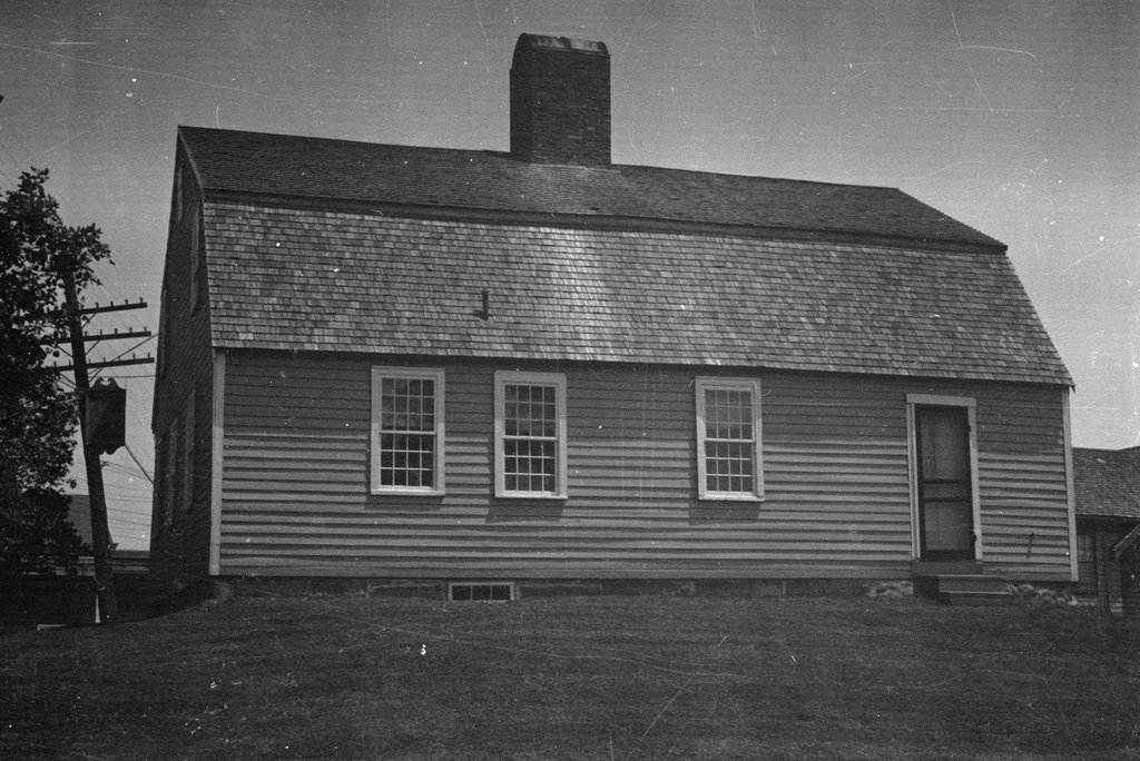
Another view of the Burnham Tavern, taken on June 17, 1937. Image courtesy of the Library of Congress, Historic American Buildings Survey Collection.

738_1937-06-17 loc habs

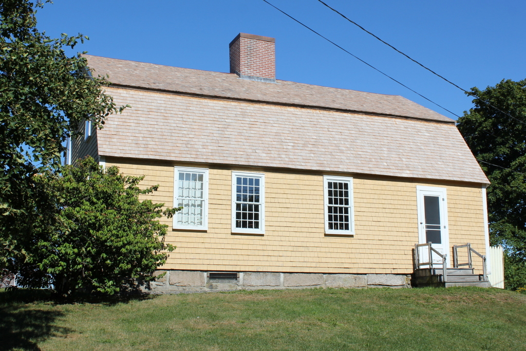
The building in 2015:

738_2015
This view shows the rear of Burnham, which as explained in the previous post was built in 1770 and played a role in the planning of the Battle of Machias, one of the first naval battles of the American Revolution.  Today, the building is well-preserved, and is maintained by the local chapter of the Daughters of the American Revolution as a museum, complete with period furnishings on the interior.  The first photo shows its appearance when it was documented for the Historic American Buildings Survey in 1937, and its exterior is virtually unchanged in the nearly 80 years since.  The only noticeable difference is the use of painted shingles instead of clapboards; this is actually in keeping with 18th century customs of putting clapboard on the front and shingles on the sides and back.

Burnham Tavern, Machias, Maine (1)

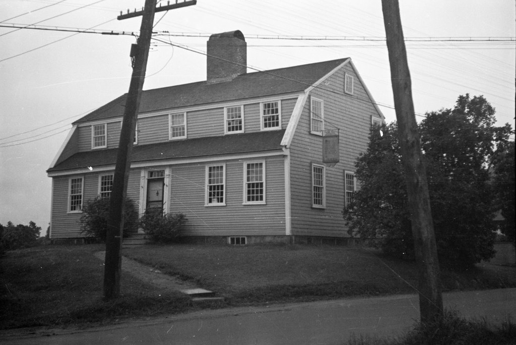
Burnham Tavern in Machias, seen on June 17, 1937. Image courtesy of the Library of Congress, Historic American Buildings Survey Collection.

737_1937-06-17 loc habs

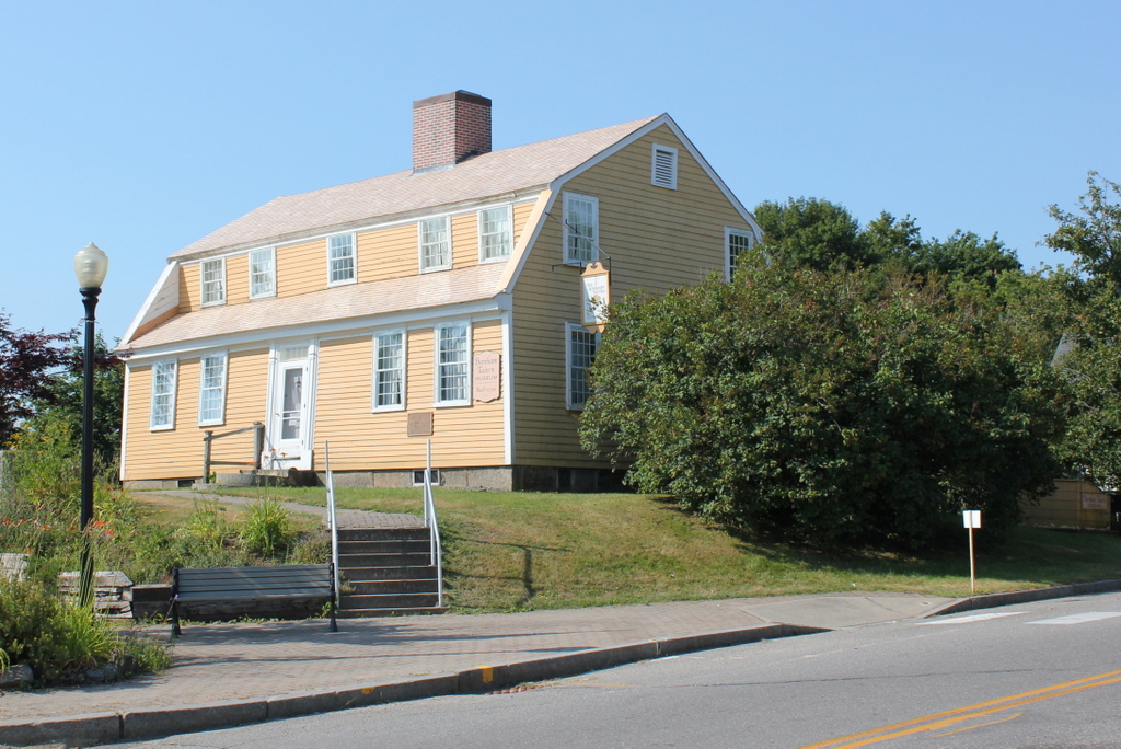
The building in 2015:

737_2015
This building is so old that it was built in a different state.  Maine was part of Massachusetts until 1820, and this tavern not only predates Maine statehood, but it also predates the American Revolution by several years.  Despite its remote location on the extreme eastern edge of the United States, it played a role early on in the Revolution, and it remains preserved as a historic landmark over 240 years later.

Burnham Tavern was built in 1770, just seven years after the area was first settled by English colonists.  Five years later, the American Revolution started, and the tavern was used to plan what became the second naval battle of the war.  In June 1775, a group of local militiamen led by Jeremiah O’Brien and Benjamin Foster captured the British schooner HMS Margaretta.  The Margaretta was renamed the Machias Liberty, and in August it and another captured vessel were commissioned as the first two ships in the Massachusetts navy.

In part because of its proximity to the British colonies in present-day Canada, Machias became a base of operations for privateers who captured British merchant vessels during the war.  In response, the British launched an attack in August 1777, with an invasion force of 123 marines and four of the most harmless-sounding ships in naval history: the HMS Rainbow, HMS Blonde, HMS Mermaid, and HMS Hope.  Undeterred by such intimidating ship names, local militiamen and Native American allies drove off the ships, and Machias survived the war without any additional attacks.

The building’s historic significance was already understood by the time the 1937 photo was taken, when it was documented for the Historic American Buildings Survey.  Not much has changed since then, down to the sign hanging on the right side of the building.  It retains much of its 18th century appearance, both on the outside and on the inside, and it is operated as a museum by the local chapter of the Daughters of the American Revolution.

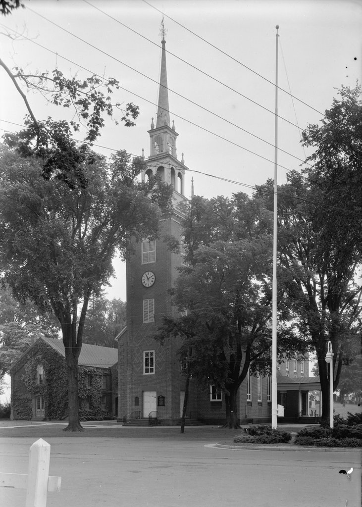
First Church of Christ, Wethersfield, Connecticut

The First Church of Christ in Wethersfield, photographed on July 29, 1940. Image courtesy of the Library of Congress, Historic American Buildings Survey Collection.

659_1940-07-29 loc

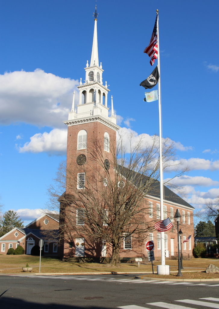
The church in 2024:

The First Church of Christ in Wethersfield is one of the oldest existing church buildings in the Connecticut River Valley.  Along with Hartford and Windsor, Wethersfield was one of the original three towns in the colony of Connecticut, and today its Old Wethersfield Historic District includes around 100 colonial-era buildings.  The church was built in 1761, and like many New England churches of the era the main entrance is on the side of the building, with the pews facing the left-hand side of the building instead of the back.  Its steeple also reflects mid-18th century tastes, and it is nearly identical to the one on Old North Church in Boston.

Wethersfield is located along two of the three main routes of the old Boston Post Road, which connected New York and Boston, so over the years this church has had several notable visitors, including future presidents George Washington, who attended a service here on May 20, 1781, and John Adams, who climbed the steeple in 1774 while on his way to the First Continental Congress.  Washington’s visit was part of a five day stay in Wethersfield, when he met with French General Rochambeau at the nearby Joseph Webb House to plan the Siege of Yorktown.

At first glance, the church doesn’t appear to have changed much in the past 75 years, but there are a few differences.  In the 1880s, the church was renovated to bring it more in line with Victorian-era styles, which included long stained glass windows that extended almost from the ground to the roofline.  The building is partially hidden by trees in both photos, but some of the windows are visible in the 1940 photo.  In the early 1970s, the tall Victorian windows were removed as part of an extensive restoration that returned the building to its original 1761 appearance, so today the historic church doesn’t look much different from when John Adams stopped by on his way to Philadelphia, or when George Washington planned the final battle of the American Revolution across the street.

Samuel Hartwell House, Lincoln, Mass.

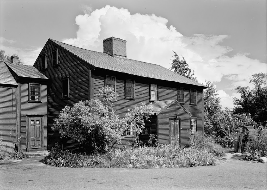
The Samuel Hartwell House, in Lincoln, Mass, in 1961. Image courtesy of the Library of Congress, Historic American Buildings Survey Collection.

Lincoln

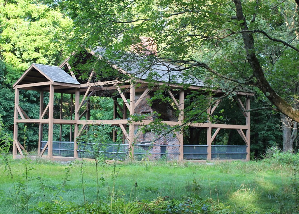
The scene in 2013:

106_2013

Located along the Battle Road in the Minuteman National Historical Park, the Samuel Hartwell House was built around 1695, and was occupied by Samuel Hartwell during the battles of Lexington and Concord, when the British forces marched to and from Concord past the house.  The house was used as a restaurant from 1929 until 1968, when it burned.  All that remained was the central chimney and the cellarhole; the National Park Service later built the frame and roof in the style of the original building.