Feeding Pigeons at Park Street Station, Boston

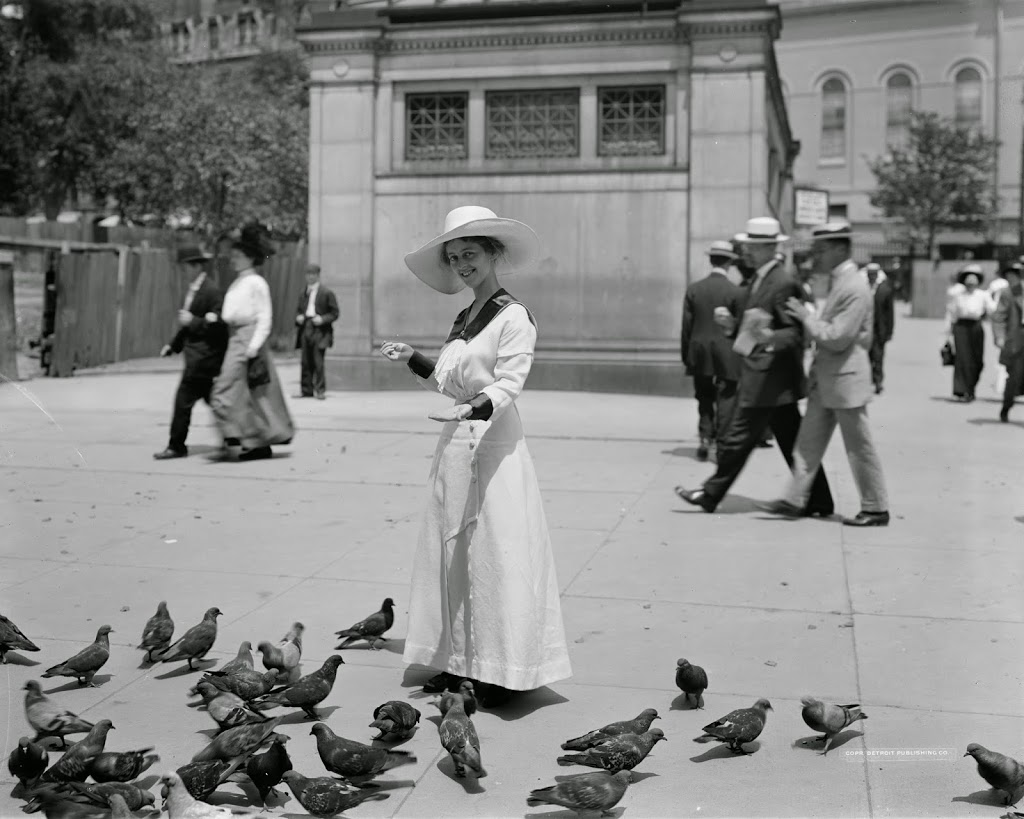
A woman feeding pigeons along the Boston Common next to Park Street station, sometime between 1900 and 1920. Image courtesy of the Library of Congress, Detroit Publishing Company Collection.

248_1900-1920c-loc

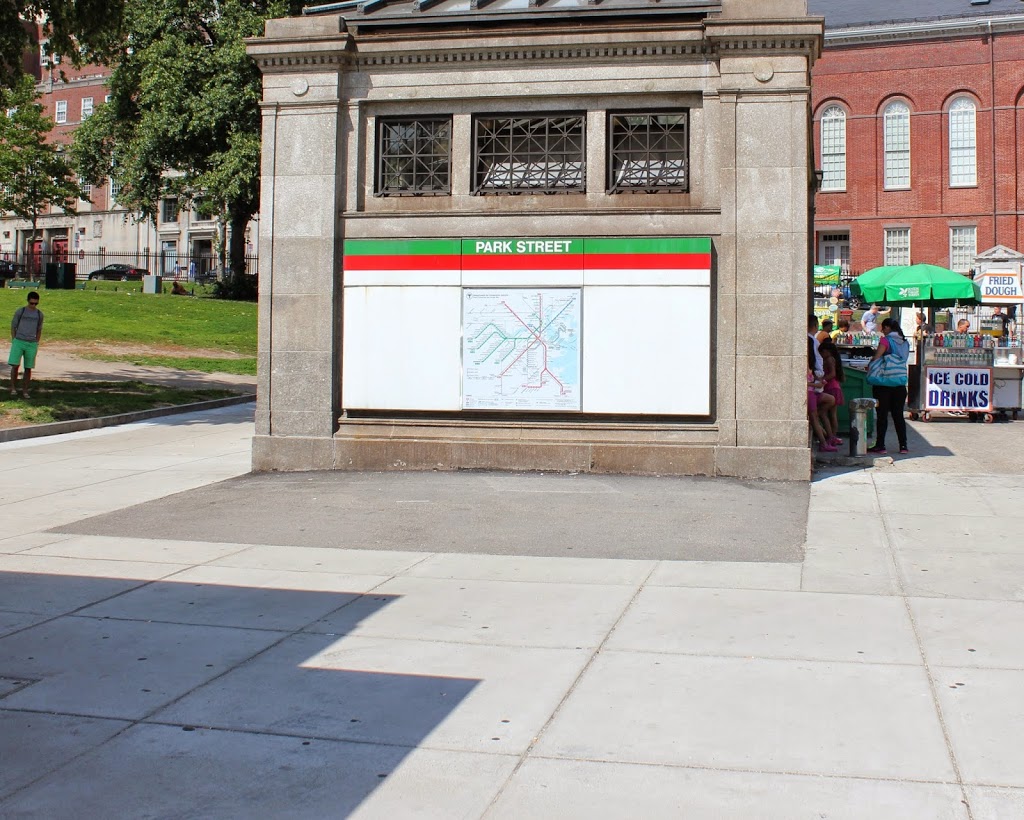
The same scene in 2014:

248_2014

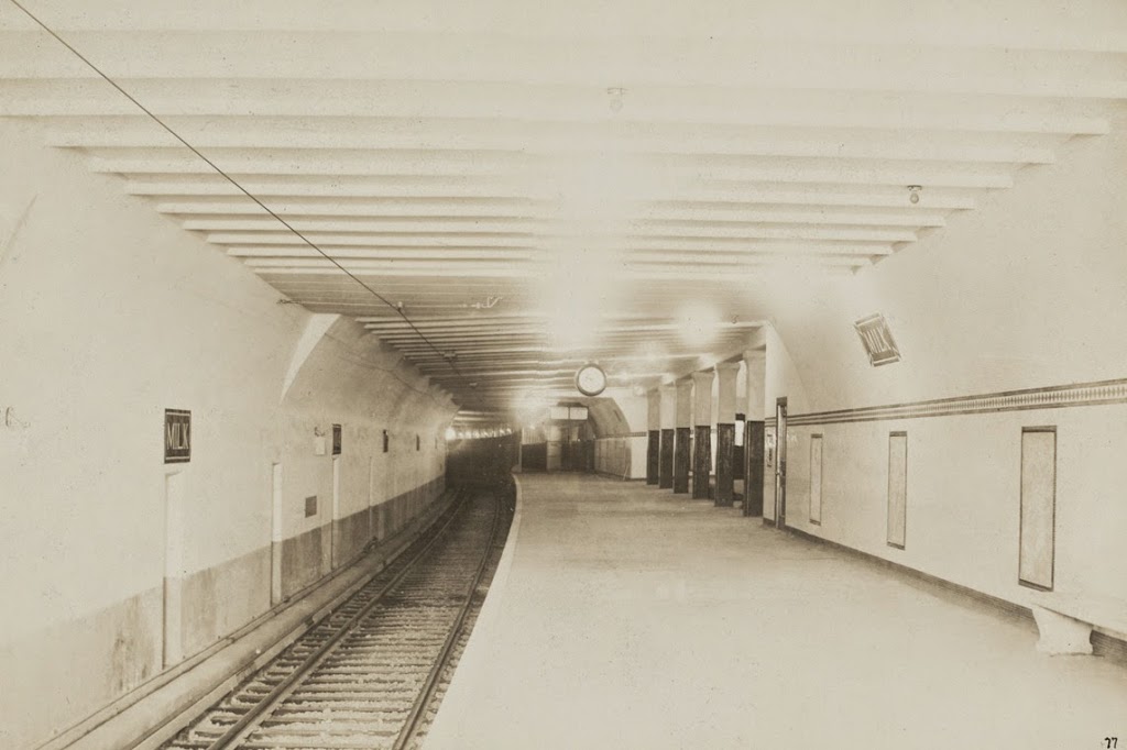
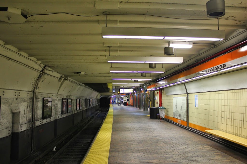
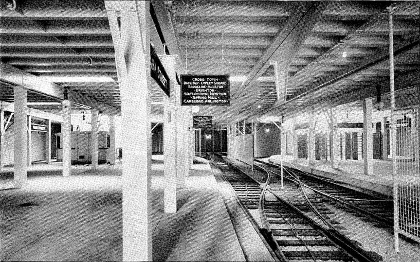
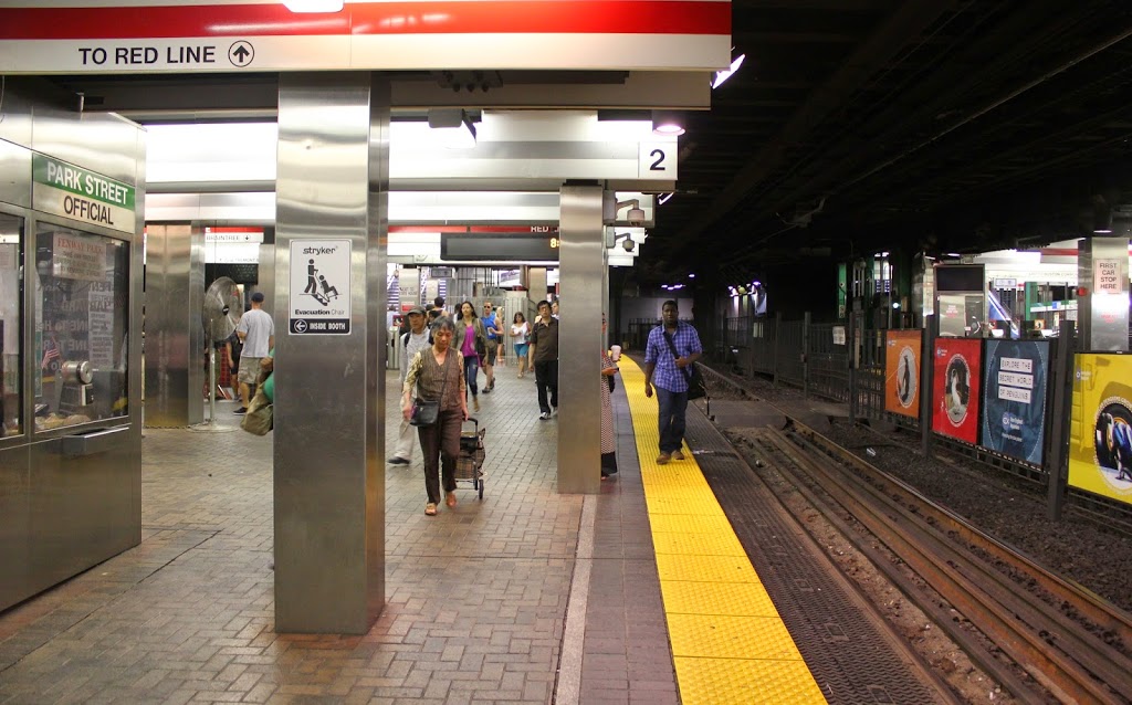
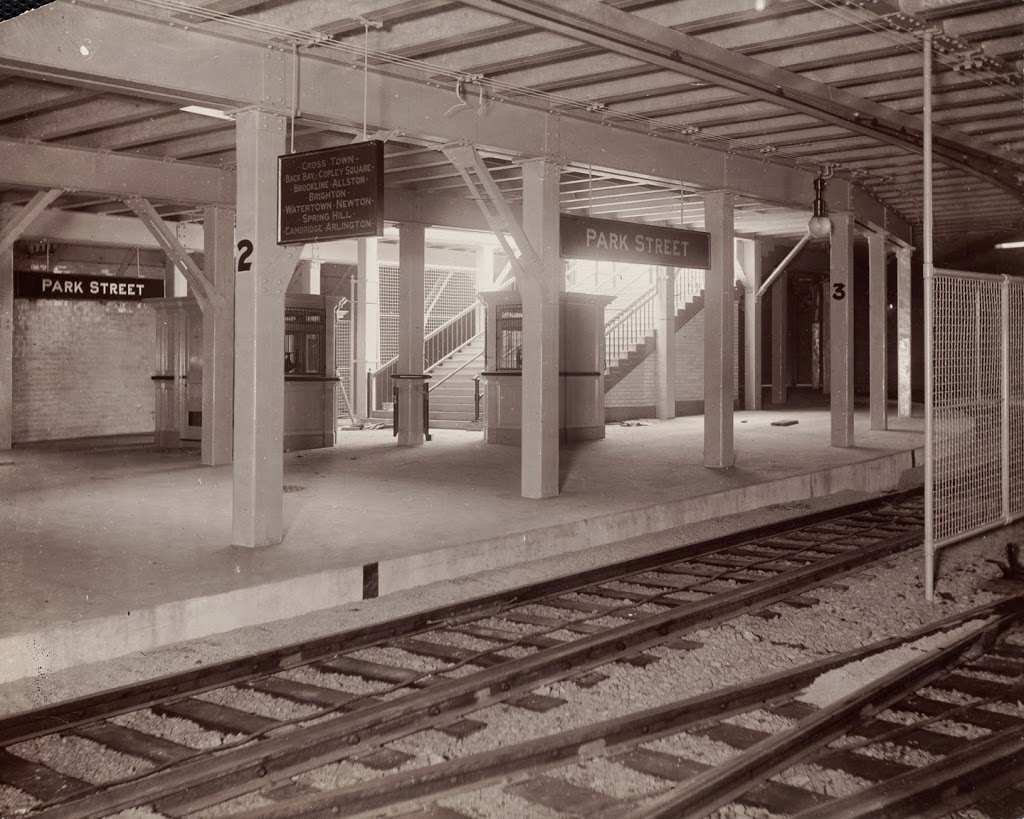
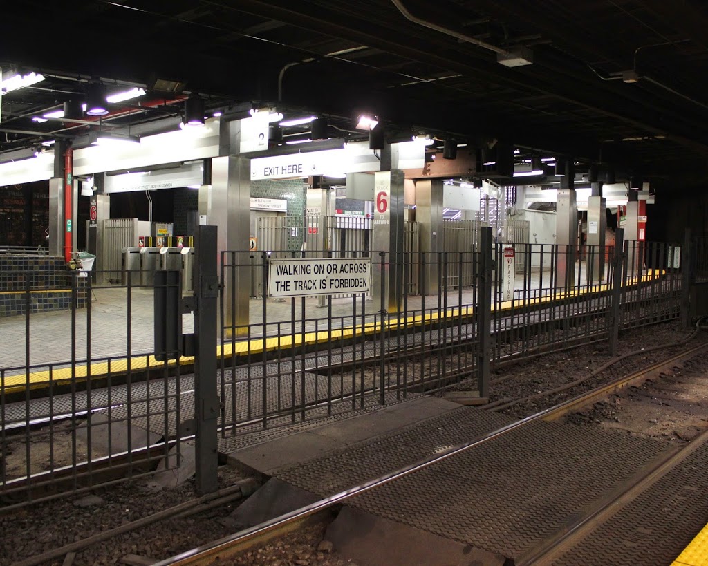
The first photo was probably taken not long after Boston built its subway network, and the Park Street station was where it all began.  As mentioned in these posts (Post 1 and Post 2) of the interior of the station, Park Street and Boylston were the first two subway stations in North America, and today Park Street is still a major hub on the “T”, where passengers can transfer between the Red and Green lines.  It is also near the start of the Freedom Trail and the Massachusetts State House, so it is frequented by tourists as well.

I don’t know who the woman in the picture was, but it is safe to say that everyone in the photo has probably been dead for over 30 years.  And, unlike the people in the two photos, the pigeons that still inhabit Boston Common are still dressed pretty much the same way.

Milk/State Station, Boston

The southbound platform of what is today the State station on the Orange Line.  At the time that the photo was taken, around 1912, it was known as Milk station. Photo courtesy of Boston Public Library.

242_1912c-bpl

The station in 2014:

242_2014

As mentioned in this post, the modern-day Green Line was the first subway in Boston and in North America.  It was opened in 1897, and was followed by the present-day Blue Line in 1904.  However, these were essentially underground trolley lines, as opposed to heavy rail rapid transit most commonly associated with subway systems.  Boston’s first true heavy rail rapid transit line was the Washington Street Elevated, which opened in 1901 and, as the name suggests, was elevated above Washington Street.  However, through downtown it was routed through the present-day Green Line’s Tremont Street Subway.

This changed in 1908, when the Washington Street Tunnel was opened, allowing elevated trains to bypass the trolley tunnels.  One unusual feature of this line, though, was that the northbound and southbound platforms were treated as different stations, with different names.  In the case of the 1912 photo above, northbound passengers would access the subway through the State station, located at State Street under the Old State House.  However, southbound passengers would enter a couple blocks away, at Milk Street, near Old South Meeting House, which meant the station, as seen on the walls in the 1912 photo, was called “Milk.”

Today, renovations have connected the two platforms, so that passengers can access trains in either direction from any entrance.  However, the southbound platform, as seen here, has survived largely unchanged in over 100 years.  The only major difference is the tunnel connecting to the northbound platform, which is barely visible in the 2014 photo off in the distance.

Park Street Subway Station, Boston (2)

Another view of the interior of the Park Street station, around 1898. Photo from The New England Magazine, Volume 25, Issue 5.

241_1898c-nemagazine

The station in 2015:

241_2014

This photo was taken just across the center tracks from the photos in this post, standing on the edge of the outbound platform facing in the inbound direction.  The stairs in the very distance, which lead up to Boston Common, are the same ones visible in the other post.

As mentioned previously, Park Street is one of the two oldest subway stations in North America, having opened in 1897.  Today, the Green Line platform configuration remains mostly the same, with two island platforms surrounded by tracks on both sides.  The two center tracks lead to a turning loop, which can be used by inbound trains to reverse direction.  Both tracks along the outbound platform are served by all trains; Boston does not have express trains.

Park Street Subway Station, Boston (1)

The Park Street station, around the time that it opened in 1897. Photo courtesy of Boston Public Library.

240_1897c-bpl

The same view in 2014:

240_2014

Although New York has by far the busiest subway system in the country, Boston’s actually came first.  The idea was to relieve congestion on Boston’s surface streets by putting trolleys underground.  Known as the Tremont Street Subway, trolleys entered the tunnel in two separate locations, at the corner of Arlington and Boylston Streets and at the corner of Tremont and Pleasant Streets.  The two lines converged at Boylston Station, and then continued up to Park Street.

Boylston and Park Street were the first two stations to be opened, on September 1, 1897, and consequently they are the oldest subway stations in North America.  The following year, the tunnel was extended to North Station.

Today, much of the original tunnel is still used by the MBTA Green Line, which still runs light rail trolleys, as opposed to the heavy rapid transit trains that Boston’s other subway lines operate.  The branch to Pleasant Street is closed south of Boylston, and the tunnel and stations north of Government Center (originally Scollay Square) have been substantially changed.

As far as the Park Street station, the overall platform configuration remains mostly the same as it was 117 years ago.  However, there have been a number of changes to the station, with probably the most significant one being the addition of the lower level in 1912 for the Red Line, as it is now known.  One of the stairways to the Red Line platforms is visible on the far left of the 2014 photo.  Today, it is one of the main hubs on the Green Line, and is the main transfer point between the Green and Red Lines.

As a side note, both photos were taken from the inbound platform. The station’s layout is unusual in that both platforms have tracks on both sides; these photos face across the two center tracks toward the outbound platform and the stairs leading up to Boston Common.