Armory at Harpers Ferry, West Virginia

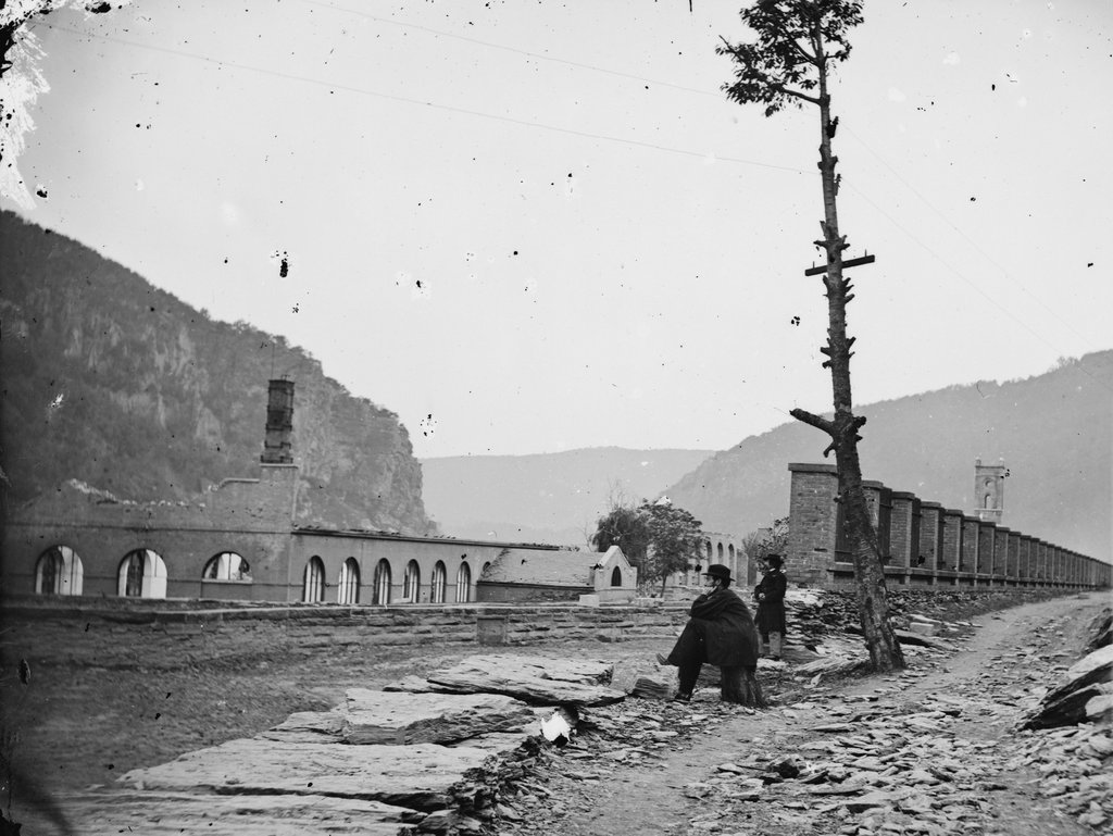
The ruins of the Harpers Ferry Armory, photographed in October 1862. Image courtesy of the Library of Congress, Civil War Collection.

730_1862-10 loc

The scene in 2015:

730_2015 loc
Prior to the Civil War, Harpers Ferry was the location of one of the country’s two federal armories, with the other being in Springfield, Massachusetts.  Both sites were chosen by George Washington, and they had similar advantages.  Harpers Ferry and Springfield are both located on major rivers at the intersection of major transportation routes, but they are also located above the head of navigation on their respective rivers, preventing a naval attack from a foreign enemy.

In the first half of the 19th century, these two armories developed new ways to manufacture firearms, using machinery that mass-produced identical, interchangeable parts and that could be operated by unskilled workers.  By the start of the Civil War, there were over 15,000 guns stored here, which helped entice John Brown to lead a raiding party in 1859.  His goal was to start a slave rebellion by taking the arsenal and distributing the weapons to area slaves, and although the plan failed, it helped to spark the Civil War only a year and a half later.

By the time the first photo had been taken in October 1862, Harpers Ferry had already changed hands a number of times in the Civil War, and armies on both sides had steadily destroyed the buildings in order to prevent the other side from making use of them.  The ruins seen here are from the same building that can be seen on the right hand side of the 1861 photo in this post.

Around the time that the first photo was taken, the ruins had several notable visitors, including Abraham Lincoln, who toured the armory site in October, perhaps on the same day that the photo was taken.  Author Nathaniel Hawthorne also visited Harpers Ferry earlier in 1862, and wrote the following description in his essay “Chiefly About War Matters”:

Immediately on the shore of the Potomac, and extending back towards the town, lay the dismal ruins of the United States arsenal and armory, consisting of piles of broken bricks and a waste of shapeless demolition, amid which we saw gun-barrels in heaps of hundreds together. They were the relics of conflagration, bent with the heat of fire, and rusted with the wintry rain to which they had since been exposed. The brightest sunshine could not have made the scene cheerful, nor have taken away from the gloom from the dilapidated town; for, besides the natural shabbiness, and decayed, unthrifty look of a Virginian village, it has an inexpressible forlorness resulting from the devastations of war and its occupation by both armies alternately.

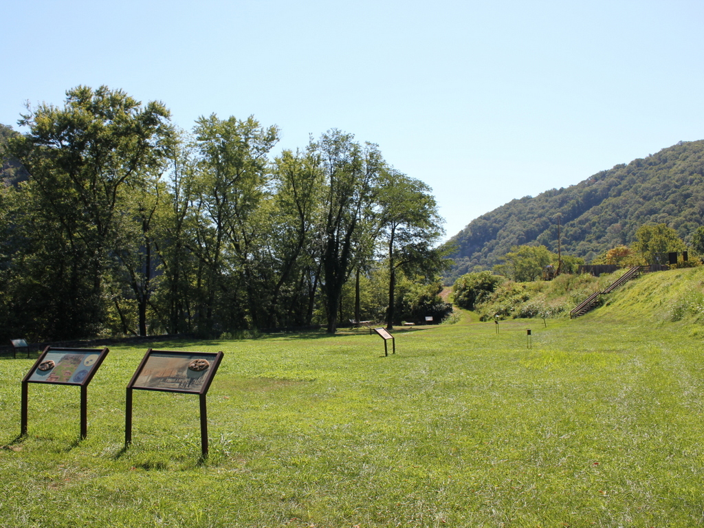
The town became part of West Virginia in 1863, and things were relatively stable here until the end of the war.  However, at that point the damage had been done.  The pre-war economy of Harpers Ferry had relied almost exclusively on the armory, but it was never rebuilt following the war.  The land was sold, and the Baltimore & Ohio built railroad tracks through part of the land, including the present-day railroad station, which was completed in 1889. Today, this area is part of the Harpers Ferry National Historical Park, and although there are no buildings still standing here from the armory, the interpretive signs help to give visitors an idea of what was once here.

J.R. Montgomery Company Buildings, Windor Locks, Connecticut

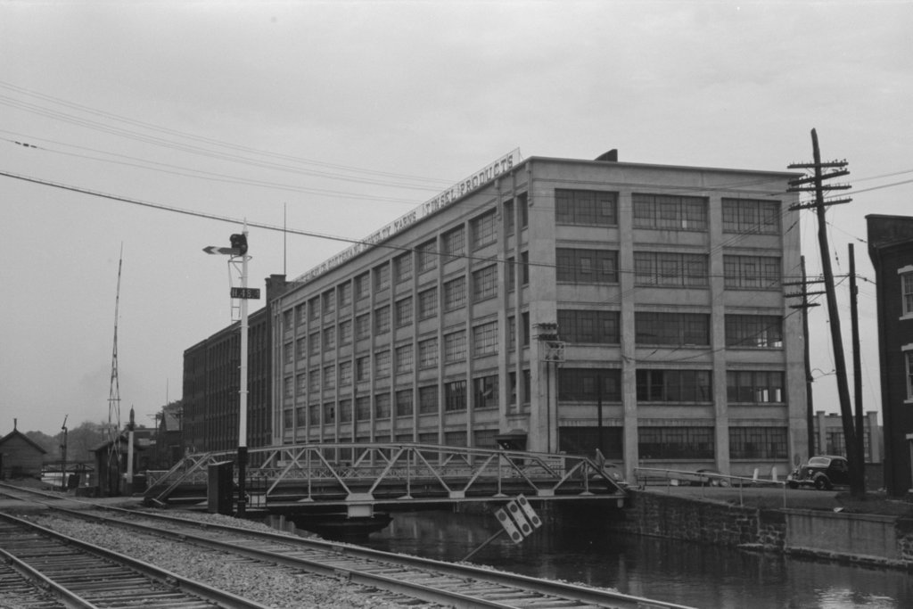
The J.R. Montgomery Company, along the canal in Windsor Locks in October 1939. Image courtesy of the Library of Congress, FSA-OWI Collection.

660_1939-10 loc

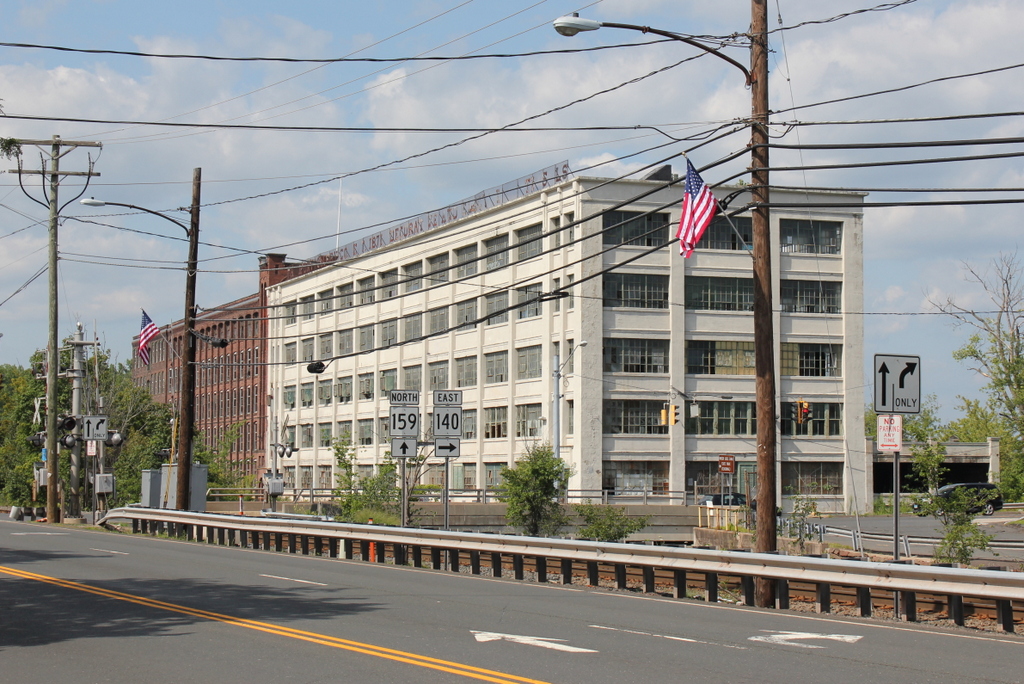
The factory in 2015:

660_2015
The town of Windsor Locks gets its name from the canal locks that were located here, which allowed boats to bypass the Enfield Falls just to the north.  More of a series of rapids than a true waterfall, the Enfield Falls are the natural head of navigation on the Connecticut River, and were a significant obstacle to river trade with Springfield and other cities to the north.  This problem was resolved in 1829, with the opening of a 5.25 mile long canal that ran parallel to the river.  However, it never became a major transportation route, because like many other early 19th century canals it was soon superseded by railroads.  However, at least one notable visitor did pass through here on the canal; author Charles Dickens traveled along the river on a steamboat in 1842, just two years before the construction of the Hartford and Springfield Railroad, which can be seen next to the canal in the foreground of both photos.

Although the heyday of transportation canals was short-lived, the Enfield Falls Canal was soon put to a different use.  Here in Windsor Locks, at the southern end of the canal, the 30-foot drop from the canal to the river made it an ideal location for factories.  Industrialist J.R. Montgomery established a thread and yarn factory here in 1871, eventually producing a variety of, as the sign atop the building reads, “Novelty Yarns” and “Tinsel Products.”

The brick building in the distance was built in 1891 and expanded to the north (further from the camera) in 1904. The white concrete section was added in 1920, so the entire structure combines 30 years of factory architecture styles into one building.  However, the Montgomery Company closed in 1989, and the building has stood vacant ever since.  It is listed on the National Register of Historic Places, but three fires and over 25 years of neglect have certainly taken their toll, so at this point the future of the historic property is certainly in question.

Agawam Woolen Mill, Agawam, Mass

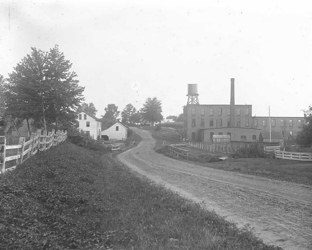
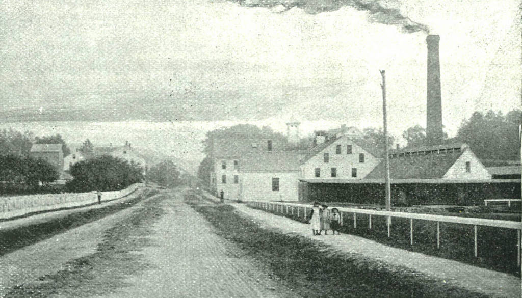
Looking west on Elm Street, with the Agawam Woolen Mill to the right, around 1895-1896. Image courtesy of the Agawam Historical Association.

633_1895-1896c aha

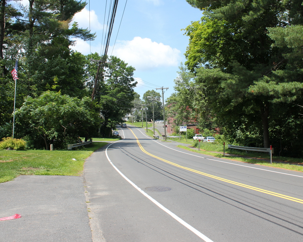
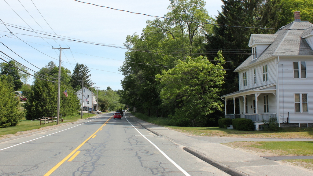
Elm Street in 2015:

633_2015
The former Agawam Woolen Mill building still stands on Elm Street, although it is mostly hidden behind the trees from this angle. Agawam was never a major industrial center, but this site along the Three Mile Brook had been used by mills since the early 1800s.  In 1857, the Agawam Company, later renamed the Agawam Woolen Company, established its first factory here, which was rebuilt in 1875 and destroyed in a fire in 1889.  The present-day factory was built around 1890, and was subsequently expanded several times after the first photo was taken.  However, by the mid 1900s, New England’s once thriving textile industry began to struggle amid increased competition, and like many others the Agawam Woolen Company closed in the 1950s.  The building still stands today, not all that different from the 1890s photo except for the early 1900s additions.  It is a contributing property, and the only industrial building, in the Agawam Center Historic District on the National Register of Historic Places.

Columbia Straw Works, Monson Mass

The Columbia Straw Works factory on Main Street in South Monson, around 1892. Image from Picturesque Hampden (1892).

559_1892c picturesquehampden

Main Street in 2015:

559_2015
In the second half of the 19th century, Monson developed into a significant industrial town, with the Chicopee Brook and its tributaries providing power to a number of different factories, including this facility on the left, which was built in the early 1880s by Alvin A. Gage and Rice Munn Reynolds to manufacture straw hats, which were sold at their store on Broadway in New York City.  Reynolds was the son of Monson industrialist Joseph L. Reynolds, and he had previously represented Monson in the Massachusetts House of Representatives in 1876 and 1877.  He also served as a town selectman and was one of the founders and trustees of Monson Savings Bank, which still exists today.  However, he committed suicide under rather mysterious circumstances in 1898, and his share of the business went to his brother Theodore, whose untimely death came less than two years later at the age of 57, following what the Boston Post described as “a supposedly slight illness.”  Theodore owned three mills in Monson, including this one, and was also the third largest stockholder in the Boston & Albany Railroad.  At his death, according to the Boston Post, he was worth close to $10 million, which would be around $280 million in 2015 dollars.

Following the death of Theodore Reynolds, the property was acquired by F.W.A. Langewald, who operated it as the Crescent Worsted Mill.  However, it burned within a few years.  The 1912 Hampden County atlas shows a couple small buildings on the site, but it appears that the fire marked the end of this location as a major industrial site.  Today, the only remnants of the factory itself are the stone foundations in the woods beyond the house on the right.  The small stream that once powered the factory still passes through the site, and across the street in the distance is the tenement house where many of the workers once lived.  It is the only recognizable building from both photos, and today it is an apartment building.

American Whip Company, Westfield Mass

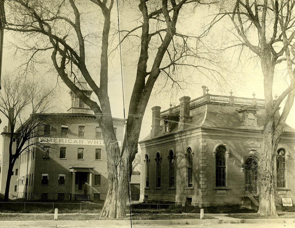
The American Whip Company building and the old Westfield Library building on Main Street, probably in the early 1890s. Image courtesy of the Westfield Athenaeum.

546_1895c westfieldathenaeum

The location in 2015:

546_2015
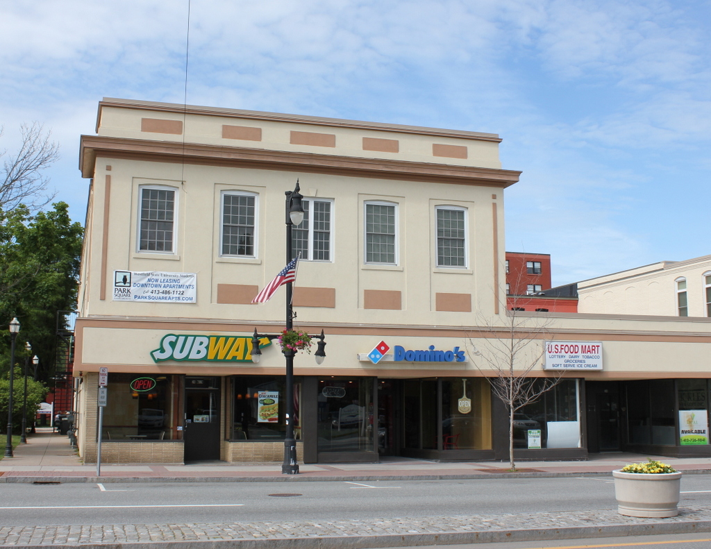
The American Whip Company was one of many whip manufacturers located in the “Whip City” of Westfield, Massachusetts. The building in the distance of the first photo was built around 1884, and less than a decade later the company merged with 13 other Westfield companies to form the United States Whip Company.  The added on to the facility with the “U” shaped building seen in this post; it is still on the site today, although it has been extensively modified.

The original 1884 building is still there, although it’s not visible from this angle; it is immediately behind, and slightly to the left of Subway and Domino’s today.  The old library building, however, is long gone – it was presumably demolished around 1892 when the United States Whip Company building was constructed on its spot.  Today, the Westfield Athenaeum is located on the other side of the Green, next to Court Street.

United States Whip Company, Westfield Mass

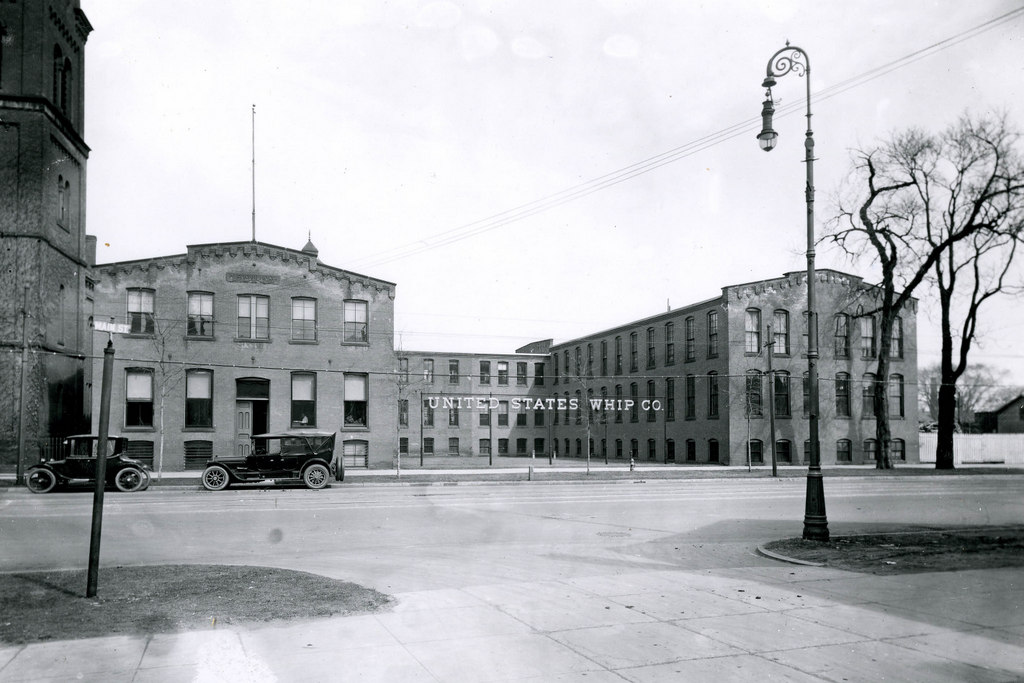
The United States Whip Company building on Main Street in Westfield, around 1920. Image courtesy of the Westfield Athenaeum.

545_1920c westfieldathenaeum

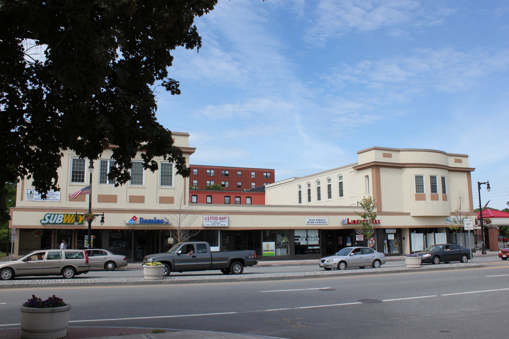
The site in 2015:

545_2015
The United States Whip Company was established in 1892 with the merger of 14 whip companies, and they built this building on Main Street in Westfield as their headquarters.  It was part of a large complex that took up much of the block between Main Street and Thomas Street, and some of the buildings were originally used by the American Whip Company, one of the companies later involved in the 1892 merger.

Westfield gained the nickname of the Whip City because of its many whip manufacturing companies, but by the turn of the 20th century essentially all of these were owned by United States Whip Company.  By the end of World War I, around 99% of the worldwide whip production was from Westfield, and the United States Whip Company accounted for about 85% of the market.  They were by far the world’s leading whip producer, but they were the leader in a rapidly shrinking industry.  Automobiles were making horse-drawn carriages obsolete, which meant a limited demand for Westfield’s primary manufactured goods.  In 1895, the city had 37 different whip companies; by 1926, not long after the first photo was taken, there were only 37 people working in the whip industry.

Today, the building on Main Street is still there, although it has been significantly altered over the years.  The brick exterior has since been covered in stucco, and the building that was once the world’s leading producer of whips is now home to Subway, Domino’s, and other businesses.  Along with the storefronts on the first floor of the original building, the space in between the “U” has been filled in with a one-story commercial block.