Lost New England Goes West: Palace Hotel Fire, San Francisco

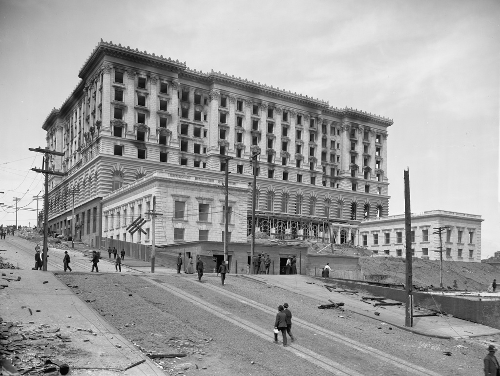
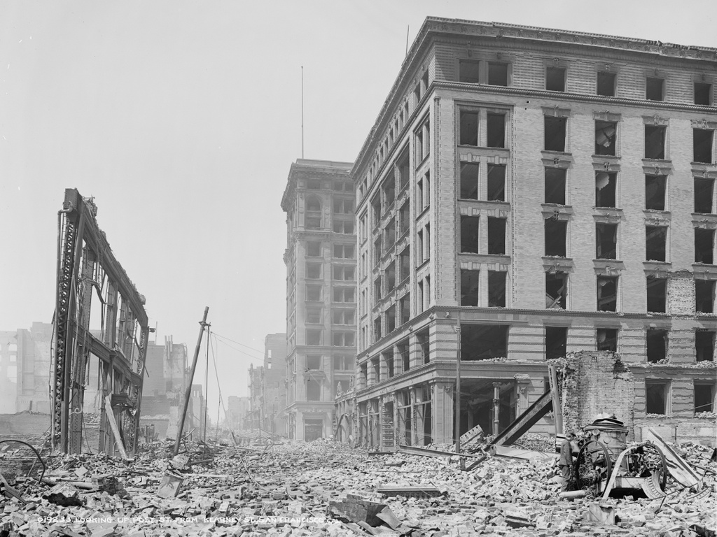
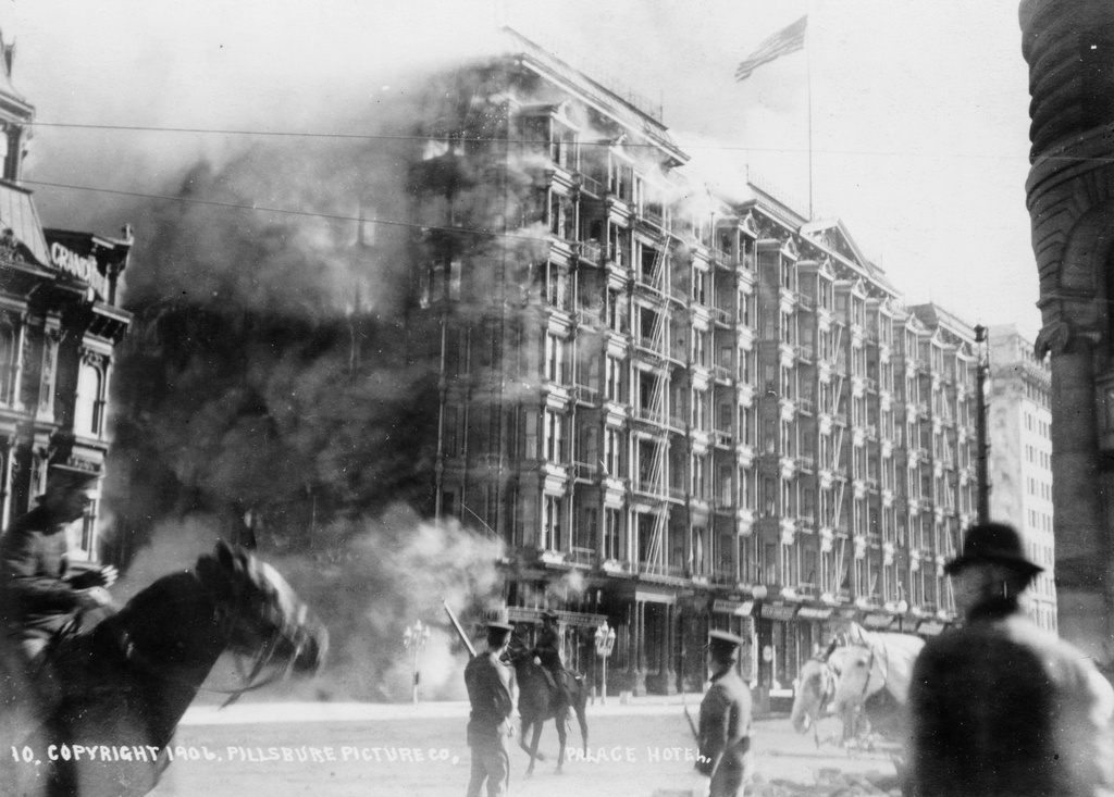
The Palace Hotel, seen from the corner of Market and Montgomery Streets as it burned on April 18, 1906, in the aftermath of the earthquake. Image courtesy of the Library of Congress.
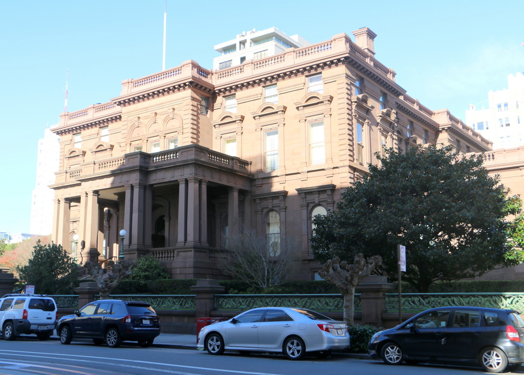
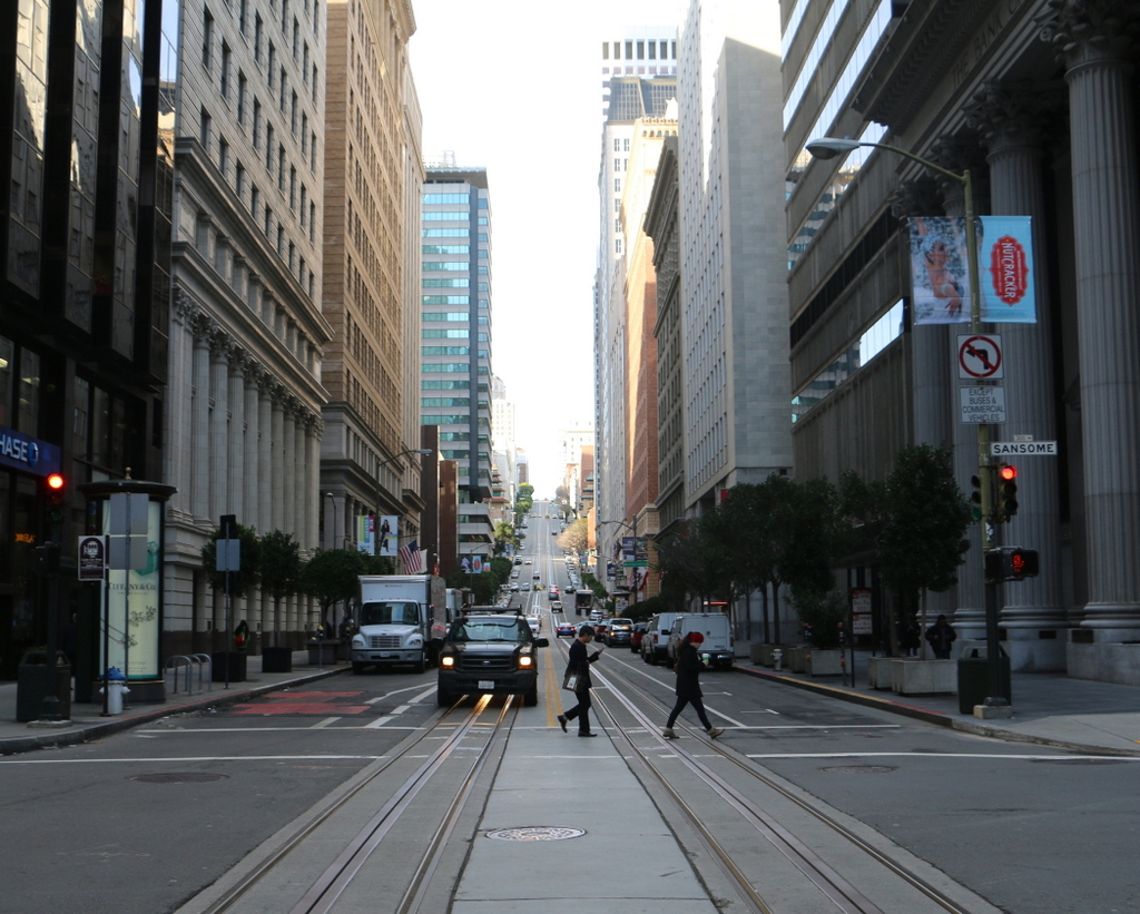
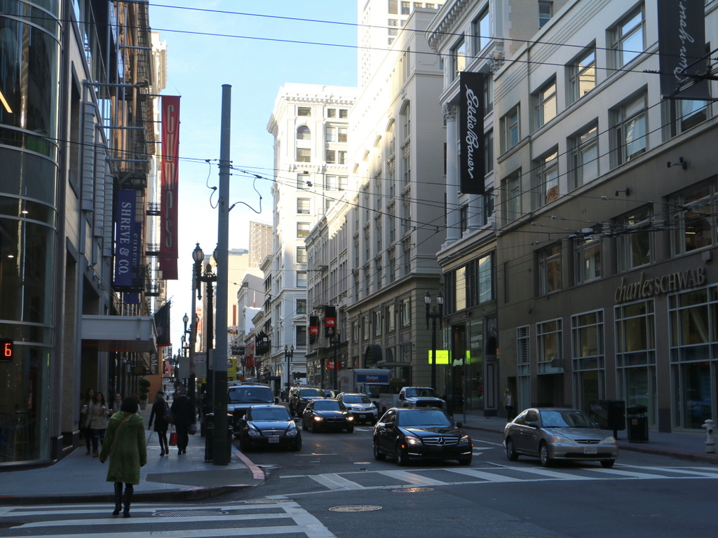
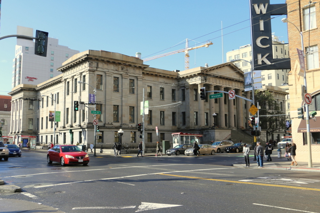
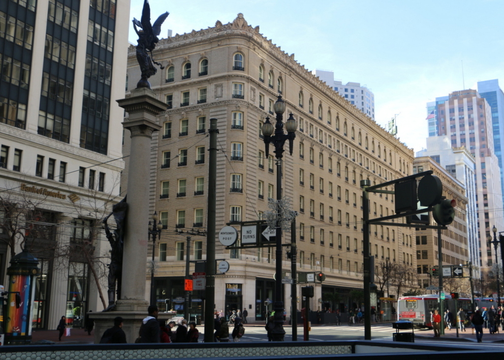
882_1906 loc

The scene in 2015:

882_2015
As explained in an earlier post, the Palace Hotel was San Francisco’s premiere hotel from when it opened in 1875 until its destruction in 1906. Like so many other buildings across the city, the hotel survived the earthquake itself with minimal damage, but fires soon began to spread throughout the city. Once they reached the hotel, the substantial amount of wood paneling inside allowed the flames to quickly engulf the entire building, as seen in the first photo. In the foreground, soldiers stand guard on Market Street, watching helplessly as one of the city’s most prominent landmarks was gutted by fire.

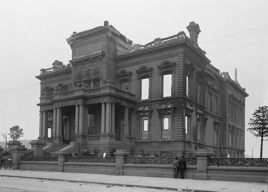
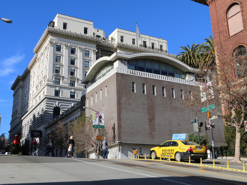
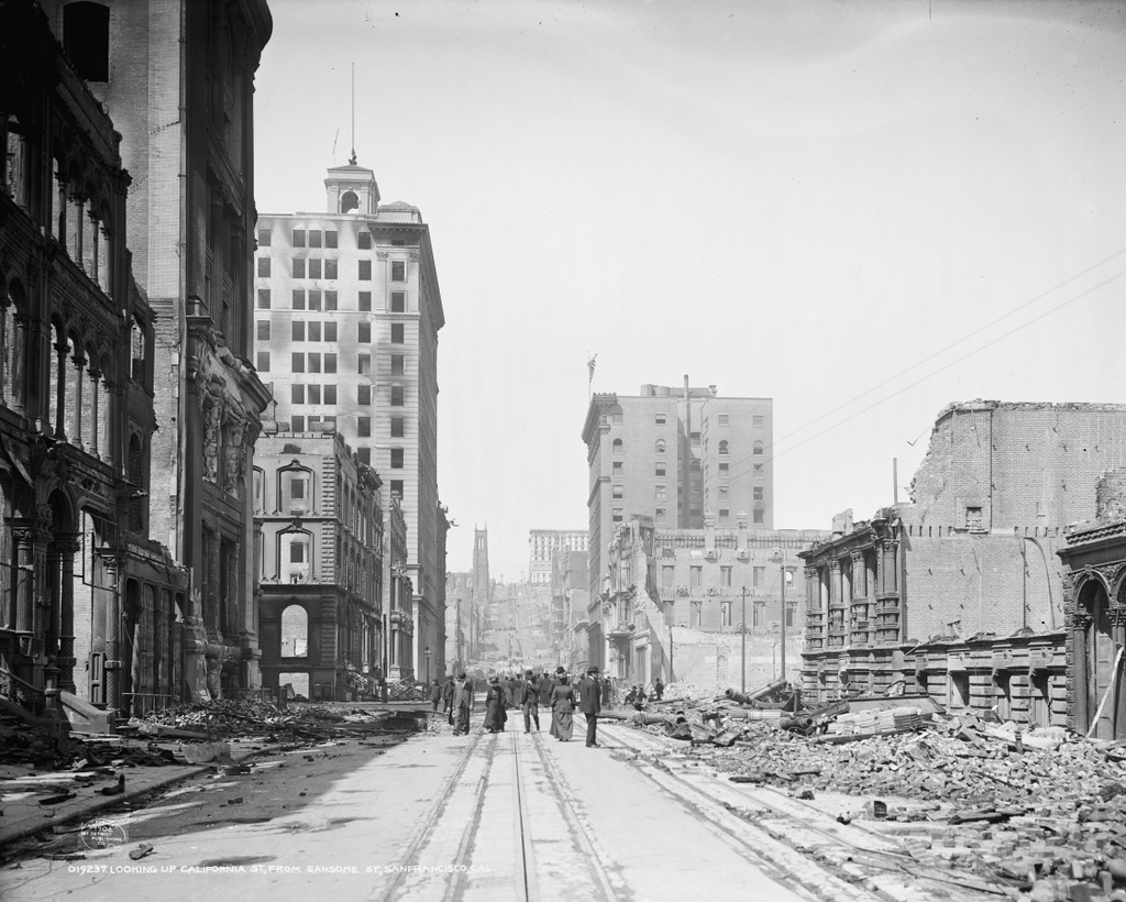
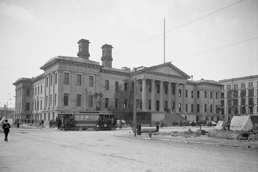
The view in this post, taken facing the opposite direction on Market Street, shows the burned-out remains of the hotel after the fire. It was soon demolished, and in 1909 the present-day Palace Hotel opened on the same spot. There is one building left standing from the first photo, though. Barely visible on the far right of the photo is the Monadnock Building, which was still under construction at the time of the earthquake. It survived the fires, and was completed the following year.

This post is part of a series of photos that I took in California this past winter. Click here to see the other posts in the “Lost New England Goes West” series.

Lost New England Goes West: James C. Flood Mansion, San Francisco

The James C. Flood Mansion on California Street in San Francisco, in the aftermath of the April 18, 1906 earthquake. Image courtesy of the Library of Congress, Detroit Publishing Company Collection.

881_1906c loc

The house in 2015:

881_2015
James C. Flood was born in New York City, but when he was in his early 20s he joined the California Gold Rush and moved to San Francisco in 1849. He had limited success in gold mining, but after a short time running the Auction Lunch Saloon, he began purchasing shares in silver mines and eventually made his fortune off of the Comstock Lode in Nevada. In 1886, he built this mansion on Nob Hill, where many of the city’s other millionaires lived at the time.

He only lived here for three years before his death in 1889, and at the time of the 1906 earthquake his daughter Cora lived here. Most of the other Nob Hill mansions were made of wood, so although the Flood Mansion was completely gutted by the fires, the stone exterior survived. The property was sold to the Pacific-Union Club, who rebuilt the interior and added wings to either side of the building and a third floor. Today, it is still used as their clubhouse, and along with the nearby Fairmont Hotel it is one of the few pre-earthquake buildings still standing on Nob Hill.

This post is part of a series of photos that I took in California this past winter. Click here to see the other posts in the “Lost New England Goes West” series.

Lost New England Goes West: Fairmont Hotel, San Francisco

The Fairmont San Francisco, seen from the corner of California and Powell Streets in the aftermath of the April 18, 1906 earthquake. Image courtesy of the Library of Congress, Detroit Publishing Company Collection.

880_1906c loc

The hotel in 2015:

880_2015
The Fairmont Hotel was still under construction when the 1906 earthquake hit. Structurally, it was heavily damaged, but it survived, and for a time was even used for emergency planning meetings before the fires made their way up Nob Hill. The burn stains over the windows in the first photo show the extent of the fire that gutted the hotel, but it would soon be repaired. The owners hired architect Julia Morgan to oversee the reconstruction, and the hotel opened exactly a year after the earthquake.

Nearly 40 years later, in 1945, it played a role in establishing the United Nations. While World War II was just coming to an end that summer, representatives from 50 countries met here at the hotel to draft the United Nations Charter, which was later signed at the San Francisco War Memorial and Performing Arts Center, and went into effect on October 26, 1945. Since then, it has remained a prominent San Francisco hotel, and it is listed on the National Register of Historic Places.

This post is part of a series of photos that I took in California this past winter. Click here to see the other posts in the “Lost New England Goes West” series.

Lost New England Goes West: California Street, San Francisco

The view looking up California Street from Sansome Street in San Francisco, in the aftermath of the April 18, 1906 earthquake. Image courtesy of the Library of Congress, Detroit Publishing Company Collection.

879_1906c loc

California Street in 2015:

879_2015
California Street is at the heart of San Francisco’s Financial District, and this area was hit hard by the 1906 earthquake and the subsequent fires. Most of the buildings in this scene appear to have been supported by load-bearing masonry walls, which easily crumbled as the ground shook. However, several taller buildings in this scene survived serious structural damage, including the 1904 Merchants Exchange Building in the left center, and the 1901 Kohl Building in the right center of the photo. These modern skyscrapers were built with steel frames, which have more “give” in an earthquake than brick or stone, allowing the building to bend rather than crack, and both are still standing today, amid newer and much taller skyscrapers.

The other surviving feature from this section of California Street is the cable car line, which is visible in the middle of the street in both photos. It was once one of 23 lines in the city, but after the earthquake most were replaced with less expensive electric trolleys. However, this line remained in operation because of its geography; Nob Hill in the distance was insurmountable for conventional trolleys, which did not have the traction to get up the steep grade. Cable cars, though, are literally pulled up the hill by a continuously-running cable under the street, which allows it to climb far steeper hills than the trolleys. Today, the city’s three remaining cable car lines are mostly used by tourists, but the California Street line still sees a significant number of commuters, because of its location in the Financial District.

This post is part of a series of photos that I took in California this past winter. Click here to see the other posts in the “Lost New England Goes West” series.

Lost New England Goes West: Post Street, San Francisco

The view looking up Post Street from Kearny Street in San Francisco, shortly after the April 18, 1906 earthquake. Image courtesy of the Library of Congress, Detroit Publishing Company Collection.

878_1906c loc

The view in 2015:

878_2015
The first photo was probably taken a matter of days after the fires had subsided in San Francisco, because there does not appear to have been any work done on cleaning up after the disaster. The street is still completely covered in debris, including the mangled remains of one of the city’s steam fire engines on the right side. It was one of 38 such vehicles that the department had, along with a sizable force of over 500 men. However, after the earthquake hit they found that their firefighting capabilities were limited by the fact that the earthquake had destroyed many of the water mains. This lack of water, combined with poor leadership decisions on the part of the city government, allowed fires to spread throughout much of the city virtually unchecked.

Today, at least one of the buildings from this photo is still standing. Located in the center of the photo a block away at the corner of Grant Avenue, the Shreve Building had just opened a few months before the earthquake. It was occupied by Shreve & Co., a prominent jewelry store, and it had been specifically designed to withstand earthquakes and fires. This was put to the test very quickly, and despite the earthquake and the building being gutted by fire, it remained structurally sound and was soon repaired.

This post is part of a series of photos that I took in California this past winter. Click here to see the other posts in the “Lost New England Goes West” series.

Lost New England Goes West: US Mint, San Francisco

The old San Francisco Mint, located at the corner of Mission and Fifth Streets, in the aftermath of the April 18, 1906 earthquake. Image courtesy of the Library of Congress, Detroit Publishing Company Collection.

877_1906c loc

The building in 2015:

877_2015
Amid the rubble and burned-out buildings left behind in the aftermath of the 1906 earthquake, the San Francisco Mint was one of the few buildings in the affected area that survived both the earthquake and the subsequent fires, as the first photo shows. The San Francisco branch of the US Mint was established in 1854 to handle the gold that was mined during the California Gold Rush, and this building opened 20 years later, in 1874.

At the time of the earthquake, the building was one of four US Mint facilities, and in addition to making coins it also held around $200 million in gold, which was a significant portion of the nation’s entire gold reserves. Because of this, its survival in the disaster was of vital importance, and as the fires spread across the city, the mint employees used a well on the property to fight the flames and quickly extinguish any fires that ignited on the building.

Part of the reason for the fire’s destruction across the city was the inept response of the city government, who ordered widespread evacuations instead of using every able-bodied person to assist in the firefighting efforts. This allowed entire neighborhoods to burn almost unopposed, but here at the mint it was a different situation. As a federal building, it was immune from the city’s evacuation order, and because of that its employees were able to save the building even as the city burned around them.

This building functioned as the San Francisco Mint until 1937, when the present-day mint opened on Hermann Street. Today, the old building is still standing. It was sold to the City of San Francisco for one dollar in 2003, and it is now periodically open to the public for different events.

This post is part of a series of photos that I took in California this past winter. Click here to see the other posts in the “Lost New England Goes West” series.