Lost New England Goes West: Market Street, San Francisco

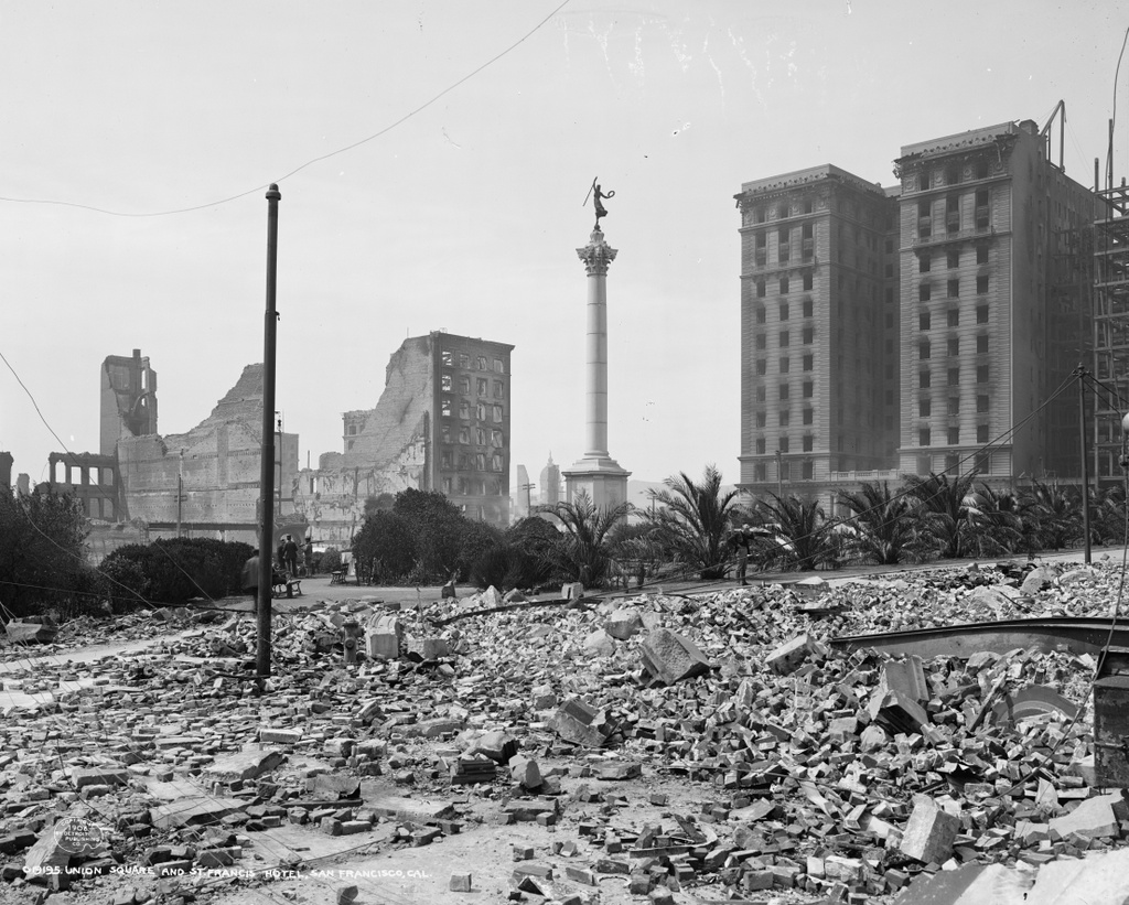
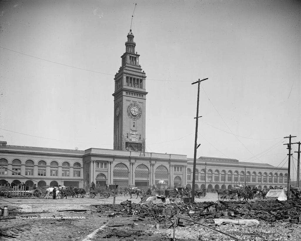
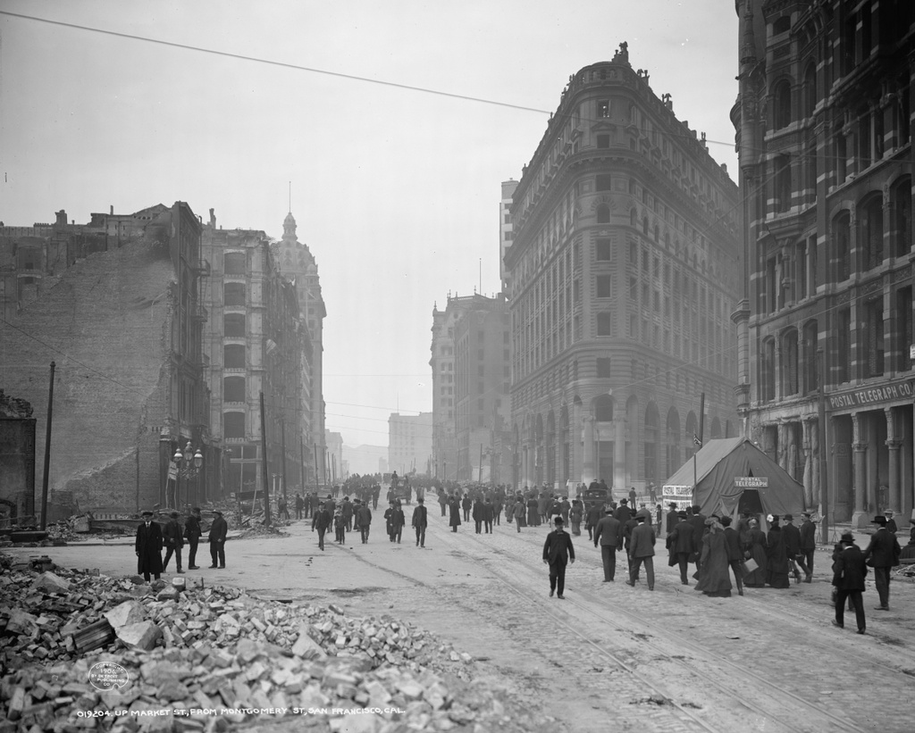
The view looking southwest on Market Street from Second Street in San Francisco, in the aftermath of the April 18, 1906 earthquake. Image courtesy of the Library of Congress, Detroit Publishing Company Collection.

870_1906c loc

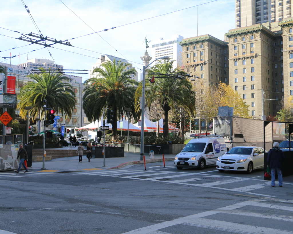
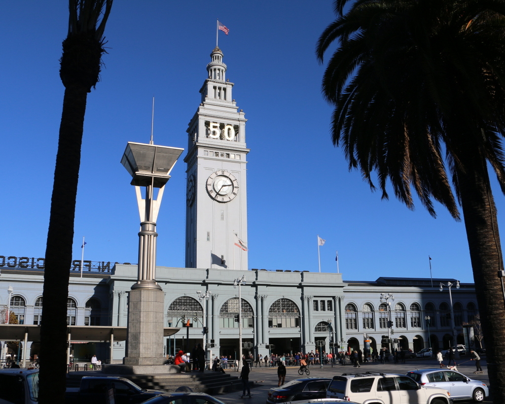
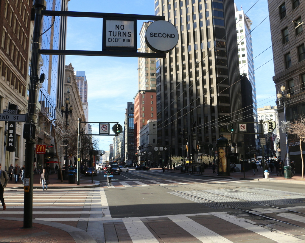
Market Street in 2015:

870_2015
Market Street is one of the main streets in downtown San Francisco, and at the time of the 1906 earthquake there were many important businesses along here. The first photo is undated, but it was likely taken within a week or so of the earthquake, and many of the people on the crowded street were likely surveying the damage for the first time. Walking along here, they would have seen a number of buildings that had either been destroyed by the earthquake itself or gutted by the fires that raged throughout the city for several days afterward. Many of these were subsequently demolished, including the Palace Hotel in the distance on the left. This prominent hotel was destroyed in the fires, and its replacement is still standing on the site today. Other displaced businesses included the Postal Telegraph Company, whose building on the far right was destroyed. When the photo was taken, the company was operating out of a tent, as seen in front of the building.

However, some of the buildings from the first scene are still standing today, although they have since been dramatically renovated. Nothing in the foreground survives, but the Call Building in the distance on the left, which was at the time of the earthquake the tallest building west of the Mississippi River, was repaired and later renovated as the Central Tower. On the right side, two historic buildings are still standing, including the red-brick Chronicle Building in the center of the photo. However, just about all that is left of the original building is the exterior facade, as the interior has been completely gutted by both the fires and by subsequent renovations over the years, including the addition of a tall tower on top of the 1890 structure in 2007. The last historic building in this scene is barely visible just beyond the Chronicle Building. Built in 1902, the Mutual Savings Bank Building survived the earthquake, and despite an addition in 1964 the original building is still standing today.

This post is part of a series of photos that I took in California this past winter. Click here to see the other posts in the “Lost New England Goes West” series.

Lost New England Goes West: Union Square, San Francisco

Union Square, seen from the corner of Post and Stockton Streets shortly after the April 18, 1906 earthquake. Image courtesy of the Library of Congress, Detroit Publishing Company Collection.

869_1906c loc

Union Square in 2015:

869_2015
Today, Union Square is one of the premier shopping areas in San Francisco, but 110 years ago it was, like the rest of the city, covered in earthquake debris and surrounded by burned-out buildings. The most prominent building in the first photo is the St. Francis Hotel, on the right side of the scene. Completed only two years earlier, the building survived the earthquake itself with minimal damage, but a combination of damaged firefighting infrastructure and poor city leadership allowed fires to spread throughout much of the city. The hotel was completely gutted by the fire, as the first photo shows, but it remained structurally sound. Soon after the photo was taken, a temporary hotel was built in the middle of the square, where it housed guests until the burned-out hotel reopened a year and a half later. Now known as the Westin St. Francis, it has been expanded several times, and today it still stands overlooking Union Square.

Another Union Square landmark from the first photo is the Dewey Monument, located in the center of the square. It was designed by sculptor Robert Aitken, whose later works included the pediment atop the US Supreme Court Building, and it was dedicated in 1903 by Theodore Roosevelt, in honor of Spanish-American War hero Admiral George Dewey and recently-assassinated President William McKinley. The 85-foot tall monument survived both the earthquake and the subsequent fires, and it is still standing in Union Square today, although it is now partially hidden by the palm trees around it.

This post is part of a series of photos that I took in California this past winter. Click here to see the other posts in the “Lost New England Goes West” series.

Lost New England Goes West: Hall of Justice, San Francisco

The Hall of Justice at Portsmouth Square in San Francisco, shortly after the April 18, 1906 earthquake. Image courtesy of the Library of Congress, Detroit Publishing Company Collection.

868_1906c loc

The scene in 2015:

868_2015
When the 1906 earthquake hit San Francisco, the Hall of Justice building was just ten years old. Despite what the first photo shows, it actually survived the earthquake itself. It had been seriously damaged, but neither the building nor the 77 prisoners housed on the upper floors were in any immediate danger. In fact, on the first day of the disaster the mayor made the Hall of Justice his temporary headquarters, since City Hall had been completely destroyed.

However, the situation here soon deteriorated. The earthquake had started a number of fires throughout the city, and a series of poor decisions on the part of city officials allowed the fires to spread. One of the ill-fated tactics was to attempt to create firebreaks by destroying buildings. In most cases, though, this was counterproductive, because the explosives tended to do a better job of igniting the buildings rather than destroying them, which only exacerbated the problem.

By nightfall on the first day, the fire was approaching Portsmouth Square, and the Hall of Justice was hastily evacuated. The prisoners were transported to another prison, and the bodies in the morgue and the police records were removed from the building and piled up in the middle of the square, covered in canvas. As the city burned around the square that night, two police officers guarded the pile. There was virtually no water available for firefighting, so the officers emptied bottles of beer onto the canvas to keep it damp, thus saving both the corpses and the records.

The first photo shows Portsmouth Square perhaps a week or so after the fire. By then the bodies and the police records had presumably been moved to a safer location, and the square was instead covered with tents of displaced residents. The burned-out remains of the Hall of Justice loom in the background, with the frame of the cupola dangling from the top of the building. It was beyond saving, and was demolished soon after. Its replacement was completed in 1910 on the same spot, and it stood here until it was demolished in 1968 to build the 27-story hotel that now stands here. Today, the only thing left from the first photo is Portsmouth Square itself, which is a major focal point within the city’s Chinatown neighborhood.

This post is part of a series of photos that I took in California this past winter. Click here to see the other posts in the “Lost New England Goes West” series.

Lost New England Goes West: Ferry Building, San Francisco

Author’s note: Although the main focus of this blog is New England and the northeast, I sometimes include photos from other parts of the country. This is the first in a series of then and now photos of California that I took this past winter.

The San Francisco Ferry Building in the aftermath of the April 18, 1906 earthquake. Image courtesy of the Library of Congress, Detroit Publishing Company Collection.

867_1906c loc

The Ferry Building in 2015:

867_2015
San Francisco is not an island, but for most transportation purposes it might as well be. Except for those traveling from the south, any approach to the city requires crossing either the San Francisco Bay on the eastern side of the city, or Golden Gate to the north. Prior to the construction of these bridges in the 1930s, the only way to do this was by ferry, and as a result this building was once among the busiest ferry terminals in the world.

The ferry terminal was built at the foot of Market Street along the present-day Embarcadero, and opened in 1898. Just a few years later, its durability was put to the test by the disastrous April 18, 1906 earthquake that, along with the resulting fires, destroyed much of the city. The first photo was probably taken only days after the earthquake, and it shows that, in contrast to the rubble and charred telephones in the foreground, the building survived with minimal damage. Interestingly, the first photo shows a makeshift barbershop on the far right side amidst the debris. The hand-written message on the side of the tent reads “Shaving 15¢” and, in smaller lettering, almost as an afterthought, is “Hair Cut 25¢.”

In the years following the earthquake, the terminal continued to be a vital part of the city’s transportation system until the completion of the Bay Bridge in 1936 and the Golden Gate Bridge the following year. Some ferries continued to operate out of here, but much of the interior was altered as passenger traffic declined. Another major change came in the 1950s, when the Embarcadero Freeway was built through here. Much like the Central Artery in Boston, this elevated highway cut off the city from the waterfront, and the ferry terminal was largely isolated.

The building survived another major earthquake in 1989, but the Embarcadero Freeway did not. It was heavily damaged in the earthquake, and was demolished in 1991 and replaced with light rail tracks that are visible in the distance of the second photo. At the same time, restoration work also began on the ferry terminal. Today, some ferries still depart from here, but the historic building is also used for office space and as a marketplace, and a year-round farmers’ market is held in front of the building three times a week.

Cocoanut Grove, Boston (1)

The Cocoanut Grove nightclub on Piedmont Street in Boston’s Bay Village neighborhood, shortly after the November 28, 1942 fire. Image courtesy of the Boston Public Library.

682_1942 bpl

The scene in 2021:

The first photo shows the Cocoanut Grove nightclub in the aftermath of the infamous fire that gutted the building and killed 492 people, making it the second-deadliest single-building fire in American history.  The building had been constructed in 1916 as a garage, and was opened as the Cocoanut Grove in 1927.  The tropical-themed nightclub became one of the most popular in Boston; owner Barney Welansky was well-connected with both the Mafia and with Mayor Maurice J. Tobin, and the club’s guests included many prominent Bostonians, and it regularly featured well-known entertainers.  Just a week before the fire, Irving Berlin performed here, and one of the fatalities from the night of the fire was movie star Buck Jones.

Although the cause of the fire is still unclear, it began in the Melody Lounge, a dimly-lit basement room located just below this section of the building.  The fire was discovered at around 10:15, and spread rapidly with the help of the flammable tropical decorations that covered much of the interior.  Within five minutes, the entire 10,000 square foot building was on fire.  Many people attempted to escape through the revolving door at this entrance on Piedmont Street, but the size of the crowd jammed the door.  The door visible to the left was at the top of the stairs to the Melody Lounge, but it was locked, along with several other exits in the building.

The aftermath of the fire led to a number of changes in both medicine and fire safety; Boston area hospitals developed new treatments for burn victims, and state and city governments enacted new laws regarding emergency exits, exit signs, and flammable decorations.  As a result of the number of deaths caused by the jammed revolving door, such doors today must have conventional, outward-opening doors on either side.

In the years following the fire, much of this neighborhood was extensively redeveloped.  This site along Piedmont Street would be used as a parking lot for many years, but as seen in the 2021 photo, there is now a condominium building here.

First Congregational Church, Wilbraham Mass (1)

The First Congregational Church on Main Street in Wilbraham, probably around 1900. Image courtesy of the Wilbraham Public Library.

551_1900c wpl

The church on fire after being struck by lightning on July 5, 1911. Image courtesy of the Wilbraham Public Library.

551_1911 wpl

The site of the church in 2015:

551_2015 wpl
In many New England towns, one of the main features of the town center is a historic 19th century Congregational church, usually painted white and complete with a tall steeple.  However, that isn’t the case in Wilbraham, in part because of a series of fires that destroyed the first three meetinghouses that were located on this site.  The First Congregational  Church in Wilbraham was established in 1741 as an offshoot of the Springfield church.  As was the case in many other towns, however, the location of the meeting house became a major political issue.  In the days before automobiles, it was particularly advantageous to live near the meeting house, and in Wilbraham the settlers in both the northern part of town (present-day Wilbraham) and the southern part (present-day Hampden) wanted a meeting house location that was convenient for them.  Eventually, a compromise was reached and the meeting house was built on Wigwam Hill, halfway up a mountain in a sparsely-populated location that presumably only worked because it was equally inconvenient to everyone.

Eventually, however, it began to make sense to have a meeting house in the center of town, so in 1794 the church moved to this location on Main Street.  It wasn’t just the congregation that moved, though.  In true Yankee frugality, the building itself was moved down the mountain and over to this site, where it stood until 1857, when a new church building was completed.  The old meeting house was moved and used as a stable until 1877, when both generations of Wilbraham churches were destroyed in a fire.

The third meeting house, which is shown in the first photo here, was completed in 1878 and was used until 1911, for reasons that the second photo makes very clear.  On July 5, 1911, the steeple was struck by lightning, and the resulting fire consumed the entire church.  I don’t know how long it had been burning by the time the photograph was taken, but it is a ghostly image, with the skeletal remains of the steeple silhouetted against the flames in the background.

Following the fire, the church merged with the Methodist church to form the Wilbraham United Church.  They alternated between the rebuilt church at this site and the Methodist church next to the Wilbraham Academy campus until 1935, when the church here became their full-time home.  However, the congregation began to outgrow that building, so a fifth-generation Wilbraham church was built a short distance away in 1958; this building is still in use today.  The 1911 church was demolished in 1962, and today the site of the first four Congregational churches in Wilbraham is now a public park.