Springfield Skyline (2)

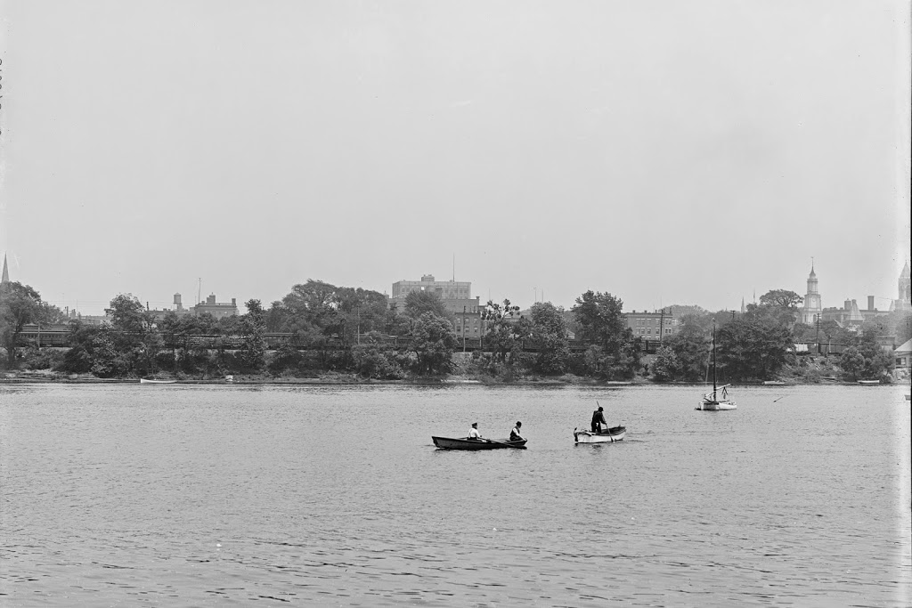
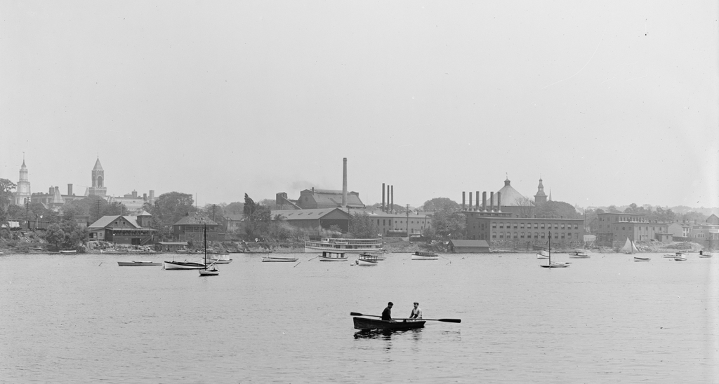
The South End of Springfield, seen from West Springfield between 1900 and 1910. Image courtesy of the Library of Congress, Detroit Publishing Company Collection.

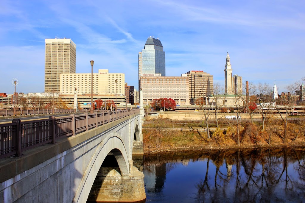
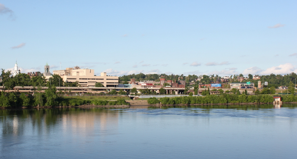
The same view in 2014:
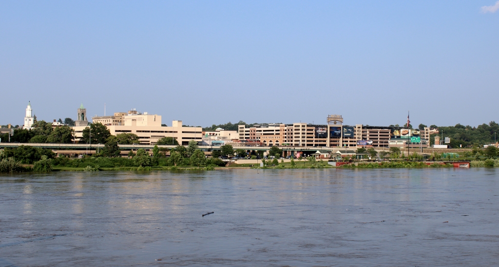
The scene in 2023:

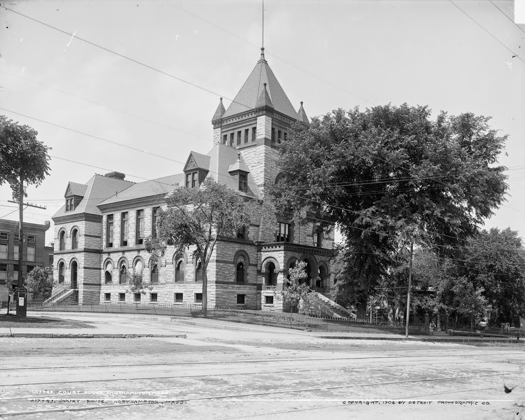
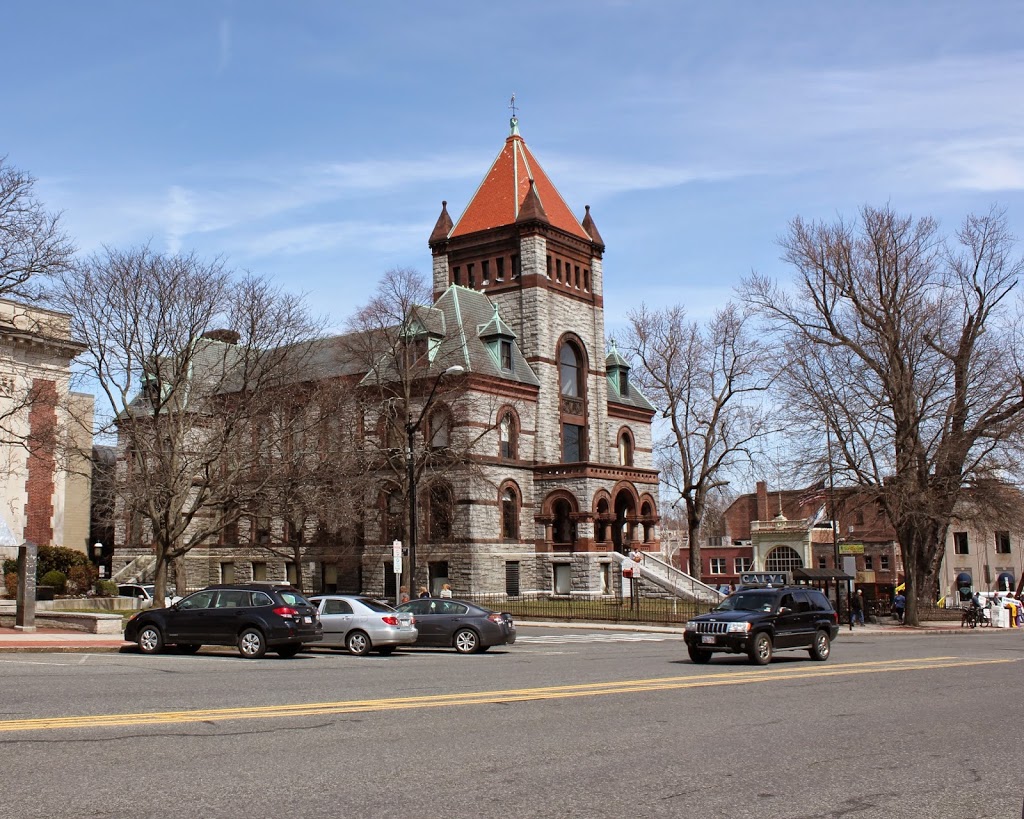
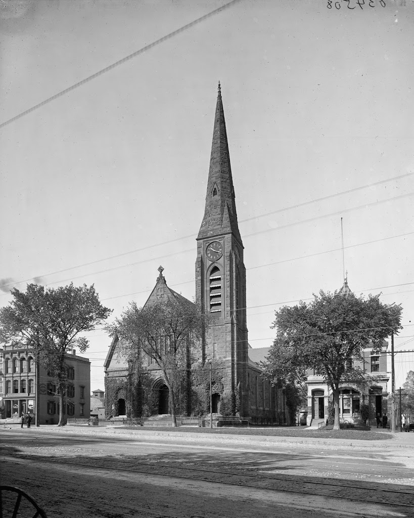
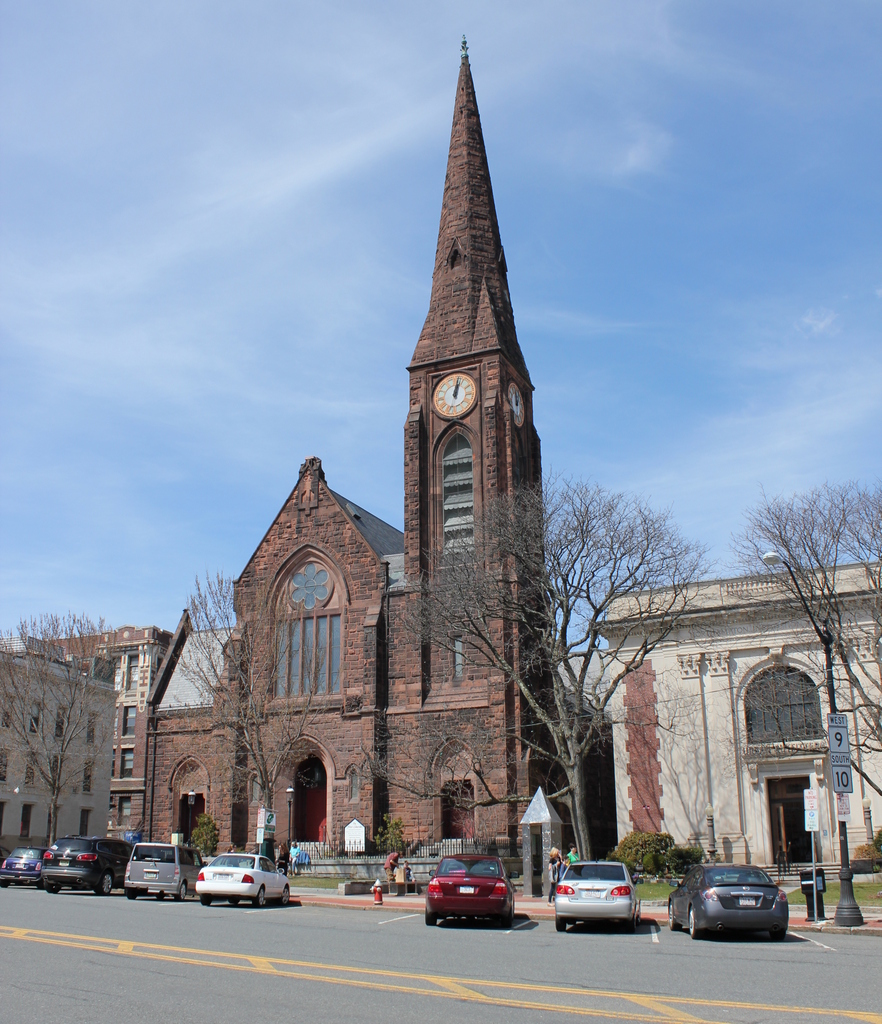
Like the photos taken from the same spot but angled a little upstream, not much remains visible from the original photo.  Old First Church, the Hampden County Courthouse, and the Court Square Building are still there, but not much else is readily identifiable in both photographs.  The steeple that is visible toward the right-hand side of the first photo is St. Joseph’s Church, which was built in 1873 and demolished in 2008.  The building that has since taken its place is visible in the second photo – it is a gray-green rectangular building visible just above and to the left of the large brick structure that is on the waterfront on the right-hand side of the photo.

Several buildings that are visible in the 2013 photo did exist when the earlier one was taken, but they aren’t visible in it. Among those is the old castle-like National Guard Armory, which was built in 1895 and damaged in the 2011 tornado. At the time it was being used as the South End Community Center, but today it stands vacant, although part of MGM’s proposed casino includes preserving the distinctive facade of the building.

Along the waterfront, much has changed in the past 100 years.  Back in the early 20th century, the waterfront was dominated by boating clubs and factories.  According to a 1910 map, there were three boathouses along this stretch of riverfront, several of which can be seen in this photo. They were the Springfield Yacht Club, the Springfield Canoe Club, and the Springfield Boat Club. Presumably many of their members are among those who are sailing or rowing on the Connecticut River.  Sadly, this is not the case today – the construction of I-91 effectively blocked off downtown Springfield from the waterfront, and today a little-used bike path along the riverfront is the only significant recreational activity available on this part of the river.

2023 Update: The third photo shows the scene nearly a decade after the second photo. The most significant change here is the MGM Springfield Casino, which stands on the right side of the scene. This photo also shows much higher water levels than the other two photos, due to floodwaters caused by heavy rains upstream in Vermont in July 2023. 

Springfield Skyline (1)

Springfield, as it looked from across the river around 1900-1910. Image courtesy of the Library of Congress, Detroit Publishing Company Collection.

056_1900-1910-2Bloc

The same view in 2010:

056_2010

It’s a good thing that Old First Church and the Hampden County Courthouse still exist – otherwise it would’ve been very difficult to pin down exactly what part of Springfield is seen in the early 20th century photo.  In addition, the old Court Square Building is barely visible in between those two buildings in photos.  There are some parts of Springfield that still look similar to how they were 100 years ago, but downtown isn’t one of them.  Along with the skyscrapers and modern hotels that now sit directly across the river, there is also the Memorial Bridge, which wouldn’t exist for another 10+ years from the first photo.  Instead, travelers would cross the river slightly upstream of the current bridge, on a terrifyingly rickety-looking covered bridge that I will probably cover in a future post.  The other big change in the past century was the elevated I-91 viaduct along the Connecticut River, which replaced the railroad as both the prominent feature along the river and also the way that most people traveled from Springfield to points north and south.

Samuel Chapin Statue, Springfield

The Samuel Chapin Statue at the Quadrangle, around 1905. Image courtesy of the Library of Congress, Detroit Publishing Company Collection.

055_1905c-2Bloc

The same statue in 2012:

055_2012

Samuel Chapin, one of my ancestors, was an early settler in Springfield, one of several such founders memorialized in a statue in the city.  He served as the first deacon of the church, was on the first board of selectmen, and also served as a town magistrate.  In 1881, one of his descendants, businessman and Congressman Chester W. Chapin, commissioned noted sculptor Augustus St. Gaudens to create this statue.  It was finished in 1887, and was first situated at Stearns Park, but was moved to Merrick Park at the Quadrangle in 1899, shortly before the above photo was taken.  The statue, named The Puritan, became one of St. Gaudens’s most popular work, and it hasn’t changed much in the past 100 years, although some of the buildings around it have.  The house directly behind it in the 1905 photo (I believe it’s the parsonage for Christ Church Cathedral) is long gone, as is the old library, which isn’t visible in the photo, but which was located just to the photographer’s right.  Note, however, the arches in the distance on the far right of the 1905 photo – those are from the art museum, which still exists – the arches aren’t visible from the angle of the 2012 photo, but the building itself is barely visible above the hedges.

Hampshire County Courthouse, Northampton

The Hampshire County Courthouse in Northampton, Mass., around 1904. Image courtesy of the Library of Congress, Detroit Publishing Company Collection.

054_1904c-2Bloc

The same building in 2014:

054_2014

The Hampshire County Courthouse hasn’t changed much since 1904, nor has it changed much since it was completed in 1886.  It bears strong resemblance to the Hampden County Courthouse that was built about 12 years earlier, and unlike that building, this one retains its top floor and its dormers adjacent to the tower.  Around the time that the earlier photo was taken, the Clerk of Courts was a local attorney and former City Council member named Calvin Coolidge, who would eventually go on to work a much more notable job in a much larger and more prominent building.   One difference between 1904 and now, although not visible in the photo, is a statue of said former Clerk of Courts, now on the grounds of the courthouse.

First Church of Northampton

The First Church of Northampton, between 1900 and 1910. Image courtesy of the Library of Congress, Detroit Publishing Company Collection.

053_1900-1910-2Bloc

In 2014:

053_2014

Built in 1877, Northampton’s First Church hasn’t changed much, although its surroundings are different than they were a century ago.  Notice in particular the absence of trolley tracks or wires and the proliferation of cars.  Nearly three centuries and three church buildings ago, this was the home to one of America’s most prominent theologians, Jonathan Edwards, who was pastor of the Northampton church from 1727 to 1751, and who led the Great Awakening from his pulpit here.  The church building that he built in 1737 was replaced in 1812 by one designed by Isaac Damon, the same architect who designed Springfield’s Old First Church seven years later.  That building burned in 1876, and was replaced by the present structure the following year.

Old Man of the Mountain

The Old Man of the Mountain, between 1890 and 1910. Image courtesy of the Library of Congress, Detroit Publishing Company Collection.

New Hampshire

The same view in 2013:

052_2013

“Discovered” by surveyors in 1805, New Hampshire’s famous rock formation lasted for almost 200 more years, before collapsing in May 2003 as a result of centuries of freezing and thawing.  Concern over the figure’s eventual collapse began even before the first photo was taken.  Frederick Wilkinson Kilbourne wrote in Chronicles of the White Mountains in 1916 that “Professor Hitchcock’s fear, expressed more than forty years ago, that, owing to the friability of the granite of which the ledges are composed and its consequent rapid disintegration, the ledges might soon disappear, has so far not been realized”  Kilbourne went on to write, “Sad will be the day (may it never come!) when that marvel of Nature shall be marred or be no longer to be seen.”

Concerns about the stability of the rocks continued through the 20th century, and in 1958 steel rods and other equipment were used in an attempt to secure the rocks.  Several of the rods are still visible at the top of the cliff.  The Old Man of the Mountain also influenced the construction of Interstate 93 through Franconia Notch; the segment of highway is one of the few two-lane Interstate highways, and was built that way partially because of concerns that construction of a wider highway could damage the rock formation.  Regardless of these efforts, though, the rocks collapsed in May 2003.