Daniel B. Wesson House, Springfield, Mass

Daniel B. Wesson’s house on Maple Street, as it appeared between 1900 and 1910. Image courtesy of the Library of Congress, Detroit Publishing Company Collection.

063_1900-1910-2Bloc

The site today:

063_2013

The building in the early 20th century was the home of Daniel B. Wesson, who was the co-founder of Smith and Wesson.  Located at 50 Maple Street, at the present-day intersection of Maple and Dwight, it was built in 1898, and was Wesson’s home until he died in 1906.  The house was purchased by a social club, the Colony Club, in 1915, and was used until February 20, 1966, when the building burned and was replaced by the bland, nondescript building that now stands on the lot.

Maple Street, Springfield

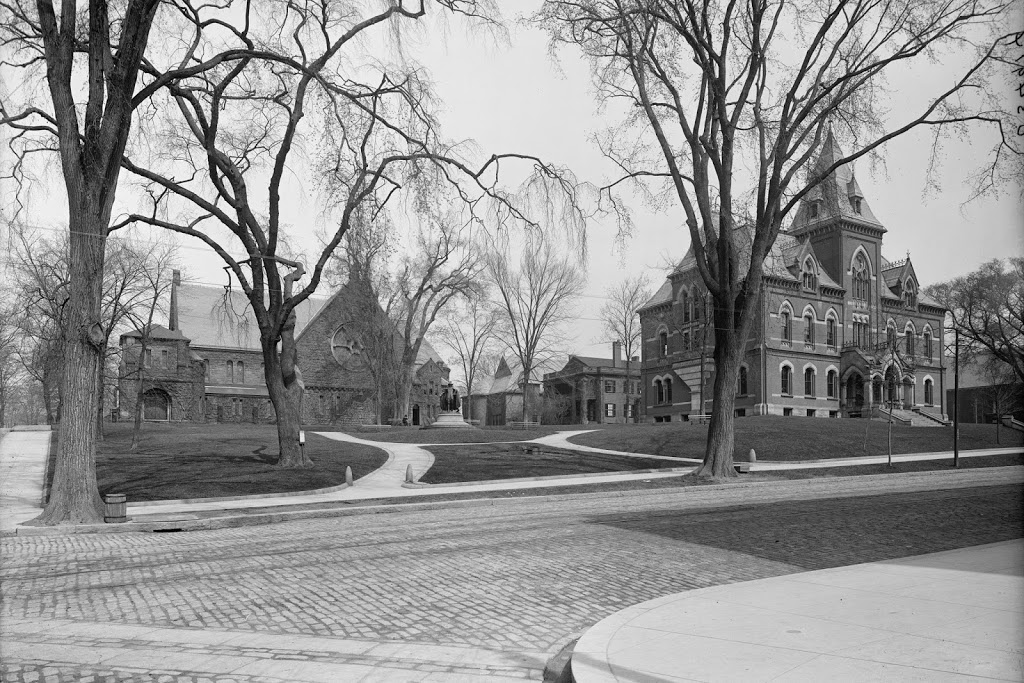
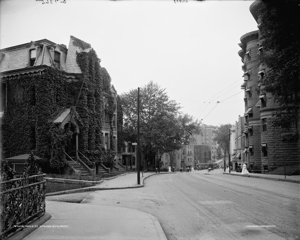
The view looking down Maple Street toward State Street, between 1905 and 1915. Image courtesy of the Library of Congress, Detroit Publishing Company Collection.

062_1905-1915-2Bloc

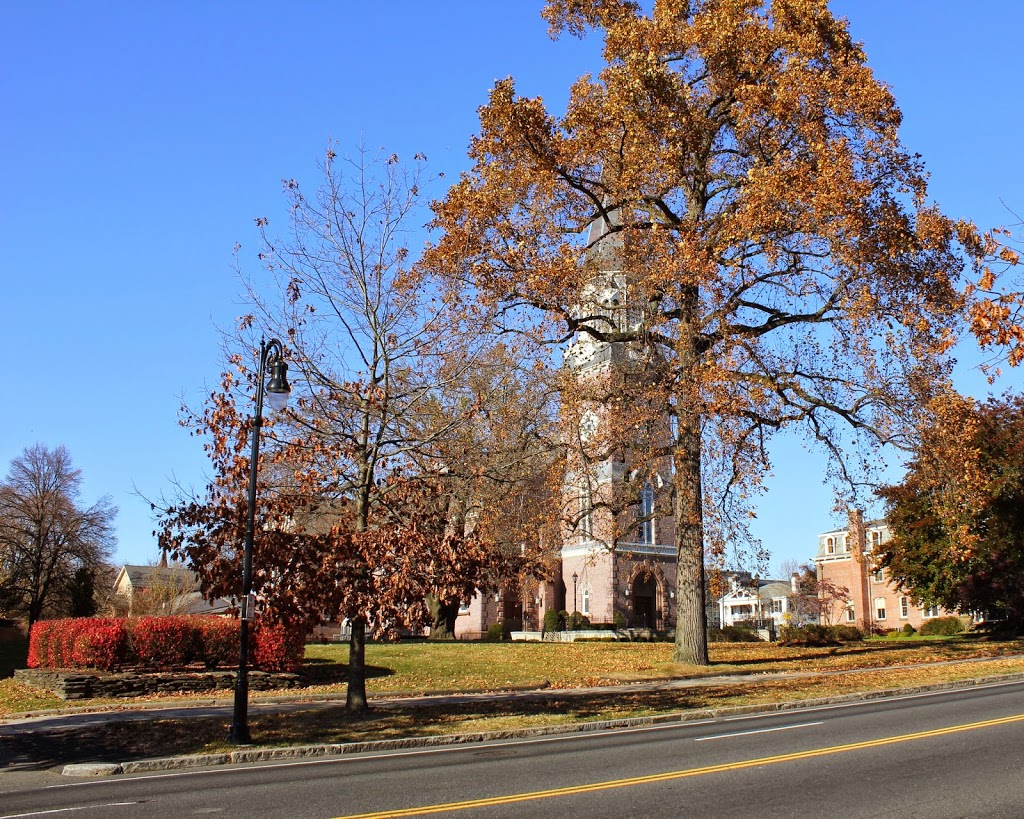
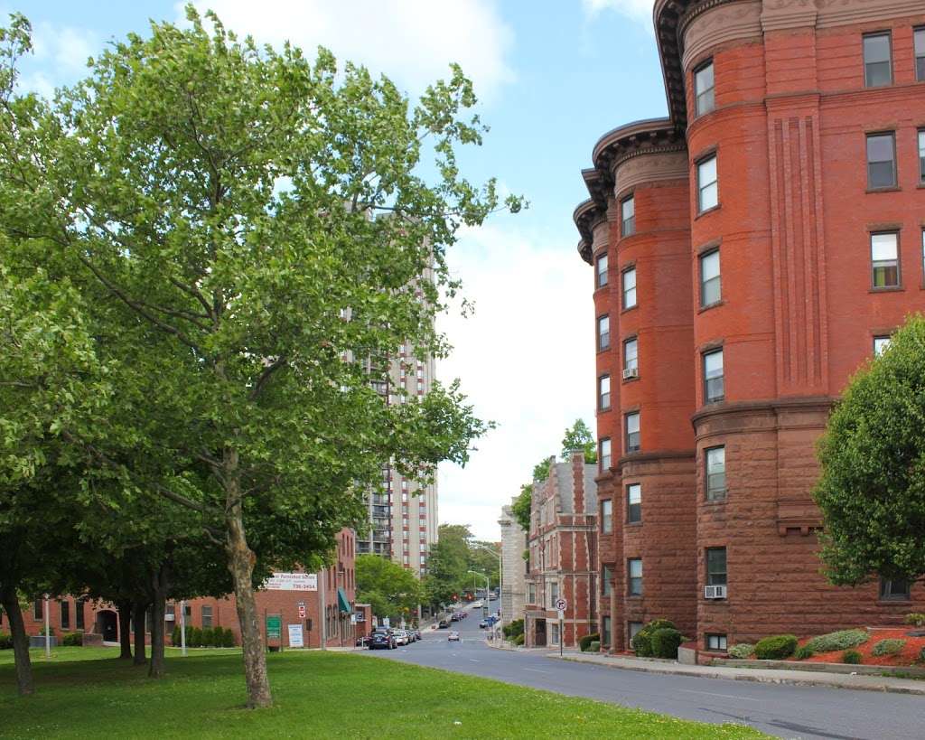
The same view in 2014:

062_2014

If the street network seems a little different here, it’s because it is.  When the first photo was taken, Maple Street and Chestnut Street (which are essentially the same road – they just switch names after crossing State Street) were together a major two-way, north-south road running along the top of the hill overlooking downtown.  Dwight Street was,  likewise, a major north-south road that ran from the North End until terminating at State Street.  However, in 1972, Dwight Street was extended diagonally up the hill to meet Maple Street, and turned into a one-way street carrying southbound traffic.  Maple/Chestnut, north of this intersection, then became a parallel, northbound one-way street.  South of here (the opposite direction of this photo), Maple Street is still a two-way road.

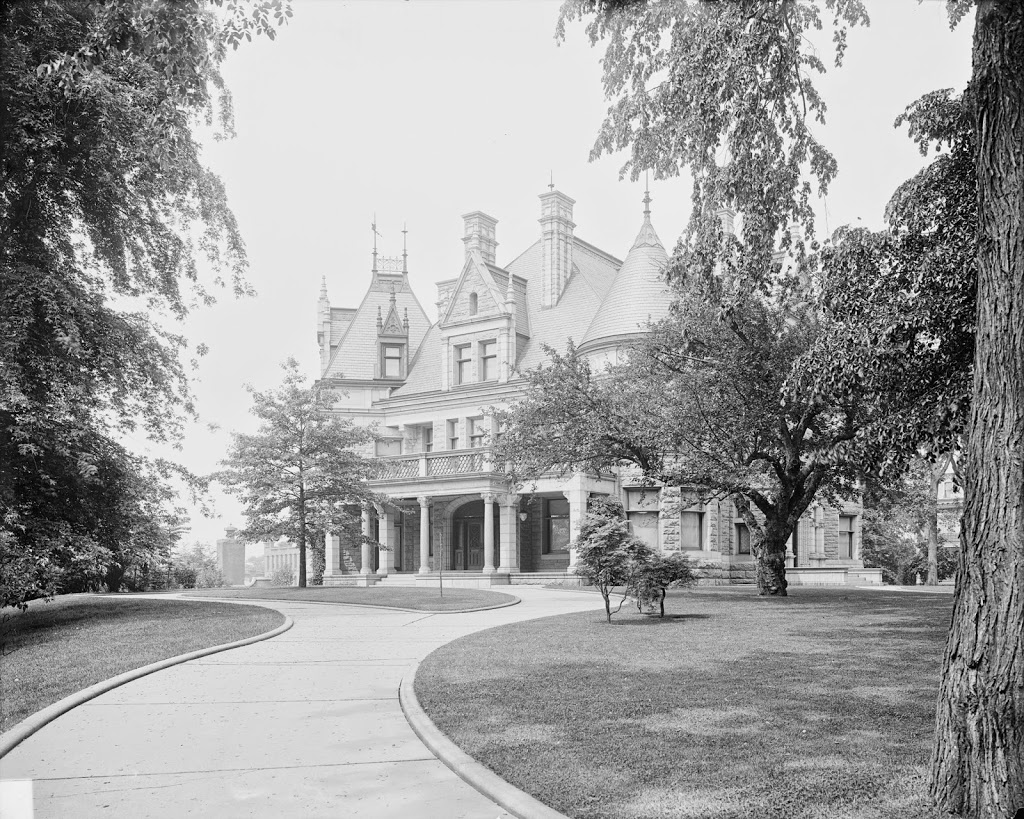
In any case, this is part of the reason why the left-hand side of this photo looks so dramatically different from the 1905-15 photo; the houses and apartment buildings were later demolished to make room for the extended Dwight Street.  The right-hand side of the street, however, remains essentially the same; the apartment building in the foreground is the most obvious, but there is also another building behind it, and the Springfield Fire and Marine Insurance Building barely visible at the corner of State and Maple.

The other major change between the two photos is the massive 34-story Chestnut Park apartment building, which was built between Dwight and Chestnut Streets on State Street.  It is the third-tallest building in Springfield and the tallest residential building.

Classical High School, Springfield, Mass

Classical High School in Springfield, around 1905. Image courtesy of the Library of Congress, Detroit Publishing Company Collection.

Schools

The building in 2019:

Originally built as Central High School in 1898, it became Classical High School in the 1930’s, and closed in 1986 when the present Central High School was built on Roosevelt Ave. It has since been converted into condominiums, and is remarkably well-preserved from its days as a school.  The building was built on the site of the former Hampden County Jail, which had been in this location from 1814 until 1887.

Visible on the far right of the 1905 photo is the old Springfield High School, which was built in 1874.  After the construction of this building, the old high school was used as State Street Grammar School until 1922, when Central/Classical High School was expanded to include a junior high school wing, which necessitated the demolition of the old structure.

Probably the school’s most famous alumnus was 1921 graduate Theodor Geisel, who was better known by his pen name, Dr. Seuss.  In addition, on a personal note, my grandfather was a 1937 graduate from the school, shortly after it became Classical High.

St. Michael’s Cathedral, Springfield

The view of St. Michael’s Cathedral, around 1908. Image courtesy of the Library of Congress, Detroit Publishing Company Collection.

060_1908c-2Bloc

From the same spot in 2013:

060_2013

The tree is somewhat blocking it, but St. Michael’s Cathedral is still there today, looking as good as it did when it was built in the 1860’s.  It was the first Roman Catholic church in Springfield, and it is currently the cathedral for the Roman Catholic Diocese of Springfield in Massachusetts, which covers all four counties in Western Massachusetts.  The 1908 photo shows the church and the rectory, both of which still exist, but it also shows St. Luke’s Sanitarium, to the left of the church, which no longer exists.  Note, however, the break in the curb along the sidewalk that once led to the building.

On an arborist note, the short but wide tree on the far right of the 2013 photo appears to be the same one in the 1908 photo.  In addition, this may be pure conjecture, but the tree that now all but obscures the church from this angle appears to be visible in the 1908 photo.  There is a young sapling that is barely noticeable in the photo, and it appears to be in the same location as the present-day tree.  The current tree looks like it could be around 100 years old – could it be the same tree?

Corner of State & Maple, Springfield

The corner of State Street and Maple Street in Springfield, between 1900 and 1909. Image courtesy of the Library of Congress, Detroit Publishing Company Collection.

059_1900-1910-2Bloc

The same street corner in 2013:

059_2013

These photos were taken from the opposite side of State Street from the photos in this post, and show some of the changes that the Quadrangle area has undergone in the past 100+ years.  Some things remain – Christ Church Cathedral and the statue of Samuel Chapin are the two obvious ones.  Even minor details such as the short, bowling pin-looking granite posts on either side of the sidewalks are still there.  But, the big difference, aside from the traffic lights and complete lack of cobblestone in the 2013 photo, is the main Springfield Library building.

The library building in the early 20th century photo was built in the 1860’s as the first public library in Springfield.  Very shortly after this photo was taken, however, construction began on the new library (this happened in 1909, thus establishing the upper limit of the date range for the photo).  But, rather than demolishing the old structure, and to allow the library to function while the new building was being constructed, the old one was moved directly back, into the present-day Quadrangle.  The new library was dedicated in 1912, and the books were moved to the old one.  Whether the old building was demolished right after that, or whether it was used for something else in the intervening years, I don’t know at this time.

Springfield Skyline (3)

The view of Springfield from West Springfield, between 1900 and 1910. Image courtesy of the Library of Congress, Detroit Publishing Company Collection.

058_1900-1910-2Bloc

The view in 2014:

058_2014

The most obvious difference here is the lack of a covered bridge – this bridge was replaced by the current Memorial Bridge (just to the right of the scene in the 2013 photo) in 1922. The first bridge across the river in Springfield was an uncovered, six span bridge that was built in 1805. It collapsed in 1814, and was replaced by the covered bridge, which was completed in 1820. The designer was Isaac Damon, the same architect who designed Springfield’s Old First Church.  This bridge far outlasted its predecessor, and even the present Memorial Bridge hasn’t reached the 102 years that the covered bridge made it to.

The bridge was finally demolished – or, to be more accurate, dismantled piece by piece to reuse the wood – in 1922, upon completion of Memorial Bridge. Although there are no visible traces of the bridge itself, it’s still easy to pinpoint its location; there is a Bridge Street in Springfield, and another one directly across the river in West Springfield. Neither street currently leads to a bridge, but they were once the approaches to the old covered bridge.