Hetty Green House, Bellows Falls, Vermont

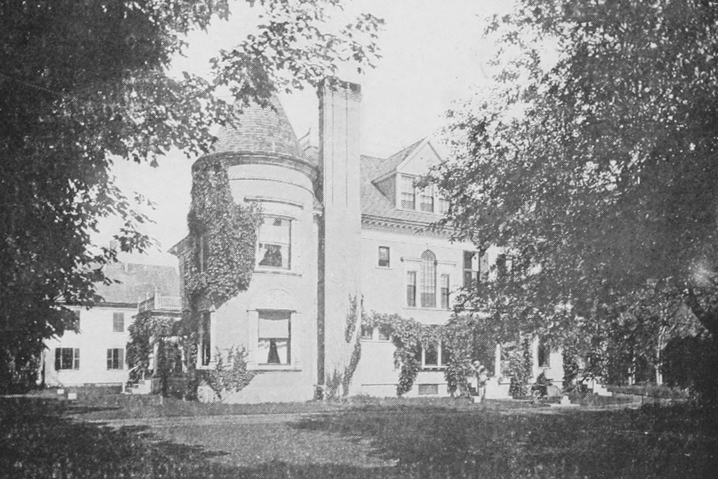
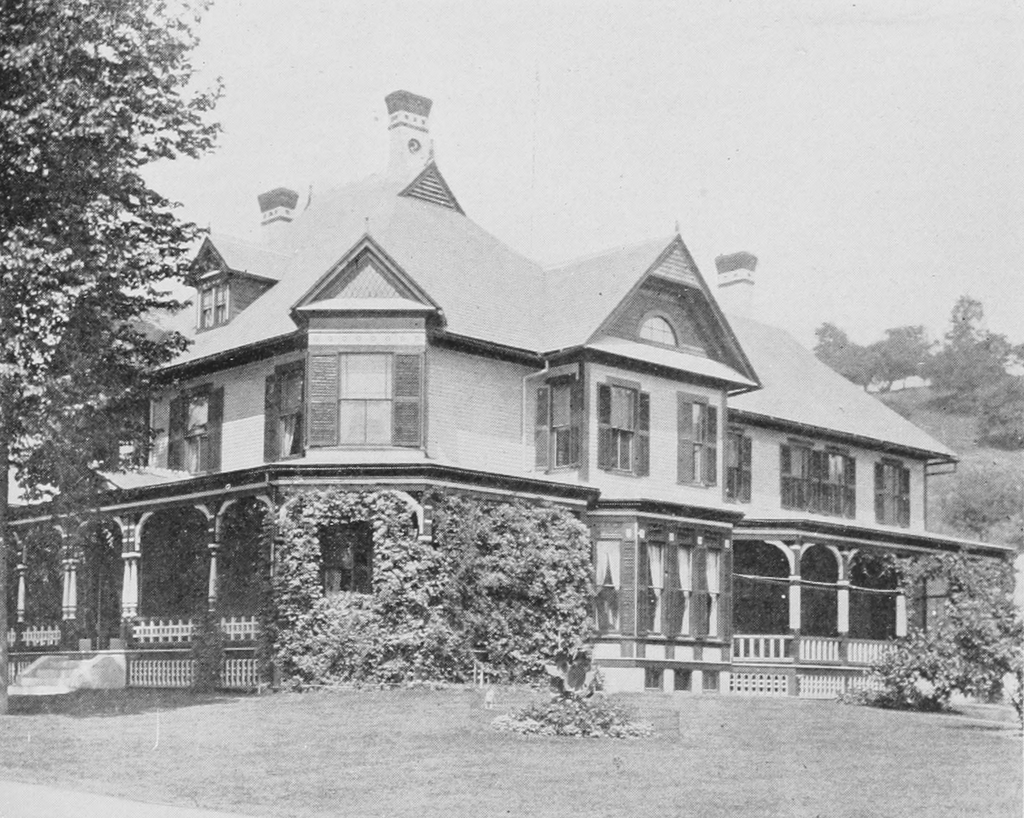
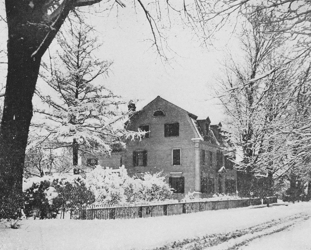
The Hetty Green House at the corner of Church and Westminster Streets in Bellows Falls, around 1900-1910. Image courtesy of the Library of Congress, Detroit Publishing Company Collection.

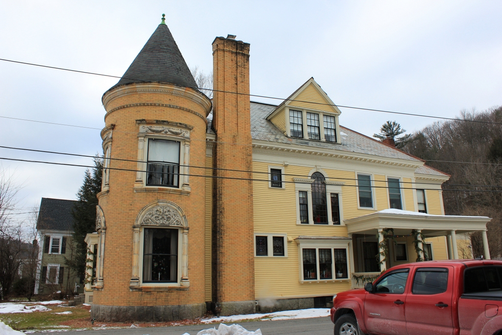
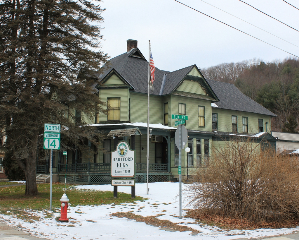
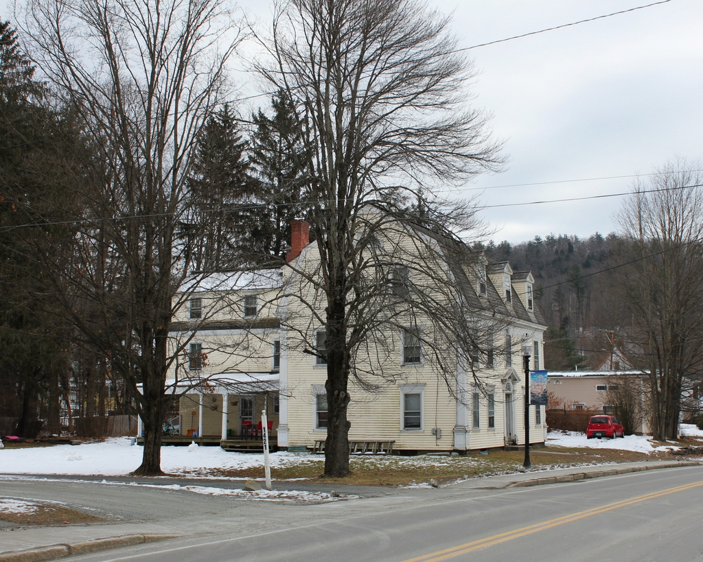
The scene in 2018:

It is hard to tell from its appearance, but this house was the home of the wealthiest woman in America when the first photo was taken at the turn of the 20th century. Throughout her life, even after she had amassed a fortune worth many millions of dollars, Wall Street financier Hetty Green lived a very frugal—and some would say miserly—lifestyle. She wore plain, old clothing, ate inexpensive meals, and shunned most luxuries, supposedly even heat and hot water.

Her house here in Bellows Falls was another example of her modest living. Although certainly a fine house in its own right, it was hardly befitting of a Gilded Age tycoon, especially considering the lavish mansions that many of her contemporaries, most notably the Vanderbilts, were constructing in New York, Newport, and other fashionable places.

The house itself was situated at the corner of Church and Westminster Streets, just to the south of the center of Bellows Falls. It was built in 1806 by William Hall, a wealthy local merchant in the firm of Hall & Green. Hall was also involved in politics, serving on the governor’s council, in the state legislature, and as Vermont’s sole delegate to the 1814-1815 Hartford Convention. He lived here in this house until his death in 1831, at the age of 57, and the house was subsequently purchased by Nathaniel Tucker, the owner of the nearby Tucker Toll Bridge over the Connecticut River.

Nathaniel Tucker had connections to William Hall, as his daughter Anna was married to Hall’s former business partner, Henry Atkinson Green. Their son, Edward Henry Green, would eventually become a successful Boston merchant, and in 1867 he married Henrietta “Hetty” Robinson, the wealthy heiress of a New Bedford whaling family. Then, in 1879 he purchased his grandfather’s old house here in Bellows Falls, and moved his family into it.

Hetty Green was 33 years old when she married Edward, and she was already extremely wealthy, having inherited about $6 million after her father’s death two years earlier. However, her fortune would continue to grow thanks to her shrewd investment strategies, and she came to be known as the “Witch of Wall Street”at a time when high finance was almost exclusively a male profession. By the time she died in 1916 at the age of 81, her estate was valued at over $100 million, equivalent to over $2 billion today, making her the richest woman in America at the time.

Hetty and Edward had two children, Ned and Sylvia, who were about 11 and 8 years old, respectively, when their father purchased this house. During his childhood, Ned became the subject of one of the most famous examples of his mother’s frugality after he injured his knee. Wanting to avoid paying for a doctor, Hetty instead tried to treat him herself. However, infection set in and the leg became gangrenous, and it ultimately had to be amputated.

In adulthood, Ned spent his money much more freely than his mother had. He owned a 225-foot steam yacht, and he built a mansion on Buzzards Bay in Massachusetts, which featured his own private airfield and radio station. In addition, he was an avid collector of coins and stamps, and at one point his collection included all five examples of the extremely rare 1913 Liberty Head nickel, along with the only known sheet of the famous Inverted Jenny postage stamp. Ned also played an important role in historic preservation when, in the 1920s, he purchased the former whaling ship Charles W. Morgan, which had once been a part of his maternal grandfather’s whaling fleet. He put it on display at Round Hill, and after his death it was acquired by Mystic Seaport in Connecticut, where it remains as the last surviving 19th century whaling ship.

Ned’s sister Sylvia, however, was much more like their mother when it came to saving money. In 1909 she married Matthew Wilks, a member of the Astor family who was 25 years her senior, although her mother insisted that they sign a prenuptial agreement to prevent Wilks from inheriting Sylvia’s money. Neither Sylvia nor her brother had any children, and after Ned’s death in 1936 Sylvia inherited his portion of the estate, as a result of a similar prenuptial agreement that he had signed with his wife, Mabel Harlow. Later in life, though, Sylvia became both miserly and reclusive, and her last public appearance was in 1937, when she testified in court to prevent Mabel from receiving a greater share of Ned’s fortune.

Upon her death in 1951 at the age of 80, Sylvia was described by Life magazine as “a friendless, childless, cheerless old woman, abjectly poor in everything but money and devoted only to the preservation of the great Green fortune.” Her net worth at the time was around $95 million, nearly $1 billion today, but with no children or other close relatives she left nearly all of her money to 63 different charities, including a variety of churches, libraries, and hospitals. Among these were the Rockingham Memorial Hospital and the Immanuel Episcopal Church, both of which are located here in Bellows Falls.

In the meantime, the old house here on Church Street in Bellows Falls remained in the Green family until 1940, although Sylvia does not appear to have spent much time here in her later years. By this point the house was in need of repairs, so rather than restoring it, Sylvia had the house demolished, and then gave the property to the town. The property subsequently became a parking lot and a park, which was named Hetty Green Park.

Today, park is still here, on the far right side of the scene, but the actual site of the house is now a bank, which was constructed in 1960. It was originally the Vermont Bank & Trust Company, but after a series of mergers in the late 20th century it is now owned by TD Bank, which continues to operate it as a branch. The bank building certainly does not have the same architectural or historic significance that the old house had, although in retrospect it seems only appropriate that Hetty Green’s former property would be used as a place where large amounts of money are kept.

Fort Bridgman Road, Vernon, Vermont

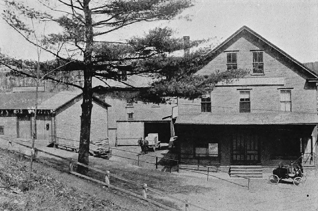
The view looking north on Fort Bridgman Road, toward the intersection of Pond Road in Vernon, probably sometime around 1907-1918. Image from author’s collection.

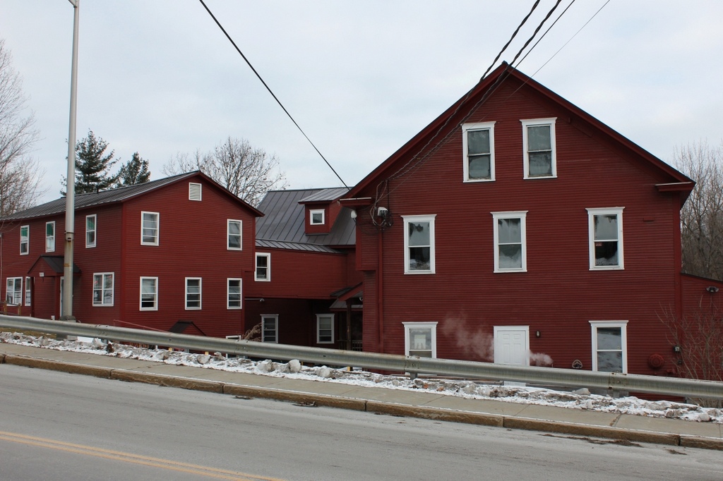
The scene in 2018:

The town of Vernon is located in the extreme southeast corner of Vermont, and for much of its history it was small, with a population that consistently hovered around 600 to 800 people throughout the 19th and early 20th centuries. Most of this population was dispersed across 20 square miles, so Vernon never had a densely-settled town center, but the main village in town was here along Fort Bridgman Road, near the corner of Pond Road.

During the 19th century, this area was the commercial hub of the town, with an 1869 map showing a sawmill, blacksmith’s shop, carpenter’s shop, lumber yard, a church, and a building that was occupied by a store, post office, and hotel. There were also about a dozen houses clustered in the immediate vicinity, and the railroad passed through here along the Connecticut River, although the depot itself was located a little further to the north of here.

The first photo was taken at some point in the early 20th century, evidently soon after a snowstorm. It is a real photo postcard, meaning that it is a photograph that was developed directly onto postcard stock, instead of being mass-produced via printing. The photo is undated, but the markings on the reverse suggest that it was taken at some point between 1907 and 1918. On the reverse is a message written by a woman named Ethel Davis, who apparently also took the photo. It reads:

Dear Aunt Jessie,

I thought you probably would like to hear from me as I am up in Vt. with a friend. This is not a very good picture as we take them our selves. It is quite lonsome up here. This is Main St Vernon, Vt.

There is lots of snow up here. I am not very lonsome. But do wish I were home. From your niece Ethel Davis.

The photo shows the view looking north toward the town center, with the Connecticut River just out of view on the far right, and the railroad on an embankment to the left. The most visible building in this scene is the Vernon Union Church, on the right side of the road. It was completed in 1900, and it replaced an earlier one on the same site, which had burned after being struck by lightning a year earlier. Beyond the church is a building that appears to have been the store/post office/hotel from the 1869 map, and on the left side of the road is a house that probably dates to the first half of the 19th century. It appears on the 1869 map as well, when it was listed as the home of Mrs. R. S. Bryant.

In more than a century since the first photo was taken, Vernon has undergone some major changes, the most significant of which was the Vermont Yankee nuclear power plant, which operated in the town from 1972 until 2014. Thanks in part to the resulting jobs and low taxes, Vernon saw rapid population growth in the late 20th century. By the 2010 census, the town had more than 2,200 residents, which was nearly four times its population when the first photo was taken.

However, despite this growth, the town center here along Fort Bridgman Road has remained small. Many of the old buildings are gone, including the mixed-use building beyond the church, which is now the site of the town garage. The church is still here, though, as is the house on the other side of the road. Both are hidden by trees in the present-day view, but they have seen few exterior changes since the first photo was taken, and the church remains in use as an active congregation.

Old North Bridge, Concord, Mass (4)

The view looking east across the Old North Bridge in Concord, around 1890-1901. Image courtesy of the Library of Congress, Detroit Publishing Company Collection.

The scene in 2018:

The Old North Bridge was discussed in more detail in an earlier post, which shows the view looking west across the bridge. However, this view shows the opposite side of the bridge, facing east from directly in front of the famous statue The Minute Man. The bridge was the site of the Battle of Concord, which occurred on April 19, 1775, only a few hours after the first shots of the American Revolution were fired in a skirmish in nearby Lexington.

Although the Battle of Lexington came first, it was almost entirely one-sided, and the British continued their march to Concord with only a single wounded soldier, compared to eight dead and ten wounded militiamen. As a result, it was here in Concord that the British first encountered significant resistance from the colonists. Prior to the battle, the British had secured the bridge during their search for hidden military supplies. However, as the colonial militiamen began assembling on the west side of the river, the outnumbered redcoats withdrew to the east bank, where the monument stands in the distance of this scene.

When the battle began, the militiamen were approaching the bridge from approximately where these photos were taken. At this point, some of the British soldiers began opening fire, evidently under the mistaken impression that their commanding officer had given the order. Two militiamen at the head of the line, Private Abner Hosmer and Captain Isaac Davis, were killed, but the colonists did not break ranks. Instead, they returned fire with a devastating volley that killed three redcoats and wounded nine more. This came to be known as “The shot heard round the world,” and it was the first time that American colonists killed British soldiers in battle. It also forced the British to retreat, marking the first American victory of the war.

The original bridge here across the Concord River was removed several years after the end of the war, and the roads were rerouted to a new bridge nearby. As a result, for many years there was little evidence of the brief but momentous battle that was fought here. The first memorial here on the battlefield was the obelisk in the distance of this scene, which was installed in 1836 and dedicated a year later. At the time, there was still no bridge here, so the monument was placed on the east bank, where it was more reality accessible from the center of town. A new bridge would not be constructed until 1874, in advance of the battle’s centennial celebration. As part of the centennial, the statue The Minute Man was dedicated here on the west side, marking the colonial position during the battle.

By the time the first photo was taken around the turn of the 20th century, the bridge had been replaced again after the 1874 one was destroyed in a flood. This one was, in turn, destroyed in a 1909 flood, and its replacement was a concrete bridge that was designed to resemble the original one. However, it sustained heavy damage in a flood in 1955, and it was subsequently replaced by the current one, which is a wooden replica of the original. Aside from the bridge, though, this scene has remained well-preserved, with few changes since the first photo was taken, and the battlefield is now part of the Minute Man National Historical Park, which was established in 1959.

Elisha Jones House, Concord, Mass

The house at 242 Monument Road in Concord, around 1908. Image courtesy of the Library of Congress, Detroit Publishing Company Collection.

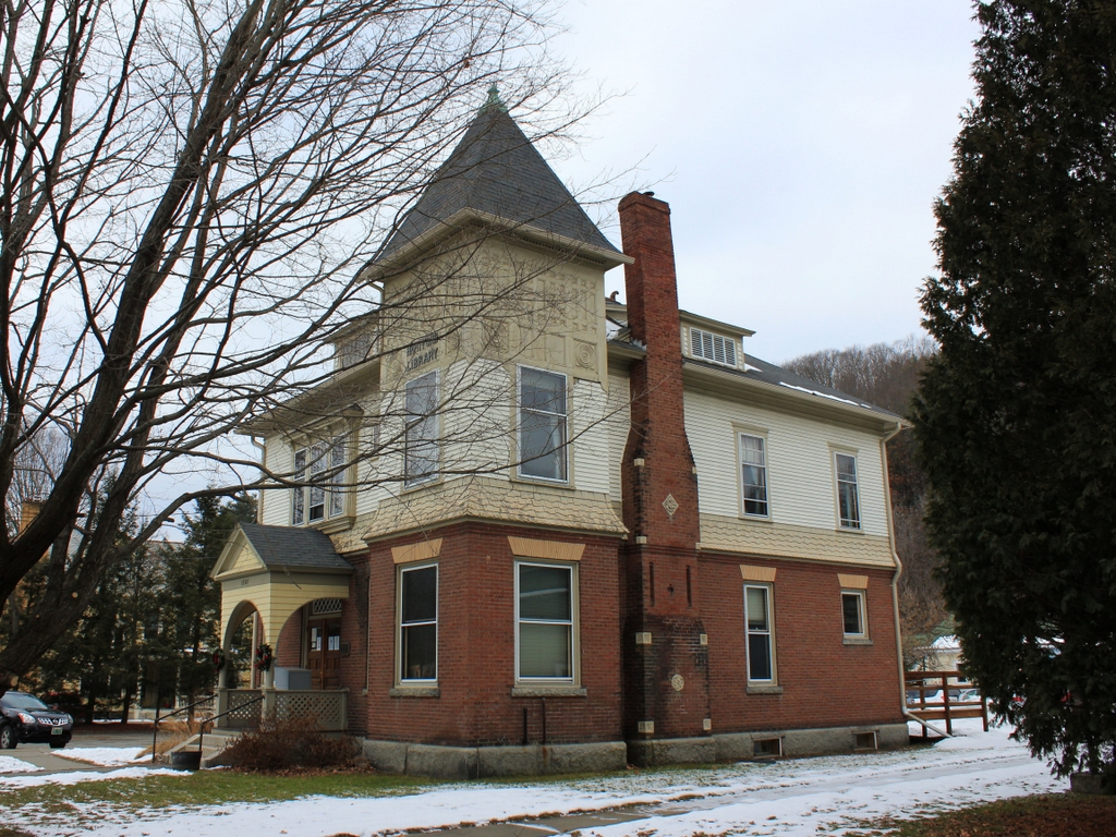
The house in 2018:

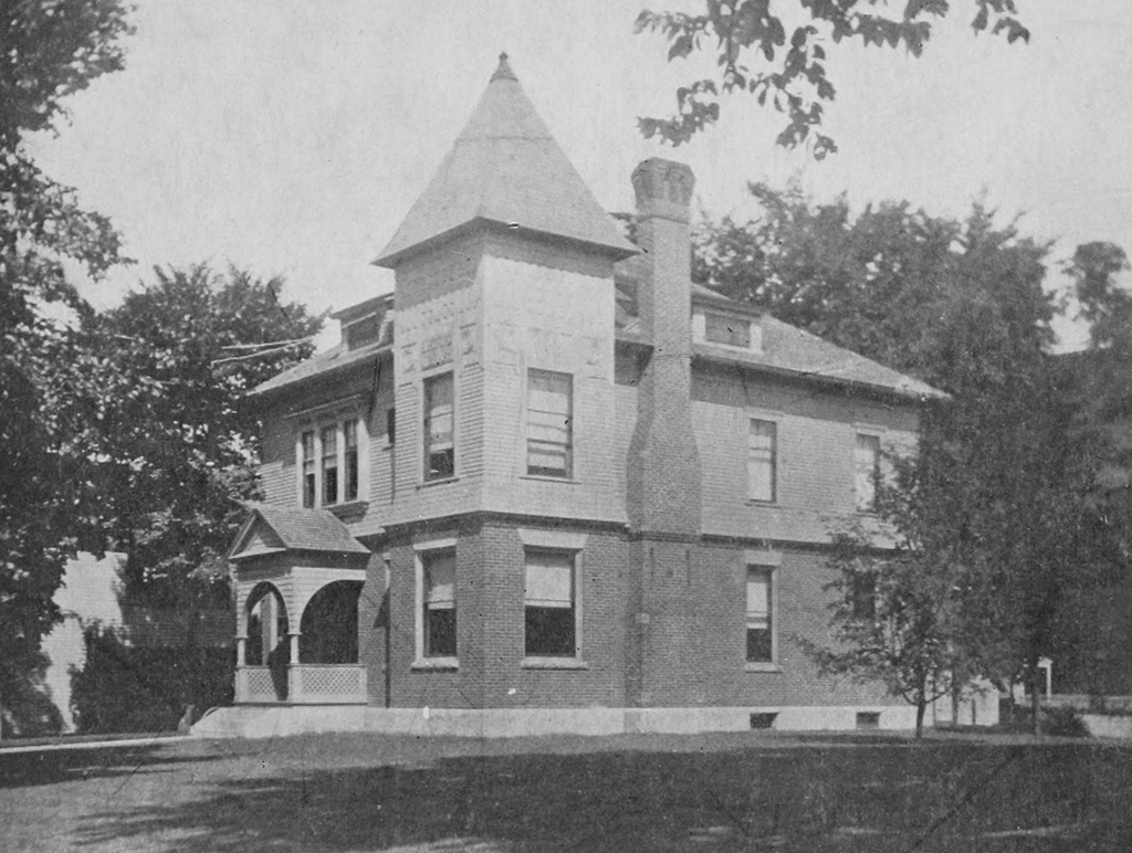
The age of this house is somewhat of a mystery, with some sources claiming that it dates as far back as the mid-17th century. However, it was probably built sometime around 1740 as the home of Thomas Jones, a blacksmith who lived here until his death in 1774. His son Elisha then inherited the property, and he went on to become perhaps the most notable occupant of this house.

Elisha Jones was about 30 years old when inherited the house. Like his father and grandfather, he was also a blacksmith, and he was evidently a wealthy man, with an estate that was valued at 1,121 pounds 8 shillings in 1777. In addition, he served in the local militia, where he held the rank of lieutenant during the American Revolution, and prior to the war his house was reportedly one of the places in town where colonial military supplies were hidden from the British.

However, Elisha Jones and his house are best known for an incident that may or may not have occurred here on April 19, 1775, during the Battle of Concord. The house is located across the street from the Old North Bridge, where the famous “Shot heard round the world” was fired by the colonial minutemen, and according to legend Jones was standing at the door of his shed after the battle, watching the retreating soldiers. One of them is said to have fired at him, although the ball missed Jones by about three feet, and instead passed harmlessly through the wall.

This large shed, which was later attached directly to the main house on the left side of this scene, still has a hole in the wall, which is supposedly where the British musket ball struck the building. However, it is difficult to prove exactly what caused this hole, and there are no contemporary accounts of this incident. The earliest published description came many years later, and it was written by John Shepard Keyes, the late 19th century owner of this house. He heard the story from Elisha Jones’s oldest daughter Mary, who was four years old at the time of the battle, and he wrote the following description in his book, Story of an Old House:

Mr. Jones had prudently taken his wife and babies down cellar, where they cowered in fear and trembling in the dark corners, while he stood guard over the barrels of beef. Soon the clatter and noise of the Britishers ceased, and all was still. Then the silence was broken by the volleys of musketry at the bridge. He could stand it no longer, but rushing up from the cellar followed by his wife and crying children, they saw the regulars retreating in confusion back to the village, bearing their wounded, some with ghastly faces, supported by their comrades, others with bloody limbs hastily bandaged to stanch the flow. . . .

To her father it lent new excitement and patriotic rage; he pointed his gun out of the bedroom window on the north-west corner of the house, determined to have one raking shot at the foe. His wife clung to his arm, begging him not to risk their burning the house if he fired from it, and succeeded in preventing his purpose and getting the gun away. Then he went to the door of the shed, and stood there looking at the retreating soldiers in scorn and triumph. One of the rear guard who may have seen his attempt to shoot, or “misliked his look,” drew up as they passed the house, and fired a “British musket ball” at Elisha. It was a well pointed shot considering that the red coats fired from the hip, and not from the shoulder with a sight along the gun barrel, as the Yankees did. The ball struck at the height of Jones’ head about three feet to the right, and passing through the boarding, glanced from an oak joist, and out through the back side into the ground behind.

It is impossible to conclusively prove or disprove this story, but in either case it has become a part of local legend, and it has contributed to the fame of the house, which is sometimes referred to as “The Bullet Hole House.” In the meantime, though, the property remained in the Jones family for many years, with Elisha’s son James Jones inheriting it after his death in 1810. James, like the previous three generations of his family, was also a blacksmith, and he owned this house until 1836, when he sold it to Nathan Barrett for $800.

Barrett evidently never lived here, instead using the house as a rental property, and over the years it fell into disrepair. He ultimately sold the house in 1863 to John Shepard Keyes, who soon set about restoring the house and documenting its history. Keyes was a Concord native who was about 42 years old at the time. He was a lawyer, and he had previously served as sheriff of Middlesex County from 1853 to 1859. In 1860, he was a delegate to the Republican National Convention, which nominated Abraham Lincoln to the presidency, and a year later he became a U. S. Marshal. He also served as a bodyguard for Lincoln, and he accompanied him during his inauguration and during the Gettysburg Address. Keyes went on to serve as a marshal until 1867, and in 1874 he became a judge on the Middlesex District Court.

After purchasing this property, Keyes soon oversaw dramatic alterations to the house. On the exterior, this included replacing the windows, installing a second-floor dormer window on the north side, and adding a portico to the front door. Keyes also moved the shed and attached it to the north side of the house, turning it into a large two-story wing. Overall, most of the house’s present-day appearance dates back to this mid-1860s renovation.

John Keyes lived here in this house with his wife Martha until her death in 1895, and he remarried three years later. He was still residing here when the first photo was taken around 1908, more than 40 years after he first moved in, and he remained here until his death in 1910 at the age of 88. His daughters, Alicia Keyes and Annie Emerson, then inherited it, although only Alicia appears to have actually lived here after her father’s death. Annie gained full ownership of the property after Alicia’s death in 1924, and a year later she sold it to Henry H. Fay.

Fay was the last private owner of the house, and he lived here until 1963, when he sold it to the National Park Service. It then became a part of the Minute Man National Historical Park, which had been established in 1959 to preserve the historic sites associated with the battles of Lexington and Concord. Since then, the house has been well-preserved in its post-1860s appearance, with hardly any changes from this view since the first photo was taken more than a century ago. However, because of these renovations it bears little resemblance to its appearance during the American Revolution, and it is not open to the public for tours, with the National Park Service instead using it as a rental property.

Captain John Parker Statue, Lexington, Mass

The statue of Captain John Parker, on the Lexington Common at the intersection of Bedford Street and Massachusetts Avenuen, around 1900-1901. Image courtesy of the Library of Congress, Detroit Publishing Company Collection.

The scene in 2018:

As discussed in more detail in the previous post, the Lexington Common is famous for being the site of the first battle of the American Revolution, which occurred here on April 19, 1775. Early on that morning, a group of some 80 Lexington militiamen gathered here on the Common, in preparation for the arrival of a large British force headed for Concord. In the short skirmish that followed, the militiamen, under the command of Captain John Parker, exchanged fire with the British. The result was eight dead militiamen and another ten wounded, compared to only one wounded redcoat. The British continued on to Concord, but the confrontation here in Lexington marked the opening shots of the conflict that ultimately led to American independence.

Captain Parker survived the battle, although his cousin Jonas Parker was among the eight who were killed. However, the 45-year-old Parker was dying from tuberculosis at the time, and the disease ultimately took his life less than five months later. Despite his short service in the war, though, he is regarded as one of the heroes of the battles of Lexington and Concord, in part because of his famous—but possibly apocryphal—command to his men prior to the battle, instructing them to “Stand your ground. Don’t fire unless fired upon, but if they mean to have a war, let it begin here.”

In 1884, these words were inscribed on a boulder on the Lexington Common, which marks the spot where his militia company stood during the battle. Then, in 1900 Captain Parker became the subject of another memorial here on the Common, which is shown in this scene. Officially known as the Hayes Memorial Fountain, it originally featured a water fountain and a watering trough for horses, and it was topped by a bronze statue of Captain Parker. The statue was the work of noted sculptor Henry Hudson Kitson, although Parker’s appearance was largely conjecture, as there are no surviving portraits of him.

The monument was dedicated on April 19, 1900, on the 125th anniversary of the battle. The ceremony included an address by town selectman George W. Sampson, who praised the egalitarian nature of its design, noting:

The drinking fountain itself, built of rough breastwork stone, is emblematical of the spirit of equality and democracy. Best of all, the figure itself carries us back to the historic past and teaches the lesson of April 19. The statue is true to life. No aristocratic figure surmounts yonder heap of rocks, and none were in the battle.

The first photo was taken sometime within a year or two after the dedication. It shows the fountain in the center of the scene, along with several other monuments on the Common. In the distance to the left is the stone pulpit, which marks the site of the town’s first three meeting houses. Just behind this pulpit is an elm tree that had been planted by President Ulysses S. Grant some 25 years earlier, as part of the battle’s centennial celebration. However, probably the most notable feature in the first photo, other than the statue, is the large 45-star flag that is flying above the Common.

Today, around 120 years after the first photo was taken, the statue remains a prominent landmark in downtown Lexington. The fountain itself is no longer in use, perhaps because there is now far less demand for horse watering troughs, and the basin is now used as a flower planter. There are also now a number of shrubs planted around it, but otherwise the monument itself has not seen any changes. Further in the distance, the stone pulpit is also still there, although President Grant’s elm tree is long gone, having probably fallen victim to Dutch Elm Disease at some point in the mid-20th century.

Lexington Common, Lexington, Mass

Looking north on the Lexington Common from near the corner of Bedford Street and Harrington Road, around 1900. Image courtesy of the Library of Congress, Detroit Publishing Company Collection.

The scene around 1910-1915. Image courtesy of the Library of Congress, Detroit Publishing Company Collection.

The scene in 2018:

These photos show a portion of the Lexington Common, which is also known as the Lexington Battle Green. Nearly every New England town has some sort of a common in the center of town, yet this one in Lexington is one of the most famous. It was here, just after dawn on April 19, 1775, that the first shots of the American Revolution were fired, and where eight Lexington militiamen were killed after a brief skirmish with British redcoats who were bound for Concord.

The British soldiers had departed Boston late in the previous evening, with the goal of seizing colonial military supplies that were being stored in Concord. This prompted Paul Revere and other messengers to make their famous midnight ride, alerting the militia companies in the outlying towns. Here in Lexington, a force of about 80 militiamen assembled on the Common. They were led by Captain John Parker, who is said to have instructed his men to “Stand your ground. Don’t fire unless fired upon, but if they mean to have a war, let it begin here.”

Upon arrival, the British ordered the militiamen to leave, with Major John Pitcairn supposedly shouting “Disperse, ye villains! Ye rebels, disperse!” Along with Parker’s earlier command, this would become one of the most famous quotes of the war, although it is hard to say exactly how accurate either of these lines really are. This uncertainty may be due, in part, to the fact that both men died within less than five months after the battle, leaving future historians with little opportunity to verify their battlefield statements.

In any case, Captain Parker recognized that his men were vastly outnumbered, and he ordered them to disperse. However, few evidently heard him. Then, in the midst of this standoff, a shot was fired. The identity of the shooter remains unknown, with both sides generally placing blame on the other, but both the redcoats and the militiamen then began exchanging fire.

The British proved to be far more effective in their fire. By the time the brief battle was over and the redcoats had resumed their march to Concord, they left behind eight dead militiamen and ten wounded, compared to just one wounded British soldier. Among the dead was Jonathan Harrington, who lived in the house that is visible in the distant center of all three photos. According to tradition, he was mortally wounded after the battle, but he managed to crawl back to his doorstep, where he died in his wife’s arms.

Despite how short and one-sided the battle was, it marked the first armed resistance to British aggression, and the Lexington Common has become an important symbol of American independence. The common is now marked by several monuments, including the one here in the foreground of this scene. Dedicated in 1884, this boulder marks the line where the militiamen stood, and it is inscribed with Captain Parker’s famous—if possibly apocryphal—command to his men to stand their ground.

The first photo was taken around the turn of the 20th century, and it shows the Harrington house as it appeared prior to a major renovation in 1910. This project, which was completed by the time the second photo was taken, involved the removal of a wing on the right side of the house, along with the replacement of the large central chimney with two smaller ones. It was intended as a restoration, although the work appears to have been based more on early 20th century ideas about how a colonial house should look, rather than how the Harrington house actually looked during the colonial era.

Today, more than a century after the second photo was taken, very little has changed in this scene. The boulder is still here marking the line of militiamen during the battle, and the Harrington house remains standing in the distance, with few major exterior changes since the 1910 alterations. The other house in this scene, visible further in the distance, also survives today, although it is somewhat younger than the Harrington house, dating back to 1820. The Common itself has also been preserved, serving as both a public park and a historic site, and in 1961 it was designated as a National Historic Landmark.