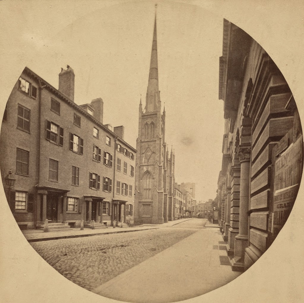
Tremont Street, Boston

The view looking down Tremont Street from School Street, around 1860. Photo courtesy of Boston Public Library.

330_1860-2Bbpl

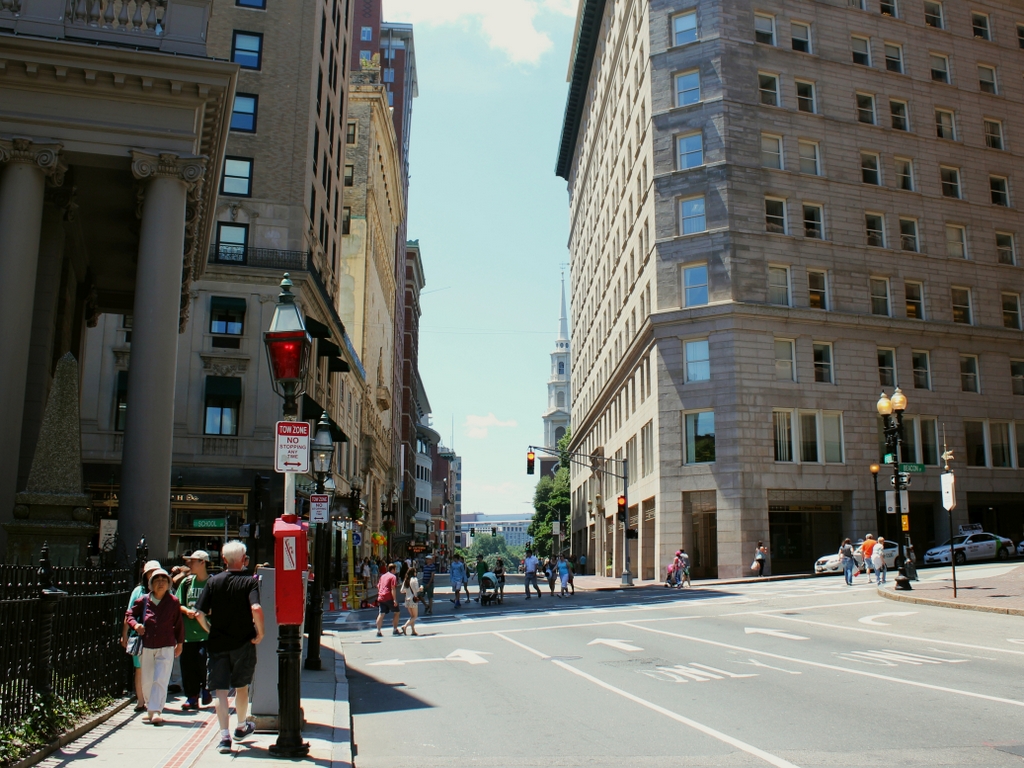
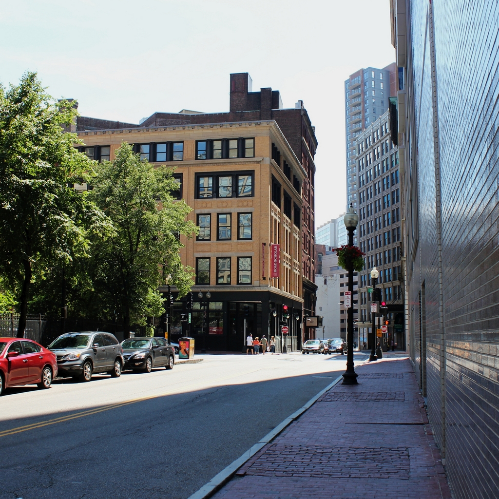
The same scene in 2014:

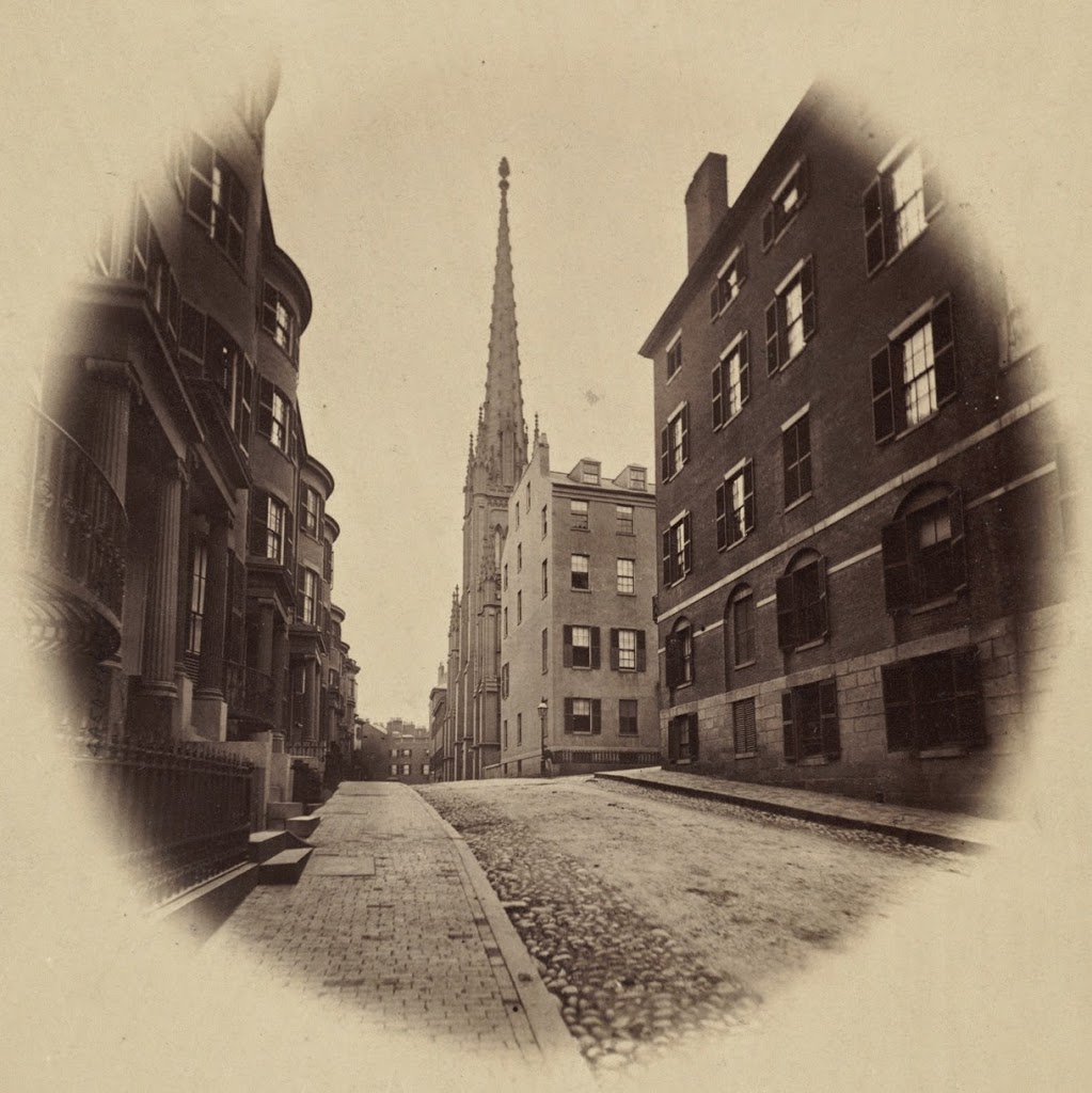
A lot has changed on this section of Tremont Street in the past century and a half, but a few constants remain. The front pillars of King’s Chapel are on the left-hand side, and the steeple of Park Street Church can be seen in the distance on the right. Another landmark in the first photo is the Tremont House, which can be seen from the opposite angle in this post. At the time of the 1860 photo, this was one of the best hotels in the city, and as mentioned in the post on the hotel, it had a number of prominent visitors throughout the 1800s.

Tremont Street has always been a major road in the city, but the first photo shows a very different scene. On the eve of the Civil War, it was a narrow dirt road with a few horse-drawn carriages. Within a few years, though, things would start to change, and by the end of the century this scene would be clogged with streetcars, which prompted the construction of the Tremont Street Subway, the first subway in the country. Today, this part of Tremont is located along the Freedom Trail, with a significant number of tourists walking along the sidewalk on a warm summer Saturday in the 2014 photo.

 

Somerset Street, Boston

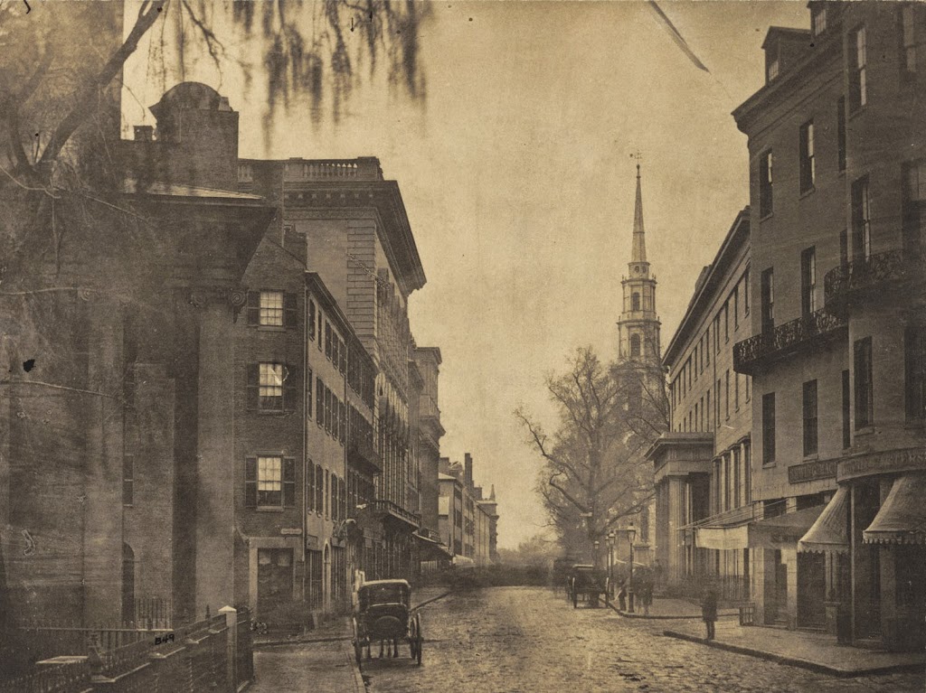
Looking south on Somerset Street in Boston, around 1860, with Ashburton Place on the right. Photo courtesy of Boston Public Library.

308_1860-2Bbpl

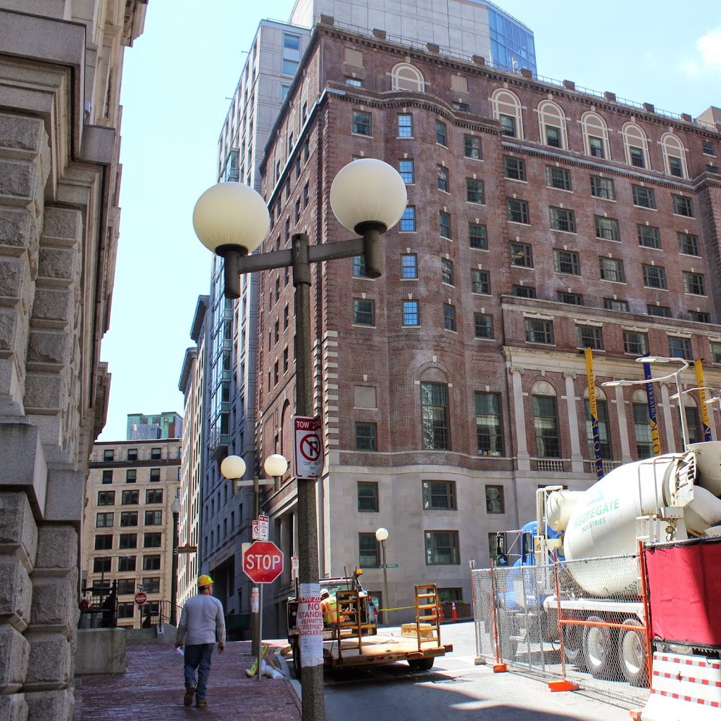
Somerset Street in 2014:

308_2014

Located on the edge of Beacon Hill, Somerset Street has completely changed in the past 150 years. Once a predominantly residential street, the rowhouses on the left have been replaced by the John Adams Courthouse, which is home to the Massachusetts Supreme Judicial Court. To the right, the First Baptist Church of Boston once stood just beyond the intersection of Ashburton Place; it was built in 1854 and was the home of the congregation until 1877, shortly before they moved to their current location in the Back Bay.  At the corner of Somerset and Ashburton today is one of the buildings for Suffolk University, and just a block over on Ashburton is the Massachusetts State House.

Bethel Church, Boston

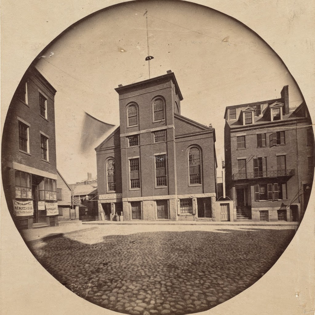
Bethel Church at North Square, Boston, around 1860. Photo courtesy of Boston Public Library.

307_1860c-2Bbpl

The church in 2014:

Built at North Square in 1833 by the Boston Port and Sailor’s Aid Society, this church provided Boston’s sailors with a place of worship, and also included a store to benefit sailors and their families. During the 19th century, several notable visitors attended the church, including Jenny Lind, Walt Whitman, and Charles Dickens.  In the 1880s, the building was sold to the Roman Catholic Church, and was reopened in 1890, after some exterior renovations as seen in the 2014 photo.

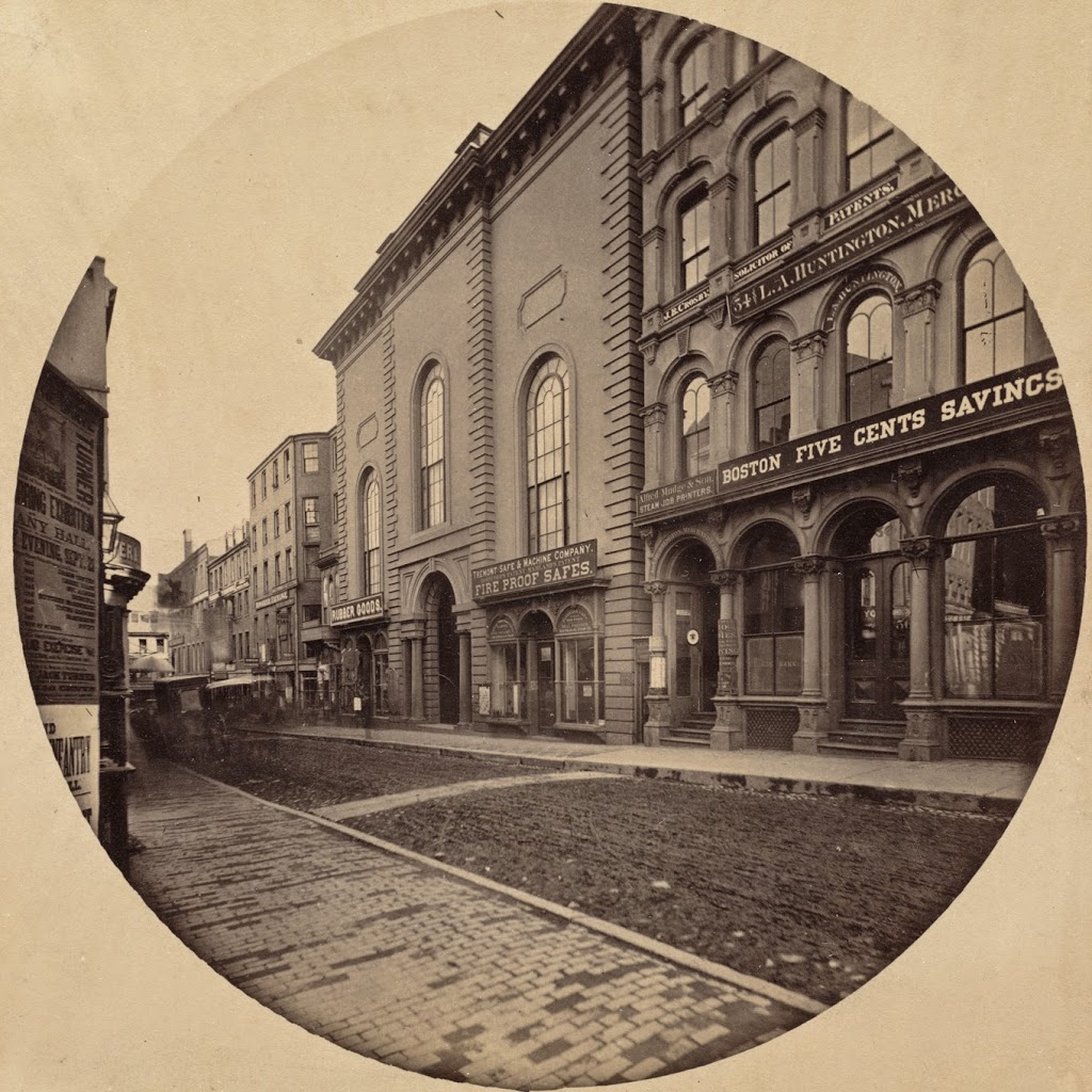
School Street, Boston

The Second Universalist Church on School Street in Boston, taken in 1860. Photo courtesy of Boston Public Library.

304_1860-2Bbpl

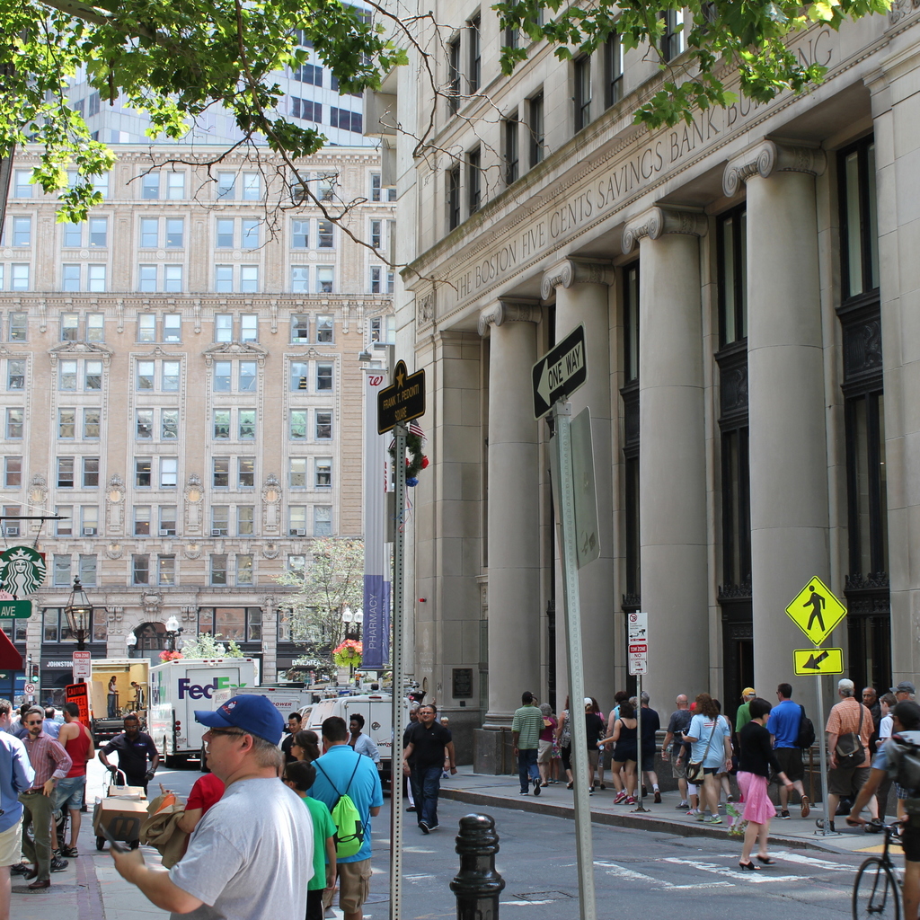
The scene in 2015:

304_2015

These two photos show some of the drastic changes on School Street in downtown Boston.  The church was demolished in 1872, and the Boston Five Cents Savings Bank building, which was built in 1858, was replaced with the current building in 1925.  The name of the bank is still visible on the building today, although the bank itself no longer exists – it was acquired by Citizens Bank in 1993.  None of the buildings from the first photo survive today, although there are a few very old buildings in the area today that are just outside the view of these photos, including the Old Corner Bookstore, at the end of School Street and just to the left, and the Old South Meeting House, which is to the right behind the buildings in the foreground.

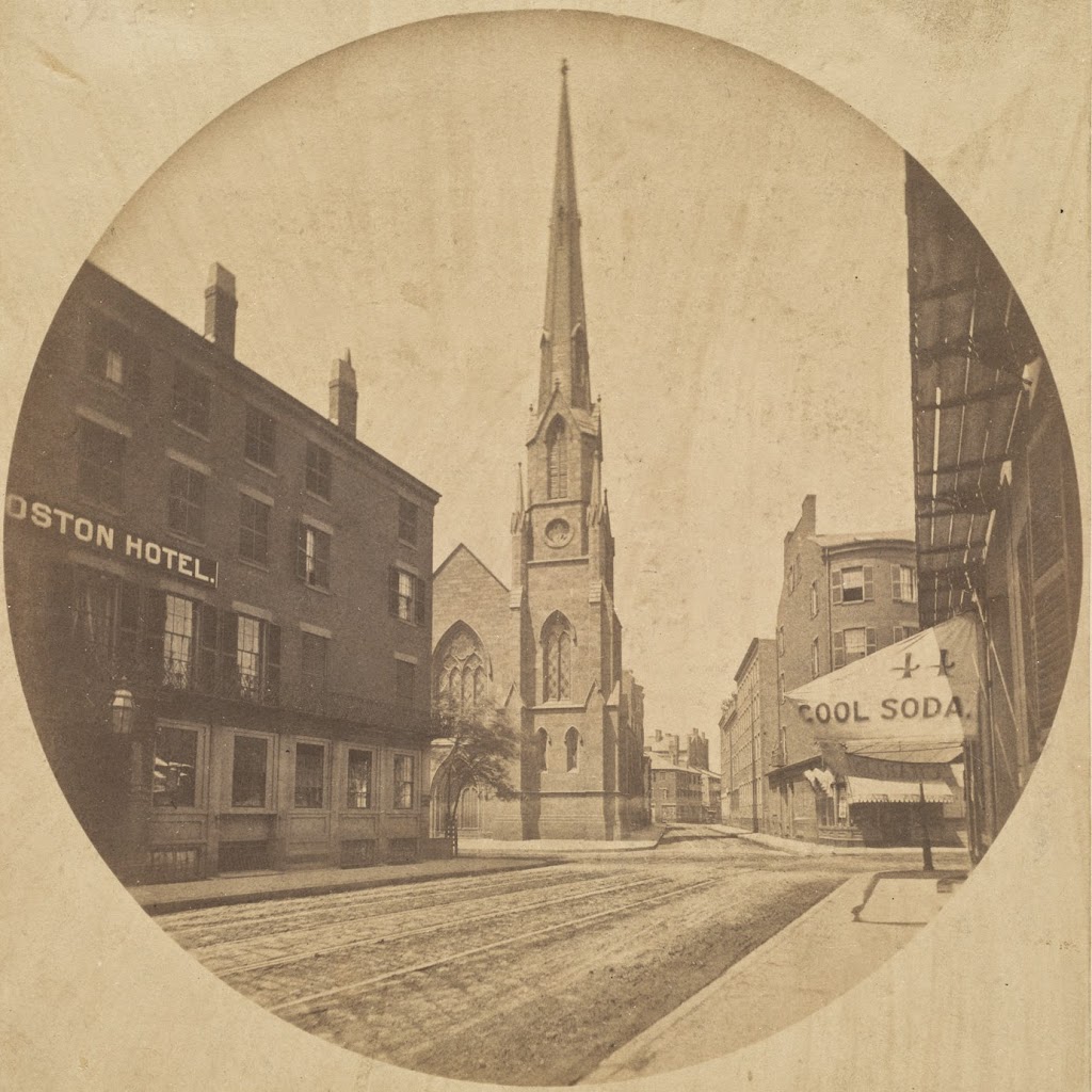
Beach Street, Boston

Looking west on Beach Street toward Harrison Avenue in 1860. Photo courtesy of Boston Public Library.

301_1860-2Bbpl

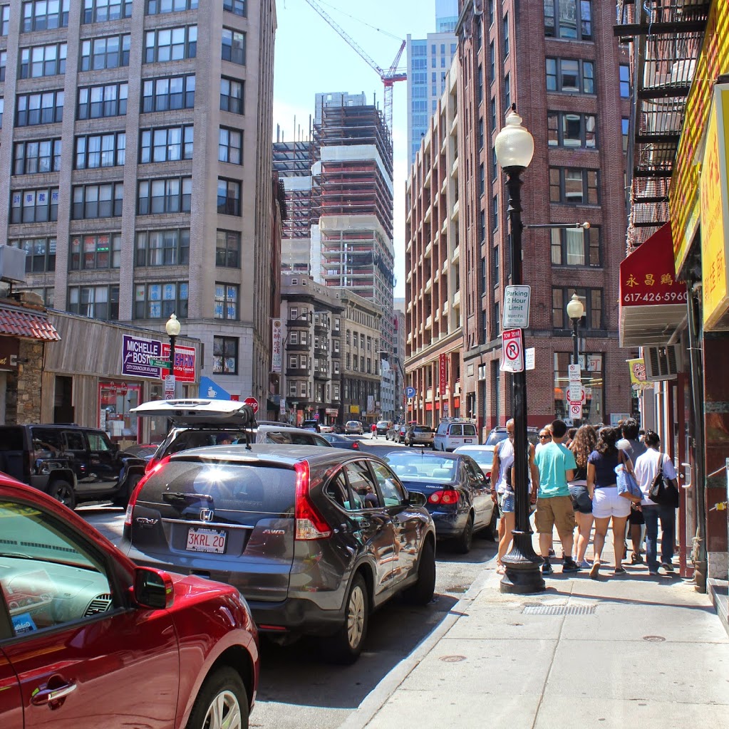
Beach Street in 2014:

301_2014

Taken before the neighborhood was redeveloped as a major commercial district, the first photo shows a variety of early 19th century architecture, with a combination of a hotel (the Boston Hotel on the left), a church (Beach Street Church), and residential buildings.  Notice also the awning that advertises “cool soda” at the business on the right.  Today, this area has undergone total redevelopment, and is now in the midst of Boston’s Chinatown neighborhood.

Chauncy Street, Boston (1)

Looking southwest on Chauncy Street in Boston, toward modern-day Avenue de Lafayette from Bedford Street, taken around 1860. Photo courtesy of Boston Public Library.

299_1860-2Bbpl

Chauncy Street in 2014:

Another work of noted photographer Josiah Johnson Hawes, the first photo shows a very different Chauncy Street than the present-day view. The church at the corner is the Rowe Street Baptist Church, which was built in 1847. The church, along with all of the other buildings in the photo, was destroyed in the Great Fire of 1872, which is one of the reasons why none of the building in the 1860 scene survive to this day.