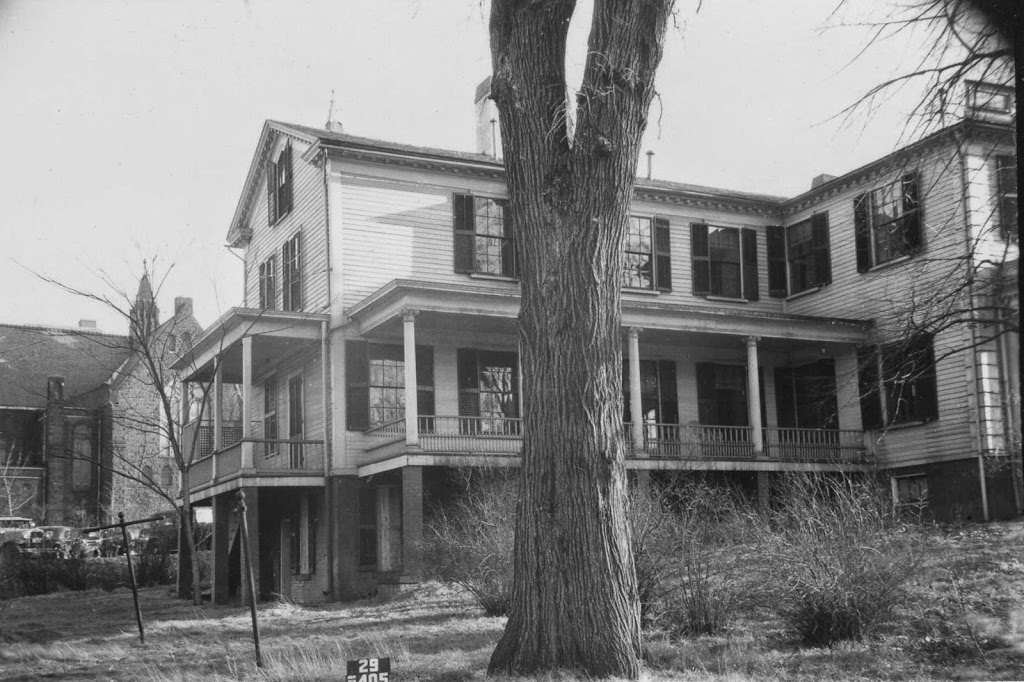
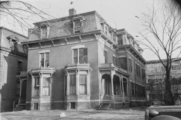
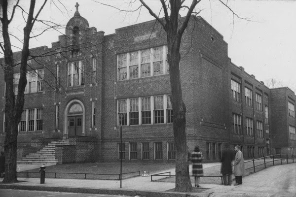
The old Cathedral High School building on Elliot Street in Springfield, around 1938-1939. Photo courtesy of the Springfield Preservation Trust.
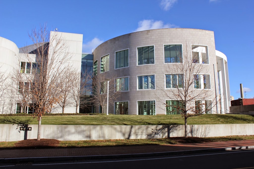
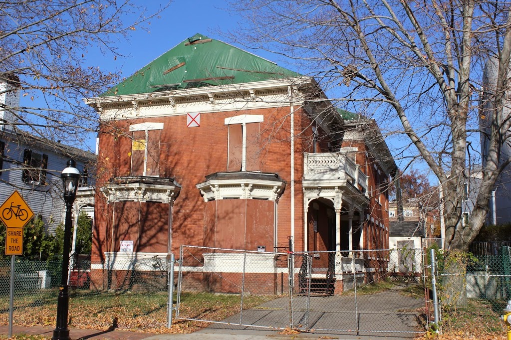
The building in 2014:
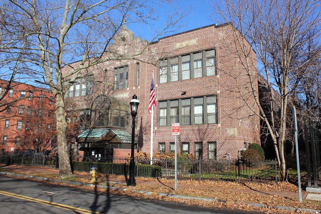
Not much has changed in the exterior of the old Cathedral High School building on Elliot Street. It was built in 1919 to meet the needs of a growing school population, and was used as a high school for 40 years until the opening of the Surrey Road campus in 1959, which was the home of the school until the June 1, 2011 tornado, which caused significant damage to the building. In the meantime, the old Elliot Street building is still owned by the Springfield Diocese, and with the demolition of the “new” Cathedral High School this fall, the 95 year old building has now outlived its successor.
When this building was used as a high school, a number of notable people attended school here, including three future NFL players: Joe Scibelli, 1943 Heisman Trophy winner Angelo Bertelli, and Pro Football Hall of Famer Nick Buoniconti. Given the approximate date of the first photo, Bertelli was likely attending the school at the time – perhaps he was even sitting in one of the classrooms when the photographer took the picture. In addition, former Postmaster General and NBA Commissioner Larry O’Brien also went here, graduating several years before the first photo was taken.