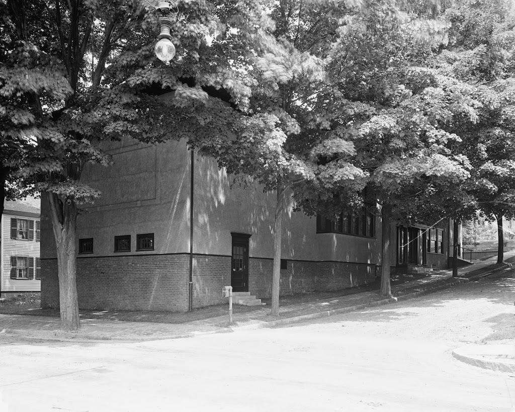
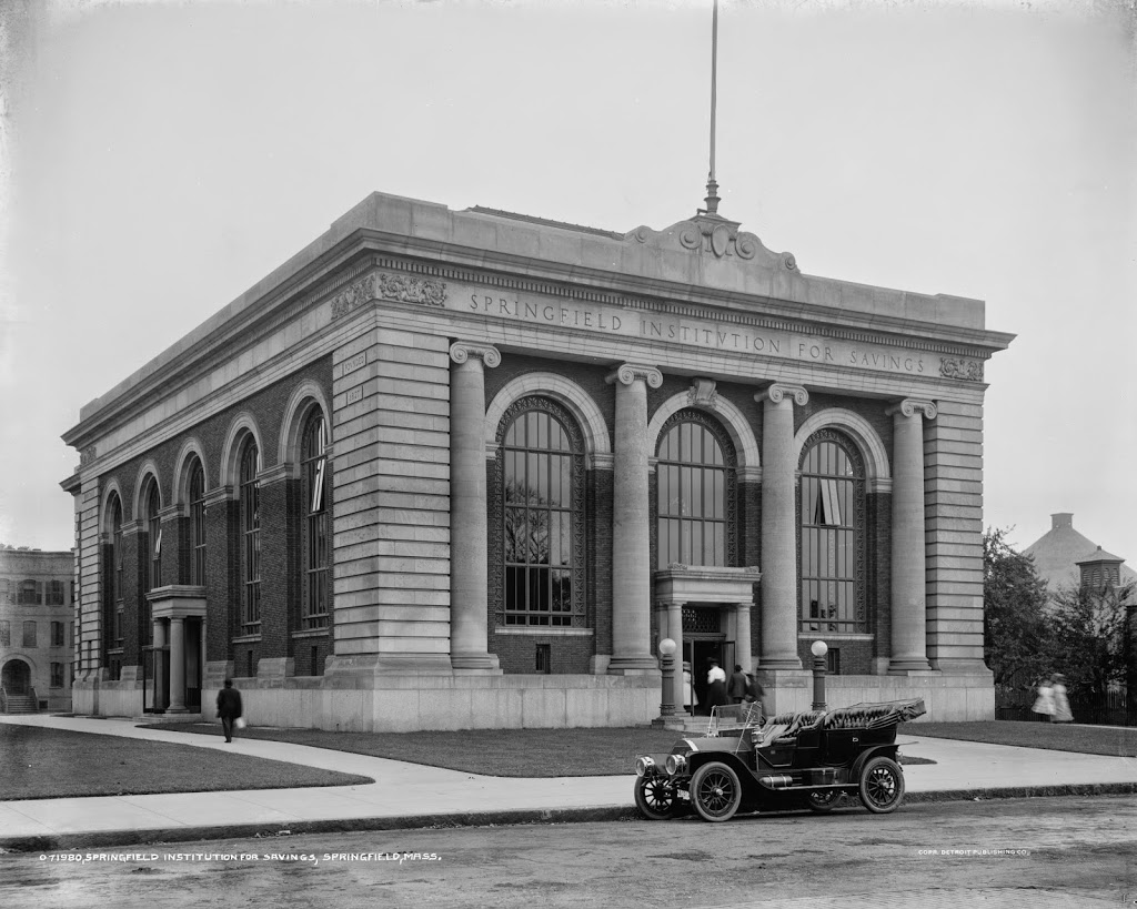
The Springfield Institution for Savings building on Elm Street in Springfield, around 1910. Image courtesy of the Library of Congress, Detroit Publishing Company Collection.
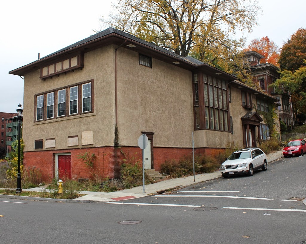
The site in 2014:
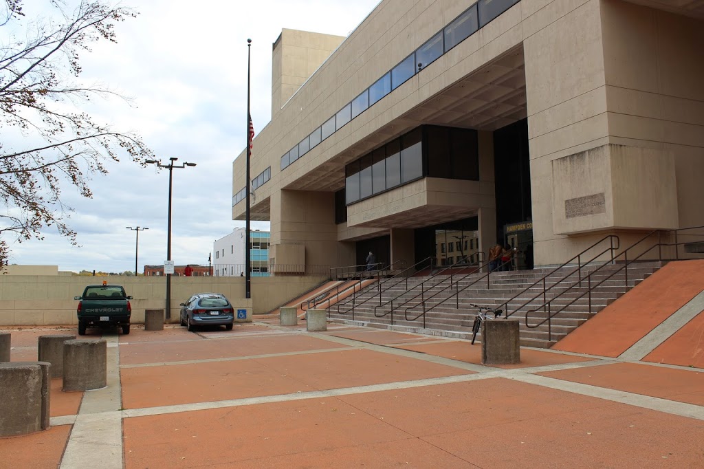
The first photo shows the former home of the Springfield Institution for Savings, one of Springfield’s first banks. Today, the building no longer exists, and neither does the company. SIS is now part of TD Bank, and the site of the building is now part of the Hampden County Courthouse. Even the street that the bank was once on, Elm Street, no longer really exists. It used to extend from Main Street to present-day East Columbus Avenue, but the construction of the new courthouse in the 1970s caused the street to be truncated, and today it is a street in name only, as the section along Court Square is gated off, and the section next to Old First Church is essentially a parking lot for courthouse employees.
What really interested me in this picture, though, is the car parked outside. Here is a close-up of it:
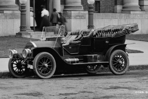
Along with giving us a clue as to the date (the license plate appears to read “1910”), it also shows an intriguing and long-forgotten part of Springfield history. The car was made by Springfield-based Knox Automobile Company, who made cars in the city from 1900 until 1914, and trucks until 1924. Their factory was on Wilbraham Road in the Mason Square neighborhood, right across the street from the Indian Motorcycle factory. The Knox building is still there, although it is in pretty rough shape and was included in the 2014 list of Springfield’s most endangered buildings.
I am fairly certain that the car in the photo is a 1909 Model “O,” although I am no expert on early 20th century automobiles, so if someone more knowledgeable than me knows otherwise, let me know. Assuming it was a Model “O,” though, it would’ve been $3,000 car 1909. Adjusted for inflation, that would be over $75,000 in 2014 dollars, so the owner would’ve been a fairly wealthy person. Today, though, cars don’t look like that, as the pickup truck and station wagon bear witness to in the 2014 photo. However, at least one 1909 Knox Model “O” still exists today; this article explains the process of restoring the car and includes plenty of post-restoration photos.