Kenmore Square Bus, Boston

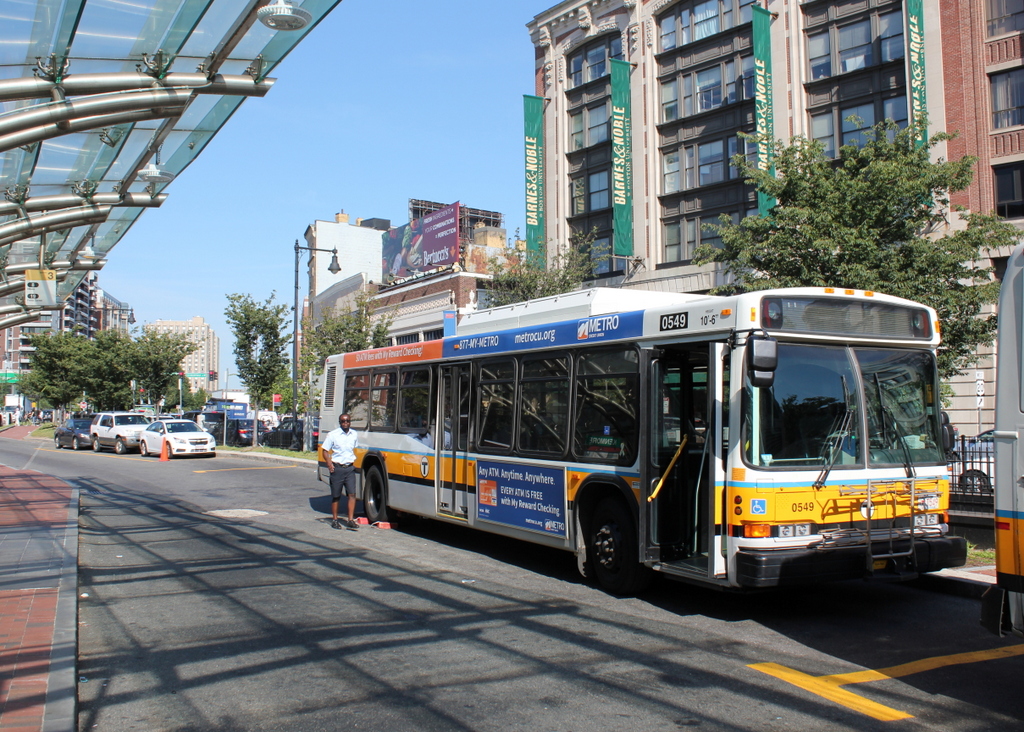
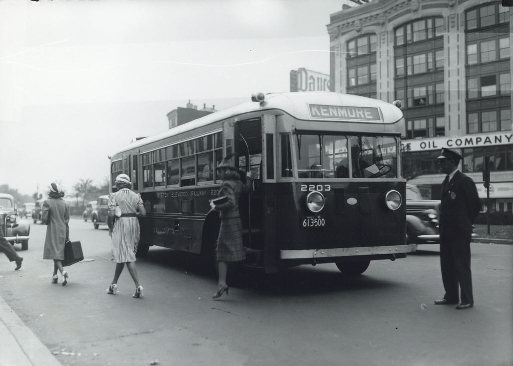
Passengers getting off of a bus at Kenmore Square, sometime in the 1940s and probably before 1947.  Image courtesy of the City of Boston Archives.

664_1940sc coba

The same location in 2015:

664_2015
For all that has changed in the past 70 years, not much is different between these two photos.  Many of the buildings in Kenmore Square are still there today, including the Peerless Motor Company Building in the background on the right.  It was completed in 1911 as the New England headquarters of the Peerless Motor Company, an early luxury car brand that was in business until 1931.  The building was used for offices, showrooms, and garage space for the company, but by the time the first photo was taken, Peerless had been gone for over a decade.  Today, the exterior of the building is essentially the same as it was when it was built over a century ago, and it is used as Boston University’s bookstore.  It isn’t visible in the photo, but this is also the building that has the famous Citgo sign that can be seen beyond the Green Monster at Fenway Park.

The most obvious change from the 1940s photo is the bus.  Not only are bus styles different today, but so is the company that operates the city’s buses.  The side of the bus reads “Boston Elevated Railway,” which was the company that ran Boston’s subways, streetcars, and buses until 1947.  With increased competition from automobiles, the company was no longer profitable, so its operations were sold to the Metropolitan Transit Authority, which later became today’s MBTA.  As seen in the 2015 photo, Kenmore Square is still a major transportation hub, and the median of Commonwealth Avenue has a reserved lane for buses next to the bus shelter, which also offers access to the Green Line station directly underneath here.

Boston University East, Boston

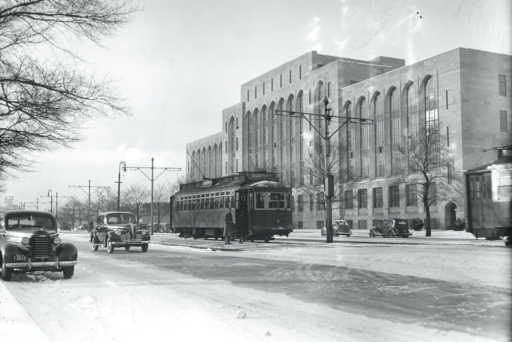
The Boston University East MBTA station on Commonwealth Avenue, around 1939. Image courtesy of the City of Boston Archives.

663_1930sc coba

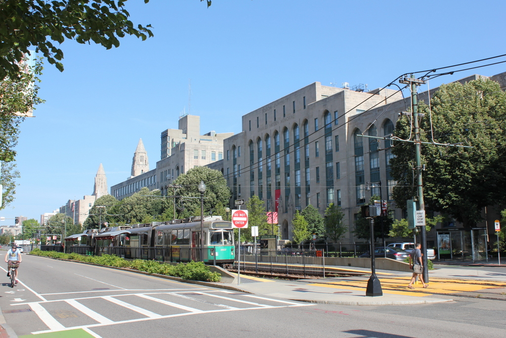
The scene in 2015:

663_2015
The first photo shows passengers boarding a Boston Elevated Railway trolley at the Boston University East station, in front of the Charles Hayden Memorial Building at Boston University.  It appears to be a Type 4 trolley, which was found on Boston’s many streetcar lines from 1911 until 1950.  Most of those lines have long since been converted into buses, but the line along Commonwealth Avenue is still in use, as the MBTA “B” branch of the Green Line.

The Charles Hayden Memorial Building in the background of both photos was completed in 1939, and it provides an earliest possible date for the photo, which the City of Boston Archives estimated as being in the 1930s.  The building was the first to be built on BU’s Charles River Campus, and just over two years after it opened the United States entered World War II, postponing other construction projects on the campus.  The other buildings along this section of Commonwealth Avenue would not be completed until 1948, but today this area between the Massachusetts Turnpike to the south and the Charles River to the north has become the school’s main campus.

Hotel Buckminster, Boston

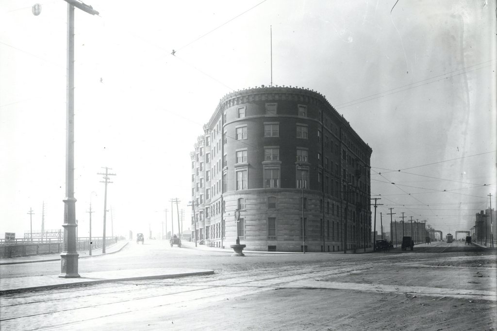
The Hotel Buckminster at Kenmore Square in Boston, around 1911. Image courtesy of the City of Boston Archives.

662_1911c coba

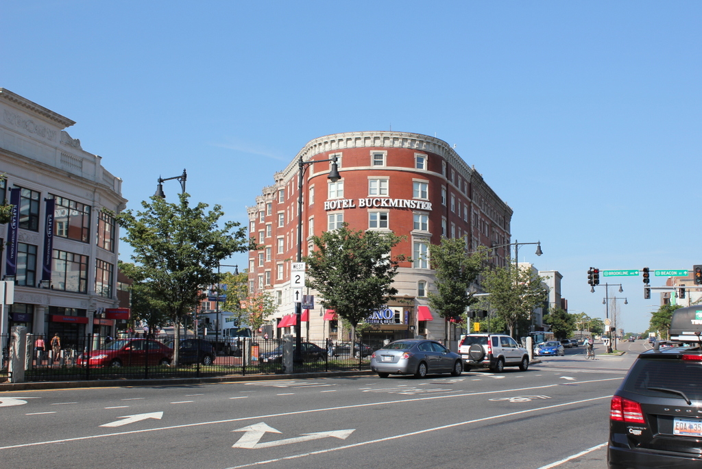
The hotel in 2015:

662_2015
The present-day Kenmore Square area was once just swampy land along the edge of the Charles River, separated from Boston the tidal flats of the Back Bay.  Boston began to fill in this land starting in the late 1850s at Arlington Street and steadily moving west.  The landfill project in the Fenway area was completed by the 1890s, and in 1897 the Hotel Buckminster opened as the first hotel at Kenmore Square, in between Brookline Avenue to the left and Beacon Street to the right.  Even by 1911, as seen in the first photo, the neighborhood was still sparsely developed.  Just a year after the photo was taken, the Red Sox would open Fenway Park on a vacant lot just two blocks south of here along Brookline Avenue.

Because of its proximity to Fenway Park, visiting teams would often stay at the hotel while they were in town.  Babe Ruth had a favorite room on the top floor along the Brookline Avenue side that overlooked Fenway Park, and it was also here that Boston bookmaker Joseph “Sport” Sullivan met with Chicago White Sox first baseman Chick Gandil and conspired to fix the 1919 World Series.  Later on, the radio station WNAC had its studio in the hotel, and in 1929 the world’s first network radio broadcast was sent from here.  From 191 to 1953, the Storyville nightclub was located in the building, and featured a number of notable jazz musicians, including Louis Armstrong, Billie Holiday, and Charlie Parker.

Over a century after the first photo was taken, the Hotel Buckminster is still around, although the neighborhood around it has grown significantly.  Although visiting teams probably don’t stay at this hotel anymore, the Kenmore Square is the primary subway station for fans going to and leaving Fenway Park, and there are a number of restaurants and other businesses that benefit from the sizable gameday crowds.  It is also a major intersection, with Beacon Street, Commonwealth Avenue, and Brookline Avenue all converging here above ground, and the “B”, “C”, and “D” branches of the Green Line meeting underground.  State Route 2 passes through here as well, and US Route 20, the longest road in the country, ends at Beacon Street, right in front of the hotel.

Huntington Avenue Grounds, Boston (3)

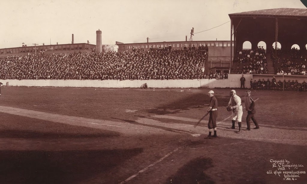
Half of a panoramic view of Huntington Avenue Grounds in Boston, in 1903. The other half can be found here. Image courtesy of the Library of Congress.

342_1903c-2Bloc

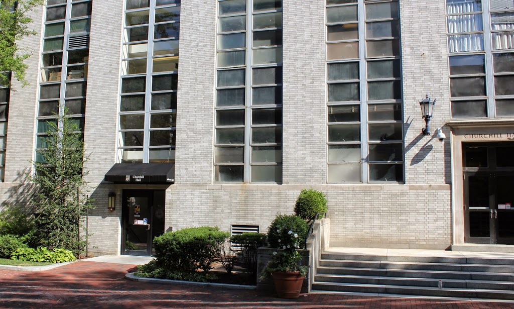
The scene in 2014:

342_2014

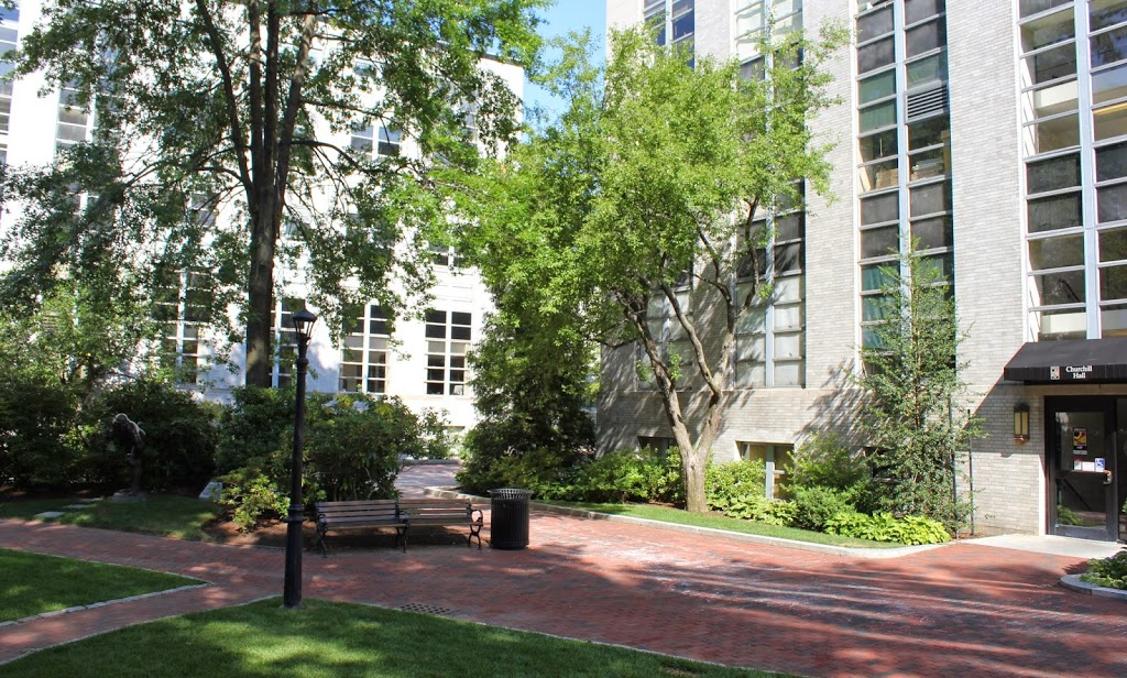
The photo at the top is the other half of the panorama from this post, and it shows the home plate area of Huntington Avenue Grounds, the original home field of the Boston Red Sox.  However, when the first photo was taken during a game against the Chicago White Sox on September 22, 1903, they weren’t the Red Sox; they were the Boston Americans, and in their third year of existence they had already clinched the pennant and were soon to face (and defeat) the Pittsburgh Pirates in the first World Series.

According to the research conducted by the writer of the Baseball Researcher blog, the batter in this scene is Nixey Callahan, Chicago’s manager and third baseman.  Behind him is Boston catcher Duke Farrell, a journeyman catcher who had been playing in the majors since 1888, and was now playing in his fourth major league.  He only played in 17 games in 1903, and was likely starting in order to allow the regular catcher, Lou Criger, to rest now that the pennant race was no longer in doubt.  Behind Farrell is the umpire, Frank O’Laughlin; he would go on to umpire in the American League until 1918, when he died from the Spanish Flu that spread across the world that fall.

Today, no distinguishing features from the 1903 photo remain today, and Northeastern University is now located on the site of the former field, where the team played until after the 1911 season.  The actual location of home plate is now located underneath Churchill Hall, the building seen in the 2014 photo.

See the Library of Congress site for the complete panorama.

Huntington Avenue Grounds, Boston (2)

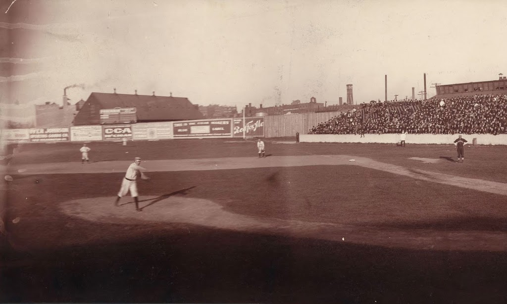
Half of a panorama view of Huntington Avenue Grounds in Boston, in 1903.  The other half can be found here. Image courtesy of the Library of Congress.

341_1903c-2Bloc

The scene in 2014:

341_2014

A lot has changed at the site of the original home of the Boston Red Sox. It seems as though they have played at Fenway Park for forever, and for good reason – they just finished their 102nd season there.  However, before Fenway Park, before Babe Ruth, and even before the name Red Sox, there was Huntington Avenue Grounds.  The first photo was taken on September 22, 1903, and is one half of a panoramic photo (see this post for the other half) that was taken by the studios of Elmer E. Chickering, a Boston photography company.  See the “then” photo in this post for a very similar scene showing pitching legend Cy Young.

Thanks to the efforts of the writer of the Baseball Researcher blog, we are able to identify not only the day that the photograph was taken, but also the players who appear in it.  Boston’s pitcher is Tom Hughes, an average pitcher who was in the midst of what would be a career year for him, with a 20-7 record.  The first baseman is Candy LaChance, with second baseman Hobe Ferris visible to the left, and right fielder Buck Freeman can be seen in the distance.  Freeman would go on to lead the American League in home runs, with 13, and Ferris came in third, with nine.

Boston would end up losing this particular game, 7-0, but it probably didn’t phase the team too much – they were up 14.5 games with eight left to play, so they had already clinched the American League pennant and were just over a week away from hosting the Pittsburgh Pirates here in Boston for the first World Series, which Boston would go on to win five games to three.

Today, the site is part of the Northeastern University campus, but all is not forgotten; there is a statue of Cy Young on the left-hand side of the photo in the distance, in front of the bushes.  It was largely thanks to Young’s pitching that the Red Sox won the 1903 World Series, and the statue made in his honor is placed approximately where the pitcher’s mound once was.  There is also a home plate marker, 60 feet away from the statue, around where this photo was taken.  However, this was not the actual location of home plate – the real location was about 90 degrees to the right, under what is now a campus building.

See the Library of Congress site for the complete panorama.

Huntington Avenue Grounds, Boston (1)

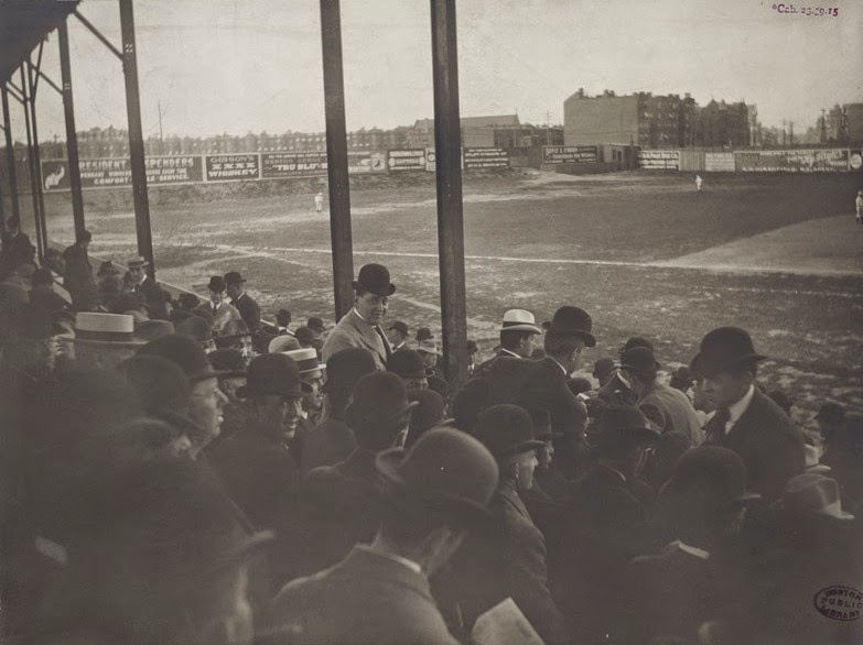
Huntington Avenue Grounds in Boston, around 1903. Photo courtesy of Boston Public Library.

340_1903c-2Bbpl

The same location in 2014:

340_2014

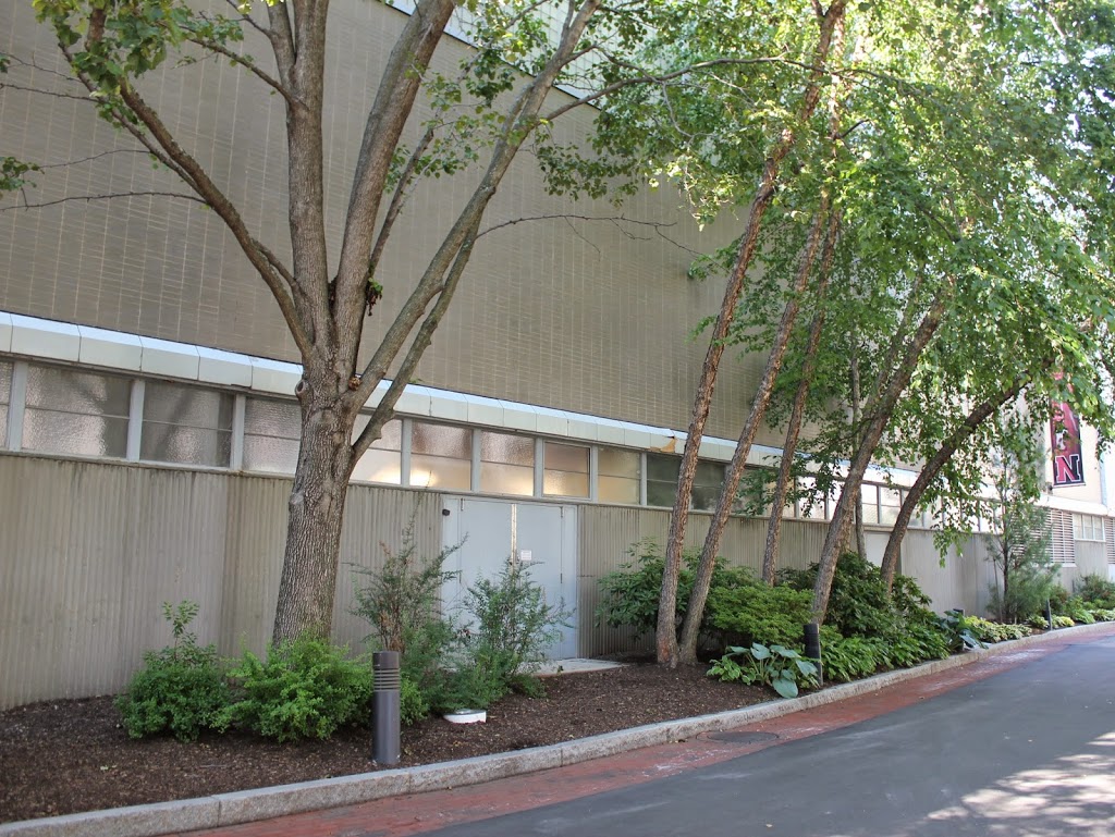
The first photo shows the stands along the third base line at Hunting Avenue Grounds and its expansive outfield. The field measured 350 feet down the left field line, and at the time of the 1903 photo center field measured an almost unheard-of 530 feet, which was later expanded to 635 feet in 1908. Beyond center field is the apartment block that is visible in the photos on this post, although none of the buildings are visible from this spot today, and there is no evidence here that a ballpark ever existed. The building that dominates the foreground here is the Cabot Center, an athletic facility on the campus of Northeastern University.