Inauguration of Abraham Lincoln, Washington, DC

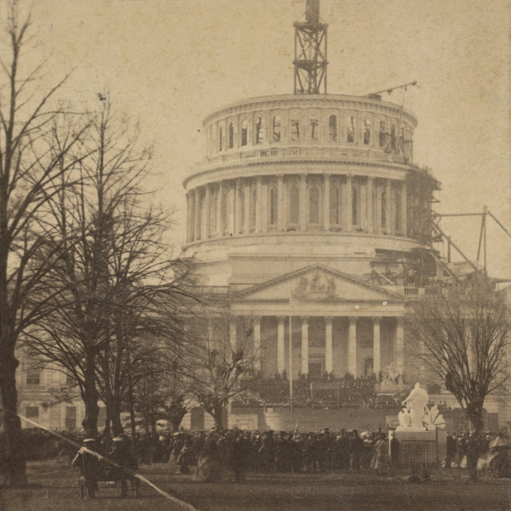
The east front of the United States Capitol, during the inauguration of Abraham Lincoln on March 4, 1861. Image courtesy of the Library of Congress.

The Capitol in 2018:

The first photo was taken around the same time as the one in a previous post, but this one shows the view from further back, with the entire unfinished Capitol dome in view, along with the crowd that had assembled for Lincoln’s first inauguration. It was the culmination of the highly-contentious 1860 presidential election, which saw the splintering of the Democratic Party into regional factions. Lincoln won the four-way race amid threats of secession from the south, and by the time he was inaugurated on March 4, 1861, seven southern states had followed through on their plans.

Because of this, there was a great deal of uncertainty on the day that the first photograph was taken. The start of the Civil War was just over a month away, and there were still plenty of questions about whether the South would be allowed to peacefully secede, or if the newly-inaugurated president would send an army to stop them. Appropriately enough, the backdrop to this event is the unfinished dome of the Capitol. Begun six years earlier, this new dome was still very much a work in progress during Lincoln’s inauguration, and it seemingly represented the as yet unfinished work of uniting the northern and southern regions of the nation.

The Capitol building itself is actually significantly older than this dome, though. Construction began in 1793, and the Senate and House wings were completed in 1800 and 1811, respectively. However, the building was burned in 1814, during the War of 1812, and its reconstruction was not ultimately finished until 1826. At the time, the building was topped by a low dome, which is visible in the first photo of another previous post. As the country grew, though, so did the Capitol building, and two new wings were added in the 1850s. As a result, the old dome looked out of proportion to the old building, so construction began on the current one in 1855.

During the early 19th century, the Capitol became the primary site of presidential inaugurations. At first, these ceremonies were held indoors, in either the Senate of House chambers, but in 1829 Andrew Jackson became the first president to be inaugurated here on the East Portico. This started a tradition that, with few exceptions, continued into the late 20th century. Jimmy Carter’s 1977 inauguration was the last to be held here on the East Portico, and since 1981 the ceremony has – with the exception of Ronald Reagan’s 1985 inauguration in the Rotunda – been held on the West Portico, on the side of the building facing the National Mall and the Washington Monument.

Four years to the day after the first photo was taken, Lincoln’s second inauguration would also be held here on the East Portico. By then, the exterior of the dome had been completed, and Lincoln’s goal of reuniting the nation had likewise been largely accomplished, with the end of the Civil War only weeks away. However, less than a week after Lee’s surrender, and only 42 days into his second term, Lincoln was assassinated by John Wilkes Booth, who had actually attended the second inauguration here, and had later claimed that he could have killed Lincoln during the event if he had wanted to.

Today, more than 150 years after the first photo was taken, the East Portico does not appear to have changed much. However, it actually underwent a major expansion starting in 1958, when a new portico was built 32 feet 6 inches in front of the old one. Aside from being built of marble, as opposed to the sandstone of the original walls, this new portico was essentially a duplicate. The old walls remain intact inside the building, although the original columns were removed and now stand in the National Arboretum. The 1958 renovations also involved the removal of two statues that once flanked the east steps. On the left, mostly hidden from view in the first photo, was Luigi Persico’s Discovery of America, and on the right was Horatio Greenough’s The Rescue. Both of these statues featured particularly unflattering depictions of Native Americans, and neither have been put on public display since then.

The other significant addition to this part of the Capitol occurred in the early 2000s, when the Capitol Visitor Center was constructed here. Consisting of 580,000 square feet of floor space on three floors, this massive expansion is almost entirely hidden from view in this scene, as it is located directly under the plaza in front of the East Portico. From this angle, the only visible signs of this underground complex are several skylights, including one on the far left side of the scene.

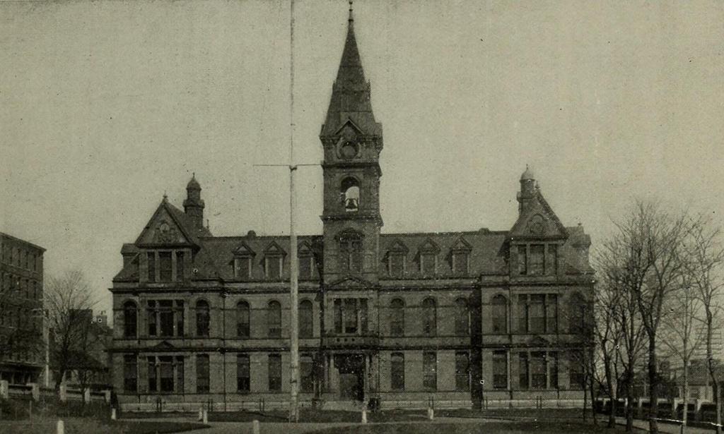
City Hall, Halifax, Nova Scotia

Halifax City Hall, seen from the Grand Parade around 1899. Image from Souvenir, One Hundred and Fiftieth Anniversary, City of Halifax (1899).

1057_1899c-souvenir150halifax

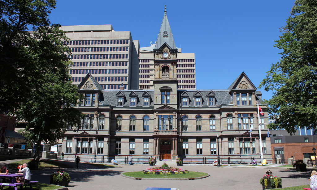
The building in 2016:

1057_2016
As mentioned in the previous post, Halifax is the largest city in Canada’s Maritime provinces, and has had close ties to New England over the years. The heart of downtown Halifax has long centered around the Grand Parade here, a city square located between Barrington and Argyle Streets. On the south side of the square is St. Paul’s Church, the oldest building in the city, and on the north side is City Hall, seen here. It was completed in 1890, with an architectural design that is based on the Second Empire style, which had been particularly popular a couple of decades earlier.

The building sustained some damage in the 1917 Halifax Explosion, but unlike the northern part of the city, the downtown area was largely spared serious damage. Today, the building remains essentially the same as it did in the 1890s view, and is listed as a National Historic Site of Canada. Its jurisdiction has significantly expanded over the years, though, In 1996, all of the existing cities and towns in Halifax County were consolidated into the Halifax Regional Municipality. This essentially extended the Halifax city limits to include over 2,100 square miles of land, more than double the land area of Rhode Island, but the old City Hall remains in use as the seat of the municipal government, over 125 years after its completion.

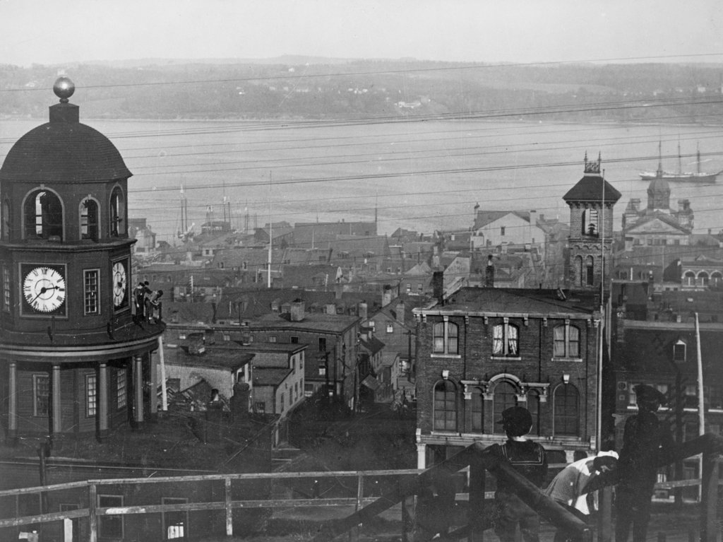
View from Citadel Hill, Halifax, Nova Scotia

The view looking east toward downtown Halifax from Citadel Hill, around 1900-1917. Image courtesy of the Library of Congress.

1056_1900-1917c-loc

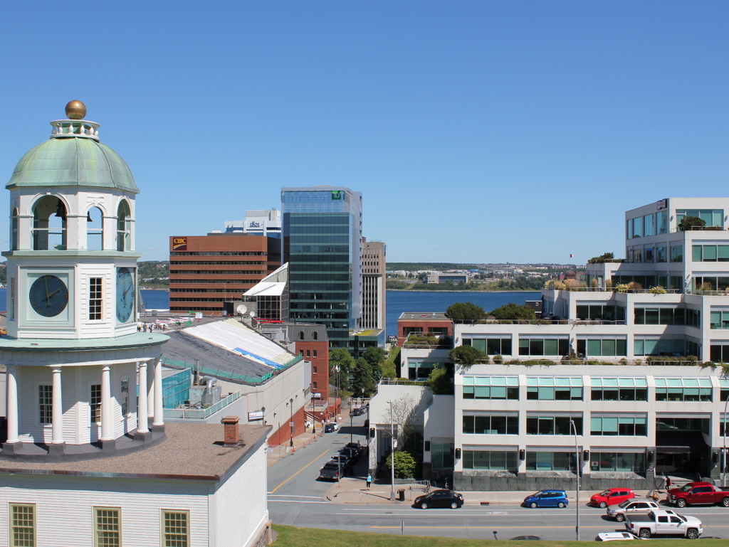
The view in 2016:

1056_2016
It isn’t in New England, or even in the United States, but Halifax has long had close ties with New England, especially Boston. It is the closest major North American port to Europe, and as such it is the last stop for outgoing ships from Boston, and the first for incoming ships. This scene here shows part of the city’s massive harbor, which has been of strategic importance over the years. After the British occupation of Boston ended in 1776, their fleet took refuge here in Halifax while preparing for an assault on New York City, and many years later the harbor was used as a gathering place for eastbound Atlantic convoys in both world wars.

Through all of this, the strategically-valuable harbor has been protected by Fort George, a series of fortifications atop Citadel Hill. The hill stands just west of downtown Halifax, offering sweeping views of the city and harbor, and making it the ideal location for a fort to command the harbor and its approaches. The photos here were taken near the top of the hill, near the outer walls of the fort. On the left is one of Halifax’s oldest landmarks, the Town Clock, which was built at the foot of the hill. It faces down Carmichael Street, which leads to the Grand Parade three blocks down the hill, where City Hall and St. Paul’s Anglican Church are located.

The date of the first photo is somewhat unclear, but it was taken sometime soon before 1917, when Halifax experienced one of the deadliest disasters in history. Known as the Halifax Explosion, it occurred on December 6, 1917, when the harbor was filled with ships heading to and from Europe during World War I. Two such ships were the Norwegian SS Imo, which collided with French ammunition ship SS Mont-Blanc. The latter caught fire, and after about 20 minutes its cargo of high explosives detonated.

The Mont-Blanc was essentially vaporized, and the blast wave leveled much of the northern part of the city, to the left and out of view in the photos here. A few earlier posts, here and here, show scenes from the aftermath of the explosion, which killed nearly 2,000 people, injured around 9,000 others, and damaged or destroyed around 12,000 houses. The main commercial center of Halifax, seen in this view from Citadel Hill, escaped serious damage. Essentially every window in the city was shattered by the explosion, but most of the buildings in the first photo would have survived the disaster.

Despite being spared from serious damage, there is very little that is still recognizable from the first photo a century later. There are a number of 19th century buildings scattered throughout this section of the city, but the only one that is readily visible in both photos is the clock tower itself, which remains a prominent city landmark.

Today, Halifax remains an important port. It is the largest city in Canada’s Maritime provinces, and its downtown has been built up with skyscrapers, partially obscuring the view of the harbor from Citadel Hill. The shoreline across the harbor in Dartmouth has also changed dramatically in the past 100 years. In 1911, the community had a population of just over 5,000, but today it has over 67,000 people, and is a major suburb of Halifax as well as a commercial center in its own right.

Lost New England Goes West: Santa Monica, California (2)

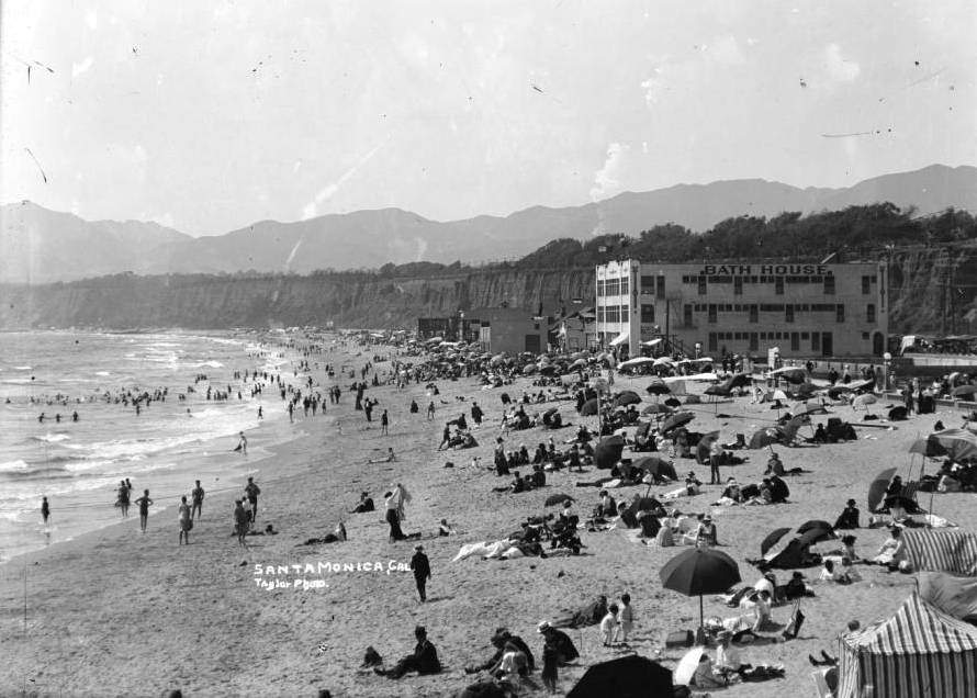
Another view looking north from the pier in Santa Monica, around 1910-1930. Image courtesy of the University of Southern California Libraries and the California Historical Society.

914_1910-1930c usc

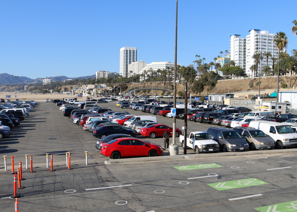
The view in 2015:

914_2015
Like the view in the previous post, these two photos show some of the changes that have happened along the beach in Santa Monica over the years. The most prominent building in the first photo here is the Windermere Hotel, visible in the upper center of the photo. It was built in 1909 and was demolished in 1962 to build Pacific Plaza, the tall apartment building that stands on the site today. Just to the left of it in the 2015 view is the Georgian Hotel, which was built in 1933 by the owners of the Windermere, probably only a few years after the first photo was taken.

This post is the last in a series of photos that I took in California this past winter. Click here to see the other posts in the “Lost New England Goes West” series.

Lost New England Goes West: Santa Monica, California (1)

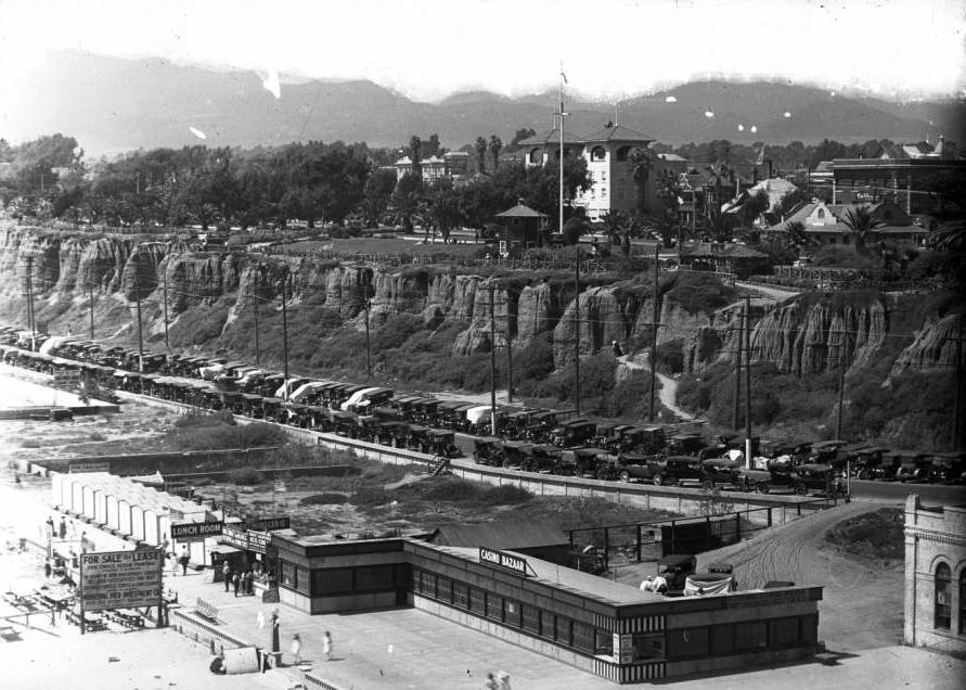
Looking north from the Santa Monica Pier in Santa Monica, California, around 1905. Image courtesy of the University of Southern California Libraries and the California Historical Society.

913_1905c usc

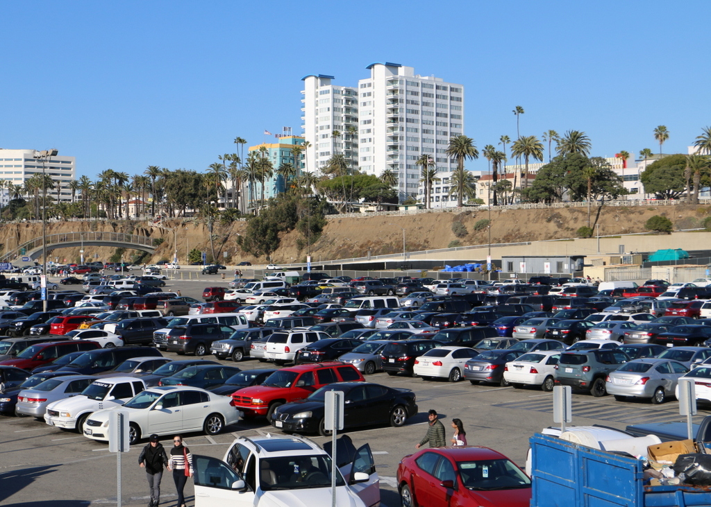
The view in 2015:

913_2015
These views shows Santa Monica looking north from the pier along the Palisades, the steep cliffs separating the city from the beach below. When the first photo was taken over a century ago, Santa Monica had already become a popular beach resort.. At the time, the area above the Palisades was still sparsely developed, but there were number of amenities along the beach, including a bath house that offered visitors the option of swimming in a heated indoor pool rather than the relatively cool ocean. The beach was crowded on this particular day in 1905, with the attire of the visitors reflecting the styles of the time, including men in dark suits and straw hats, women in long white dresses, and swimmers dressed in nearly full-body bathing suits.

Today, not much is left from the original photo except for the Palisades. Even the beach itself has been extensively altered and widened, and a large parking lot now sits on this spot. In the distance, hidden from view, the Pacific Coast Highway now runs along the bottom of the Palisades, beneath the modern hotels and condominium buildings that now line Ocean Avenue on the top of the cliffs.

This post is part of a series of photos that I took in California this past winter. Click here to see the other posts in the “Lost New England Goes West” series.

Lost New England Goes West: Venice, California

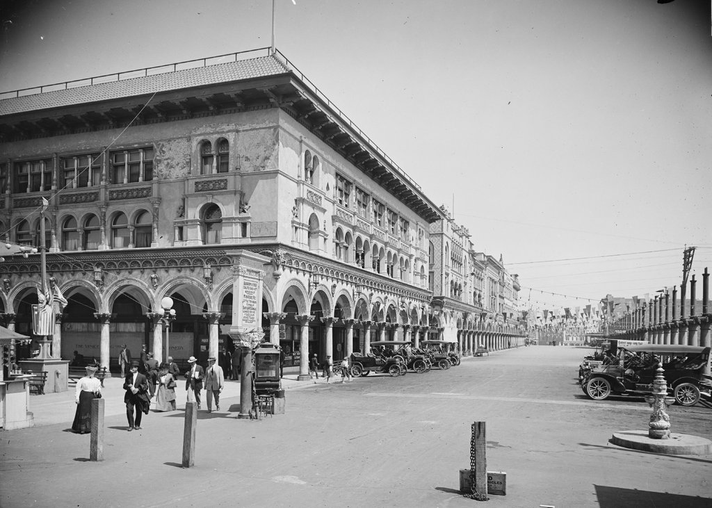
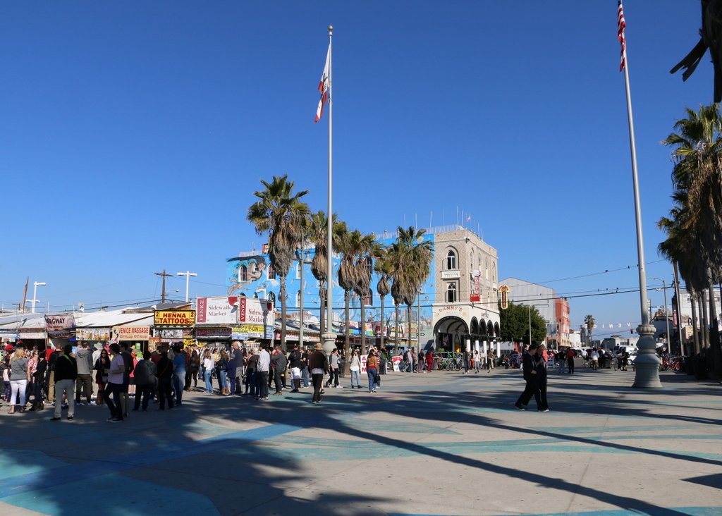
Looking east on Windward Avenue in Venice, around 1912. Image courtesy of the Library of Congress, Detroit Publishing Company Collection.

912_1900-1915 loc

The scene in 2015:

912_2015
Venice was founded in 1905 as a beach resort town just west of Los Angeles. Its developer, tobacco company owner Abbott Kinney, envisioned it as the “Venice of America,” complete with canals, gondolas, and Venetian-style architecture. Among the architectural features in the first photo are the arcades, or arches, along all of the buildings here on Windward Avenue. The building on the left at the corner is the Hotel St. Mark, which was built in 1905, and beyond it are a number of other matching buildings. On the right side, many of the buildings are not yet completed, with a row of columns marking where arches would eventually be built.

When the first photo was taken, Venice had already become a popular tourist destination. The white sign in front of the hotel advertises some of the city’s attractions, including the aquarium on the pier (admission 10 cents), the scenic railway, gondolas and boats on the canals, and the Venice Plunge, which was a heated indoor salt-water pool on one of the piers.

The city was successful in attracting tourists, but politically it was unable to support itself, so in 1926 the residents voted to be annexed by Los Angeles. This brought some major changes, which included filling in most of the canals and building roads on top of them. Venice’s decline continued during and after the Great Depression, and by the 1950s it was in serious decay. The piers were demolished by the 1960s, as were many of the historic buildings here along Windward Avenue and elsewhere in Venice.

Today, Venice is known for its unique countercultural aspects, including artists, street performers, and an inordinate number of medicinal marijuana dispensaries. A number of small shops now occupy the space where the Hotel St. Mark once stood, but a few of the buildings from the first photo still remain, including the one in the center of the photo and another further down Windward Avenue. Over the years, Venice has been used as a filming location for many movies and television shows, several of which feature this particular view here. The opening scene of Orson Welles’s 1958 film Touch of Evil shows the St. Mark a few years before its demolition, and a 2003 episode of Gilmore Girls includes several scenes from this section of Windward Avenue.

This post is part of a series of photos that I took in California this past winter. Click here to see the other posts in the “Lost New England Goes West” series.