Ely Road, Monson, Mass

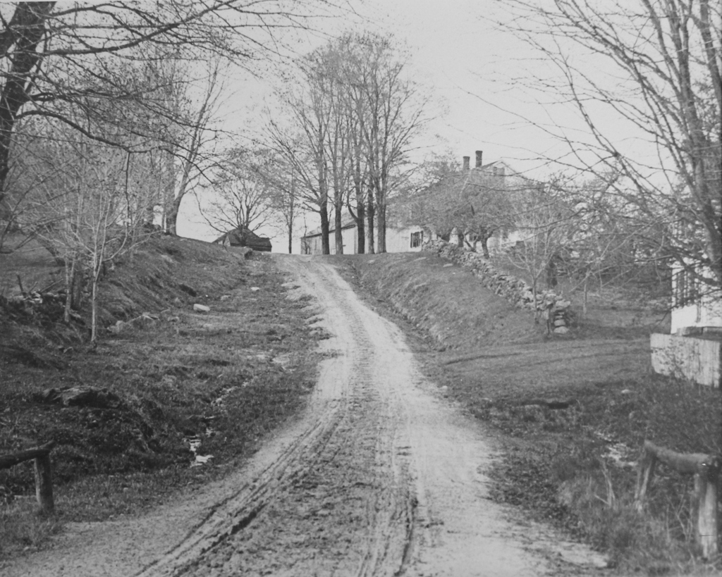
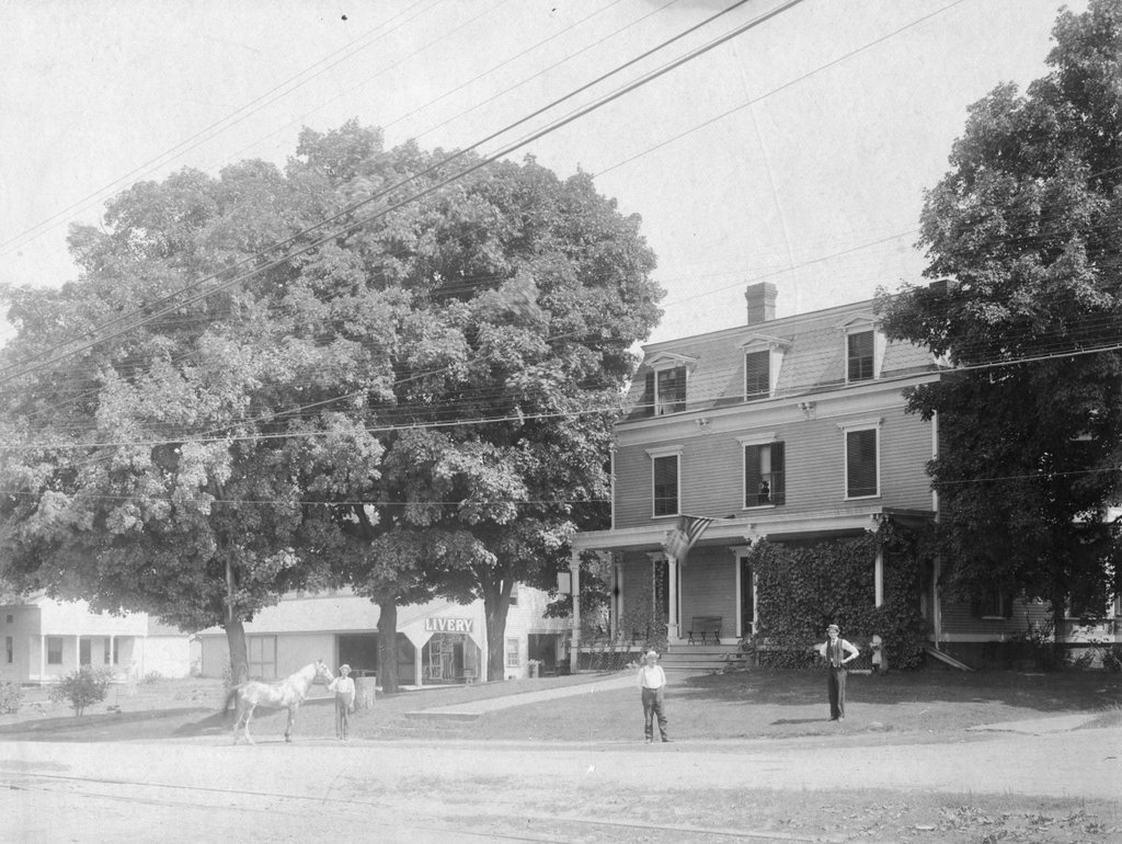
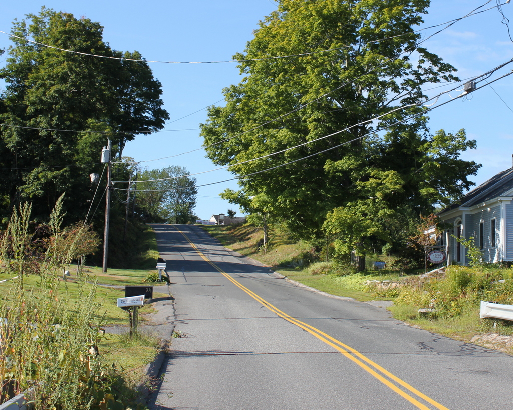
Looking up the hill on Ely Road toward the Keep Homestead, sometime around 1900-1920. Image courtesy of the Monson Free Library.

753_1890-1920c mfl

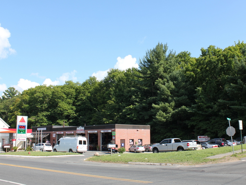
Ely Road in 2015:

753_2015
Ely Road is named for Alfred Ely, who lived on the street and served for 60 years as the pastor of the First Church of Monson.  The church is located at the bottom of Ely Road about a quarter mile from here, and from 1809 until 1843 Ely lived at the house at the top of the hill.  The house was built around 1800, and in 1854 it was purchased by Marcus Colton, who conveyed it to his nephew Edward Keep two years later.  From then it would remain in the Keep family for the next 132 years, until the death of Edward Keep’s granddaughter, Myra Keep Lovell Moulton, in 1988.

Upon her death, Myra willed the house to the town, to be used as the Keep Homestead Museum.  The house is hidden from view by the trees in the 2015 photo, but it is still there, and it is open to the public once a month from April to December.  Its collections include Myra’s extensive button collection, along with other antique furnishings, documents, and other items relating to the history of Monson.

153-157 Boston Road, Springfield, Mass

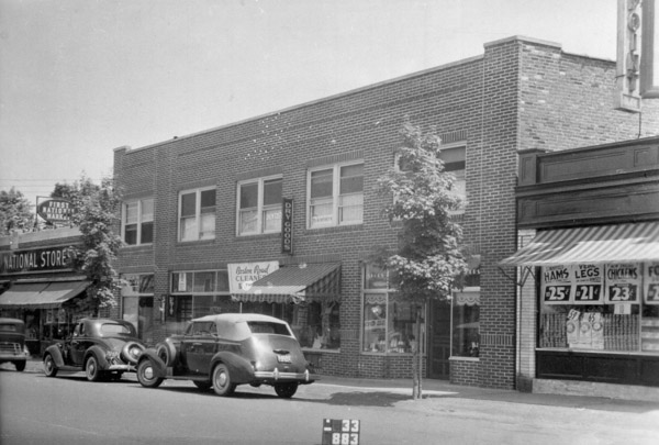
A commercial block on Boston Road in Springfield’s Pine Point neighborhood, around 1938-1939. Image courtesy of the Springfield Preservation Trust.

746_1938-1939 spt

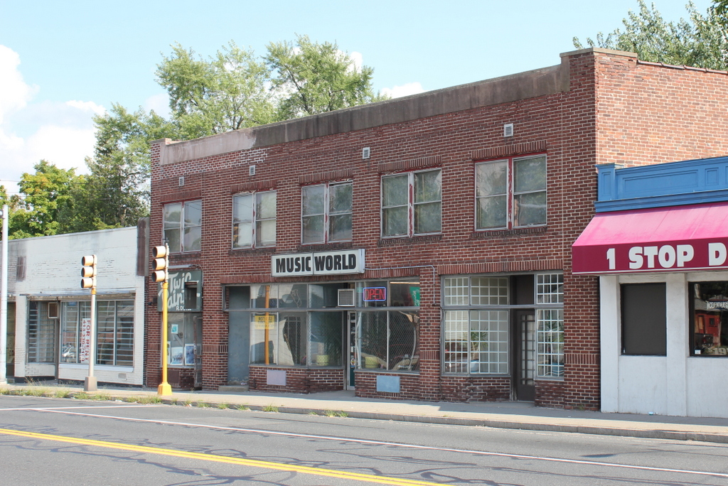
The building in 2015:

746_2015
Springfield’s Pine Point neighborhood was developed in the early 1900s, and consisted primarily of middle class, single-family homes.  This section of Boston Road was the commercial center of the neighborhood, and the first photo shows a variety of businesses here, including two grocery stores, a dry goods store, and a dry cleaners.  Just out of view to the left was the first Friendly’s restaurant, which opened a few years before the photo was taken.  These buildings were probably built around the 1920s or 1930s, and although the stores have changed, the buildings themselves are still standing.

Collins Inn, Wilbraham, Mass

Collins Inn at the corner of Boston Road and Chapel Street in North Wilbraham, probably in the 1890s or early 1900s.  Image courtesy of the Wilbraham Public Library.

742_1800sc wpl

The scene in 2015:

742_2015
The historic center of the town of Wilbraham has always been along Main Street in the town’s approximate geographic center.  When it was first settled in the 1700s, this was the ideal place for farming, but as changes in industrialization, transportation, and communication came about in the 1800s, the village of North Wilbraham gained prominence.  Its location on the banks of the Chicopee River and along the main road from Springfield to Boston made this area an important spot for industry and transportation.  In 1839, the Boston & Albany Railroad opened through here, with the North Wilbraham railroad station being located right across the street from here.

The building in the foreground of the first photo was the Collins Inn, which was opened in 1874 by Warren L. Collins.  It sat directly across Boston Road from the railroad station, and across Chapel Street from the Hollister Block, which at the time was used as a drugstore and post office.  In addition to the inn, Collins also operated a livery stable on the site, and ran a stagecoach line from here to the center of Wilbraham, about two miles away.

Aside from transportation, though, the Collins inn also offered Wilbraham another connection to the outside world – the telephone.  The telephone was invented in 1876, and within just four years a line was established from here to the center Wilbraham, at a cost of $30 per year for subscribers.  However, a few years later the cost increased to $100 per year (equivalent to over $2,400 today), and the service was discontinued because of a lack of families willing to pay.  When phone service was re-established in 1904, the Collins Inn became the town’s telephone exchange office for the New England Telephone and Telegraph Company, serving 21 customers in Wilbraham.

The telephone exchange remained here until 1914, when it moved to a different building across the street.  Around the same time, the Collins Inn closed, although the building itself remained standing for some time.  The 1964 History of Wilbraham book indicates that it was still standing at the time, although today its former location is now a parking lot.

State Street, Springfield, Mass

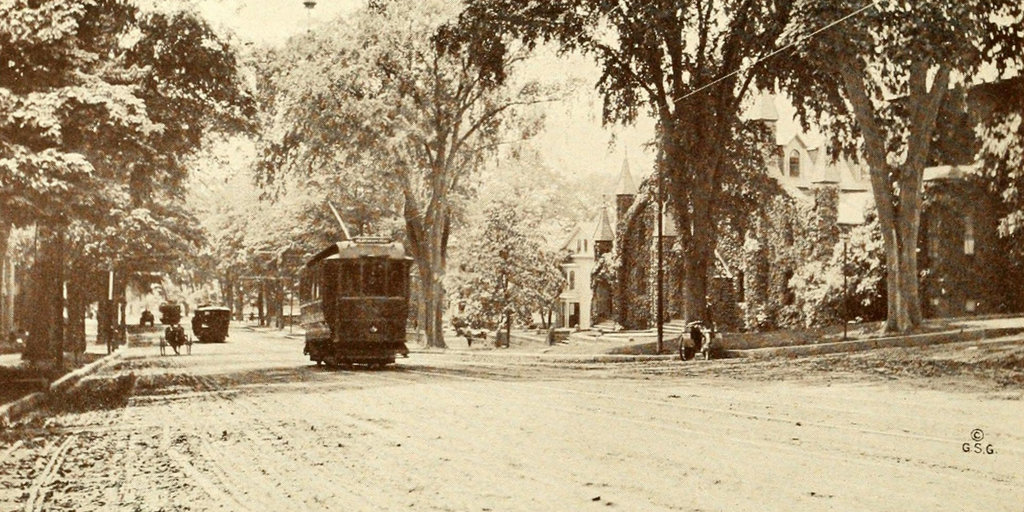
The view looking west on State Street from Myrtle Street in Springfield, around 1913. Image from Progressive Springfield, Massachusetts (1913).

733_1913c progressivespringfield

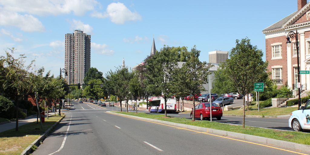
State Street in 2015:

733_2015
The first photo shows roughly the same section of State Street as the one in this post, just taken from the opposite direction.  In the early 1900s, the elm-lined State Street was primarily residential, with a number of single-family homes on either side.  Also in the photo, on the right, is the ivy-covered facade of the First Baptist Church, which was built in the late 1880s.  The congregation merged with another Baptist church around the time the photo was taken, and the building later became St. Paul’s Universalist Church.  It was later demolished, and today there is a parking lot on the site.

By the early 1900s, the street was still unpaved, but automobiles were still fairly rare anyway.  Instead, the trolleys of the Springfield Street Railway carried much of the city’s traffic, and at least three appear to be visible here on the busy State Street corridor.  Their days were numbered, though, because within a couple decades most trolley networks around the country had been replaced with buses.  In Springfield, these buses eventually came under the control of the Pioneer Valley Transit Authority, and they still operate many lines along this part of State Street, as seen in the 2015 photo.

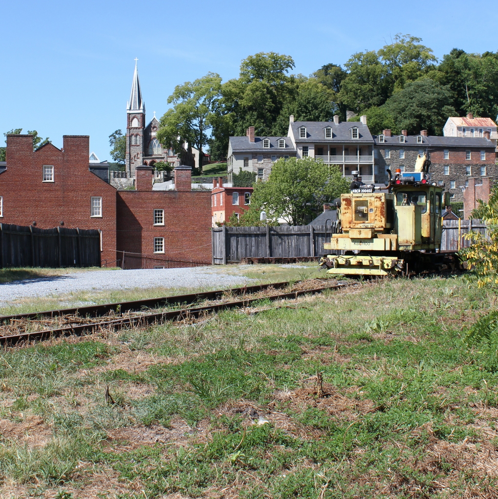
Harpers Ferry, West Virginia (2)

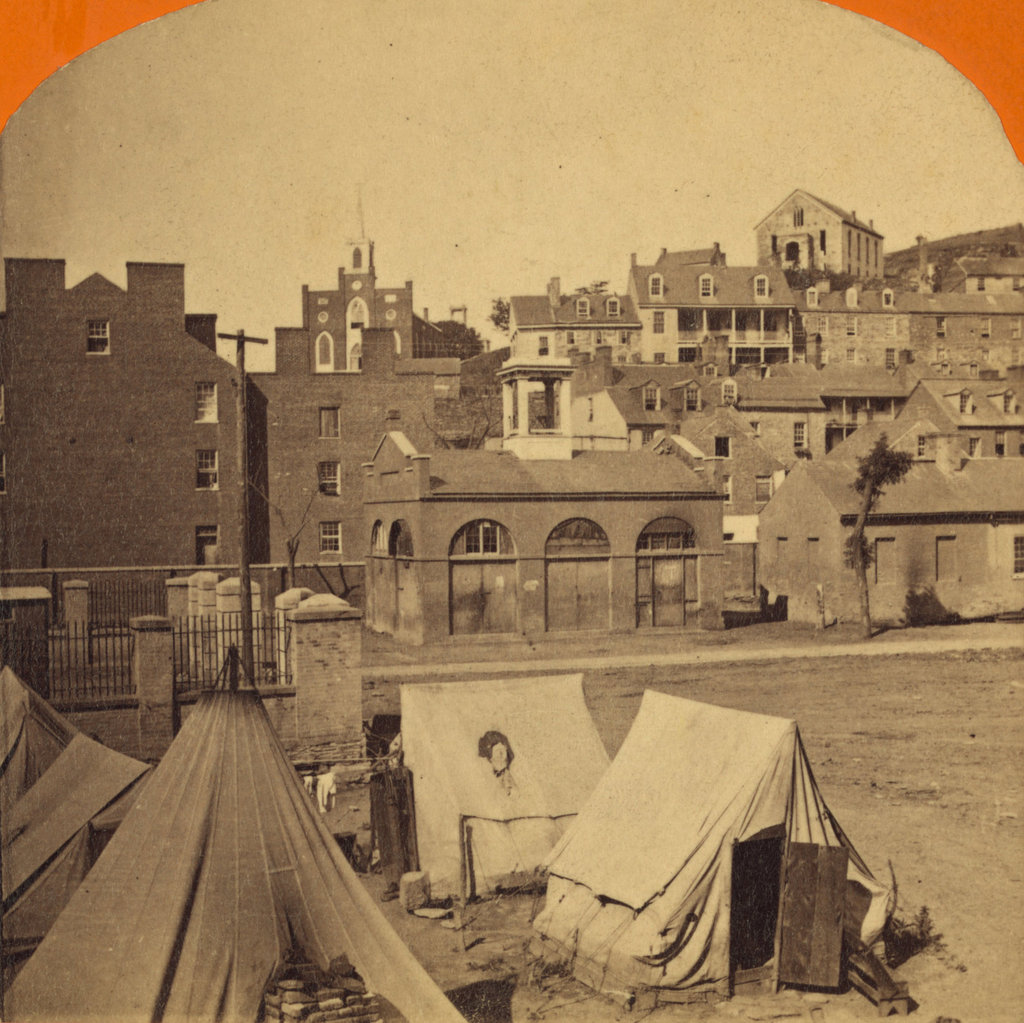
The town of Harpers Ferry, photographed around 1862. Image courtesy of the Library of Congress, Civil War Collection.
731_1860c loc

The view in 2015:

731_2015 loc
These two views of Harpers Ferry are remarkably similar, considering how much damage the small town sustained during the Civil War.  The Library of Congress estimates that this photo was taken around 1860, which seems a little too early.  This photo is half of a stereocard from a series called “War Views,” and since the war didn’t start until 1861, it seems unlikely that it was taken before then.  Instead, it was probably taken around 1862; the tents in the foreground were part of a “contraband camp” that the Union army established on the grounds of the former armory in March 1862 to house escaped slaves from the Confederacy.

A number of notable buildings are visible here, with the most prominent being the Armory fire engine house, better known as “John Brown’s Fort,” seen in the center of the photo and explained in more detail in this post.  To the left of the “fort” is the Gerard Bond Wager Building, a three and a half story brick building that was completed in 1838.  Prior to the Civil War it was used as a grocery and dry goods store, and it is still standing today and is operated by the National Park Service as a museum.

Beyond the Gerard Bond Wager Building is St. Peter’s Roman Catholic Church, which was built in 1833 and is still standing today, although with some extensive alterations.  It survived the Civil War, but it was renovated in 1896 to bring its exterior in line with the then-popular Neo-Gothic architectural style.  The original brick walls were replaced with granite, the steeple was removed, and a new asymmetrical facade was built with a taller steeple on the left side.

Another church in the original scene was St. John’s Episcopal Church, seen on the top of the hill to the right.  It was built in 1852 and sustained damage during the war, eventually being repaired in 1882.  However, it was subsequently abandoned in 1896, and today the picturesque ruins are still there, although they are hidden from view by the trees in the 2015 photo.

The last of the prominent historic buildings in these two photos are the four in a row next to each other, seen just below St. John’s Episcopal Church.  All four are still standing today, and the left-most of these is the Harper House, which is the oldest surviving building in the lower town.  It was completed in 1782 by Robert Harper, the town founder who not coincidentally operated a ferry here.  He died the same year it was completed, and it was later used as a tavern, a private residence, and by the start of the Civil War as a tenement house, accommodating up to four families.  To the right of the Harper House is Marmion Hall, which was completed in 1833, and the last two buildings to the right were built in the 1840s as the Marmion Tenant Houses.  These last two were, prior to the war, rented out to armory workers, who were just a short downhill walk away from their jobs.

Today, railroad tracks cover much of the former armory site, and nearly all traces of the historic site are long gone.  However, the town that grew up here because of the armory is, for the most part, preserved in its pre-1860s appearance.  Much of the lower town is now part of the Harpers Ferry National Historical Park, and is run by the National Park Service.
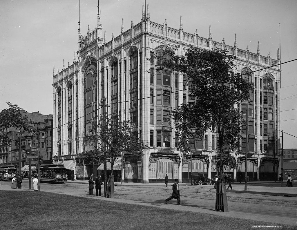
Berkeley Building, Boston

The Berkeley Building at the corner of Boylston and Berkeley Streets in Boston, around 1908. Image courtesy of the Library of Congress, Detroit Publishing Company Collection.

718_1908c loc

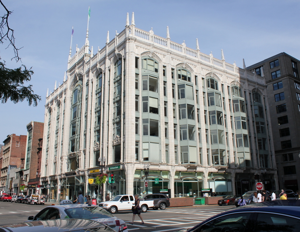
The building in 2015:

718_2015
Not to be confused with the old John Hancock Building a block away, which is also known as the Berkeley Building, this building was completed in 1905 and is an excellent surviving example of Beaux-Arts architecture in Boston.  It was designed by Stephen Codman and Constant-Désiré Despradelle; the latter was a noted architect and professor at MIT, which at the time was located diagonally across from here.  Over a century later, the building is still in good condition, with even the original 1905 storefronts still intact.

Also of note in the first photo is the group of rowhouses just to the right of the Berkeley Building. These were built in 1861 and were among the first houses to be built in the newly-filled Back Bay area.  Over time, Boylston Street became a major commercial center, and most of the original homes were demolished.  These ones survived into the early 20th century, but the first photo shows drastic changes on the ground level to create storefronts.  The one in the middle would be demolished soon after the first photo was taken, but the houses on either end are still standing today, although they are mostly hidden behind 20th century alterations.