Main Street, Hartford Connecticut

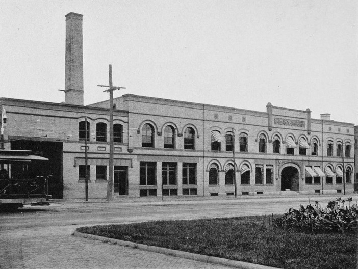
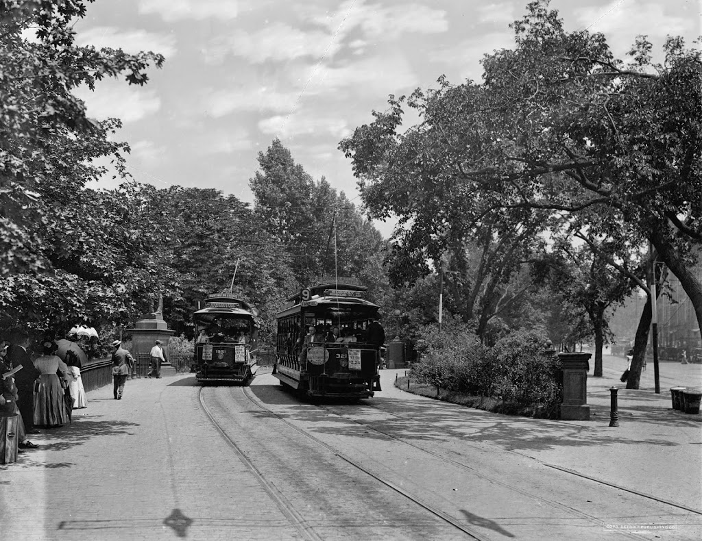
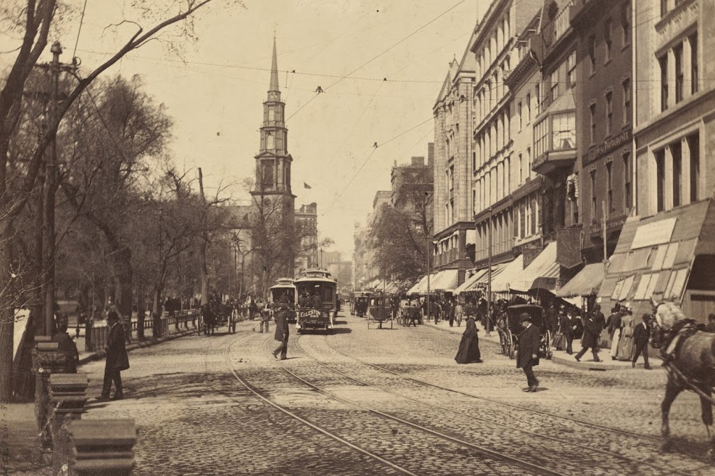
Looking north on Main Street in Hartford from near the corner of Pearl Street, around 1905. Image courtesy of the Library of Congress, Detroit Publishing Company Collection.

517_1905c loc (02 City Hall and Main Street)

Main Street in 2015:

517_2015

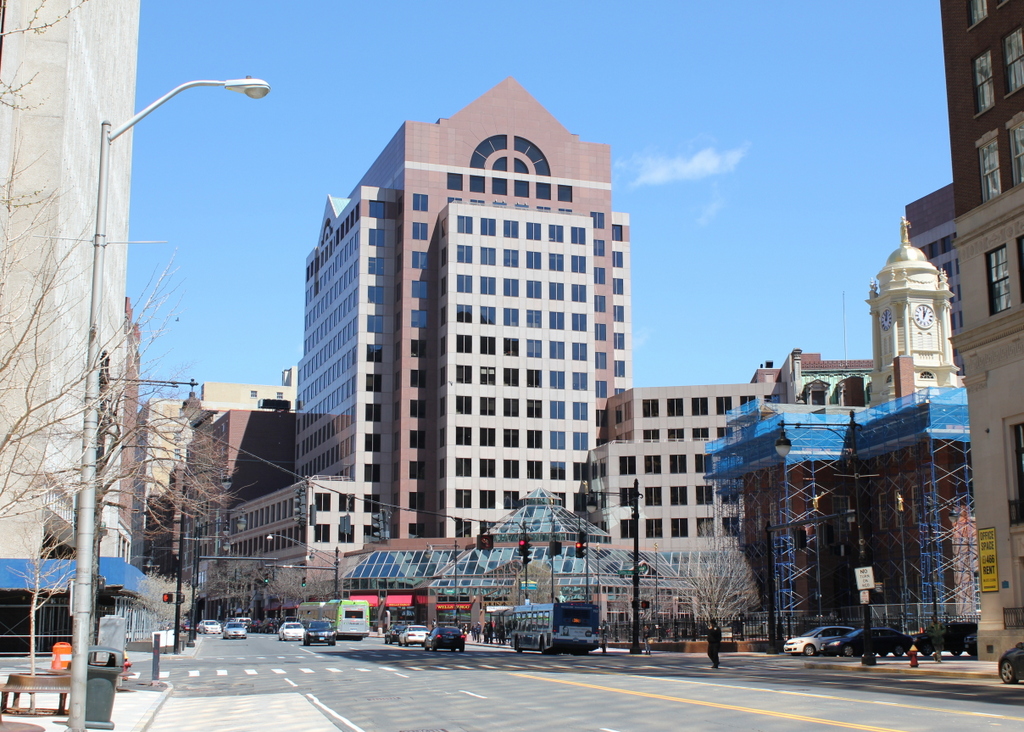
Not much remains the same between these two views of Main Street in Hartford, although one of the few surviving buildings also happens to have been probably the oldest from the 1905 photo – the Old State House, on the right-hand side.  Built in 1796, it was substantially older than all of the other buildings in the foreground in 1905, but today it is double the age that it was back then, and all of its neighbors have long since been replaced by modern skyscrapers.  The only other survivors from 1905 are a couple buildings in the distance.  One of these is the tall building the left-center of the 1905 scene.  At the time, it towered over the other buildings on Main Street, but today it is literally in the shadows of its neighbors, and is barely noticeable in the 2015 scene.

Aside from the changes in buildings, the two scenes also show the differences in transportation.  The trolleys of 1905 have been replaced by buses, bicycles are not nearly as common on Main Street today as they were 110 years ago, and there are far fewer pedestrians walking along the street (although granted the 2015 photo was taken on a Saturday – a weekday scene would probably look busier).  Also in the first photo is a large billboard just to the left of the center, with the words “Wilson High Ball that’s all!”  Wilson was a blended whiskey brand, and in between the two photos alcohol went from being legal, to being illegal, and then back to being legal again.  The company apparently survived Prohibition, but like the building that once featured its billboard, it doesn’t appear to be around anymore.

Trolley Barn, Springfield Mass

The Springfield Street Railway trolley barn at the corner of Main and Carew Streets, around 1905. Photo from Springfield Present and Prospective (1905).

The building in 2023:

The late 19th century saw a dramatic growth in suburbs, and this was fueled in part by the development of inexpensive forms of mass transit such as street railways.  Although most commonly associated with electrified trolleys, these originally started as horse-drawn cars on rails.  This was the case in Springfield, where the Springfield Street Railway opened in 1870.  The original line was a single track that ran about 2.5 miles from Hooker Street in the North End, where the stables were located (not coincidentally, this is now the site of the PVTA headquarters), south along Main Street to State Street, and then along State Street to Oak Street, just past the Armory.  The line was served by four cars and 24 horses, and rides were eight cents each or 16 for a dollar.

It must have been popular, because within four years the network was expanded east on State Street to Winchester Square, and south on Main Street to the Mill River.  More lines were later opened, along Maple and Central Streets to the Watershops, and other lines to Indian Orchard, Brightwood, and along Worthington Street.  Meanwhile, fares continued to drop, first to six cents and then to five.  The biggest change, however, came in 1891, when all of the lines were electrified to run trolleys instead of horse-drawn cars.

By the end of the 19th century, the network was extended to Longmeadow, East Longmeadow, and Feeding Hills, and connections were made to street railway networks in Holyoke, Westfield, Northampton, Palmer, and Hartford.  As a result of the growth of the company, this building was built in 1897 as a new headquarters, at the corner of Main and Carew Streets in Springfield’s North End.  At the time that the first photo was taken, the company operated almost 94 miles of track, with 48 of those miles in Springfield, and operated 227 cars on the lines.

However, as was the case with trolley lines around the country, the Springfield Street Railway wouldn’t last.  Just as electrified trolleys replaced horse-drawn cars, automobiles and buses replaced the trolleys.  The trolley barn (the name itself is a holdover from when the horses were housed in literal barns) is still there, and still looks very much the same as it did over 100 years ago.

Public Garden Incline, Boston (2)

Trolleys at the Public Garden Incline at the corner of Boylston and Arlington Streets in Boston, around 1910-1911. Image courtesy of the Library of Congress, Detroit Publishing Company Collection.

338_1910-1920-2Bloc

The scene in 2014:

338_2014

These were taken from near the location of the photos in this post, showing trolleys entering and emerging from the Tremont Street Subway onto Boylston Street.  The car on the right-hand side is returning from Brookline Village, and the one on the left is heading toward Huntington Avenue, along the modern-day E Branch of the Green Line.  This car is particularly intriguing, because one of the flyers on the front reads “Baseball to-day American League Huntington Avenue,” The exact date of this photo isn’t clear, and the Library of Congress estimates that it was taken between 1910 and 1920, but this little flyer indicates that it couldn’t have been any later than 1911, the last year that the Red Sox played at Huntington Avenue before moving to Fenway Park.  Many of the people on the trolley are probably fans heading to the game, and will likely see future Red Sox legends such Smoky Joe Wood, Tris Speaker, and Harry Hooper.  Today, Red Sox fans still travel along this route to get to the game, although the incline that the trolleys once emerged from has been closed for a century, and no evidence remains on the surface that it ever existed.

Public Garden Incline, Boston (1)

Trolleys entering and exiting the Tremont Street Subway at its southern end at the Boston Public Garden, around 1904. Image courtesy of the Library of Congress, Detroit Publishing Company Collection.

337_1904c-2Bloc

The scene in 2014:

337_2014

When the Tremont Street Subway opened in 1897 as the first subway in the country, trolleys ran underground from downtown all the way until the corner of Arlington and Boylston, where the tracks emerged here and continued along Boylston Street to points west.  The three cars in the first photo represent three different routes, with the one on the far right returning from Newton, the one ahead of it coming from Roxbury, and the one in distance is heading toward Huntington Avenue.  Today’s Green Line still has four different branches, all that is left of what was once a much larger streetcar system.  The subway portal itself closed in 1914, when the subway was extended under Boylston Street to Kenmore, and no evidence remains on the surface to suggest that trolleys once emerged here from underground.

Park Street Station, Boston

Tremont Street during construction of the Park Street subway station in 1897. Photo courtesy of Boston Public Library.

336_1897-2Bbpl

Park Street Station after completion, taken in 1906. Photo courtesy of Boston Public Library.

336_1906-2Bbpl

Park Street Station in 2014:

336_2014

As mentioned in previous posts, the Tremont Street Subway (today’s MBTA Green Line) was the first subway in the country, and Park Street was one of the first two stations, along with Boylston.  The station opened in 1897, and helped to relieve congestion on Tremont Street by removing the trolleys from the surface, as seen in the first photo.  Today, the station is still there, as is Park Street Church behind it.

See this post and this post for a few photos of the interior of the station.

Tremont Street Trolleys, Boston

Looking up Tremont Street toward Park Street Church in Boston, in 1895. Photo courtesy of Boston Public Library.

335_1895-2Bbpl

Tremont Street in 2014:

335_2014

These photos were taken from almost the same spot as the ones in this post and this post, but the first one here shows Tremont Street as it appeared before the construction of the Tremont Street Subway.  By the time the 1895 photo was taken, Tremont Street was becoming crowded with traffic, from pedestrians to carriages and even trolleys, as seen in the distance of the first photo.  Toalleviate the congestion, the trolley lines were put underground, making this the first subway in the country.  Today, Tremont Street is still a busy road, but trolleys such as the green and orange one in the 2014 photo are purely for tourism – the real trolleys still run underground through here on the MBTA Green Line.