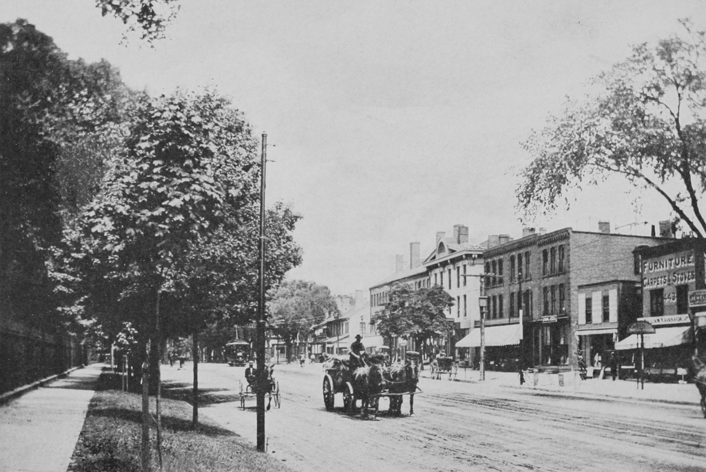
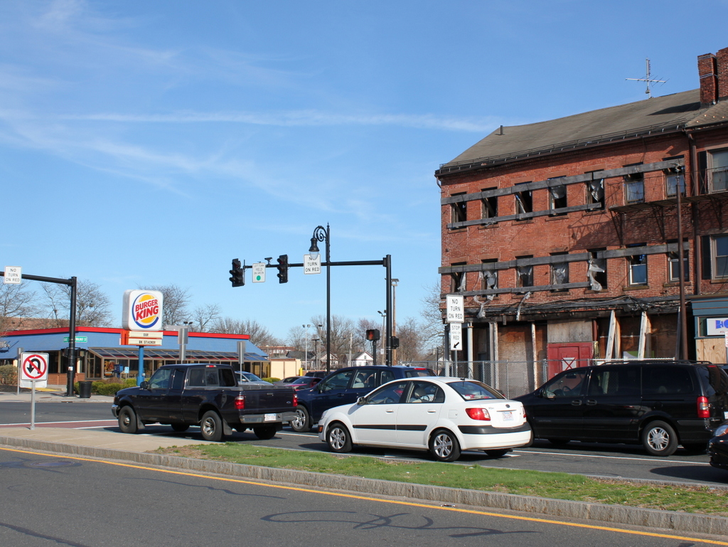
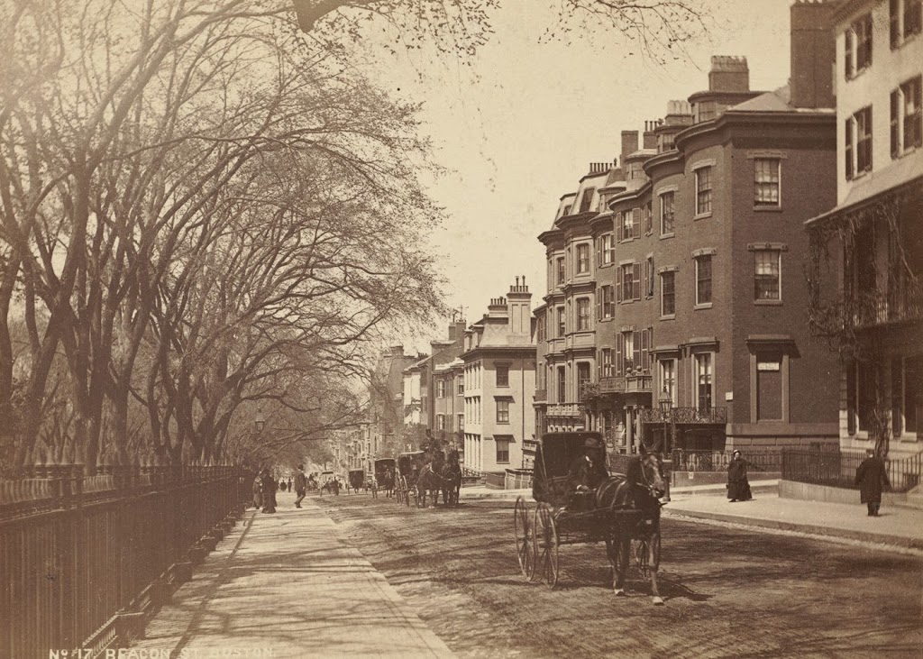
Agawam Ferry, Springfield Mass

The Agawam Ferry, sometime in the 1870s or earlier. Photo from Springfield: Present and Prospective, published in 1905.

Agawam

The view in 2014:

227_2014

The cities of Springfield and Hartford have historically had a strong connection, being located along the same river only about 25 miles apart.  However, they are located on opposite sides of the river, so travelers have had to cross it one way or another.  Before the construction of the bridges in Springfield, the Agawam ferry, located near the present-day South End Bridge, was the primary way to cross the river when coming from the south.  The ferry was used up until 1879, when the original South End Bridge opened.  This bridge, in turn, was replaced by the present South End Bridge, which is partially visible on the far right of the 2014 photo.  Both photos are taken from the Agawam side of the river, near Bondi’s Island, facing the South End of Springfield.

State Street from the Armory, Springfield, Mass

The view looking east on State Street from the sidewalk along the Armory grounds, sometime in the late 1800s. Photo from Springfield: Present and Prospective (1905).

The scene in 2019:

The buildings in these photos are the same as the ones in the previous post; the only difference is that they are seen from the opposite direction.  Although these two photos were taken well over 100 years apart, many of the buildings are still there, including the Gunn Block and the two adjacent buildings in the background, which date to the 1830s, and the three buildings in the center of the photo, which likely date to around the time of the Civil War.  Even one of the businesses from the first photo almost made it to the present-day; the sign for William Kavanagh is barely visible on the sign above the awning on the building to the far right.  Today, the building is gone, having long-since been replaced by a newer Kavanagh building, with a newer sign.  However, Kavanagh Furniture closed in 2008, although it was probably the longest-lasting of all of the businesses from the first photo.


Corner of State and Walnut Streets, Springfield, Mass

The corner of State Street and Walnut Street, looking east, sometime around 1892. Photo from Picturesque Hampden (1892).

The scene in 2019:

The building on the left in the first photo is the Rockingham House, which is discussed in this post. To the right is the Gunn Block, which was built in 1836 and has served a variety of purposes over the years, originally as a store selling “West Indies Goods” but later as a meeting place, offices, a bar, and apartments. The building is now vacant, but it is owned by the organization Develop Springfield, and will hopefully be restored in the near future.


Rockingham House, Springfield, Mass

The Rockingham House, on the southeast corner of State Street and Walnut Street, sometime around 1892. Photo from Picturesque Hampden (1892).

The scene in 2019:

Built in 1796 diagonally across from the Armory, the Rockingham House was originally called the Armory House, for obvious reasons.  Along with being used as a lodging place for people associated with the Armory, it was primarily used by teamsters in the early part of the 19th century.  Long before railroads and Jimmy Hoffa, teamsters were the primary means of overland transportation from Springfield to Boston.  It was common for them to bring loads from riverboats up the hill.  The inn was conveniently located right at the top of the hill, so they would often stay overnight there before heading out the next morning.

Once the railroads linked Springfield to Boston in 1839, this part of the inn’s business declined, and it began to be used instead as a boarding house.  As mentioned in the 1884 King’s Handbook of Springfield, “It ceased to be a stopping-place for transient guests some time ago, but is still a pleasant home for some residents who do not care to keep house.”

Obviously, the Rockingham House no longer exists, although it wasn’t demolished to build a Burger King.  Rather, it was replaced by a gas station – a 1974 article from the Springfield Republican indicates that it was demolished “several years ago.”

Corner of State & Dwight Streets, Springfield Mass

The view looking at the northeast corner of Dwight Street and State Street, sometime in the 1870s.  Photo from Springfield: Present and Prospective, published in 1905.

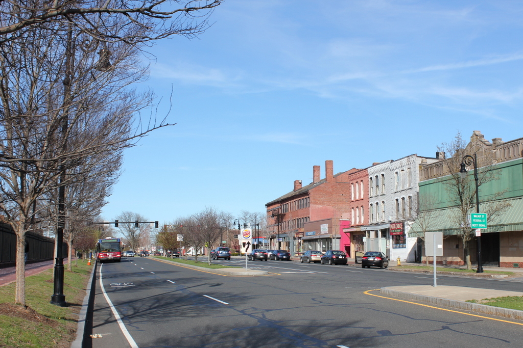
The same scene in 2014:
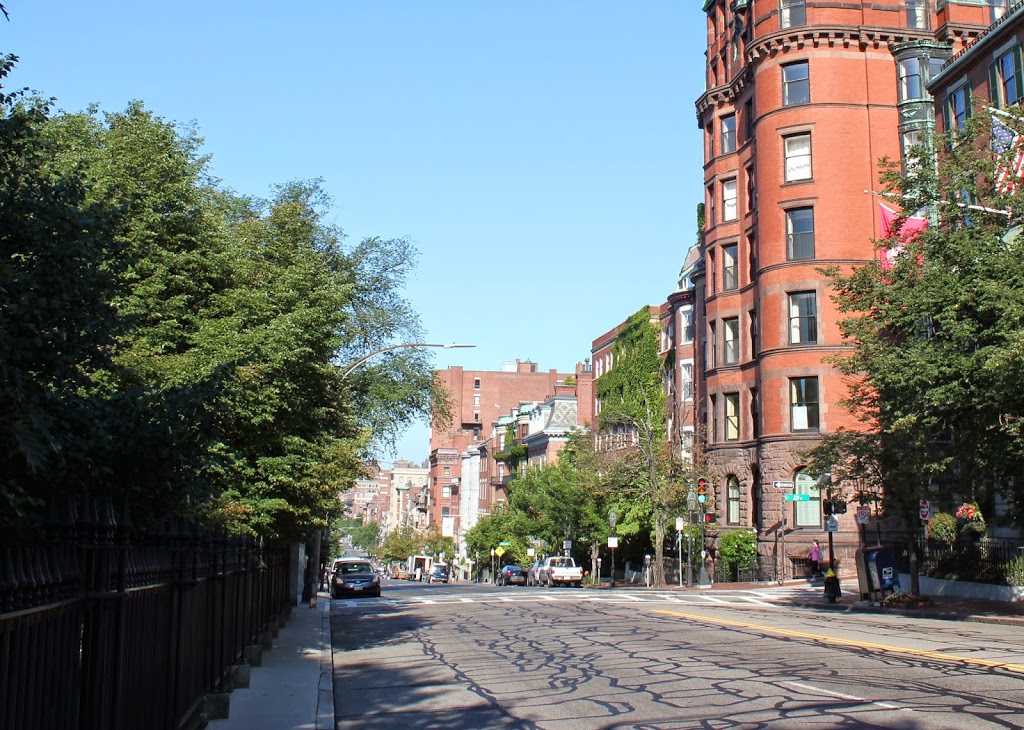
221_2014

The church on State Street in the first photo is the old Episcopalian Christ Church, which was built in 1839. When the congregation outgrew the building, the present-day church was constructed just up the hill (visible just to the right of the old church in the distance). I don’t know when the old church was demolished, but the location is now home to Springfield’s tallest apartment building.

North End, Boston

The North End of Boston from the Charlestown Navy Yard, in 1870, with the USS Kearsarge in the foreground. Photo courtesy of Boston Public Library.

The scene in 2021:

Boston’s skyline has obviously changed significantly over the past 150 years, but at least one constant remains in both photos: Old North Church, which is barely visible behind some masts, just to the left of the Kearsarge, in the 1870 photo.  The Kearsarge was a famous ship by this point – during the Civil War, she defeated the infamous Confederate commerce raider CSS Alabama.  After she was decommissioned, a US battleship was named after her; she is the only non-state to have a US Navy battleship named after her.