Old Manse, Concord, Mass (1)

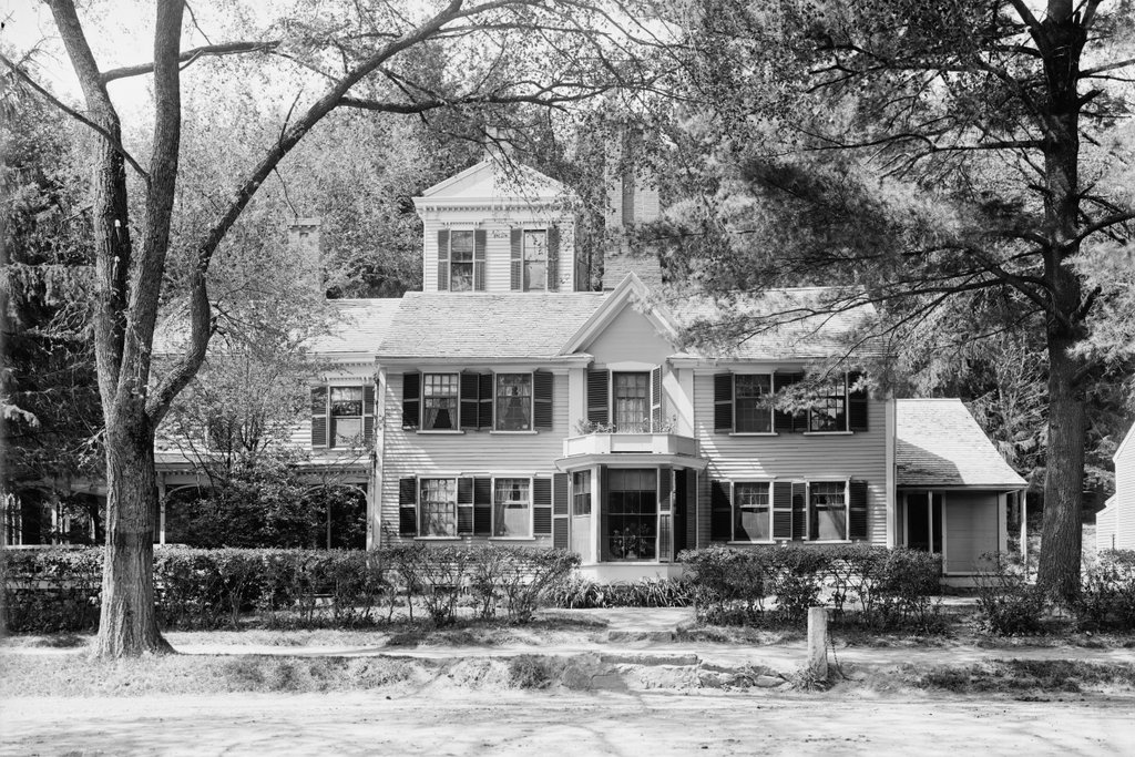
The Old Manse on Monument Street in Concord, around 1890-1901. Image courtesy of the Library of Congress, Detroit Publishing Company Collection.

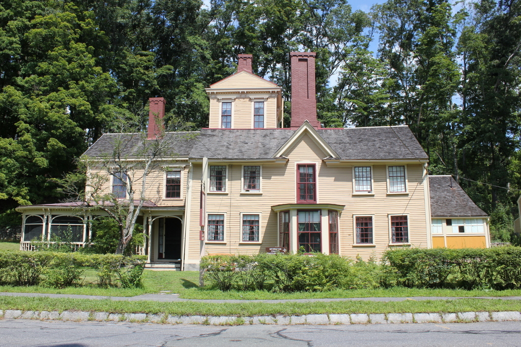
The house in 2023:

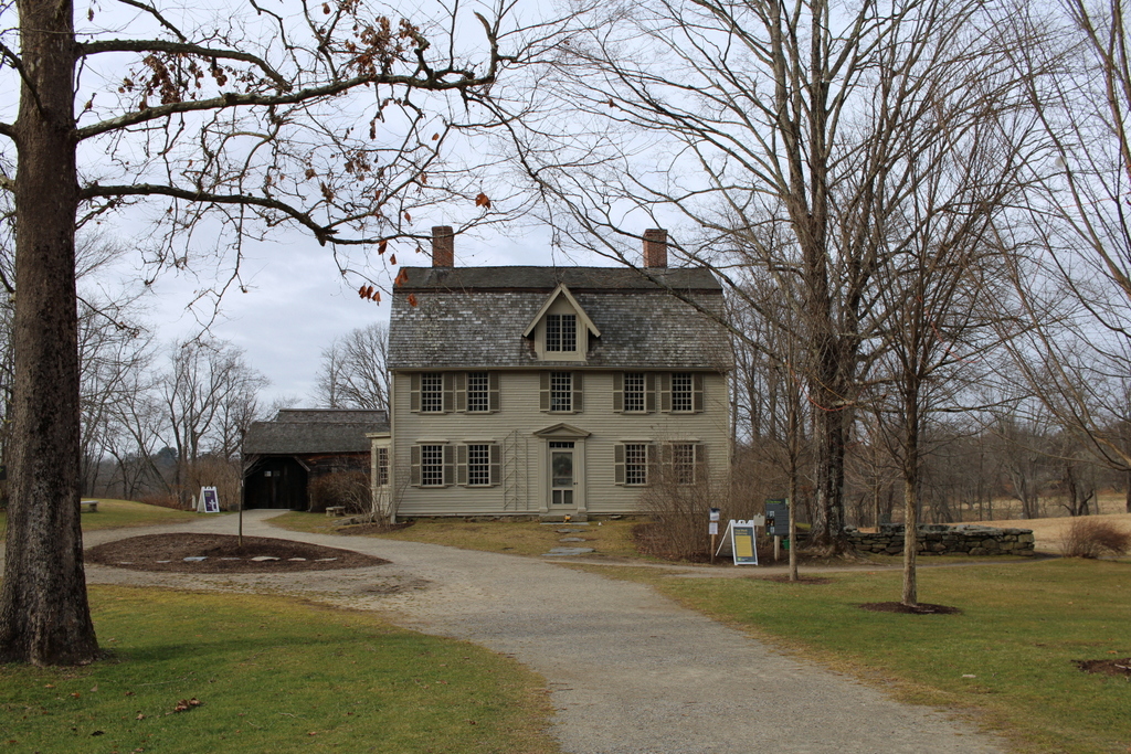
The Old Manse is one of the most important historic buildings in Concord, with connections to the American Revolution and to two of the most important authors in 19th century America. It dates back to 1770, when it was constructed as the manse, or parsonage, for the First Parish Church. The church itself was located in downtown Concord, while the Old Manse is about three-quarters of a mile north of there, along the banks of the Concord River and adjacent to the Old North Bridge.

The first pastor to live here in this house was William Emerson, the grandfather of future Transcendentalist author Ralph Waldo Emerson. He was about 27 years old at the time, and he had served in the church since 1766. It was during his pastorate that, in October 1774, the Massachusetts Provincial Congress met in his church after the British authorities had formally disbanded the colonial legislature. The delegates, who were presided over by John Hancock, continued to meet anyway, and during their time in Concord Emerson served as the chaplain of the congress.

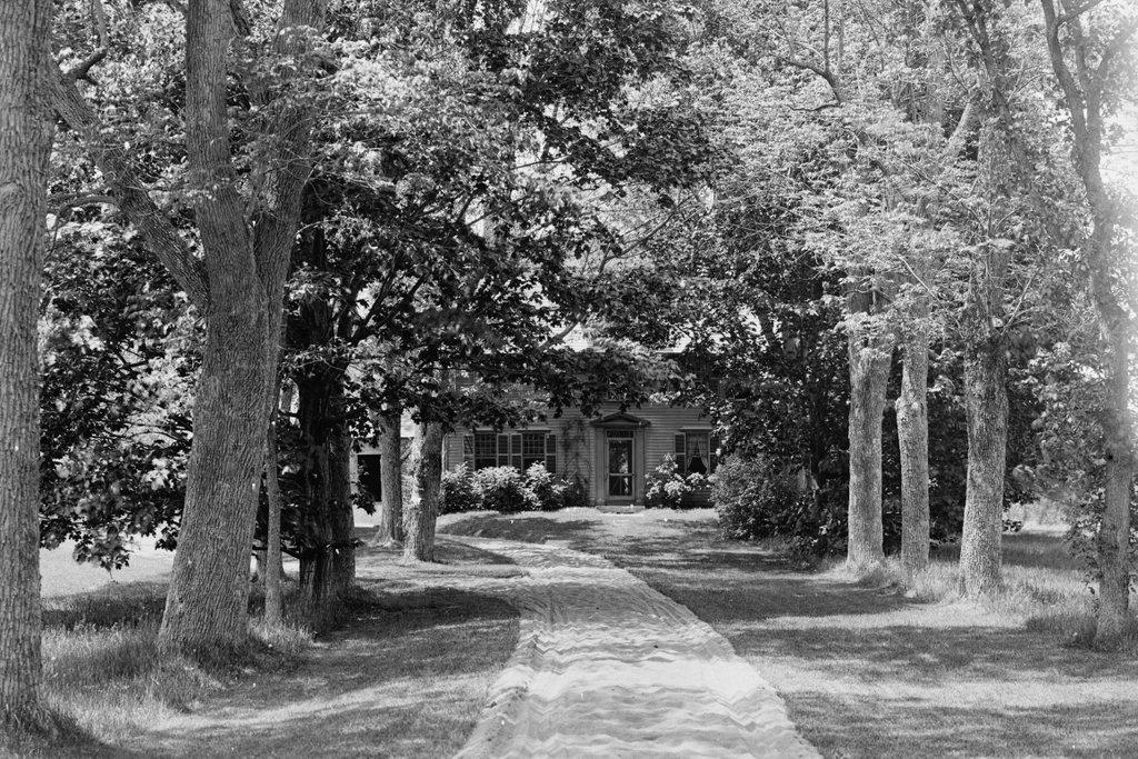
Within six months, Concord was again at the center of revolutionary activity when, on April 19, 1775, British forces left Boston to search for hidden caches of munitions in Concord. After a brief skirmish in nearby Lexington, which marked the beginning of the American Revolution, the British arrived in Concord, where they began searching the town. They ended up at the Old North Bridge, which was quite literally in Emerson’s backyard, just beyond the trees on the far right side of this scene, about 150 yards from the house. It was here that the redcoats engaged with the local militia forces, and where the famous “Shot heard round the world”—as Emerson’s famous grandson later termed it—was fired.

Reverend Emerson and his family witnessed the battle from the house, although he was not directly involved in the fighting. However, he subsequently joined the Continental Army as a chaplain, and he is generally considered to have been the army’s first such chaplain. He traveled north to Fort Ticonderoga in upstate New York during the summer of 1776, but he subsequently fell ill and died in Rutland, Vermont on October 20, at the age of 33.

His death left his widow Phebe with five young children to care for, including a newborn daughter. She subsequently remarried in 1780 to Ezra Ripley, who had succeeded her late husband as pastor of the church. This was not an uncommon practice for young pastors to marry the widows of their predecessors, although there was a bit of an age difference here, as Ezra was ten years younger than Phebe. The couple had three more children together, and they continued to live here at the Old Manse for the rest of their lives. Phebe died in 1825 at the age of 83, and Ezra continued to serve as pastor of the church until his death in 1841 at the age of 90, for a total of 63 years in the pulpit.

In the meantime, Phebe’s eldest son, William Jr., followed his father into the ministry, graduating from Harvard in 1789 and eventually becoming pastor of the First Church in Boston. Like his father, though, he also had a short life, dying in 1811 at the age of 42. His son, Ralph Waldo Emerson, was seven years old at the time, coincidentally the same age that William had been when his father died in 1776. Ralph would continue the family tradition by attending Harvard and becoming a pastor, serving in Boston’s Second Church starting in 1829. However, his young wife Ellen died two years later from tuberculosis, causing a crisis in faith that led him to resign from his position in 1832.

In 1834, when he was about 31 years old, Ralph Waldo Emerson moved into the Old Manse, where he lived for about a year with his elderly step-grandfather. Although he was not yet a published author, Emerson did some writing while he lived here, including working on his famous essay “Nature,” which was published in 1836. During this time, he also became engaged to his second wife, Lidian Jackson. They married in 1835, and they subsequently moved into their own house, which still stands at 18 Cambridge Turnpike in Concord.

After Ezra Ripley died in 1841, his son Samuel inherited the property. He was also a pastor, serving in Waltham, Massachusetts, but starting in 1842 he rented this house to newlyweds Nathaniel and Sophia Hawthorne. At the time, Nathaniel Hawthorne was about 38 years old, and he had enjoyed only moderate success as a writer. However, during his time here in Concord he continued to write, and in 1846 he published Mosses from an Old Manse, a collection of short stories that were, for the most part, written here in the house. The title of the book also provided the name for the house, which continues to be known as the Old Manse today.

Aside from writing a number of short stories here, Hawthorne also took inspiration from a tragedy that occurred in 1845, when 19-year-old Martha Hunt drowned herself in the Concord River near the house. He was part of the search party that recovered her body, and he later incorporated the incident into his 1852 novel The Blithedale Romance. In the book, one of the main characters, Zenobia, meets an identical fate, and Hawthorne provides a lengthy description of the search and the discovery of her body, which is described as “the marble image of a death-agony.”

In the three years that the Hawthornes lived in the Old Manse, they had several notable visitors, including future president Franklin Pierce, who came here in the spring of 1845. He and Hawthorne had been classmates at Bowdoin College, and they would remain lifelong friends. Several years later, in 1852, Hawthorne would publish a campaign biography of Pierce, using both his name recognition and literary talents to promote Pierce, who had earned the Democratic nomination for president. Pierce ended up winning the election, perhaps in part because of Hawthorne’s efforts, but his presidency ultimately failed to live up to the abilities that his friend had described in the biography.

In 1845, Samuel Ripley was looking to return to this house and live here, so by the end of the year the Hawthornes had relocated to Salem. They subsequently lived in Lenox before returning to Concord in 1852, purchasing The Wayside on Lexington Road. In the meantime, Samuel Ripley resided here at the Old Manse for only a few years before his death in 1847. However, his widow Sarah continued to live here for another 20 years. She was a noted scholar who, in the days before widespread higher education for women, had been almost entirely self-taught. She was an expert in a wide range of subjects, and over the years she tutored a number of college students.

Sarah Ripley died in 1867, but the house remained in her family for several more generations. Her daughter Sophia Thayer inherited the property, and after her death in 1914 it went to her daughter, Sarah Ames. During the early 20th century, the house was used primarily as a summer residence, and Sarah Ames owned it until her death in 1939. Her husband, architect John Worthington Ames, then sold the property to the Trustees of Reservations, a nonprofit organization that focuses on historic preservation and land conservation.

The first photo was taken sometime around the 1890s, during Sophia Thayer’s ownership, and very little has changed in more than 120 years since then. Today, the Old Manse continues to be owned by the Trustees of Reservations, and it is open to the public for guided tours. Much of the surrounding area, including the battlefield site at the Old North Bridge, has also been preserved as part of the Minute Man National Historical Park, which was established in 1959 and is administered by the National Park Service.

First Parish Church, Concord, Mass

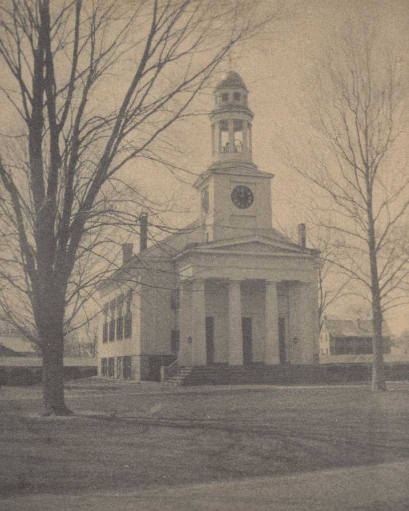
The First Parish Church on Lexington Road in Concord, around 1895-1900. Image courtesy of the Boston Public Library.

The scene in 2018:

Concord’s First Parish Church was established in 1636, just a year after the town itself was incorporated, and over the years it has occupied several different meetinghouses here in the center of town. The first two were built in the 17th century, and the third in 1712. This one would subsequently undergo several major reconstructions, but it was otherwise still standing when the first photo was taken sometime in the late 1890s.

When it was built in 1712, this church had neither a tower nor portico, and it was set on a different foundation. Despite its modest appearance, though, it served as Concord’s church for many years. Perhaps most significantly, it was temporarily used as the de facto colonial capitol building in October 1774. At the time, the British government had just disbanded the colonial legislature through one of the so-called Intolerable Acts. However, the elected representatives of the various towns ignored this decree and met here at the church in Concord, where John Hancock presided over the assembly, which was known as the Massachusetts Provincial Congress. The pastor of the church at the time was William Emerson, who served as the chaplain of the congress. He subsequently died during the American Revolution in 1776, but he is perhaps best known today as the grandfather of Ralph Waldo Emerson.

The original appearance of this church was fairly typical for New England meetinghouses of the period, with their plain, unadorned style reflecting Puritan beliefs about worship. However, by the late 18th century these ideas about church architecture had begun to change, giving rise to the iconic white-steepled churches that have long been a defining characteristic of small-town New England. However, traditional Yankee frugality still played a role in decision-making, and many of the old churches were simply remodeled instead of being demolished and rebuilt.

Such was the case here in Concord, where the old 1712 building was expanded by 12 feet and a 90-foot tower was added to it in 1792. An even more dramatic change came in 1841, though, when the church hired noted Boston architect Richard Bond to redesign the church in contemporary Greek Revival style. The result was the exterior that appears in the first photo, with its tower and front portico with four large Doric columns. This project also involved rotating the church so that it faced Lexington Road, and constructing a new, six-foot-high granite foundation. All of this work was done at a total cost of $8,300, equivalent to a little over $200,000 today.

The renovated church continued to be a prominent landmark in downtown Concord throughout the 19th century. During this time, Concord was at the height of its importance as a literary center, and its membership included Ralph Waldo Emerson, along with the family of Henry David Thoreau. However, Thoreau himself was not a member, and he made a point of refusing to pay the municipal tax that, at the time, helped to support the church. Despite this, Thoreau’s funeral was held here in the church in 1862, followed by Emerson’s 20 years later.

In 1900, the interior of the church underwent another remodeling, this time to prepare it for the celebration of the 125th anniversary of the Battle of Concord. This included repainting the interior, adding decorative woodwork, and installing electric lights. The whole project took several months, but it was essentially completed by the night of April 11, at a cost of $2,500. However, the building caught fire in the early morning hours of April 12, probably from the spontaneous combustion of rags that the painters had left behind. None of the other surrounding buildings were damaged by the fire, but the church was a total loss, leaving only a few salvageable items by the time the fire was extinguished.

In the aftermath of the fire, the church soon began efforts to replace it with a near-identical replica. Using the original 1841 plans, the architectural firm of Cabot, Everett and Mead designed a new church on the same site. There are a few minor differences between the two designs, including the slope of the roof and the details of the tower, and the new one has a vestibule behind the front portico. Overall, though, it was a a very faithful reproduction of the old church, and at first glace the two buildings are nearly identical. This 1901 church building is still standing today, and it continues to serve as an active Unitarian congregation nearly four centuries after the church was established.

Springfield Armory Main Arsenal, Springfield, Mass

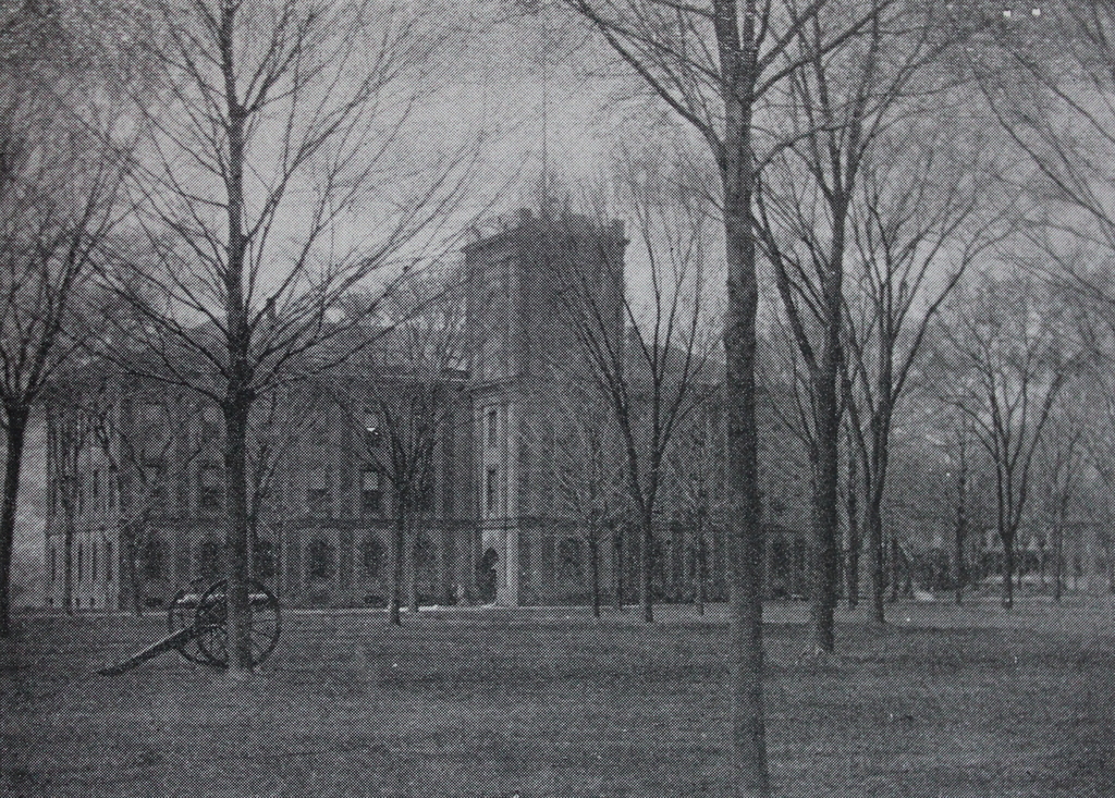
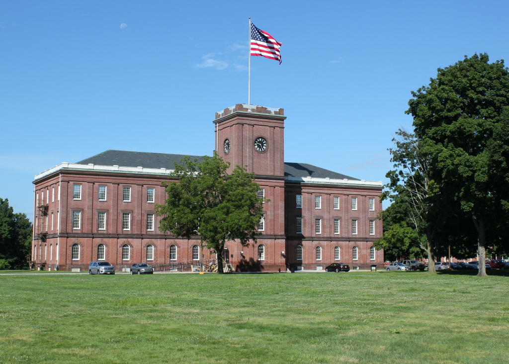
The Main Arsenal at the Springfield Armory, seen from Armory Square around 1892. Image from Picturesque Hampden (1892).

The building in 2018:

The origins of the Springfield Armory date back to 1777, when the Continental Congress established an arsenal here on a bluff overlooking the downtown area of Springfield, on the north side of State Street. The location was ideal, as it was at the crossroads of major trade routes, and it was also upstream of the last rapids on the Connecticut River, which protected Springfield from the threat of British naval attack. General Henry Knox, who had passed through Springfield a year earlier to bring captured cannon to Boston, was a strong advocate of this site, describing it as “perhaps one of the most proper Spots in America on every Account.”

During the American Revolution, the arsenal consisted of a small group of buildings, none of which are still standing, and the facility’s primary purpose was to store and repair weapons, and produce cartridges. After the war, it continued to be used as storage for muskets and powder, and in 1787 it was the scene of the last major battle of Shays’ Rebellion. The rebels had attempted to seize the munitions here, but they were ultimately defeated by a state militia force that assembled to protect the arsenal. However, the event had a significant impact on American history. Occurring only months before the Constitutional Convention, it helped to demonstrate the weaknesses of the Articles of Confederation and the need for a new, stronger national government.

In 1794, Congress authorized two federal armories for the production of small arms, with one in Harpers Ferry, Virginia and the other here in Springfield. This site here on State Street would continue to be the primary facility, but the armory also included several shops along the Mill River, located about a mile south of here. Much of the manufacturing was done at these shops, where the river could be harnessed as a source of power. However, other work was done here on State Street, and this location is also where raw materials and finished firearms were stored.

The armory steadily grew during the first half of the 19th century, but the most significant changes came in the 1840s, when superintendent Major James Ripley oversaw a major expansion of the facility. The most notable of these additions was a new main arsenal, which is shown here in these two photos. It was completed in 1850 on the west side of Armory Square, and it could store 300,000 muskets on its three floors. The most notable feature on the exterior of the building is the tower here on the eastern side, which rises 89 feet above the ground level. Because of its location on higher ground above downtown Springfield, the tower has long been a distinctive part of the skyline, and it has become a symbol of Springfield itself, appearing at the top of the city seal since 1852.

In retrospect, Major Ripley’s improvements here at the armory came just in time. By 1850, it was producing over 20,000 guns per year, but this would dramatically increase in 1861, with the onset of the Civil War. That same year, the Harper’s Ferry armory was destroyed, leaving Springfield as the only remaining federal armory. To supply the needs of the Union army, the workforce here increased from 200 to over 2,600, and in 1864 the armory produced over 276,000 rifles. The total output here at the armory during the war was over 800,000 guns, which was more than it had made in the previous 66 years combined.

No Civil War battles occurred anywhere near Springfield, but the armory did survive one threat in 1864, when two would-be saboteurs planted a bomb here in the main arsenal, in the tower near the clock. Despite the fact that the country was in the midst of war, the armory was evidently still open to the public, and two strangers persuaded a reluctant arsenal keeper to bring them up to the top of the tower, supposedly to see the view. Later that night, a watchman found a suspicious bundle near the clock, which had apparently been left by the two men. A subsequent inspection revealed that it had a fuse and was filled with powder, although it probably would not have done much damage to the building even if it had detonated.

The first photo was taken less than 30 years later, in the early 1890s. The armory was still a vital part of the country’s small arms production, and it would remain in use for much of the 20th century. During this time, the facility also played an important role in developing new firearms, including the M1903 and the M1 Garand. The latter was designed by—and named for—John Garand, a Springfield resident who worked here at the armory as a civilian employee. It became the standard-issue Army rifle throughout World War II, and about 3.5 million were produced here in Springfield during the war.

After the war, the armory was used primarily for research and development, with most of the production being outsourced to private contractors. The M14 rifle was designed here during this period, as were other weapons such as machine guns and grenade launchers. However, the facility was ultimately closed in 1968, resulting in a loss of nearly 2,500 jobs.

Following the closure, much of the property was turned over to the state of Massachusetts, becoming the campus of Springfield Technical Community College. The college constructed some new buildings here, and converted the old armory buildings into classrooms and offices. However, the federal government retained control of the western part of the armory, including the main arsenal and the commandant’s house, which stands in the distance beyond the trees on the right side of the scene. Both buildings are now preserved as part of the Springfield Armory National Historic Site, which is run by the National Park Service. As shown in the present-day scene, the arsenal’s exterior appearance has hardly changed since the 19th century, and the first floor of the building is now a museum, housing an extensive collection of firearms and machinery.

Crawford House, Carroll, New Hampshire

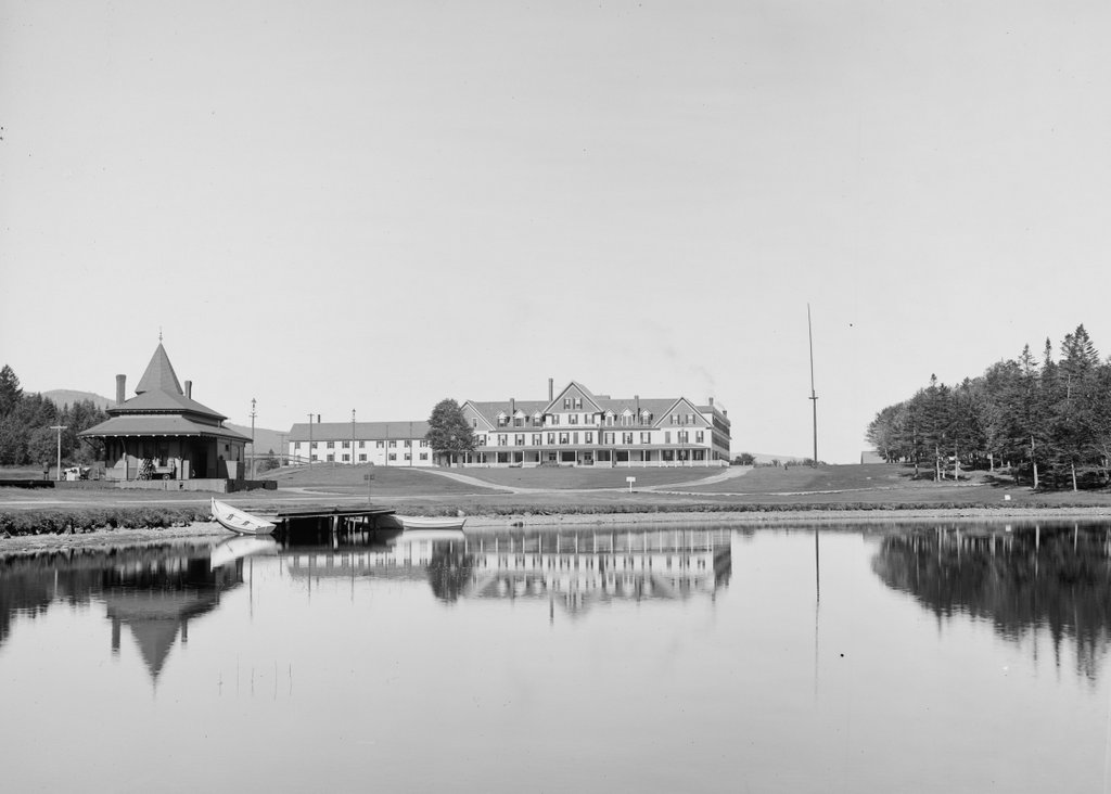
The Crawford House at Crawford Notch in the White Mountains of New Hampshire, seen from across Saco Lake, around 1891-1910. Image courtesy of the Library of Congress, Detroit Publishing Company Collection.

The scene in 2018:

The first photo shows the Crawford House, one of the many large hotels that were built in the White Mountains during the second half of the 19th century. It stood just to the north of the gates of Crawford Notch, one of the most important mountain passes in the region. The location of the hotel was near the high point of the notch, at the divide that separates the watersheds of the Ammonoosuc and Saco Rivers. In the foreground of this scene is Saco Lake, which forms the headwaters of the Saco River. From here, the river flows southeast through Crawford Notch before emptying into the Atlantic Ocean just south of Portland, Maine. Less than a half mile to the north of here, on the other side of the hotel, is Ammonoosuc Lake, which ultimately drains into the Connecticut River and then to Long Island Sound.

This site was an ideal location for a hotel. At the time, this road was the only east-west route through the mountains, and this area to the north of Crawford Notch was relatively broad and flat, unlike the long, narrow valley to the south of here. The first hotel in this immediate vicinity was the Notch House, which was built in 1828 by Ethan Allen Crawford. He was the son of Abel Crawford, the first white settler to live near the notch, and his family operated several taverns in the area. Ethan’s brother Thomas became the manager here at the Notch House, and he ran it until 1852, two years before it was destroyed by a fire.

The Notch House was located near the spot where these two photos were taken, but around 1850 Thomas Crawford began construction of a new hotel nearby, on the site of the hotel in the first photo. However, he ran into financial problems before it was completed, and he had to sell the property in the early 1850s. The new owner finished the hotel, which became known as the Crawford House, but, like the Notch House, it fell victim to fire, burning on April 30, 1859.

Such fires were not uncommon in large resort hotels of this period, which were generally made almost entirely of wood and lacked effective fire suppression systems. Despite this setback, though, the hotel was quickly rebuilt. The work began on May 10, 1859 and it was completed in just two months, with the hotel holding a celebratory dinner here on July 13. This new Crawford House, which was still standing when the first photo was taken, was three stories high and originally measured about 200 feet in length, with two wings that extended back about the same distance. Overall, it was much larger than the old building on the site, and a July 1859 article in the Boston Evening Transcript declared it to be the largest hotel in the state.

Another New England newspaper, the Independent Democrat of Concord, New Hampshire, published a letter around the same time that the hotel opened. The letter described a journey through the White Mountains, and it paid particular attention to the new Crawford House. The writer commented on how quickly the hotel was built, and also provided a glowing description of its interior, writing:

It is not too much to say that the “New Crawford house” is an advance upon any other at the Mountains. Its dining hall is of magnificent proportions, measuring 85 feet by 40, and 14 feet high. The principal parlor is 60 feet by 40. The general reception room is large and airy; while the sleeping rooms, of which there are some 120, are large, high, and thoroughly ventilated, leaving nothing, in these respects, to be desired. Then, the whole house is to be furnished in the most elegant and substantial style, and the whole is to be lighted with gas.

Guests at the Crawford House could enjoy a variety of outdoor activities. There were short hikes to places such as Ripley Falls, Arethusa Falls, and the summit of nearby Mount Willard, and for the more ambitious there was the Crawford Path, which led 8.5 miles to the summit of Mount Washington. This trail, which began here at the Crawford House, was created by Abel and Ethan Crawford in 1819, and it was eventually incorporated into the Appalachian Trail, making it probably the oldest active hiking trail in the country today. Guests could hike these trails on their own, but the hotel also had ponies that they could ride, along with experienced guides to accompany them.

In 1870, the Crawford House was purchased by brothers Asa T. and Oscar F. Barron. At the time, they also operated the nearby Twin Mountain House and Fabyan House, and their hotel empire would subsequently include the Mount Pleasant House and the Summit House, which was located at the top of Mount Washington. Oscar died here at the Crawford House in 1879, and Asa died eight years later, but the Barron family would continue to run these hotels for many years.

For the first two decades of its existence, the Crawford House was not directly served by railroads, but in 1875 the Portland & Ogdensburg Railroad opened through Crawford Notch, making the hotel far more accessible to visitors. At the time, it was the only hotel in the vicinity of the notch, and it received a glowing review in the 1887 Chisholm’s White-Mountain Guide-Book, which included the following description:

[T]his is a good hotel of the first class, 1,900 feet above the sea, with broad and almost interminable piazzas, cool and airy halls, post-office, telegraph-office, livery-stable, bowling-alley, gaslights; environs which the landscape-gardener has justly approved; and a dining-room where even Epicurus or Uncle Sam Ward need not famish….

Near the front of the house is the pretty little Saco Lake, the cradle of the Saco River, and so far widened and deepened by art as to give a reason for being for the boats which float on its crystal tide. The rugged forest between the lake and the overhanging mountain has been combed and brushed and perfumed, and otherwise adorned for a summer pleasaunce, so that it has won the happily suggestive name of Idlewild.

In 1888, not long after this description was published, the rail line through the notch was acquired by the Maine Central Railroad. Three years later, the railroad built a new station here at the Crawford House, which is visible on the left side of this scene. It was built of wood, and it featured an ornate Queen Anne-style design, complete with a small tower on one corner of the building. Most hotel guests and other visitors to Crawford Notch would have arrived here by way of the station, and the building also served as the local freight house and post office.

By the time the first photo was taken at the turn of the 20th century, the Crawford House was owned by the firm of Barron, Merrill, & Barron. This partnership was comprised of Asa Barron’s sons, Oscar G. and William A. Barron, along with Cardenio H. Merrill, and the trio also ran the other Barron hotels here in the White Mountains. Merrill died a few years later in 1908 at the age of 68, and Oscar in 1913 at 62, but William continued to operate the hotel until 1947, when he retired and sold the property. He died in 1964 at the age of 96, only a week after the death of his son, William A. Barron Jr., who had served as a brigadier general in the Army during World War II and as chairman of the board of Gillette after the war.

The Crawford House outlasted most of the other 19th century grand hotels in the White Mountains, but it ultimately closed in 1975, nearly 120 years after the building was constructed. It was destroyed by a fire two years later, on November 20, 1977, and the property was subsequently acquired by the Appalachian Mountain Club, which constructed the Highland Center on the site. This building, which serves as a lodge and an educational center, stands in the center of the 2018 photo. Today, the only surviving building from the first photo is the railroad station on the left. It was added to the National Register of Historic Places in 1982, and it remains in use as a railroad station, serving as the northern terminus for most tourist excursion trains on the Conway Scenic Railroad.

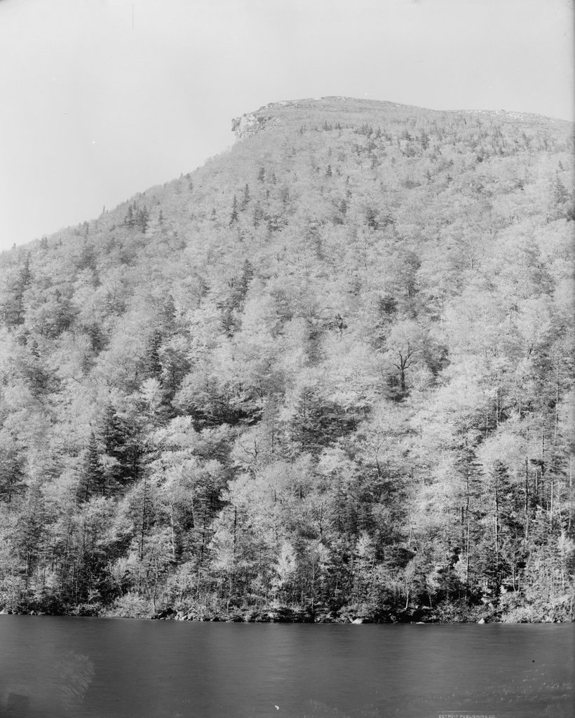
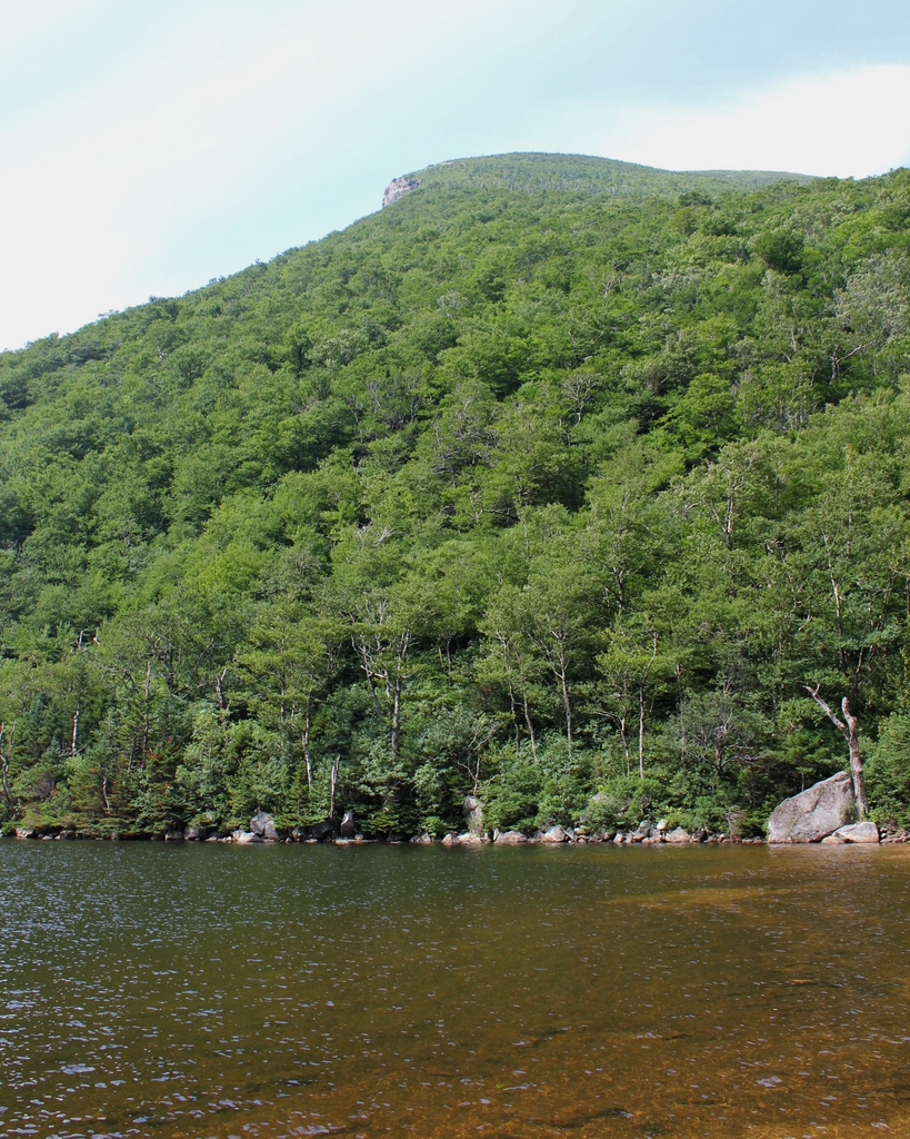
Old Man of the Mountain, Franconia, New Hampshire

The Old Man of the Mountain, seen from Profile Lake at the base of Cannon Mountain, around 1890-1901. Image courtesy of the Library of Congress, Detroit Publishing Company Collection.

The scene in 2018:

The Old Man of the Mountain was previously featured on this blog many years ago, in a post that showed a closeup of the rock formation, before and after its collapse. Unlike that view, however, this scene here shows not just the rock formation, but also its surroundings, including the east side of Cannon Mountain and Profile Lake at its base. This is, more or less, the view that most visitors would see of the Old Man from the ground, without the aid of binoculars or telephoto lenses.

The iconic granite profile was formed at some point after the last ice age, as a result of erosion at the top of the cliff. It stood 1,200 feet above the surface of Profile Lake, and it was on the side of Cannon Mountain, which rises a total of 4,080 feet above sea level. Cannon Mountain forms the western side of Franconia Notch, an important mountain pass through the White Mountains, and by the early 19th century the Old Man of the Mountain had become a notable landmark for travelers passing through here.

The first recorded mention of the rock formation came in 1805, when a pair of surveyors observed it from near this location. As the story goes, they arrived here at dusk and camped along the shore of the lake. When they awoke in the morning, one of the surveyors looked up from the lake to discover the sun shining on the east-facing cliff, illuminating the stone profile.

Over the next few decades, the Old Man of the Mountain drew the attention of writers and other prominent people. New Hampshire native Daniel Webster famously declared, regarding the rock formation, that “God Almighty had hung a sign out to show that here He makes men.” Although originally from Massachusetts, poet John Greenleaf Whittier wrote extensively about the White Mountains, and he made reference to the Old Man of the Mountain in his 1850 poem, “The Hill-Top,” which includes the following lines:

Beyond them, like a sun-rimmed cloud,
     The great Notch mountains shone,
Watched over by the solemn-browed
     And awful face of stone!

Also in 1850, Nathaniel Hawthorne published a short story, “The Great Stone Face.” It was one of several stories that Hawthorne set in the White Mountains, and it included the following description of the formation:

The Great Stone Face, then, was a work of Nature in her mood of majestic playfulness, formed on the perpendicular side of a mountain by some immense rocks, which had been thrown together in such a position as, when viewed at a proper distance, precisely to resemble the features of the human countenance. It seemed as if an enormous giant, or a Titan, had sculptured his own likeness on the precipice. There was the broad arch of the forehead, a hundred feet in height; the nose, with its long bridge; and the vast lips, which, if they could have spoken, would have rolled their thunder accents from one end of the valley to the other.

In time, the Old Man of the Mountain became probably the most recognizable symbol of New Hampshire. Its rugged features paired well with the state’s “Live free or die” motto, and over the years it has appeared on everything from license plates to state highway signs to the 2000 New Hampshire state quarter. It has also appeared in countless paintings, postcards, photographs, and other illustrations over the years. The first photo was one of these, having been taken around the late 19th century by the Detroit Publishing Company, which produced postcards of landmarks across the country.

For more than a century after the first photo was taken, this scene remained essentially unchanged. However, as early as the 1870s, geologists has begun expressing concerns that the same forces of erosion that created the Old Man of the Mountain might soon destroy it. The many cycles of freezing and thawing had caused large cracks to form within the rocks, leading the state to secure it with chains in the 1920s. Then, in 1958, the formation was further reinforced with cement and steel rods. However, these measures ultimately proved to be only temporary solutions, because it finally collapsed on May 3, 2003, nearly 200 years after it was discovered here by the surveyors.

Today, with the exception of the loss of the rock formation, the rest of this scene still looks the same as it did when the first photo was taken. In fact, it is largely the same as it would have appeared in 1805, when the surveying team first spotted the Old Man of the Mountain from near this location. This area is now part of the Franconia Notch State Park, and it is surrounded by the much larger White Mountain National Forest, which preserves most of the land here in New England’s highest mountain range.

Normal Hall, Westfield, Mass

Normal Hall, the boarding house at the Westfield Normal School, at the corner of Washington and King Streets in Westfield, around 1892. Image from Picturesque Hampden (1892).

The scene in 2018:

As discussed in an earlier post, the Westfield Normal School was established in 1838 as a teacher training school in Barre, Massachusetts, where it operated for several years before relocating to Westfield in 1844. Starting in 1846, the school occupied a building a block away from here, at the northeast corner of Washington and School Streets, but for many years it lacked a residential building for students who did not live locally. This problem was not resolved until 1874, when the state constructed the dormitory building in the first photo, which was located here at the northwest corner of Washington and King Streets.

This Second Empire-style building was the work of noted architect Alexander Rice Esty, and it was constructed at a cost of $10,600. It could accommodate up to 130 students, with two per room, and each student paid $3.75 per week, equivalent to about $86 today. The school furnished the rooms, including providing a mattress, pillows, and coverlet, but students were required to bring their own bedding, towels, napkins, napkin rings, and clothes bags. The recommended bedding, according to the school’s 1874 catalog, was four pillow cases, three sheets, and two blankets. These items all had to be marked with their owner’s name, lest they get lost in the laundry.

Aside from students, some of the school’s faculty also lived here, as did John W. Dickinson, who was the principal when the building was completed. He had served as the head of the school since 1856, and he remained in this position until 1877, when he left to become secretary of the state board of education. He later became the namesake of Dickinson Hall, a new residential building that opened in 1903, and the name lives on today with a second Dickinson Hall, located on the present-day campus of Westfield State University.

By the time the first photo was taken in the early 1890s, the normal school was undergoing significant changes, with the construction of a new academic building on Court Street. Later in the 1890s, the old school building was demolished, and replaced with a new training school. During this time, though, Normal Hall remained in use as the school’s boarding house. Room rates had remained largely the same in the intervening years, with female students paying $75 for a 20-week term, or just under $2,200 today. They did have an option to live here without a roommate, although it cost an additional 50 cents per week. Male students were also permitted to live here, at the rate of $80 per term, but at this point the school was still overwhelmingly female, with only 6 men enrolled during the 1892-1893 school year, out of 155 total students.

The 1900 census lists all of the students and faculty who lived here in this building at the time. There were 60 students, all of them female, along with nine female teachers. One teacher had an older woman, presumably her mother, who lived here with her, and there were also seven servants who lived here. The building was supervised by 35-year-old Belle Wilson, who resided here with her husband Charles and their teenaged son Carroll. Charles was a noted marine biologist, and he taught at the normal school for many years, including heading the science department from 1897 until 1932. He is remembered today as the namesake of Wilson Hall, the main science building at Westfield State University.

Normal Hall remained in use until 1903, when Dickinson Hall opened nearby on King Street, in the rear of the new Court Street school building. The old boarding house was subsequently sold to a private owner and converted into an apartment building. It stood here until the early 1970s, when it was destroyed by a fire, and the site was subsequently redeveloped as Washington House, a 112-unit apartment building for elderly housing. Although begun by a private developer, it was sold to the Westfield Housing Authority in 1974, shortly before its completion. This building is still standing here today, as shown in the 2018 photo, and it continues to be used as public housing for elderly residents.