
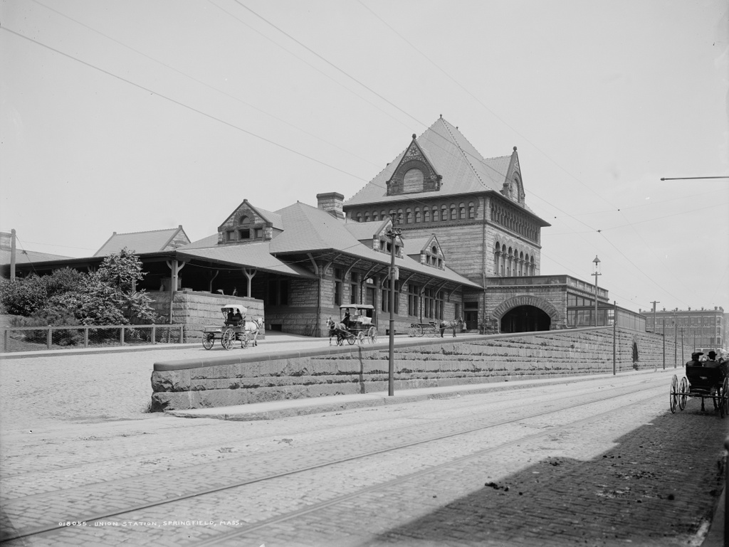
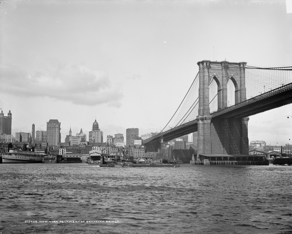
Union Station in Springfield, Mass, around 1905. Image courtesy of the Library of Congress, Detroit Publishing Company Collection.
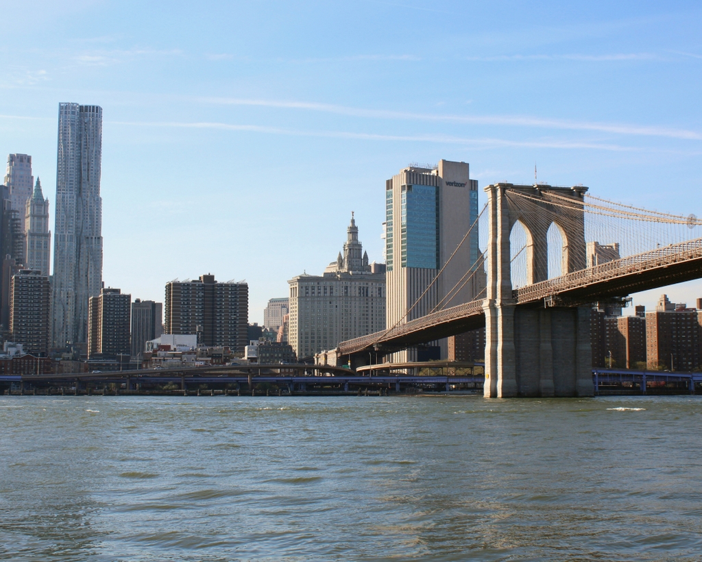
The scene in 2014:
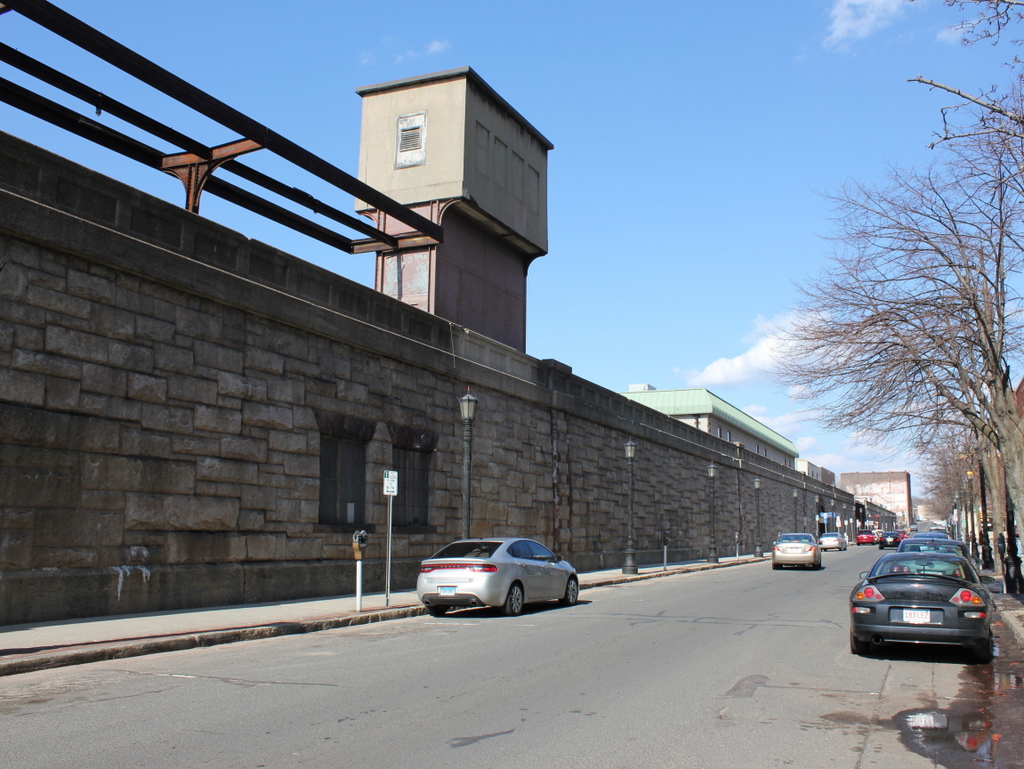
Prior to 1890, trains passing through Springfield on the Boston & Albany Railroad had to cross Main Street at street level; this resulted in significant traffic issues as the city grew, so in 1890 a stone arch was built over Main Street, and an elevated stone viaduct carried the railroad through downtown. As part of this, the old Union Station was opened in 1889. Designed by Shelby, Rutan and Coolidge in the style of Henry Hobson Richardson, the station consisted of buildings on both the north and south sides of the tracks (as seen in this photo, taken around the same time). The 1905 photo shown above shows the south side, looking east along Lyman Street. This station was demolished in 1925 and replaced with the present-day Union Station. This station, located on the other side of the tracks, has been closed since 1974, but is in the process of being renovated. In the meantime, rail travelers today use the Lyman Street entrance to access the modern Amtrak station, which is a far cry from Richardson’s original design.


