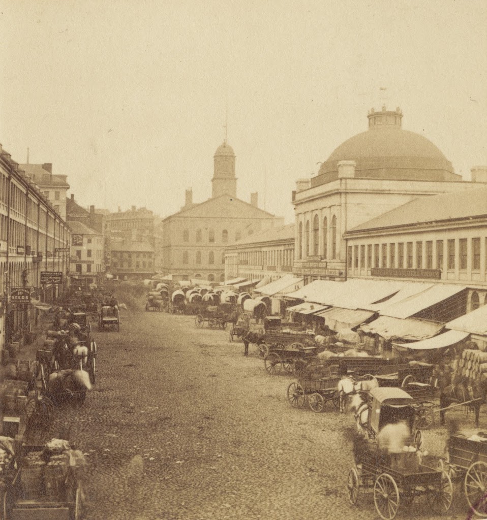
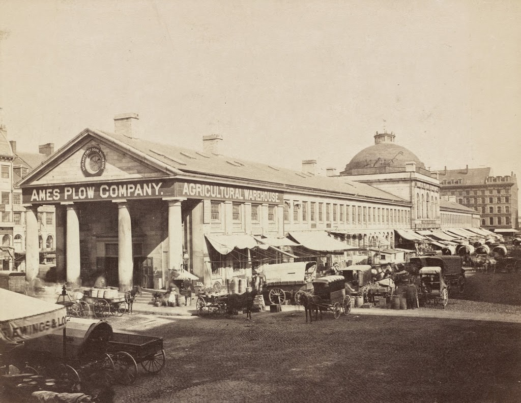
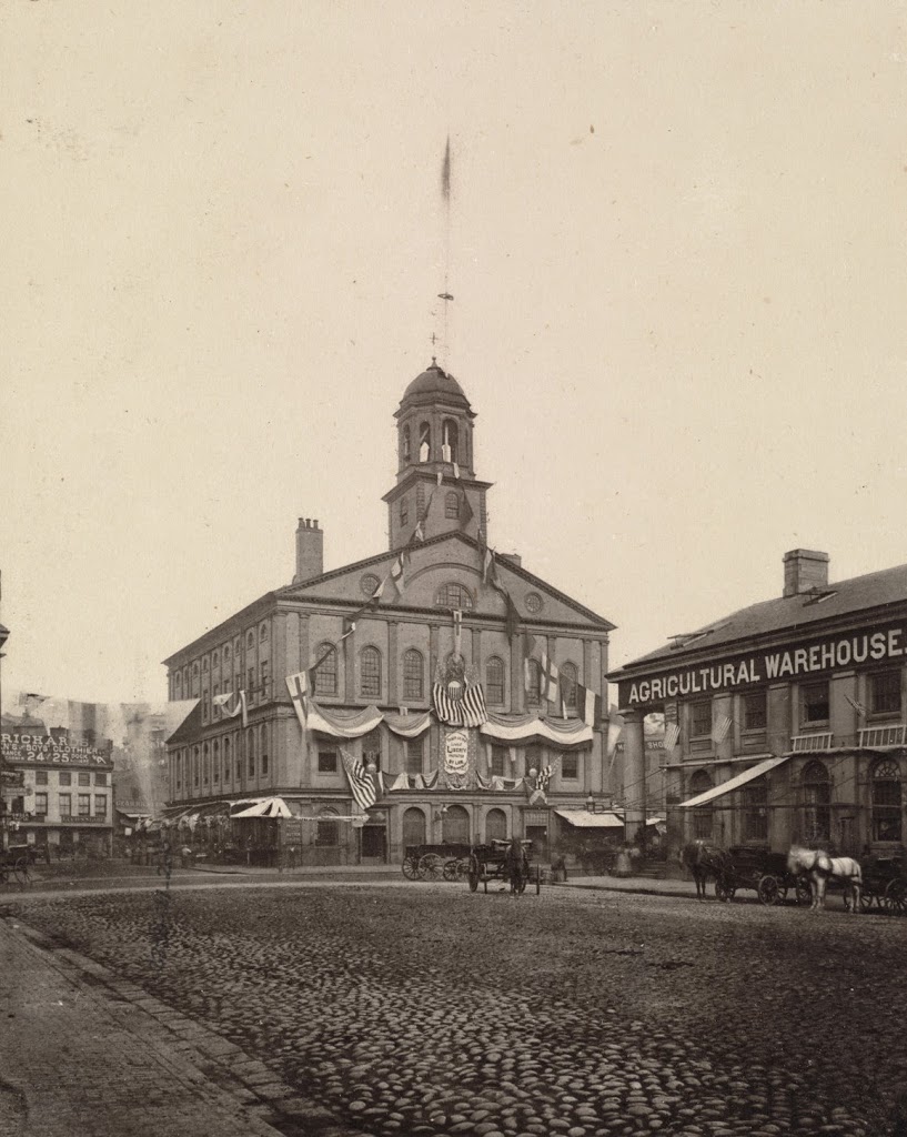
Quincy Market, Boston (1)

The view of Quincy Market looking east from in front of Faneuil Hall, sometime in the 1800s.  Photo courtesy of Boston Public Library.

249_1800sc-bpl

The same view of Quincy Market in 2014:

249_2014

Built in 1825, Quincy Market has been a major commercial center for nearly 200 years.  However, its role and the surrounding neighborhood have certainly changed.  Originally, as seen in the first photo, it was a place for Bostonians to buy and sell food products, ranging from fruits and vegetables to cheese and meat.  It was also built right along the waterfront; today it is several blocks from Boston Harbor.  But, the building hasn’t moved – the waterfront has.  Over the years, Boston has significantly expanded its land area, both through annexing surrounding towns but also through landfill, which included dumping dirt, rocks, construction debris, and even old ships into the harbor and building atop it.

Because of that, Quincy Market is no longer has a waterfront location, but it is still a commercial center, although today it consists of fast food vendors that primarily cater to tourists and workers from nearby City Hall.  The Quincy Market area also offers shopping, gift stores, and in this particular scene, photos with Spider-Man.  It is also located along the Freedom Trail, which is marked by the brick path in the foreground.

Feeding Pigeons at Park Street Station, Boston

A woman feeding pigeons along the Boston Common next to Park Street station, sometime between 1900 and 1920. Image courtesy of the Library of Congress, Detroit Publishing Company Collection.

248_1900-1920c-loc

The same scene in 2014:

248_2014

The first photo was probably taken not long after Boston built its subway network, and the Park Street station was where it all began.  As mentioned in these posts (Post 1 and Post 2) of the interior of the station, Park Street and Boylston were the first two subway stations in North America, and today Park Street is still a major hub on the “T”, where passengers can transfer between the Red and Green lines.  It is also near the start of the Freedom Trail and the Massachusetts State House, so it is frequented by tourists as well.

I don’t know who the woman in the picture was, but it is safe to say that everyone in the photo has probably been dead for over 30 years.  And, unlike the people in the two photos, the pigeons that still inhabit Boston Common are still dressed pretty much the same way.

Beacon Street looking west from Charles Street, Boston (2)

Another view, around 1887, looking west on Beacon Street from Charles Street.  Photo courtesy of Boston Public Library.

247_1887-bpl

The scene in 2014:

247_2014

A similar view to the photos in this post, these photos show how Beacon Street has changed in the past 127 years.  Not a whole lot of dramatic changes have occurred; the street is now a paved, four lane thoroughfare, but the Public Garden is still there on the left, and many of the rowhouses on the right are still there, including the granite ones from 1828 on the far right of the photos.

Beacon Street looking west from Charles Street, Boston (1)

The view looking west on Beacon Street from Charles Street, between 1865 and 1870. Image courtesy of the Boston Public Library.

246_1865-1870c-bpl

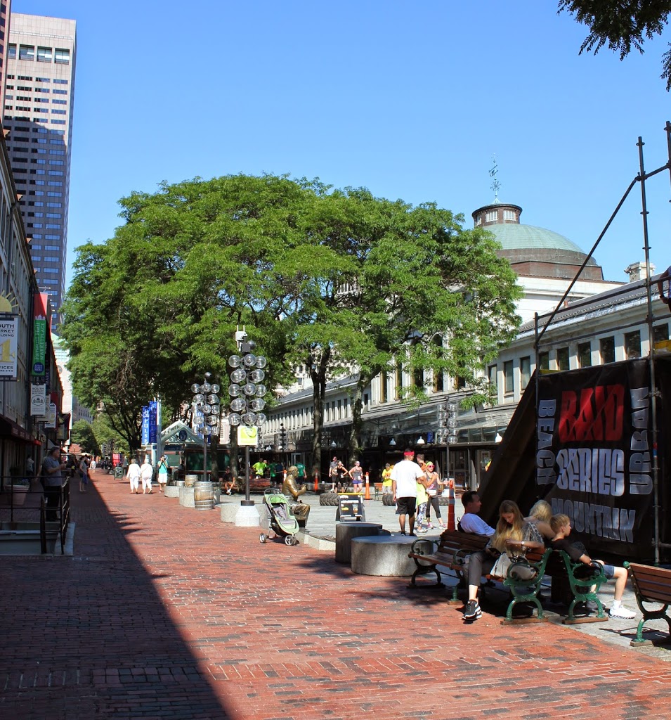
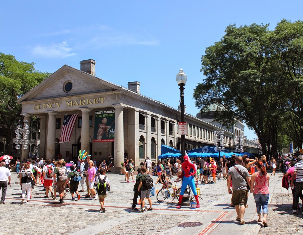
The same view in 2014:
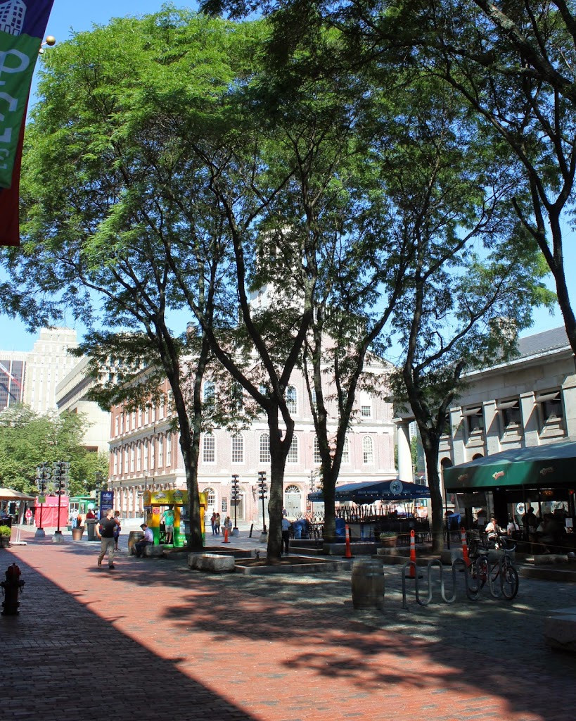
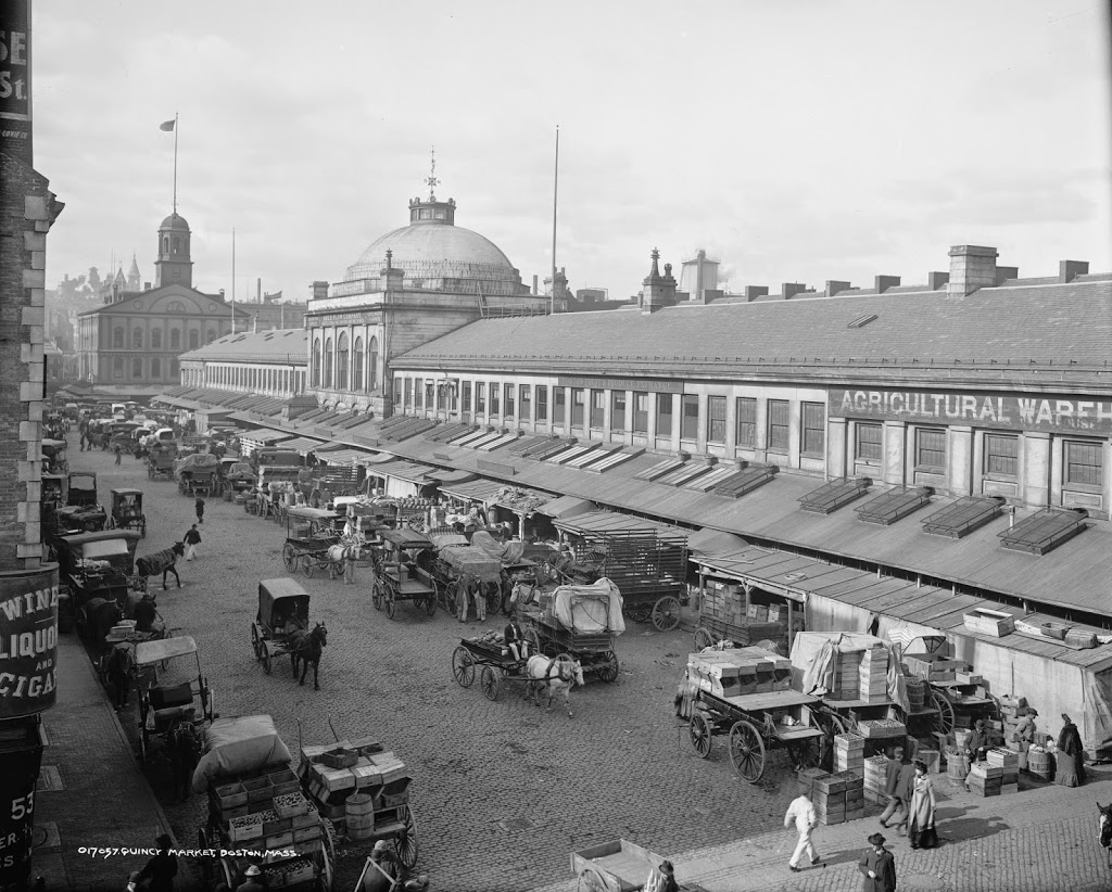
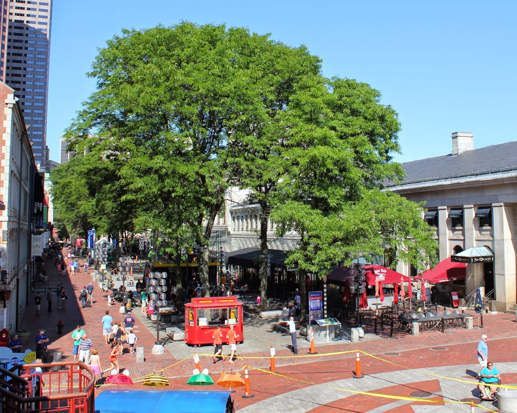
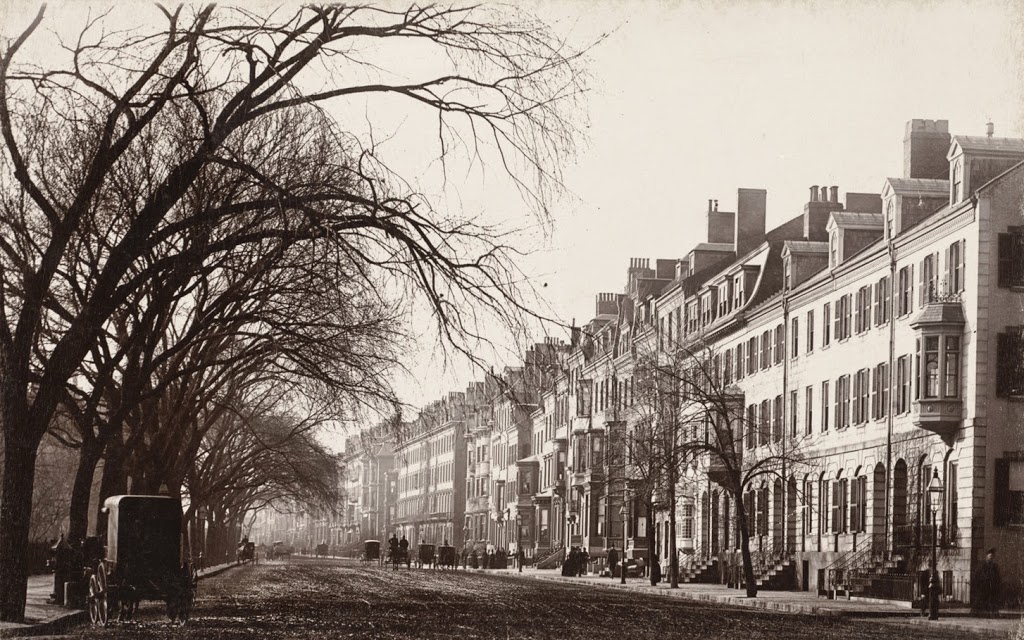
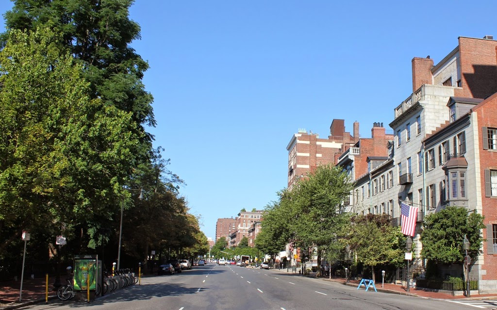
246_2014

The buildings in the distance in the first photo would have been almost brand-new; these are part of the Back Bay neighborhood, and would have been built within about ten years before the photo was taken.  The buildings in the foreground, however, are much older.  The granite rowhouses just past the brick building on the far right of the first photo are still there; they were built in 1828, almost a decade before the Public Garden across the street was even established.  The brick townhouse next to it in the foreground was probably even older, although it was demolished at some point, probably around 1917, when the tall apartment building in the 2014 photo was built.

Beacon Street looking east from Charles Street, Boston

Looking up Beacon Street toward the State House, sometime in the 19th century. Photo courtesy of Boston Public Library.

245_1800sc-bpl

The same scene in 2014:

245_2014

The first photo was probably taken around the 1860s or 1870s, and many of the townhouses predate even that photo by half a century.  One of the houses in this view, featured in this post when Theodore Roosevelt came to visit, was built in 1819, and many of the other houses likely date to the same period, which was around the time when Beacon Hill was first being developed.

For being close to 150 years apart, the two scenes are remarkably similar – most of the townhouses in the foreground appear virtually unchanged, and trees in Boston Common and a wrought iron fence (probably the same one) still line the left-hand side of Beacon Street.  It’s a picturesque neighborhood, and also a pricey one – the house featured in the Roosevelt post is currently on the market with an asking price of $11.9 million.

Theodore Roosevelt in Boston

Former President Theodore Roosevelt leaves a house on Beacon Street in Boston, in 1916. Photo courtesy of Boston Public Library.

244_1916-bpl

The same house in 2014:

244_2014

As mentioned in this post, Beacon Hill has long been the home of some of Boston’s most prominent citizens.  Among those in the early 1900s was Dr. William Sturgis Bigelow (the man holding the door in the background), a physician and friend of Theodore Roosevelt, who is seen here walking down the steps to Beacon Street.  According to contemporary newspaper accounts, Roosevelt made several visits to Dr. Bigelow’s home on 56 Beacon Street after leaving the presidency.

Today, the exterior of the townhouse is virtually unchanged in the nearly 100 years since Roosevelt’s visit.  As of July 2014, the house, which was built in 1819, is for sale – for a mere $11.9 million.