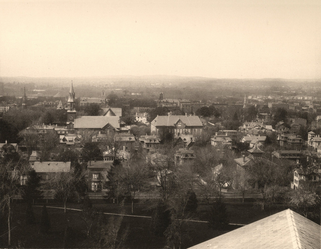
Looking southwest toward downtown Springfield from the Arsenal tower, around 1882. Photo from Springfield Illustrated (1882).
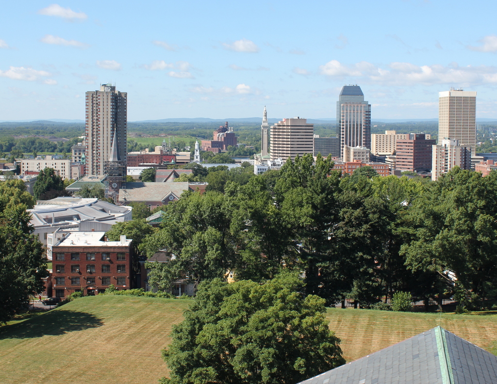
The view in 2015, photographed with permission from the Springfield Armory National Historic Site.

When the first photo was taken around the early 1880s, Springfield was in the midst of a period of rapid growth. In the previous 20 years, the city’s population had more than doubled to 33,340 people by 1880, thanks in no small part to the presence of the Armory where the photo was taken. The Main Street corridor in the distance had become a major commercial center for the entire region, and the slope in the the foreground at the base of the Armory hill had developed into an affluent residential area. Most of the buildings in the first photo were built in the 1860s or 1870s, including most of the houses seen here. Other major landmarks visible here include St. Michael’s Cathedral, which is easily visible on the left side, and St. Michael’s Hall, in the center. Just to the left of St. Michael’s Cathedral is the tower of the old library building, and to the left of it is the steeple of the Church of the Unity. Further in the distance, beyond St. Michael’s, is the Hampden County Courthouse, with the steeple of Old First Church barely visible to the right of it, along with the tower of the old City Hall building in approximately the upper center of the photo.
As dramatic as the population increase had been by the time the first photo was taken, the growth would continue at an even more dramatic pace over the next 50 years, with the population reaching almost 150,000 by 1930, almost 4.5 times the 1880 population. Much of this growth was in the suburban parts of the city, but the downtown area also saw significant development. However, unlike many other comparably-sized cities in the northeast, Springfield’s skyline did not see many dramatic changes until later in the 20th century. From 1908 to 1970, a state law prohibited any buildings taller than the 125-foot steeple of Old First Church, with the exception of the Springfield Municipal Group Campanile tower. Since 1970, though, downtown Springfield has grown upward, starting with the 29-story Baystate West, now named Tower Square, which is visible on the far right of the photo. Other skyscrapers soon followed, including the Chestnut Park apartment building on the left side of the photo, and Monarch Place, just to the right of the center.
Many of the historic structures from the first photo are now gone, including the old library, the Church of the Unity, and St. Michael’s Hall. Many of the Victorian single-family homes and duplexes are also gone, having been replaced by apartment blocks as the city grew in the first half of the 20th century. Some, however, are still standing, including the two brick houses on Byers Street in the foreground that have towers on their roofs. A few blocks further down the hill, mostly hidden by the trees, is the Quadrangle-Mattoon Street Historic District, which includes many buildings that were standing when the first photograph was taken. The Armory itself, including the Arsenal tower where these photos were taken, is also a historic site. It closed in 1968, and is now the home of Springfield Technical Community College as well as the Springfield Armory National Historic Site.
For other then and now views from the Arsenal tower, see the other posts showing the view facing west, northwest, south, and north.


This is an awesome series! Funny, I went to STCC, but never visited the Arsenal Tower. Where did you find Springfield Illustrated, used for the source photos?
Thanks, glad you like it! The State Library of Massachusetts has a copy of “Springfield Illustrated” here: https://www.flickr.com/photos/mastatelibrary/sets/72157649254418557/