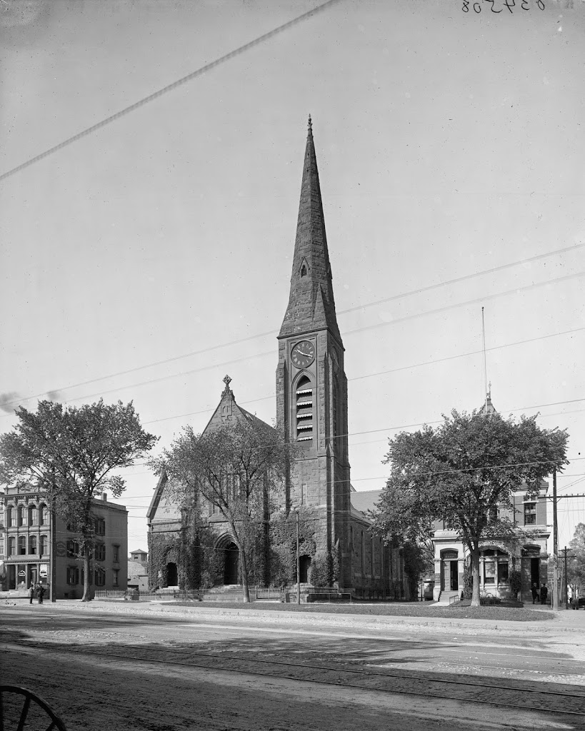
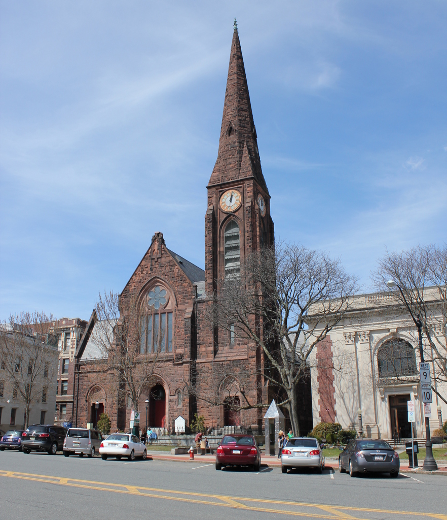
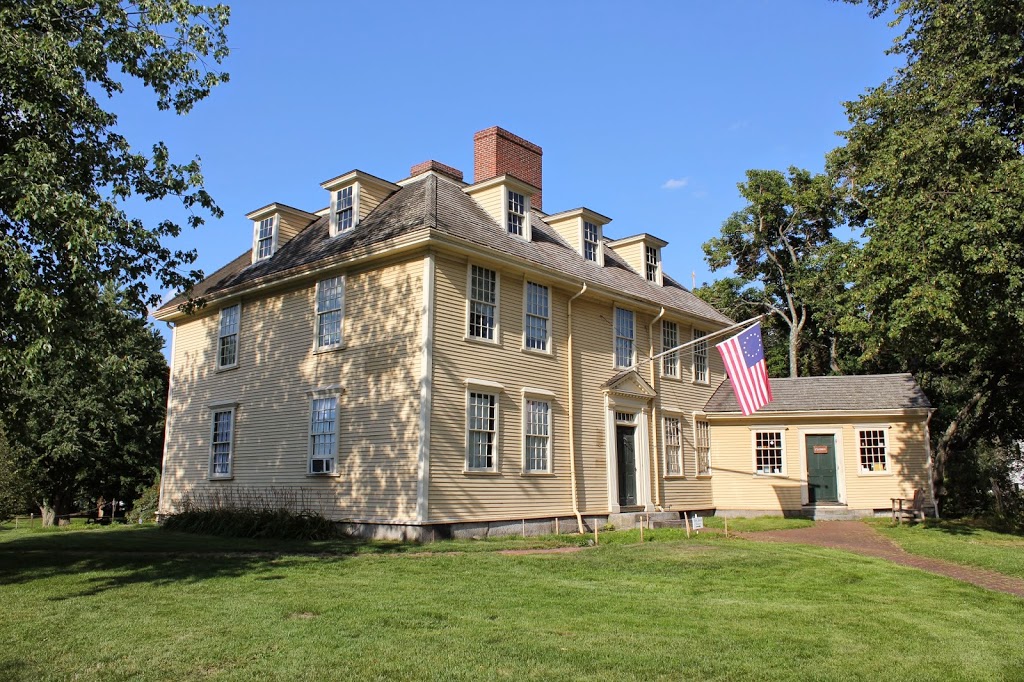
The First Church of Northampton, between 1900 and 1910. Image courtesy of the Library of Congress, Detroit Publishing Company Collection.
In 2014:
Built in 1877, Northampton’s First Church hasn’t changed much, although its surroundings are different than they were a century ago. Notice in particular the absence of trolley tracks or wires and the proliferation of cars. Nearly three centuries and three church buildings ago, this was the home to one of America’s most prominent theologians, Jonathan Edwards, who was pastor of the Northampton church from 1727 to 1751, and who led the Great Awakening from his pulpit here. The church building that he built in 1737 was replaced in 1812 by one designed by Isaac Damon, the same architect who designed Springfield’s Old First Church seven years later. That building burned in 1876, and was replaced by the present structure the following year.
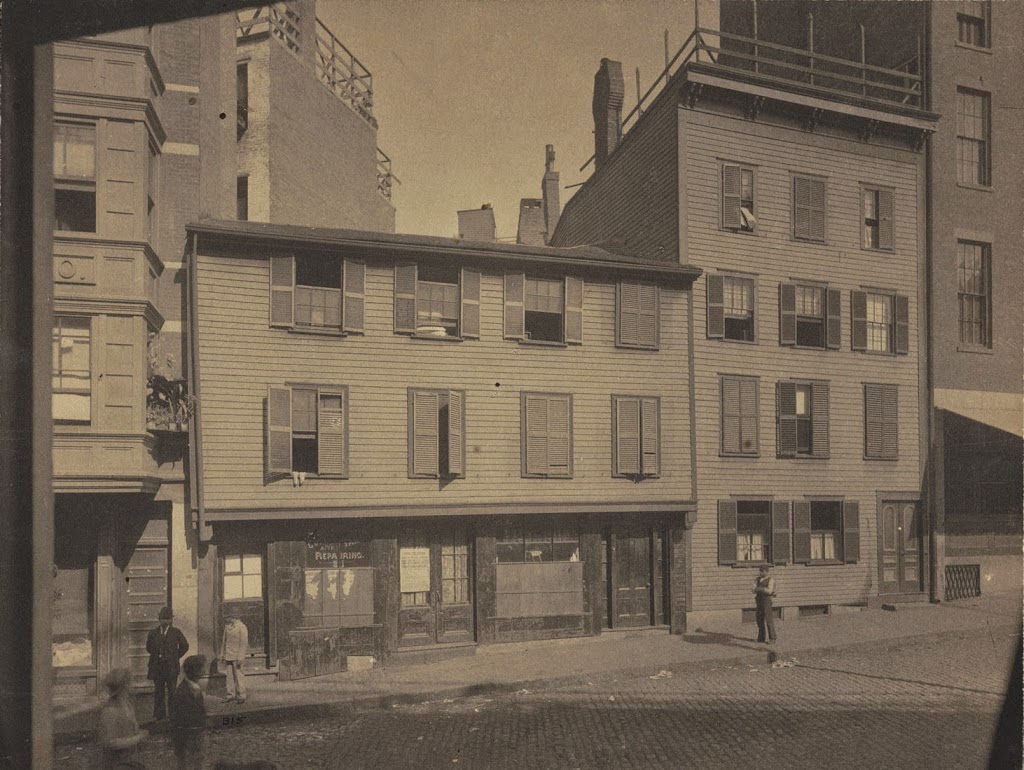
Paul Revere’s House in Boston, around 1898. Image courtesy of Boston Public Library.
The house in 2014:
Built in 1680, Paul Revere’s house is the oldest building in downtown Boston, and was owned by Paul Revere from 1770 to 1800. He actually added a third floor, as seen in the 1898 photo, but shortly after the photo was taken, the house was purchased by one of Revere’s descendants and restored to its 1680 appearance. Despite all of the modifications, it is estimated that about 90% of the structure is original to 1680, which is impressive, considering how different it looks in the two photos.
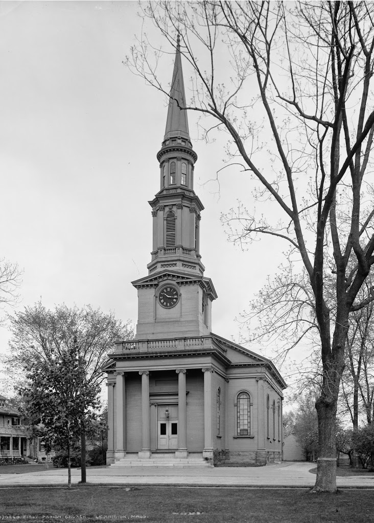
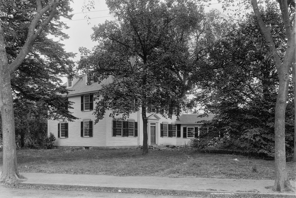
First Parish Church in Lexington, Mass., between 1900 and 1910. Image courtesy of the Library of Congress, Detroit Publishing Company Collection.
The same church in 2013:
Although many buildings in Lexington predate the historic battle in 1775, the First Parish Church building isn’t one of them. This particular church was built in 1847, replacing the 1793 one that burned in the midst of a renovation. Since then, not much has changed from this viewpoint, as evidenced by the two photos taken over a century apart.
The John Ward House, at 38 St. Peter Street in Salem, Mass, around 1906. Image courtesy of the Library of Congress, Detroit Publishing Company Collection.
The scene in 2019:
The John Ward House is one of the oldest buildings in Salem, having been built in stages between 1684 and 1723. It was originally the home of currier John Ward, and it remained in the Ward family until 1816. It was subsequently used as a bakery, and by the time the first photo was taken in the early 20th century it had become a tenement house. However, in 1910 the house was moved several blocks away, to its current location off of Brown Street, and it was restored to its colonial-era appearance. Here on St. Peter Street, nothing has survived from the first photo, but the John Ward House is still standing at its new location, and it is now owned by the Peabody Essex Museum.
The house at its current location, as seen in 2013:
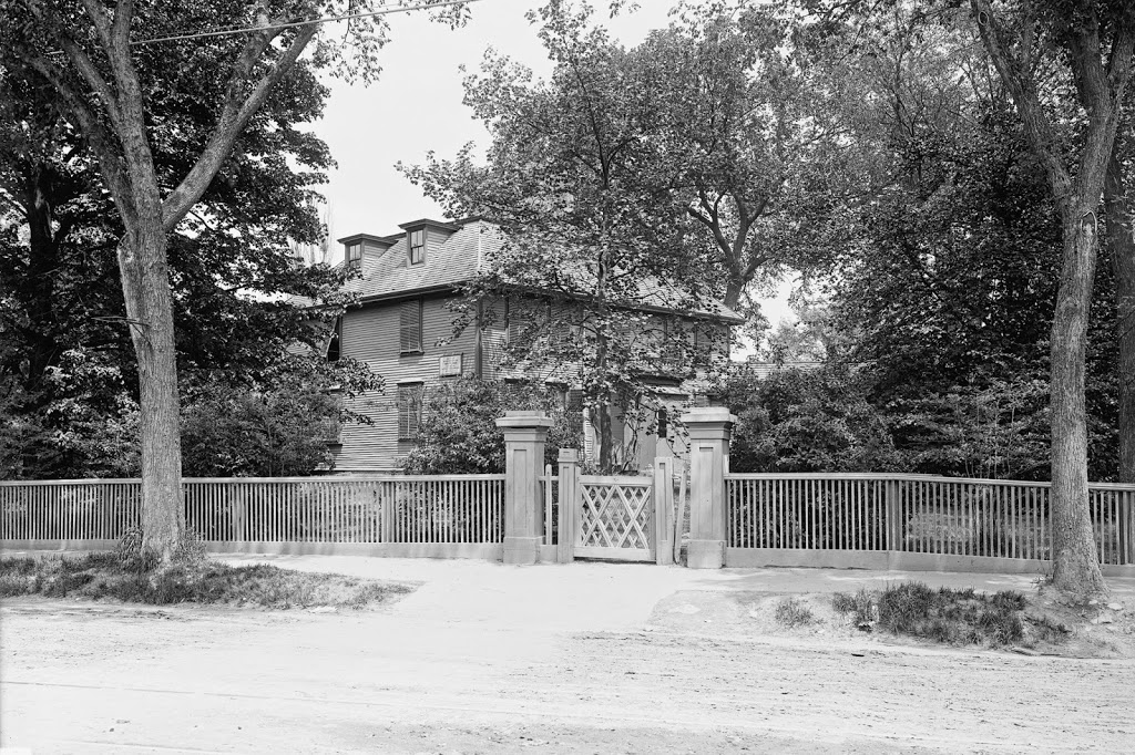
The Buckman Tavern in Lexington, between 1890 and 1901. Image courtesy of the Library of Congress, Detroit Publishing Company Collection.
Between 1910 and 1920. Image courtesy of the Library of Congress, Detroit Publishing Company Collection.
In 2013:
This building, located just to the east of the Lexington Green, was built around 1710 by Benjamin Muzzy. His son John operated it as a tavern for many years, and the tavern was eventually acquired by John Buckman after his marriage to John’s granddaughter Ruth Stone in 1768.
It was during Buckman’s time here that the tavern gained attention as the site where many of Lexington’s militiamen gathered on the morning of April 19, 1775, just before the Battle of Lexington. This battle—really more of a small skirmish—occurred directly in front of the tavern on the Green, and it marked the start of the American Revolution. There was at least one bullet that passed through the front door of the tavern, and later in the day there were two wounded British soldiers who were brought here, and one of them died here in the tavern.
After the battle, John Buckman continued to operate this tavern until his death in 1792. Two years later, it was acquired by Rufus Merriam, who had witnessed the battle nearly 20 years earlier as a 13-year-old boy. He later became postmaster, and the town’s post office was located here starting in 1813, but the building does not appear to have been used as a tavern for much longer after that.
The property would remain in the Merriam family for many years, and it was eventually acquired by the town of Lexington in 1913. The interior was subsequently restored to its colonial-era appearance, and the old tavern is now leased by the Lexington Historical Society, which operates it as a museum.
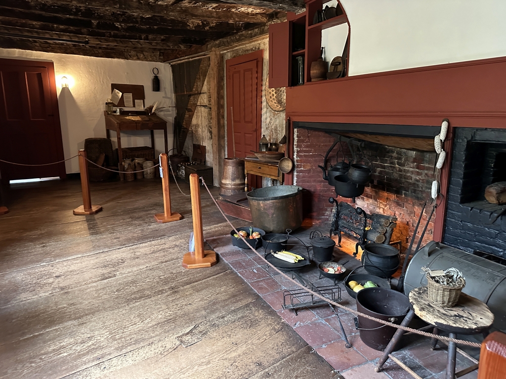
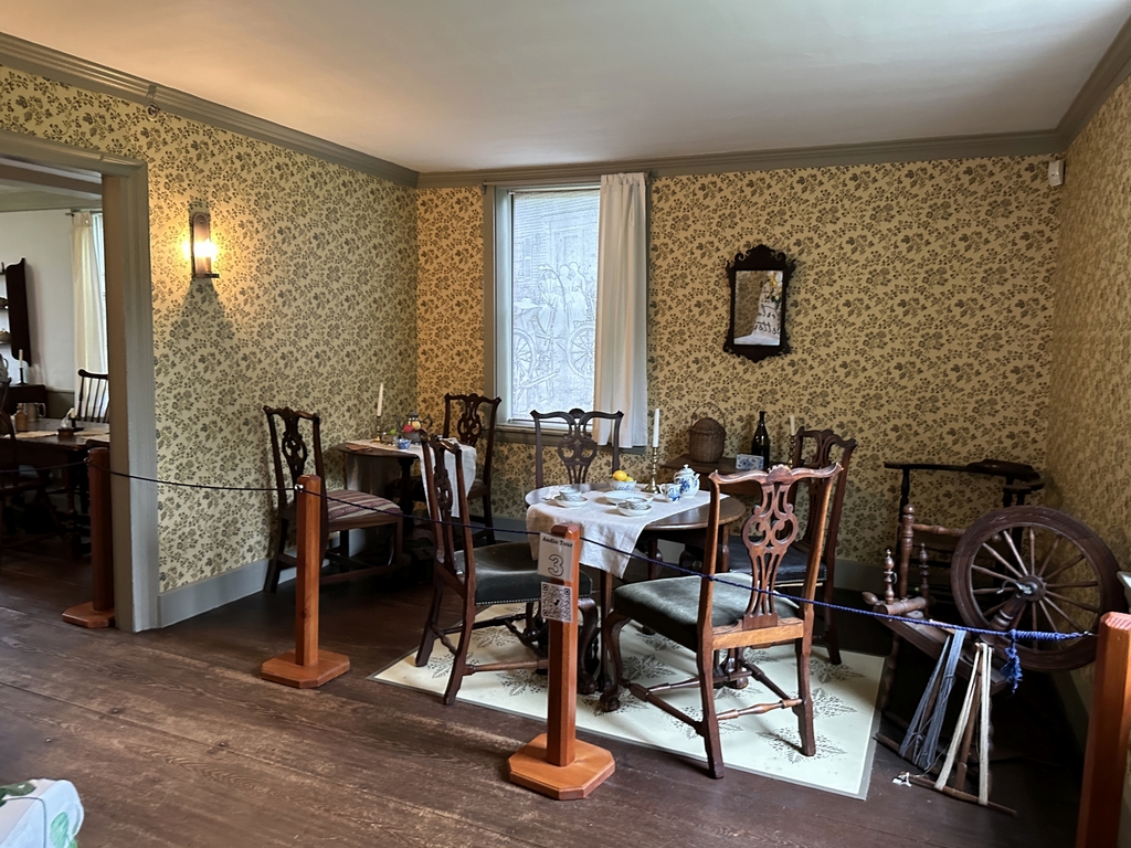
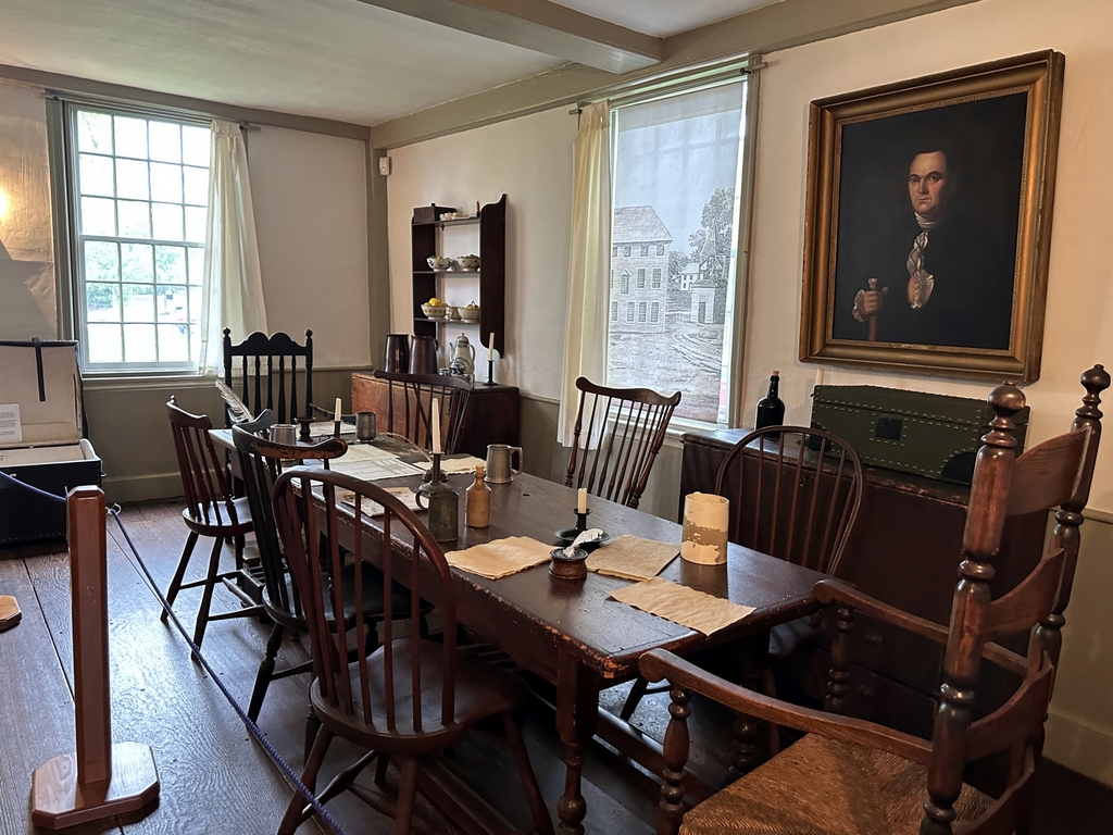
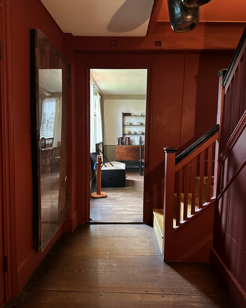
2023 update: I have added some photos from the interior of the tavern, which were taken during a May 2023 visit:
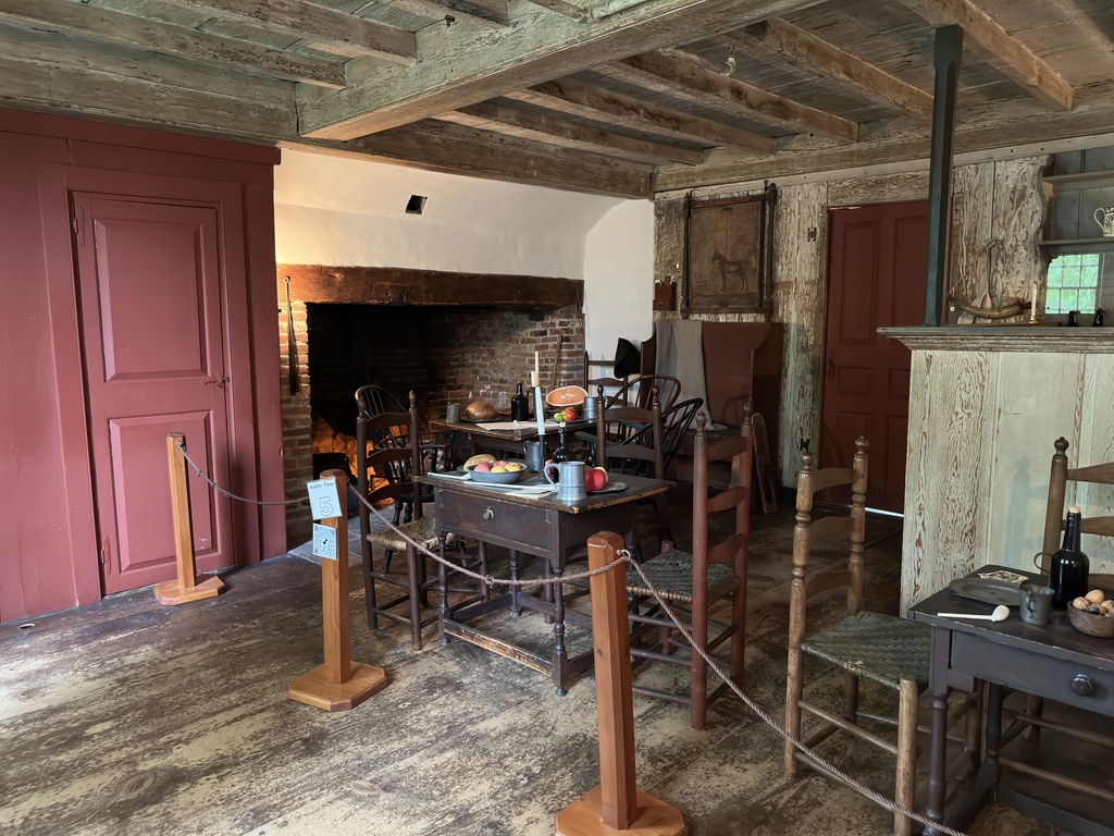
The kitchen in the back of the tavernThe ladies’ parlorThe room in the northwestern corner of the ground floorThe front entryway. On the left side, behind the plexiglass, is the original front door, with a yellow arrow pointing to the bullet hole.The tap room, where the militiamen gathered prior to the battle.
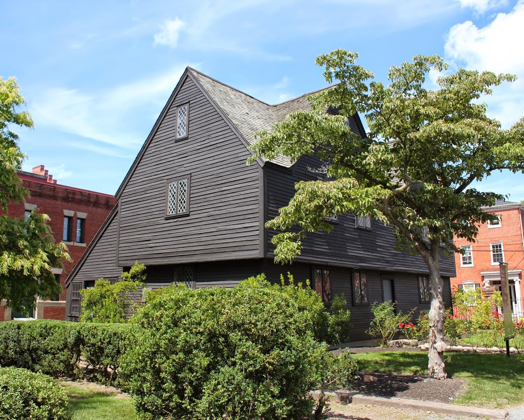
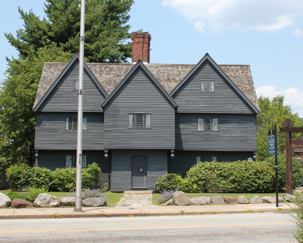
The Witch House, at the northwest corner of Essex and Summer Streets in Salem, around 1901:
The house in 2019:
The Witch House in Salem is one of the oldest houses in Massachusetts, and is the only surviving building in Salem with direct ties to the 1692 Salem Witch Trials. The house was owned by one of the judges, Jonathan Corwin. It was likely built in the 1660s or 1670s, although some place its date in the 1640s or even earlier. The 1901 photo was taken prior to its restoration and move; a street widening project necessitated moving it about 35 feet, and the house was restored to its presumed 17th century appearance, which did not include the attached storefront from the 1901 photo.